BLAKE
RIGG (LITTLE LANGDALE), LONG CRAG on WRYNOSE FELL, PIKE
O’ BLISCO, COLD PIKE, LITTLE STAND & STONESTY
PIKE
from WRYNOSE PASS
Summary
Date - 30th September 2007
Distance - 7.5 miles
Map - OL6
Start point -
Wrynose Bridge,
Wrynose Pass (NY 285033)
Summits Achieved
Name
Height (ft)
Height (m)
Grid Ref
Blake Rigg (Little
Langdale)
1755
535
NY 2851 0390
Long Crag on
Wrynose Fell
1788
545
NY 2798 0397
Pike O'Blisco
2313
705
NY 2713 0421
Cold Pike
2300
701
NY 2628 0360
Little Stand
2428
740
NY 2504 0337
Stonesty Pike
2510
765
NY 2494 0412
The Walk
After driving through the very
narrow lanes of Little Langdale we arrived at Wrynose Pass and
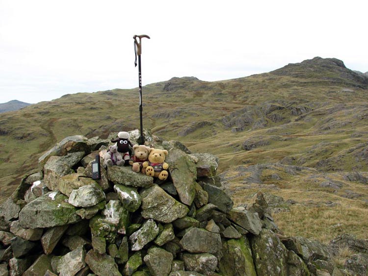
settling into Dad's rucksack we started our ascent over boggy
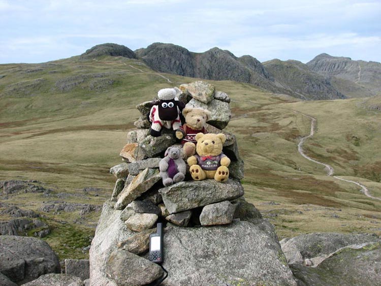
ground and then up past Little Horse Crag to Blake Rigg, where we
hopped out to have our photo taken. Note that walking sticks seem
to grow out of the cairns here!!
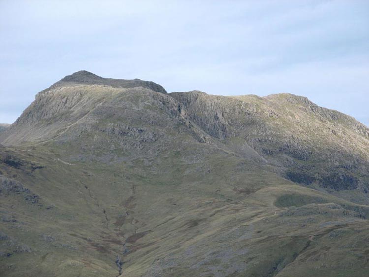
In the distance we could see the
massive bulk of Bowfell that we had all climbed in January 2006
in freezing conditions when it was covered in snow and ice. Today
it looked more benign.
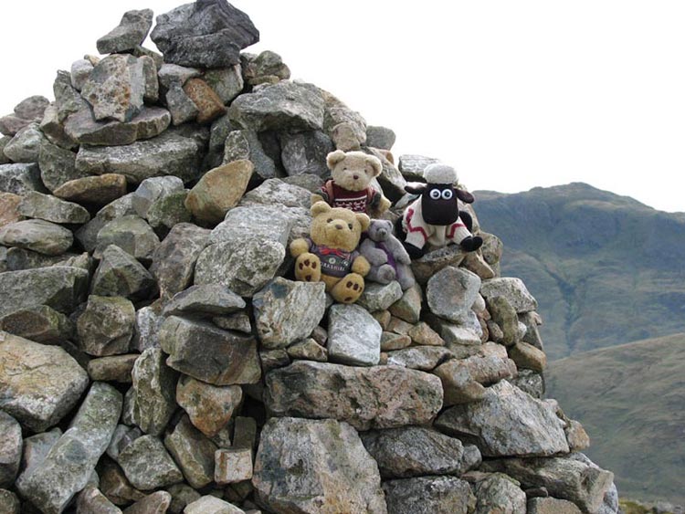
We then walked over to the bare
rocky outcrop of Long Crag on Wrynose Fell before making the
steep and scrambly climb to Pike o' Blisco. The summit is adorned
with a very shapely cairn. Grizzly & Allen had not been up
here before so they were pleased to bag the summit.
After Dad had taken a few photos,
including us of course, we made the descent to Red Tarn and then
headed towards the Crinkle Crags.
We were not destined for those
today having climbed them with Uncle Bob and Dad in October last
year. All the time we had superb views of the mountains all of
which we had climbed before too (how lucky we are to have a Dad
who will take us on all these walks). Part way along the path we
headed left up the side of Cold Pike to reach the neat cairn at
the summit. Here again we had views of Crinkle Crags and Bowfell
amongst other mountains. Again Grizzly & Allen bagged this
summit.
It would now have been easy just to
walk along the top and descend to Wrynose Pass. Dad has however a
book that lists all the 541 fells in the Lake District over 1000ft.
So far he had done 372 and he is intending to try and climb the
lot. Two not climbed were in fairly easy reach and so we dropped
down and crossed some very rough and at times boggy ground to
ascend to the next ridge. It was very steep and made Dad out of
breath, but after a stop or two we made it and visited first the
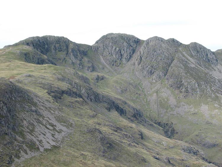
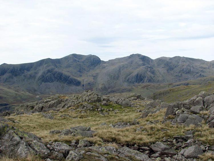
summit of Little Stand. Here we had a superb view of the Scafells
(the highest fells in the Lake District). The photo actually
shows Slight Side (far left), Scafell, Scafell Pike (highest
mountain in England), Broad Crag and Ill Crag.
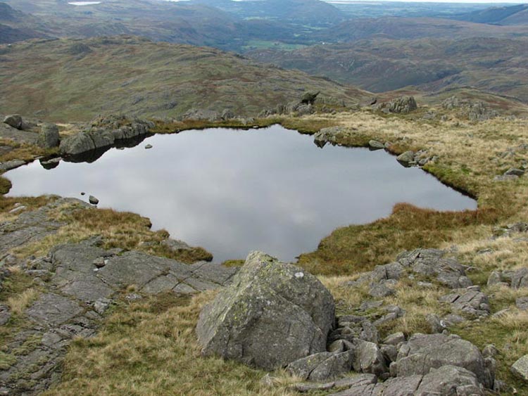
On its summit Little Stand has two
little tarns. Here is one of them.
The last top was Stonesty Pike the
summit of which was hard to find as the top was a large plateau
but with the help of Dad's GPS device we got there. We now had to
double back on to the path we had walked before to descend to Red
Tarn (so called because the rocks all around are reddish in
colour), and then descend to Wrynose Pass.
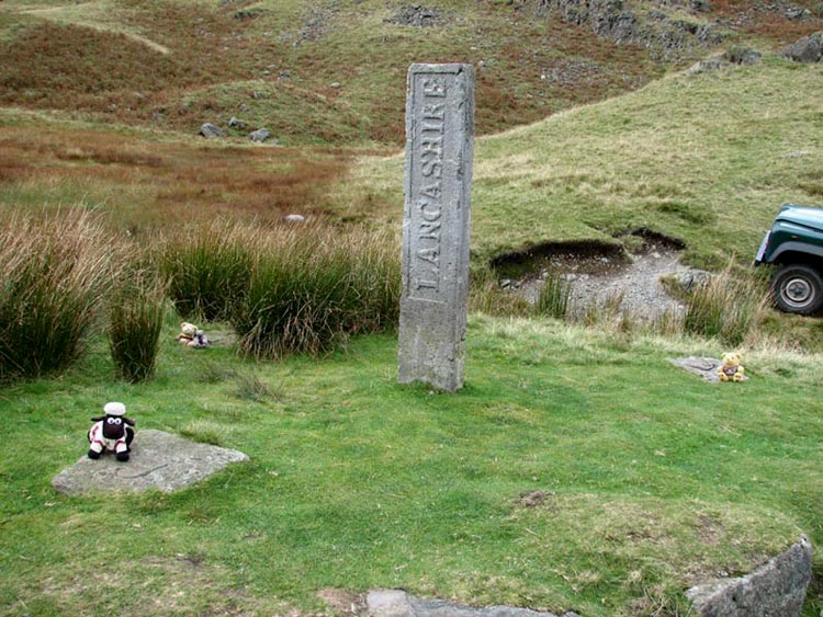
This was reached at the Three Shire
Stone. Before the reorganisation of boundaries this marked the
place where the old shires of Cumberland, Lancashire and
Westmorland met. Here we are by the stone. Shaun is in Lancashire,
Allen and Grizzly in Cumberland and Tetley is in Westmorland.
All that then remained was to walk
down Wrynose Pass to the car and for Dad to drive us home after
another super day.