ROUGH CRAG, HIGH
STREET, RAMPSGILL HEAD, KIDSTY PIKE, HIGH RAISE, LOW
RAISE & CASTLE CRAG from MARDALE HEAD
Summary
Date - 30th May 2010
Distance - 9.5 miles Ascent - 2750ft
Map - OL5
Start point -
Car park at Mardale
Head (NY 469107)
Summits achieved
Name
Height (ft)
Height (m)
Grid Ref
Rough Crag
2060
628
NY 4542 1124
High Street
2718
828
NY 4407 1104
Rampsgill Head
2598
792
NY 4433 1287
Kidsty Pike
2560
780
NY 4473 1257
High Raise (High Street)
2634
802
NY 4482 1345
Low Raise
2474
754
NY 4565 1376
Castle Crag (Mardale)
1296
395
NY 4692 1275
Preface & Route
Shaun, with Little Eric hitching a
ride on his back, trotted in to find Allen, Grizzly & Tetley,
pouring over walking books and scrutinising intently an Ordnance
Survey map.
"What ever's going on?",
he asked
Allen said excitedly, "Dad has
said we can choose the walk for Sunday, the only stipulation
being that he does not want to have to drive too far to the start."
"So what progress have you
made so far?", asked Little Eric.
"We have got hold of Dad's
list by location area of those Birkett fells we have not climbed,
and it seems to us that doing some in the Eastern Fells, would be
most appropriate", replied Grizzly.
"That's right", added
Tetley. "There are a few we need to do from the head of
Haweswater, and we were just in the process of sorting out which
to do and the best route to take."
Allen had been looking closely at
the map and said, "the layout of the outstanding tops is
such that we cannot do them all in one walk."
Shaun trotted up and looked at the
map over Allen's shoulder. After giving it some thought he said,
" I think the most exciting route up would be via The Rigg
and over Rough Crag to High Street."
"You're right", said
Tetley. "Then heading north along the ridge we can return to
take in Low Raise and Castle Crag. That way we would bag three
Birketts. We will repeat four Wainwrights too, but that will be
good for Little Eric, who has not visited them before."
"Thanks pal", said Little
Eric cheerfully.
"So that's decided then"
said Shaun. "Now we just have to see if Dad agrees."
"I'll go", called out
Allen grabbing the map as he rushed out.
"He rushes about like a
whirlwind. Makes me feel tired", said Tetley laughingly.
It was not long before he returned
with a wide grin on his face, so we knew that Dad approved of our
idea.
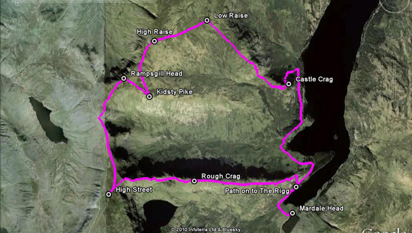
So here is a map of our route -
We start from the parking area at
Mardale Head, rounding the head of Haweswater. At a junction we
climb a narrow path onto The Rigg and then climb to Rough Crag.
The dark area just north is the steep side of the ridge falling
to Riggindale. The dark patch to the south is Blea Water. Then on
up Long Stile to reach High Street. Walking north we head to the
summit of Rampsgill Head, before turning SE for the short walk to
Kidsty Pike, which dominates the north side of Riggindale. Then
it's north again to High Raise. On new ground, an easy walk
roughly NE brings us to Low Raise marked by a very large cairn. A
long descent, that steepens as we progress brings us back towards
the shores of Haweswater. Here is a little separate top of Castle
Crag. It may seem odd to go north from here, but this is the only
safe way down to the path by the reservoir, which is followed to
the start.
The Walk
With the long days we were awake
early, and we all lent a paw to get our picnic ready and safely
packed in Allen's rucksack. Meanwhile Dad was getting his kit
ready and before long it was being placed in the car boot.
"Almost ready", called
out Dad.
"OK", replied Shaun, as
we rushed to settle on the front seat, waving to Uncle Brian as
we passed by.
As Dad backed the car out of the
drive, Little Eric asked, "which way are we going?"
"The quickest route is up the
M6 to Shap then via Bampton Grange to Haweswater", replied
Dad
"Is that the way we went when
we walked from Burnbanks in January 2009?", he persisted.
"Yes", said Dad patiently.
"I am really excited, as I
have never been to Mardale Head before", added Little Eric,
finally lapsing in to silence.
The M6 route was so familiar, the
Howgills looking majestic as we swept through the Lune Gorge.
Allen called out, "I can see
the three we still have to do, to complete all the tops."
"We will definitely be doing
those, as I am determined to complete the Howgill challenge this
year", said Dad emphatically.
Soon we were leaving the motorway
and passing through the long linear village of Shap. We took the narrow road forking left between substantial dry stone walls enclosing it on either side. There
was little traffic and we made good progress.
As we neared Bampton, Tetley called
out, "look that's Knipescar Common over there. It is one of
the Outlying Fells and if my memory serves me correctly we
climbed it with Uncle Eric in February 2007?"
"I remember it well, and that
unusually the trig point on the summit was a ring set into the
ground", piped up Grizzly.
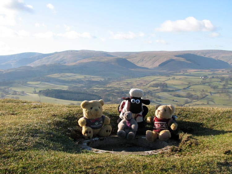
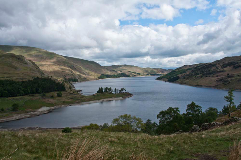
Here we are at the summit. The
distant fell on the left is High Street, then going right Kidsty
Pike (small bump on horizon) and High Raise with Low Raise
slightly lower in front. All were to be summited today.
Soon we were passing the sign to
Burnbanks to the right, our route being on ahead. As we rounded a
corner, we were rewarded with a wonderful display of bluebells
in the woods to the left. "Enchanting", murmured Shaun.
Glimpsing the huge dam, Allen
called out, "just look how low the level is."
"Aye pal, if we don't get some
substantial rain soon there will be a drought", replied
Tetley.
Following the road, in just a few more miles and we
arrived at the car park at Mardale Head about 09:30. It was nearly full, but it was bank holiday. As Dad got
his boots on, we jumped into his rucksack and settled down.
"Through that gate and right round the
head of the reservoir", instructed Shaun.
"Wow", breathed Little Eric, "what a majestic view of the mountains
surrounding the head of the valley."
"Wonderful of the sunlight dappling Mardale
Ill Bell" pointed Allen. "One of the tops on the Kentmere Horseshoe.
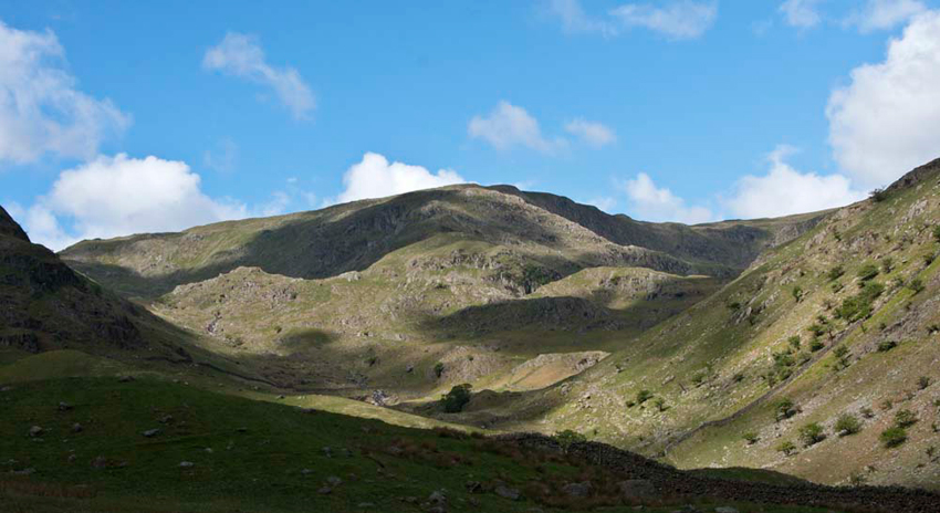
The path leads to the junction of walls in shadow to
the left, climbing onwards passing Small Water, and then steeply
up Nan Bield Pass."
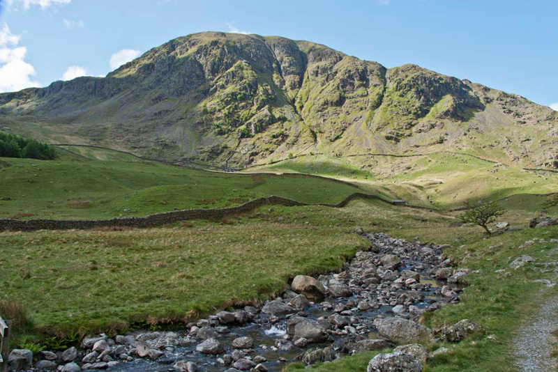
Tetley said, "that is the col between Mardale Ill Bell and
Harter Fell the craggy face of which dominates the head of the valley
on the left."
Our reverie over, Dad turned his
back on this scene, and we walked on crossing Mardale Beck by the footbridge and then by the reservoir.
Ahead was
The Rigg whose long ridge we were to ascend ultimately to High
Street. "To cut a corner we should take the narrow path branching left to
reach it" said Shaun.
This forms one side of the valley of Riggindale
that is home to the only golden eagle in England. Despite keeping
a sharp look out unfortunately we did not see it.
"Wow", called out Allen.
"What a superb view of Haweswater. Get the camera out Dad!"
"What is the promontory called?",
asked Little Eric.
"Speaking Crag", replied
Shaun as he consulted the map. "We will cross it on our
return at the end of the walk."
"Well it's time for some real
effort now", said Dad as he commenced the ascent of the
ridge.
The winding rocky path, steep at
times led up over numerous rises towards our first summit
objective Rough Crag. More superb views too of the lake and the
fells at the head of the valley.
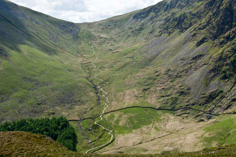
"What is that sinuous path" pointed Little Eric.
"The ascent route to Gatesgarth Pass", replied Grizzly. "We will use that route to tick of the rest of the outstanding Birkett summits in this area."
This was in fact to be the very next Sunday. A very different day weather wise too, with thick cloud and mist
shrouding the mountains all day.
Some way ahead we could see the
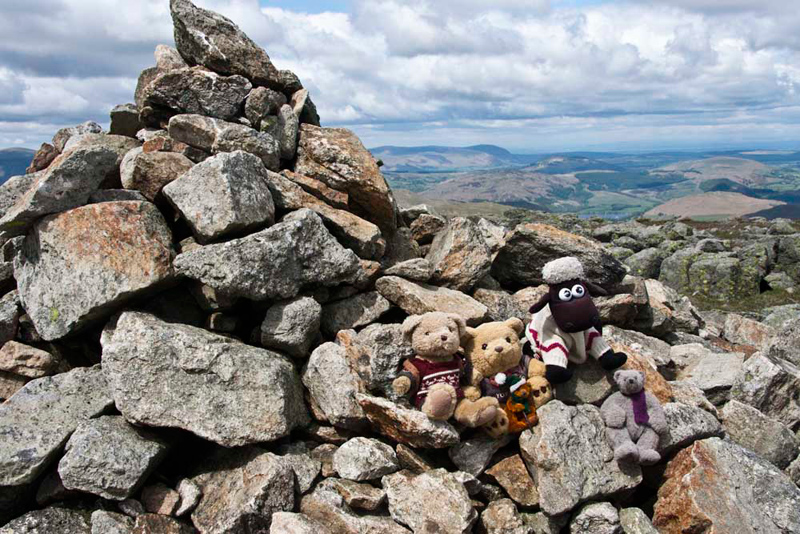
cairned top of Rough Crag, finally reached after further stops to
take pictures. This summit, a Birkett, was a first for us all.
"Get the camera out Dad",
cried Allen as we settled on the cairn.
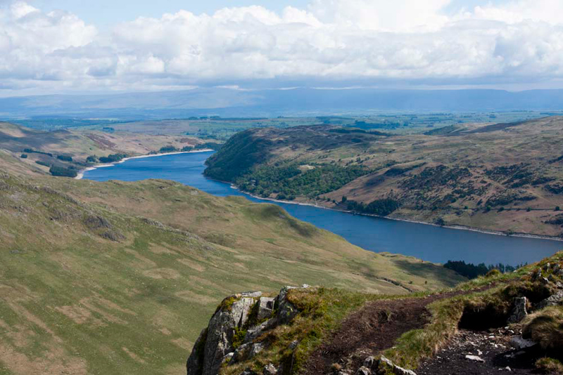
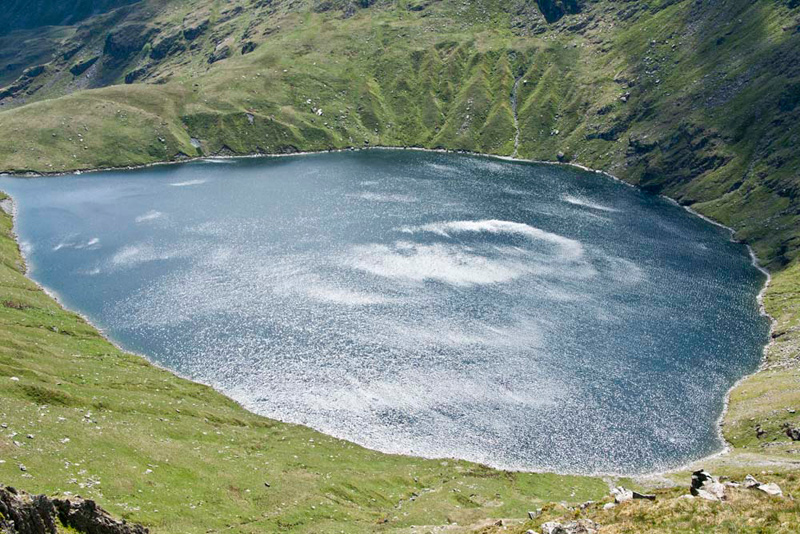
The summit afforded further
wonderful views. North-east the crescent shape of Haweswater
Reservoir was plain to see.
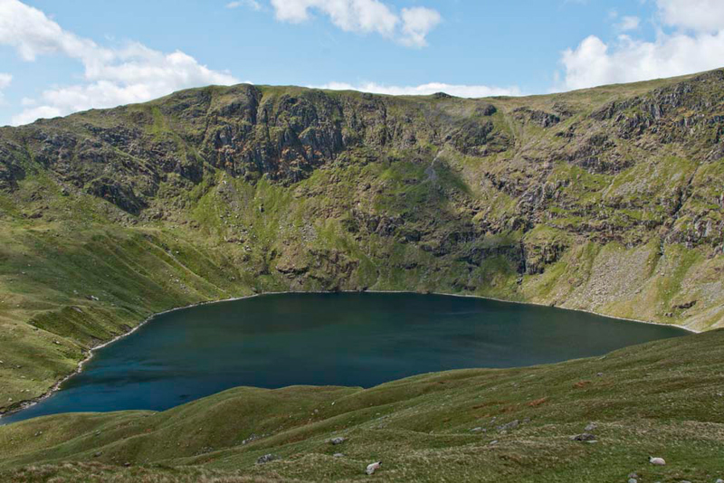
Looking in the opposite direction, Grizzly said, "that's the
corrie tarn of Blea Water nestling below Mardale Ill Bell, and
right the slopes of High Street. It has the
distinction of being the deepest in the Lake District, at 206ft (63m).
Its depth is only exceeded by Wastwater and Windermere."
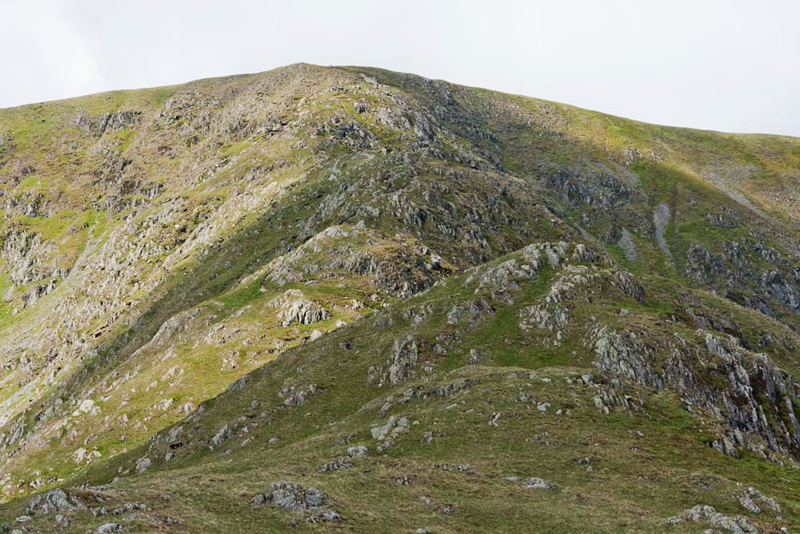
We were now about half way along
the ridge. Shaun said, "the remaining ascent is called Long Stile."
"Oh it looks to be very steep", said Little Eric. "I can't see a path."
Reassuring him Shaun replied, "there is, albeit
narrow steep and rocky. We can just discern the cairn at its top, a little to the right of the highest point."
To reach this however, as is always the case, we had to first
descend diagonally from Rough Crag and then
cross the col known as Caspal Gate, with its small tarn. This
view looks back to Rough Crag.
Then, best foot forward, Dad took
us up Long Stile. We had not walked this ridge before, but, as Grizzly commented, "without a doubt this is the best way to climb High Street."
About halfway Tetley called out, "there is another superb view of Blea Water."
We
passed a walker making the descent, who said, "it's windy on the top."
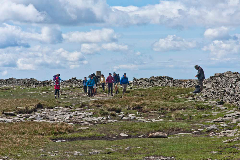
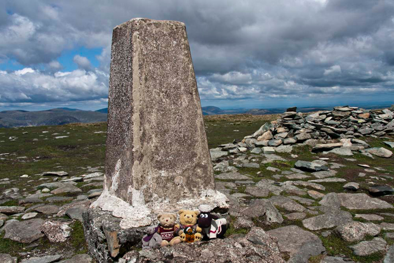
Once level ground was gained, it was just
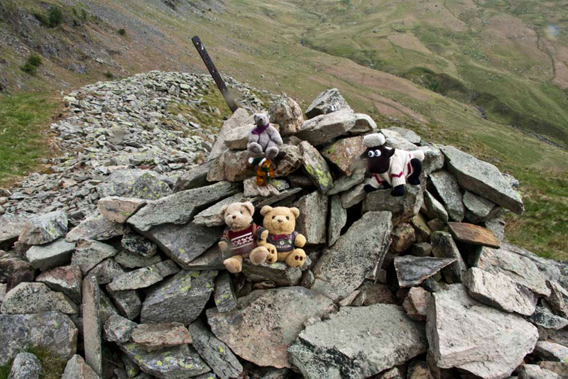
a short walk to the trig point. A busy day too, as you can see, on High Street.
The wind was pretty fierce, Tetley saying, "no chance to sit on the top of the trig point. We should be able to sit on the lee side for our picture."
Across
here runs the High Street Roman Road. In all it runs for some 23
miles. North to south from Brougham Castle (BROCAVVM ROMAN FORT), then via Brougham
Hall, Eamont Bridge, Yanwath, Tirril, and over Moor Divock. It
then climbs over the long ridge crossing Loadpot Hill, Wether
Hill, High Raise, Rampsgill Head and on to High Street, its
highest point. Then it descends via Troutbeck Park, Troutbeck,
Robin Lane & Jenkin Crag to end at GALAVA ROMAN FORT (Ambleside).
We tried to visualise the cohorts of Roman soldiers that had
walked along here, and wondered where they had originally come
from, before they were posted to Britain. Today we were to walk
from here the section north to High Raise.
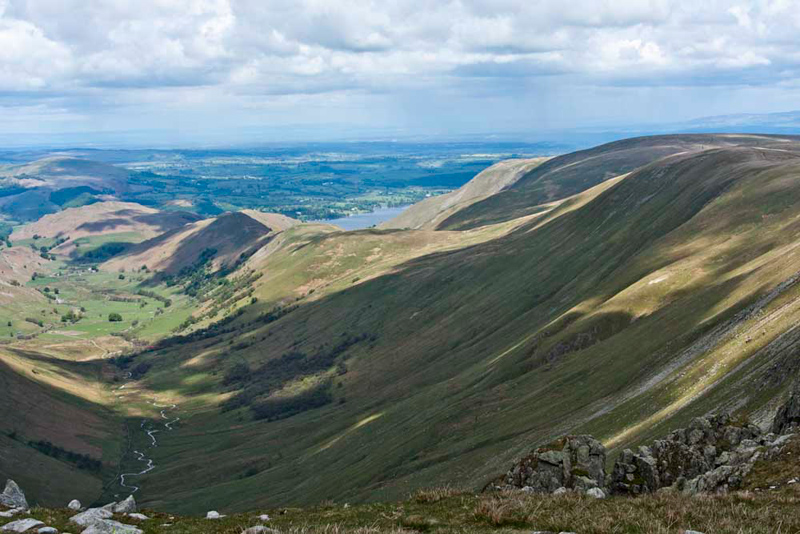
So, in the footsteps of the Romans,
Dad strode north, descending steadily towards the Straits of
Riggindale. Haweswater could be seen as we looked right down into
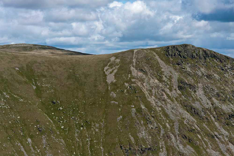
the valley of Riggindale. "That's Kidsty Pike, our
next objective", said Allen. "Distantly behind we can see High Raise, to be visited
after Kidsty Pike."
At the 'Straits', the impressive
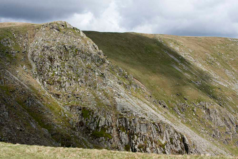
Twopenny Crag falls away on the right.
Here the path forked, and we went
right to climb above the crag, where it forked again. Ahead to
High Raise, and right to Kidsty Pike. However before this fork
Dad suddenly cut off left over rough ground.
"Wherever are we going?",
called out Allen. "We need to keep on the path if we are to
reach Kidsty Pike."
"I'm deviating to Rampsgill
Head first, so Little Eric can bag the summit", said Dad.
"Oh yes, I had forgotten that",
replied Allen.
"Thanks Dad", cried
Little Eric.
It was not far over the rough
ground, and soon the summit cairn was in sight. Just before, Dad
stopped to chat to a couple for a few minutes. It was windier
still up here, and after a sudden strong gust they decided to end
the chat and head on.
Despite the wind we were determined to hop out, but only
long enough for our picture.
As the name implies it stands at the head of the valley Ramps Gill. "What a super view of the valley", said Little Eric. "A picture is in order."
"We can see part of Ullswater, and the green hills in front are Gowk Hill and Brownthwaite Pike that we climbed three weeks ago", said Tetley. "Beyond following the ridge the brown summit is Steel Knotts and at the end dappled by cloud, Hallin Fell."
"So it really is to Kidsty
Pike now", called out Allen.
"Yes", replied Dad, as he
strode off.
It is just a third of a mile, first
over rough ground, and then joining the path for the gentle climb to
the summit.
There are other walkers who will be here soon", said Little Eric. "We had better hurry and get our picture taken."
If you think it looks like there is
a steep drop immediately behind the cairn, then you are quite
correct as the cairn is literally on the edge. The ridge
immediately in the background is the one we had climbed earlier
to High Street.
We were safely tucked in the rucksack again, by
the time the walkers arrived, and it turned into quite a social
occasion.
A couple arrived, and when Dad saw them get their
camera out, he said, "I'll take your picture."
"That's kind, thank you."
In the meantime another couple
arrived. The first couple went on their way. The gentleman of the second couple said, "they are on their
honeymoon. We are doing the Coast to Coast walk."
"To the lady, Dad said, "I see you are carrying a bear just like my Allen, except
he is wearing trousers."
"Our daughter bought it for her Dad, but he said he was not carrying a bear", she replied with a laugh.
"Unlike me", replied Dad, who then went on to explain about us and the adventures we had been on.
"I am amazed how many walks they have been on and their achievements", she said
Dad then kindly took their picture here too, before directing them on their
way. They did not seem to have a map or guide book, but hopefully
it was in the their rucksack. Dad said, "we wish you well on your
adventure, and hope that you do not get too wet on Tuesday, as rain is forecast."
As we set off again Allen said,
"it would nice if I had a pair of trousers like that bear."
"I'll have to see what I can
do", replied Dad. "They sell clothing at the bear shop
in Manchester, but it is for larger bears."
Sadly he was not successful, but Allen said, "never mind, thanks for trying."
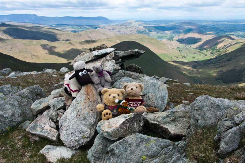
A clear path led north and soon we
were at High Raise, topped by an impressive and shapely cairn,
adjacent to which is an effective wind shelter.
"The shelter will be a a good place for lunch", suggested Shaun. "if we sit facing south we will be able to lunch in comfort while the wind whistles overhead."
"Well it's time to stop", replied Allen.
"We know, you're hungry", laughed Tetley.
As we sat munching our sandwiches and having warming mugs of tea, Little Eric enthused, "I am having a wonderful summit day. This is the 4th Wainwright that
I have ticked off, as well as the other Birkett summits."
Grizzly said, "before we set off, please take our summit picture here Dad."
"Of course Lads."
Packing up, we snuggled into the rucksack, ready to face the strong wind.
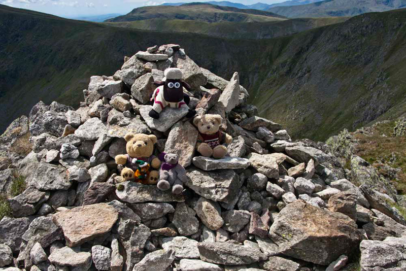
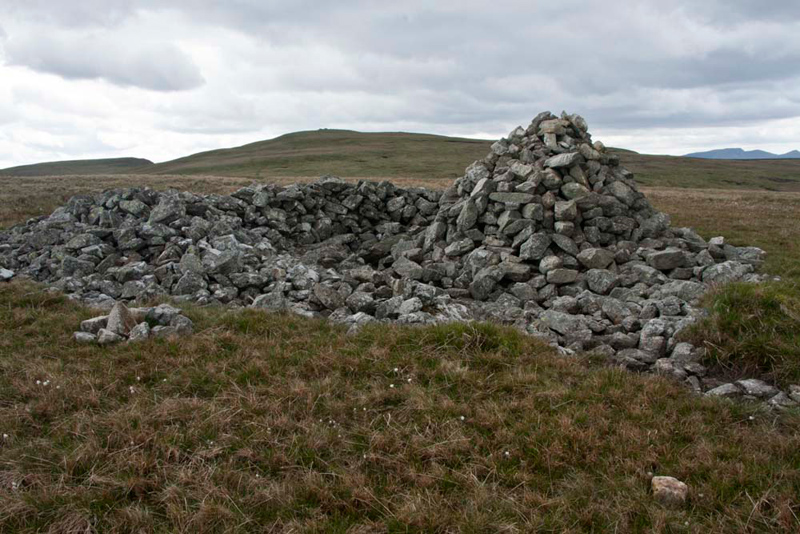
Looking up from the map, Shaun said, "Low Raise, a Birkett summit is next. We head roughly north-east on that clear track. After a bit of gentle descent it is then pretty flat walking."
In fact it took Dad just ten minutes to the flat summit crowned by this large cairn and tumulus, pictured with High Raise on the skyline.
"Picture time again", called out Little Eric, as we scrambled out to sit on the lee side.
Looking at the map, Allen said, "we are now at the furthest point
from our start, so as they say we are finally turning for home."
"We have to head down the
south-east ridge, that gets steep near an area marked on the map as Hanging Stones", advised Shaun.
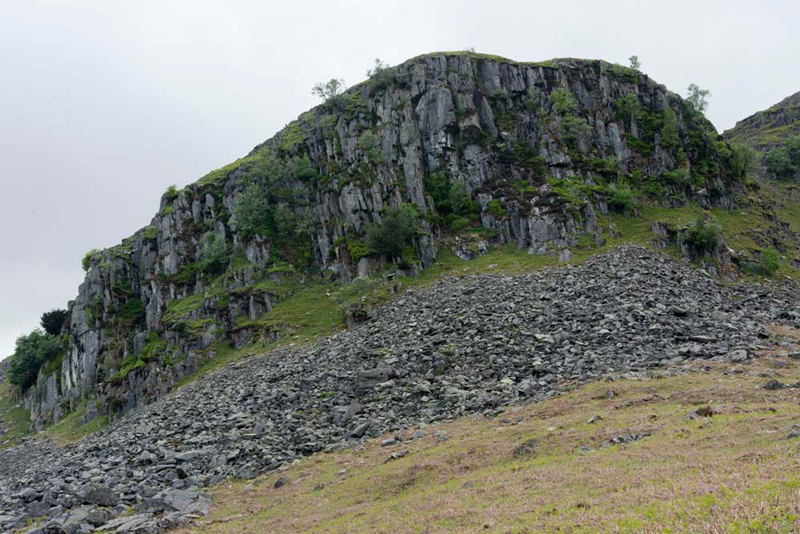
It is unfrequented, so the descent was over trackless rough grassy terrain. As Shaun had indicated eventually this steepened as we encountered
crags. Here Dad carefully picked his way down, before climbing
slightly to cross the undulating end of the ridge.
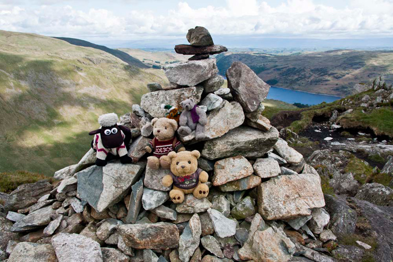
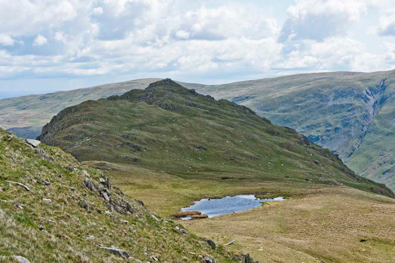
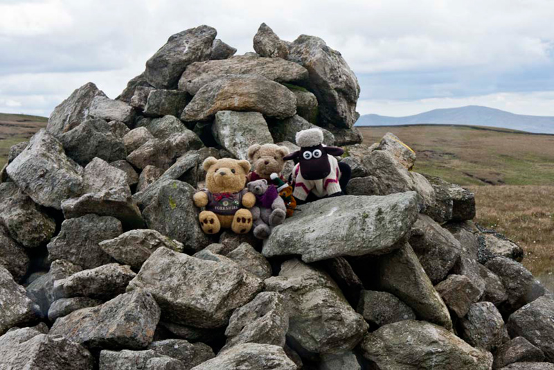
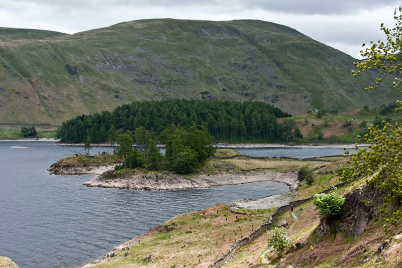
Tetley pointed, "there's our final objective, the separate little top of Castle Crag, across that tiny valley below.
The ascent was soon done, and we jumped out to sit at the cairn for our final picture today.
Grizzly told us, "this is the site of an Iron Age
Hill Fort, where limited excavation was carried out in the 1920s."
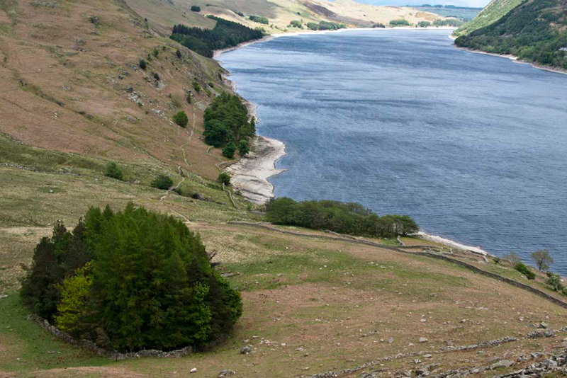
To the north below is this small
enclosed plantation, with Haweswater stretching away behind.
"I wonder what the reason was for creating it?", mused Little Eric.
"To regain the path by the reservoir
we have to walk to this plantation", said Shaun. "But, not directly as the
north side of Castle Crag drops away vertically, and stepping over
will be certain death."
"Instead we should circle left to find the old narrow trod that contours down to the plantation", instructed Shaun.
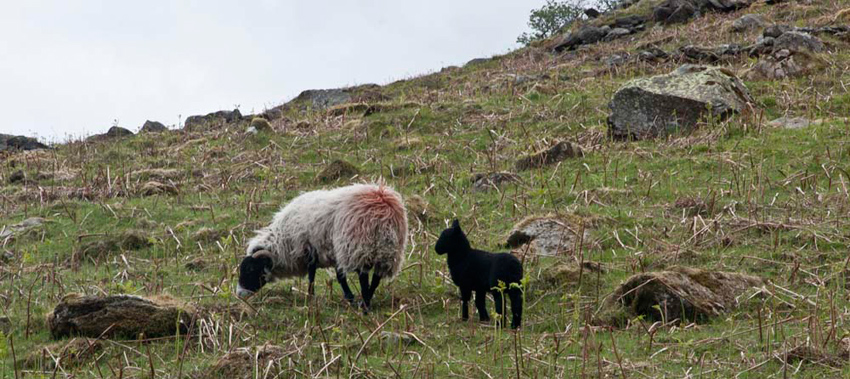
To Allen's joy we had not seen many sheep today, but his hopes of having a sheep picture free story, was dashed as we espied this ewe with its
black lamb. "So near yet so far", sighed Allen.
Facing the plantation, Shaun then said, "we just go right to path by the reservoir."
This was followed for
about two miles south over Flakehowe Crags, Gate Crag,
Bowderthwaite Bridge and The Rigg and so to the car. There were
further fine views including this of Speaking Crag and the The
Rigg backed by Branstree.
"What a superb walk", cheered Allen as we arrived at the car.
"We have all enjoyed it, despite the wind, and we have got another few Birketts ticked off", added Tetley.
"A big thank you Dad as always", said Grizzly.
"And especially from me", called out Little Eric. "I have ticked off all the Wainwright summits today too."
We admit to being pretty tired when we
got home so slept very well.
"Refreshment time Dad?", said Shaun.
"Yes lad, after all that effort I am hungry."
So,
he stopped at Junction 38 Services at Tebay. Here he fortified
himself with a roast beef dinner, chocolate cake and pot of tea
with extra hot water. Well he had certainly earned it!