RAMBLE in the LUNE VALLEY,
from DEVIL'S BRIDGE, KIRKBY LONSDALE
Summary
Date -
3rd January 2010, 4th January 2015 & 9th March 2017
Distance - 12.5 miles, 11.75 miles (9/3/2017) Ascent - 831ft
Map - OL2
Start point -
Devil's Bridge,
Kirkby Lonsdale (SD 616782)
Summits Achieved
Name
Height (ft)
Height (m)
Grid Ref
Gildard Hill
377
115
SD 5214 8023
Preface
"Brrr", isn't it cold",
said Allen.
"It certainly is, and the
longest cold spell I can ever remember", replied Tetley.
"Still there is no snow, so
perhaps Dad will take us for a walk on Sunday to get our 2010
account underway", chipped in Grizzly.
"Shall I go and find out?",
asked Allen
"No need", replied
Grizzly, "that is what Shaun is doing now."
"Here he comes", called
out Tetley, who was looking towards the door.
In trotted Shaun, with Little Eric
riding on his back.
"Well?" enquired Allen
excitedly.
"A walk is on, going up the
Lune Valley from Devil's Bridge. It is 12 miles so we will get a
good start to 2010, and there will be good views too. And before
you say it, Allen, yes we have done it before, but there is no
harm in repeating nice walks."
"I'm fine with that",
replied Allen, "and also Little Eric has not done it."
"I'm really looking forward to
going" said Little Eric, giving a cheer too.
It was repeated again almost five years to the day, so getting out 2015 account off to a fine start with regard to distance. The only variation, was that after crossing the grounds of Casterton Hall and reaching the road, we this time turned left to Casterton Hall Golf Club, and then return along Laitha Lane. At the narrow road we descended right to Devil's Bridge.
Photographs were taken of course, including different ones not taken in 2010. So thanks again to Dad's nimble fingers, the original 2010 story has been augmented with additional narrative and extra pictures.
In March 2017, we once again repeated this walk. A sunny day giving fine views. Having all been to the summit of Gildard Hill today we stuck to the published route that avoids the summit. Following recent rains conditions underfoot were extremely muddy and places, and with this in mind it was decided to avoid Laitha Lane, returning along the road after exiting the grounds of Casterton Hall. Some photographs were taken and with thanks to Dad some have been included to further augment this story.
The Walk
It was a frosty morning, as we
dashed out to the car. Dad completed putting his gear in the boot,
then said his goodbye to Uncle Brian, and we set off up the Lune
Valley. Everywhere was frosty, and Tetley commented as we arrived at the start, "the temperature
is minus 4C.
"Snuggling deeply down in the rucksack will be a priority then", replied Grizzly.
It was to be a
superb day with clear blue skies and hardly any wind, although
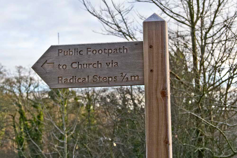
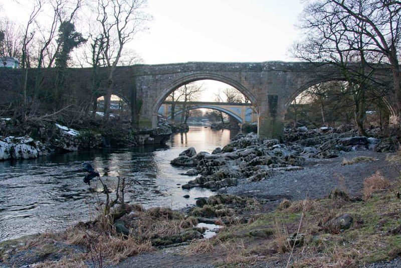
the temperatures barely got above freezing all day. Dad parked on the approach to Devils Bridge, then once ready Shaun advised. "we take the signed path left through the gate, alongside the river."
Dad stopped to take this shot of Devil's Bridge. Grizzly told us, "the impressive three arched bridge constructed of well masoned gritstone,
spans the River Lune, and dates from around 1370. It no longer carries traffic, this
being catered for by a more modern bridge we can see just a very short
distance south."
Grizzly went on, "in common with many bridges of the
same name, legend holds that the Devil appeared to an old woman,
promising to build a bridge in exchange for the first soul to
cross over it. When the bridge was finished the woman threw bread
over the bridge and her dog chased after it, thereby outwitting
the Devil. Several large stones in the surrounding area,
including the Great Stone of Fourstones are ascribed to the Devil's
purse-strings bursting open as he ferried masonry to build it."
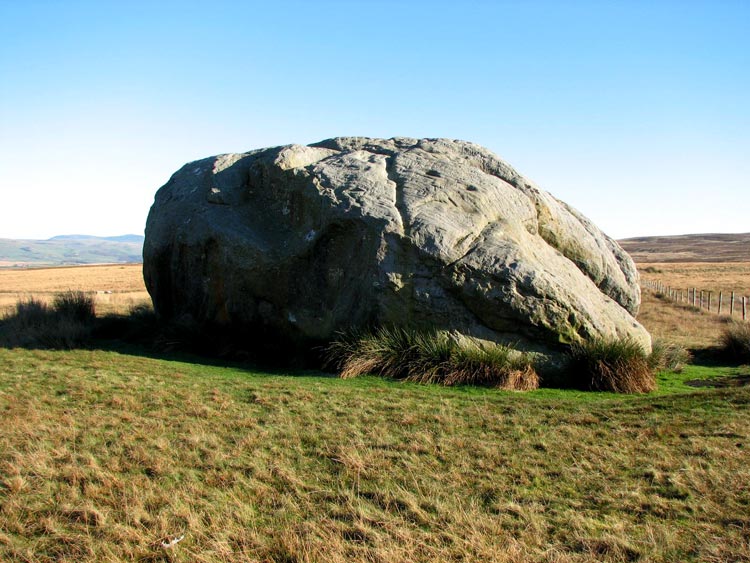
This picture was taken in November
2005, on a walk with Uncle Eric. The stone lies on an otherwise
featureless moor, above the town of Bentham. As can be seen it is
huge measuring about 30 feet round and 12 feet high, with steps
cut into it, which we scampered up so we could sit on the top.
There were once three other stones next to this one (hence it's
name), but they were apparently broken up for sharpening scythes
about two hundred years ago.
Right, back to today's adventure.
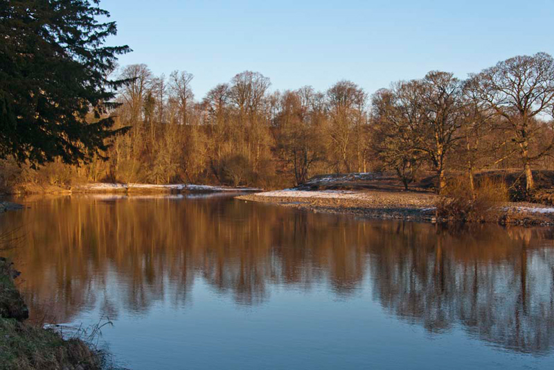
The path by the river was followed passing below the town of
Kirkby Lonsdale. Suddenly a beautiful sweep of the river opened
before.
Oh that is just so beautiful", cried Allen. "A photograph is a must."
Just then a gentleman came by, and
seeing Dad with his camera enquired what model it was. His name
was Barry Healas, and he is very interested in photography,
as well as being very passionate about Gaff-Rigg Sailing. Quite a few minutes chat then ensued,
about photography and Dad was very pleased to have met him. Now
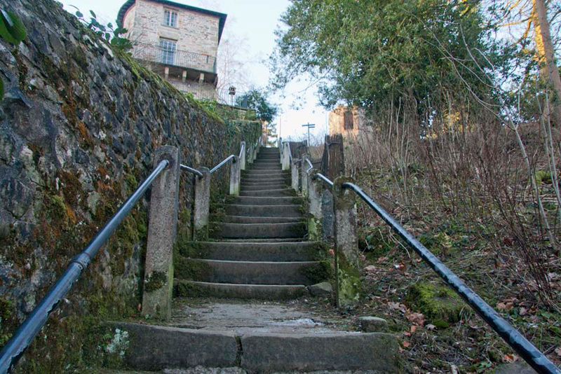
both Barry and Dad were faced with climbing the so called Radical
Steps that lead to the church and town. (70 odd steps and steep).
Climbing steadily, Dad was a little out of breath as he reached the top. "Phew they really were steep", said Little Eric.
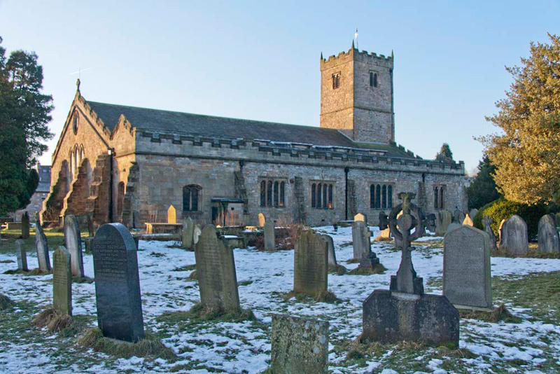
At the top, walking just a few
yards left we were able to see the impressive St Mary's Church across the snow covered graveyard. The
early morning winter sun is warming the stone of the east end and
tower.
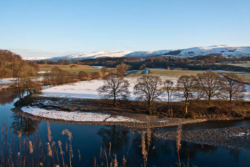
Returning along the path and just
beyond the top of the steps is the magnificent view of the
sweeping bend of the river backed by the snow covered hills. "Just stunning", breathed Tetley.
Grizzly said, "this is known as Ruskin's View,
because of a comment John Ruskin made after seeing J. M. W. Turner's
painting of the scene. He said, 'The Valley of the Lune at
Kirkby Lonsdale is one of the loveliest scenes in England. .
.'."
By now about an hour had passed,
but as you can see there had been plenty of picture stops, as
well as Dad's chat to Barry. So Tetley said, "if we are going to finish this adventure today, we had better get a
move on."
Dad replied, "yes, you are
right", as he headed determinedly along the path that took
us into Underley Park.
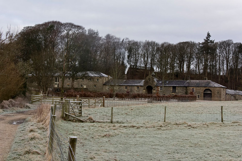
Crossing a small stream, the path
turned left to a gate, with the buildings of Home Farm before us.
The footpath was to the left of the fence and on to the access leading to the road.
"We go right", called out Shaun, "and then shortly right again along the rather narrow road that leads to Mansergh, Rigmaden &
Killington."
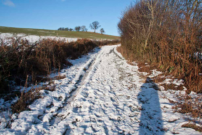
Like all the narrow side roads we were to walk along
today, it was still beset with snow and ice, there just being two
tracks where the tyres of vehicles had cleared it. This provided
mostly a good surface to walk upon - when there were no vehicles
coming along that is, which was most of the time. The uncleared
sections were solid ice at least two inches thick. As we walked
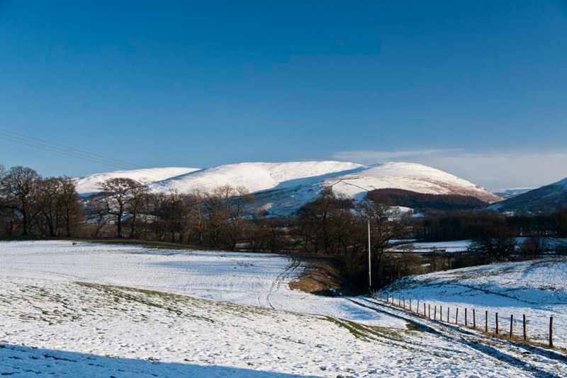
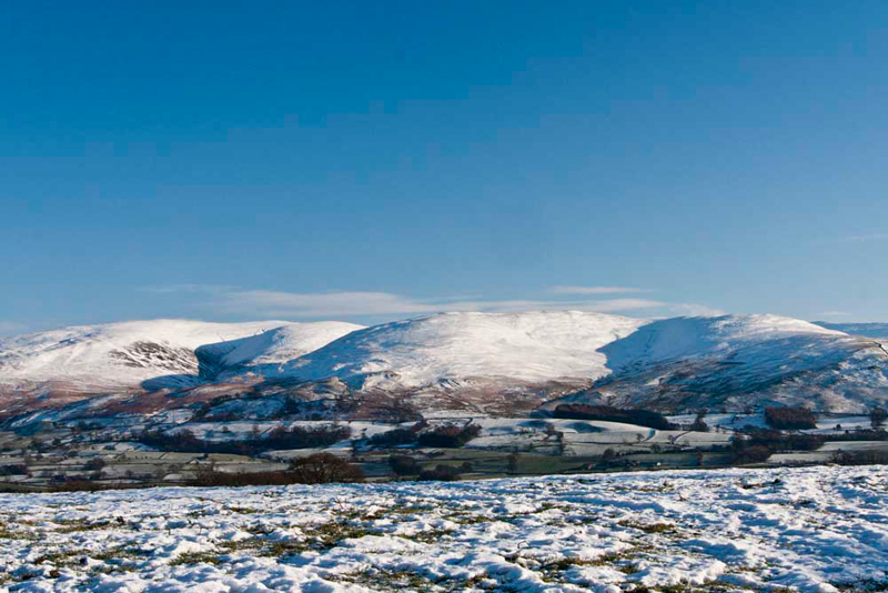
along, to the right the view was wonderful of the fells, white
under their blanket of snow.
"Is that Middleton Fell?",
asked Little Eric.
"Yes", replied Allen
knowledgeably. "We all climbed it in May 2008, in the
company of Uncle Bob."
"That was the day we thought
we were going to get caught in that wicked thunderstorm, but
thankfully it went away to the east of where we were walking",
said Shaun.
"It looks superb today, so
take a picture please", implored Tetley.
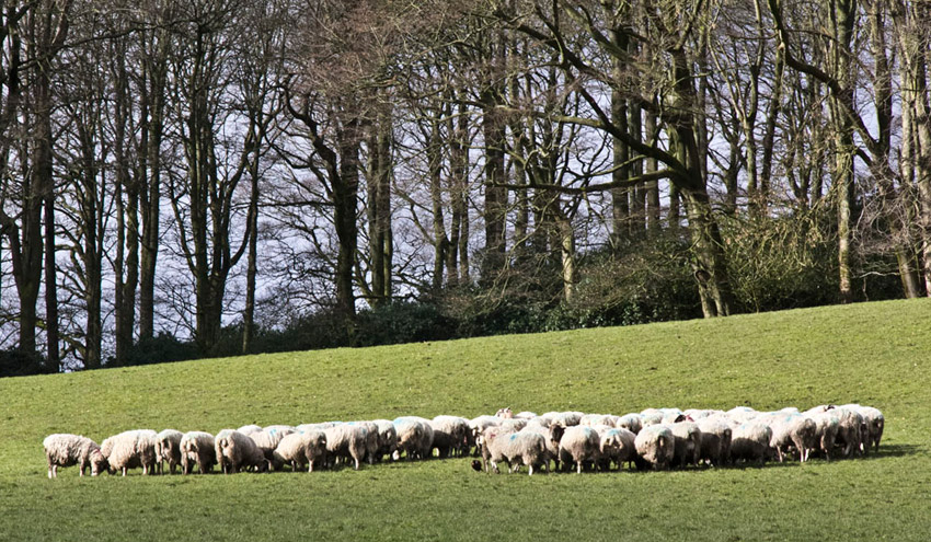
All was green on the day in March 2017 and to the right we saw that the farmer had just delivered feed for his flock that had hungrily gathered to devour it...
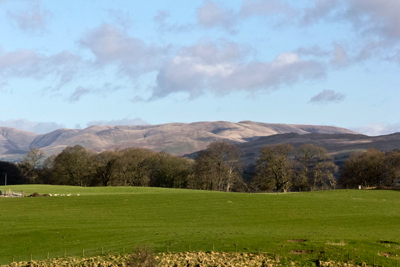
... and as well as the fine view of Middleton Fell, today in 2017 there was this of the Howgill Fells. "Ahh", sighed Tetley, "we had many lovely walks exploring them."
Approaching Mansergh Hall Farm, the road
bent right. "We go ahead up the track, Chapel Lane, between the hedges", said Shaun.
"The fact that this leads to Mansergh Church, is presumably the origin of the name", commented Grizzly.
This picture was taken in 2015, but in 2010 the track was covered in deeply frozen snow. The low winter sun gives a long shadow of Dad lining up the shot.
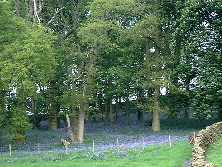
Presently Grizzly said, "that
wood over there looks familiar. If I remember rightly it will be
carpeted with bluebells in spring"
"You're right", replied
Dad. "I took a picture when we did this walk in May 2004. It
looked magnificent."
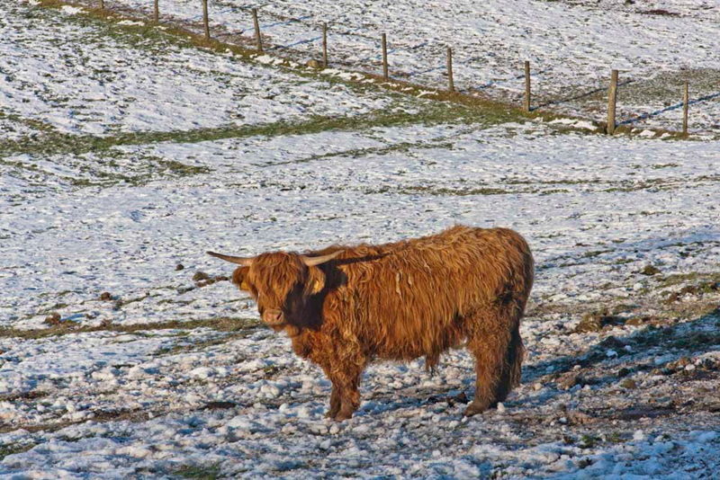
In an adjacent field were some
Highland Cattle. Pointing Little Eric said, "that one makes me think about our hug pal Hamish."
They were well catered for with hay, in a feeder just out of shot
to the right.
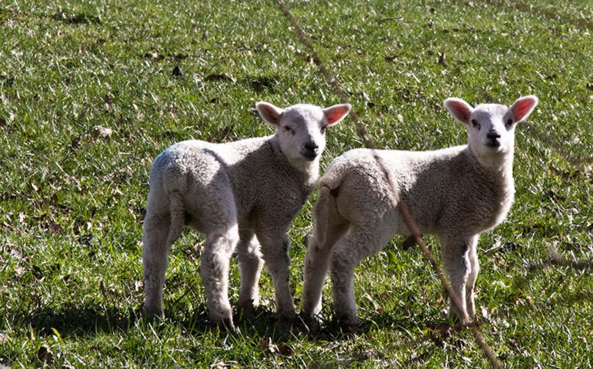
In 2017, spring was upon us and there were lambs in the fields beside the track.
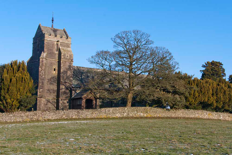
After a gate we entered pasture,
and come to Mansergh Church. Grizzly told us, "it is dedicated to St Peter, and dates from 1880. The unusual tower at the west end
has a saddleback roof which is topped by a handsome weather cock. The timber porch on a stone base was added in 1903."
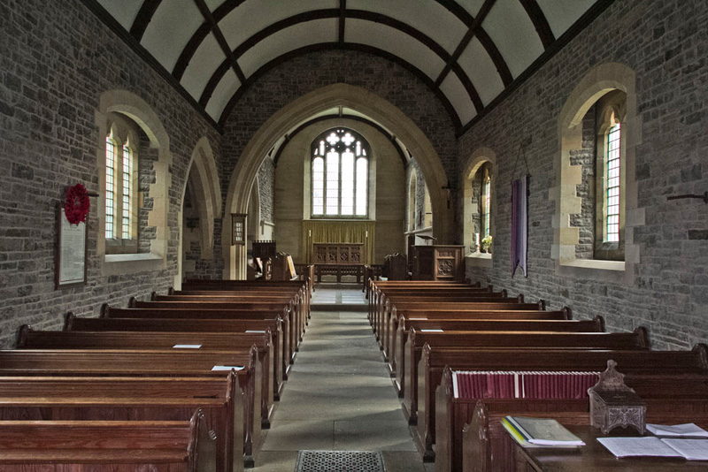
On our walk in 2015, Grizzly asked, "can we go inside Dad?"
"Certainly lad, that's if it is not locked."
Well it wasn't and here is the view along the nave showing the waggon roof.
On the wall in the tower was a plaque that gave us information about the building of the current church, which replaced a church built in 1726 or 1727. It states -
The Foundation Stone of this Church was laid in the 11th day of June 1879 by Christopher Hulme Wilson son of Christopher Wyndham Wilson and grandson of William Wilson of Rigmaden Park. William Wilson took the chief part in the rebuilding of the Church to which the Master and Fellows of Trinity College Cambridge the Vicar of Kirkby Lonsdale the Earl of Bective and other Landowners of Mansergh liberally contributed. William Wilson dying before the completion of the Church the work was finished at the recourse of his son C W Wilson.
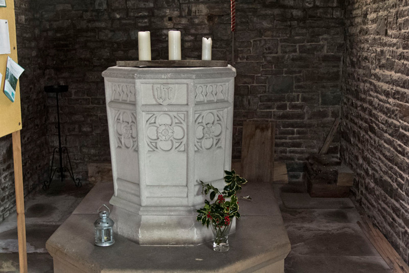
Within the tower is the octagonal font.
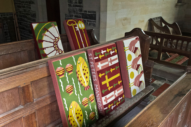
All around the church were colourful hassocks or kneelers, of which these are an example.
"That was really interesting" said Grizzly. "I love looking round churches." Then noticing a seat outside, said, "how about you take our picture Dad?"
"Sure lads. Get settled so I can line up the shot."
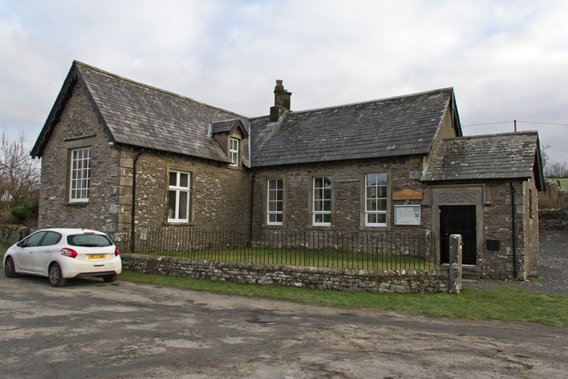
A lane by the church led down to
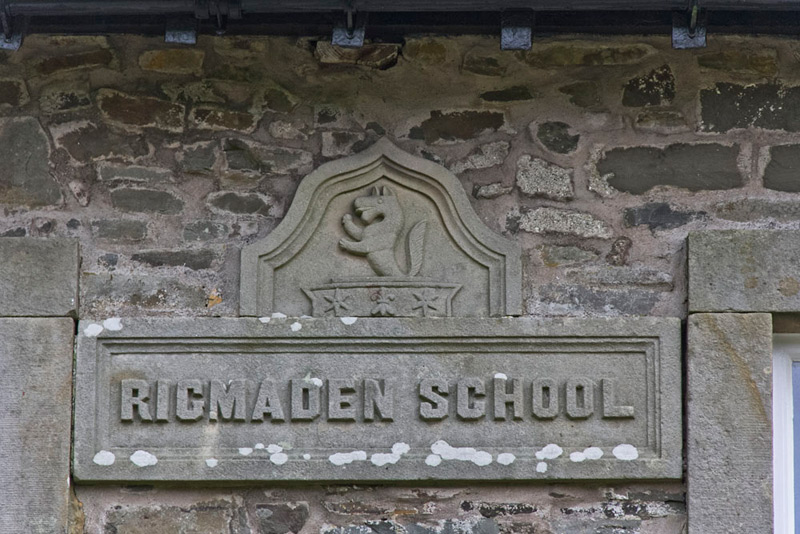
the road, where stands this building that is now Mansergh Community Hall, but was once Rigmaden School. This would appear to date from 1839 according to the date on the lintel over the door.
Set between two of the windows is the name stone, surmounted by a depiction of what we think is a fox.
Following the road right, we came to a sharp corner. "Again we go straight ahead along the hedged
track", instructed Shaun.
This climbed steadily to come to Mansergh
High Farm. Soon after, a gate gave access to pastures again. "Wow", called out Allen. "That's another fine winter's view across the Lune Valley
to Middleton Fell."
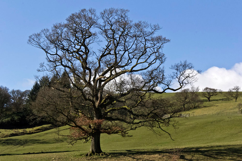
While on the slopes to the left this shapely tree amongst other stands bare of its foliage.
At the next gate the waymark
directed us right along the edge of the pasture and then down to
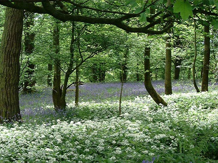
a gate. Passing the long deserted farm of Woodside, we walked on through Hag Wood.
Tetley said, "the leafless trees and bare ground
belie what a wonderful display of bluebells and wild garlic,
delight the eye in spring. We should include the picture you took in May 2004 in our story."
Exiting the wood through a gate,
the path led over a another wide pasture to the road at Rigmaden.
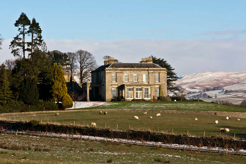
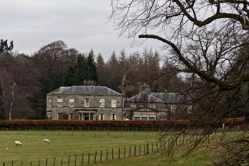
Above this stands the impressive buildings of Rigmaden Park. "It was built in the early 19th century for Christopher Wilson of Kendal", informed Grizzly.
"Long before any of you were born, I did this walk in August 1990. Then this building had suffered a terrible fire, and
was totally burnt out", said Dad. "It's wonderful to see it restored to its former glory."
We strolled the road past Rigmaden
Park and coming to a junction, Shaun said, "go right and follow the road as it winds round."
This took us past buildings that have been converted to residential use. They were
formerly Rigmaden Saw Mill. Then, passing Rigmaden Farm the road
descended through trees with a pretty beck running alongside, to
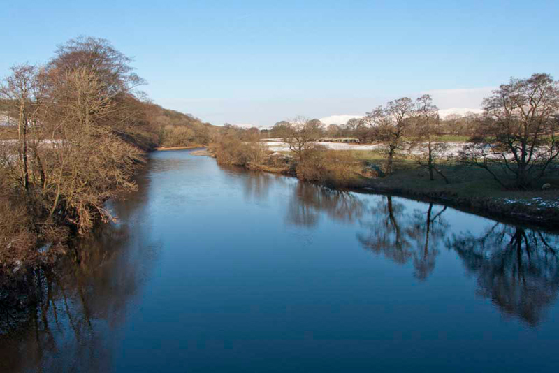
bend left and come to Rigmaden Bridge spanning the River Lune.
The river was very still, and dazzlingly blue in the winter
sunshine.
Soon we came to the main road, Shaun saying, "we go over that stile opposite, and then cross three
pastures to a minor road."
At the third stile we stopped just a
few minutes for a bite to eat, much to Allen's relief as he was hungry as usual.
"Will you take our picture sitting on the stile, Dad", asked Little Eric.
"It was right along the road passing
Apple Garth Farm. Coming to the next junction, Shaun said, "take the right fork, Betweengates Lane."
This is very narrow, so it was fortuitous that
Dad had stopped at the junction to ring Uncle Brian, as otherwise
he would have met a large farm tractor with little or no room to
pass!
At the main road, Shaun advised, "cross then just a few yards left, we take the access track right
Treason Field Farm."
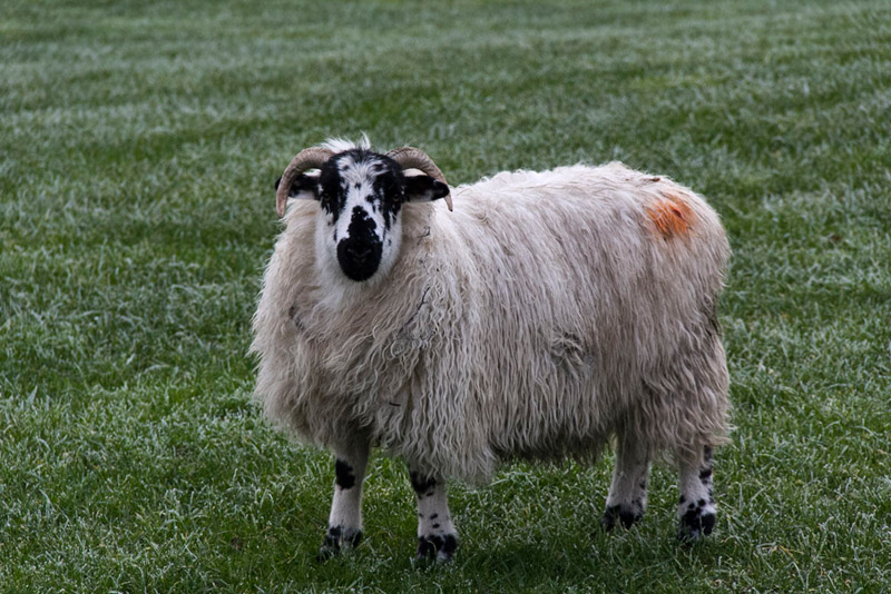
In 2015 Dad stopped by a pile of felled trees for a bite to eat, then setting off again was able to snap this shot of this handsome blackfaced sheep that posed for him.
Beyond this we followed the hedged track,
called High Beckfoot Lane, for about a mile to Beckfoot Farm.
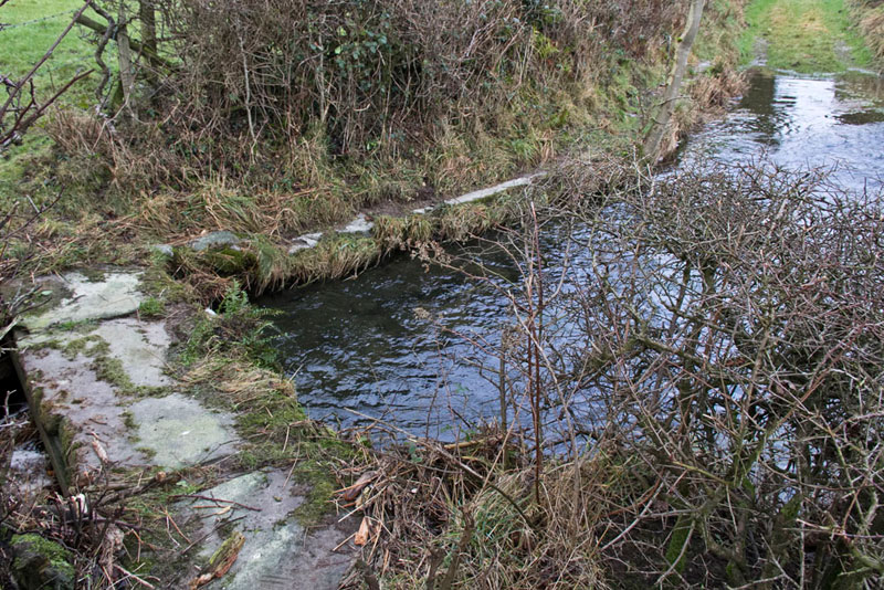
Near the start a deep stream crosses the track. This reinforced
raised path by the hedge and bridge allows the obstacle to be
overcome. This is taken looking back.
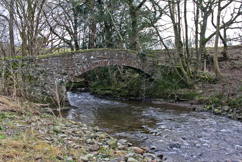
At Beckfoot Farm the beck is now crossed by a flat concrete bridge, replacing the more graceful packhorse bridge to its left. Grizzly told us, "the bridge dates from 1723 and is now Grade II listed."
From English Heritage records, the Parish Constable's Account for 7th January 1723 records a payment of £10 to Benja Craven and Josa Scott masons 'for the building a Stone bridge over Howden Beck at Beckfoot. In consideracon whereof ye said Benja Craven and Joshua Scott doe hereby promise joyfully and severally to uphold and keep sd Bridge in good and sufficient repair during the terme of seaven years from the day hereof, as witness our hands the day and year above sd'.
Beyond we joined the road
that winds round to a signed path on the right.
In 2017, before taking this, Allen complained, "I'm hungry."
"Me too", said Southey. "Let's gather round for lunch."
The path crosses
fields and climbs to come beside some trees, where just to the left stands the very modest Gildard Hill. "I have not been to the summit, unlike the rest of you", said Little Eric.
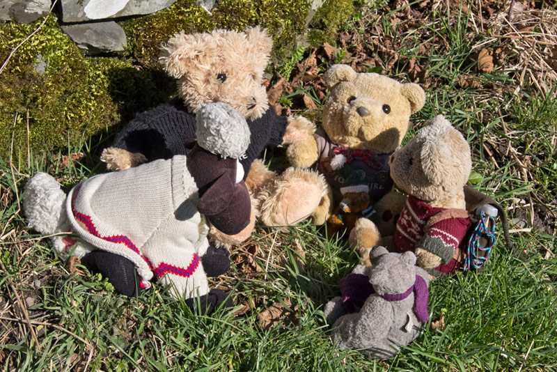
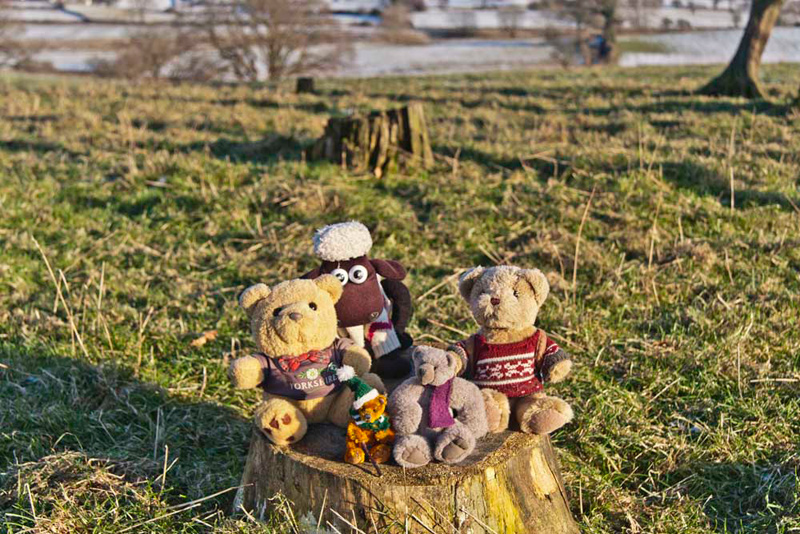
"Well we had better rectify that", stated Dad as he strode off.
A tree stump
provided a grand place to sit for our picture.
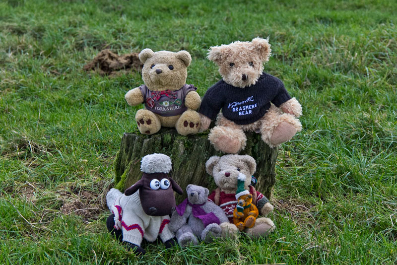
In 2015, a similar situation applied this time for our pal Southey. "Would you mind taking us to the top again, so Southey can bag the summit?", asked Tetley.
"Of course not lads."
Dropping down to the corner to rejoin the route, Shaun said, "through the gate and follow the path in the woods."
This led into a field that we crossed into more woodland, the track leading to Casterton Hall, where clearly signed the path is diverted around to the left of
the buildings. Following the signs, the final section across rough pasture brought
us to the road, where turning right in a few hundred yards we arrived at Devil's
Bridge.
"Despite having done this walk before, we have nevertheless
had a super today, especially seeing the majestic views of the
snow covered hills", said Allen.
In 2015 our return route was to Casterton Golf Club and then along Laitha Lane. This first involved walking a short way along the road, from which we had this fine view of Casterton Hall.
After changing, Dad then drove to
the village of Barbon, going to Mr Williamson's to stock up on
supplies of chutney and marmalade. Then in the warm car he drove
us home, stopping in the village of Hornby, to have tea and cake
in the cafe at the Post Office. There was plenty of tea, and
quite a large piece of chocolate cake. Dad told us that the cake
was not bad, but not up to the standard to Eileen's cakes.
In 2015, Dad's refreshment stop was of course Elaine's at Feizor, where he had a lovely bacon and sausage bun and pot of tea, being looked after by Megan. Again Sheila was on and Dad had remembered to take our pal Snowdrift, which is her favourite.