THE TEBAY GILL
HORSESHOE in the HOWGILL FELLS,
from TEBAY VILLAGE
Summary
Date - 14th February 2010
Distance - 6.5 miles
Ascent - 1040ft
Map - OL19
Start point - Mount Pleasant,
Tebay (NY 619045)
Summits Achieved
Name
Height (ft)
Height (m)
Grid Ref
Roger Howe
1034
315
NY 6173 0303
Powson Knott
1227
374
NY 6192 0214
Blease Fell
1556
474
NY 6237 0045
Hare Shaw
1548
472
NY 6274 0130
Knott (Tebay Gill)
1280
391
NY 6309 0228
Weather Hill
1132
345
NY 6308 0319
Preface
Allen strolled in with
Little Eric who had hitched a ride in his rucksack, to find
Shaun and Tetley, pouring over some listings.
"What are you
looking at?", he enquired.
"Dad has found
time to analyse our Howgill Fells challenge. So now we know which
fells each of us need to climb to catch up with Dad",
replied Shaun.
"He has said too,
that he will take us to all these before doing the ones that he
has not climbed, so that we can all finish them together, like we
did with the Outlying Fells last year", went on Tetley.
"How many walks
does it involve?", asked Allen, eager to know all the facts.
"Of those in the
main Howgill massiff, five in all. Two on the north side, one on
the west and two on the south", replied Shaun, after
consulting the lists.
Continuing on the same
theme, Tetley added, "there is also the matter of the
Whinfell Ridge, that just Shaun and I have done. It was a
substantial walk, as besides the five tops in the ridge from
west to east, there is then the matter of returning through the
Borrowdale Valley. In this regard, Shaun and I have been looking
at Dad's copy of A. Wainwright's 'Walks on the Howgill Fells'.
This details a number of walks that do the ridge in parts that
will actually make it more interesting, as doing it this way we
will visit areas we have not been to before."
"Sounds good",
replied Allen. Then after gathering his thoughts for a moment,
"that will make seven or eight walks in total."
"Yes", said
Shaun.
"By the way,
where's Grizzly?", asked Tetley.
"Watching some
sci-fi programme on television with some of his pals and Dad",
replied Allen.
However just then he
trotted into the room.
"Did you enjoy it?,
asked Tetley.
"Sure did",
he replied. "I also have good news too. Now that Dad has
worked out the Howgill Fells we have to climb, he is eager to get
on with ticking them off for us, so our walk on Sunday will be
from Tebay doing the round to Blease Fell."
Consulting the lists
again, Shaun interjected, "that is good news for you Allen
and Little Eric, as they are on your individual lists, and five
tops will be ticked off."
"Great",
called out Allen, doing somersaults round the room!
The Walk
It was not a long distance to the
start, just north along the M6 to Junction 38, so Dad decided
that we did not need to set off too early.
When we heard Dad loading his gear,
Grizzly called out, "come and let me put our picnic in your
rucksack, Allen"
"Coming" he called out in
reply.
That done we dashed out and settled
on the front seat of the car ready for the off. The motorway was
quiet and we got to Tebay without any delays.
As we drove along the slip road,
Little Eric asked, "which way are we going at the roundabout
today?"
"To the right towards Kendal,
and when we get to the sharp bend at the top of the hill, we park
just along the narrow road on the left", replied Dad. "This
was in fact the original road to Kirkby Stephen, prior to the new
road being built on the old railway line", he added.
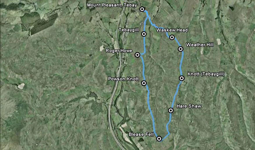
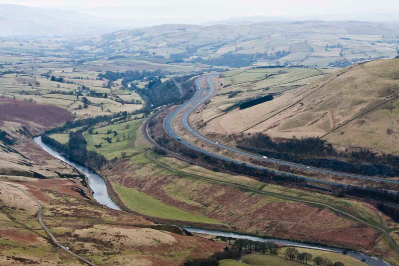
So, before we set off here is a map
of our route -
From Tebay the route
was south along the ridge above the Lune Gorge to Blease Fell.
The M6 shows up clearly to the left. After enjoying the view from
Blease Fell, we turned north along the ridge to the east of Tebay
Gill to return to the start. Within the bounds of the route, the
ravine of Tebay Gill, is clearly visible
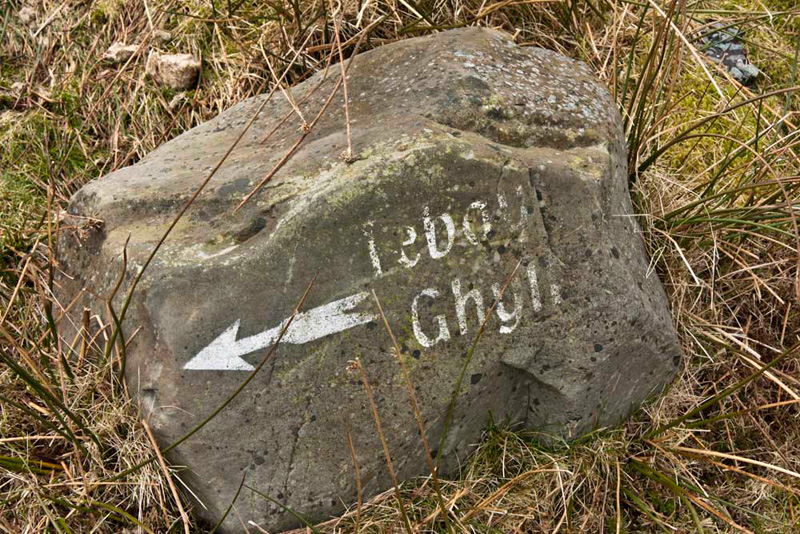
Dad got his boots and coat on, and we snuggled down into the rucksack. Shaun said, "our route is up that narrow road between the buildings."
This divided a number of times to lead to the
scattered buildings, and at the third fork, Tetley said, "we go left here towards the building called Tebay Ghyll, as indicated by the name
painted on that stone boulder."
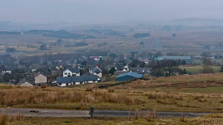
"There's a fine view of Tebay, with the M6 motorway sweeping north
into the mist beyond", called out Allen.
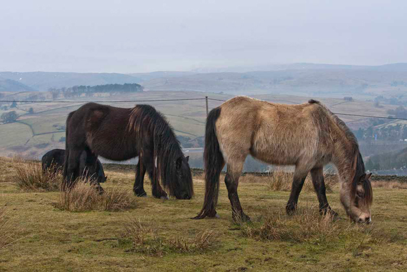
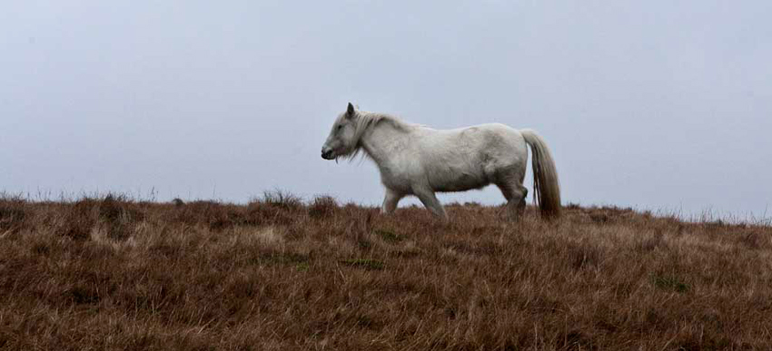
A group of horses were
unconcernedly munching away at the grass, totally ignoring us. "I wonder if these are some of the many wild horses that roam freely on the Howgill Fells", mused Grizzly.
As Dad finally put his
camera away, Shaun piped up, "come on Dad, we had better be
getting on, or we will never complete the walk."
"OK",
replied Dad striding purposefully on up the hill.
The rough track
continued past Tebay Ghyll and up the east slopes of
Roger Howe. "That's the first summit", enthused Little Eric.
"The summit is over to the right", said Tetley, looking up from the map.
Dad struck off
half right over the thick grassy terrain to the wide flat summit area.
Shaun said, "from our previous visit we have the grid reference for the spot height marked on the map, so the GPS will guide us to this."
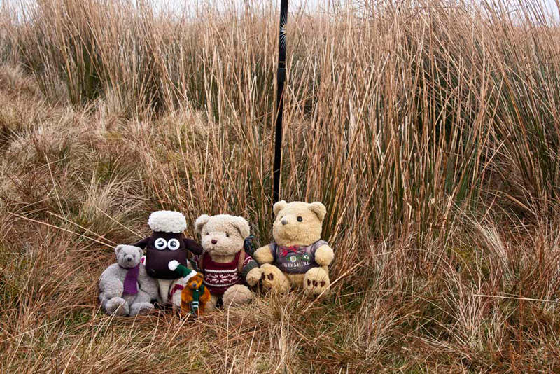
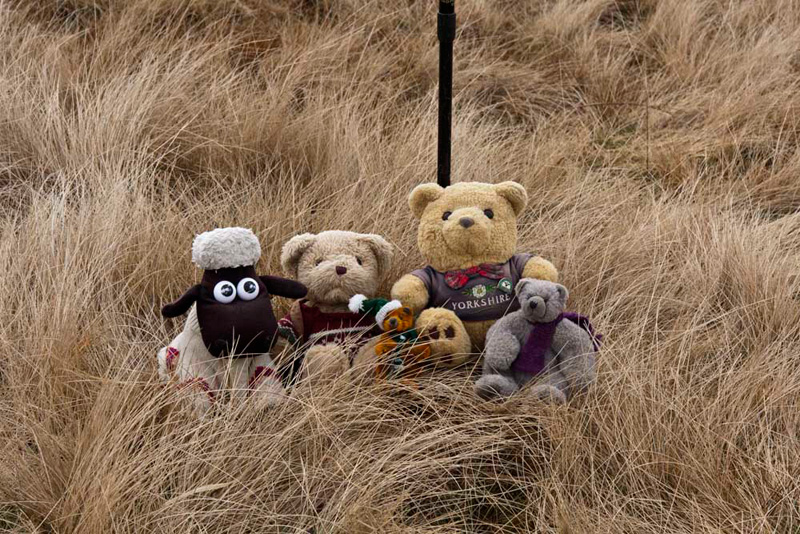
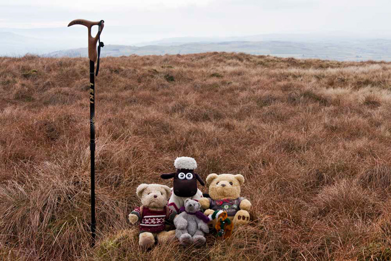
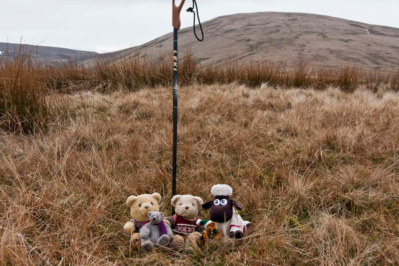
There Allen said, "great, one down. Time for our picture for the record."
Settled again, we walked on drifting left to regain the
cart track. Allen was looking at the map. "this indicates that the track ends before the next
summit, but I can see that it clearly continues well beyond."
"As we know not all the paths and tracks are shown on the maps", replied Shaun. "As for today, I recall this track goes all the to Blease Fell our furthest point south
today."
So, striding the track, the ground rose ahead to the summit
of Powson Knott. Another unmarked grassy top, so once again having the grid reference and the GPS helped."
Two down", cheered Little Eric, as we scrambled out to settle for our picture.
As Dad strode on, Tetley pointed, "that's the pretty and
unspoilt valley of Borrowdale."
"I thought Borrowdale was near Keswick?", queried Little Eric.
"Yes you're right", agreed Tetley. "Before the reorganisation of the boundaries in 1974, the county now Cumbria was actually two counties Cumberland and Westmorland. So, this is Borrowdale in Westmorland. The more more dramatic and beautiful namesake near
Keswick, was originally in Cumberland."
"Visibility is not
brilliant today, so the ridge to its southern side is rather lost
in the mist, but the the summits in view are left to right,
Whinfell & Castle Fell. The valley heads due west before
swinging north west below the hills", said Shaun. "It was
absolutely idyllic walking through that valley."
"I agree",
replied Tetley. "It is seven years ago too. How time flies."
After a last lingering
look, Dad strode off again, heading on south along the cart track,
descending slightly at first, before climbing on to our ultimate
goal of Blease Fell. The track had been dry and run straight and
true, but we encountered a rather boggy section on the final
ascent.
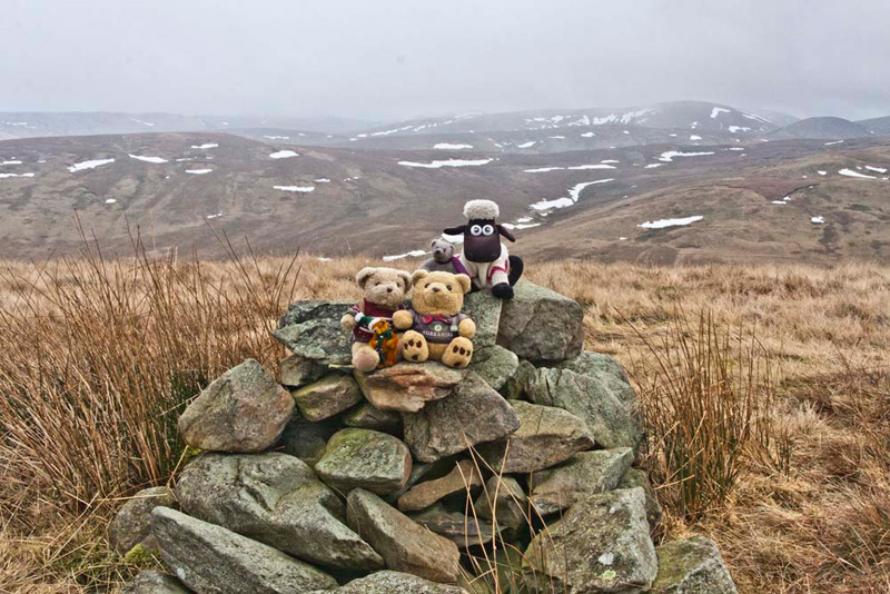
"Look there is
the cairn", called out Allen, urging Dad to head to it.
"Hold on a minute",
replied Grizzly. "That is the viewpoint, but not the summit,
which is amongst that bog and long grass to the left."
"Yet again the summit is a large flat expanse,
so actually deciding the highest point is going to be a little difficult", commented Little Eric.
Using the GPS, Dad
cast around to find as near as possible the position of the spot
height on the map. After a minute or so he stopped and declared, "this will do."
Getting rather fed up of the fact that there were no
cairns marking the summits, a little grumpily we hopped out
and settled on a large grassy tussock for our picture.
Jumping
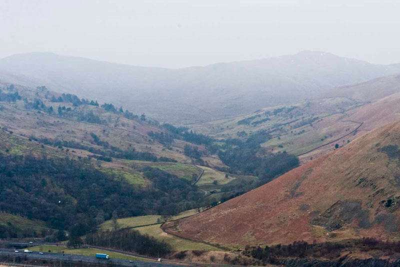
into the rucksack, Dad then took us to the cairn, from which there is this dramatic view. "Wow", called out Allen. "Worth the effort to get here."
Unaffected by human
intervention the River Lune, carves its way through the valley on
its route to Morecambe Bay. Man's influence can be seen with
first the Victorians who built the railway - part of the main
line between London and Scotland. In the 1970's following a
similar line but higher up the hillside the civil engineers built
the M6 motorway. It is tiered on its passage through the gorge.
This lessens the impact on the landscape, and helps to prevent
closure in severe snowy conditions. The narrow road to the left,
starts from the A685 Tebay to Kendal road, at Low Borrowbridge
and runs under the west side of the Howgills eventually to
Sedbergh. Part of the first section, known as Fairmile Road, is
in fact on the course of a Roman Road, there having been a fort
near Low Borrowbridge.
"Time for lunch,
so get the sandwiches out", said Shaun.
"OK",
replied Allen taking his rucksack off.
Dad got his sandwiches
out too, and we all sat munching away, enjoying the lovely view
before us and it was with some reluctance that we packed up and
settled in Dad's rucksack for the return leg.
A clear path was
followed that seemed to be curving round to the north, but then
it started descending and turned more east. "This is not the direction we
want", stated Shaun. "We should abandon the path and make directly north across the rough boggy trackless ground."
Suddenly Little Eric
called out, "look there are the group of wild fell horses we
saw from the other side as we approached Blease Fell."
They were making their
way in that direction now, but we wanted Dad to try and get a
picture. However they were totally unconcerned about us, and had no intention of posing for Dad, but he did manage to get this shot of the
last one as it walked slowly away. It makes plain too, how deep
the tussocky terrain is.
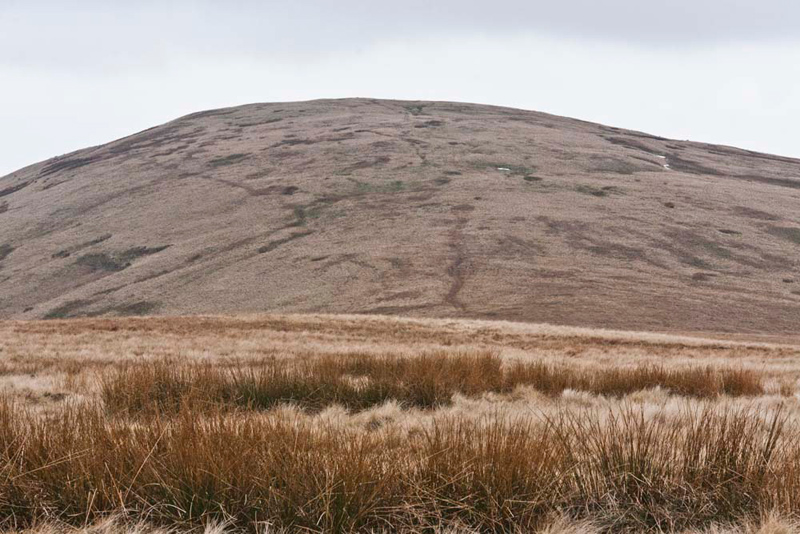
"That's Hare Shaw ahead, our next summit", pointed Tetley.
We ploughed on, and to Dad's delight a track materialised, which led to the summit.
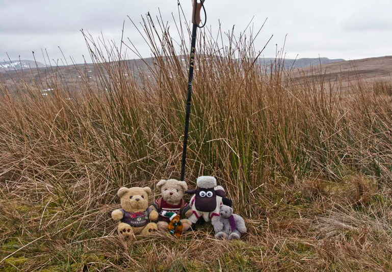
As we approached Allen
let out a cry, "at last a cairn for us to sit on for our
summit picture."
"Just two summits to go", said Little Eric. "I can see that the track leads down and then on up the gentle slopes of Knott."
There, Tetley said looking back, "We've come quite a way from Hare Shaw and lost some height too."
"The summit is just a little way off the path", said Shaun, checking the GPS reading.
"Unmarked again", commented Allen as we arrived.
"This is one of the three summits in the
Howgills called Knott", said Tetley. "The others are south of Ravenstonedale, and north-east of Sedbergh. "If we are to complete this challenge, Dad
will have to take us to all three."
There's the last summit today, the modest rise of Weather Hill", pointed Grizzly.
Dad strode off, and after about half a mile or so its flat unmarked
summit was attained.
A very gentle
descent soon brought us to the bridleway and the sadly forlorn
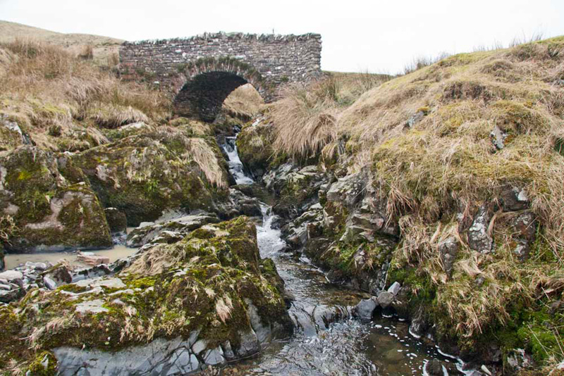
and neglected buildings of Waskew Head. Turning left the
bridleway was followed down eventually crossing Tebay Gill Beck
by a stone arched bridge, the south retaining wall of which was
in need of considerable repair.
"The stream with
its rocks looks like it might make an interesting picture",
remarked Tetley.
"OK, we'll have a
look" replied Dad, as he clambered down the bank and lined
up the camera.
Strolling on, we soon reached the junction where we had walked up past
Tebay Ghyll this morning. Then just a short stroll along the road and
we were back at the car.
"Super walk", cheered Allen. "Thank you from Little Eric and I for repeating it so we could tick off the summits."
We then settled in the car
to have the rest of our picnic, while Dad went in search of
refreshment. We expected him to drive to Junction 38 services,
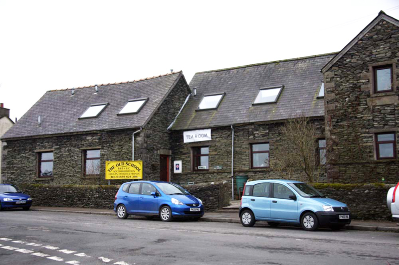
but as we had parked this morning Dad had noticed the Old School
Guest House & Tearoom, just a few yards away, so he decided
to go here today.
The building was as it
says the old school, and is owned by Steve & Joanne. They
bought it some years ago and operated it as a guest house, but
last year they opened the tearoom, in what was one of the old
classrooms. It is very nicely appointed, homely and welcoming.
Dad had a lovely bowl of soup, then a nice roast pork dinner,
well deserved we agreed after his efforts today. There is a wide
range of food on offer, and the tearoom is open every day. For
more information click the following link - www.theoldschooltebay.co.uk.
Suitably rejuvenated
all that remained was for Dad to drive us home, going along the
old road to Kendal, and then to Low Sizergh Barn farmshop, where
we bought some delicious Oaties biscuits, to take home for Uncle
Brian.
"Thank you lads, very thoughtful", said Uncle Brian. "They are my favourites."