KNOUTBERRY, THE
SOURCE OF THE RIVER LUNE, GRERE FELL & KNOTT from
RAVENSTONEDALE
Summary
Date -
(1) 21st February
2010 (2) 2nd March 2010
Distance - (1) 3.25 miles (2) 6.75
miles Ascent - (1)
300ft (2) 1100ft
Map - OL19
Start point - Ravenstonedale (NY
722041)
Summits Achieved
Name
Height (ft)
Height (m)
Grid Ref
Knoutberry
1736
529
NY 7042 0131
Grere Fell
1785
544
NY 7030 0053
Knott (Ravenstonedale)
1526
465
NY 7142 0129
Preamble
Over lunch
STAG were discussing where the next walk might be.
"From
what I overheard Dad saying to Uncle Brian, I think he intends
for now to continue with ticking off more of our outstanding
summits in the Howgill Fells, so I wonder which walk we will do
next?", said Allen.
"From
what I recall, Dad said he wants to get the northern section done
once and for all. That being the case, we will be doing the walk
to the source of the River Lune, from Ravenstonedale",
replied Grizzly.
Shaun
piped up, saying, "that will make progress for the rest of
you, as I went there with Dad and Uncle Eric ten years ago. That
was in the early days of Dad taking us along on walks, and I was
the only one who went regularly and even then not on every single
walk. It will be an interesting adventure, and there are some
fine views into the rest of the Howgill massif."
"I
went with you on some of the walks at that time, but for reasons
no one can now remember, Dad did not always take me along",
interjected Tetley.
"That's
right", replied Shaun, "but from 2001 onwards, I
happily had you for company on every walk we went on."
"It's
nice the hear about the early days, long before I was adopted",
added Allen.
Preface & Route
And so it turned out that the next Sunday (21st
February), we set off for Ravenstonedale. There was fog at home,
but Dad was confident it would lift and hoped that the day would
be good. The fog gave way to frosty ground as we headed north,
but we were not prepared for, nor expected, the scene that
greeted us as we arrived. All was white under a covering of snow,
and more was gently falling. Thinking the weather would improve
we set off out of the village and on towards Knoutberry, the
first summit. Soon however the track petered out and route
finding was difficult in this totally trackless area, also
visibility was very poor in the continuous snow. For these
reasons and the fact that Dad was concerned about being able to
get the car out of the village, on our return some hours later,
he decided to abort after about a mile and a half from the start.
We returned for another attempt on 2nd March,
when we had Uncle Eric for company too. The day was in complete
contrast with clear blue skies and excellent visibility, with
everywhere still white under snow. We were glad that Dad had
aborted the first attempt, as today was a superb day for this
adventure.
The story of the walk will be a combination
of the two days, the pictures graphically illustrating the
contrast in the weather conditions.
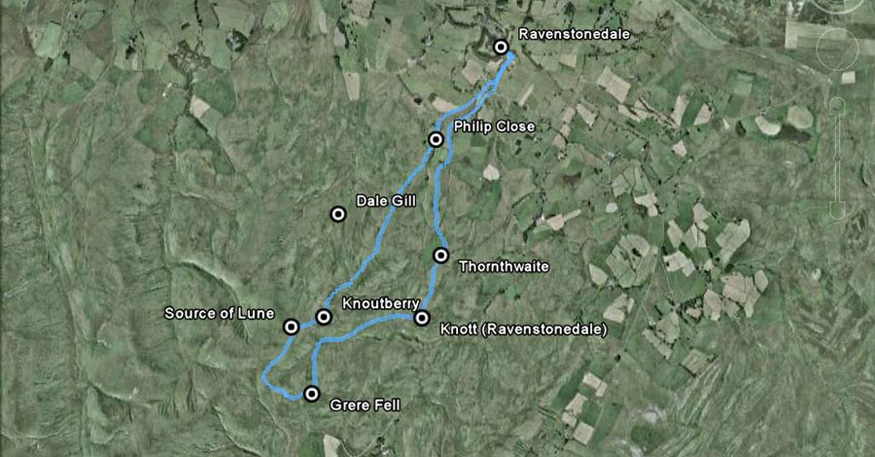
Before we start, here is a map of the route
-
Through the village
the path leads over the footbridges and joins the track signed
Tarn Riggs. This leads on past the enclosure of Philip Close.
Ascending Snowfell End the summit of Knoutberry is finally
reached. Ahead on the slopes of Green Bell lie the springs of the
source of the River Lune. Contouring round Green Bell a col is
reached and walking left it is an easy ascent to Grere Fell. We
now make a steep descent due north of Grere Fell to cross Long
Gill, where a path leads to the last summit Knott. Descending,
the large enclosure of Thornthwaite comes into view. This is
skirted to its right where a path and track materialise leading
past Kilnmire Farm and into Ravenstonedale. NB - the indication
of Dale Gill, refers to the name of the stream from the actual
source of the Lune.
The Walk
We got ready for the off about 08:30 on the Sunday of 21st February, Tetley commenting, "the fog is down."
"Dad feels confident it will lift, so we better get settled in the car, as he has got his gear loaded", replied Allen.
Heading north on the M6, we left the fog behind, the ground was
white with frost.
Nearing Tebay the cloud was down and, as we drove east towards Ravenstonedale, Little Eric said, "it's starting to snow."
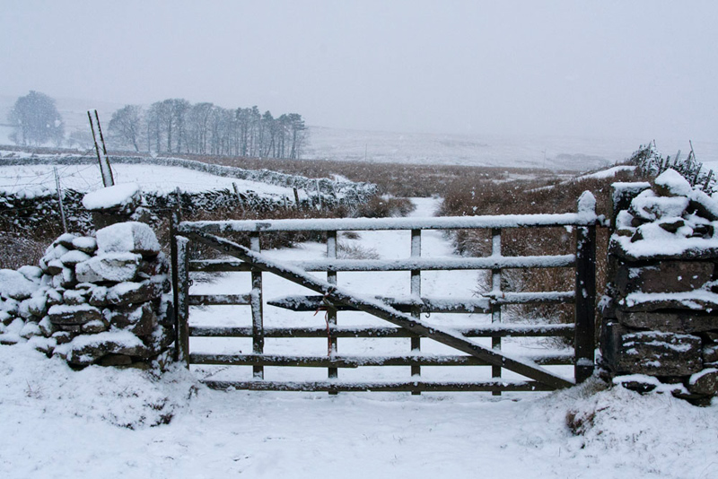
Leaving the main
road and entering the village, the tyres of Dad's car created the
first tracks through the snow. We parked by the school, in one of
the few remaining places.
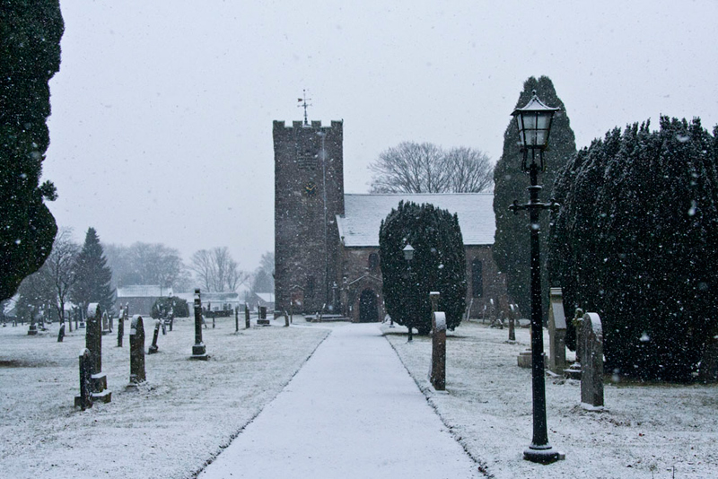
"I wondered if the others are parishioners at St Oswald's Church, but there are no footprints on the path", commented Grizzly.
As the snow gently
drifted down we set off. Shaun said, "follow the road through the village to Town Head and then take footpath right."
It was necessary for
Dad to take care, for beneath the covering of snow were deeply
frozen patches of ice. After he nearly slipped over, he said, "walking on the verges is safer than the road."
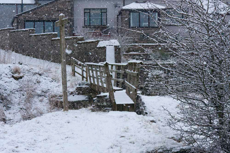
The path turned left round some houses and crossing the beck by the footbridges, we then continued along the track signed
Tarn Riggs.
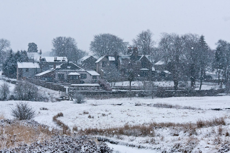
We were looking back
towards the village a real winter scene through the falling snow.
"That will make as good shot", piped up Allen.
"OK",
replied Dad, hauling the camera out of its case again.
Progress was hindered
by a gate secured by a chain and hook. The fastening was
exceedingly tight, and coupled with the fact that the gate had at
some point dropped on its hinges, it proved difficult to open and
then secure afterwards. Nevertheless, Dad persevered and
succeeded, following the "Country Code". What Dad did
not know, was that he was to struggle again with this gate
fastening a little later, after the decision to abandon the full
walk today.
So, moving on to the 2nd
March, it was to be exactly the same outward route we took with
Uncle Eric, but the snow at lower levels had mostly melted away,
and none lay on the track through the gate. The trees in the
background are within the large enclosure called Philip Close,
that we were to walk by, beyond which the track petered out.
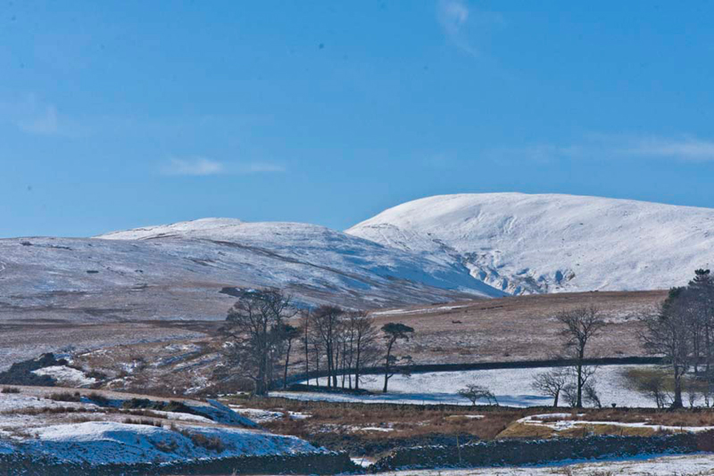
In complete contrast
to that snowy Sunday, the hills and our route was were sharply
defined against the blue sky.
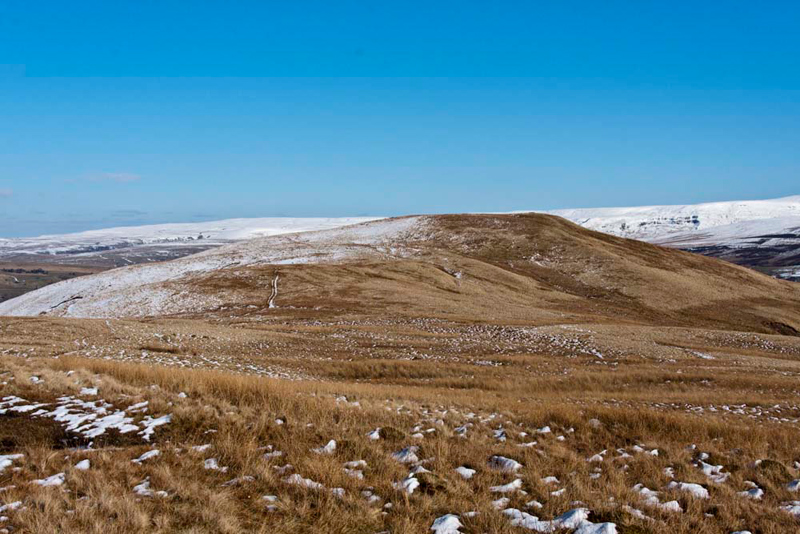
"You have been
here before, so what's what, Shaun?", enquired Grizzly.
"The rise on the
left is Snowfell End, which we will walk along, to cross the next
rise and then beyond to the most distant, which is our first
summit Knoutberry. The higher hill to the right is Green Bell
where the source of the River Lune lies", Shaun replied
authoritatively.
The way led over
trackless and boggy ground above Wyegarth Gill, towards the
slopes of Snowfell End.
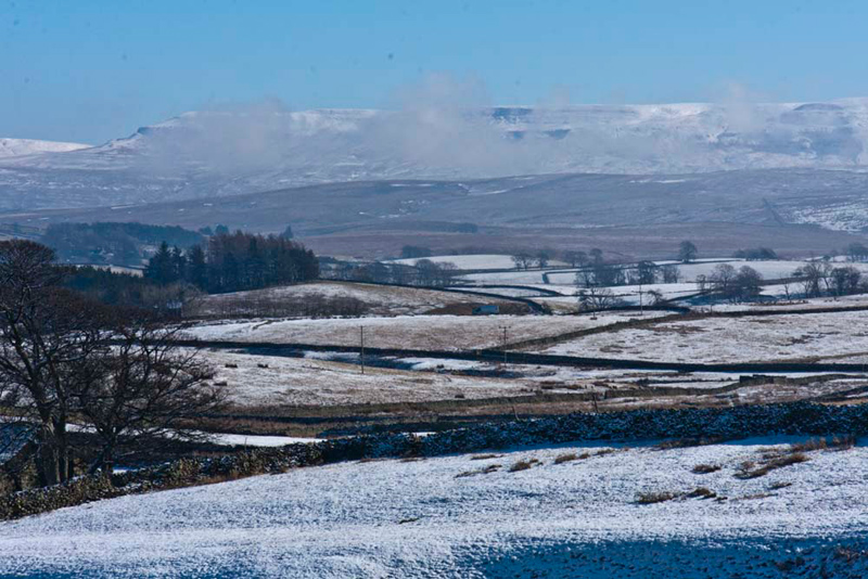
"That's a very atmospheric view of Wild Boar Fell covered in mist", commented Tetley.
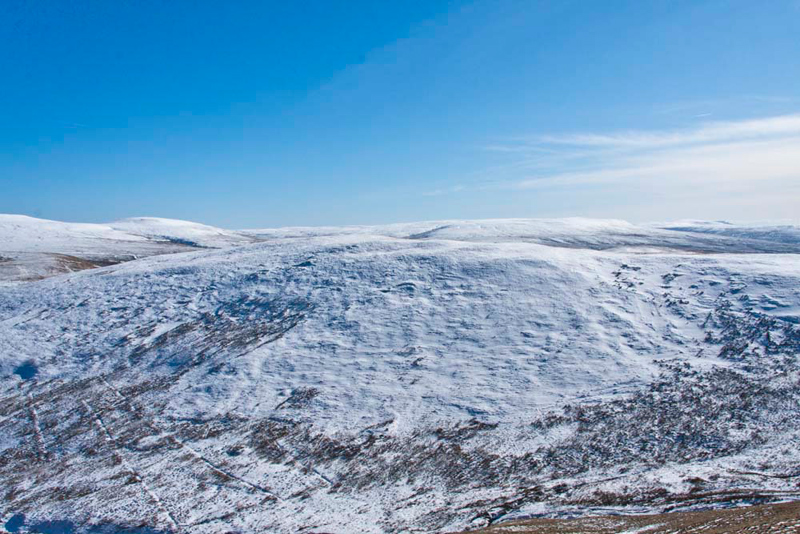
Once Snowfell End was gained, we contoured along below the ridge, and steady
progress was made over the next rise, for the final ascent to
the snow covered summit of Knoutberry.
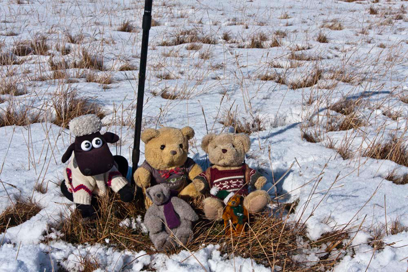
The Howgill Fells are by
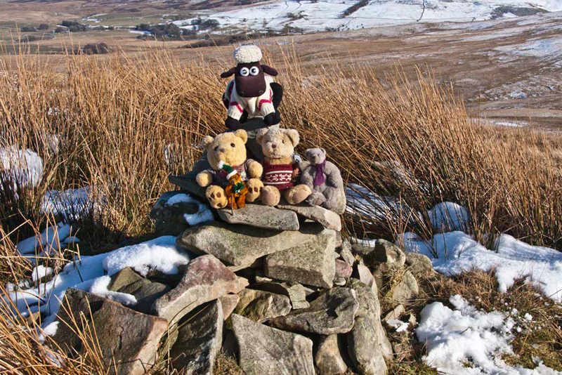
nature very grassy and there is little stone evident. "Yet another summit without a cairn", sighed Allen.
Shaun said, "it's fortuitous that Dad's boots have melted
away a patch of snow, so we can at least sit on the grass
for our picture."
Knoutberry is a top defined in Wainwright's book
on the Howgill Fells, so in line with tradition, Uncle Eric and
Dad ate some Kendal Mint Cake, to mark reaching its summit.
A clear path descended
from the summit crossing to and leading up Green Bell.
Shaun called out,
"Do you see that ruined sheepfold."
"Yes",
replied Little Eric for the rest of us.
"Well, just a
little way to the right is the highest spring marking the source
of the River Lune", he replied.
"Come on Dad",
urged Allen, "I can't wait to get there."
"Alright, but
just give Uncle Eric a little longer to catch his breath",
said Dad.
"Sorry Uncle Eric",
he said.
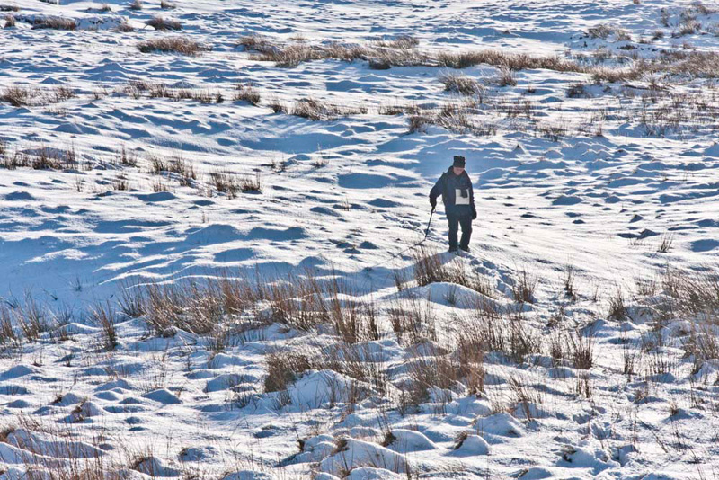
A few minutes later
off we went, Uncle Eric and Dad making two lines of footprints in
the virgin snow. Quite soon we arrived at the sheepfold and Dad
cut across right to find the narrow depression, where spring
rises out of the hillside.
"This is it"
announced Shaun, "the source of the Lune."
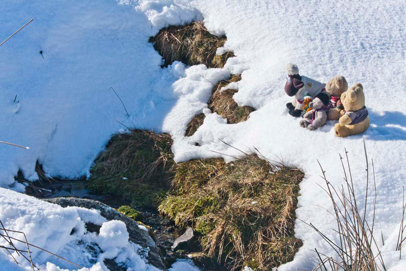
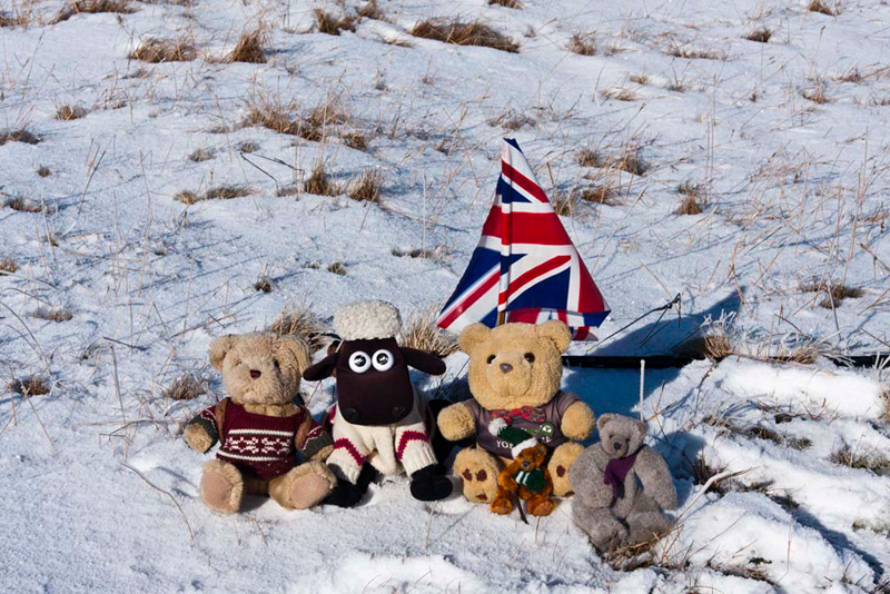
We leapt out of the
rucksack and settled in the snow, for our picture overlooking the
spring.
"Wow", said
Allen, "it is hard to imagine that this tiny stream will
become that wide river."
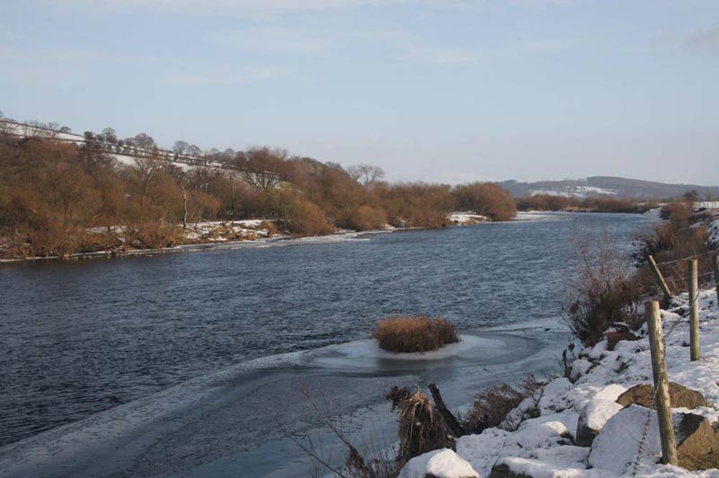
Here it is in the Lune
Valley just a few miles from its estuary into Morecambe Bay.
Grizzly told us, "the Lune starts its journey as Dale
Gill, being joined by Stwarth Gill to the west of High Cocklake.
It then becomes Greenside Beck and later Dry Beck, before
assuming the name Lune at the village of Newbiggin-on-Lune."
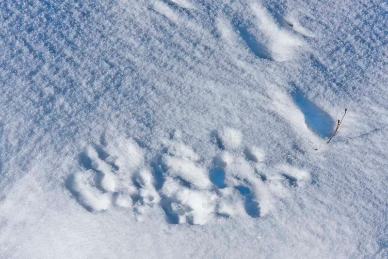
Beyond the enclosure of Philip
Close, nobody else had ventured so the snow was undisturbed other
than occasionally by the tracks of animals. One such had passed
by the spring, its footprints now added to by the depressions
where we had sat.
Safely tucked in his rucksack again, Uncle Eric and Dad trudged through the snow to the path leading
up Green Bell. Everyone had been to its summit, so today we
contoured round its eastern slopes towards the col ahead. The
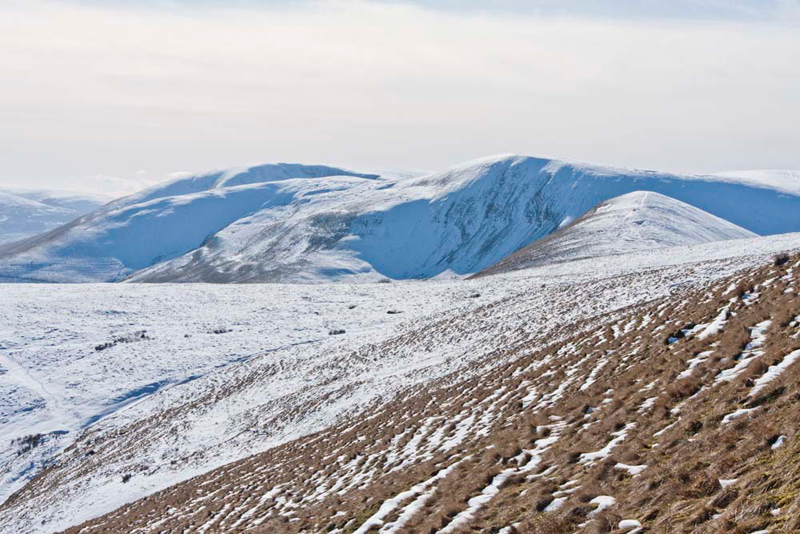
view opened out to the hills further south.
"What are we looking at?",
asked Little Eric, who was not as familiar with these fells as
the rest of us.
Tetley
piped up, "that is Kensgriff with the path tracking across
it, and behind the higher fell is Yarlside that sits at the head
of Bowderdale. The arm running down left is called Ben End, and
peeping over behind it is Cautley Crag."
"Thanks", replied Little
Eric. "You are clever Tetley." Then continuing he said,
"if I remember right, we walked up Bowderdale with Uncle
Eric in 2008."
"That's right", chipped
in Allen, not wanting to be left out. "We actually went on
to The Calf the highest point in the Howgills, but the main
objective that day was so that we could tick off Hazelgill Knott.
It sits right in the middle and it is a long walk to reach it
from any direction."
"Where are we going now?",
asked Grizzly.
Shaun replied, "to that hill
to the left over there, Grere Fell. We head onwards to the col and there turn left to follow the path to the summit."
The walk round the slopes of Green
Bell was rather difficult as they are steep, so it was
with some relief that we found the old shepherds path, that eased
the gradient. Soon after we came to the path along the col and
Uncle Eric and Dad trudged through the crisp snow up to the flat
summit of Grere Fell.
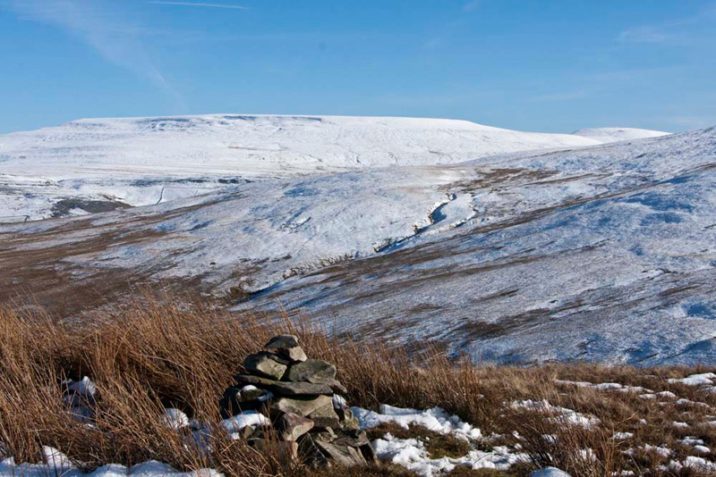
"No cairn again", sighed Little Eric. "And no option this time but to sit on the snow."
"Will you get the flag out please, to add colour to the otherwise white landscape, Dad?", Grizzly asked.
Pointing north-east, Shaun said, "there's our final summit, Knott. To get there we will have to cross Long Gill, in the valley below."
Again the terrain was
trackless and there is no option but to descend steeply, in a
northerly direction, the slopes of Grere Fell in the general
direction of Knoutberry. So, best foot forward Dad set off blazing
a trail down the fell through the snow. As we got nearer to the
gill the gradient eased, but it was still quite hard picking a
way through the rough ground and rocks hidden under the snow. Dad
descended quicker than Uncle Eric. Here he is making his descent following Dad's footprints.
Reaching Long Gill, Dad waited for Uncle
Eric to catch up, then together they found a safe place to cross.
Climbing the slope a little way, a rough footpath was
joined. "Great", cheered Little Eric. "It leads towards Knott."
"It looks like
there is a cairn on the summit", said Allen excitedly.
"I think you are
right pal", replied Grizzly.
"Lets hope so, we
deserve at least one on the walk", piped up Shaun.
After a while the path
turned north, but we kept ahead in the same general direction,
and then at the next junction took the right fork to climb gently to
Knott's summit. Allen had been right too, there was a cairn to
sit on to reward our efforts. We immediately jumped out of the
rucksack and settled on it as Dad lined up the camera to take our
picture.
"That's two of the three Howgill summits called Knott done", said Allen. "Just the one near Sedbergh to go."
As we snuggled in the rucksack, Grizzly called out, "Wow, that's a superb view of Wild Boar Fell and Swarth Fell."
Looking at the map we
could see that we were only about a mile and a half from
Ravenstonedale, but we could not see the village from the
summit.
"We just need to
head north" said Uncle Eric, so off we went.
Soon we were
descending and the large enclosure called Thornthwaite came into
view.
"We need to go to
the right of that, and I can see the path we will join",
said Dad.
Soon we were on the path, that became a track after we had rounded the enclosure. This joined with the footpath we had
followed higher up after crossing Long Gill, and shortly after it became enclosed between walls.
Here our progress was
brought to an abrupt halt as the path was completely flooded
across between the walls.
"Oh heck", exclaimed Little Eric, as gentle prodding with sticks revealed it
was deep and very muddy too.
Uncle Eric took one route and Dad
another. Dad used the stones at the base of the wall to assist
getting past this obstacle. Up to then both his and Uncle Eric's
boots were completely clean, but they were now well and truly
mucked up. This obstacle surmounted, the track led on to pass the
farm called Kilnmire.
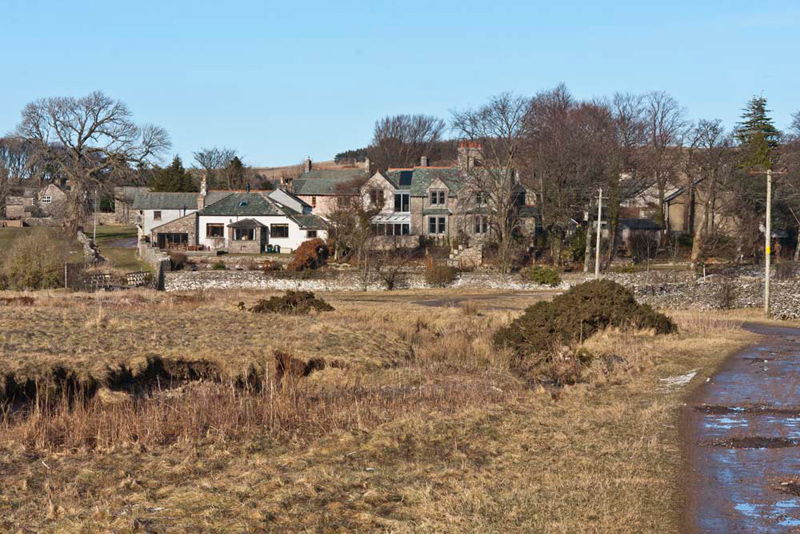
Tetley said, "take a picture of
the village please. It is similar view to that you took in February. The shot today
will show the contrast in the weather conditions."
Shortly the track crossed the
old narrow arched bridge, and we strolled through the village to the car.
"Fantastic walk", cheered Allen.
"Thank you Dad, as always. It has been another grand day out", added Grizzly.
Well, after all the effort we agreed that Uncle Eric and Dad
deserved some refreshment, so they went to the Old School House
tearoom in Tebay, where cake and tea was enjoyed. Dad says thank
you to Uncle Eric for the treat.
PS.
This is our 100th story. So we wish to say a big thanks to Dad
for his tireless efforts in typing them for us, and also to Uncle
Brian for proof reading them.