TROUTBECK
VALLEY, SCOT RAKE, FROSWICK, ILL BELL, YOKE & GARBURN
PASS from TROUTBECK
Summary
Date - 2nd September 2010
Distance - 10.5 miles
Ascent - 2480ft
Map - OL7
Start point -
Church Bridge,
Troutbeck (NY 412027)
Summits Achieved
Name
Height (ft)
Height (m)
Grid Ref
Froswick
2360
720
NY 4352 0852
Ill Bell
2484
757
NY 4366 0772
Yoke
2316
706
NY 4377 0673
Preface
Tetley & Grizzly, strolled in to find
Shaun, Little Eric and Allen were sitting in front of Dad's
laptop.
"What are you on with"?, asked
Grizzly.
"We are looking back at the photographs
of recent walks with Uncle Eric", replied Shaun.
"I cannot thank Uncle Eric enough, for
agreeing to do those Wainwrights, so that I could complete the
challenge to climb all 214", said Allen earnestly. "Dad's
pictures provide a great record, and I will cherish that one of
Dad and I together on Grisedale Pike, my last Wainwright",
he went on excitedly.
"It's over a week ago now, and you
still don't seem to have quite come down to earth", replied
Tetley laughingly.
"It's a case of which we are going to
do next, as I have told Dad, that he is definitely not doing all
my outstanding ones", said Little Eric.
"Well Uncle Eric did mention to Dad, if
he had been up the Roman Road from Troutbeck, replied Shaun.
"The route would lead along the valley then up Scot Rake to
the ridge of the Kentmere Horseshoe. I know for a fact that we
haven't been up that path, so that may well be our next
expedition."
As he had been talking, Little Eric had
grabbed Dad's copy of Wainwright's Book 2 Far Eastern Fells, and
was furiously leafing through it. "Although not often
climbed directly, Wainwright suggests this is a route to Froswick,
which alone I have not climbed before", he enthused.
Shaun replied, "that will indeed be the
start of our return route, then on over Ill Bell and Yoke to the
Garburn Pass, descending this to Troutbeck."
"Even better", cried Little Eric
excitedly, "as that would be three tops I have never visited
before."
Tetley interjected, "we have always
climbed these fells the usual way north, up from the Garburn Pass,
but this way we will be walking south, so in a way it will be a
new route for us."
"I really hope we
do the walk, but it is up to Uncle Eric after all, as Dad said he
should choose the next one", said Little Eric.
Cocking an ear,
Shaun said, "well that's a coincidence, as Dad has just
answered the phone, and it is Uncle Eric, who is ringing."
Off you go Allen",
laughed Tetley, "I know you can't wait to find out."
A few minutes later he
returned, with a broad smile across his face. "The walk we
have been discussing is on for Thursday."
"Hooray", we
all cheered in unison.
The Walk
Thursday dawned and for once, we
were to enjoy a lovely late summer day with warm sunny periods
and little wind even on the summits.
We all helped to get the picnic
ready and safely stowed in Allen's rucksack.
"We all appreciate that you
always carry the picnic, pal, said Tetley, giving Allen a hug.
"No problem pals", he
replied. "After all we need to keep our strength up."
"That's the boot of the car
being slammed shut, so Dad must be about ready for off",
called out Grizzly.
So we dashed out and settled in the
car, for the drive to Uncle Eric's. There, we decamped to Uncle
Eric's car, for the short drive along the A591 to Ings, where we
took the narrow road right via Moor Howe to Troutbeck, parking by
Church Bridge.
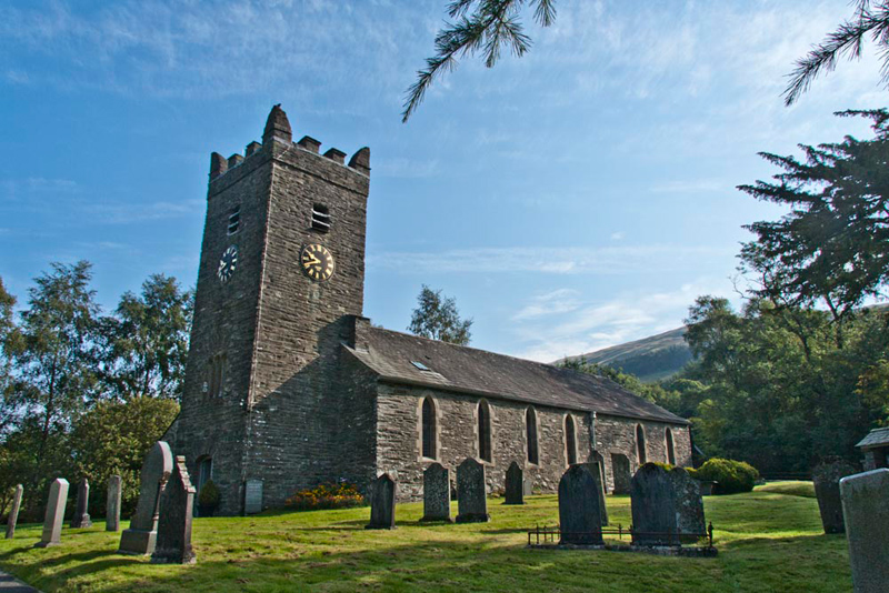
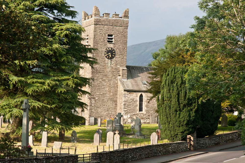
Dad and Uncle Eric soon ready, we got settled in the rucksack, Shaun saying, "we go through that gate into the churchyard."
In the early morning the building looks darker
in the shadow, in contrast to the shot you will see, taken at
the end of the walk.
Grizzly said, "it bears the unusual name of Jesus Church, and dates from 1736, being restored in 1861. It stands on the site
of an earlier 15th century chapel."
Exiting by another gate, Shaun said, "we turn
left, then further on go right through another gate to cross the fields
in the direction of High Green."
Then at a road we went right, to
shortly come to the main A592. Crossing with care, we walked on
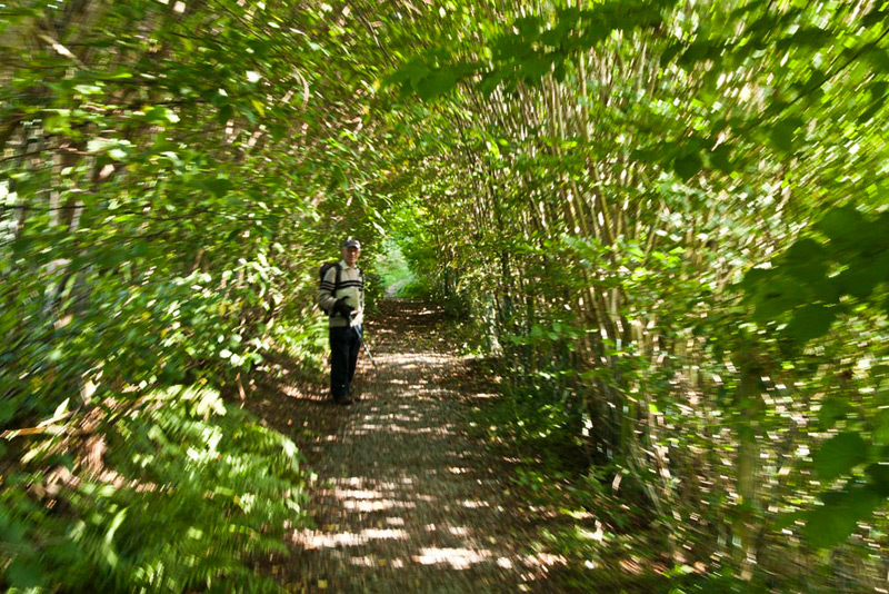
along the bridleway, Ing Lane, directly opposite. The track was
rough and descended. Levelling it then rounded a corner, where the
trees formed a tunnel.
"Please stop Uncle Eric, while Dad takes your picture", called out Allen.
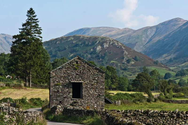
Soon this path joined a narrow
surfaced road and as we approached an old stone barn, there was a
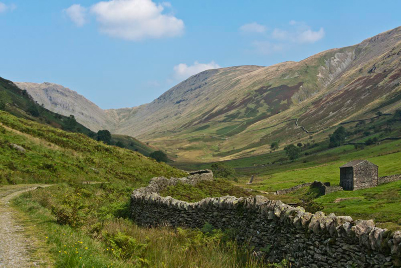
grand view ahead. "That will make a super picture", called out Tetley.
"That's Troutbeck Tongue, in
the centre of the valley", called out Little Eric, who
was showing off the knowledge he had gained in the two and a half
years since he joined the group.
"Yes, we last climbed it in
November 2008", added Tetley.
Shaun said, "our objectives
today are those higher fells to the right. From the back, Thornthwaite Crag, Froswick, rising to Ill
Bell. The last two being on our itinerary today."
Strolling on we crossed Ing
Bridge over the Trout Beck, then on to cross the Hagg Beck by
Hagg Bridge, just yards from its confluence with the Trout Beck.
We were now almost under the slopes of Troutbeck Tongue, and we
could see some buildings ahead to its left side.
"What are those buildings?",
asked Grizzly.
"Troutbeck Park Farm",
replied Uncle Eric. "It was one of the farms bought by
Beatrix Potter, to save it from development. After she had bought
it she introduced Herdwick sheep."
"Dad's and our favourites",
we all chorused in reply!
"I bet if Dad sees some, he won't be
able to resist taking pictures", cried Tetley, laughingly.
Beyond Hagg Bridge, Shaun said, "our route is diagonally right up Hall Hill,
towards the right side of Troutbeck Tongue."
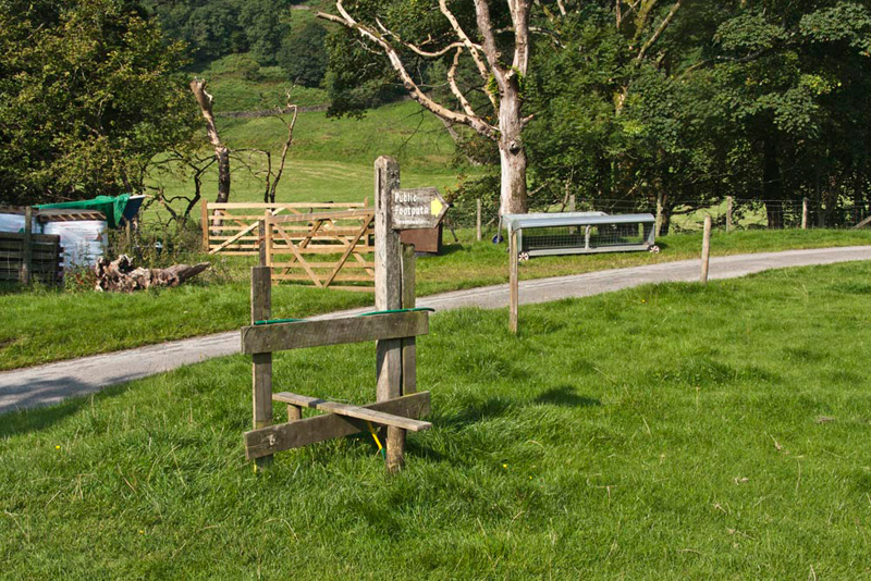
This was clearly signed by this now redundant stile, as
the enclosing fence had been removed. Nevertheless Dad just had
to climb it.
"What are you like?", laughed Allen.
At the top we passed through a gate. Tetley said, "this is where we struck left up the slope on our ascent to Troutbeck Tongue."
Keeping ahead we walked the track for about a mile to the foot
of Scot Rake.
Shaun said, "to get to Scot Rake we have to walk to the
most distant wall corner on the lower hillside, where we can see the narrow track rising diagonally
up the fellside."
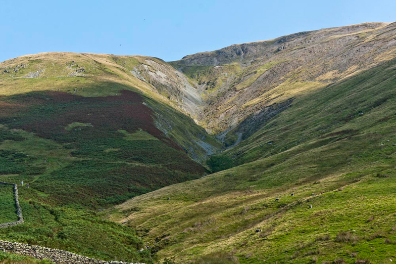
Strolling on the path was level for a while,
before it started to climb, the dramatic view of Blue Gill
opening out to the right. The start of the ascent of Scot Rake,
is where the walkers are standing, adjacent to the wall.
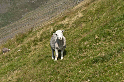
The
sheep on the fell side are Herdwicks, and Grizzly
speculated, "I wonder if they belong to the tenant of Troutbeck Park
Farm."
As we started the climb, Dad paused to let Uncle Eric catch-up. Tetley said, "that's a fine view back down the valley of Troutbeck Tongue with Wansfell behind."
The ascent of Scot Rake started in
earnest, the narrow path contouring its way steadily upwards to
the ridge between Froswick and Thornthwaite Crag.
"Doesn't look much like a
Roman Road", remarked Allen.
"Well that was centuries ago",
replied Grizzly.
"Nevertheless, it is hard to
see how such a road could have been made", persisted Allen.
"Well we will have to have a
look at that book of Dad's called 'Road and Trackways of The Lake
District' by Brian Paul Hindle, and see what he has to say",
replied Tetley.
We have mentioned the High Street
Roman Road in some of our previous stories, and we have to say
now that perhaps that information is not entirely correct,
although much of what follows is open to conjecture, as little
actual physical evidence has been found.
There is no doubt about the central
section of this road as it crosses the summit of High Street and
then down into the Straits of Riggindale, on to High Raise and
northwards along the ridge to Loadpot Hill and down to Heughscar
Hill. It is the route south, however that is relevant to the walk
today, and from the summit of High Street, it skirts Thornthwaite
Crag. It could then have descended into Hagg Gill, via Scot Rake,
(our ascent route). R. G. Collingwood described its route
continuing for four miles as far south as Allen Knott, once
thought to have been a Roman Fort. There is indeed a track along
this route, but there is little real indication that it is of
Roman origin, as it is rarely straight and the terrain and
vegetation would have made it a difficult route in Roman times.
Scot Rake was used by peat carriers taking peat to Windermere, in
the days before the arrival of the railway provided cheaper
supplies of coal. Thus it is entirely possible that Scot Rake is
not Roman in origin. It also seems to be unlikely that having
built a road along a high ridge, the Romans should leave it so
soon.
What is most important is the road's
destination. Early researchers suggested it must have been
heading for the fort at Ambleside, but such a direct connection
is not far short of physically impossible, and in fact no link
has been found. So, suppose the road did in fact continue along
the ridge, skirting the summits of Froswick, Ill Bell then
descending to Yoke and on to the Garburn Pass (our onward route
once we reached the ridge). A Corn Rent map of 1838 marks two
short lengths of track on Yoke as Roman Road, thus indicating the
track had been built and was then regarded as ancient. Then
continuing on the high ground rounding the headwaters of Park
Beck, the Roman engineers might have reverted to their normal
practice of a straight alignment. A parish boundary runs on such
an alignment, with just one slight change of direction, to the
small hill of Grandsire (just south of Windermere). This is
itself very close to a line drawn directly between the forts at
Ambleside and Watercrook near Kendal, a route mentioned in the Antonine
Itinerary, but most of its length has not been traced on the
ground.
So the southern route of High
Street is virtually lost in the mists of time, but, we did walk
along part of both the 'possible' routes, so maybe, just maybe, we
did walk in the footsteps of the legionnaires.
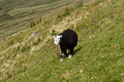
Strolling on, after a few minutes, Tetley said , "look Herdwicks and there's a lamb."
Seeing Dad getting the camera out, Allen sighed, "not more sheep pictures."
"Well", replied Dad. "There were none in the last story."
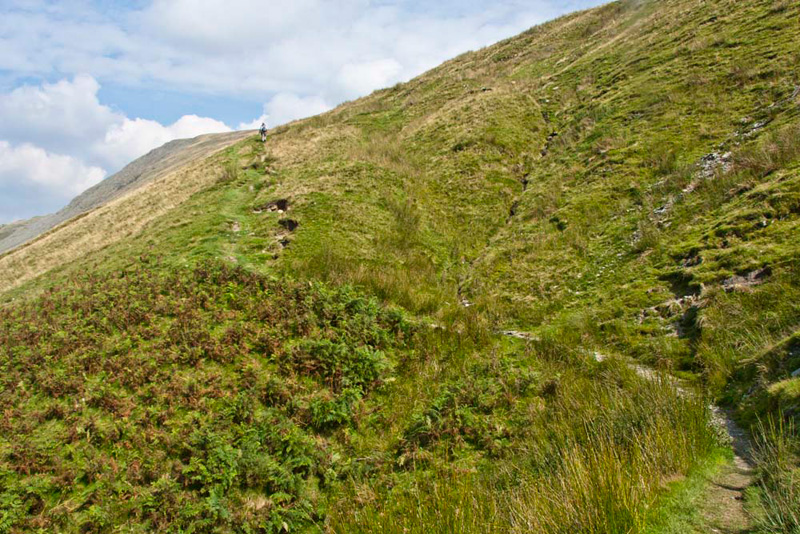
Finally Scot Rake was done and we gained the ridge between Thornthwaite Crag and Froswick.
"Wow what a superb view of the Kentmere Reservoir and the valley beyond stretching away into the distance", pointed Grizzly.
Here we turned south along the ridge to get down to the matter of
bagging summits, well, as far as Uncle Eric and Little Eric were
concerned.
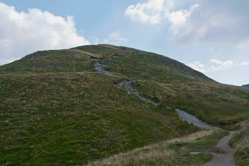
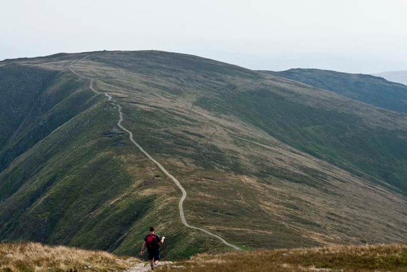
Level at first, the path soon steepened...
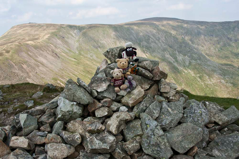
...winding its
way to Froswick's small, neat summit and cairn.
Jumping out of Dad's rucksack, we
scrambled on to the cairn, Little Eric calling out, "please
take our picture Dad."
After looking north, Grizzly said, "that is Thornthwaite Crag, its tall cairn just in view. The
Roman Road would have run along the ridge, skirting
right of Thornthwaite Crag, and on to the distant top High Street,
from which the road gets its name."
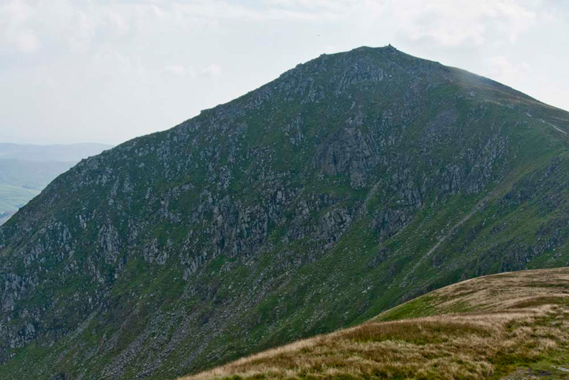
Ahead the steep side of Ill Bell
plunged into the Kentmere Valley. Grizzly said, "the name probably means 'the treacherous bell-shaped hill'. The second element suits its shape."
The clear path descended to a
col, from which it climbed above this edge for 400ft, to Ill Bell's wide
summit, topped with three cairns. The middle one and largest
being at the highest point. We could not resist climbing up for
our picture.
"Ooh", said Little Eric,
"it's awfully high, and I don't know whether I can manage."
"Don't worry pal",
replied Allen, "I'll get my rope and we can haul you safely
up."
"Thanks pal, that's very kind",
he replied.
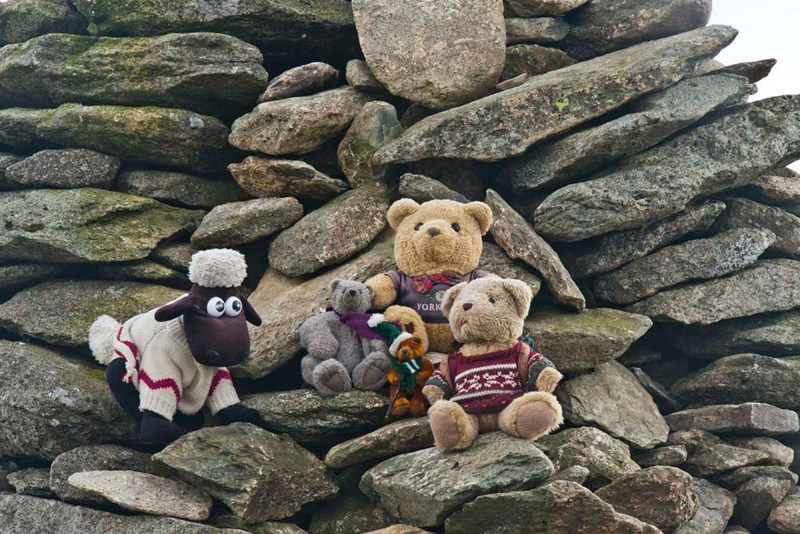
Here looking north is the main
summit cairn and the smaller one, that we reached first on our
ascent today.
With most of the climbing done, Uncle Eric said, "let's have lunch"
"Ooh yes", said Allen.
"I know", laughed Little Eric, "you're hungry."
Just a little way on Uncle Eric said, "those rocks look a likely place to sit."
"This is the 'Yoke View'
terrace, I presume", said Dad to Uncle Eric.
"Quite right", he replied.
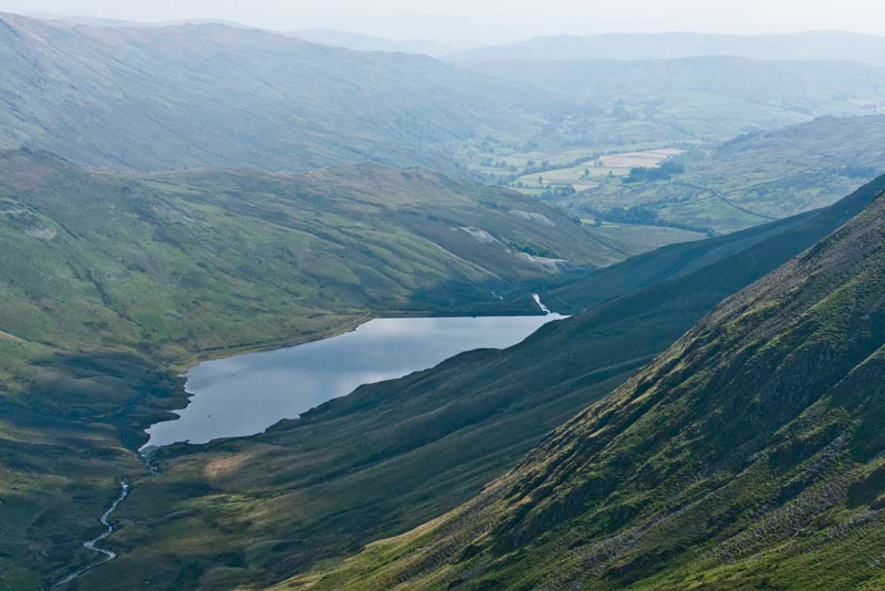
Well there was a fine view to Yoke,
our final summit today.
We had a separate table.
"Very Noel Coward", said
Grizzly!
As we munched our sandwiches we
reflected on the walk so far, thinking yet again how lucky we are
to have a Dad who takes us on such great adventures.
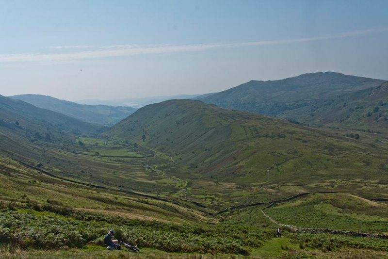
Then lunch
over we set off again in the footsteps of the walker in the
picture above, down to the col and on up to Yoke. Before we
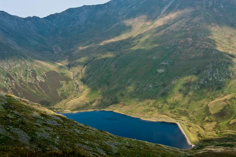
started the climb to Yoke, we paused to look down to the Kentmere
Reservoir, shining blue, with the slopes behind.
"That's Nan Bield Pass, that links Mardale Ill Bell with
Harter Fell"said Shaun
"I remember that misty day last June when we descended from Harter Fell, to the pass", commented Allen. "We were bagging some outstanding Birketts."
The reverie over, it was best foot
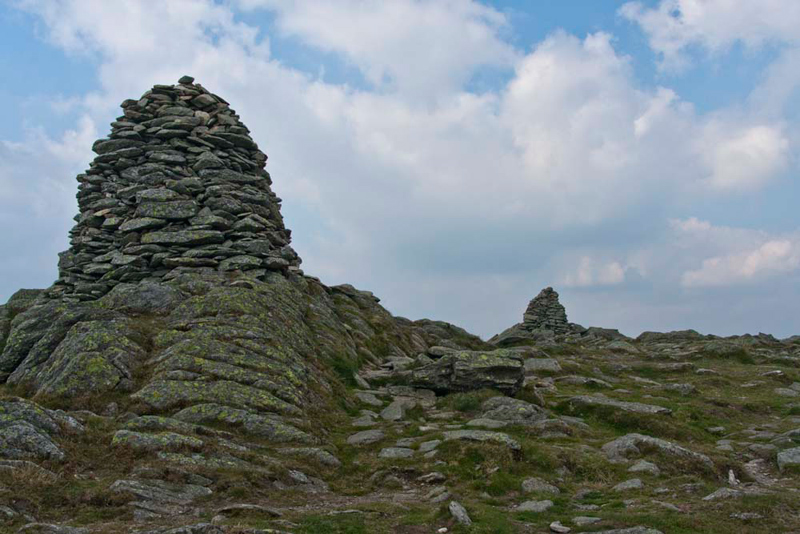
forward once again, on the gentle climb to Yoke, the summit
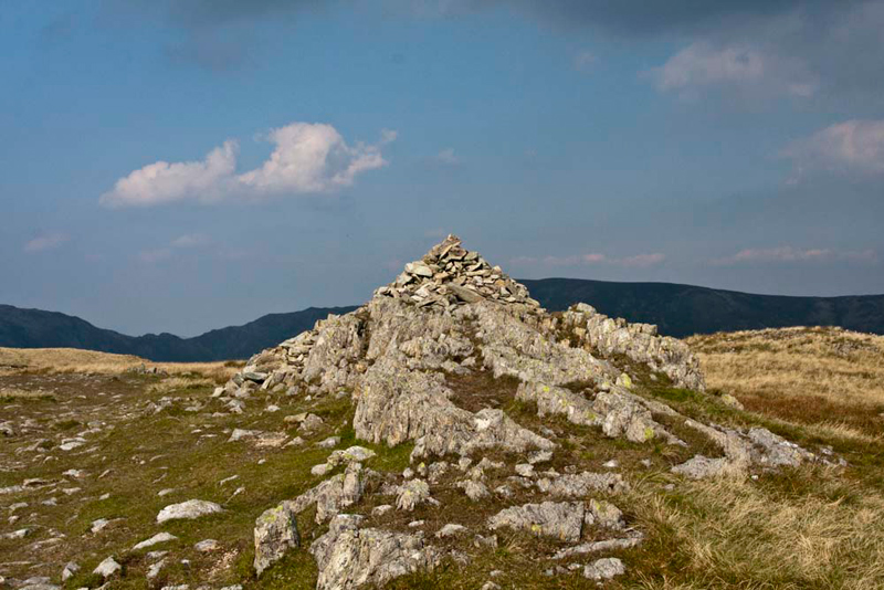
marked by a cairn on a small rocky outcrop.
We quickly scrambled out to pose at the summit...
...and as Dad
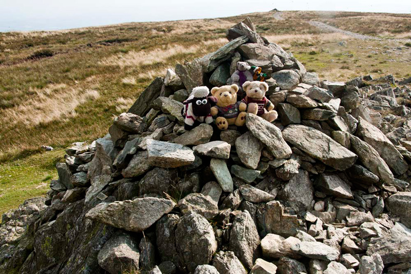
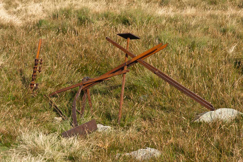
took our picture, we heard Uncle Eric remark, "I didn't know you had brought
us to the Yoke sculpture trail, Gerry."
We all looked at him rather
quizzically, but looking behind the summit, realised what he meant.
No, there is not a sculpture trail, but nevertheless some
artistic person had taken the trouble to arrange these discarded
bits of metal. "Maybe it should be entered for the Turner Prize?", joked Allen.
There was still about 3 miles to
walk, so it was time to get going again.
First the long descent
dropping about 850 feet to the Garburn Pass, that links Troutbeck
with Kentmere. At the pass we turned right to descend the, at
times, rough rutted and stony path.
Shaun said, "technically it is a road,
but not surfaced, which has at times been open for use by 4 x 4
vehicles, resulting in the uneven and rough surface."
The pass led
all the way to the A592, where it was just a short walk to the
car. The late afternoon sun was shining on Troutbeck Church,
giving the stone a much lighter colour, compared to the picture
at the beginning of the story.
As you can see it was now 17:40, so for
once there was no stop for tea and cake, rather Uncle Eric just
drove us to his house, where we jumped into Dad's car for the
drive to Morecambe.
"Another grand day", said Tetley.
"Yes", agreed Shaun. "Thank you Uncle Eric and Dad for taking us on the adventure."
"You're welcome", said Uncle Eric, "I have ticked off three more Wainwrights."