FROM
INGLETON TO RIBBLEHEAD,
via INGLEBOROUGH, SIMON FELL & PARK FELL
Summary
Date - 12th September 2010
Distance - 8 miles
Ascent - 2540ft
Map - OL2
Start point -
Disused quarry,
Storrs Common (SD 702732)
Summits Achieved
Name
Height (ft)
Height (m)
Grid Ref
Ingleborough
2373
723
SD 7412 7455
Simon Fell
2133
650
SD 7546 7517
Lord's Seat
2079
634
SD 7592 7489
Park Fell
1848
563
SD 7645 7696
Preface
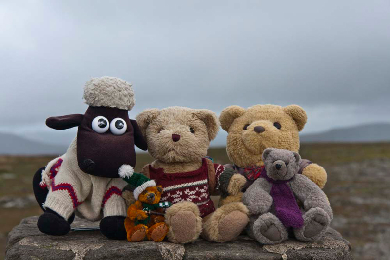
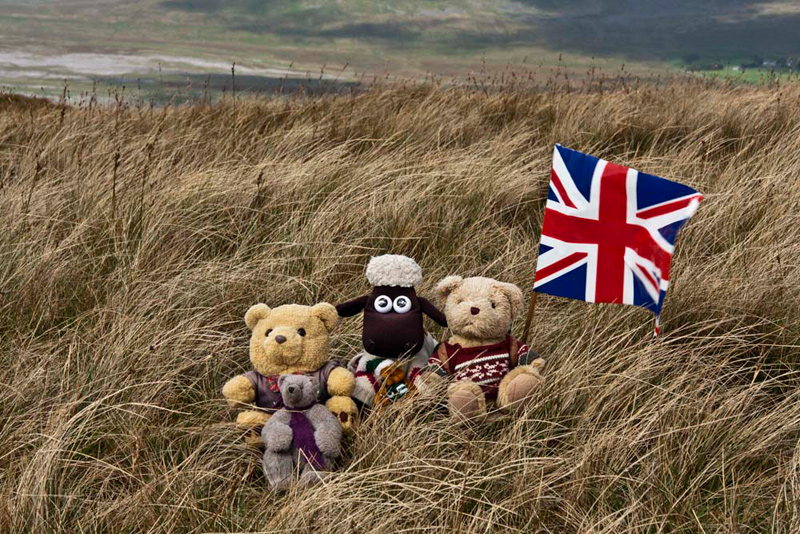
Following their previous walk, Tetley and
Shaun (with Little Eric perched on his back for a better view),
were quietly reading the book about Roads and Pathways in the
Lake District.
"Without this we would not have had
such an insight into the possible routes of High Street, at its
southern end", said Little Eric.
"That's right", replied Shaun.
"It enabled us to give a more accurate view in our story,
when we climbed Froswick, Ill Bell & Yoke."
"There are many ancient routes",
went on Tetley. "It is quite hard to take it all in, but it
will add to the enjoyment of any walks we may do that take in
these routes."
"Where's Grizzly?", asked Shaun.
"Watching NCIS with his pals and Dad",
replied Tetley.
They then lapsed into silence and continued
reading.
A little while later this quiet reverie was
interrupted by the whirlwind of Allen bursting into the room,
closely followed by Grizzly.
"Great news", he shouted. "While
Dad was watching television, he was interrupted by Uncle Bob
ringing. He is free on Sunday, so he and Dad have arranged a walk
in Yorkshire."
"Where too?", asked Little Eric,
excitedly.
Grizzly replied, "we are doing a linear
walk, from Ingleton to Ribblehead, climbing Ingleborough, Simon
Fell and Park Fell in the process."
Allen went on, "that will mean that we
will have done Simon Fell and Park Fell, in the company of Uncle
Bob, as we climbed them first on our own."
"What will be good too", added
Tetley, "in that climbing Ingleborough by this route, we
will then have summited it by all the possible approaches."
"I remember the last time", said
Little Eric, "it was ever so steep up to the col on the path
from Chapel-le-Dale, and it was so windy on top too".
"Yes, I do not know how we managed to
hang in for our picture by the trig point", added Shaun.
"Everyone else, was sensibly sitting in the shelter!"
The Walk
These fells, are situated on the
western fringe of the Yorkshire Dales National Park, and as such
the meeting point at Ribblehead is only about 40 minutes from
home for us. Not so for Uncle Bob, who coming from Doncaster, had
a much longer drive, but it was his choice to do this walk. We
saw Uncle Bob's car as we arrived, but we could not see him. This
was because he was purchasing a large cup of tea from the snack
van that is often here, especially on Sunday.
We were still sitting in the car
and we heard Uncle Bob ask, "would you like a cup, Gerry?"
That's a silly question",
remarked Tetley.
"Quite", replied Allen
rolling about with laughter. "Whenever has Dad been known to
refuse tea."
We sat patiently while they drank
this, looking across at the view of the mighty Ribblehead Viaduct,
backed by Whernside, its top covered in cloud. This was to be the
case with Ingleborough in the early part of the day, but after
the mist lifted, good views were the order of the day.
As explained, the walk was linear,
so leaving Dad's car here, we decamped to Uncle Bob's car, while
Dad transferred his kit, then we drove back the way we had come,
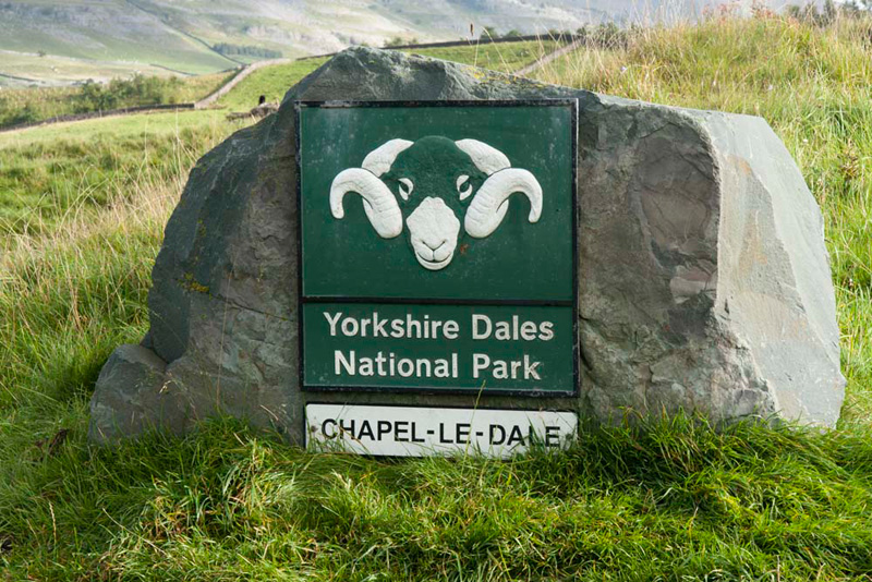
almost to the town of Ingleton. Just before the road started to
drop down, Uncle Bob pulled off into the site of a long abandoned
quarry, just at the boundary of the National Park, clearly
indicated by this sign.
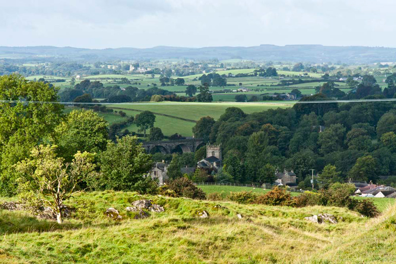
While Uncle Bob and Dad got ready,
we surveyed the scene across the road, down over Ingleton, the
church and long disused railway viaduct in view amongst the
houses. "That is Burton in Lonsdale in the distance above the viaduct that we drove through this morning", commented Grizzly.
"I'm sure that the Railway
Bears, have mentioned something about the viaduct and stations at
Ingleton, involving a long running dispute between railway
companies", mused Shaun.
"It was to do with rivalry
between the London North Western Railway (LNWR) and the Midland
Railway Company", replied Tetley. "There were
aspirations for the line through Ingleton to become a main line
to Scotland, but when they could not agree terms for running over
each others metals, the Midland Railway applied to Parliament and
got permission to build the Settle-Carlisle route."
"I remember now", said
Shaun. "Subsequently the LNWR backed down. The Midland then
told Parliament that they no longer needed to build the Settle-Carlisle
line, but were told that having been given permission, they must
proceed and one of the most scenic lines in Britain, was born."
For the full story about Ingleton's
stations and viaduct click this link - Ingleton Viaduct. The website 'forgotten relics', is an
amazing resource for anyone interested in information about
viaducts, bridges, tunnels, etc., on long closed and disused
railway lines.
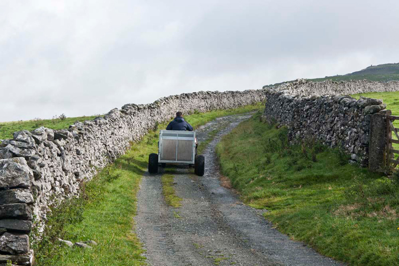
By now Dad was ready, so we settled
in his rucksack, and off we went, Shaun saying, "we climb the rough ground at
the rear of the car park, up to and then alongside the substantial
stone wall to join the good track, Fell Lane."
This was our route, in
the wake of the farmer on his quad bike.
As the track climbed, the view
widened to the left. "The sun is shining brightly on the
limestone of Twistleton Scars", pointed Allen. "Whernside's top is clear now, but the mountain is still dark under the cloud."
The surfaced lane meandered on its
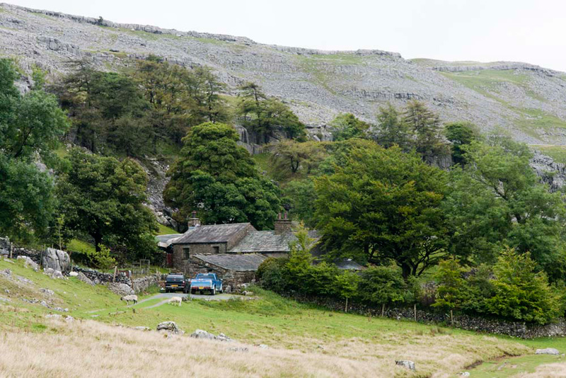
way, ending at Crina Bottom Farm, that nestles below the limestone fellside.
Ahead is the fine view to Ingleborough. As we passed through the gate and came into sight of the farm, Little Eric called out, "that's
the view in the print that Dad has on his wall."
"Yes pal, you are right", agreed Tetley.
The light was constantly changing
and the mist rolling in and then off Ingleborough, so providing a
seemingly endless opportunity for photographs. Dad took a lot,
but heaven alone knows how many Uncle Bob took. We just had to be
very patient.
Finally Dad said, "we had better be getting
along as otherwise there will be nothing for it but to return to
your car Bob!!"
Oh, after all the effort I suppose
we had better allow Dad to include shots from this location. First with mist swirling round Ingleborough...
...and this after the mist had cleared off with the mountain bathed in sunshine.
So onwards along the right side of the wall, the path now becoming more rough and
rocky in places and muddy and slippy on the sections undergoing
erosion repair. After crossing this, the climb really got underway, with three
sections of steep ascent interspersed with flat areas, to attain
the summit plateau.
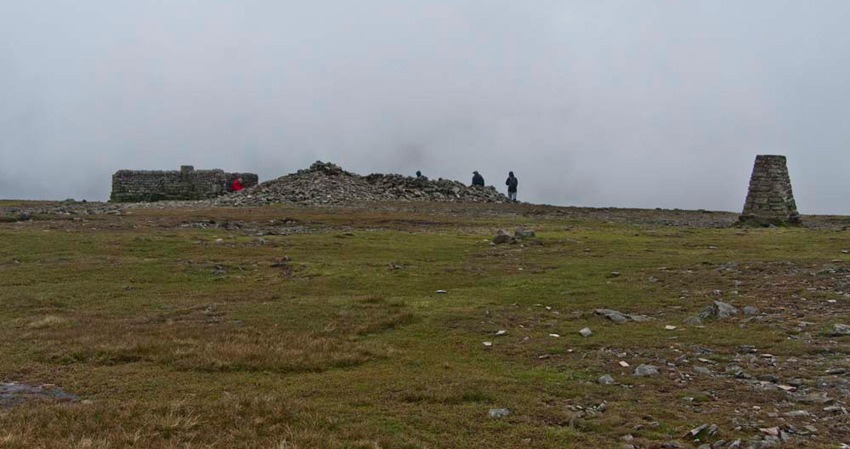
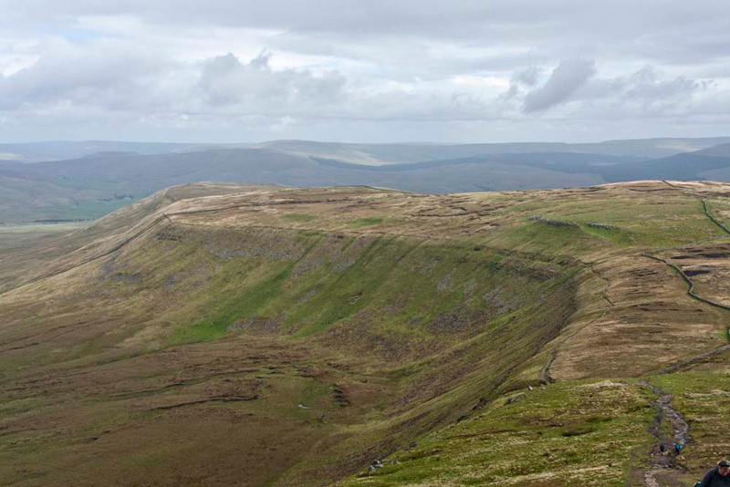
This is a broad flat area half a mile in
circumference, with many objects of interest provided by man.
There is a well built cross-wall wind shelter with an excellent
view indicator and a column erected by the Ordnance Survey with
between them a large cairn.
As we had reached the summit, Little Eric
asked, "what is that even larger cairn just to the left."
"That is all that remains of
the battlemented round tower (a hospice - shelter for travellers),
built in 1830. The jollifications on the day of the opening
ceremony became so alcoholic, that parts were thrown down there
and then, the rest being destroyed later", replied Grizzly,
reading from the Limestone Walks book by A Wainwright.
He then went on, "as we head off the summit, if you look carefully
you will be able to pick out the the circular foundations of huts
of a settlement of the first people to live in the district, and
the shattered wall of the military camp, believed to be Roman."
Armed with all this information we
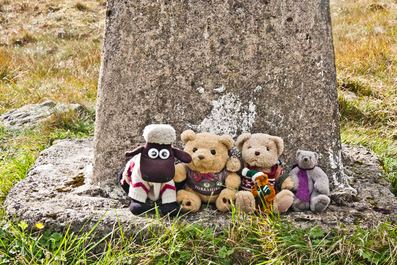
looked carefully and did indeed pick out these features. However before that Shaun said, "time of our picture sitting on the trig point pals."
Ingleborough is extremely popular,
so we were not in the least surprised to find many people
wandering around the summit.
"Time for a snack now", said Allen, rubbing his tummy.
"I know", laughed Tetley, "you're hungry."
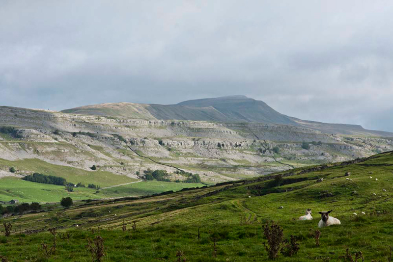
So we adjourned to the shelter to have our sandwiches cake and tea, and also get out of the cold wind. The day was clear now, so
the view was extensive of the surrounding fells, and we were able to identify most of them. "We've climbed them all", commented Grizzly.
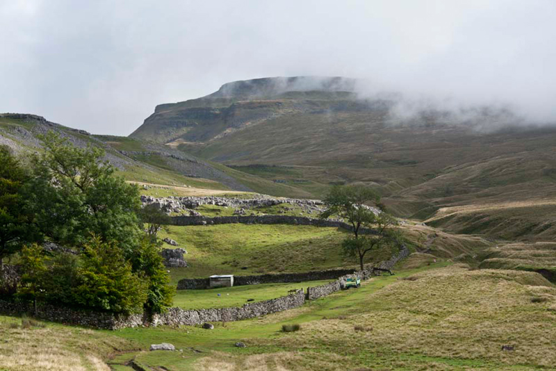
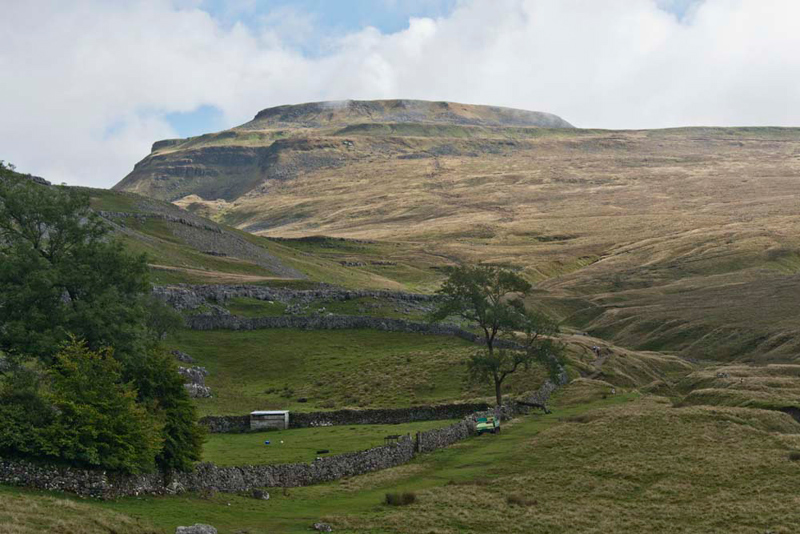
Ready for the off again, Shaun said, "we head north now, to take the Chapel-le-Dale path that descends to the col."
"The ongoing ridge is our route to Simon Fell and Park Fell beyond", said Allen.
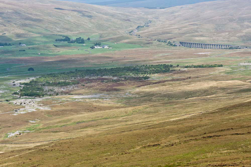
At the col Tetley pointed, "that's a super view to distant Ribblehead Viaduct, where our walk will eventually end today.
We can see the track curving round from the end of the viaduct,
as it passes Blea Moor sidings and signal box, before
disappearing into the tunnel under Blea Moor."
Dad, then turned the camera on
Uncle Bob, who posed for what we think is an excellent picture of
him.
Simon Fell was soon reached
by following the wall round its angles and then climbing to the
flat broad top of its unremarkable summit.
"Huh", huffed Tetley. "There is nothing to mark the summit. Will you get the flag out to add colour to our picture, please Dad."
However, it does provide a good
vantage point for looking back to Ingleborough. Shaun said, "we walked
along the rim on the right, before descending via the path in the
centre. The view also gives a clear idea of the width of its flat
summit, and that it is tilted slightly to the left."
Looking at the map, Allen said, "to the right is the subsidiary summit of Lord's Seat. We have not been there before."
"Ok", said Uncle Bob, "we'll have to rectify that today, and it will another fell added to our list."
However there was not a gate in
the wall to give us access from this point, so Dad and Uncle Bob
had to climb over, taking care to avoid contact with the barbed
wire on top. We then crossed to another wall and walked alongside
it to arrive at a fancy ladderstile, beyond which it was just a
short distance to the summit.
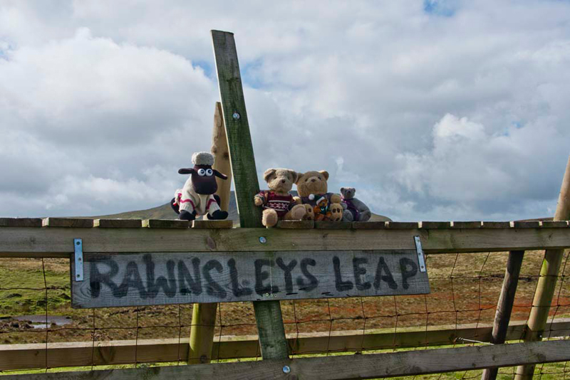
However for a while this was
ignored as attention centred on the ladderstile, which on its
far side was painted the name "Rawnsley's Leap".
Perhaps a reference to the name of the people who either own the
land or farm it. We sat patiently while Uncle Bob and Dad had a
lot of fun, with Dad pretending to jump off while Uncle Bob took
his picture.
"Can we have our picture taken
now", asked Shaun.
"Sure", replied Dad.
"Right" called out Shaun,
"lets climb up and settle on the top step."
We did, and Dad snapped the shot,
but not before Allen, Tetley and Little Eric had leapt off (twice).
Well it was great fun!
With the excitement over we
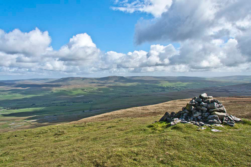
strolled the few yards to the cairn on Lord's Seat.
We think it
was all the excitement too, that caused Dad and us to forget to have our picture taken at the cairn. Well it gives us an excuse to return here at a
later date. It was well worth the walk today as there is a fine
view over Ribblesdale to Pen-y-ghent and the village of Horton in
Ribblesdale.
The map does not show a spot height
for the summit, so when we got home Grizzly did some research on the
Internet. He told us "Lord's Seat is actually in the parish of Austwick, and is the
highest point at 2079ft (634m). I got the information
from a parish document."
Walking back we ignored Rawnsley's
Leap, to keep along the other side of the wall, before crossing a
fence (again topped with barbed wire).
Shaun said, "now just follow the wall
down and up for just over a mile, and then strike away from it up
the slopes of Park Fell, towards the trig point marking its
summit."
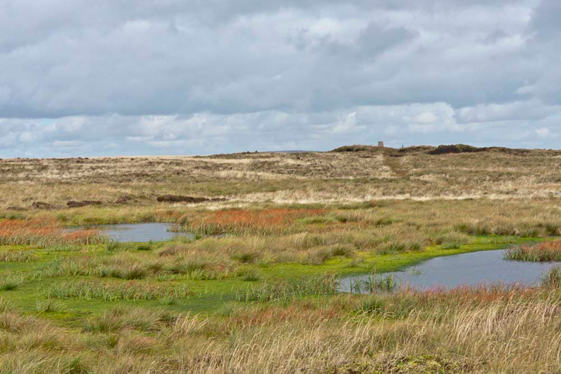
Nearly there, a boggy area and pools appeared to block our approach. "Heavens how are we going to
get across that", called out Little Eric in dismay.
"Don't worry pal", said
Tetley reassuringly. "The path skirts round to the right,
before swinging back and making directly for the trig point."
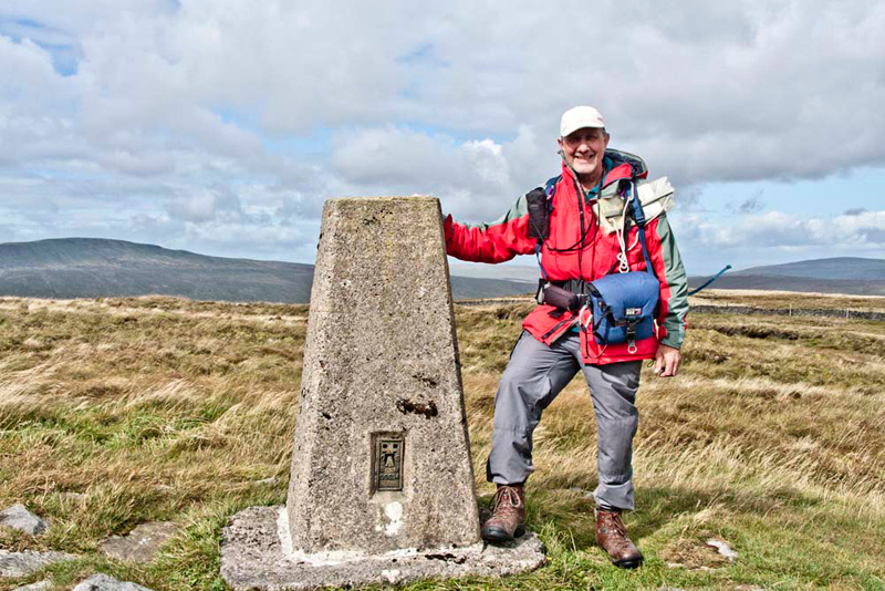
Once there, Allen said, "come on pals time for our picture again. We'll have to sit at the bottom though, as it is too windy to hang in on top."
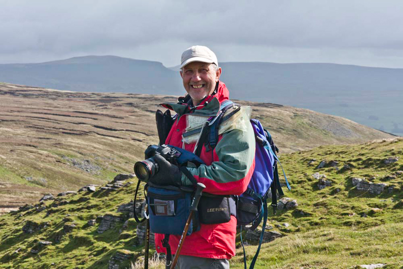
Dad then said, "Bob stand by the trig point while I take your picture."
How windy it was can be seen
from the way that the strap on Uncle Bob's rucksack is streaming
out.
So, we made our way off the summit, descending steeply to
pass eventually through a gate in the wall.
Let's stop here for a sandwich and drink", suggested Uncle Bob.
"Oh good", cheered Allen. "We can have a second picnic too."
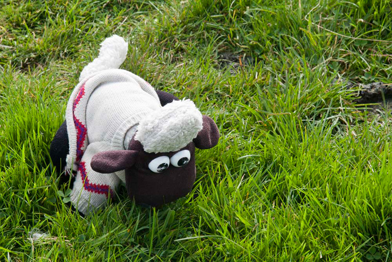
Shaun was extra hungry, so before setting off again,
he decided to graze the lush grass.
"Right that's enough Shaun",
called out Dad. "Time to be moving on, so hop up and get in
the rucksack with the rest of your pals."
"OK Dad."
He then directed us, "it's left along a wall, to
eventually climb it via a stile, then continue in a north-westerly
direction."
Here we crossed sections of wonderful limestone pavement. Then,
rounding an old quarry we walked along its access track, where
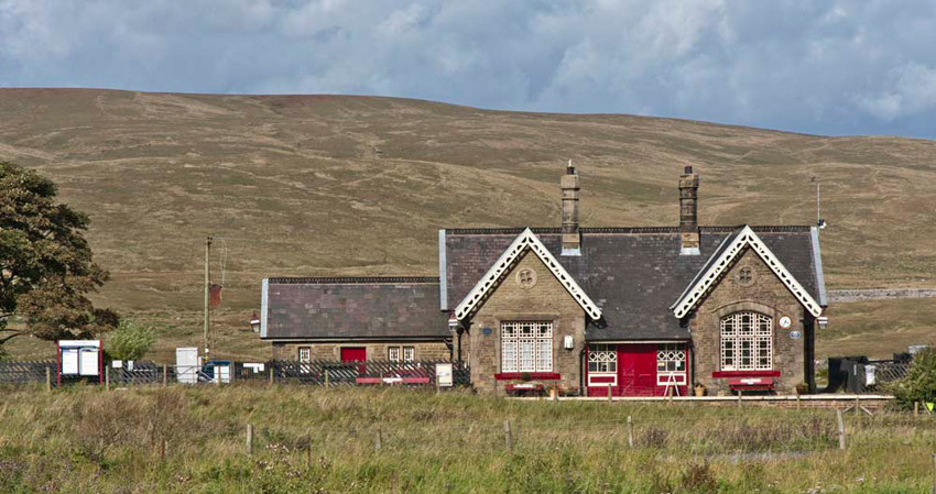
away to the right were the beautifully restored buildings of
Ribblehead Station.
A further 100 yards or so and we
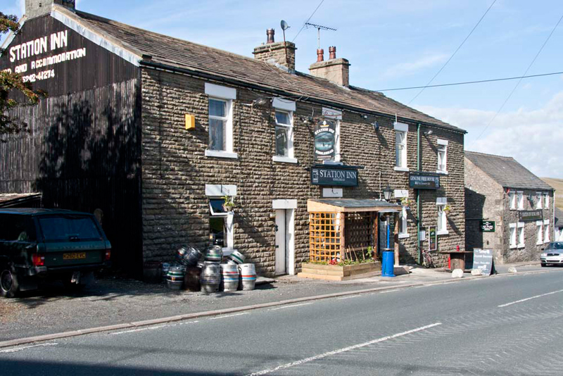
were at the road, beside the railway bridge, under which on the
left is the Station Inn...
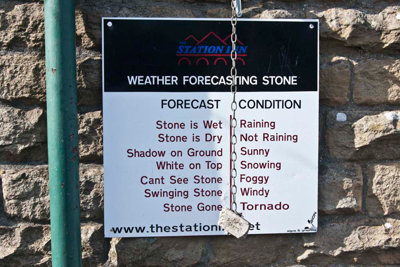
...with its intriguing weather forecasting
station, in the form of a stone hanging from a chain. "Wonderful", called out Little Eric.
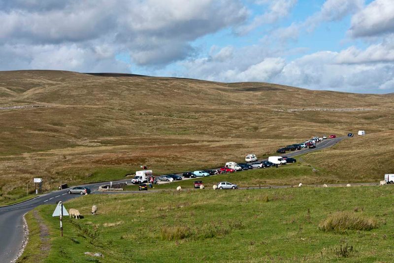
Looking down the hill, along the
road was the typical Sunday scene at Ribblehead. Dad's car is
beyond the white van.
At the car we decamped from the
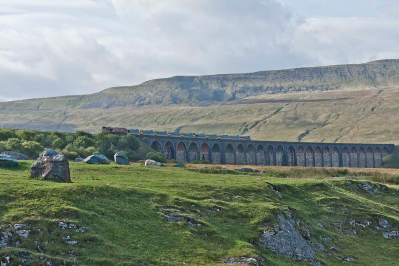
rucksack, Allen calling out, "look pals, there's a freight train crossing the viaduct.
Settling on the back seat, Dad drove us to
Ingleton and Uncle Bob's car.
After getting changed Dad then
drove into Ingleton village. We sat in the car having the rest of
our picnic with a few welcome cups of tea. Shaun commented, "we take after Dad for tea, none more than you Allen."
Meanwhile Dad and Uncle Bob wandered round the village, coming
across the chip shop, where they had fish chips & peas with
bread and pots of tea, sitting outside.
"They were excellent", said Dad, "and it has saved me having to get a meal ready when I get home."
Then goodbyes were said, "thank you for your company Uncle Bob", said Tetley. "We've had a super walk."
"You're welcome lads. It has been a cracking day!"