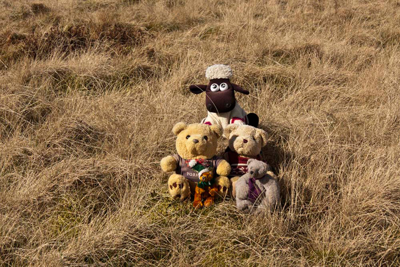
Shaun, Tetley & Little Eric, were sitting in front of Dad's laptop, looking at the pictures taken on their last walk above the east side of Coniston Water.
"Dad was able to get a good few pictures, but it was such a shame that the day was so cloudy, as they always look so much better in the sunshine", said Shaun.
"I was denied that terrific view along Coniston Water from Brock Barrow, which the rest of you enjoyed on the walk with Uncle Eric in 2006", bemoaned Little Eric.
Tapping away with his paws, Tetley navigated to the folder for that walk, and brought up the picture. "Here you are pal, at least it is recorded so you can see it."
"Wow", enthused Little Eric, "it really is a superb view. At barely over 700ft, it just goes to prove the point that you do not necessarily need to be up on the high fells to get the views."
"We are supposed to be walking with Uncle Bob on Sunday", remarked Shaun.
"Oh yes, he wants to walk over Barbon Low Fell and then up to Casterton Fell, which he has not climbed before", said Tetley.
Just then Allen strolled in with Grizzly, who had been watching an episode of Fringe with Dad and his other TV pals.
Grizzly said, "before we watched the programme, Dad phoned Uncle Bob. He actually thought it was a week on Sunday, but as it turns out he is fine to walk this Sunday."
"That's great", cried Little Eric, "I can't wait, and it will be good to have Uncle Bob for company too."
"Is there any tea?", asked Allen.
"We've had it already", replied Tetley, but when he saw Allen's face drop, he went on, "only joking, we were waiting for you both to arrive before we got the flasks out.
"Great", called out Allen, "I'm gasping for a drink", as he rushed off to get the mugs.
"He's just like Dad", said Shaun, letting out a bellow of laughter.
The Walk
In contrast to our last walk, today was lovely day with lots of blue sky, and it was warm out of the cool wind. It is usual to meet Uncle Bob between 08:30 and 09:00. The arrangement was to meet at Barbon village by the church. The village is situated in the Lune Valley and is dominated to the east by the huge bulk of Middleton Fell and Barbon Low Fell, each split by the valley of Barbondale, through which the motor road leads to Dentdale. The latter fell was our objective today. We were there soon after 08:30 and waited for Uncle Bob.
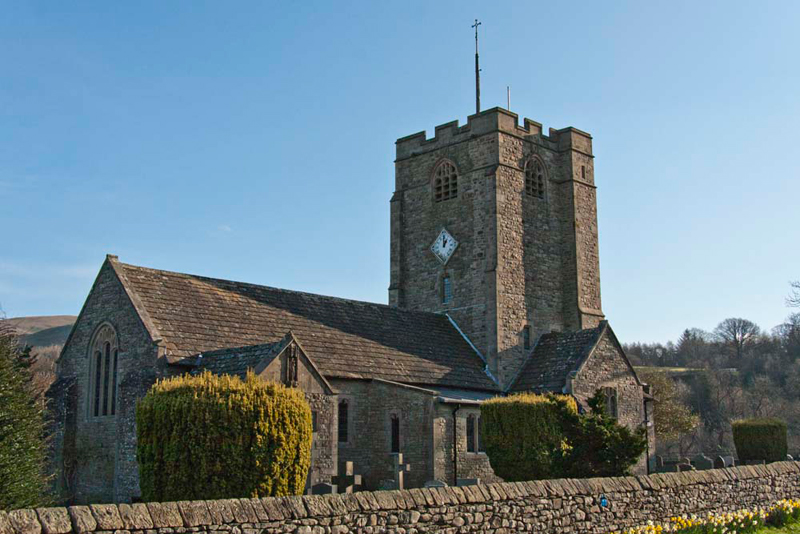
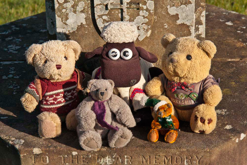
"I'm going to take a shot of the church and if you come along I'll take you sitting in the churchyard", said Dad.
So first here is St. Bartholomew's Church, Barbon.
Grizzly told us, "probably on or close to this site there was a chapel of ease, before 1610. Then in 1815 a new church was built, which was very short lived, replaced in 1893 by the present building, to accommodate the growing population of Barbon and the surrounding rural area. Lady Shuttleworth laid the foundation stone of this church in 1892, and she also gave the stained glass window at the West end of the church to the parish. Building work cost £3500, with the building consecrated on the 9th of September 1898."
"Thank you pal, for adding interest to our day", said Little Eric.
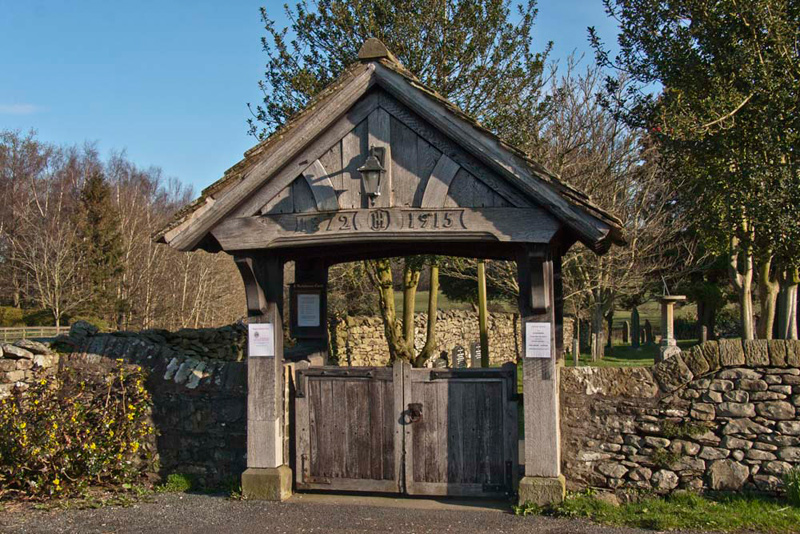
Access to the grounds is through the lych gate.
In the churchyard to the right of the gate, you will notice a memorial topped by a sundial. This is where we sat for our picture.
During all this Uncle Bob arrived. We called out, "Hi Uncle Bob. Great to see you."
"Good to see you too lads. I have been up the road to see if there is any where to park by the road junction, the actual start point. There is some verge parking, so will save us the steep climb along the narrow road out of the village."
Once they were both ready and us settled in Dad's rucksack, we set off along the Casterton road. After just over half a mile, Shaun pointed, "we take this grassy track rising up the fell."
It came close to the woodland ahead, before bending back on itself, as indicated on the map, effectively heading back in the direction of where we had started.
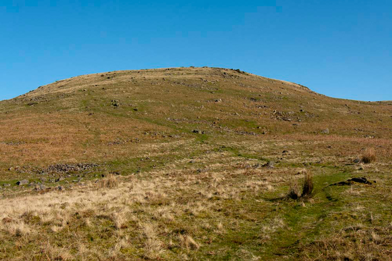
Coming to a divide in the path, Shaun instructed, "we ignore the main path right towards the ridge, but instead continue ahead climbing steadily towards the what the map indicates is Long Hill."
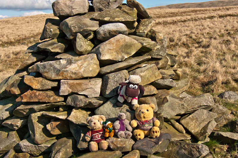
This was crested, and the highest point reached at the second of two neat cairns. "Is this a summit?", asked Little Eric.
"Sadly no pal", replied Tetley. "The map shows neither of the cairns, nor a spot height."
All the time there were wide views west and north, and the Dad and us waved to Uncle Brian, as the nuclear power stations at Heysham could be clearly seen.
Shaun said, "even though this is not a summit will you take our picture sitting at the cairn?"
"Of course."
Settled again in the rucksack, "we now followed the ridge round, until confronted by a substantial stone wall, that blocked progress, with no sign of a stile or gate.
"What now?", called out Little Eric.
"Walls to not daunt Uncle Bob and Dad", said Allen, as we climbed left, gaining the height of another ridge.
"This looks to be a good place to climb the wall", said Uncle Bob.
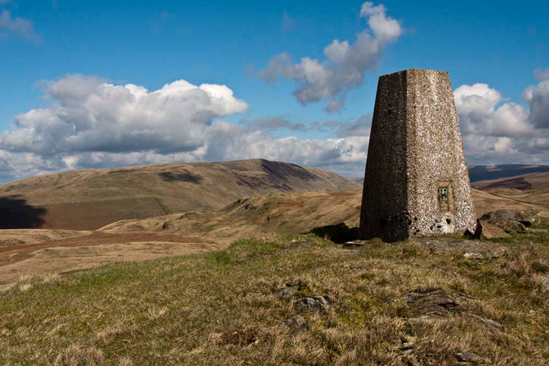
This done, the trig point was then clearly in view, and after descending into a dip, the facing slope was climbed to reach it.
Grizzly said, "at least until the wall, we had been exploring Barbon Low Fell, as clearly indicated by the map, but the highest point here is known generally as Casterton Fell. This does have some logic as it is indeed above the village of Casterton. In his book on 'Walks in Limestone Country', Wainwright names the top as Casterton Fell, which we will use for the sake of recording."
"Thanks pal", replied Allen. "Let's get on top of the trig point to record the achievement for the story."
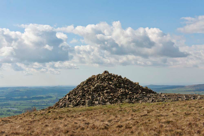
"We're heading next for that large pile of stones that marks the viewpoint known as Brownthwaite Pike", called out Shaun.
Looking round, Tetley said, "to get there we must first head half right to that wall corner, where there is a gate."
It was only a short distance to this, and once through, the path went left up the slope and along to the huge pile of stones...
...from where we could look back to Casterton Fell. This shows too that the day had become more cloudy, but there was no rain in them.
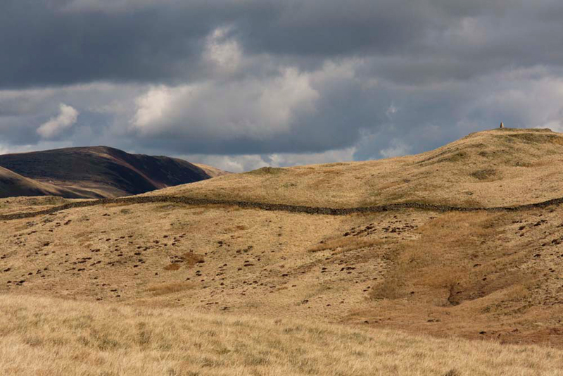
Little Eric was bagging both the tops today, and aired his concern about this summit. "Crossing the ridge to this huge cairn, it seemed to me that on the last part we actually descended slightly."
Shaun looked at the map and said, "I agree pal, the actual spot height is not at the cairn."
"I remember this now, from our last visit", went on Tetley. "We need to walk back a little way for our proper summit picture."
There is nothing to mark this, so we just sat on the grass.
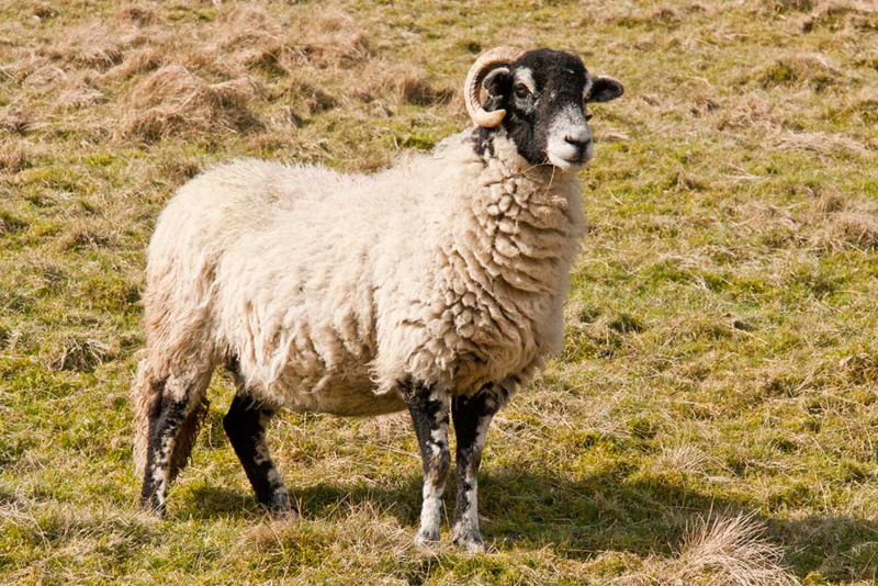
Below the hill runs a bridleway, left along which was our route. A short descent brought us to it. This runs under the east slopes of Casterton Fell, and then loops right down to the narrow road. There were some sheep with lambs, on the path, but too far away for a proper picture, and they moved off as we approached.
"That's good", said Allen fearing the worst about us having to put another such picture in the story.
However just when his hopes had been raised, Dad spotted a blackfaced sheep that stood and posed. "Darn it!!" he called out.
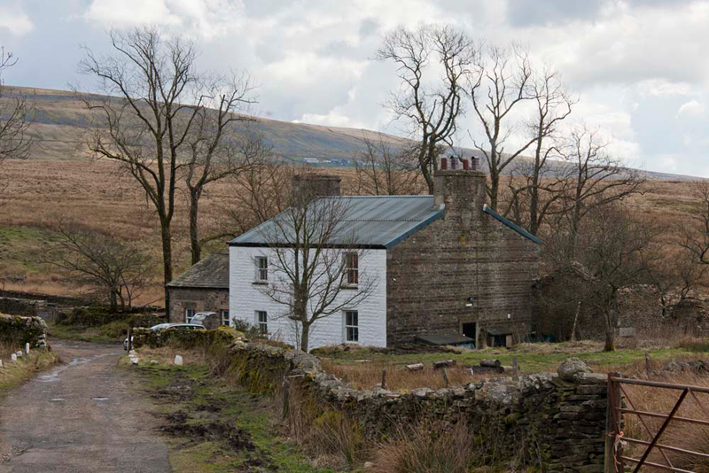
At the road we walked left along this, to where it ends at Bullpot Farm.
This is the headquarters of the Red Rose Cave & Pothole Club, which was started in 1946 with members drawn mainly from the Lancaster area. It is now one of the largest and leading caving clubs in the United Kingdom.
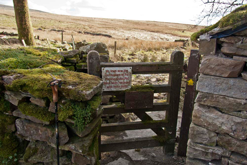
We were now deviating off our return route to visit Ease Gill Kirk, a small gorge. The path to this was through a gate at the side of the buildings, upon which was a sign telling us that the iron ladders had been replaced by resin bolts at Fall Pot and Stake Pot.
We were quite definitely not going potholing, but Grizzly commented, "I suppose they are safer and do not rust like iron."
We know that there must be wonderful things to see underground in the caves, but as a group we are quite content to stay above ground and enjoy the countryside, as indeed is Dad.
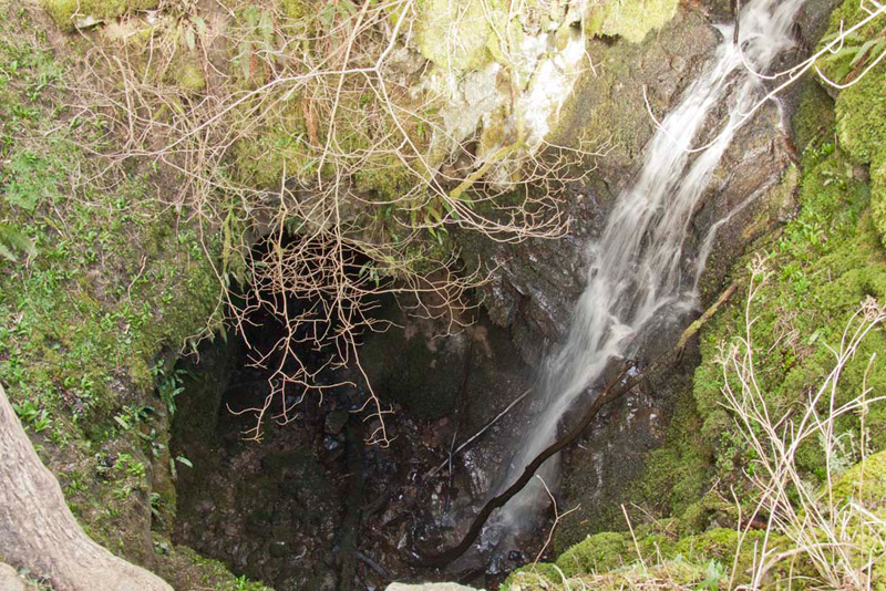
Just a little way along the track, a stile in a fence, gives access to Bull Pot of the Witches. Dad gingerly walked down the short path, peering over to get a better view. The drop of the waterfall is about 50 ft. More information can be found by clicking the following link. - Bull Pot
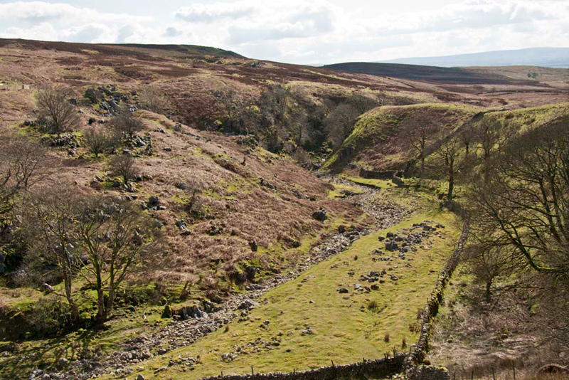
The rough track led on, passing some long abandoned limekilns to the left, to eventually come in sight of Ease Gill.
"The gill looks to be pretty dry, similar to when we descended the upper reaches, on the day we had climbed Gragareth", remarked Tetley.
"That was pretty hard going negotiating the rocks, and criss crossing to each side to make progress along the banks", added Shaun with a sigh.
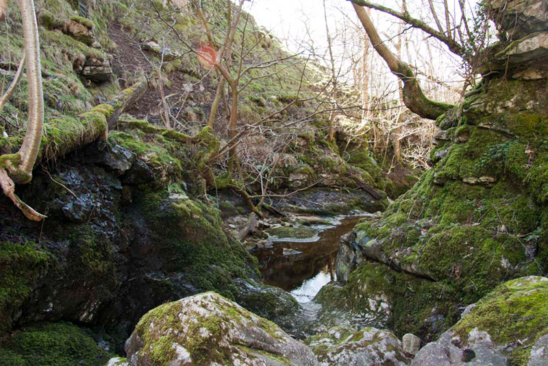
A steep path led down to the ladderstile that we then climbed at the junction of the walls, from which the path can be seen heading to the short narrow gorge of the Kirk.
None of us had been here before, and in fact it was Uncle Bob, who had really expressed the desire to visit. Not really all that impressive, and definitely not a L'Oreal moment! You know, in the adverts for their products, they usually end with the words 'I'm worth it'.
The deep pool appeared to block the way, but there is in fact a route past this, but in any event we had to return to Bullpot Farm, so we did not go any further.
As we reached the ladderstile once again, Uncle Bob said, "let's have lunch."
"Great" agreed Allen, slipping his rucksack off, "I'm starving."
He then got the sandwiches out and passed them round.
"What's on the menu today, Grizzly?", he asked.
"Cheese and pickle and egg and tomato", he replied.
"Lovely", said Shaun tucking in.
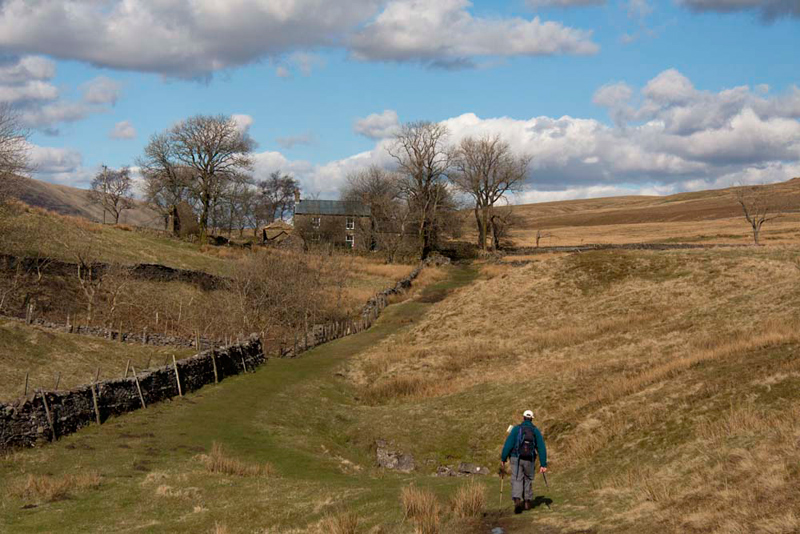
Lunch over, we climbed the steep path once again, and we headed along towards Bullpot Farm. Uncle Bob can be seen here striding out ahead of us. Just beyond the wall corner on the left lies Bull Pot, mentioned earlier.
Once at the farm, Shaun said, "we take the track crossing the lower slopes of Barbon Low Fell, then descend to Blindbeck Bridge on the Barbondale Road, from which it's just a mile along the road to the start."
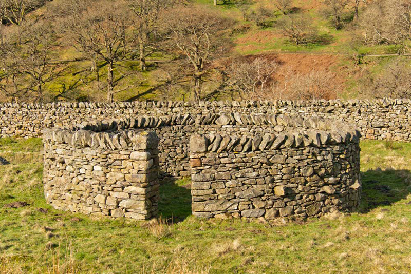
As we strolled along the road, Little Eric called out, "just look at that wonderfully constructed sheepfold over there. It is surely worth a picture Dad."
"This is surely on of the many structures built by the famous Andy Goldsworthy", said Tetley.
"Ooh yes we have seen many examples of his work in the past", added Allen.
If you are interested to find out more about him, a quick search on Google, will reveal lots of hits.
While we had been on some of the tracks a few times before, we had never explored the fell so much as we did today.
"That was a good walk", said Grizzly, "and so good to have your company Uncle Bob."