A lazy Monday afternoon, and a quiet time, as Dad and Uncle Brian were at Elaine's in Feizor as usual.
The mugs of tea had been poured and the biscuits passed round, which had brought a wide smile to Allen's face.
"What a contrast in the weather", he remarked. "On that last walk from Harden Bridge, it had been just like summer, and Dad had walked in shorts and t-shirt, but that will not be the case when we go with Uncle Eric on Wednesday, as it has turned so cold again, and there has been snow too."
"The good weather lasted all that following week, which was just great for Dad, Uncle Brian, Fletcher, Polly and pals, for their stay at Armathwaite Hall", added Tetley.
"Let's hope that week does not turn out to be summer, like last year, when there was hardly any sunny warm weather", said Little Eric mournfully.
"Amen to that", added Tetley. "Now where exactly are we going on Wednesday?"
Shaun had got the map and was studying it intently. "It is a walk published in the Westmorland Gazette, but Dad has not got a copy, but as far as I can see we are doing a circle above either side of the River Dee in upper Dentdale. We have in fact done most of the section on the west side, but in the opposite direction. That was on the day we climbed Aye Gill Pike."
"What a day that was", exclaimed Grizzly. "All was green in the valley, but the ridge was blanketed with deep snow, making for hard walking and by the time we had got back to the car, we had walked about 13 miles. We had to endure hail and rain at times, while in Morecambe the sun had shone all day!"
"Well let's hope at least we get a dry day on Wednesday", said Allen, holding his empty mug out for a refill.
"OK, tea belly", laughed Shaun, obligingly pouring the tea.
The Walk
To reach the start, we had first to drive up the beautiful Lune Valley, to the outskirts of Kirkby Lonsdale, before taking the Sedbergh road.
"I never tire of this scenery, no matter how many times I have driven up this valley", remarked Dad.
"I know", replied Tetley. "How lucky we are to live in this part of the country."
"Thank goodness I was able to take early retirement all those years ago, and not have to move to Ipswich", Dad went on.
After a few miles along the Sedbergh road, we turned right into the pretty village of Barbon, that is dominated by the vast bulk of Middleton Fell, and Barbon Low Fell.
"That was a nice walk with Uncle Bob exploring Barbon Low Fell, and I ticked off a couple of summits too", enthused Little Eric.
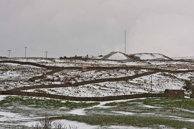
Giving a cheery wave to Mr. & Mrs. Williamson, where Dad gets his chutney and marmalade as we passed, the road climbed out of the village and on along Barbondale between those two fells, climbing steadily before dropping down into Dentdale. As a measure of how the weather had changed, the hills were snowbound and we encountered snow lying on the road, at the highest points. Shortly we passed through the charming village of Dent, then continued up the valley on its east side, to the parking area by the road, close to the River Dee, where we met Uncle Eric.
"Good morning", we called out.
"Hello Lads, nice to see you", replied Uncle Eric.
The day was quite bright with sunny spells, but the wind was bitingly cold from the north-east. We quickly snuggled down in the rucksack to keep as warm as possible.
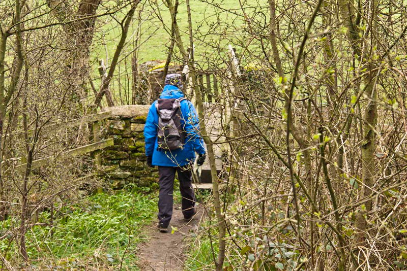
Then, all ready, we followed Uncle Eric as he descended the short distance, to cross the footbridge over the River Dee.
The field beyond was crossed, to the road. "Turn right here", instructed Shaun.
He then read the walk description and looked at the map. "The version of the map is an old one", Shaun commented.
"As is the one I have", replied Uncle Eric.
Tetley said, "the instructions are a bit vague as to which of the iron gates on the left we should take."
In the event it did not really matter as we walked along until the Dales Way came in from the right. Later Shaun said, "we actually should have taken the drive to Laithbank, as that was actually the route of the Dales Way."
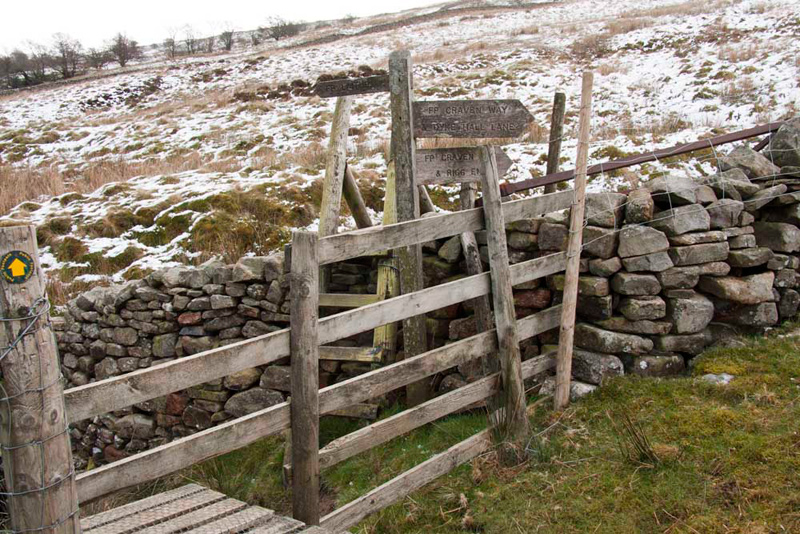
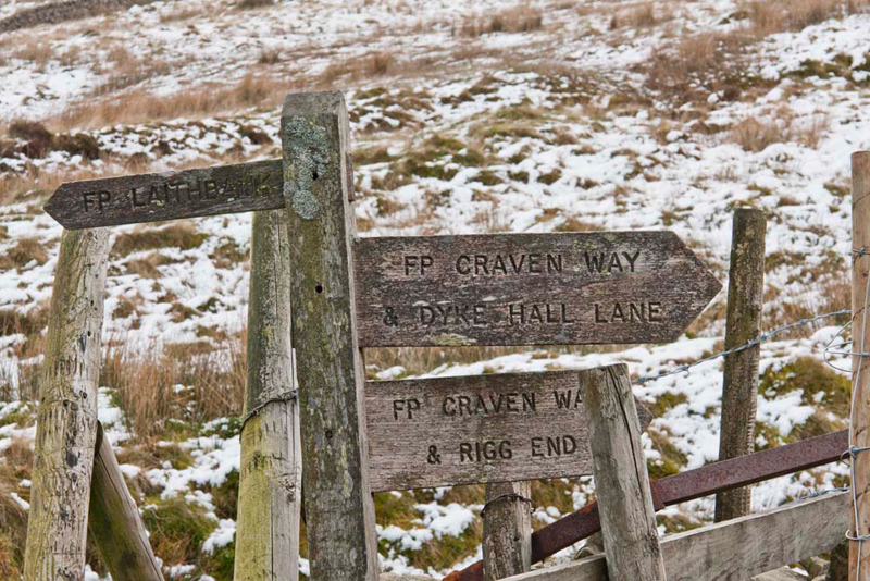
Where the Dales Way came in, Shaun now advised, "through the gate opposite and climb by the wall to the three armed signpost, by a complex of stiles, above Tub Holes."
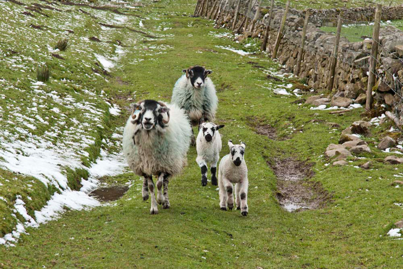
The contrast in the weather is clear from the lying snow.
"Which way now?", asked Little Eric.
"Left over the stile and on ahead, ignoring the ladderstile", replied Shaun.
"As indicated by the yellow waymark arrow, and the Laithbank arm of the signpost", commented Tetley
"Yes pal."
At Laithbank, we reached another three armed signpost. "Keep on the Dales Way along the drive", said Shaun.
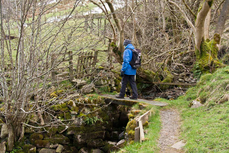
The path continued ahead to cross more stiles and pastures, including this small footbridge near West Clint.
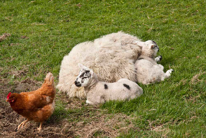
The buildings of Coat Faw & Hackergill Farm were then passed, on our way to the large area of woodland shown on the map around Littletown. Along one part of the path, we were chased by these ewes and lambs.
"I was hoping to avoid sheep pictures in the story", muttered Allen. "But, we cannot deny you including this one Dad."
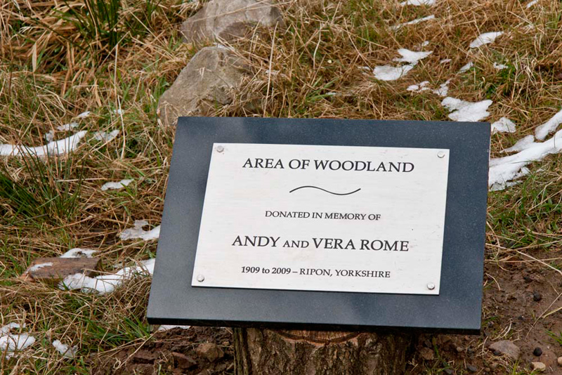
As we approached Littletown, Tetley called out, "the conifer woodland has all been felled. Look there is a plaque over there, I wonder what that is all about."
This speaks for itself, and relates to the regeneration of this and a wider area. In 2010/11 the conifers were all felled to be replaced by approximately 40 acres (around 21,000 trees) of new native broadleaf woodland. Just one of the projects undertaken by the Yorkshire Dales Millennium Trust.
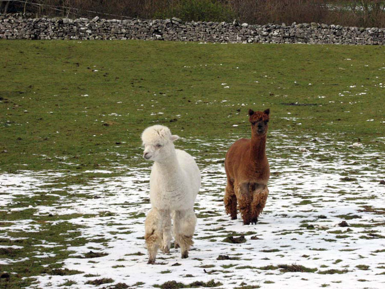
"I remember clearly that there were two alpacas here", said Allen.
"They still are", cried Grizzly. "Down there by the entrance gate."
Too far away to photograph today, we include this shot Dad took in March 2008.
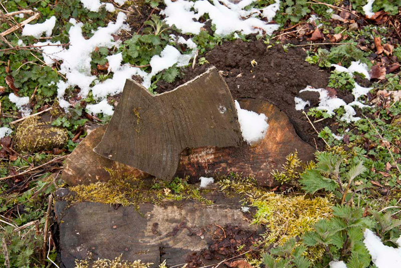
Beyond the drive the rough path continued. "Look", called out Grizzly. "Someone has fashioned a waymark arrow out of a piece of the felled wood. I wonder how many people will recognise it for what it is?"
Just in case, a paper sheet with an arrow logo, covered in plastic, had been placed there too. Dad had temporarily removed it to take his picture. The dry patch shows were it was.
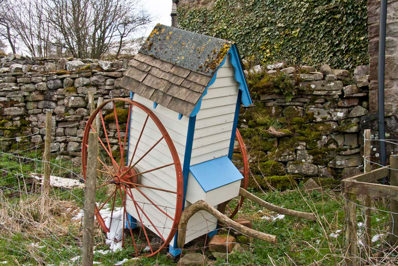
Soon now we reached Riving. "That's a rather curious vehicle, with a door at the rear", pointed Tetley.
"It must be hand drawn in the manner of a rickshaw, from the look of it", commented Allen.
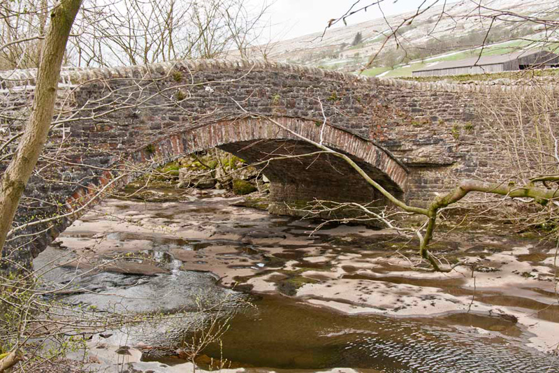
The path now soon led down to the road. "We go right to Ewegales Bridge", instructed Shaun.
Grizzly told us, "the bridge is Grade II listed. It dates from probably the late 17th century or early 18th century."
This spans the River Dee.
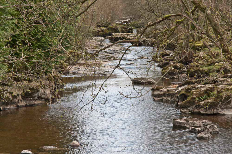
Uncle Eric said, "we do not cross this, but keep ahead on the narrow path by the river to Lea Yeat Bridge, which we do cross."
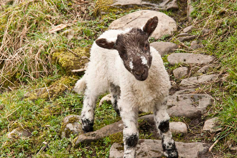
This little lamb was just begging to be snapped. Big ahh, everyone. "Huh", grumped Allen. "We're not doing very well avoiding sheep pictures in this story."
At Lea Yeat, a narrow road climbs steeply to Dent Station, the highest mainline station in England. Across the snow covered fields surrounded by their stone walls, the roof and chimneys can be seen.
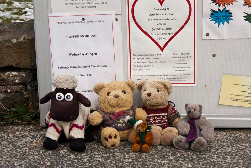
Often on walks we pass notice boards, with details of events taking place in the parish and local area. Uncle Eric is always interested to read these, so we waited patiently.
Then Little Eric said, "that convenient flat stone is a good place for our picture. We have to appear in every story."
"Where now, Uncle Eric?", asked Tetley.
"Along the road until we get to Cowgill Grange", he replied.
At the entrance this sign pointed to our next objective.
"We follow the drive for a short way then go left by the wall", read out Shaun.
"Oh yes", agreed Grizzly, "the waymark is hidden behind those tall conifers."
This path led to a stile into a field. Then it was on and on over more fields via gated stiles. These were tucked away and sometimes difficult to see.
Allen commented, "waymarks abounded on the other side of the valley, but here it would be helpful for a few more."
At one point we were walking through someone's garden, here the path being quite definitely signed to keep walkers to the edge.
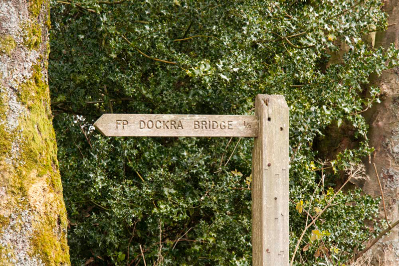
All this led to a track, where we went right to cross Dockra Bridge, and then more fields and stiles towards farm buildings, close by the road.
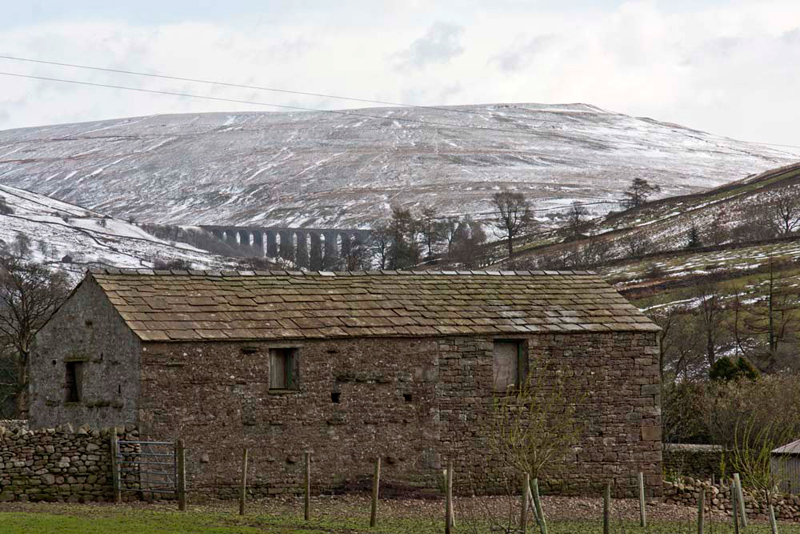
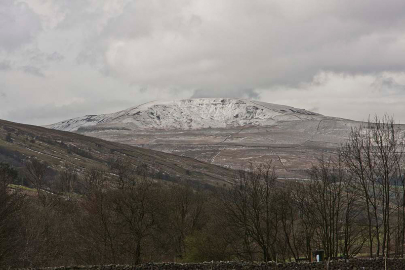
"There's super view behind, over that building to Dent Head viaduct, backed by snowbound Blea Moor", called out Grizzly.
This arrested the attention of both Dad and Uncle Eric, and cameras were hauled out.
Grizzly then proceed to give us some further information about it. "I had looked it up in that old book Dad has about the Settle-Carlisle line. Dent viaduct is one of many on the line, standing at 1150ft above sea level. It is built of the local blue limestone, has ten spans, and is 197 yards long and 100ft high. It spans the infant River Dee, either side of which we have been walking today."
At the farm buildings, our route was over a stile behind them. Just beyond, was this ewe, with her two lambs nestling close to keep warm. "Ahh", said Little Eric.
"That's a dramatic view of Great Coum, that rises above the west side of the dale", pointed Tetley. "Worth a shot for the story."
"We go slightly right across this next pasture, and then over a stile and on to the next one." instructed Shaun.
There Uncle Eric said, "we now need to keep to the right of that barn ahead, then on to the left of the farmhouse."
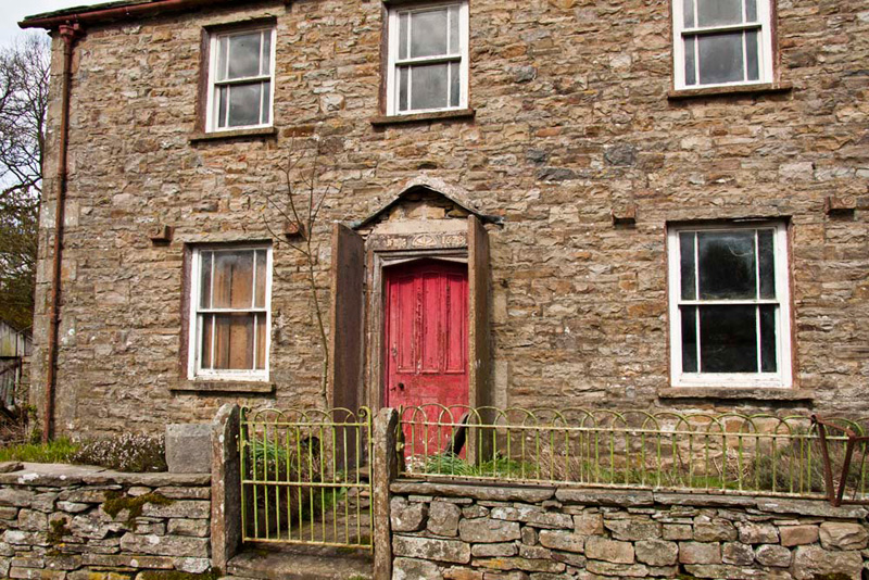
This is Spice Gill, so named we presumed from the stream that ran just beyond, descending from the slopes of Rise Hill.
It is abandoned, and we think you will agree looks sadly forlorn. Wanting to know more, Grizzly later looked it up on the Internet. "It is a Grade II listed building. Although the lintel over the door has a date of 1678 and the initials IM, it mostly dates from about 1860-70."
Note too the substantial stone slate slabs that were part of a porch, the top of which has now fallen away. The square stone bosses either sides of the windows, indicate, according to the walk description, that it is part of the Sedgwick Estate.
Right, back to the walk. A few yards on we crossed Spice Gill, by this simple slate slab footbridge, and into the pasture beyond via the gated gap stile.
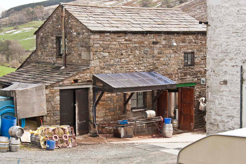
This pasture crossed and then another, brought us to the buildings of Hollins, the home of Dent Brewery, famous locally for such wonderful beers as Aviator, Ramsbottom, T'owd Tup & Kamikazi. The water to make these and indeed all the brews, comes from the Hollins' own spring up on the fellside. If you want to find out more click the link.
Soon, we reached an access track, where we turned down left to the road and then right just a few yards to the cars.
"That was an interesting walk, thank you for suggesting it, Uncle Eric", said Tetley.
"You're welcome", he replied.
Because of the cold it had been decided not to have the usual picnic. We had ours afterwards sitting in the warmth of the car, while Dad and Uncle Eric, had a very nice lunch at Stone Close in Dent. Uncle Eric had soup, carrot & walnut cake & coffee, while Dad had shepherd's pie, blackcurrant crumble with custard, and tea.