Allen was sitting tapping away on Dad's laptop, with Tetley and Little Eric looking on.
"That was a nice walk we did from Whinlatter Visitor Centre", said Little Eric.
"Yes there were terrific views", replied Allen. "Hang on while I bring up the photos that Dad took."
"Just stunning of Bassenthwaite and Skiddaw, and those of Grisedale Pike are especially good", remarked Tetley.
"Grisedale Pike has a special meaning to me, as it marked the completion of my Wainwright challenge", sighed Allen.
"You were certainly a proud bear that day, and we were all proud of you too", said Tetley.
"It would indeed be wonderful to be able to say I had done that challenge too, but it would mean Dad will have to repeat half of the 214", said Little Eric. "Just not fair to put Dad through all those tops again, so I will just have to dream."
"Well at least you ticked off another one that day, when we got to the summit of Barf, replied Allen. "You are getting on with the Outlying Fells, and there are quite a few that Dad may do with Uncle Eric, that you have not done, so completing that challenge may well be on."
"I hope so", enthused Little Eric, "but I am determined that Dad will not be rushed over this."
"Well it looks like you will be making progress with that on Saturday", called out Shaun, as he strolled in with Grizzly, who had just finished watching an episode of Fringe with his pals.
"How's that", said Little Eric brightly.
"Dad is taking us to do the Naddle Horseshoe again, over the fells surrounding the valley between Swindale and Haweswater", replied Shaun.
Pausing a moment for thought Tetley then said, "not only will you tick off four Wainwright Outlying tops, but also 7 in the Birkett challenge."
"I'm going to be a very happy bear on that day, so I think it calls for tea and biscuits all round", enthused Little Eric.
"Great", said Allen. "I'm gasping for a drink", as he rushed off to get the mugs.
Then Shaun poured the tea, and Grizzly handed round the biscuits, and we all sat contentedly, chatting about past adventures.
The Walk
Saturday soon arrived and we got up early, to make the sandwiches and safely stow these with the biscuits and drinks in Allen's rucksack.
As we heard Dad slam the boot of the car shut, we dashed out, calling a cheery goodbye to Uncle Brian, who was looking forward to a quiet day!
It was a sunny start, and as we drove north on the M6, the Howgills made a majestic sight. However the day was to soon cloud over with just a few sunny intervals, and bitingly cold wind. Will we ever get some warm weather this year?
Tetley said, "for Shaun and I it is the third time we have done this walk. First in June 2004, then again with you Allen & Grizzly, with Uncle Eric in February 2008."
"Oh yes", said Allen, adding, "we were on with the Birkett challenge by then so we took in all the tops, not just the Wainwright summits, as was the case in 2004."
"Quite right", interjected Dad. "After today you will all have done them, so I do not expect to return again."
Leaving the motorway at junction 39 for Shap, we joined the A6, turning right for a short distance, to go left on the road that leads to Wet Sleddale. Very soon we turned right, along the waterworks road to its junction with the Bampton to Swindale road, beside which is the concreted parking area.
While Dad was getting ready we settled ourselves in his rucksack, which was duly shouldered by him. Shaun instructed, "Dad, we should stroll a little way on along the waterworks road, to then take the track left over Rosgill Moor."
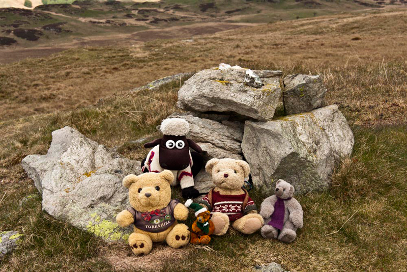
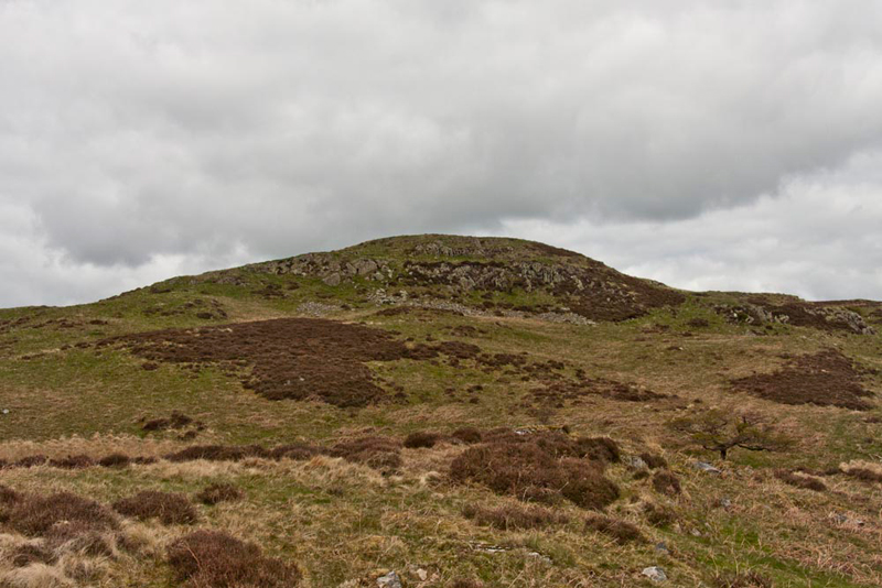
Tetley pointed, "that's our first objective Scalebarrow Knott, with the substantial wall running over its right shoulder."
"I can see two cairns" said Little Eric.
"Yes, that's right, but we must go to the furthest one, as that is the highest point", replied Tetley.
The track led us soon under the hill. "We take the right fork", said Shaun.
Soon a narrow trod went off to the right. "That's the way to the summit", said Allen.
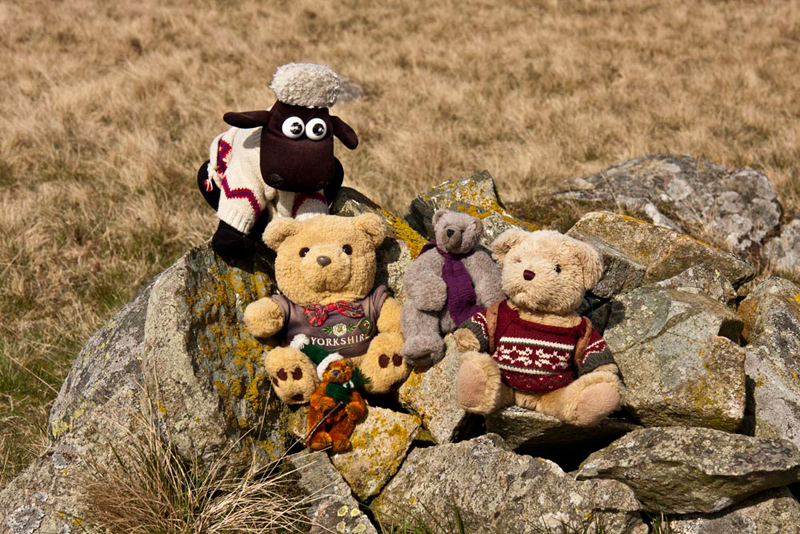
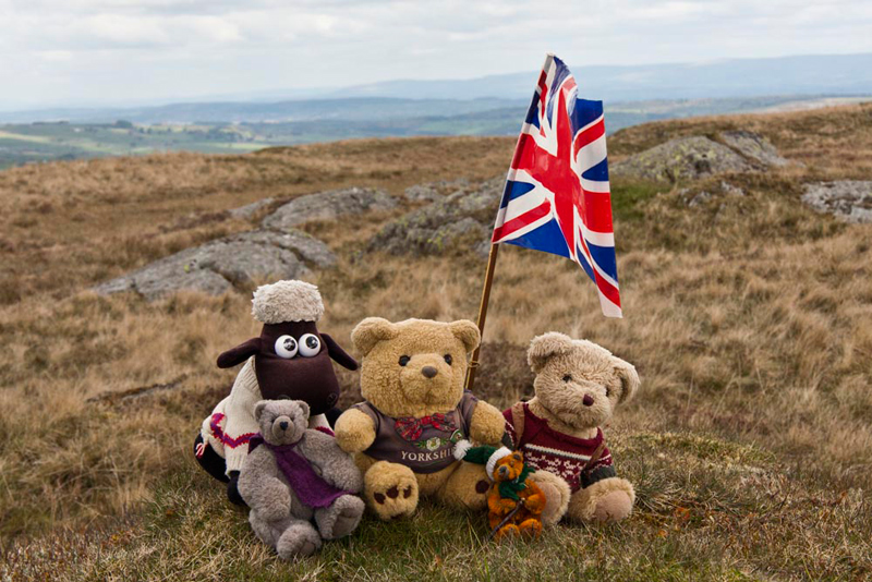
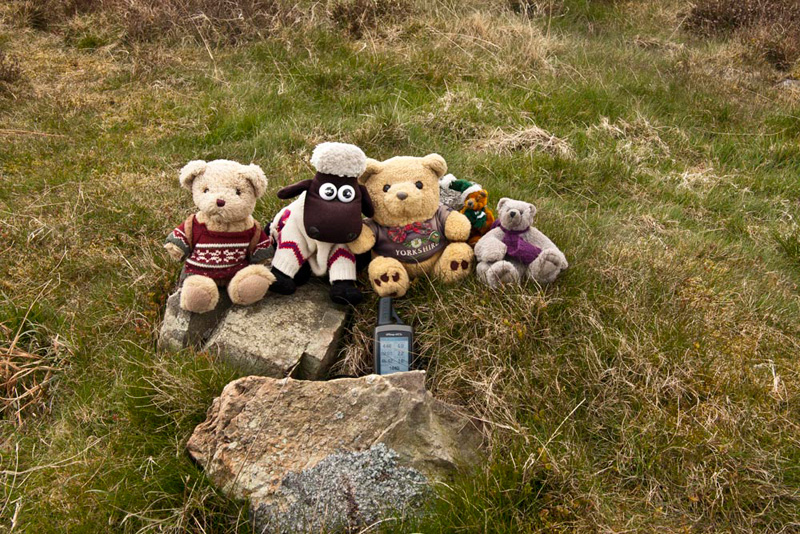
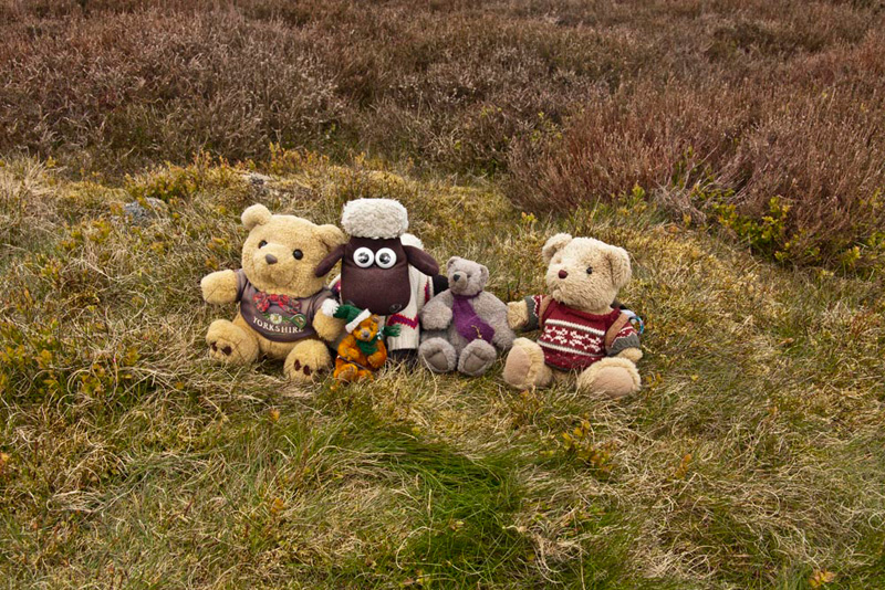
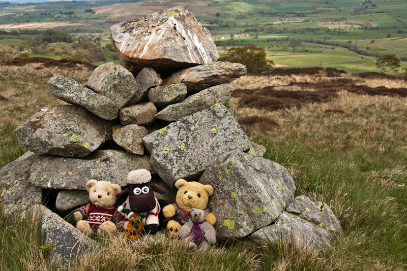
As we arrived, Little Eric called out enthusiastically, "come on pals, let's settle on the cairn for our picture."
"Can you enlighten us about the name, Grizzly?", asked Tetley.
"For sure pal. According to the book by Diana Whaley, it means 'the hill with the sheiling' . This is from the Old Norse skali for sheiling and berg for barrow. Apparently Knott seems to have been added later."
"Where now?", asked Little Eric.
"Harper Hills is next, which is the hill ahead, its summit cairn being in view on the skyline", replied Shaun. "To get there we need to get back on to the main track."
This dipped down then began to climb again.
"That's the village of Burnbanks down to the right", called out Allen.
"You're right", replied Tetley. "We walked from there in January 2009 to do four then outstanding Birketts. Originally the place was built for the workers constructing the dam that created the Haweswater reservoir, to supply Manchester. The village all but died out, as it was largely abandoned, but eventually the remaining 18 bungalows were rebuilt to revive the village.
At a fork, Dad said, "I am going to go left here off the main track, as it seems to lead more directly to the summit."
He was right too, as after traversing a few knolls the cairn on Harper Hills was duly attained. "Picture time again", called out Little Eric.
Once again Grizzly informed us about the origin of the name. "It may be the occupational surname, derived ultimately from Old English hearpere, or Old French harpeor." The plural hills may be due to the small subsidiary summits.
Then Little Eric asked again, "where now?"
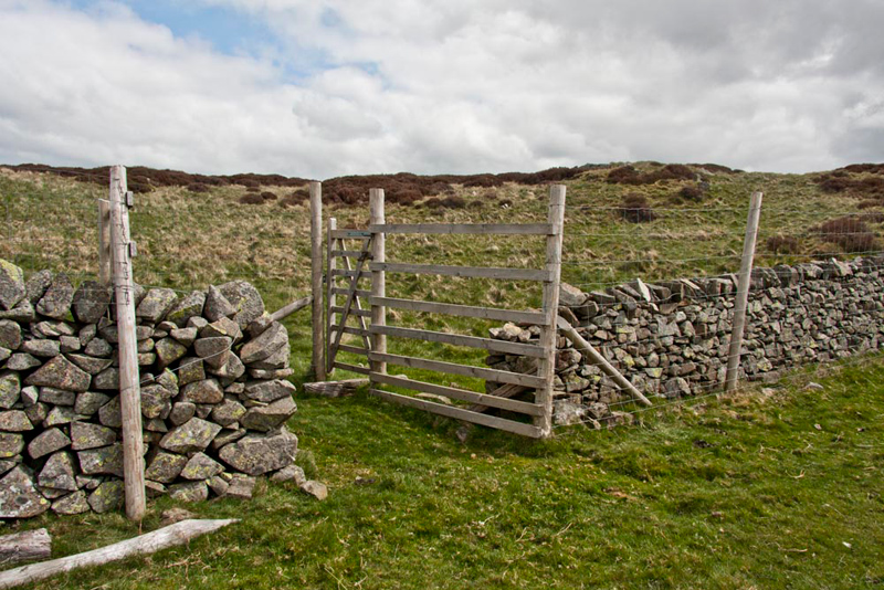
"Powley's Hill, which is the higher hill directly ahead, but first we have to get on to the track, to get to the gate in the fence", said Shaun.
"Thanks pal", Little Eric replied. "Although I have been walking for four years, I am still pretty much a novice, compared to the rest of you."
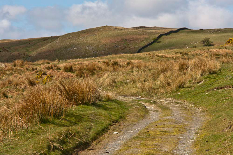
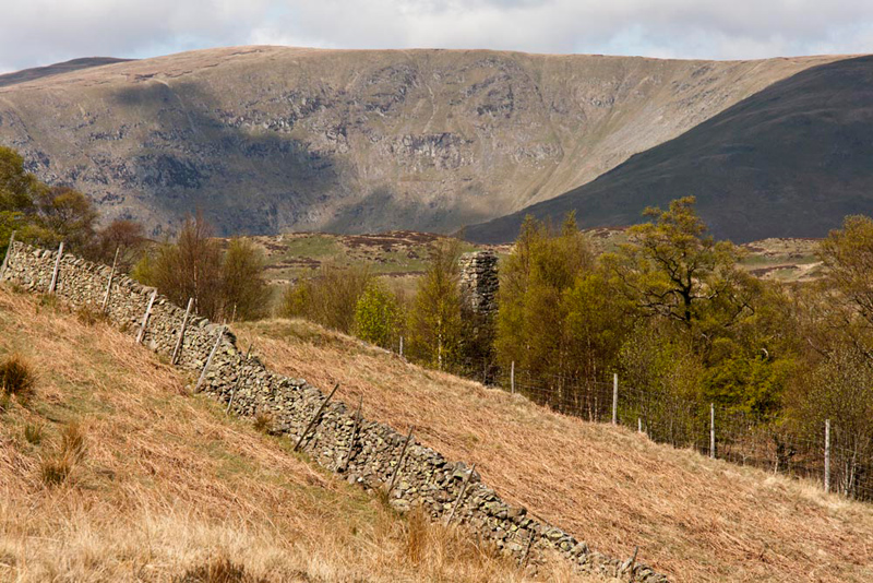
A rough path of sorts led off from the summit, and gradually dropped down, eventually curving right to the main track that descended towards the fence gate. This can be seen in the shot below, with Powley's Hill rising beyond. Although the landscape is pretty featureless, it gives the reader some idea of the terrain.
Beyond the gate Dad kept right on the track, to gain the crest, Little Eric suddenly calling out, "what's that over there amongst the trees."
"A stone built chimney, and all that remains of a long gone building", replied Tetley.
The massive ridge of High Street (2718 ft) provides the backdrop.
As we approached the crest, Shaun said, "if we take the narrow trod, left it will lead to the summit."
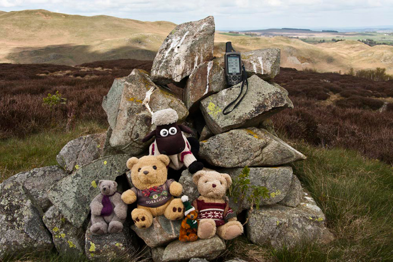
It meandered, climbing steadily to come to the ridge of Powley's Hill, at its north-east end. "According to Bill Birkett this is perhaps the highest point" read out Allen.
"Well I cannot disagree", replied Dad.
Then Allen went on, "but as he further states the Ordnance Survey show the summit further to the south."
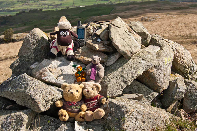
We headed to this, to match the grid reference we had recorded last time, and settled on the highest of the small ridged outcrops for our picture.
"There's no cairn", moaned Allen. "Will you get the flag out to add some colour, please Dad?"
Grizzly informed us, "the name is apparently from the surname Powley, Pulley or Pooley, common in the Parish Records 16th-18th century, plus hill."
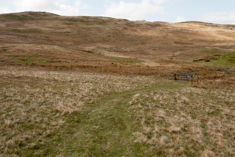
"Before you ask, Little Eric, "we keep on in basically the same direction, to get to the last top on this side, Hare Shaw, which is also the highest point we will reach today", lectured Shaun.
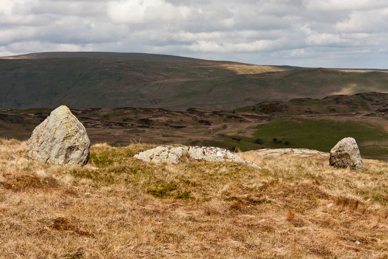
So, settled once more in Dad's rucksack, off we went. The map shows just ahead a spot height of 474m, and whilst this did not count as a summit, Dad kindly walked over it for us. Then down and up again, passing east of a rise with two standing stones.
Further undulations were crossed, and two cairns passed, before the furthest was reached, this marking the summit of Hare Shaw. "Wonderful", cheered Little Eric. "That's one side of the horseshoe done, and three of the Outlyers bagged."
"What is the origin of the name, Grizzly?, asked Allen.
There are two possibilities. First is probably 'hare wood or copse', though we are on a hill and it is not presently wooded. The other, which cannot be ruled out, is the derivation of 'Hare' from the Old English hār, that means 'grey, hoary'.
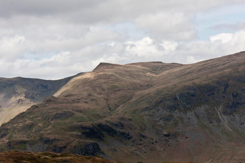
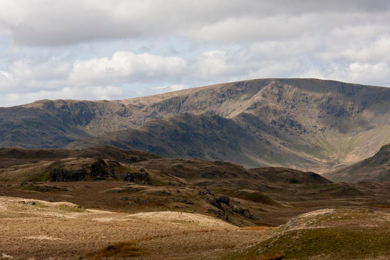
Although unseen, Haweswater lay below. Mountains tower all around. To the south are Selside Pike, Branstree, Harter Fell and the Nan Bield Pass. More too in the west to south-west arc, illustrated in the pictures below.
First the unmistakable triangular shape of Kidsty Pike (2560ft), with Rampsgill Head (2598ft) behind,
and below, from the left Mardale Ill Bell (2496ft) and High Street (2718ft). Tetley said, "one of the of occasions we climbed High Street in May 2010, we did it via the long ridge in the centre taking in the summit of Rough Crag (2060ft)."
"Brr, isn't it cold up here. That wind just cuts right through you", said Allen.
"Too true, Lad", replied Dad. "I've done with the photography, so let's get off down."
"We have to get back to the wall, we can see distantly below", pointed Shaun.
There is no path, so Dad just picked a line through the knolls and over the flat bogs.
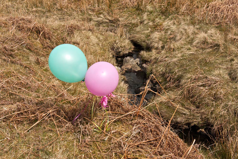
"What are those bright objects over there?", called out Shaun.
"Not sure, but let's go and have a look", replied Tetley.
As we got nearer, Little Eric called out, "they're balloons, that have some how got snagged on bracken. Lord alone knows where they have come from"
"And he's not telling", joked back Allen.
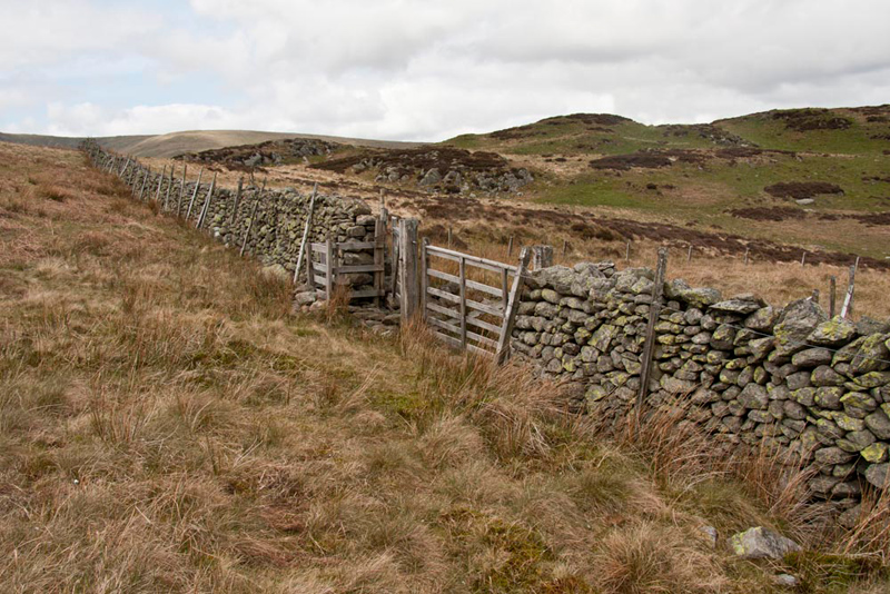
"When we get to the wall, we must go left to find the gate that allows access to the Naddle Forest", said Shaun.
As it turned out it was only a very short distance from the point we rejoined the wall.
Once through, we went immediately left by the wall, to, in a few steps, climb the facing hurdle, and gain the path in the Naddle Forest. Wide clear and grassy, leading to a fence gate.
"We should ignore the gate, instead bear left and climbing directly to the summit of Naddle High Forest", instructed Shaun.
Tetley said, "in Wainwright's chapter in the Outlying Book, this is referred to as the 1427ft unnamed summit. When drawing up his list Birkett allocated the name High Forest, as it is so referred to on the OS map."
"That cairn ahead, marks the summit of our next top Wallow Crag, at about the same height we are now", said Grizzly. "However there is the matter of getting over the substantial stone wall and fence first."
"There's a gate, that the track we left to get to this summit goes to, but that involves losing height and having to climb up again", said Allen rather dispiritedly.
"When Tetley and I originally did this walk in 2004, that was the only way through, but it did not matter, as Wallow Crag is a Birkett, so we did not bother to climb it", said Shaun. Then reading Birkett, he went on, "the instructions suggest keeping to the ridge line."
Having listened patiently to this debate, Dad said, "right, that's what we will do then."
The ridge undulated as the narrow path led us on, and over the last rise the wall and fence faced us, and there was no possibility of climbing them.
However looking left Dad exclaimed, "the fence changes sides there, and the wall is breached." Then as we got nearer, he said, "look there is a gate too."
"Great", cheered Allen. "Once on the other side, there is just a few yards of climb to the cairn on Wallow Crag."
"This is surely the 1380ft nameless summit, referred to in Wainwright's Outlying book chapter" commented Tetley.
"Time for lunch", said Allen, rubbing his tummy. I'm hungry."
"No surprise there", laughed Tetley. "Mind you we need to get fortified to the rest of the walk."
There were more fine views to enjoy. Earlier we had seen two walkers on Harper Hills, and looking back we saw then again, now on High Forest. These were the only other people we saw all day.
"Right that's just three tops to go", said Little Eric enthusiastically.
"Last time we went to Low Forest next", recalled Tetley.
"That's right lad, but there seems to be a good path just down there, that meanders by that tall fence, which bars access to the cairn on Hugh's Laithes Pike. So we will go there first today" announced Dad.
The path ran clear and true, even through the patches of heather, as it rose and dipped with that tall and unclimbable fence to the left. The cairn on the other side of the fence came into view and we climbed to the highest point on this side, as on previous occasions.
We were about to jump out for our picture, when ever eagle eyed, Tetley called out, "look the fence has been cut over there. It is a section about 3ft square hinged at the bottom."
So, Dad taking off his rucksack and camera, which were duly passed through the gap, he then climbed through himself, and for the first time ever we got to the actual summit and cairn, which we promptly climbed up for our picture.
"Yippee", cheered Shaun.
Allen said, "This is a Wainwright Outlyer. The book was originally published in 1974, when I suspect that then there was no fence. Good to have access to the cairn again, however and by whom the gap has been made, as it does indeed stand at the highest point.
Grizzly then piped up. "The name means 'the peak above Hugh's barns'. 'Said to be named after Hugh Holme, the first of the family to live at Chapel Hill in Mardale'. The second element is from Old Norse hlaoa, 'barn'.
"Naddle Low Forest is next", said Little Eric.
"Yes", replied Shaun, "it is that rather unprepossessing rise to the south."
The fence was recrossed and Dad pulling the fence flap up, to leave it has we had found it. Low Forest is thickly covered in heather and with no clear path Dad just forced his way through to reach the grassy patch at the unmarked top. "This is just a Birkett summit", commented Tetley.
"Just the truly unnamed summit to go", called out Little Eric.
"No doubt about this, as the top is marked by that neat cairn, we can clearly see to the north-east" pointed Allen.
Descending from Low Forest, which on this side exhibits a few small crags, a boggy area was crossed, followed by the gentle climb to the cairn.
Grizzly commented, "the elevation is 1296ft, as shown in the revised second edition of the Outlying book. In the original 1974 edition, Wainwright showed the height as 1320ft."
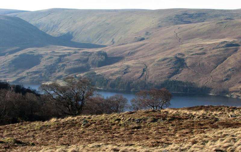
From here, there is a nice view of Haweswater with the fells behind. Dad took this shot on the day we did this walk with Uncle Eric in February 2008.
Shaun said, "we need to find the hurdle in the fence to get down to the valley. Birkett does not include this summit, so his instructions do not apply. He says go north, but this is from Low Forest. So, from here we need to loop back south towards it."
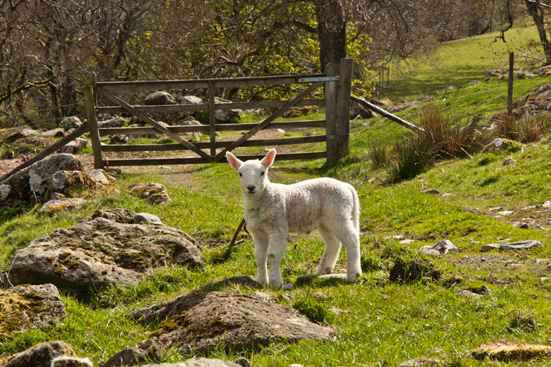
There was a path running in that direction and soon the hurdle came into view. This was climbed and the path beyond followed as it made its descent of Highfield Crag to the valley track, which we followed left to Naddle Farm. There had been no sheep, and with luck we thought, the story would conclude without any such pictures. However it was not to be as along this track, this lamb posed for Dad.
"Oh well, never mind!", sighed Allen. "I have to say he is very cute."
At the farm, we took the signed gate on the right, and crossed the stream (almost completely dry) by the ford. The steep zig zag track now faced Dad, ascending the opposite side of the valley.
"I have not been looking forward to this", he remarked, pausing to catch his breath. "I am not a fit as I was, so we will have to get more hill walks in", he went on.
Great, we all thought.
The track eventually led to a gate in the wall so regaining Rosgill Moor, where the route was retraced below Scalebarrow Knott, to the car.
"I speak for us all in saying what a super walk Dad", cried Little Eric joyfully. "It is not often that we do 9 summits in a day, all of which I have bagged, of which four were Wainwright Outlyers, and seven Birketts."
Now as you know, Dad likes to round off the day with tea and either a meal or cakes and the like. "I have got it all planned, to have a heartening meal at Junction 38 Services at Tebay."
"Well you deserve it", replied Grizzly.
However to his dismay the cafe was closed, and did not reopen until 18:30. As these services are primarily for lorries, we guess it was closed as it was bank holiday weekend. So instead we just drove home. Uncle Brian laughed when we told him the services had been closed.