NEWTON FELL NORTH from BARROW BANKS
NEWTON FELL SOUTH from LOW NEWTON
Summary
Date - 17th June 2012
Distance - 5.75 miles
Ascent - 1185ft
Map - OL7
Start point -
North - Barrow Banks (SD 384849)
South - Yew Tree Barn (SD 405823)
Summits Achieved
Name
Height (ft)
Height (m)
Grid Ref
Newton Fell North
780
238
SD 3952 8432
Newton Fell South (Dixon Heights)
585
177
SD 4134 8155
Preface
Allen, Grizzly & Tetley were looking glumly out of the window as the rain poured down.
"What a wash out this year is proving to be", said Allen despairingly, "We can only hope that there will be at least one decent day, with a rest day afterwards for Dad, when we can hopefully get to the summit of Pen, and finally complete our Birkett challenge."
"Let's hope so", agreed Tetley, "but for now it is not looking too good for this weekend."
Just then Shaun and Little Eric strolled in. "We bring tea", said Little Eric brightly.
"Even on such a miserable day, that brought a smile to Allen's face, and as he opened his mouth to speak, Grizzly, beat him to it, saying, "I know, you're gasping", then letting out a bellow of laughter.
"Spot on pal", Allen replied.
Once settled with the steaming mugs and biscuits, Shaun went on, "I bring news too. Dad has looked at the weather forecast, and whilst it is not going to be very sunny, at least it will be dry tomorrow, so he plans to take us on a walk."
Butting in excitedly, Little Eric said, "we are not driving very far, nor climbing very high, but we are going to do Newton Fell north and south, two of the Outlying summits I have not bagged."
"We have been there before, of course", replied Tetley, "but not since the rights of way act, and the revised edition of the Outlying book shows that it is now possible to ascend Newton Fell north, on the left side of the wall. So we will be able to get to the actual highest point, that was previously inaccessible."
"Can't wait", cheered Little Eric holding his mug out for a refill.
"You are as bad as Allen for your tea", chided Shaun, laughingly.
The Walk
Newton Fell North
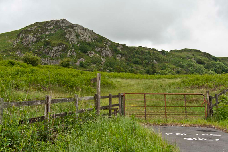
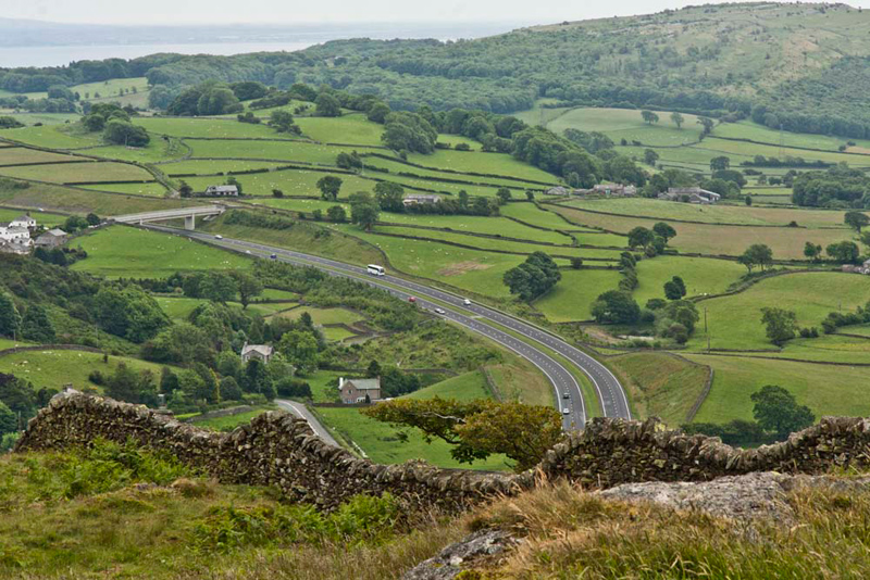
The weather forecast proved to be correct and the day was dry, but as always there was that cool wind. There used to be a convenient layby on the left of the A590, but since the Low/High Newton bypass has been built, this has gone, so instead Dad used a section of long disused old road on the right. The one good advantage of this is that we did not have to cross the busy road with its speeding traffic.
Dad got ready, and then we walked the short distance to the gate, and the stile which was climbed to give access to the open fell.
"Is that the summit we can see?", asked Little Eric.
"No pal, that is White Stone. We will climb to that, but the actual summit is a distance further in a south easterly direction", said Tetley.
There are a number of paths that weave up the fell through the bracken, and on the ascent, Dad used one that kept rather closer to the ravine of Whitestone Beck, to reach a convenient point to cross it. Although pretty full, after all the rain, this presented no problem.
"I'm going to follow this path right first, to visit the outcrop White Stone, for Little Eric's sake."
"Thank you, Dad."
This done and once more on the main path, we headed to the cross wall.
"There's the new stone step stile", pointed Shaun. "In the past, walkers could only walk to the right side of the wall that climbs the fell. But since the rights of way act, the new stile allows access to the land to the left of the wall."
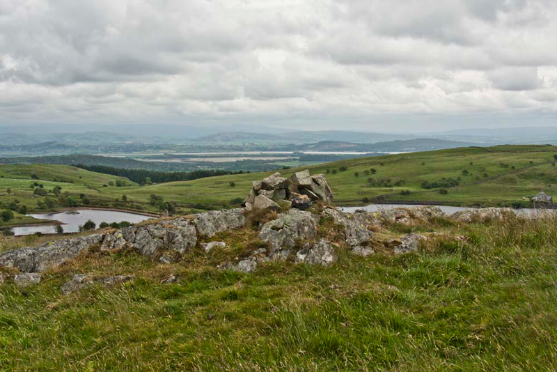
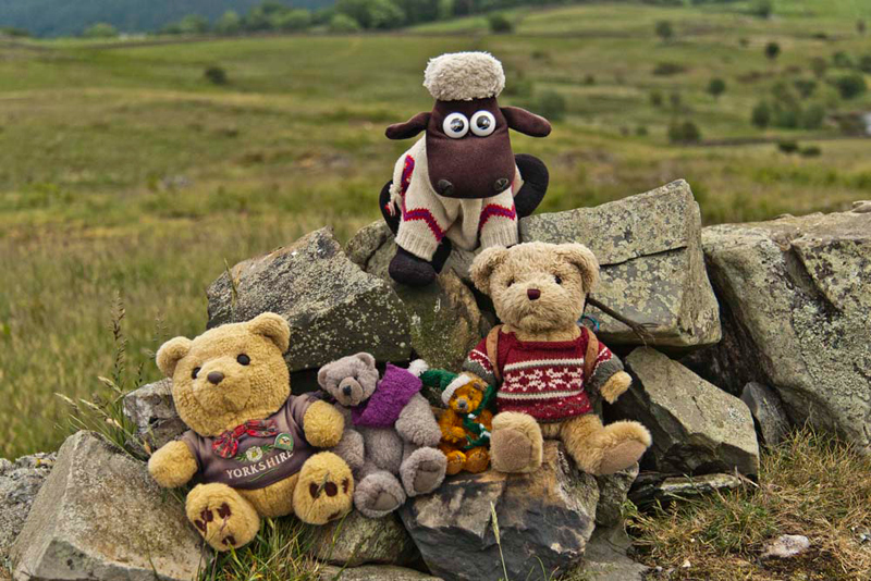
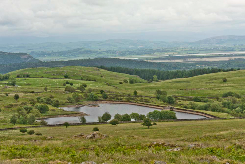
Crossing two small depressions we soon attained the unattractive highest point, a rocky outcrop with its cairn.
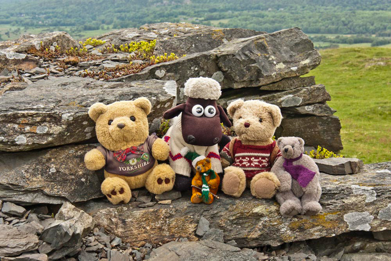
"Please take my picture", said Little Eric, as he settled with the rest of us by the cairn.
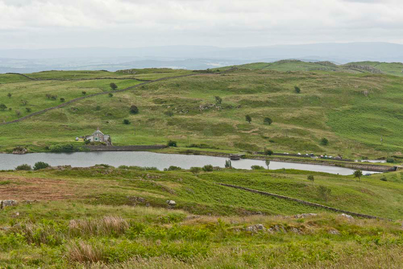
From here there were extensive views, first of Newton Reservoirs.
Then over the wall, the sweep of the new bypass.
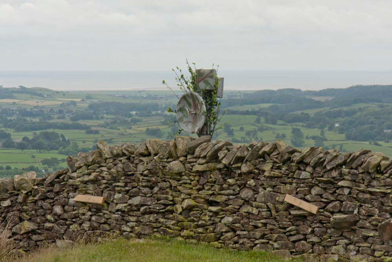
As we had climbed up, it had looked like there was someone standing by the wall at the summit, but this was obviously not the case as the object did not move. It turned out to be a communication dish of some sort, but for what or whom we have no idea.
So, that was Newton Fell north. We returned by the same route, but Dad used the waymarked path this time for the descent, once we had crossed Whitestone Beck.
Newton Fell South - Dixon Heights
A traverse of the ridge of Newton Fell, is not possible as there is no access to much of it. So to climb to Dixon Heights, we had to reposition to a new start point. This was at Yew Tree Barn, where coincidently is the Hat Trick Cafe, run by Jane and Sam, and one of Dad's favourite cafes.
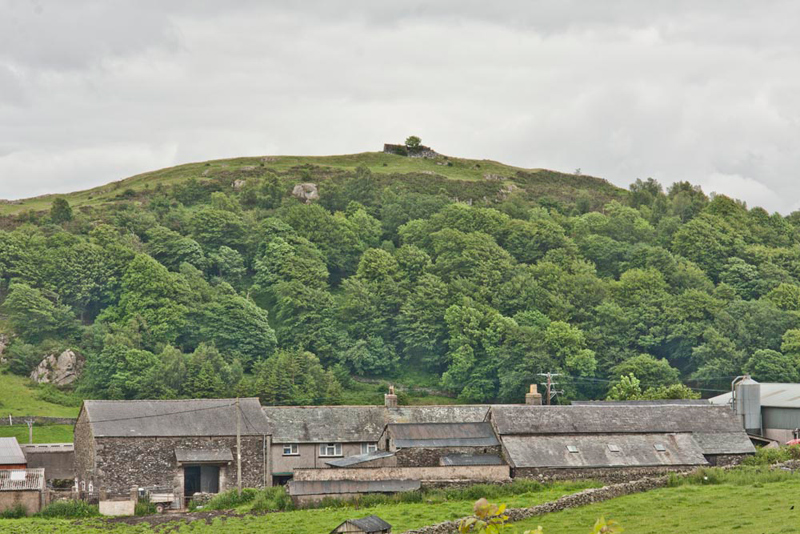
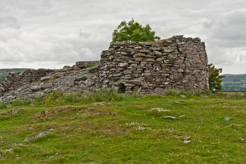
Dixon Heights is notable whenever it is seen from the road, for the ruined tower that adorns the summit.
From the start we continued along the old road towards its junction with the start of the new bypass and the dual carriageway up Lindale Hill. Here Dad took the track to Buck Crag.
After a little while Shaun said, "I do not think this is the way", as he scruntinised the map.
By now we had got to Moss End Farm, where we met the farmer, who confirmed this.
We had trespassed, but only on the access path, Dad saying, "I am sorry. Please accept my apologies."
Turning round we walked back to the road, during which Allen remarked, "that is a good view of Dixon Heights, to include in the story."
Dad said, "we will have to walk down the side of the dual carriageway for a distance."
This was not very pleasant with the traffic hurtling along at 70mph.
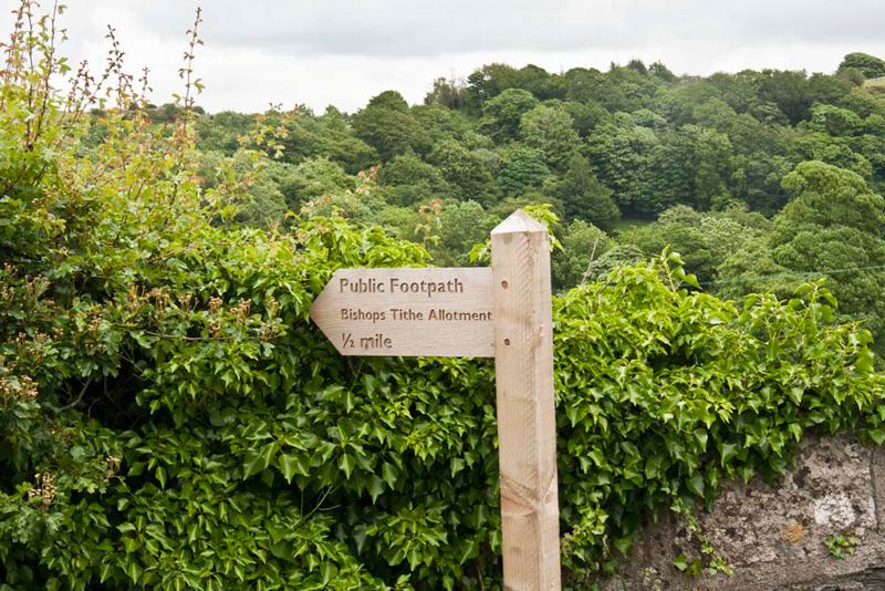
"Here's our route", pointed Shaun. "Along the drive to Eller How."
"No doubt about this", added Grizzly. "There's a signpost."
As can be seen the sign reads Bishops Tithe Allotment, which is an enclosed area of land just to the north of Dixon Heights. There is indeed a footpath running through this which leads down to a narrow road called, Back o' the Fell Road.
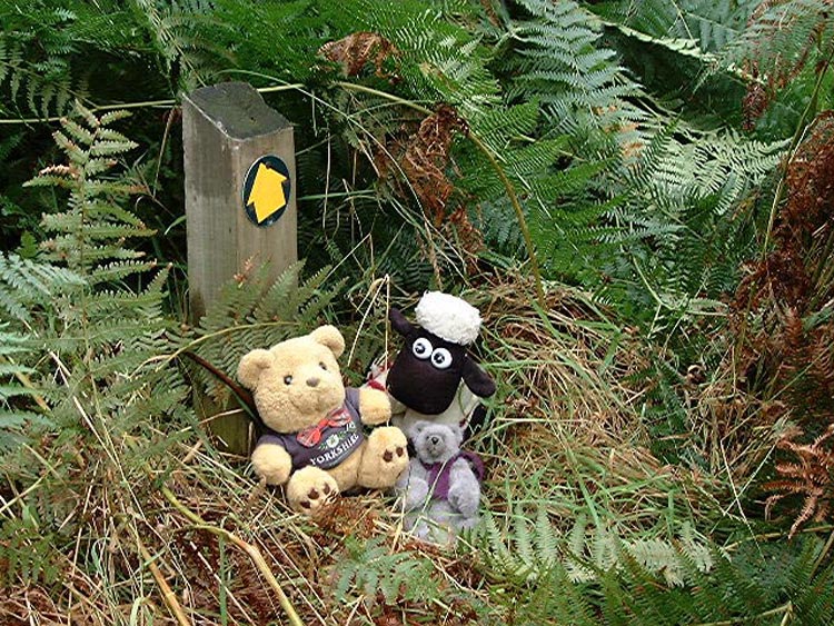
"I remember there were two occasions that we used this footpath, up from the Back o' the Fell Road", said Allen. "The only problem is that the hillside is covered in bracken, that in the summer gets to well over 6 feet tall, and it made for difficult progress."
"Oh yes", agreed Tetley. "And the waymark signs are of a height for bears, and so are pretty useless in summer."
This is clearly illustrated in the shot taken in August 2004. At least the sun was shining that day!
We walked through the houses, and then on along the track. "Take the right fork", advised Shaun.
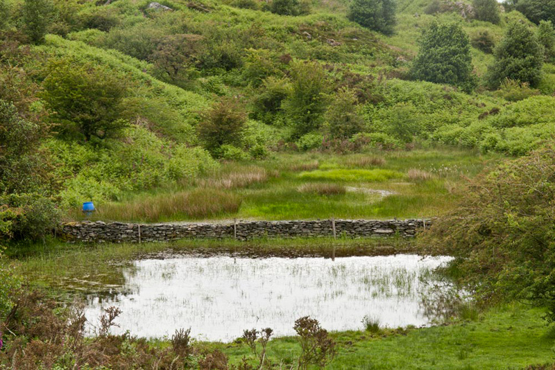
This climbed to the col by the very overgrown Tom Tarn, that is on the edge of Bishops Tithe Allotment. Beyond the extensive and dense bracken can clearly be seen. Uncle Eric, tongue in cheek, keeps suggesting walking that path in August, to which Dad politely declines. We wonder why?
"The tarn has become much more overgrown, since we last saw it in 2006", said Tetley.
Here, it was right to climb the relatively short distance to the remains of the tower marking the top of Dixon Heights and Newton Fell south.
On the stone littered floor of which we settled for our usual picture.
There are extensive views across Morecambe Bay from here, but the conditions were such today that they were not clear enough for photography.
"So where now?", asked Little Eric.
There is no alternative but to return by the same route", replied Shaun.
"So we will have to endure the unpleasant walk beside the busy A590 again", commented Little Eric
Allen added, "and the fact too that it will be a steady climb uphill."
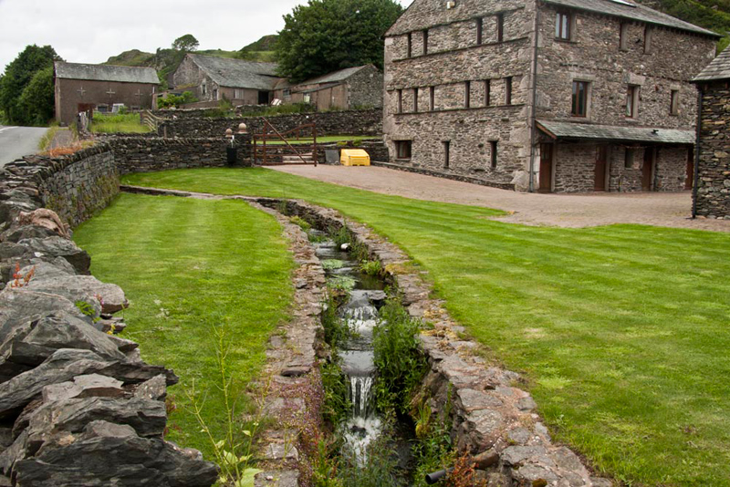
It was a blessed relief to get to the old road, and we thought this garden with the stream running through it, was worth a picture.
"Thanks for doing those tops again Dad", called out Little Eric. "I am a bit closer on the Outlyer challenge."
"You're welcome lad."
There are no prizes for guessing where Dad went now. Jane and Sam's Hat Trick Cafe. The good thing too, is Dad always takes us in with him. The cafe was busy, which we were all pleased to see. Dad had the lovely Carolina Gold sandwich, followed by delicious apple apricot and cranberry crumble with cream and tea to drink of course. Lovely!!