1.GUMMER'S HOW & BIRCH FELL
2.CARTMEL FELL (RAVEN'S BARROW)
Summary
Date - 7th July 2012
Distance - 4.75 miles
Ascent - 1260ft
Map - OL7
Start points -
1.Astley Plantation car park (SD 390 887) 2. Layby on Cartmel Fell road (SD4145 8806)
Summits Achieved
Name
Height (ft)
Height (m)
Grid Ref
Gummer's How
1054
321
SD 3904 8848
Birch Fell
1043
318
SD 3951 8913
Cartmel Fell (Raven's Barrow)
525
160
SD 4127 8792
Preface
Allen & Little Eric were staring glumly out of the window, at the rain falling like stair rods. "What a wash out this summer has been so far", said Allen.
"It has, and there does not seem to be much prospect of any real improvement either", replied Little Eric. "With all the other things Dad has had on, this has rather limited the opportunities for walks."
Grabbing the iPad, Allen opened the Met Office app, checked the Lake District forecast and said, "it is Dad's Saturday off from the Lifeboat shop, and surprisingly the weather looks to be fine, so perhaps we will get a walk in."
"I know this may sound selfish, but perhaps we could do some more of my outstanding Outlying tops in the south Lakes, as it would not be too far for Dad to drive", suggested Little Eric.
"Sounds fine to me", replied Allen, "they have got to be done sometime."
Grizzly, Shaun and Tetley, wandered in just then, bringing flasks with them.
"Ooh tea!", cried Allen, rushing off to get the mugs and tuck tin.
All settled with steaming mugs, Little Eric, told the rest of us about his suggestion.
"Fine by me too", said Shaun, getting the Outlying Book of the shelf. "We could do Gummer's How and Birch Fell, like we did before, and then there are a number of other options close by that you need to bag too."
"Birch Fell!", laughed Tetley. "We did that in April 2006, just days after Dad had bought the Birkett book, and it is one of the included summits. In his summary Dad noted this, and also stated quite firmly that this did not mean he intended to climb them all.... It just goes to show what happens over time, as there is now only Pen to do to finish all 540."
"Oh, and the miles upon miles of walking and thousands upon thousands of feet of climb. It makes one feel tired just thinking about it", sighed Grizzly.
"Right", said Allen, draining his mug, and grabbing Little Eric by the paw, "we'll go and see Dad, and find out if he likes our idea."
"OK", replied Shaun, "I'll refill your mugs for when you get back."
"Thanks", called out Little Eric, as they dashed out of the room.
It was not long before they were back, smiling broadly, so we knew the walk was on.
"Roll on Saturday", cried Little Eric, accepting his refilled mug.
The Walk
Gummer's How & Birch Fell
We awoke to find the weather dry and for once warm enough for Dad to be in shorts. As it was not far to the start, nor was the walk very long, we did not set off too early. After leaving the busy A590 Barrow road, the drive through the beautiful Lyth Valley was enchanting. Then turning left, it was along the narrow road through Bowland Bridge and up Strawberry Bank, where the road steepens and swings up through a sharp hairpin bend. After a further distance, it passes between the forest, then starts to descend. On the left is the car park and our start.
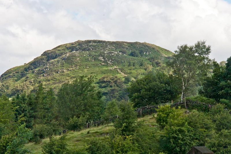
While Dad got ready, we looked across to Gummer's How.
To give Little Eric some detail of the walk to come, Tetley said, "we cross, and walk up the road to the right, then soon take the kissing gate, and walk though the trees. You can then see that the path climbs the fell, and there are a few easy scrambles through the rocks, to finally swing right up to the trig point that can just be discerned on the skyline."
"One of the easier ones we have climbed then?", he replied.
By now Dad was ready, so we settled in his rucksack, and set off.
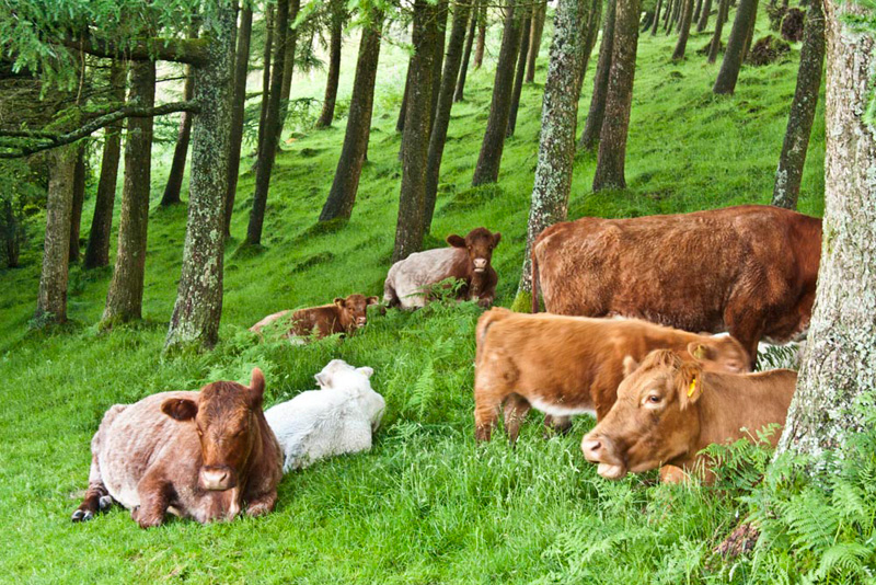
Hardly had we got beyond the gate, but we came across these cattle, sitting lazily by the path.
"I wonder what breed they are?", said Grizzly.
"There's an information board over there", called out Allen, "let's go and see what it says."
Grizzly, scanned the board and told us the following. "They are Luing cattle, a breed that famously evolved on the island of Luing in Argyll, off the west coast of Scotland. It is a cross between Highland cattle, selected for its ruggedness and hardiness, and Shorthorn, for their beef qualities. This had resulted in a cattle with the best qualities from both breeds. The British Government officially recognised it as a breed in its own right in 1965."
"Thanks", said Tetley, "but what are they doing here?"
"I was coming to that", replied Grizzly, patiently. "Apparently Gummer's How has been singled out as an area of habitat importance. Management of the land around it is being undertaken, through the Higher Level Environmental Stewardship Scheme, to preserve and enhance the important ecological value of the upland vegetation on the fell. The cattle have been introduced to assist vegetation management designed to encourage the important shrub and flower habitat once abundant on the fell. The Luing breed has been selected for their special characteristics adapted to survive on rugged hill ground."
"Thank you pal, that was a most interesting and informative lecture", said Allen.
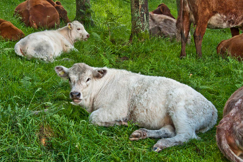
Before walking on, Dad took another picture of a white pair.
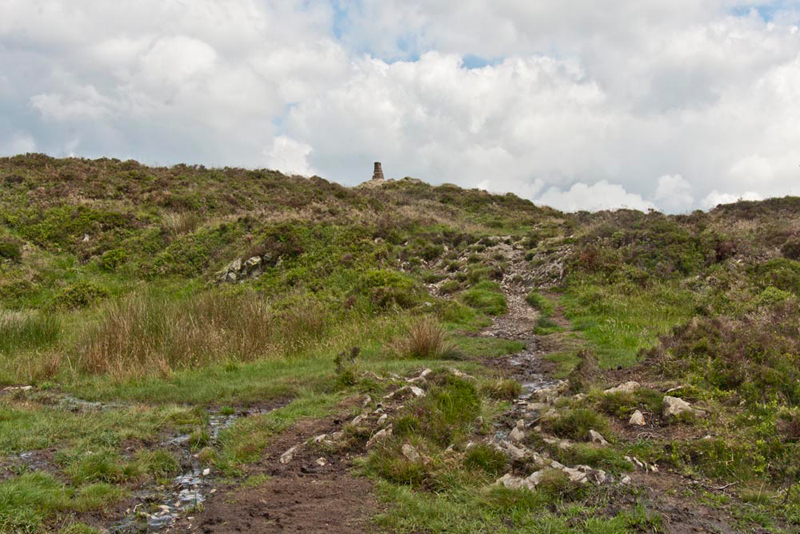
Dad strode through the trees, and soon we reached a path junction. This was the start of the rockier part of the fell, and the simple scrambles that led to the final approach to the summit.
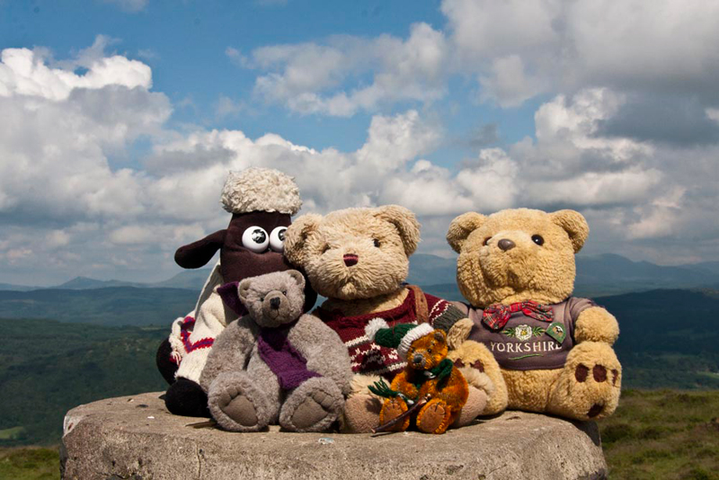
As we reached the trig point, Dad glanced at this watch. "That's 20 minutes to walk up, just as I did in 2006."
"Photo time", called out Little Eric.
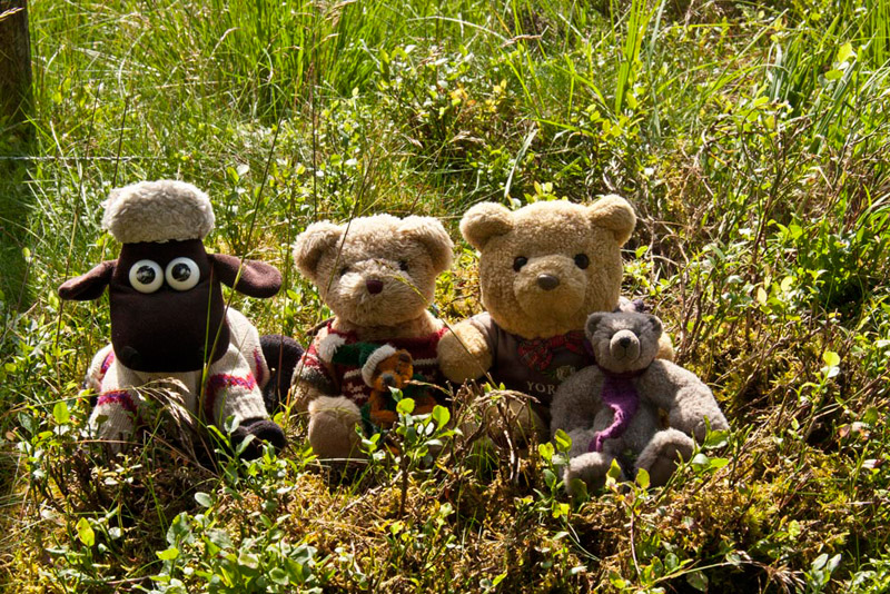
There was little wind so we were able to sit on top of the trig point for this.
Grizzly told us, "according to Diana Whaley's book, the name is possibly 'Gummer's hill, with Gummer a surname originating in an Old English personal name such as Gummar or Guthmaer/Guomaer."
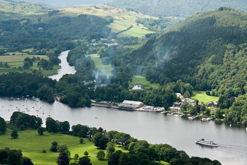
Standing just above the shores of Windermere, Gummer's How affords some excellent views, particularly of the foot of the lake, and Lakeside, the southern terminus of the steamers.
Allen said, "The smoke is rising is from the locomotive, heading the train waiting to take passengers, from the steamer, on the pretty journey to Haverthwaite."
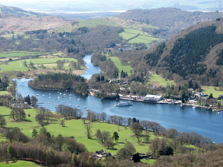
The lake was steely grey today due to the cloud, here is the similar shot taken in 2006, showing the contrast, when the skies were blue, not something we have seen a lot of this year!
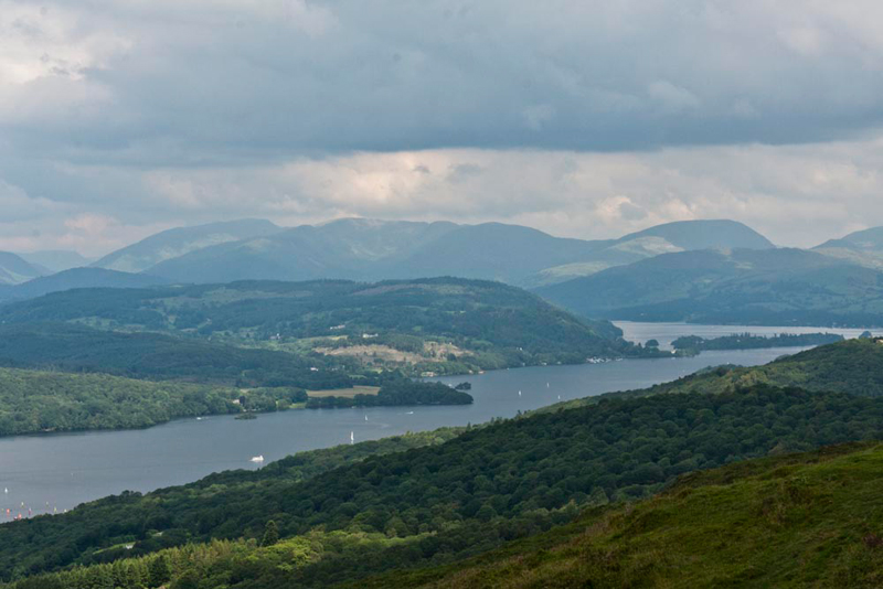
Windermere is the largest of the lakes, and here stretches away north. "The view is rather hazy today of the The Fairfield Horseshoe with Red Screes to the right", commented Tetley.
"Right Lads, time to head for Birch Fell", said Dad.
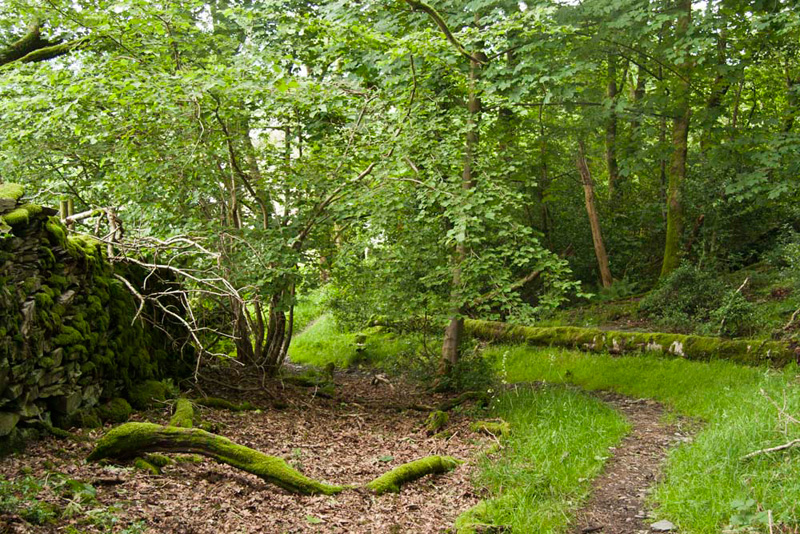
Heading north, we followed the path down from the summit. "We need to take a path right that will lead to the side of the extensive bog, and then walk left alongside", advised Shaun.
This latter path was very muddy, Allen remarking, "it's a wonder the path has not disappeared completely, considering how much rain we have had."
Coming to a ruined wall, Shaun instructed "here we go right beside it."
In fact Dad walked on top of it as much as possible to avoid the bog. Towards its end the wall climbed to join a cross wall, which we climbed to then make our way though the larches to the fence. We had all, Dad included, really forgotten the route, but soon realised that the way was not to the right by the fence, but rather left to get to and follow the joining wire fence tracking east, that crosses the summit area.
"Oh dear", said Dad. "I wish we had consulted the photos from 2006 to find the true summit."
"Me too", said Little Eric,
At what appeared to be the highest point Dad took our picture by the fence.
In truth we should have crossed the fence and then gone just a bit south to find the rocky outcrop that is actually the top. Here we are there in 2006.
Grizzly said, "the name is simply 'the hill-slope where birch grows'."
Little Eric mused, "it was not really of any consequence that I have not actually got to the summit, as I will not be completing the Birkett challenge."
As we rewrite this story in 2023, Little Eric is much closer to possibly completing the Birkett challenge. So, it was important that he did reach the actual summit. This was achieved on 21st July 2020. Click the link to see that story and his picture at the summit. Gummer's How
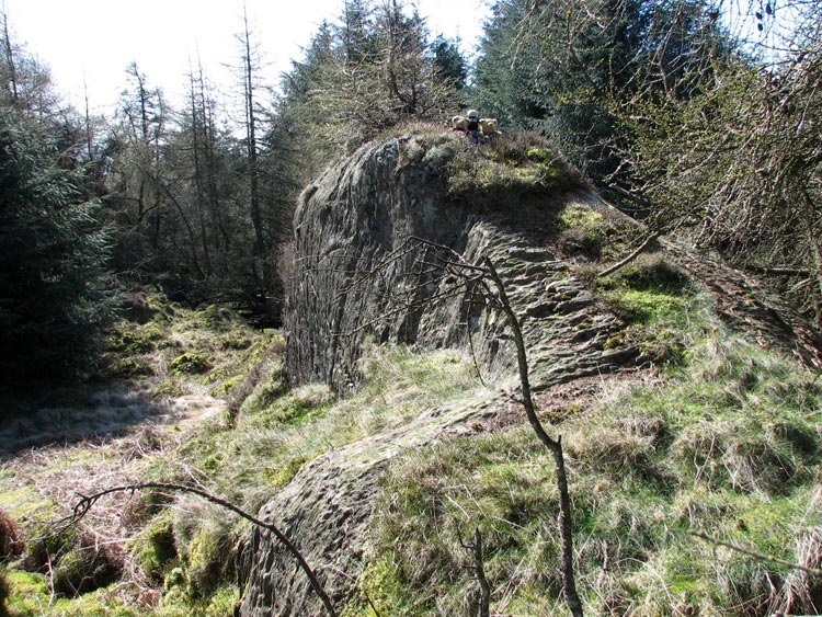
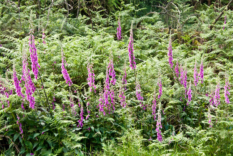
Birch Fell is clothed in a dense and tangled mass of trees, and we suspect that its summit is, in the main, probably only visited by those intent on completing the Birkett fells. Returning by much the same route, these foxgloves made a pretty sight amongst the bracken.
"Right", said Shaun. "We just return to Gummer's How and reverse our ascent route."
At Gummer's How, we met and chatted to a family from Manchester, the husband originally coming from Milnthorpe, which we had driven through today. They expressed surprise when Dad said this was his second visit to the summit today. We were spotted, so Dad explained about us, and they made a note of our website. Heading down we found a nice spot to sit and have our lunch, with that superb view of Lakeside and the sweep of the fells.
We did not bother decamp from the rucksack, on the drive to the start point for Cartmel Fell. This involved returning the way we had come this morning, and once down the sweeping hairpin of Strawberry Bank, it was right along the very narrow road to Cartmel Fell, where we parked just at the side of the road at a pull in.
Cartmel Fell (Raven's Barrow)
Tetley said, "I recall this is probably one of, if not the easiest summit to attain."
"Yes pal", agreed Shaun. "Walk along the road for a short way, and then climb the ladderstile in the wall on the right."
Here the path led to another wall that we crossed via the stone step stile.
"Where now?", asked Little Eric.
"Up by the wall", replied Shaun.
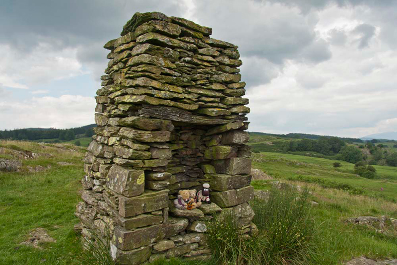
The ascent was steep, but only short in duration, and soon we were at the monument at Raven's Barrow, that is considered the summit of Cartmel Fell. According to Wainwright it is known locally as Ravensbarrow Old Man. We settled on the inset seat for our picture.
"The name means presumably 'the hill frequented by ravens'", Grizzly informed us.
"The ground just behind looks to be slightly higher", remarked Little Eric.
"I agree", replied Dad, "but the monument is considered as the summit. However, I plan this time to do the circuit as per the Wainwright book, so I will make a point of crossing this higher ground, for completeness sake."
"Can't say fairer than that", remarked Allen.
Dad crossed the higher ground, and then followed a path over the access area, towards the wall and woodland. At a junction, it was right along the bridleway that circled the back of the summit area, and then descended to a gate, and beyond, on down in a loop to the road.
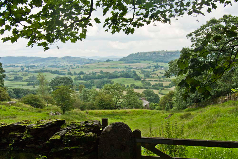
Across through the trees was a nice view of the Winster Valley.
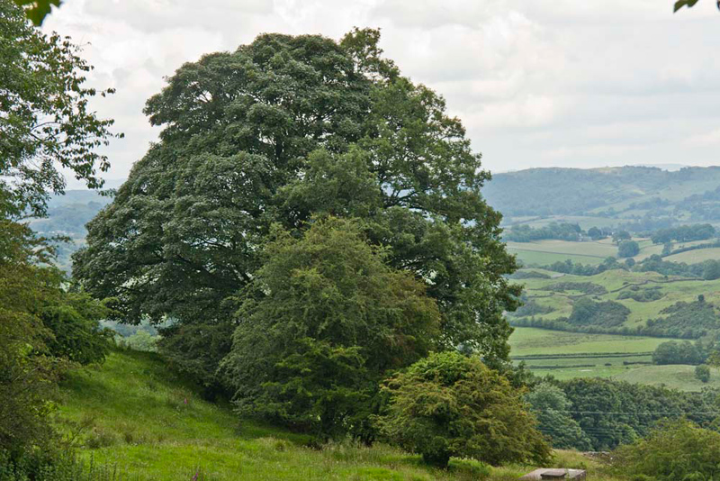
Looking left, Shaun said, "I think that large tree with the smaller ones in front, gradually increasing in size, will make a nice shot."
"Mmm, I like it too", added Tetley.
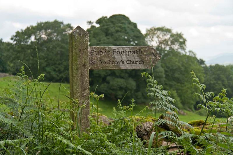
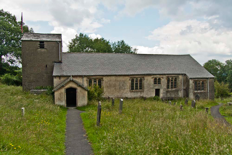
As we walked along the road towards the car, Dad said, "to add a bit of distance, I am going to take you via St. Anthony's Church. It was a long time ago here, that I did one of my teddy talks, in the village hall."
"That will be nice", said Little Eric.
We passed by the car to take the overgrown path signed to the church.
Narrow at first, it widened out at its lower end to a stile into the churchyard.
"Thinking that you might bring us here, I made some notes", said Grizzly. "St. Anthony's Church was built in 1504 as a chapel of ease to serve the local farming community in the parish of Cartmel Priory. Little has changed since the building of the Church, except the addition of the South porch. It is the only church in the north of England dedicated to St. Anthony.
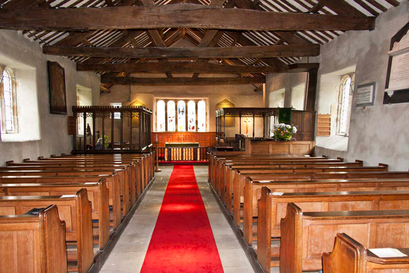
We went inside, moving about as quietly as possible, so as not to disturb the gentleman sitting in the boxed pew near the east end.
Grizzly whispered, "this boxed pew known as the Cowmire Pew, is thought to have been constructed from the chancel screen in 1571. The boxed pew opposite on the south side dates from the 17th century. In front of this, partly hidden by the flowers, is the three decker pulpit, a rarity dating from 1698. The lower deck is where the clerk sat, the middle was for the reader and the top was where the sermon was, and still is, preached."
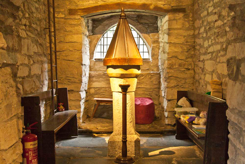
The font is situated at the west end in the lower part of the tower. Note too, the teddy bear sitting on the pew on the left and the rabbit on the right pew.
As we walked along the path from the church, Grizzly remarked, "that was very interesting to visit, thanks Dad."
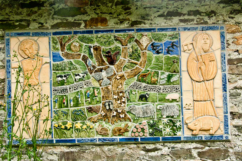
The entrance is by the parish hall where Dad gave his teddy talk, and which used to be the primary school until 1971. On the wall was this mosaic, made and placed here on the side of the village hall in 2004 to celebrate the 500th anniversary of St. Anthony's Church.
We assume the figure on the right is St. Anthony, and the central feature is a tree. A stone wall runs across from side to side. and within outlined sections are flowers, animals and birds local to the area, as well as people engaged in activities.
For a different route we used the narrow motor road to return to the car.
"I guess it is refreshment time now", laughed Tetley.
"It sure is, and normally I would go to Jane and Sam's at Low Newton, but they are on holiday and the cafe is closed, so instead I intend to go to the cafe within Bob Parratt's at Milnthorpe.
Ideally Dad wanted to return along the road in the direction we had come, but it was rather too narrow for Dad to accomplish turning his big car round. So instead we continued on along the ever narrow road that finally led down to the village of High Newton. Then through Low Newton, past Jane and Sam's to join the main A590 and so drive to Milnthorpe.
Dad was just in time for hot food, and he had a large bacon bun with lots of bacon, at a very reasonable price. Tea of course to drink and extra hot water was brought. Then he finished off with delicious apple crumble and custard. Just Dad's sort of cafe!
Nice easy day, but interesting none the less, and thanks as always Dad.