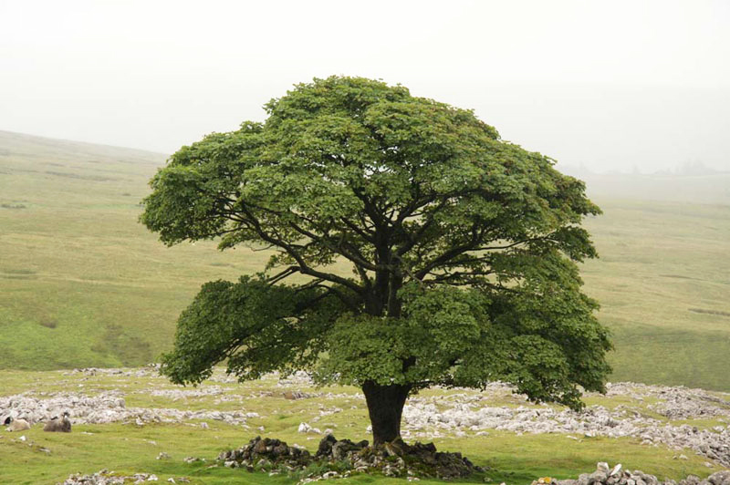
1. STENNERSKEUGH & FELL END CLOUDS from COTE MOOR
2.WALKING TOUR OF KIRKBY STEPHEN
Summary
Date - 25th July 2012
Distance - 4 miles (1), 2 miles (2)
Ascent - 600ft
Map - OL19
Start point - 1.Cote Moor (NY 739015)
Summits Achieved
Name
Height (ft)
Height (m)
Grid Ref
Stennerskeugh Clouds
1536
468
NY 7444 0050
Fell End Clouds
1500
457
SD 7385 9979
Preface
It was Monday, and Dad and Uncle Brian had gone to Elaine's at Feizor, as usual, so all was quiet and we were musing over yesterday's walk.
"I have really made inroads into my outstanding Howgills", said Little Eric. "In fact there is just one left in the Howgill massif itself, but first there is matter of bagging those further east between the Rawthey and Mallerstang."
"It was a good day, despite the wind, that blew incessantly", replied Allen.
Grizzly added, "we only saw that group of horse riders, on the bridleway and no one on the hills at all. It just goes to show how unfrequented these hills are."
"A place of solitude", sighed Tetley.
"Time for tea", said Shaun, filling the mugs and with Tetley's help passing them round.
"Just what I needed", said Allen, accepting the mug gratefully.
"Would you like a cheese scone, pals?", asked Grizzly. "Fresh made this morning."
Ooh yes please", said Little Eric, on behalf of us all.
So all content, our thoughts turned to Wednesday, when a walk was planned with Uncle Eric. Allen had grabbed the iPad and was looking intently at the details on the Met Office app.
"Mmm, it is not looking good for the Lakes, or the coast for that matter. The best of the weather seems to be more east." Then after a few more taps with his paw, he went on, "I have got the forecast for Sedbergh, which looks to be mainly dry if rather cloudy, in fact wherever we go cloud seems to be the feature."
"What are you suggesting?", asked Tetley.
"Well, Little Eric has Stennerskeugh and Fell End Clouds to do, as part of the Howgill challenge, and to me that seems to be the best option, weather wise."
"It's just that the walk is rather short", replied Shaun, "but I agree we have to go and do it again sometime, for our pal's sake."
"I hear Dad arriving home", said Allen. "So, come along Little Eric, let's put the suggestion to him."
Shortly afterwards, they returned. Little Eric said, "Dad is happy to suggest this when he speaks to Uncle Eric, tomorrow, so we will just have to wait and see."
The next evening Dad strolled in, to tell us the result of the conversation with Uncle Eric. "The forecast is the same, and he agrees that going very high is out due to the low cloud, and he is very happy to do these hills again, so it's on."
"What about the question of distance?", asked Little Eric.
"It will not really be the day for a picnic outside, so Uncle Eric has suggested going to Kirkby Stephen afterwards, where we can have lunch, and then he will take us on a walking tour of the town. This will add about another 2 miles to the day, and will be interesting."
"That's great!", responded Tetley.
The Walk
Stennerskeugh Clouds & Fell End Clouds
Last year the summer was bad enough, but nothing compared to this year.
"We seem to have gone straight from spring to autumn", remarked Tetley, as we ran out to the car, in the soaking drizzle.
Thankfully by the time we got to Kendal it was dry, although Uncle Eric said that it had only just stopped raining. We began to wonder what sort of a day was in store, but as it turned out it stayed mostly dry for the walk on the Clouds, so we made the right decision.
Not so clear, however, as when we did the walk in December 2007, as you may note, because we have included a few pictures taken on that day, in today's account.
Uncle Eric drove us to the start at Cote Moor, where we parked on the verge of the narrow road that leads from the main A683 to the tiny community of Stennerskeugh, and the walled estate called The Street.
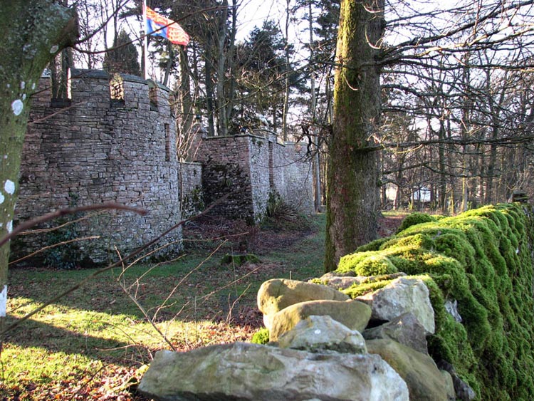
Settled in Dad's rucksack, we set off, along the road, going left with the high wall of The Street estate on the right. behind which is this castellated folly. Getting a picture is awkward at the best of times, but the dense vegetation on the verge prevented this today, so we include the picture taken in December 2007. A bright sunny winter day. Maybe we will get some of those later this year to compensate for the poor summer!
We peered over the wall, and Little Eric, who alone had not seen this before, asked, "what is it all about."
"It is a remnant of Hwith House that was demolished in 1927. A fine house built in 1868 by John Hewetson, who gave it its strange name, composed of the initials of the first names of his five sons", replied Tetley, who has an amazing capacity for remembering detail from previous walks.
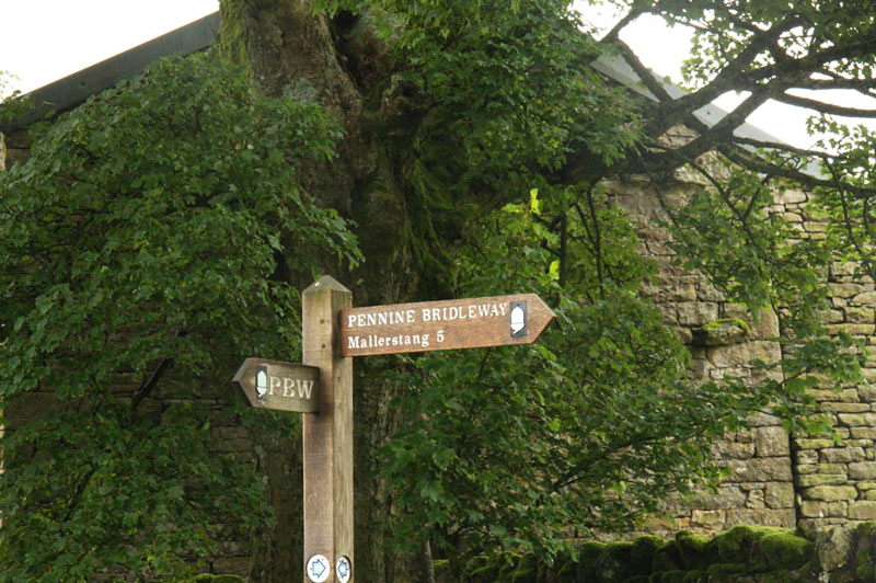
In a few yards now we reached a signpost. "We go right here", called out Shaun.
Part of the Pennine Bridleway, after five miles it leads to the next valley Mallerstang, beyond the bulk of Wild Boar Fell, that back drops the Clouds to the east. We did not see much of this fell today, its higher slopes being covered by cloud.
Looking at the map, Shaun remarked, "we crossed this bridleway at High Dolphinsty, on the way from Wild Boar Fell to Little Fell, when we did them with Uncle Bob."
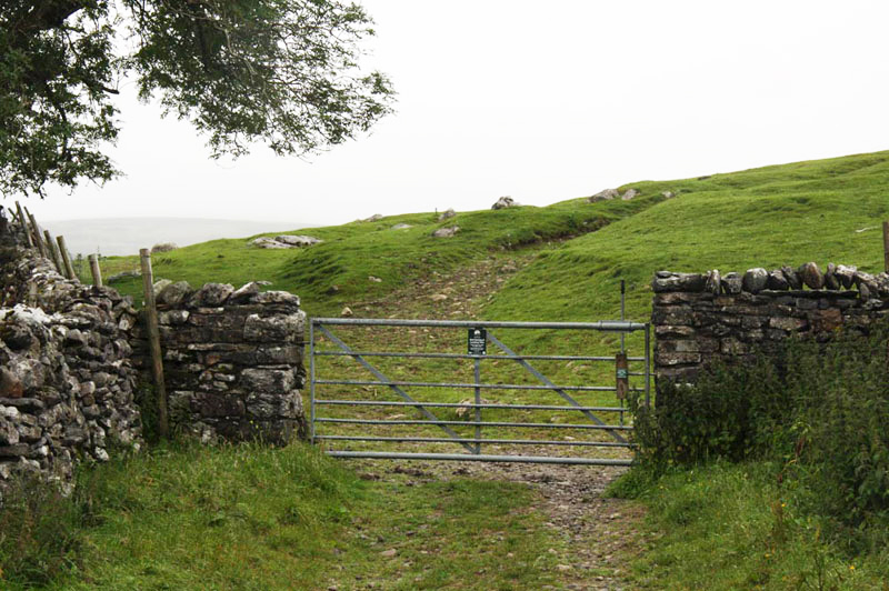
The path began to climb, reaching a gate.
Now on open fell, Allen said, "I recall we follow the bridleway, for a short distance, before leaving it right, to climb steadily through the extensive limestone."
"That's right pal", agreed Grizzly. "It leads to the summit of Stennerskeugh Clouds and the cairn marking it."
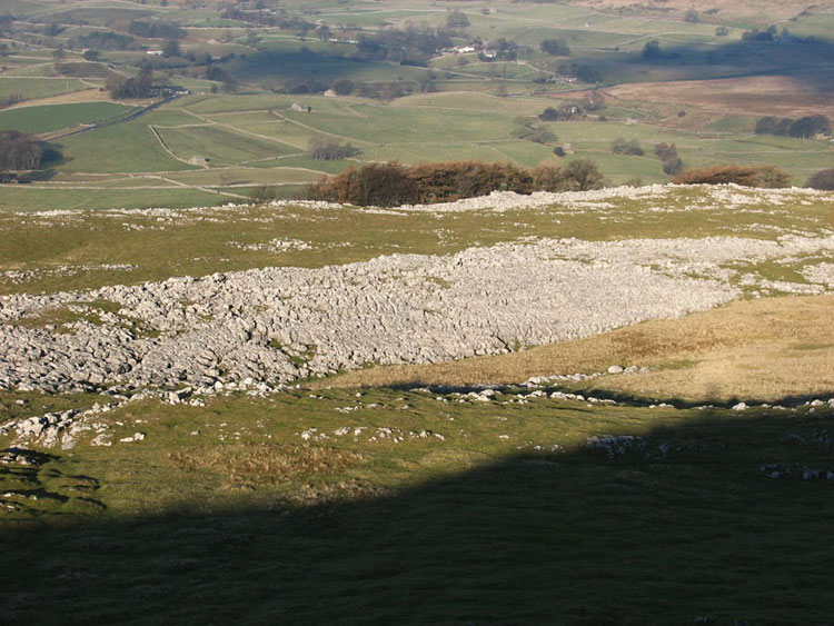
No shortage of rock here, so the cairns are substantial.
It was so quiet and peaceful up here, and like many days in the Howgills we did not see another person. Limestone pavement abounds here on the lower slopes, as can be seen in this shot from 2007.
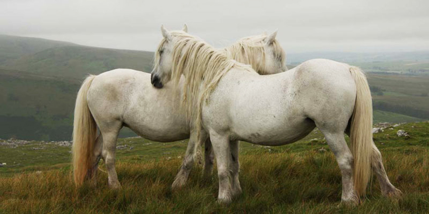
Our way led on ahead, descending gently. We had already seen some of the wild fell horses that roam the Howgills, two with foals.
As we walked on, Grizzly, called out, "there are more horses, two beautiful white ones."
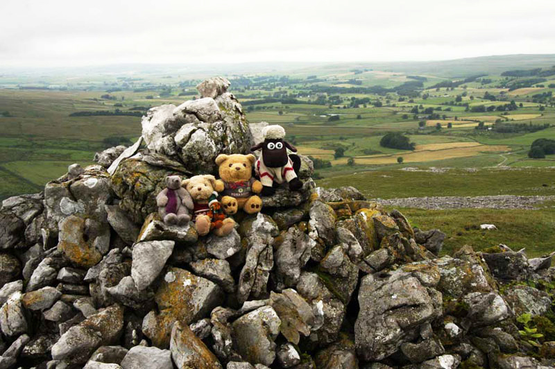
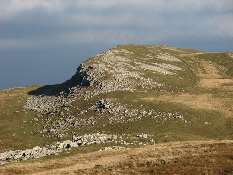
Shaun said, "if we circle left round the dip we will avoid losing too much height. Then crossing right we will gain the first cairn on Fell End Clouds, that marks the summit."
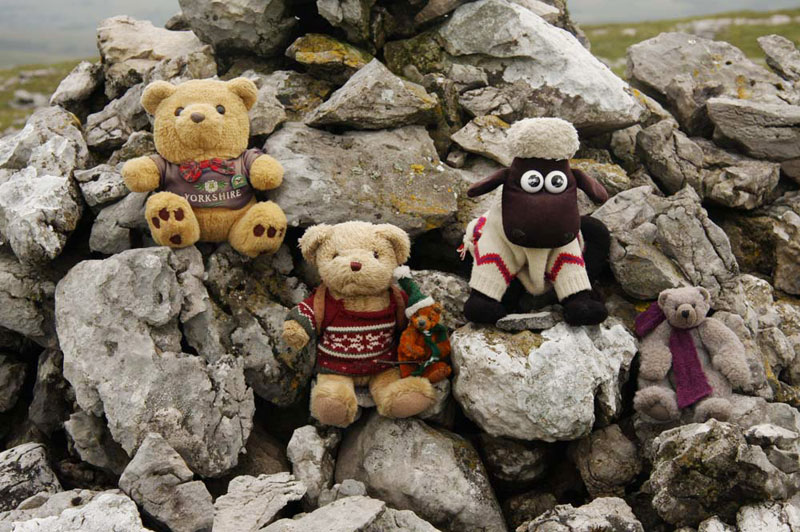
"Take our picture", called out Little Eric, as he scrambled with the rest of us up the cairn.
"What a shame that it is not very clear today, as the view to Stennerskeugh Clouds makes a nice picture", bemoaned Allen.
"I know for a fact Dad took that same shot back in 2007, and being a much better day, we can use that instead", replied Tetley.
"However do you remember all these facts?", said Little Eric in wonder.
"Don't know", replied Tetley. "I just seem to store them away, and then be able to immediately recall them when necessary."
Reading the instructions in Wainwright's Howgills book, Shaun said, "we now head to a conspicuous tree."
"Well, I have heard of beech and elm, but not conspicuous", said Allen, bursting out laughing.
"I like that", said Uncle Eric, laughing.
Soon Tetley called out, "that must be it, as there are no others anywhere else."
Now we could see a track coming from a gate in the wall some distance ahead. "Going right along that is our route", advised Shaun.
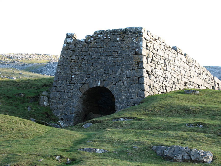
We made our way down the easy slope to join it. This led to the road just below an old limekiln. Again this photograph is from 2007.
Grizzly said, "this is the old road, long ago replaced by the current A683, but according to Wainwright, when he published his book in 1972, is still often referred to by its former name: The Street."
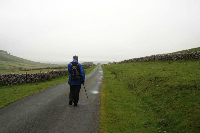
Here Uncle Eric strides out along it, on our way towards the start.
At its end the main road is joined, then after a short distance we went right over the moor to pass Street Farm and on along a track to join the road to the car.
"Thank you for a lovely walk, and for doing it again", said Little Eric. "Just three to go to complete the challenge", he went on.
"You're welcome", replied Uncle Eric.
Tour of Kirkby Stephen
While we settled in Uncle Eric's car, he and Dad got changed, then we drove the few miles to the town. It is very much a linear town. Passing under the bridge carrying the Settle-Carlisle line, by the west station, soon the site of the east station is reached, and then a long straight road with houses either side leads into the main street, with its shops, cafes pubs etc. Towards the end of this we turned up Silver Street to the free car park.
We stayed in the car, to have our picnic, while Dad and Uncle Eric, walked the short distance to the main street, going to the Pink Geranium cafe for a nice sausage & egg roll with tea.
"I have been here before, with Brian", Dad remarked. "That was on a day we had been in the Yorkshire Dales."
Later on checking he found out it was in February 2004.
They returned to collect us, so we set off on Uncle Eric's tour. Going left up one of the many alleyways, we came to Royal Arcade, the houses surrounding the ancient cobbles. "This was formerly the courtyard of a coaching inn", said Uncle Eric.
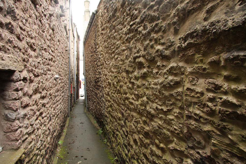
Crossing the square, it was through the archway in the far corner to the narrow alley, Little Wiend.
"Gosh, it really is ever so narrow", exclaimed Allen.
"There are many similar ways into the town, so designed to be easily defended against marauders." replied Uncle Eric.
Returning across Royal Arcade, we passed a building called Faraday House.
Uncle Eric said, "this was once a Sandemanian Chapel, where the parents of Michael Faraday worshipped 200 years ago."
We all knew of Michael Faraday, an eminent scientist, who is best remembered for his research into electricity, and as the inventor of the first electric transformer in 1831.
"Where to now?", asked Shaun.
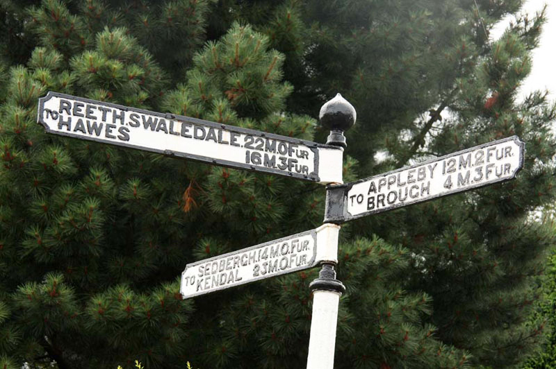
"Down the main street, to look at a signpost", replied Uncle Eric.
We thought this rather odd, but when we got there saw the reason why.
Despite Britain having adopted some metric measures for weights, etc., our distances on roads are still shown in miles and fractions of miles. This original sign however is shown in miles and furlongs. For younger readers, a furlong represents one-eighth of a mile equivalent to 220 yards (201m).
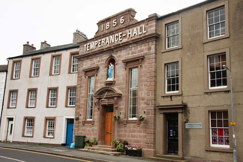
"It's along Mellbecks, to Franks Bridge" said Uncle Eric, "but first I want to show you the Temperance Hall."
Uncle Eric told us, "built in 1856, as a focus for the temperance movement that urged reduced or complete abstinence (teetotalism) from alcohol, it has since had a number of uses throughout the years. These include a school and a centre for evacuees. Latterly it had lain empty for a period, until bought about two years ago by Kevin and Lynn. Having renovated the building they have now opened it as a small private museum of Lynn's vast collection of Costume and Memorabilia, collected over some 35 years. The collection begins in 1800 and runs through to the 1970's, covering everything to do with clothes and personal items. It is open Friday, Saturday and Monday from 10am to 5.30pm, and Sunday 11am to 5pm. There is also a tearoom."
Dad's eyes lit up at the thought!
In an alcove above the entrance stands this statue of the Temperance.
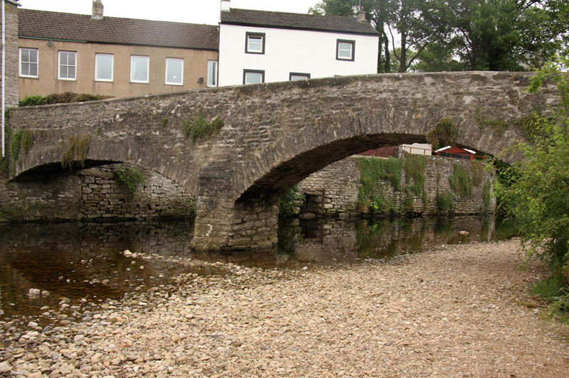
Walking on we reached the bottom of Mellbecks, and Frank's Bridge.
Spanning the River Eden it dates back to the 16th century, and forms part of the old corpse route from the neighbouring churchless villages of Hartley and Winton.
"I wonder what those large stones are just on the other side of the bridge", mused Grizzly.
Uncle Eric replied, "they are where the bearers would rest the coffin before negotiating the climb to the church."
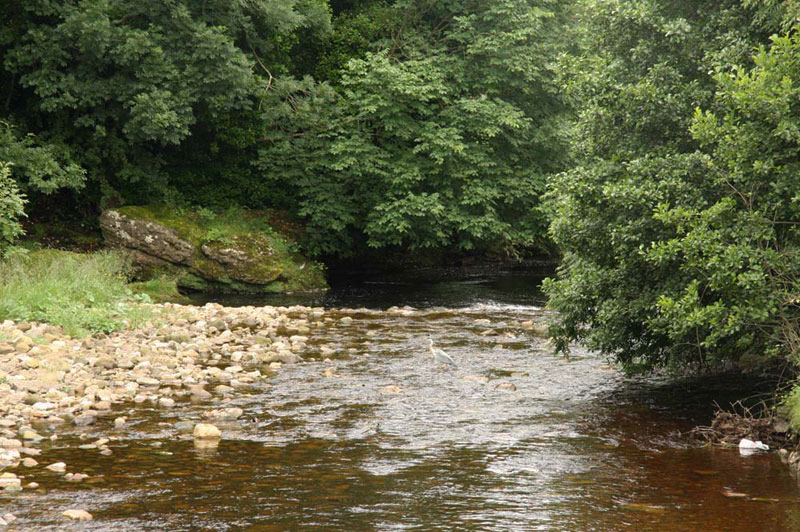
From the bridge the river and trees make a nice view, downstream. If you look closely you might spot the heron, waiting patiently for his dinner.
"We have been to the source of this river", said Tetley. "When we did the Mallerstang Ridge with Uncle Bob, back in April 2007. One of the summits was Hugh's Seat (2260ft). Just below and north is a large area of peat bog, that is drained by Red Gill Beck, which is the Eden's source."
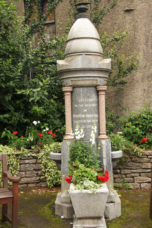
From the bridge we took what would have been the route of the coffin bearers, but for now not actually going to the Parish Church. Instead we walked down Vicarage Lane, then on to rejoin the main street at its junction with Silver Street. Here on the corner stands this former drinking fountain, the troughs now bedded out with flowers.
The dedication states - Erected To The Memory Of Harrison Thompson, A Native Of This Town, AD 1865.
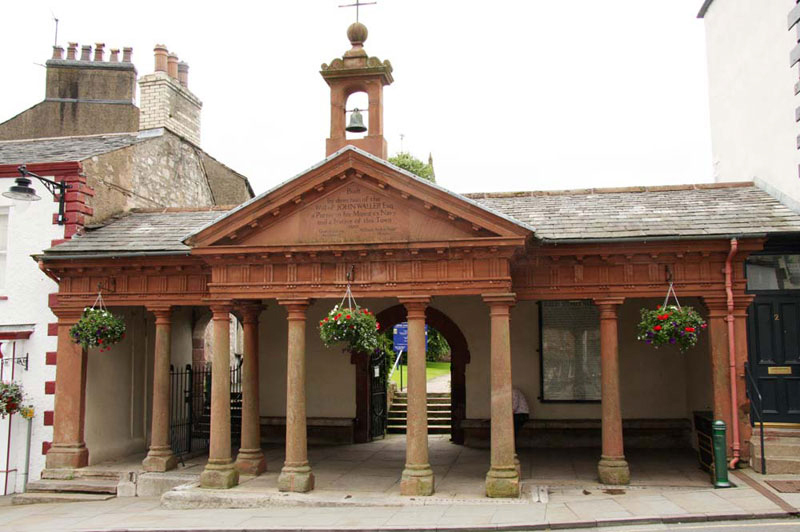
Crossing the road, we then strolled back to the Market Square, the most prominent feature of which is the old cloisters that form the entrance to the church.
"These were provided by John Waller, purser in His Majesty's Navy, in 1810" said Uncle Eric. "It was used as the butter market by the local farmer's wives who would ring the 'butter bell' which hangs above."
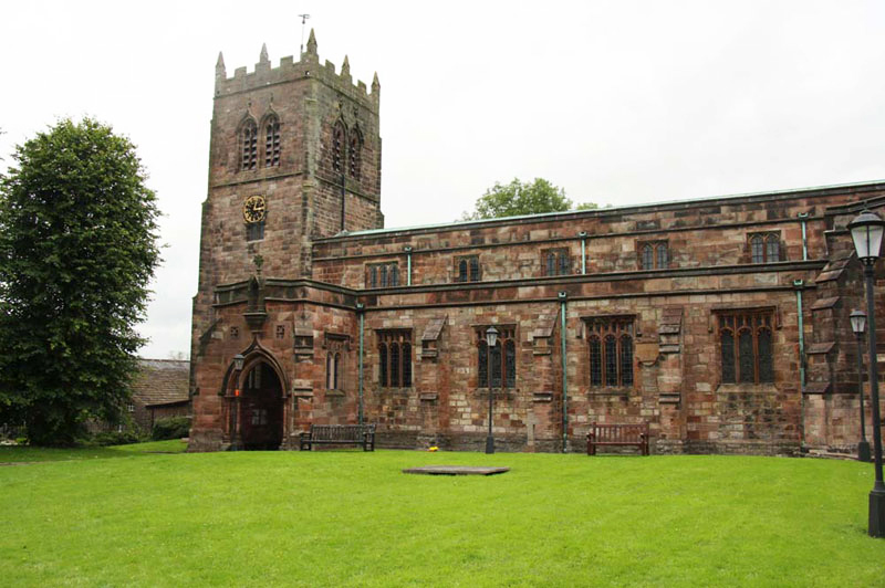
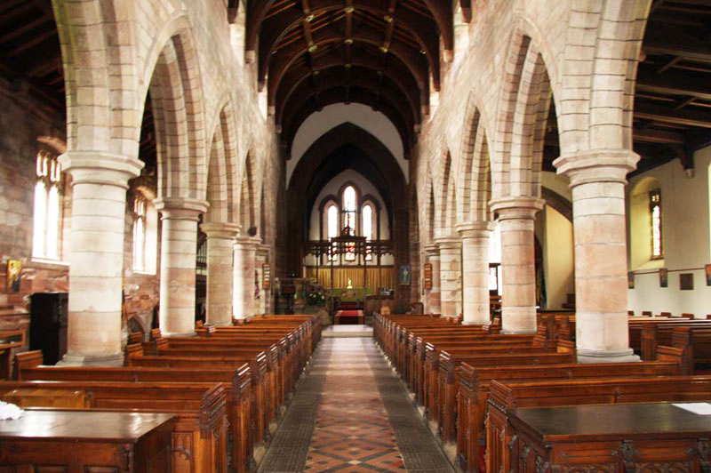
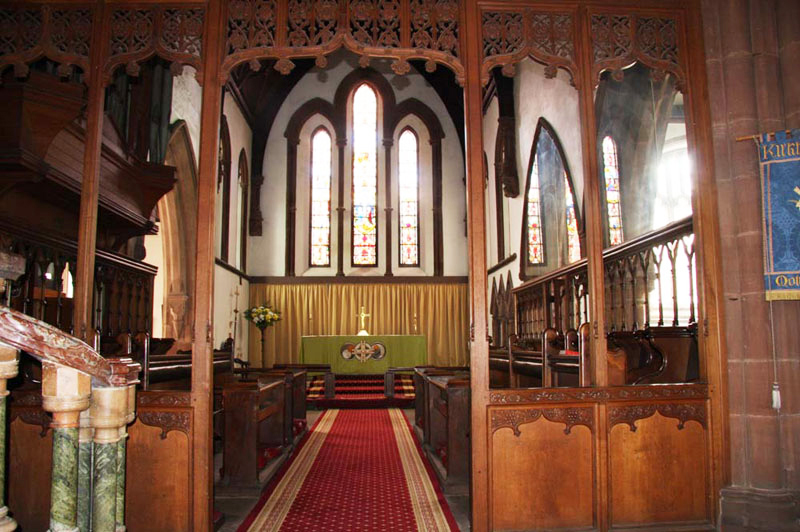
Walking through this and up the steps, we entered the churchyard of the Kirkby Stephen's historic Parish Church.
The Parish Church of Kirkby Stephen is known locally as the Cathedral of the Dales. It is believed that at least three churches have stood on this site, the earliest being Saxon. Testimony to this early history is the Loki Stone - an Anglo-Danish cross shaft with a carving of a chained devil, representing the old Norse god Loki. This is historically important, as one of the few physical survivals from the time when the Vikings settled parts of this area.
The whole church was rebuilt around 1230 and the nave arcades and the north transept survive from this time.
The south aisle was rebuilt in the 15th century and the tower was added shortly afterwards. The clerestory was added in 1871, and the north and south chapels were rebuilt in the mid-19th century, as too was the chancel.
For over twenty years the church has been happily shared with the Roman Catholic congregation - mass is celebrated each Sunday at 9.00 am. Once a month the two congregations share a joint evening service.
"On behalf of all of us, thank you Uncle Eric, for giving us a most interesting tour of the town", said Shaun.
"You're most welcome Lads", he replied.
There was just one disappointment, in that we did not see or hear the parrots that usually sit and fly around the buildings. Maybe next time.
A day of contrasts and most enjoyable indeed, as always.