WHIN BEN, WHITESIDE, GASGALE CRAGS, HOPEGILL HEAD, SAND HILL & GASGALE GILL from LANTHWAITE GREEN
Summary
Date - 8th August 2012
Distance - 5.5 miles
Ascent - 2360ft
Map - OL4
Start point -
Parking area Lanthwaite Green (NY 1590 2078)
Summits Achieved
Name
Height (ft)
Height (m)
Grid Ref
Whin Ben
1355
413
NY 1657 2126
Whiteside - west top
2317
707
NY 1704 2194
Whiteside - east top
2359
719
NY 1752 2209
Gasgale Crags
2306
703
NY 1783 2220
Hopegill Head
2525
770
NY 1857 2221
Sand Hill
2480
756
NY 1870 2187
Preface
Shaun and Grizzly, strolled in to find Allen, Little Eric and Tetley, gathered round the laptop, muttering, and with worried looks on their faces.
"We bring tea", announced Shaun.
Grizzly adding "cherry and ginger scones too."
"Lovely", called out Allen, but for once his face did not brighten up, and it was left to Tetley to go and fetch the mugs.
"Whatever is the matter pal", asked Grizzly with concern in his voice.
"As we know Dad checked through the list of Birkett fells, when he originally bought the book in 2006, marking off those he had done. Since then he did that again, which resulted in our having revisit a small number, to ensure we had reached the summits", replied Allen
"Yes", replied Grizzly.
"Well we think that there maybe another one that we have not actually done", went on Allen.
"Oh dear", said Shaun. "How has this come to light."
Tetley said, "before we go into that let's get the tea poured and the scones passed round."
"Ooh yes", cried Little Eric, "I'm gasping."
"Hey that's my line", retorted Allen, laughing.
That done, Tetley then went on. "It has all come about since Dad and Uncle Brian went to Keswick last Wednesday to see a play and then on to have a meal in the Brasserie, at Armathwaite Hall. Arturas was serving, and his girlfriend Natalia came in and she was introduced. She knew about Dad's walking, and asked for a suggestion from Crummock Water. He was not able to properly suggest on the spur of the moment, but later sent a message via Facebook, of the walk we did in 2005 that took in Whiteside, Grasmoor, Wandope etc."
Letting Tetley get his tea, Allen went on. "There are three spot heights on Whiteside, the west and east tops, and what Birkett refers to as Gasgale Crags. We know that we have done the first two as Dad took our picture. Gasgale Crags however is just a Birkett top and not having bought the book then, Dad was not aware of its significance. Looking at the map, the spot height is just to the left of the path, and so it is almost certain that we did not go to it."
"I see the dilemma", said Shaun. "To be sure we do need to go back along that ridge."
"Is Dad aware of this?, asked Grizzly.
"Yes, it was Dad who actually spotted it". replied Allen.
"Is there a plan?", asked Shaun.
"Well yes. Uncle Eric has never climbed Whiteside before nor has Little Eric, for that matter either, so Dad is going to suggest doing this walk when we go with Uncle Eric next week", replied Tetley.
Why are you looking so worried then?", asked Grizzly.
"There is a lot of climb, around 2300ft, and Dad is not sure if Uncle Eric will feel up to tackling this", said Allen.
"I see", replied Grizzly.
So, Dad rang Uncle Eric earlier than usual the next week, to give him chance to think about whether he felt up to doing this walk, and we had an anxious 24hrs wait to see what he would say. Thankfully the conversation on the following night was good news and Dad came to tell us the walk was on.
"That's just great", cried Allen with relief.
The Walk
It is a long way to the start, so we were up early, and we all lent a paw to get the sandwiches made and stowed with the rest of the picnic in Allen's rucksack.
As Dad finished putting his gear in the car, we dashed out and settled on the seat, for the drive to Uncle Eric's in Kendal. Here we transferred to his car for the journey to the start. This was up the M6 and west along the A66, then over the Whinlatter Pass to Lorton.
"We've take this route many many times", commented Tetley, "in our quest to complete the Birketts and Wainwrights."
Through Lorton, at the junction it was left along the A5086 to the start at Lanthwaite Green, at the north end of Crummock Water. Uncle Eric pulled off into the rough parking area on the right.
The day was dry throughout, and warm, but there was some wind as we got higher, which provided some relief from the heat. For the most part it was cloudy, but the sun did come out by mid afternoon.
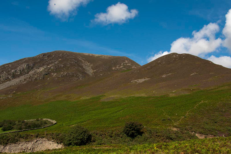
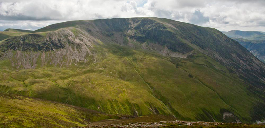
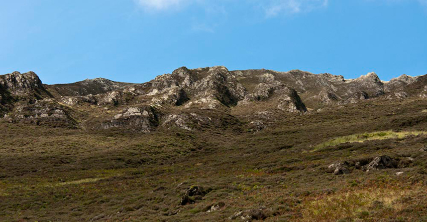
While Dad and Uncle Eric got ready, we looked across the road where Whiteside and Whin Ben (right) dominated the view. "Little Eric", Allen said, "our path is through the bracken and rising up the lower slopes of Whin Ben." This shot was actually taken at the end of day, as the light was much better and the skies blue.
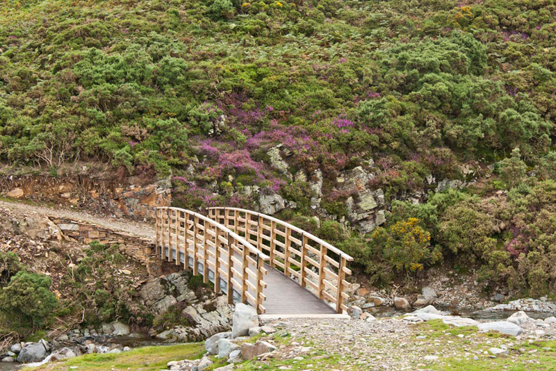
"The first thing is to find the bridge over the River Liza", said Shaun, reading the Wainwright. "It is not in view from the road", he went on.
"Well I reckon if we follow that wide green path immediately across the road, it will take us there", replied Dad.
Sure enough too, it did. By the looks, it has been fairly recently renewed. The heather makes a nice splash of colour too.
Just a few yards from the bridge, a narrow stony path went off right, and the ascent to Whin Ben began.
"Here we go", said Dad, putting his best foot forward.
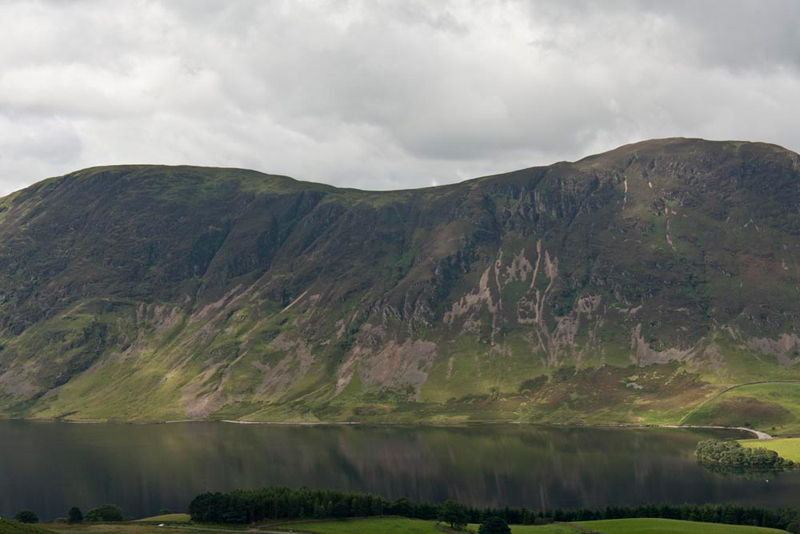
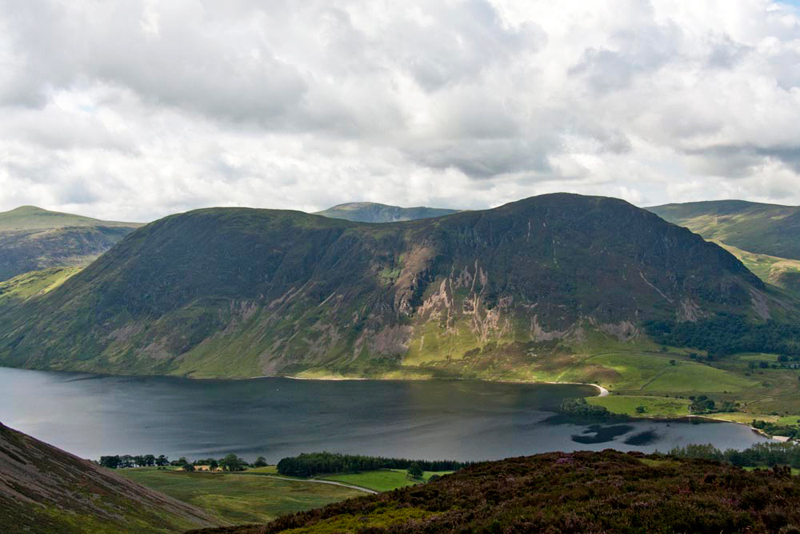
It was a good path, that was never in doubt, but rough and stony and there were a few minor scrambles. The ascent was steep, although we have been on steeper, and the gradient did not slacken off on its way to the summit. Stops were made to catch breath, and look back over the wonderful views that unfolded. Crummock Water is dominated on its west side by Mellbreak, which we had climbed last year. The lake is mirror smooth providing super reflections of the slopes of Mellbreak. There are two tops on Mellbreak, south and north. It may not look it in this picture, but the south top, to the left is in fact the highest point on the fell.
Little Eric commented, " I remember when we were standing at the south top, looking to the north summit you would swear blind that it was higher."
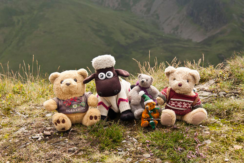
The final rise crested, the top of Whin Ben was achieved with its tiny cairn. "Picture time", called out Tetley.
"That's another summit bagged", said Little Eric with satisfaction.
Allen said, "there is no doubt that this is a separate summit and indeed the spot height is shown on the Ordnance Survey map. However, for whatever reason it is not recognised by Birkett and so has no significance in any of our challenges."
Grizzly told us. "Regarding the name, whilst it is not specifically referred to in Diana Whaley's book, it means 'the hill where gorse grows'. Whin for gorse, and Ben meaning hill or mountain."
Ahead beyond the dip, the path climbed on towards Whiteside. First to and over the large rocky tor, then swinging left up the ridge.
Before starting off again, we took some time to look at the wonderful views from this vantage point.
"Crummock Water looks rather forbidding", remarked Tetley. "And again, the north top of Mellbreak looks higher."
"Yes it certainly does", agreed Allen. But the Ordnance Survey map is quite clear that the north top summit is at 509m, while south top summit is at 512m."
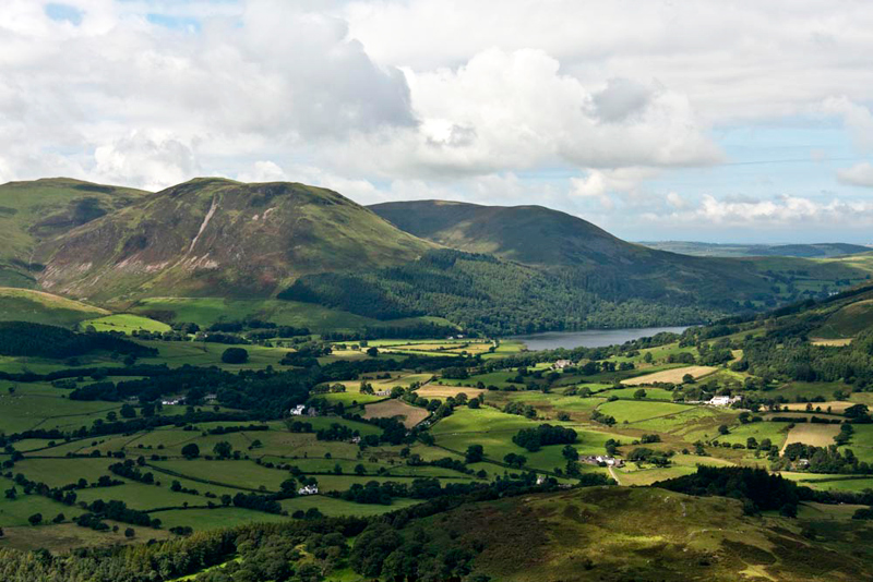
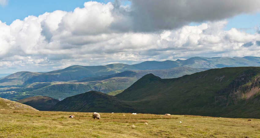
"That's Loweswater over there", called out Shaun. "The fells above are Carling Knott, Blake Fell to the left, and Burnbank Fell to the right."
"And on the right side of the lake is the Fellbarrow group, where we first met Uncle Bob", called out Grizzly.
"Well I suppose we had better be getting on Lads", said Uncle Eric.
"OK", Shaun replied as we settled in Dad's rucksack.
It was down to the dip, then on ahead on the good path, that steepened as we neared the large rocky tor.
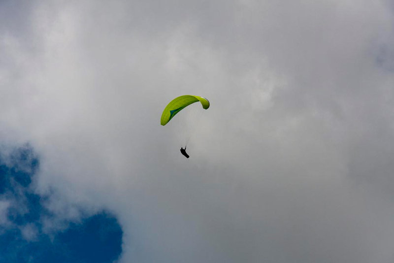
Little Eric called out, "look pals there are quite a few people paragliding."
"Rather them than me", replied Allen.
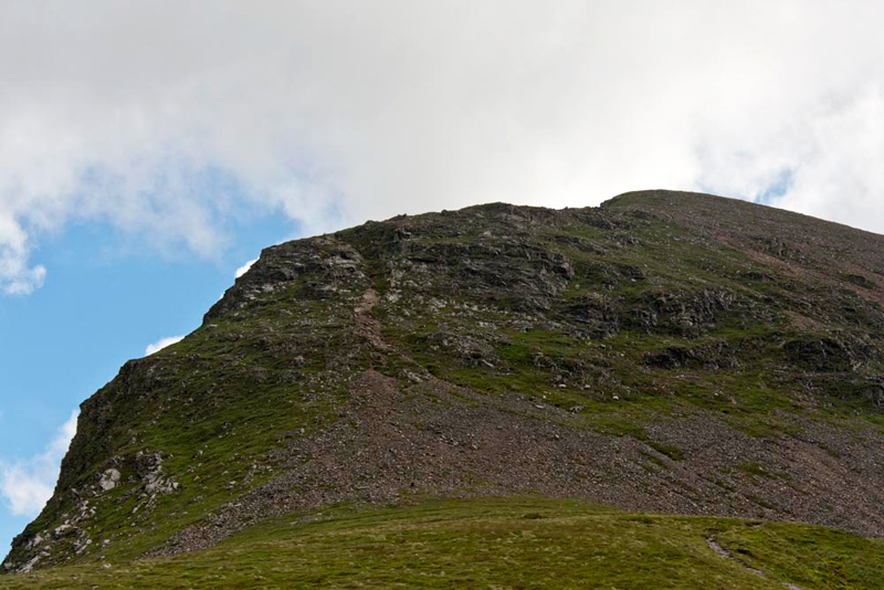
The path climbed the rocky tor, to level ground beyond, and the start of the final push. Almost immediately the ascent steepened and never relented. A rough rocky route, eroded by the passage of thousands of pairs of boots, with lots of loose stone. Two intermediate rises had to be attained with some minor scrambling in places.
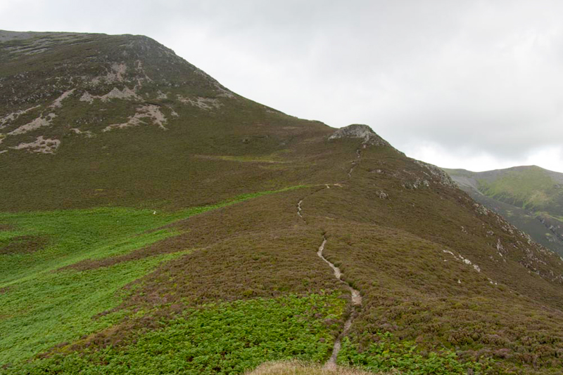
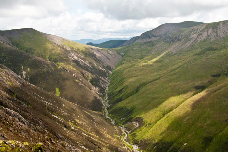
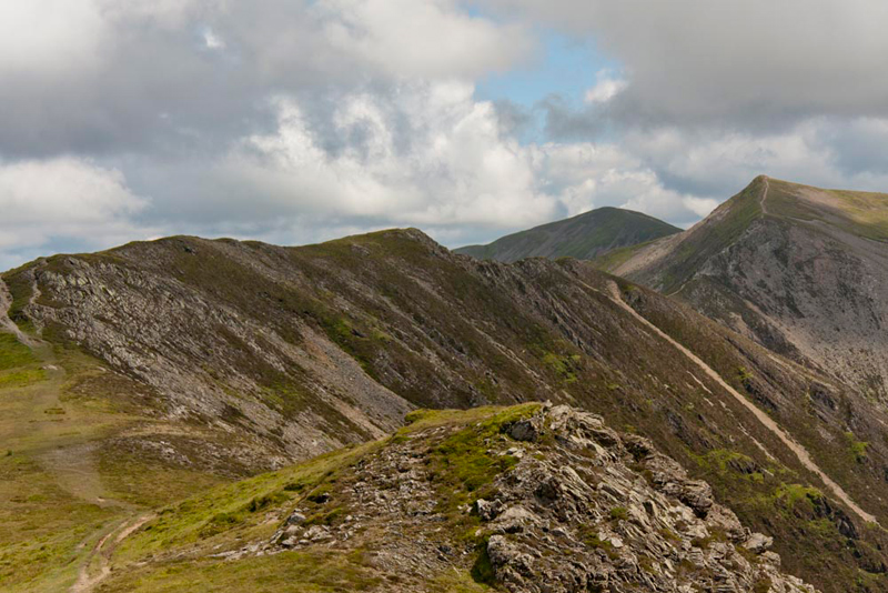
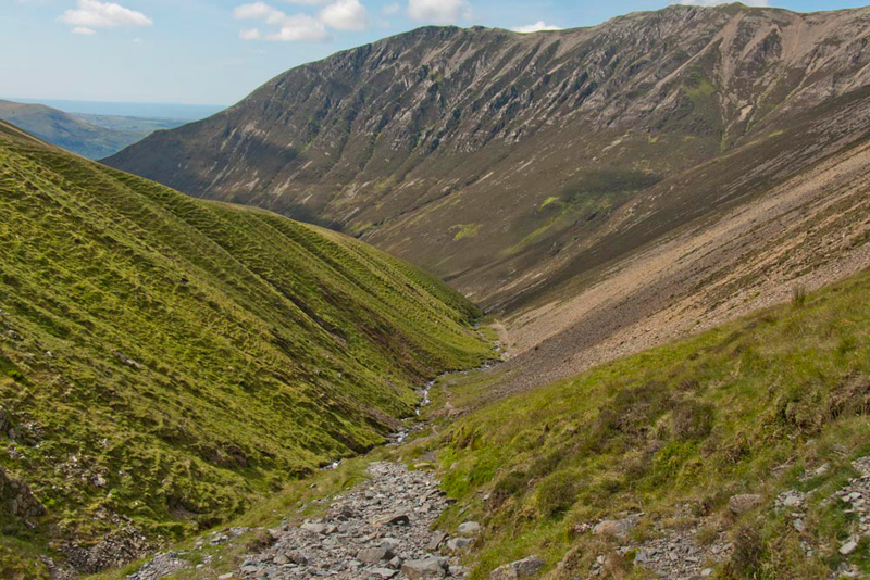
Pointing right, Tetley said, "that's Gasgale Gill, our return route. The summit to the left is Sand Hill. Dominant to the the right is Crag Hill, while closer forming the right side of the valley, are the slopes of Grasmoor."
While Dad had been taking this, Little Eric had asked, "will we be at the summit when we get to the top of that rise?"
"Yes pal", replied Grizzly, "and that will be another Wainwright you have ticked off."
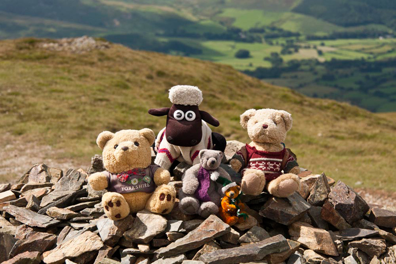
And so it was, suddenly the rock gave way to reveal the grassy summit, surrounding a small rock outcrop, with a rough cairn.
Then as is the tradition, Dad and Uncle Eric had a piece of Kendal Mint Cake, to celebrate reaching the summit.
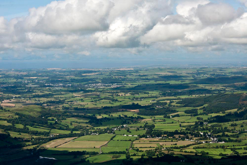
There were the same wonderful views we had had on the ascent, but additionally now stretching away north-west, was the Vale of Lorton. Beyond this is the Solway Firth that divides England from Scotland.
"No doubt about our route", remarked Little Eric.
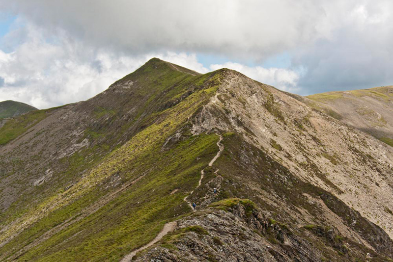
"No pal", agreed Shaun. "After dropping and crossing the grassy area, it climbs to run along the ridge to the east top. This is in fact the highest point of Whiteside. However Wainwright considered the west top, where we are as the summit. The path then drops over Gasgale Crags to a col, and then rises steeply over and intermediate rise to Hopegill Head."
"Distantly between is Grisedale Pike", went on Tetley.
"That was my last Wainwright", sighed Allen. "It is hard to believe it is nearly two years ago now."
"Right, time to be getting on again", said Uncle Eric.
Apart from the climb to gain the ridge, the walk to the east top was easy.
The next top, Gasgale Crags was the important one to us, from the point of view of the Birkett challenge, and Uncle Eric and Dad surveyed the way ahead.
"That's definitely it", said Uncle Eric,
"Yes", agreed Dad. "That rise just to the left of the path.
"I am sure we would have just passed it by in 2005, but not today", said Tetley.
"No", agreed Shaun.
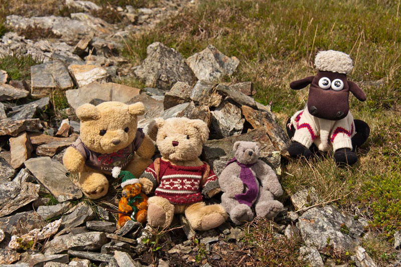
"While you take the lads picture here, I will walk on to Gasgale Crags", said Uncle Eric.
In 2005 there had been a cairn at the East Top, but this has now disappeared.
By the time this was done, and we were on our way again, Uncle Eric was leaving the path and walking to the top of Gasgale Crags. We saw him bending down, and when we arrived he had collected some of the stones into a small cairn for us to sit by.
"How very kind of you", said Allen.
"You're welcome", he replied.
To be absolutely sure Dad checked the GPS position against the map and this clearly was the summit.
"Even though the distance from the path is not much more than 10 yards, the summit is slightly higher, so it was right that we came here, to remove any lingering doubt", said Allen emphatically.
"We can now without a shadow of doubt, say that we have just Pen to summit, to complete the Birkett challenge" added Tetley.
"According to Diane Whaley in her book on place names, Gasgale is likely a shortening of a name such as Gaitscale meaning 'goat shieling', informed Grizzly."
"Hopegill Head next", called out Allen who was looking in that direction.
While we got settled in the rucksack, Uncle Eric had walked on ahead, and can be seen in the dip. He stopped to chat to the walker coming the other way, as did Dad when we met him too. There is 300ft of ascent to Hopegill Head, the hardest part being the first section to and over the rocky prominence.
Mighty Grasmoor (2791ft) stood away right across the valley. "I think that would make a nice shot for the story", said Allen.
The ridge from Whiteside is slender and rises to the small neat summit of Hopegill Head. Left the path descends on the route to Ladyside Pike, and right to Sand Hill and Coledale Hause. Ahead the ridge ends abruptly at the precipitous drop of Hobcarton Crag. Wainwright says the summit is fashioned for the accommodation of solitary walkers, but today there were five others there, who Dad and Uncle Eric chatted to for a few minutes.
"This is the fourth ascent to this summit, so we have agreed that you do not need to take our picture again", said Allen.
"Ok lads, if you say so."
Shaun said, "our route is south, with the easy descent and gentle climb to Sand Hill."
There Tetley said, "the fourth time again, so no need for a picture."
Instead, he took this shot looking east, the furthest range being the whole of the Helvellyn ridge. "Magnificent", breathed Little Eric.
Allen said, "from left to right is Clough Head, Great Dodd, Watson's Dodd, Stybarrow Dodd, Raise, White Side, Helvellyn, Nethermost Pike & Dollywagon Pike. The mountain at the far right is Fairfield. A pointed top can be seen too between White Side & Helvellyn. This is Catstycam, the summit of which can be reached from Helvellyn by descending Swirral Edge."
"That is very steep and in winter a dangerous descent, the scene of many accidents and deaths too over the years." commented Grizzly.
Shaun went on, "in front of the Helvellyn ridge, is that between Thirlmere and Derwentwater, with Walla Crag, Bleaberry Fell, High Seat and High Tove. Closer, the pointed rise in deep shadow is Causey Pike with Scar Crags to the right. The lower ones to the left of Causey Pike, are Stile End and Outerside."
The next objective was Coledale Hause, some 600ft lower than the summit of Hopegill Head, down the rough stony path, much eroded by the passage of many walkers. The massive bulk of Crag Hill dominated the view ahead, its facing buttress being Eel Crag.
On reaching the hause Shaun said, "last time we took the path left down into Coledale, but today our route is right via Gasgale Gill, which is new ground for us all."
The fell to the right of course is Whiteside, Grizzly saying, "it shows clearly why it acquired that name, from the look of the colour of the scree. Diana Whaley says the name means 'the pale hill slope'."
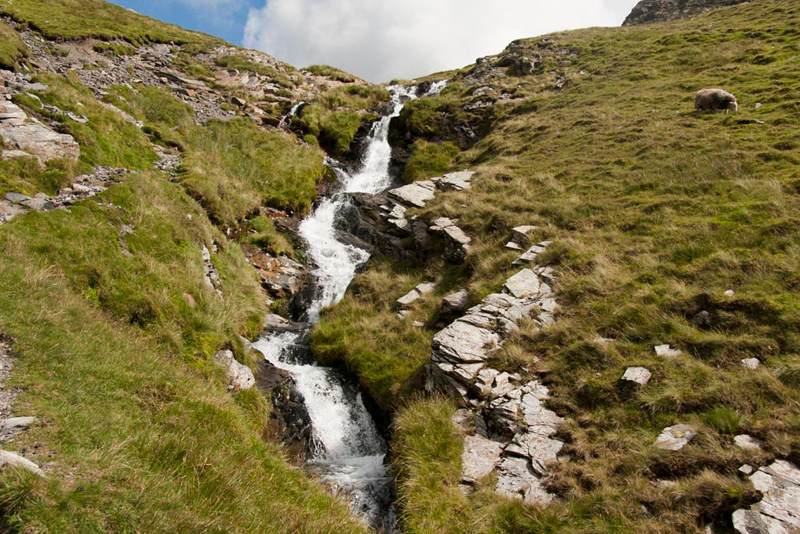
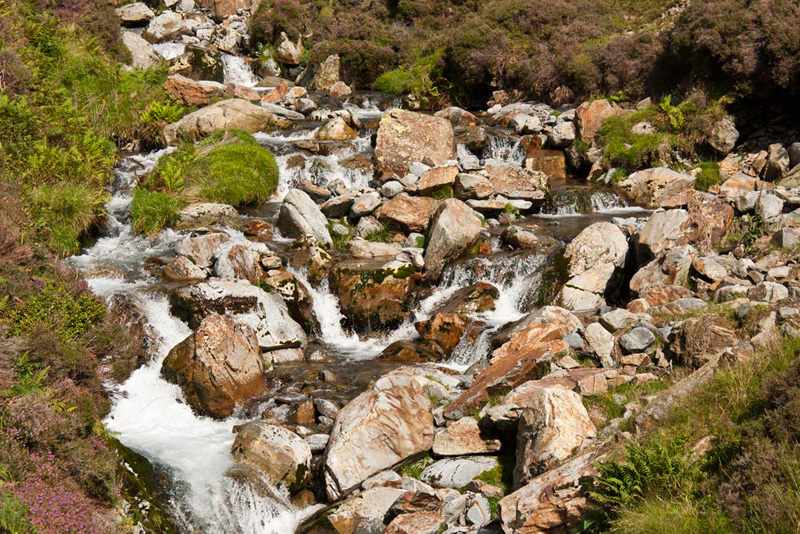
The River Liza runs through Gasgale Gill and was our constant companion, ever roaring and running swiftly with numerous falls. A bubbly mass of white all the way.
"My tummy is rumbling", complained Allen.
"Mine too", added Tetley.
"Now we have got the climbs out of the way, we are going to stop for lunch", replied Dad.
A little way down the path we found a roughly level area to sit, and mostly sheltered from the cool wind.
It was nice to sit and relax for a while, and we munched away at our sandwiches, with the view of the waterfall above.
"I've made some apple and cinnamon scones", said Grizzly.
"Ooh lovely", cried Shaun, "if they are anything like those cherry and ginger ones they will be absolutely scrumptious."
They were too!
After a further while, Dad said, "I suppose we had better be getting on again.
"OK", replied Little Eric, as we settled ourselves again in Dad's rucksack.
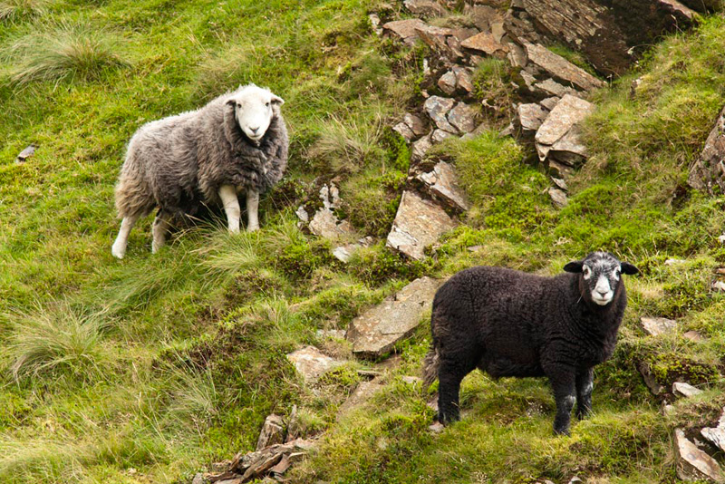
It was a delightful walk through the valley. The path was good, if rocky at times and just a few awkward rocky steps involving sliding down on bums. You might have noticed too that there have so far been no sheep pictures, but our luck finally ran out, as this Herdwick ewe and her lamb posed for Dad.
"What beautiful markings on the face of the lamb", remarked Grizzly.
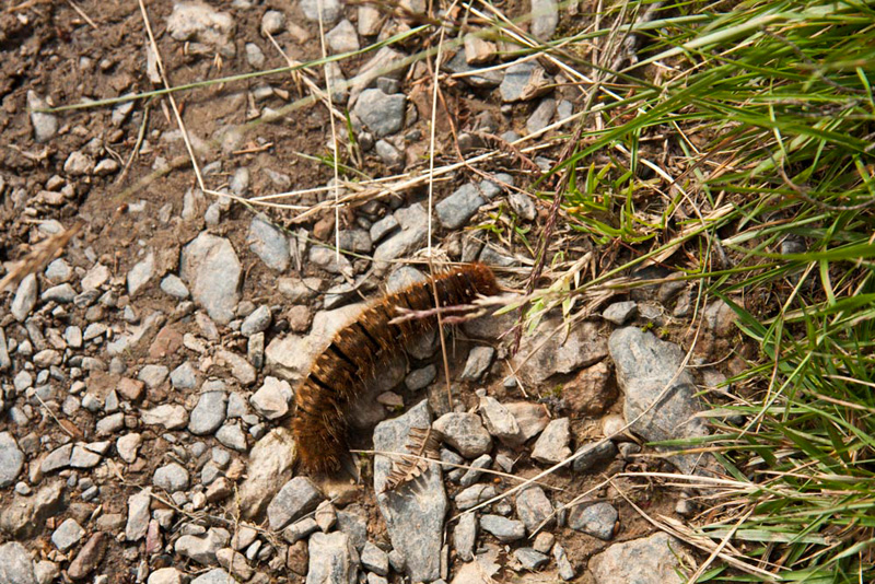
"What's that on the path", called out Allen.
Peering closely, Shaun replied, "a furry caterpillar."
We actually saw a few of these, Dad and Uncle Eric being careful not to tread on them.
The valley is narrow and V shaped, so not created by glacial activity. The sides are steep, and crags towered on the skyline.
To our left, the River Liza was a constant source of noise, only becoming muted occasionally when hidden behind the bank. There were many pretty falls, like this on the lower section, where it splits into many streams amongst the jumble of rocks.
So finally the descent was accomplished, and the path brought us to the footbridge we had crossed this morning to get to the ascent path to Whin Ben. Just a short stroll over the level grassy area brought us to the car.
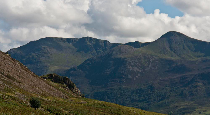
Looking south Tetley said, "that's High Stile and Red Pike, two of the fells that dominate the west side of Buttermere. The lower fell in the foreground to the left of Red Pike, is called Dodd. One of three with this name in the Lake District. The others are Dodd above Bassenthwaite Lake, and Dodd to the north of Whiteside."
What a super walk", said Little Eric. "Thank you for your company Uncle Eric, and for driving us to and from the start."
"You are welcome lads. I have enjoyed the walk, and bagged a few summits that I have never visited before."
And finally the summit tally. Uncle Eric and Little Eric, bagged Whin Ben and the two summits on Whiteside, and we all bagged Gasgale Crags.