On back road between Bowston & Staveley (SD 4898 9801)
Summits Achieved
Name
Height (ft)
Height (m)
Grid Ref
Unnamed summit
1296
395
SD 4896 9981
Brunt Knott
1400
427
NY 4844 0062
Unnamed summit
1280
390
NY 4966 0035
Ulgraves
1090
332
SD 5112 9961
Preface
It was another wet day, and Tetley and Little Eric were reading and listening to Classic FM, to try to take their minds off the rain lashing against the window.
"It's tea time", remarked Tetley, and as if by magic Shaun and Grizzly arrived with flasks and cake tin.
"Were having a change from scones", Grizzly announced. "I've made some coconut and cherry slice on a chocolate base, instead."
This was passed round with the steaming mugs of tea, and our day was brightened despite the weather.
"The cake is truly scrumptious", enthused Tetley. "You can make some more of this!"
"You are right there", added Shaun, picking up another piece, but then paused with it half way to his mouth. "Where's Allen!", he exclaimed. "He never misses out on tea and cake."
"Too true. Either he has forgotten the time or he's not well", replied Grizzly.
"He'll be along you can be sure. He is too like Dad, to miss out on tea and cake", said Tetley.
And sure enough just a few minutes later, Allen came dashing in, calling out, "I have news of our next walk."
"Well just sit down and get your breath back first", commanded Tetley.
"OK, and anyway I am gasping for a mug of tea." Sinking his teeth into a slice of the cake, he added, "yummy!! You will make some more of this Grizzly?"
"I certainly will", he replied, glad that it had been liked by us all.
After a few minutes, Little Eric ventured, "so....where are we walking next."
"Oh right", replied Allen, brushing a few crumbs off his jumper. We seem to be having a better run of luck with the weather on Sundays and this coming weekend is no exception. So Dad has suggested exploring Potter Fell above Staveley, as it is an interesting area, and more importantly for you Little Eric, will mean bagging another two Outlying summits.
"That's Brunt Knott and Ulgraves, if I remember right", interjected Little Eric.
"Yes", agreed Allen. "There are also two unnamed summits, one of which not even Dad has been to before. On past visits to this area we have always started at Garnett Bridge just off the A6, but for a change Dad has decided to follow the route defined by AW in the Outlying book."
"Well I have never really liked the approach from Garnett Bridge", replied Tetley. "But let's hope we can get the parking spot on that very narrow back road between Bowston and Staveley."
"All I can say is roll on Sunday!", cried Little Eric, as he munched away on another slice of cake.
The Walk
Clear blue skies greeted us this morning, and after a chilly start the day was warm. We all helped getting the picnic ready, which was stowed in Allen's rucksack, then we strolled out and settled in the car ready for the off.
Another advantage of doing this walk was that it is not a long drive to the start. From the M6 we took the Kendal turn off, and after the by-pass headed on along the road to Windermere, but turned off at Plantation Bridge to the hamlet of Bowston. Turning left over the River Kent, it was soon left again towards Staveley.
"You know, I have never driven along this road before", remarked Dad.
We looked out for landmarks to discern our progress. "There's Hundhowe, and the path we will return along at the end of the walk, so it's not far to the start", called out Shaun.
Just a little way further Dad spotted a pull in on the right, and said, "I think we will park here, it is as good a place as any."
In his book Wainwright shows just one parking space, but in reality, there are in fact a number of places.
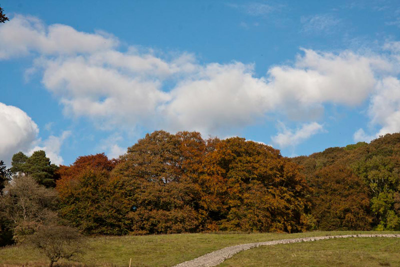
As Dad was getting ready, we noticed that an access track had been built up the fell in connection with some works and our eyes travelled up along it.
"What lovely autumn colours on those trees up there", remarked Grizzly
"With with spring they are my favourite seasons", added Allen.
"OK Lads, I'm ready, so get settled in the rucksack", called out Dad.
"OK", called back Tetley.
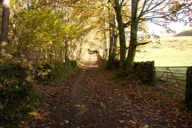
"We need to take the narrow road right to Side House" said Shaun, glancing at the map. "It's just a few hundred yards along this road."
Although surfaced it was strewn with leaves, that had been shed by the trees lining it.
Eventually this swung away left, and here we kept ahead on a track to come to Side House, where there is a pretty waterfall on the beck.
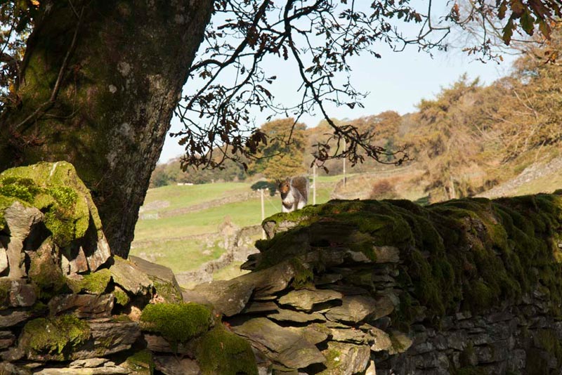
The wide clear track continued on passing through a gate, with a wall to the left. Suddenly, Tetley whispered, "look there's a squirrel on the wall."
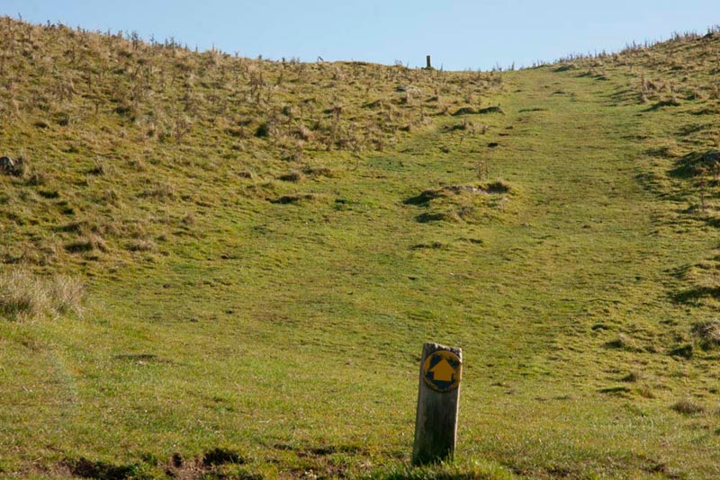
As can be seen it is a grey, but we would have much preferred it to have been a red, our native species that is greatly endangered. Shortly after this we emerged into the open, and a small bear sized sign pointed our direction to our first objective.
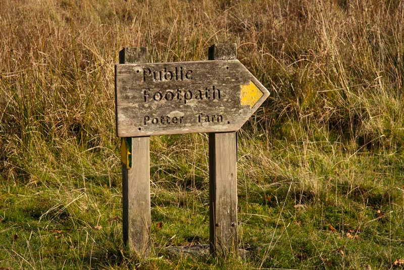
The path a clear grassy swathe climbed up steadily, and there was no risk of getting lost as more bear sized waymarks have been provided.
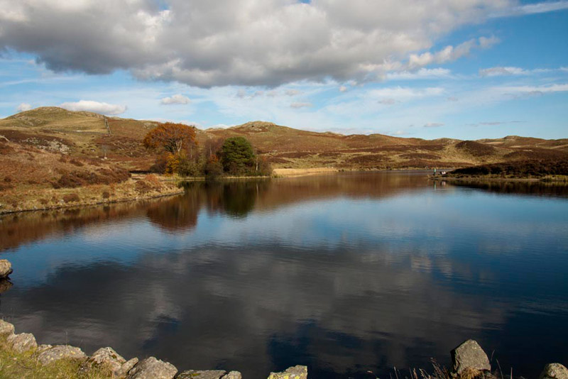
"Once we get to the top, we will see Potter Tarn, Little Eric", informed Tetley.
As it came into view, Little Eric said, "it has a dam."
"Yes", replied Tetley. It is in fact a reservoir built to supply water to James Cropper's paper mill in Burneside. It is not now a large as when built as the dam became unsafe and the water level was lowered in 1990 by reducing the height of the middle of the dam.
Crossing in front of the dam, we then climbed the step stile in the facing wall.
"The path ahead leads to Gurnal Dubs tarn, and we will return along it later", said Shaun. "For now we need to go left immediately, by that tree."
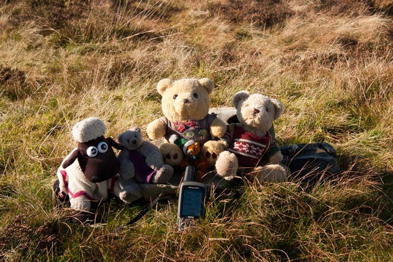
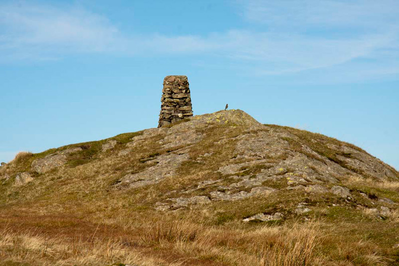
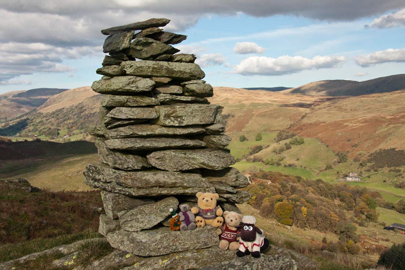
A narrow trod at first it soon became a clearer path. When the wall turned away left, we followed the path half left to gate in another wall. Beyond the crag ahead was skirted, and then after crossing over two rises, we reached the final one, where it was just a little way right from the wall to the tiny cairn marking the unnamed summit at 1296ft (395m). Despite having walked this area a few times before this was the first time any of us, Dad included, had been to this summit.
Allen said, "what a shame it is unnamed, otherwise it would have advanced my quest to reach 1000 summits. Anyway, you will take our picture at the cairn?"
"Of course lad."
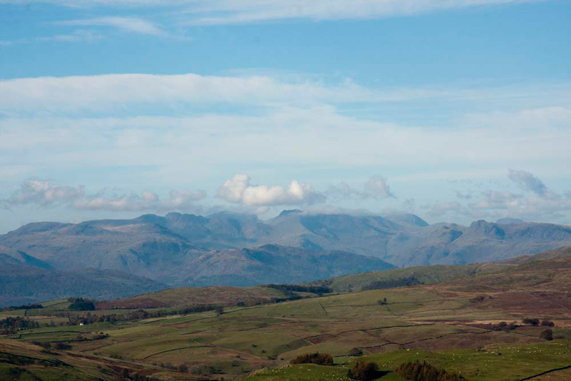
The clear weather, also meant we were afforded wonderful views to the Lakeland Fells.
The Crinkle Crags can be seen just left of centre, and going right the depression at Three Tarns. Right of this is Bowfell just out of the cloud, then Esk Pike covered by cloud and the bulk of Great End. Unmistakably right of this are the Langdale Pikes, with behind the pudding basin shape of Great Gable.
"Is it Brunt Knott next?", asked Little Eric.
"Yes lad", replied Shaun. "We descend to that wall corner, climb the stile, and then follow the easy path up to the summit."
After the stile there was a short part over rough ground before gaining the easy grassy path of the steady climb to the summit of Brunt Knott, the rocks adorned with a trig point.
This we promptly climbed for our picture, of course.
"My tummy's rumbling" remarked Grizzly
"Mine too. This would be a good place to have lunch", said Allen.
"My thoughts exactly", replied Dad, fishing his tuck box out the rucksack.
We sat just below the summit, happily munching away on our sandwiches and cake.
Shaun, remarked, "having made our way up here on the right of the upland area, we descend more to the left, and make for that wall junction. The next objective being the unnamed summit to the right of the wall going about south."
"Potter Tarn was pretty", said Little Eric.
"Wait to you see Gurnal Dubs Tarn, that is even prettier and will look lovely under the blue skies today", replied Tetley.
We then chattered on about past adventures, and as a result Dad had finished his lunch first. Mind you he does not eat much, perhaps one or two sandwiches and a chocolate biscuit at most. So while we were finishing he gave Uncle Brian a call, to check he was OK. He was too, enjoying a nice quiet day, with Dad being out with us.
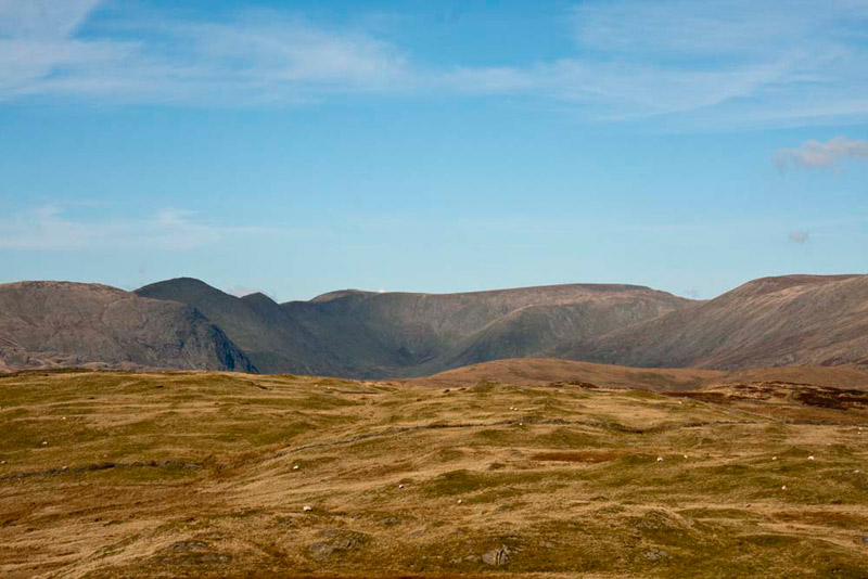
Before leaving we returned to the summit to admire the lovely view of the Kentmere Fells, and muse on the days climbing them.
They surround the Kentmere Valley, which is the source of the River Kent. On the left, from front to back is Yoke (2316ft) with Rainsborrow Crag sticking out on its right side. Then Ill Bell (2484ft), Froswick (2360ft), then rising to Thornthwaite Crag (2569ft) distantly behind. On the right of the ridge at the rear is Mardale Ill Bell (2496ft). The declivity is Nan Bield Pass and in view on the right is Harter Fell (2552ft). The horseshoe, about 12 miles in all, is completed by crossing Kentmere Pike, Goat Scar and Shipman Knotts.
"Time to go", said Dad, stuffing his jumper in the rucksack. "It is warm enough now just to walk in my t-shirt." So we got ourselves settled too, and then headed down the fell.
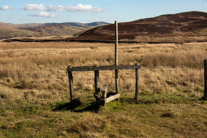
"To get to the walls, there is a fence to cross, so we need to find the stile", called out Shaun.
Dad spotted it as he made the descent, adjusting the pathless route to make for it. To the right behind is the unnamed summit at 1280ft (390m), our next objective.
A narrow trod led on and soon brought us to the cross wall. At right angles a wall heads away south, and our route was alongside. The Outlying book shows walking with the wall on the right, but to get to the unnamed summit it is necessary to to walk with it to the left. Before the Rights of Way Act, there was no official access to this side, but now a stile has been provided and the route marked as a footpath. The narrow path climbed by the wall and as best as possible, when Dad judged right, we walked away right up the rise heading for the summit.
As we crested the rise, Allen said, "it looks to be higher to the right."
"I agree", replied Dad, turning that way, and in a short distance we had reached it, marked by a small cairn, by which we sat for our picture. So that was the 1280ft (390m) unnamed summit, out of the way, just leaving Ulgraves. Dad took us back to the wall and we walked on ahead.
"There are cross walls to get over", said Shaun, scrutinising the map.
Dad replied, "this designated as a footpath now, so I expect there to be a way over them."
But....no! All barbed wire fence on the cross wall and a tall wire fence above the left wall.
"Oh heck!", exclaimed Little Eric. "So much for this being a footpath."
"No problem", replied Dad. "I have had much harder obstacles to get over."
The most sensible thing was to get over the left hand wall and so regain the book route. Dad quickly climbed on top of the wall and made short work of the fence, before jumping down to the ground. All was easy now as gates allowed ways through fences and walls, Ulgraves being immediately ahead.
"To get to Ulgraves, we need to go through that gate in the wall on the right", advised Shaun.
Beyond it was a short steepish climb, to the flat top, the highest point being marked by a tall shapely cairn.
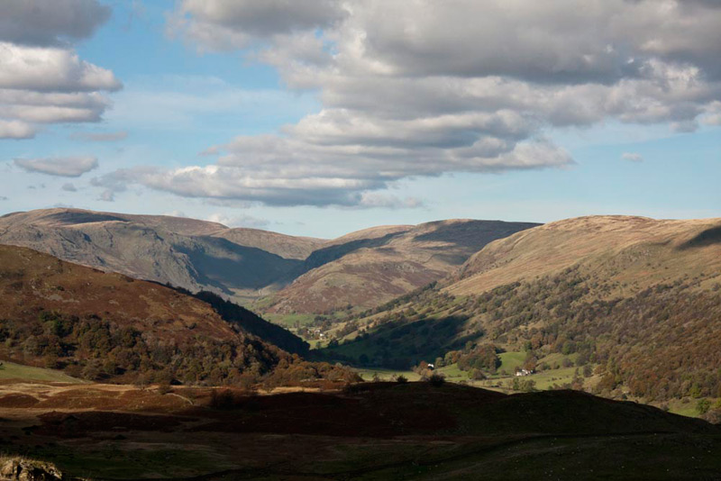
The valley below is Longsleddale, a wonderful view being afforded from here.
The highest fell on the left is Harter Fell, on the Kentmere Horseshoe. The surfaced road in the valley ends at Sadgill, where beyond a rough track climbs up. This is Gatesgarth Pass, and crosses the watershed, to descend to Mardale and the Haweswater reservoir. Again we remembered the days walking this route.
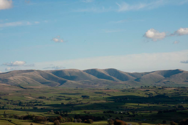
Looking in the other direction, there is this fine view of the Howgill Fells. We had enjoyed many many days tramping these as we completed our quest to reach all the summits. Still pretty unfrequented, this is the place to solitary walks to get away from the hustle and bustle of life!
"Wow, it is worth coming here just for the views", cried Little Eric.
"We want to head south-west, to a gate at a wall corner", said Shaun.
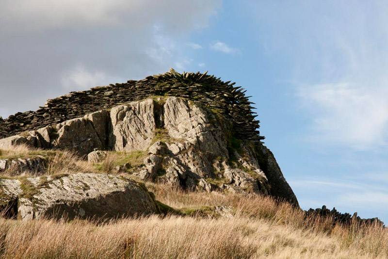
As we descended, away to the right, the wall at one point had been built up over and down a rocky outcrop.
"Amazing", breathed Grizzly.
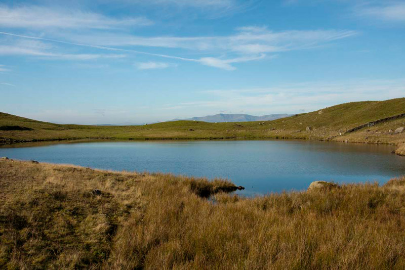
Reaching a dip, the path then climbed to the gate, and beyond we followed a narrow path to stile in a fence, and on to a wide track, that ran above and round Gurnal Dubs tarn, coming to a building. Here we sat on the wall above the tarn, to have another sandwich and take in the pretty view.
The tarn was created by erecting an unobtrusive dam to enclose three smaller natural ponds (or "dubs") to make one larger lake. The stone building we had passed was a boathouse erected by the Fothergill family. Shown on the map, nearby, are three small pools, known as Low, Middle and High Taggleshaw. These are now just about completely silted up and little remains of open water.
"It is indeed very pretty, as you said Tetley", mused Little Eric, who like the rest of us was reluctant to leave.
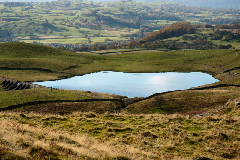
Finally, shouldering the rucksack with us safely tucked inside, Dad set off up the wide grassy path to the ladderstile in the wall at the brow. Dad paused on the top of the stile to take this shot looking down on to Potter Tarn, once again. This is probably about the best vantage point for viewing it.
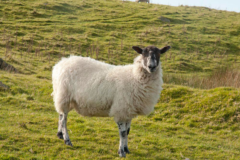
A clear path wound its way down, coming to the stile in the wall, that we had crossed this morning. Went on to cross the dry out flow then immediately turned left on a wide grassy path. As we walked along here, we were undone, as a sheep stood and posed for Dad.
"Damn!", exclaimed Grizzly, I thought we had got away with it.
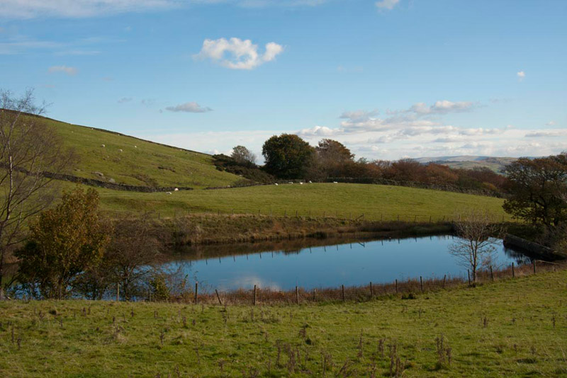
After a gate, we passed the small reservoir of Ghyll Pool, that like Potter Tarn, was constructed to provide water for John Cropper's paper mill in Burneside.
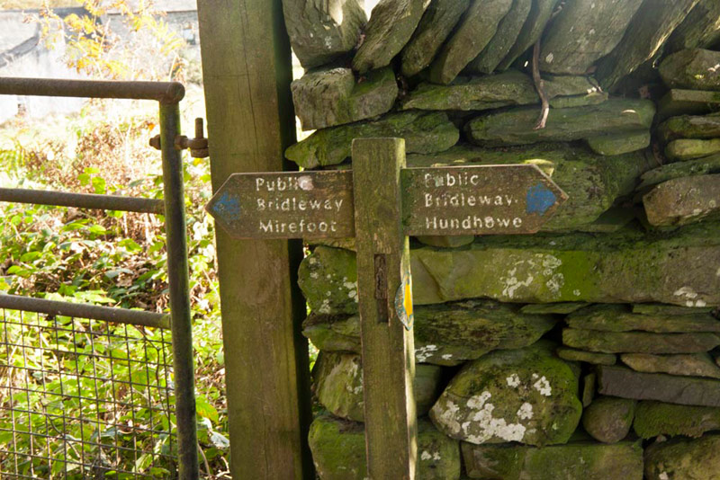
The path now began to descend more steeply and became stony, finally arriving at a signed t-junction.
"Our way is right, through the gate to Hundhowe", announced Shaun.
The rough and overgrown bridleway descended to the buildings of High Hundhowe, and to the road, where we walked right along this to the car.
"Thanks for a really wonderful day", enthused Little Eric. "It really is a most interesting upland area, and varied with the summits and tarns."
And the boring bit of the stats. Little Eric bagged all 4 tops, while the rest of us bagged the 395m unnamed summit.
"I hardly need to ask", remarked Tetley, "but I guess it is cafe time now, Dad."
"Spot on" Dad replied. "I am going to Sheila's cafe within Bob Parratt's at Milnthorpe."
The shortest route would be to return along the road we way we had come this morning, but it was too narrow for Dad to be able to turn round his big car, so we drove on into Staveley, taking care to avoid the many pedestrians as we neared the village. Driving through, we regained the main A591, and it was on, the via the A6 to Milnthorpe and Bob Parratt's..
Having been a few times he is recognised by the staff. He had the lovely Sunday roast beef lunch accompanied by a pot of tea with extra hot water. This is a quite excellent cafe and we heartily recommend it for a visit.