The 200th story that we and our other pals have written
Summary
Date - 18th November 2012
Distance - 8 miles
Ascent - 1730ft
Map - OL5
Start point -
Swindale at end of unenclosed road (NY 5214 1425)
Summits Achieved
Name
Height (ft)
Height (m)
Grid Ref
Langhowe Pike
1313
400
NY 5284 1347
Great Ladstones
1439
440
NY 5321 1236
Seat Robert
1688
515
NY 5264 1141
High Wether Howe
1742
531
NY 5150 1092
Fewling Stones
1640
500
NY 5131 1177
Preface
"The Sunday weather has been kind to us recently and we have enjoyed some lovely walks, some in countryside none of us had been to before", mused Little Eric.
"That's right", replied Grizzly. "It would be nice through to get into the hills again, and enjoy the peace and solitude."
"Ooh yes, pal", agreed Allen, "especially if we could do a few tops in one day, as that is what I need to really move my summit total on towards 1000."
"There must be some Outlyer walks that fit the bill, and it would give my total in that respect a good uplift too", replied Little Eric.
"Right", cried Allen, "you get the book Grizzly, while I check the weather for this coming Sunday", as he grabbed the iPad.
Grizzly with Little Eric looking over his shoulder, scanned down the page listing the walks, then Grizzly pointed his paw, saying, "Seat Robert. That is a likely candidate."
Then opening the book to that page, Little Eric exclaimed, "you're right, doing that walk will take in five summits."
Unnoticed while this had been going on Shaun and Tetley had strolled in, flasks of tea in paw.
"Goody", called out Allen, temporarily abandoning the iPad to get the mugs, and then helping to pour the tea.
Meanwhile Grizzly produced a cake tin, which he opened and passed round, saying, "I've made chocolate caramel shortbread for a change."
"Scrumptious", sighed Shaun, as he sank his teeth into a slice. "Better hide it afterwards, otherwise Dad will be having some, as it is one of his favourite cakes."
Turning the conversation back to Sundays' walk, Tetley said, "I heard your suggestion about Seat Robert etc, for Sunday. Sounds fine, but that area of the Ralfland Forest is pathless, so it needs to be day free of low cloud and mist. One thing for sure is that we will meet few if any other walkers."
Wiping a few crumbs off his mouth, Allen piped up, "the Sunday luck continues. The day is forecast to be dry, mostly sunny and clear, so it looks to be a goer to me." Then draining his mug, and passing it to Shaun for a refill, he went off to ask Dad about our suggestion.
It was quite a while before he returned. "What took you so long?", asked Tetley.
"Dad was on the phone to Aunt Tish and Uncle Eddie, so I had to be patient, however the good news is that the walk is on, but Dad has said we will be making an early start, so that we make the most of the daylight on these short days.
"Yippee", shouted Little Eric, taking another piece of cake.
The Walk
We made sure we were up early and ready for the off, calling goodbyes to our pals as we dashed out and settled in the car. Dad drove north on the M6, leaving at junction 39, the Shap exit.
The morning was bright, but there was more cloud about than the forecast had indicated, and we were to encounter some hailstones for a time. It was cold in the wind.
Our destination for the start was Swindale, and our walk was to be in the upland area between that valley and Wet Sleddale. Joining the A6, Dad turned right then soon left on the road to Wet Sleddale, leaving this almost immediately right to drive along the private waterworks road, being a shortcut. Cars are not authorised to go along here, but Dad had used it before and not been stopped. One word of warning to anyone using this road however, it is poorly maintained in places so care is necessary to avoid some large potholes.
Coming eventually to a crossroads, Shaun called out, "this is where we parked when we did the Naddle Horseshoe."
Here Dad turned left, leaving the waterworks road, and drove along the narrow road towards Swindale, seen here in this shot taken when we did the Naddle Horseshoe walk in early May this year. The upland area to the left side of the valley was where we would be walking today.
The parking is at the end of the unenclosed section, the limit for tourist traffic. Vehicles are not permitted to go any further, unless one lives in the valley of course.
As we arrived a farmer was there with his wife and grandchildren. His land rover and large trailer took up quite a bit of the parking area, so Dad tucked the car in at the top end, having turned to face back along the road.
They were all staring at the fell away to the right, and we were naturally inquisitive, so Dad asked what was going on.
The farmer replied, "I have got a sheep stuck on the fell." He then point across, saying, "it is stuck at the top of that crag, above that scree. I'm waiting for the mountain rescue team to retrieve it."
While Dad was getting ready, the farmer backed his quad bike out of the trailer and rode up the track to below the crag. Then he walked across through the bracken, and part way up the scree slope, calling out at the same time. When he returned shortly afterwards he remarked, "it's still alive, sitting sunning itself." He then joked, "one thing is for sure it will be confined to lower pastures, once rescued."
By now Dad was ready, so we settled in the rucksack and as he shouldered it, Allen said, "the mountain rescue team will soon be here." He had spotted their land rover a distance away along the road.
So leaving the farmer and them to the work to come, we set off along the road into the valley, which was slippery with ice after the frost last night.
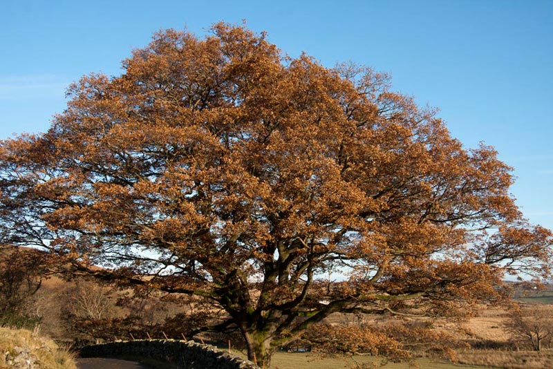
"That oak tree still looks nice in its autumn colours", called out Tetley, prompting Dad to get the camera out and line up the shot.
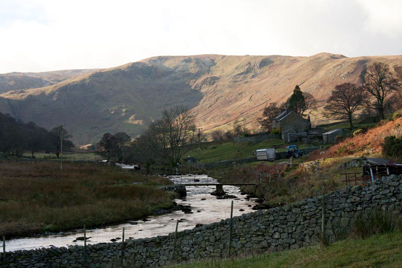
Swindale Beck was running along below to the left and at a bend then became in front of us, a wider view of the valley opening up too. The buildings are Truss Gap Farm.
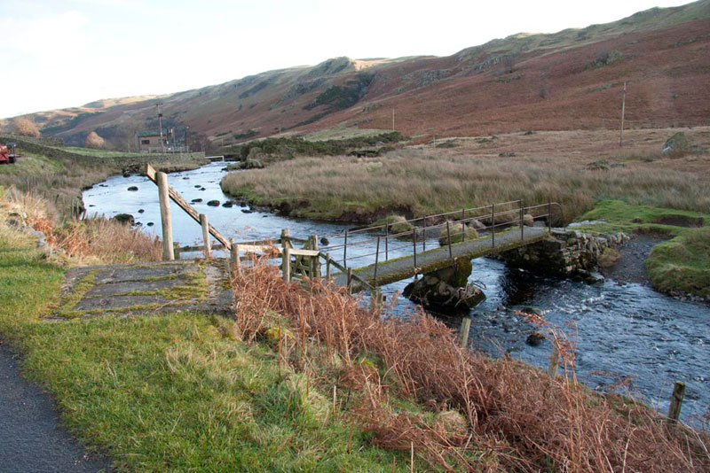
The footbridge crossing the beck can be seen and Dad utilised this to get across.
"Right, where now?", asked Little Eric.
"We need to negotiate this boggy ground in front to gain the path, where we go left, effectively back in the direction we have just come", replied Shaun.
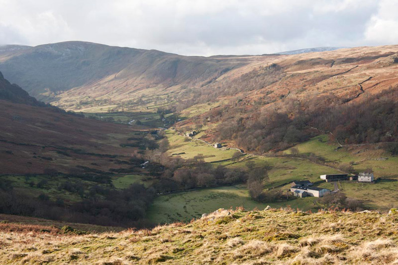
Dad found the easiest way to cross the boggy ground was to walk the little way right by the beck to the ford, and then strike left to soon gain the green path. We walked this excellent path for a full mile, it at first keeping fairly level, before rising steadily to the skyline at an altitude of about 1100ft. Looking back we were afforded this fine view of Swindale.
The distance was such that we had walked back to beyond our start point, across the valley. Grizzly called out, "I can see the mountain rescue team. They have climbed up to the crag to get that errant sheep."
"Oh yes", replied Tetley. "Let's hope for the farmers sake, that they are successful."
"Little Eric then went on saying, "I have read the chapter in the Wainwright Outlying book, and it shows that this is an old corpse road. What does that mean?"
"Well lad", replied Tetley. "There is no church or sacred ground in the valley, so when someone dies, they have to be taken to the nearest community, in this case Shap, to be buried. In olden days long before the current motor road was built, the bodies were carried on packhorses, along this track as it was the only route to Shap, so hence its old designation."
"Thank you" said Little Eric. "I don't know if I will ever be as knowledgable as you Tetley."
Reaching the skyline, Shaun said, "we now need to take a tractor track going back sharp right."
"Here it is", called out Allen.
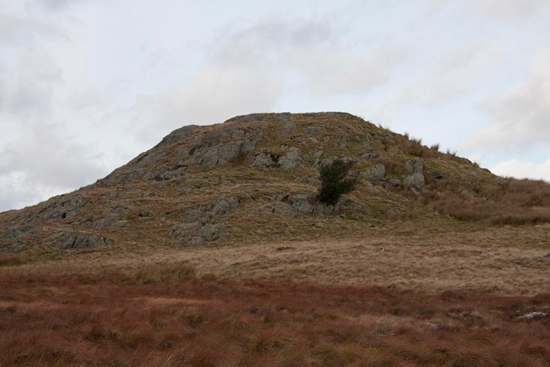
Walking along this Shaun then said, "the first summit Langhowe Pike is to the right of this path, which according to the book, just peters out."
Sure enough he was correct, and there was no path at all heading towards Langhowe Pike, so Dad just picked his way carefully over the rough and boggy ground. Soon the summit came into view the cairn standing out clearly, and once there, we hopped out and settled for the first of our many pictures today.
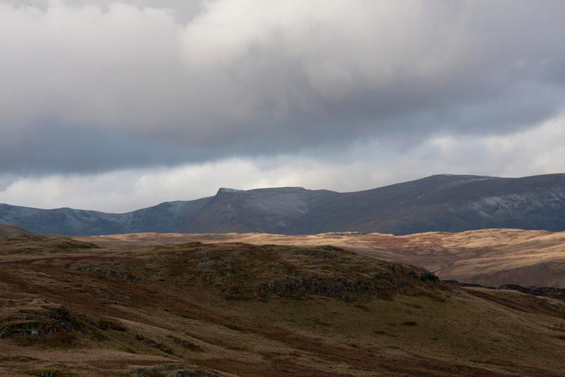
To the west of Swindale lies the upland area of the Naddle Forest, where we walked in May, and west below this is Haweswater, the long ridge of High Street dominating over it. Here it can be seen, white under snow, from our vantage point on Langhowe Pike.
"Right time to get on", said Dad, so we settled in the rucksack again.
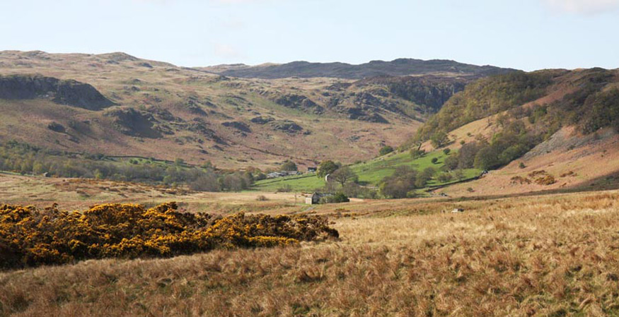
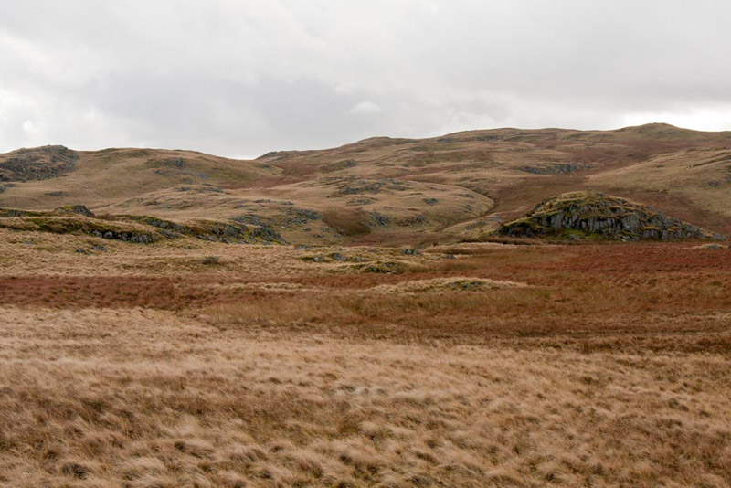
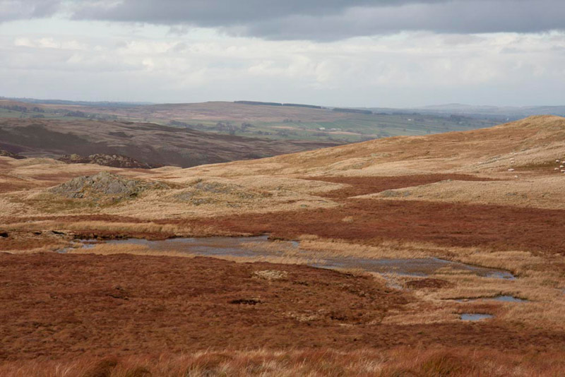
This area is an untamed wilderness, with no proper tracks, just those made by sheep and farmers' quad bikes. There are extensive boggy areas that were unsurprisingly very wet after all the rain - squelch squelch as Dad walked along!! This shot below gives a good idea of the landscape.
"So where do we go now?", asked Little Eric.
"Well we can actually see a good deal of the walk to come", replied Shaun. "Our next objective is that rocky outcrop ahead to the right, Rowantree Crag. From there we head for Great Ladstones, the prominent rise away over on the extreme left, before traversing the ridge, to Seat Robert, the highest point distantly above Rowantree Crag", he went on patiently.
Just a few minutes walking and we were at Rowantree Crag. As Dad climbed the few feet to he top, Allen said, "it's not a summit, mores the pity."
"I know, but nevertheless, I thought you might like your picture taken at the cairn", replied Dad.
"Ooh yes", enthused Grizzly.
Now heading across towards Great Ladstones, Dad paused to take looking back this shot of Rowantree Crag.
While we had been there and indeed now too, Little Eric was peering about intently.
"What are you doing?", queried Allen.
"Looking for the rowan tree", he replied.
"Well as Wainwright states in his book, there are none, the only tree one being that holly by the east side", said Tetley.
"Well then, maybe a rename is in order!", exclaimed Little Eric.
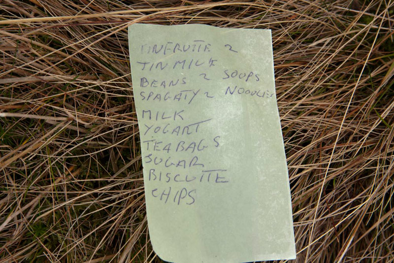
So now it was south-east over the rough boggy terrain, to the cairned summit of Great Ladstones. On the final approaches, Allen suddenly called out, "what's that on the ground?"
Now we do not wish to be unkind to people, but we could not help but smile at some of the spelling, in particular the the attempt at spaghetti!
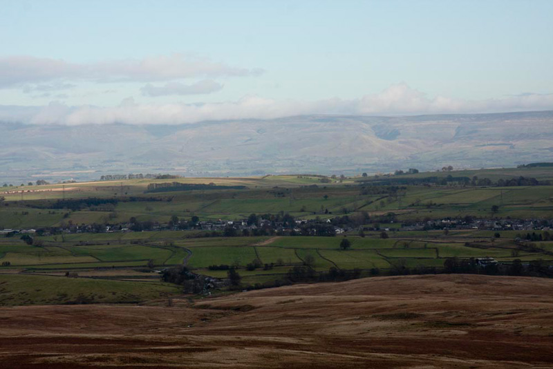
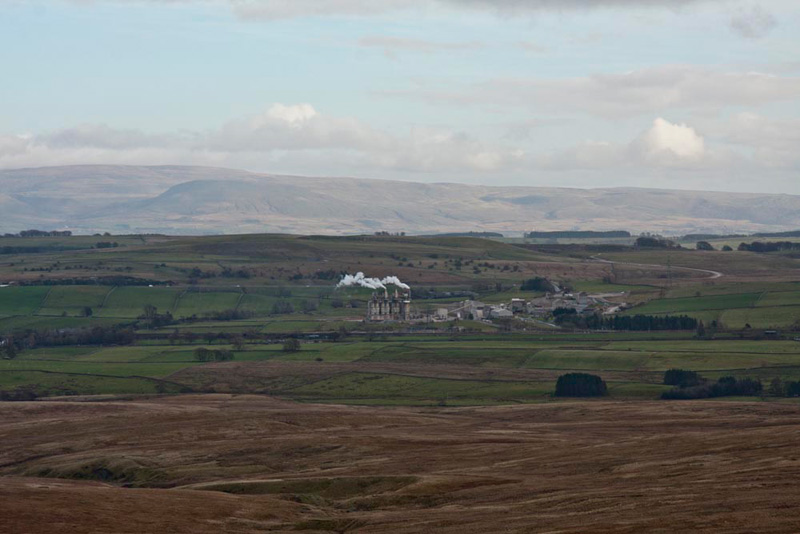
A minute later we were standing by the cairn on Great Ladstones, with wide open views to the east. Here first the long linear village of Shap, with behind the Eden Valley and then Pennines.
"There's the chippy", called out Allen.
Well that's what the Lads call it, but of course it really is The Hanson Cement Works, that seems to be always in view no matter from whatever direction you look to Shap.
Finally swinging the camera round to the west, the unmistakable triangular shape of Kidsty Pike.
So Seat Robert was next, which we could see looking rather distant beyond a few other rises, to the south. In vain we looked for any proper path, there being only the odd sheep track here and there.
"Don't worry Lads, we'll just make a rough beeline for it, avoiding any bogs of course, as best as possible", said Dad, as we settled in the rucksack once again.
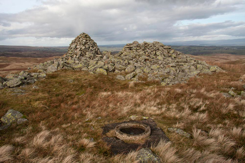
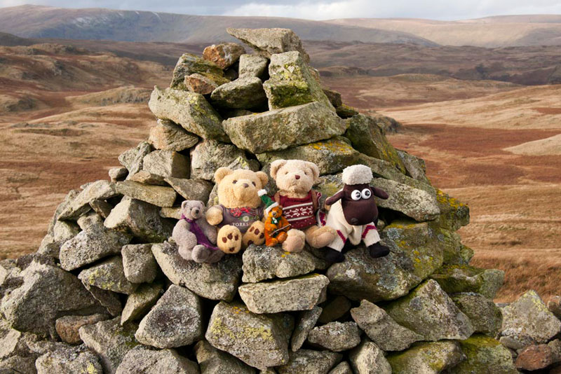
The Outlying Book shows a route, but to Dad it seemed better to keep a little west of this and after about half an hour the task was completed and we were standing at Seat Robert's summit, with its two large piles of stones. One a substantial cairn, the other fashioned into a shelter.
"Where's the trig point for us to sit on?", asked Little Eric, expecting the tall column like structure, that have featured in many photos in previous stories.
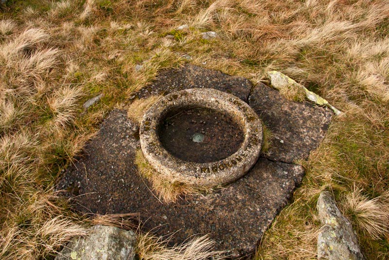
"It's different here and on some other fells in this area, as it is a ring embedded in the ground", replied Tetley.
Seen in the foreground of the above picture, we include this close-up shot too. The words cut into the stone ring read - 'Ordnance Survey Trigonometrical Station'. For anyone interested in finding out more about trig points and there use in the past by the Ordnance Survey in producing the maps that are a vital companion to any walker, you can visit the excellent site - trigpointinguk.com
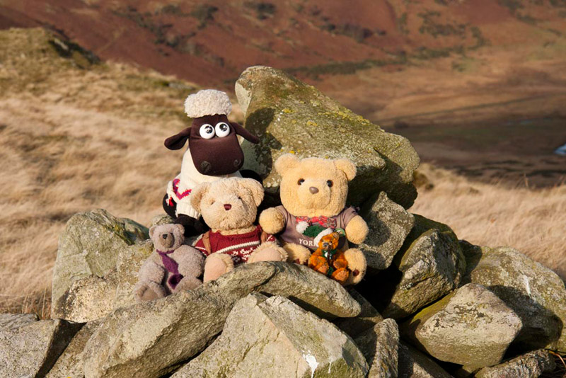
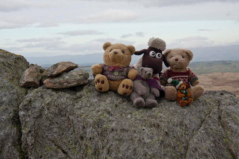
Then we scampered up on to the cairn and settled for our picture.
Pointing south-west, Shaun said, "there's our next objective Little Eric, High Wether Howe, with its summit cairn."
"What is that tarn called down to its right?", he asked
"Haskew Tarn", Shaun replied. "It looks from here to be rather overgrown in places, so I guess it is very shallow."
Dad took a shot of the tarn from here, but a better view was afforded when we had got about half way to High Wether Howe.
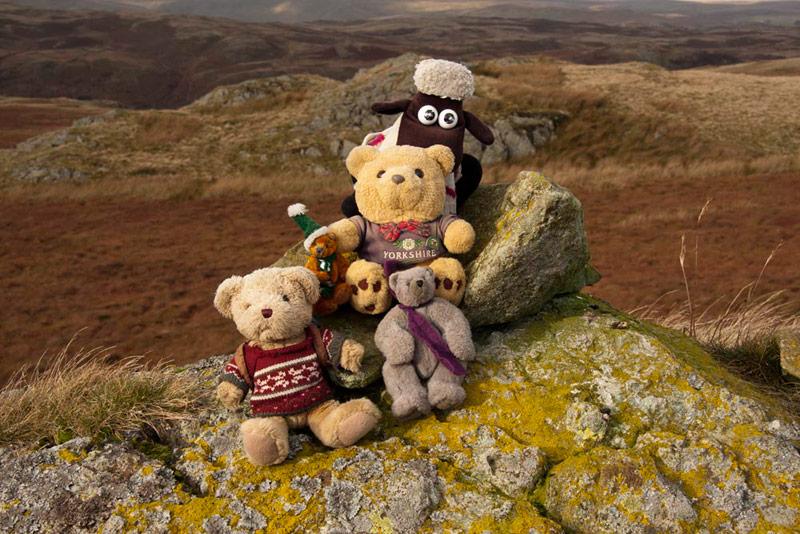
Shortly after the stop to take this we reached the cairn on High Wether Howe. It seems the name means the high hill where wethers (castrated rams) roam.
"That's 986", called out Allen.
"79", intoned Little Eric.
This outburst refers to the summits achieved by Allen and the Outlying Fells bagged by Little Eric. In fact they were doing this at every summit on the round today, but it would have become boring to include them all.
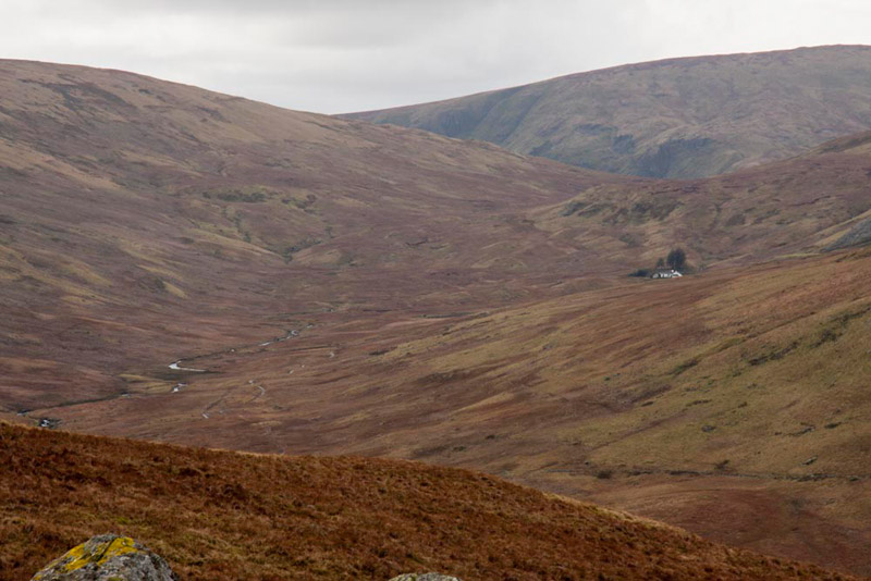
We had our photo taken here, and we paused a little while to have another bite to eat, while looking down on lonely Mosedale, with its only building Mosedale Cottage that was once a shepherds cottage but is now a bothy allowing overnight stays for walkers. The distant hill, is Harter Fell, part of the Kentmere Horseshoe.
"We have walked through there a couple of times, on return from climbing Nabs Moor and Howes. The last time with Uncle Eric in thick snow, in February 2009", remarked Tetley. Then showing off his knowledge, he went on, "in terms of location, Mosedale provides a link between Swindale and the Gatesgarth Pass, which itself runs between Longsleddale and Mardale in which lies Haweswater Reservoir."
"It is indeed a very lonely place, and in that very chapter in the Outlying Book, Wainwright's narrative once the descent from Howes is complete into the valley reads, 'follow the cart track left through desolation profound', added Shaun.
"What a wonderful description", replied Grizzly.
"Are you ready for the off again, Lads", said Dad.
"Yes", replied Allen, as we settled in the rucksack. "Just one more summit to go."
"That's right", replied Shaun. "Fewling Stones, whose name apparently means, where wildfowling took place."
It could be seen ahead the direction roughly north, and Dad descended, to cross a depression, then cross a number of rises, to reach the number of rocky outcrops of Fewling Stones, the highest having a tiny cairn perched on it, where we balanced ourselves for our final picture of the day.
The sky behind us looks clear, but in the direction we are looking it was black as night, and clearly it was raining hard. Fortunately that was away to the south, the direction we had come from. Looking at the clouds, Allen said, "it appears to be moving away east, and not coming towards us, but I guess we may well catch the edge of it as we walk on." This turned out to be the case, but the rain was light and did not last more than a few minutes.
"We need to head down and find the path that leads to the wall corner below Gouther Crag", instructed Shaun.
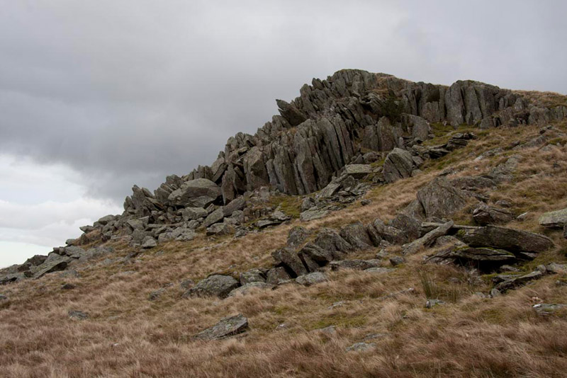
Dad picked his way down off the fell and headed towards the wall, so finding the rather intermittent quad bike track that was boggy in places. Along the way we passed below Beastmans Crag, with its splintered craggy rocks.
Little Eric speculated, "perhaps the name comes from it being used by shepherds as a vantage point for seeing where their sheep were."
"You're probably right", replied Grizzly.
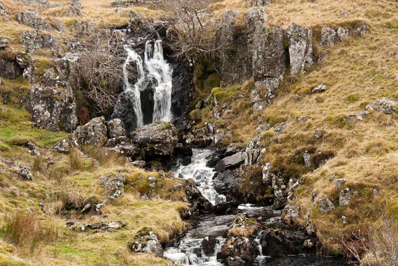
So after more meandering, the heather covered Gouther Crag appeared to the left, and beyond the wall corner the ravine of Gouther Crag Gill dropped away and with at the top this pretty little waterfall.
"Do we go down that way?, asked Little Eric
"No, we need to cross the gill and pick up the path indicated by that cairn", replied Shaun.
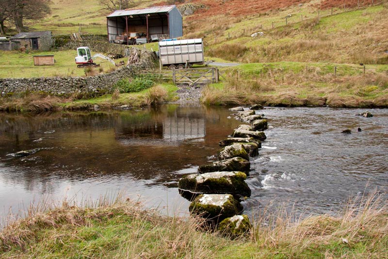
This wound its way down descending steadily, with the dramatic sheer face of Gouther Crag to the left. At the bottom we arrived at the green path we had taken this morning, with the Swindale Beck just beyond. As well as the footbridge and ford, there are stepping stones too.
Dad walked towards these, to as he intended edge round along the bank towards the footbridge, and Allen said, "you're not thinking of crossing them?"
"No Lad, it would be foolish not to use the footbridge. The stones look as if they may be slippy, so there is a real risk I could fall, and we would all get wet."
"A wise decision", declared Tetley.
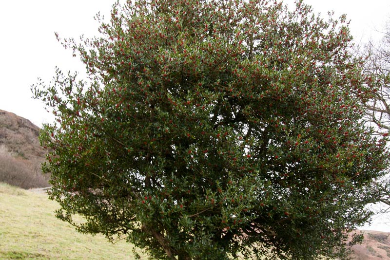
Once over the footbridge, it was a return walk along the road to the car, passing at one point this large holly tree.
"I know I always seem to state the obvious but I guess it is refreshment time now Dad?", said Tetley.
"Sure is. On to the M6, then a quick run down junction 38, and a visit to the services in Tebay."
He must have been hungry as Dad enjoyed beef and onion pie with mash potatoes, vegetables and gravy, and not forgetting of course a pot of tea with extra hot water.
A grand day out!
And finally.........
As you may have noticed in the heading this is the 200th story on our website. How can we really adequately put into words how much we appreciate all that our Dad has done for us. We must thank him first and foremost for taking us on so many wonderful adventures in the mountains hills and countryside of Northern England, and for taking some of our other pals on wonderful holidays in UK and abroad. At the beginning it was Grizzly, who started sending a letter to his cousin in America and Aunt Wendy, giving brief accounts of our walks and a few pictures. This developed into e-mail stories to a few friends, some of whom suggested a website. Not knowing really anything about creating websites, Dad fathomed it out and so Stag Walks came into being. This is thanks only to the hours upon and hours that Dad spent initially setting it up, and all the many hours since typing on our behalf and our other pals too, the subsequent stories, and writing and maintaining other pages such as the summits we have climbed.
We truly do have the most wonderful Dad in the world. We love you so much, and thank you for everything!