"Our luck rather ran out with last Sunday being such a poor day", said Tetley.
"Quite", replied Allen, "and whatever the weather this coming Sunday, we will not be walking as Dad and Uncle Brian will be beginning their stay at Armathwaite Hall."
Looking up from the iPad diary, Little Eric said, "he seems to have a couple of free days, so I wonder if we might be able to fit a walk in. They are Wednesday and Thursday. I'd check the Met Office app, but I'm not very good at navigating it."
"Pass it over, and come and sit by me, and I will show you how", said Allen.
Thanks pal, you are very kind and patient", he replied.
Tetley meanwhile, had had an idea where to go, and went and got a book off the shelf, pawing through it to the relevant page.
"Well Wednesday looks good", said Allen. Then glancing over said, "what are you looking at Tetley?"
"A suggestion for a walk, with six summits. They are Outlyers, so will move your total along well Little Eric, and also be good for your summit total Allen."
"Ooh yes!", exclaimed Allen. "That would mean only another seven to get to 1000 summits."
"Well put us out of our misery, and tell us which walk it is", called out Shaun, as he and Grizzly came marching in with flasks and cake tin.
"The circuit of Devoke Water."
"Great", cried Allen. "I'll go and ask Dad now and assuming he is agreeable, we can celebrate with cake and tea."
"It's cherry and ginger scones, today", said Grizzly.
"My favourites", called back Allen, as he dashed out of the door.
The smile told it all as he returned, and happily munching on Grizzly's delicious scones and with steaming mugs in paw, the map and book open in front of us we discussed the walk to come.
Planned for Wednesday, we in fact did the walk on Thursday, as the forecast had changed a little. Dad pointed out whilst both days were to be clear and sunny, it was a much calmer day from the wind point of view on Thursday.
The Walk
We awoke to see that there had been a sharp frost overnight, so our departure was delayed somewhat, while Dad defrosted the car windows. This did give us some extra time to pack our picnic, and ensure we were ready as soon as Dad was.
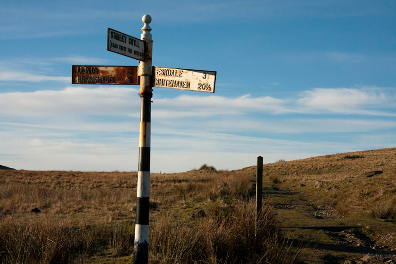
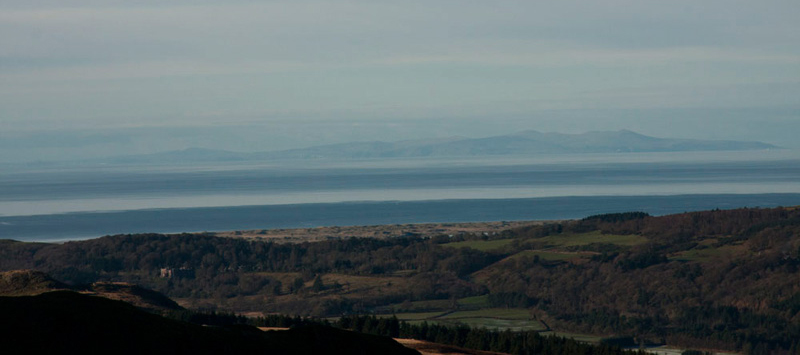
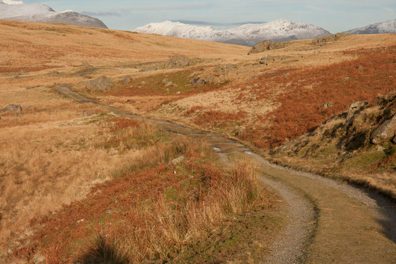
It was quite a distance to the start, the last time we had been in this direction was when we climbed Hesk Fell with Uncle Eric in June. It was along the A590, to Greenodd, then joining the A595, we drove on towards Broughton in Furness. At times the road had icy patches and the police were there to warn and slow the traffic down. Just before Duddon Bridge, we turned right up the Duddon Valley to Ulpha, then took the road left to drive over Birker Fell. Dad took it very carefully on these roads as there was ice. The Birker Fell road leads eventually to Eskdale, but we did not go quite that far today, stopping where the narrow road goes off right signed to Stanley Ghyll (road unfit for motors), Dad parking on the verge.
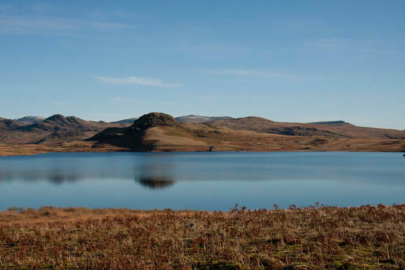
As can be seen, there is a signed track opposite, leading to Devoke Water, which was to be our route.
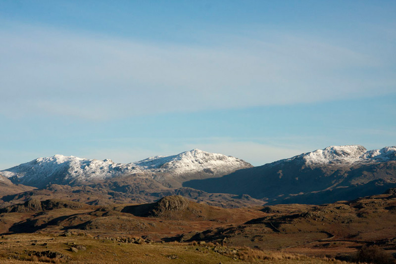
As we got out of the car, and standing with our backs to the track, Allen called out, "wow, what a magnificent view."
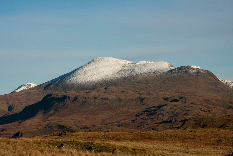
"What is that large mountain?", asked Little Eric.
"Scafell, the second highest in England, and the prominence half way up on the right slope with no snow is called Slight Side", replied Tetley. "I remember the day we climbed to those summits back in April 2006. It was a wonderfully clear, but cold day."
"My is it that long ago", added Grizzly. "How time flies. I seem to remember that there was no snow, but the rocks of the cairn had a white frost on one side."
We were then about to get into Dad's rucksack, when Little Eric piped up again, "and what are those mountains to the right of Scafell."
Patient as ever, Tetley said, "from the left, Esk Pike, Bowfell & Crinkle Crags."
"Thank you pal. I'm happy, so we can go now."
It was a beautiful sunny cold day, with hardly any wind. Apart from a couple walking along the track as we were climbing to Rough Crag, we saw no other person. Just quiet peace and silence. We did not even see any sheep, so for once you will be spared any such pictures in this story!
As we strolled along the access track to the lake, Shaun instructed, "the book indicates we should strike off half right about 20 yards beyond the gate to head for Rough Crag."
"There's no sign of a path", complained Little Eric.
"I guess that much of this walk will be trackless, so I will just have to pick the best route", replied Dad, striking up the slope.
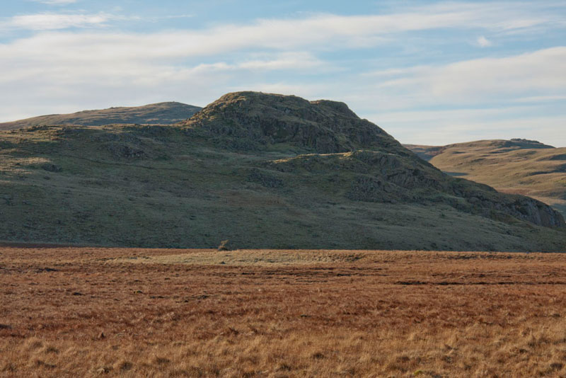
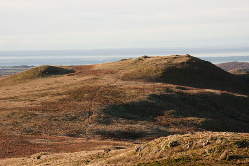
After a short distance, Rough Crag came into view and it was clear we were heading in the right direction. Of more interest was the view behind, the lake appearing as we gained height, and beyond the summits that awaited us later today.
Seat How the last and lowest summit dominates. Distantly behind to the left is Woodend Height that via Yoadcastle (not in view), will be reached from White Pike far distant to the right.
"This side is just the warm up for what's to come over there", remarked Grizzly.
Dad walked on, but after a few minutes stopped again as Tetley called out, "there are the Birker Fells, overtopped by Harter Fell."
"That was quite an interesting day on the Birker Fells.", mused Allen. "That is Green Crag to the right, and then there were a number of other summits along the ridge going left, the rounded hump if I remember correctly being Crook Crag."
"You're right", agreed Tetley. "Then on another day we walked up from Birks Bridge in the Seathwaite Valley, on to Harter Fell, returning via Demming Crag and Horsehow Crag."
Shaun added, "when we were setting off we saw the mountain rescue team training their search dogs. How interesting that was, even the little that we saw."
Impatient to bag his first summit of the day, Little Eric said, "all this reminiscing will not get us round this walk today."
"No, you are right lad. Best foot forward eh", replied Dad.
It was not actually very far and soon we stood at Rough Crag's summit.
Dad took our picture, but our attention was drawn to the horizon out to the west, over then Irish Sea, where quiet clearly rose the outline of the Isle of Man, and seeing it our thoughts turned as always to Aunt Tish and Uncle Eddie.
"That's Water Crag along the ridge", said Shaun,
"And there's a clear path to it, as well", added Little Eric.
"According to Birkett, the highest point is to the north, or the right side as we look at it from here, rather than the cairn on the left", remarked Allen.
"That's right", agreed Tetley, "and it is clear from this viewpoint that that is correct. The Outlying book shows the height at 997ft, but the latest map shows 305m (1001ft), hence it just making it as a Birkett top."
"Well if we are ever going to get there, we had better get settled in the rucksack", demanded Little Eric, who was eager to be on the way again.
"You're bossy today", replied Allen.
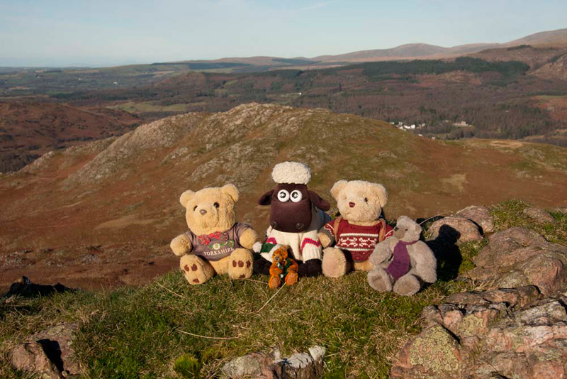
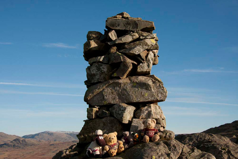
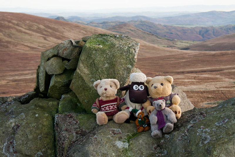
Descending to the dip, where there were boggy areas, we then climbed steadily, to leave the path right and gain the summit area and cairn where Dad took our picture. This was after we had walked the few yards north to the actual highest point, and here we are -
Looking south, Grizzly said, "that's the north side done, but Dad is going to be faced with a lot more effort for us to summit the next four tops.".
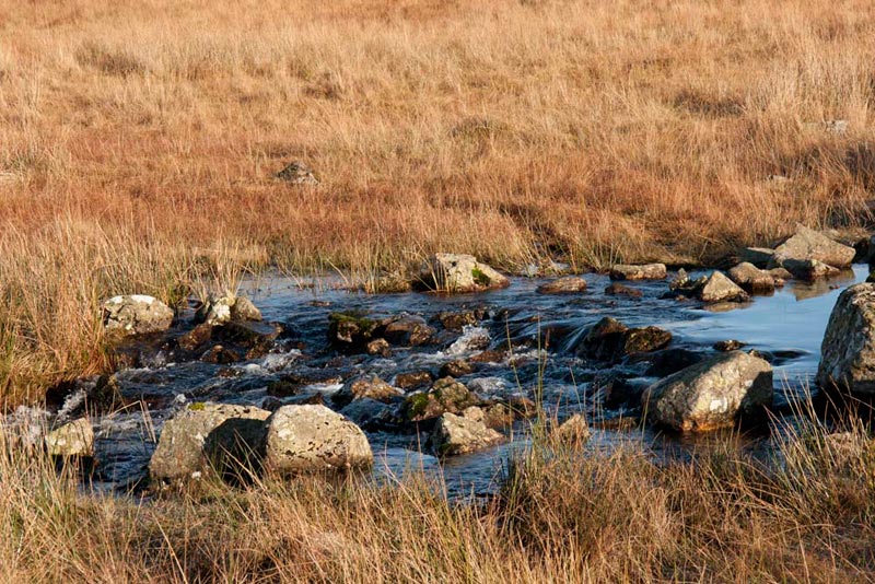
A clear path descended to lake level. There was lots of boggy ground all over today and none more so than this section, but fortunately due to the cold temperatures last night, it was for the most part frozen, so Dad's boots did not did not sink in. It would be a more difficult matter negotiating this otherwise. Here we encountered Linbeck Gill the outflow from the lake that then joining Black Beck, flows eventually into the River Esk. It was in spate and flowing fast, but there are rocks where boulder hopping is necessary at the crossing point. Anywhere else the water is too deep! This shot was taken after we had crossed.
"Oh heck, that looks a little tricky", said Little Eric.
"We have to cross, and this is where I wish that I had bought my stick with me to give me some extra balance, replied Dad. "Never mind here goes".
We got half way, and Dad had the rest planned in his mind, but the next step although it looked to provide firm footing, proved otherwise and his left foot slipped, and that was a soggy sock for the rest of the walk! Still he got his right foot firmly on the next rock, and regaining his balance, in a couple more steps we were over.
"Not the first time you've had a wet foot Dad", remarked Tetley.
"No lad, and I guess it will not be the last. I'll soon forget about it as I put my mind to getting up to White Pike."
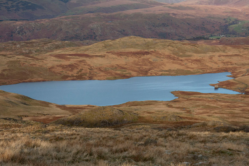
First however our eyes turned left for the lovely view along the lake, the upper slopes of Seat How providing a reflection.
Not being one of the 18 stretches of water that comprise the lakes in the Lake District, Devoke Water is classed as a tarn. It is the largest, and one of the highest, at an altitude of 770 feet (223m), having a depth of 46 feet, and being almost a mile in length.
"Oh it is just so tranquil and peaceful", whispered Shaun, as we gloried in the beauty and silence. Then after a minute or so, and ever practical, he said, "Birkett states, we now need to bear right to a large circular pile of stones, an old shelter and a forlorn wooden post."
From here we then went first left and then right over more boggy ground to gain the shoulder and start the climb to White Pike. Its tall cairn had now disappeared from view, but the way was south, and being midday, Dad just kept a line facing into the sun, as a guide over the pathless terrain. The fact however that the sun is so low in the sky at this time of year, did mean it was hard to see the way ahead.
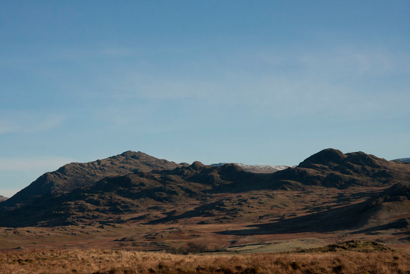
After a few minutes, Allen called out, "that is another nice view of Devoke Water, especially with the backdrop of the mountains. One for the story Dad?"
From the left the mountains are - Lingmell, Scafell with Slight Side, Esk Pike, Bowfell & Crinkle Crags.
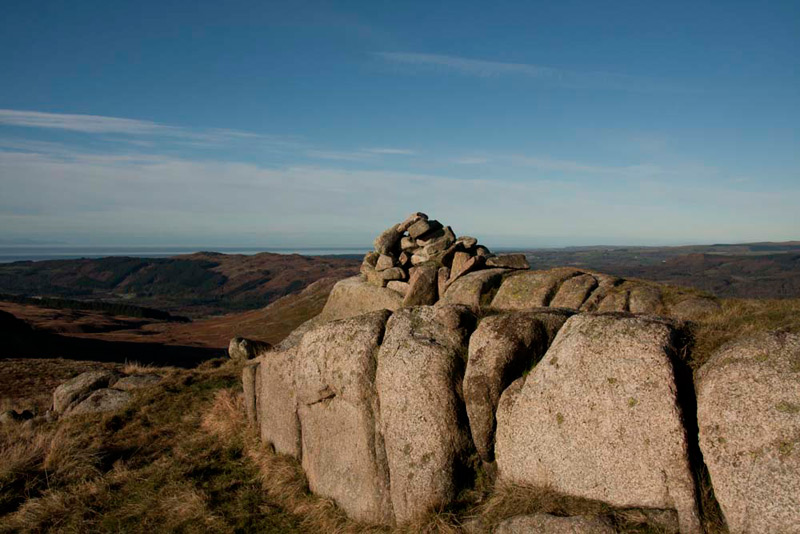
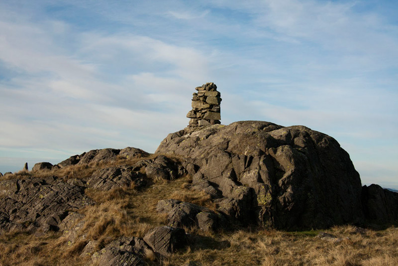
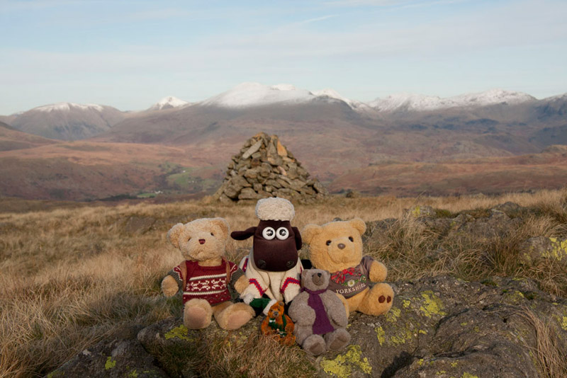
Continuing on, and after cresting a number of intervening rises, the twin rocky summit came into view, the most westerly having the tall pillar like cairn.
"Well that's the hardest part of the walk over and done with", sighed Dad.
"Come on", shouted Grizzly, "let's get up on the cairn for our picture."
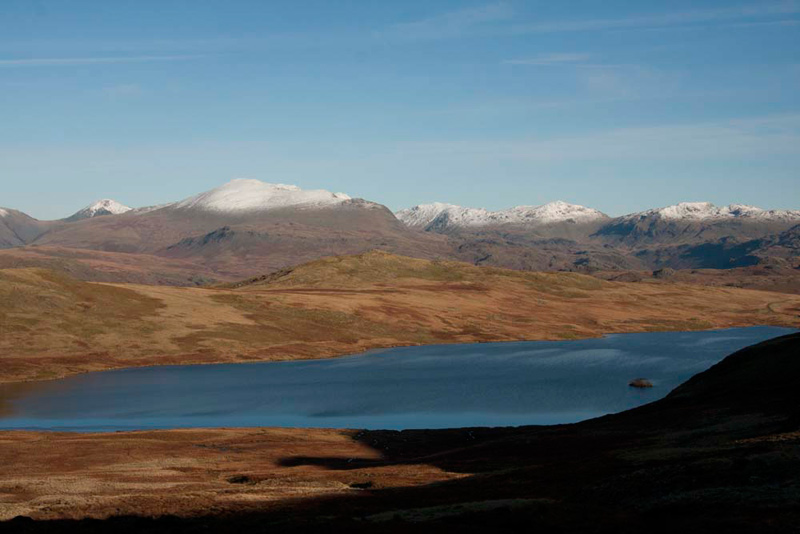
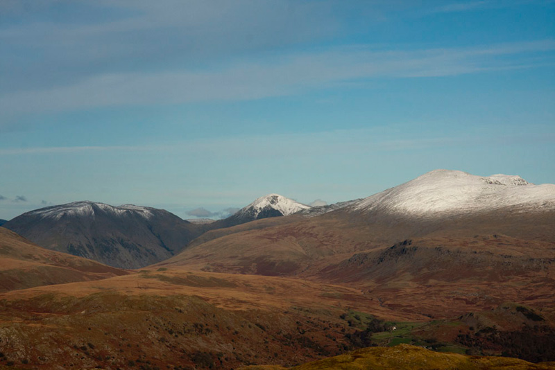
There were good views west over the lowlands of the Esk Valley, and looking north-east, the aspect of the mountains had changed. Now Great Gable (2949ft) could be seen, to the left in this picture. Then going right, as before, Lingmell (2649ft), Scafell (3162ft), with now Scafell Pike (3210ft), the highest in England behind right.
"Right, where now?", asked Little Eric.
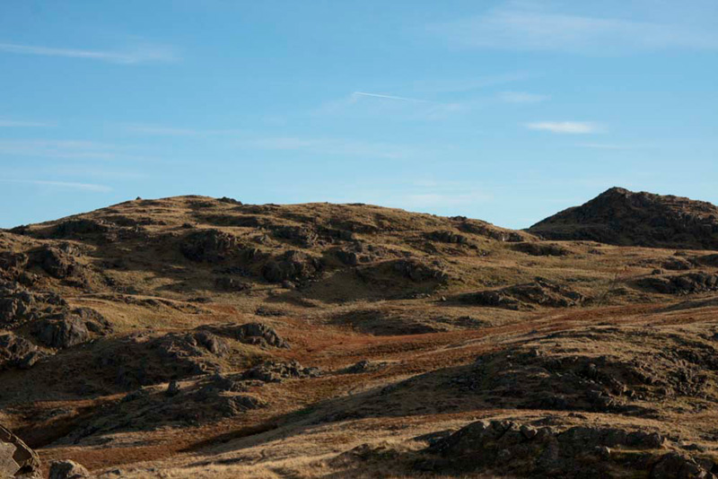
"We go east following that clear path, to Woodend Height and Yoadcastle", said Shaun, seen below left and right respectively. Part of the path can just be seen crossing the lower shoulder of Woodend Height, aligned below the summit of Yoadcastle.
"At Water Crag, the cairn was not at the highest point, and this is the case with Woodend Height too, the actual summit being slightly to its right, looking from this angle", remarked Tetley.
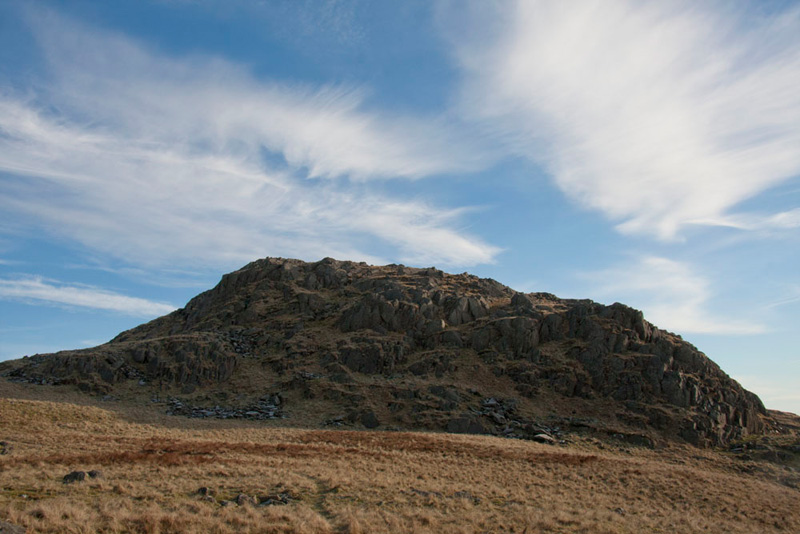
Settled in Dad's rucksack, he strode off along the path, leading below the slopes of Woodend Height and towards rocky Yoadcastle. Its name means horse fort. We like this shot for the sky, too.
The path led over the col, from where it was just a short scramble right to its small perched summit cairn.
Regaining the col, we now took another clear path, to soon arrive at the top of Woodend Height.
"You were quite right Tetley, the cairn is definitely not at the highest point", said Allen.
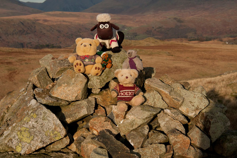
This was a small ridge of rocks a few yards south, where we sat for our usual picture, the cairn forming the backdrop, with the mountains beyond.
"What a lovely view of the lake with Rough Crag our first summit today", said Shaun. "The boathouse can be seen clearly, and we should make a beeline for that down the pathless shoulder."
As we made our way down, we could see clearly Seat How the final summit, with the mountains forming a backdrop.
Shaun said, "the ascent route can be seen, via that grassy slope to the right of the main bulk of the fell."
It was a long and seemingly endless descent down the shoulder, but finally it was done, and as we neared lake level, Dad cut right over boggy ground towards Seat How. Crossing two low broken walls, we then reached the grassy slope, that was steeper than it looks from the picture above. Round the back we spotted the path to the summit, the short scramble bringing us to the cairn.
It was then just a simple matter of retracing the ascent, but once down the grassy slope, we cut right under the fell, to descend to the track, along which we walked to the car, the with further grand views of the mountains.
It was about 14:45 now, so Dad decided to head straight home to get there in daylight. Thankfully the ice we experienced on the road this morning had largely gone.
"Thanks Dad for a great day", cried Little Eric, whose total of Outlying fells bagged had moved on to 86
"Yes", echoed Allen, "that has got me to 993 summits, ever closer to the 1000, so that I can join Shaun, Tetley & Grizzly, in achieving that goal.