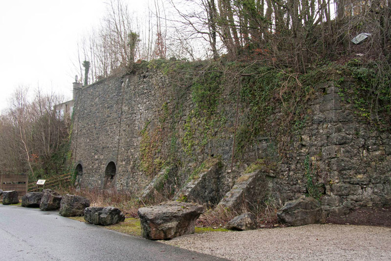
Old road at Sandside near limekilns (SD 4804 8093)
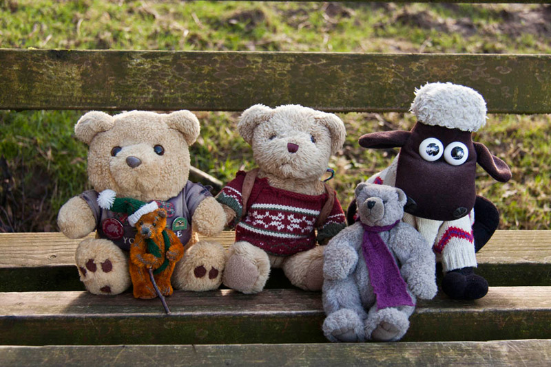
Summits Achieved
No summits were reached on this walk
Preface
It was New Year's Day and having wished each other a Happy New Year, Tetley said, "let's hope we get a good number of walks in this coming year, and that you are able to complete the Wainwright Outlyer Challenge, Little Eric."
"I hope so too. Just two walks will do it, and Uncle Eric also has these tops to bag, so when the longer days come they should hopefully be accomplished. I will be a very happy bear as when the rest of you finished the Outlyers, I had only done about half. What a wonderful Dad we have, that he has repeated over 50 just for me."
"Quite", said Allen, "but we have enjoyed revisiting them too. We did pretty well for walks in 2013. In all 38 covering just over 300 miles. Good going bearing in mind the other calls on Dad's time."
Shaun and Grizzly meanwhile had arrived with the tea and cakes.
"Ooh just what the doctor ordered", said Allen. "I'm...
"gasping for a cuppa", interjected Tetley, letting out a laugh, as he went off to get the mugs and plates.
"What's the cake, Grizzly?", was Allen's next question.
"Apricot slice, that Little Eric has made, and I have made chocolate caramel shortbread."
Tetley passed round the plates and we all took some cake, while Shaun had filled the mugs and passed them around.
Taking a bite, Tetley said, "Grizzly, Little Eric, the cakes are delicious. You really do spoil us."
"I love baking", replied Little Eric, "and if you like the results then I am very happy."
Shaun had been looking at the calendar on the iPad, and remarked, "there is a walk down with Uncle Eric for tomorrow, so that will get our 2014 account off to an early start. Has any decision been made as to where it will be?"
Not definitely, but recently Uncle Eric mentioned a walk published in the Westmorland Gazette. It follows the route of the Storth Geotrail and sounds interesting", replied Tetley. "We will just have to see, when Dad talks to Uncle Eric tonight. Meanwhile I'll have another piece of cake, Grizzly."
"Here you are pal", he replied passing the tin.
Later Dad came in and said, "the walk is on for tomorrow, and Uncle Eric has suggested the one from the Gazette of the Storth Geotrail. It is just over 3 miles, so Uncle Eric has also suggested an extension, along the track bed of the old railway into Arnside and then via Hazelslack and back via Storth. That will make it about 8 miles in all, a good start to our 2014 season."
"Sounds great Dad, roll on tomorrow", enthused Grizzly.
NB - The Geotrail has been developed between the villagers of Storth and the Landscape Trust. Although we were following its route, the description below really only touches on the many features concerning the geology. Please click the link if you wish to see the full information - Storth Geotrail
The Walk
The arrangement was to start the walk about 10:00 and as it was not far to drive to Sandside, we did not need to be up very early for once.
The instructions, suggested that we should park at The Ship Inn. However as we did not intend to eat there, both Uncle Eric and Dad thought it would be better to park on the promenade at Sandside. However this plan was changed due to the forecast high tide. Instead we actually parked on the old road behind where the Arnside to Hincaster railway used to run.
We called out, "Happy New Year, Uncle Eric. Here's to our 2014 walks with you."
"A Happy New Year to you Lads, and it is nice to see you all", he replied.
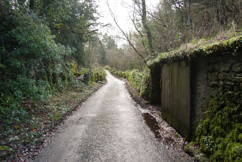
Soon Dad was ready and we got hunkered down in the rucksack, and off Dad strode, passing the remains of these old limekilns.
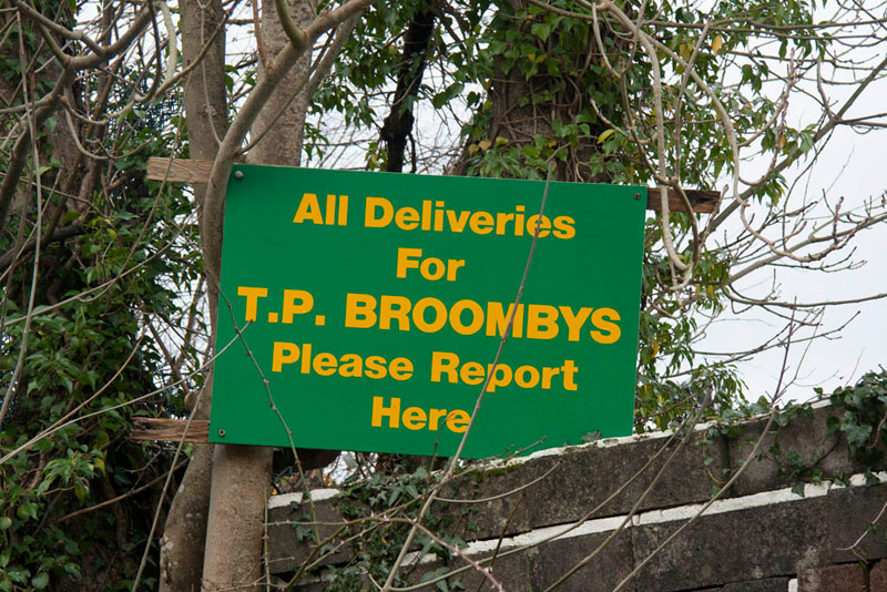
We were heading towards Sandside Cutting on the former railway, but before reaching it, we passed behind the premises of Travis Perkins Builders Merchants. Dad remarked "it used to be Broombys, who had a number of premises in the area."
"So I see", said Grizzly, who had spotted that the sign at the back.
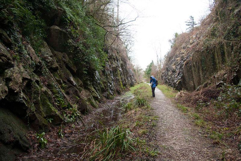
Soon we reached the cutting, where there was an information board. It told us that the Arnside to Hincaster railway link, of which Sandside cutting is part was completed in 1876 and remained open for through traffic until 1963. The last train ran on the Sandside to Arnside stretch of line in 1972. Though it was constructed to carry coke from the Durham coalfields to the Furness iron industry, it also provided a passenger service between Grange and Kendal or Windermere up to 1942 affectionately known as the 'Kendal Tommy'. During the First World War it was of such national importance that it was listed as a 'Lifeline of Britain'. In 1994 Beetham Parish Council acquired the 700 metres of disused line from the Dallam Tower Estate and created a footpath from The Ship Inn to Friar Cote Bridge, where we were about to walk.
This is the first overbridge...
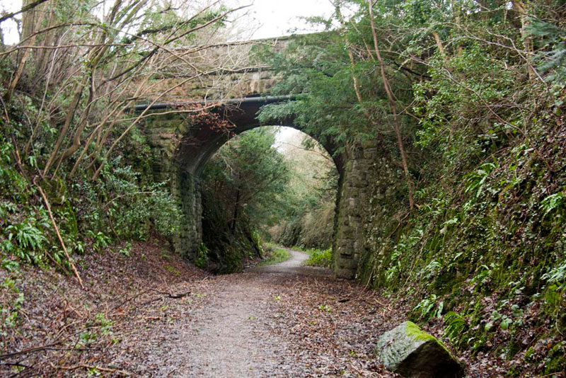
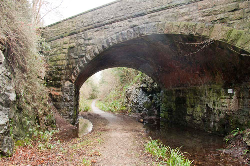
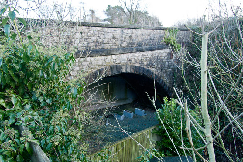
then looking onwards to the second bridge, showing how deep it is.
Here is the second bridge. Uncle Eric said, "this is a skew bridge, so called because it crosses at an angle to the line."
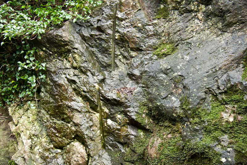
To the side the rock face is exposed, and Allen called out, "what are those vertical cuts in the rock?"
"They are where the original builders drilled down so that explosive charges could be inserted to blast the rock out", replied Dad.
At its end a gate exited us on to the main road. "Where now?", asked Allen.
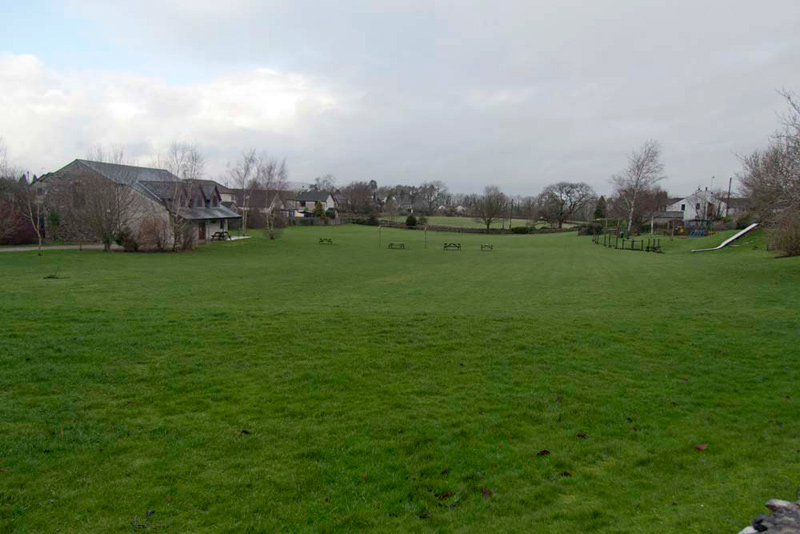
Shaun had the instructions and was quick to reply, "we go right the very soon right again into Green Lane and walk up to the war memorial. Then we cross the road, and go left past the shop, and following the road as it bends right on Yans Lane. Then finally we take a gate into and across the playing field on to Shaw Lane."
At the far side, Grizzly, then said, "where now pal?"
"Right to Storth Road, then turn left along this to a crossroads. There it is left along Cockshot Lane, to then take the third on the left, Throughs Lane", replied Shaun.
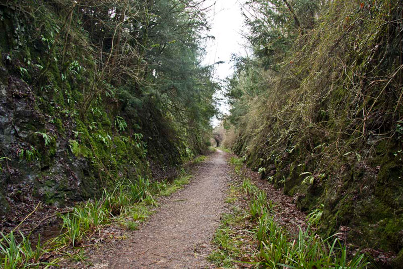
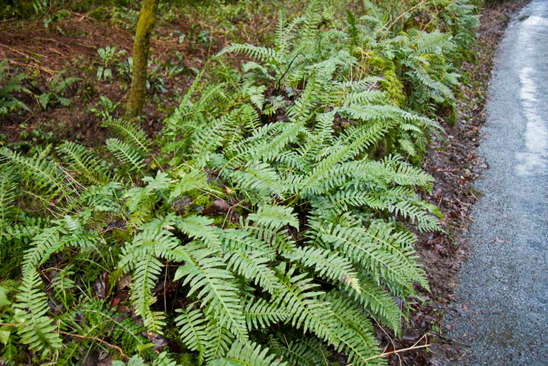
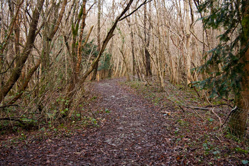
Arriving at Throughs Lane, we paused, and Little Eric said, "those ferns make a nice picture, Dad."
Throughs Lane is narrow with dramatic tree clad Limestone Cliffs, as in past this picture shows. Over millions of years erosion of limestone beds has taken place, which has formed this corridor that is part of what is known as the Silverdale Disturbance. The geology to us is rather hard to understand, so if you wish to know more we once again suggest referring to the detailed document of the Geotrail.
At the end we came to Yans Lane at its opposite end. "The route is right for about 50 yards, to a small building, then we take the gap stile on to a footpath beside the building", said Shaun.
This is the view from the stile.
"What a delightful path", remarked Allen, as we strolled along.
It led through lovely woodland, winding and climbing a little up and down, to come out onto Cockshot Lane again, but further on.
"It's left for about 200 yards, then we go left again on a footpath", instructed Shaun again.
As we approached this Little Eric called out, "that's a nice view to that little tree fringed tarn."
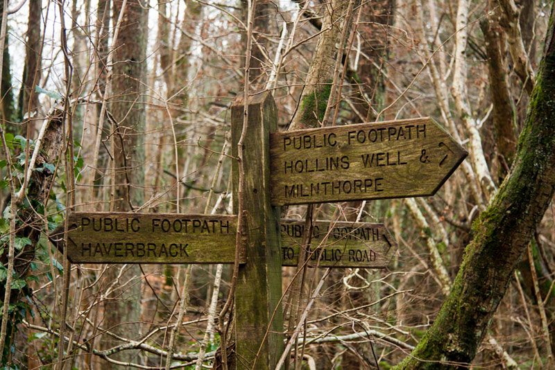
At the end, where the gate opposite is marked private, Shaun said, "we should go left and climb the stile beside a gate, and on to a junction."
Here there was this three-armed signpost our route being in the direction of Hollins Well & Milnthorpe,
on a delightful path through the woods,
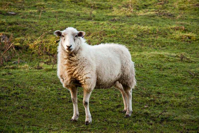
that was eventually to bring us out of the woodland via a gate to the left and into pasture. Here there were sheep, and much to Allen's chagrin, this one posed for Dad. "Hmph, I suppose we will have to include the picture in the story", he growled.
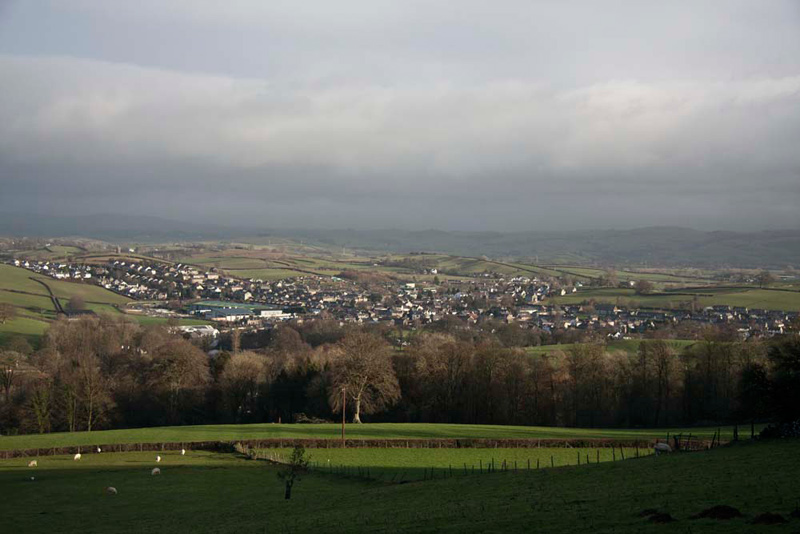
The route was down the pasture, but our attention was arrested by the views and we stopped to take them in. "These have got to be worth taking" implored Grizzly.
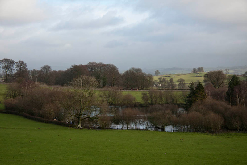
First to the town of Milnthorpe bathed in sunlight, which we had come through this morning on the way to Sandside.
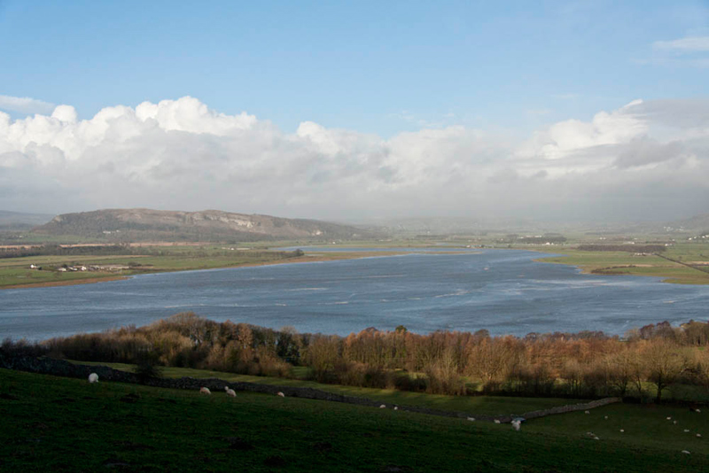
And looking more to the left, this of the Kent Estuary, showing that the tide was indeed in flood.
"We have walked extensively in the Arnside and Silverdale area, but these paths today are all new, and seeing these views has been like the icing on the cake", said Tetley. "Thank you Uncle Eric for suggesting this walk."
"You are welcome. It is new to me too."
After descending the large pasture, the gate led on to a track, Lovers Lane. "There's a seat", said Allen, "please take our picture, as we have to appear at least once in each story."
"We should cross the lane, and take that gap stile", advised Shaun.
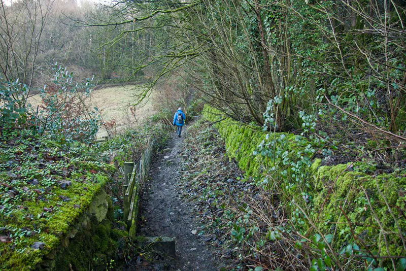
This took us along a narrow path with a wall on the left and a fence on the right, that descended and then went left to a stile onto a track.
"We take the stile opposite", called out Shaun.
The path went beside the wall to the right, and here a number of boulders with a pinkish tinge were sticking out of the ground.
"These are Shap granite", said Tetley. "They are erratics, that have been brought down millions of years ago by glaciers and deposited here. We have seen erratics before notably on Norber above Crummock Dale in Yorkshire."
At the end of the field another stile led on to the junction of the main road and Quarry Road at the entrance to the business park. "We go left on Quarry Road," said Shaun
This was in fact the road we had driven along to the start this morning. To its right we could see the cutting where the railway had once run, and at Uncle Eric's suggestion we took a short deviation to view the bridge over it.
Returning to the road, we strolled on passing Dad's and Uncle Eric's cars, so completing the circle and the published walk.
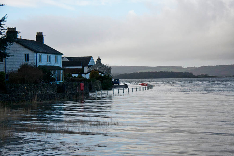
Strolling on to the Ship Inn, the plan had been to walk along the main road, but as can be seen this was now impassable due to the high tide. The tide was even higher the following day and sadly The Ship Inn was flooded, causing extensive damage.
"Well it was a good job you did not park on the road as originally planned", remarked Tetley.
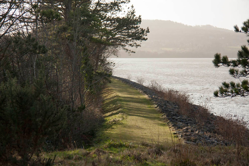
We were heading for Arnside now, so the only way we could make progress was to walk along Sandside cutting again. This is the view looking towards Arnside from the second bridge, and was taken earlier. Uncle Eric is lining up his shot of the drill holes for the explosives.
Exiting on to the road again, it was left up to where it makes a sharp bend left across another bridge now filled in over the track bed of the railway. Here we climbed the crash barrier and descended to the track bed beyond that hugs the estuary.
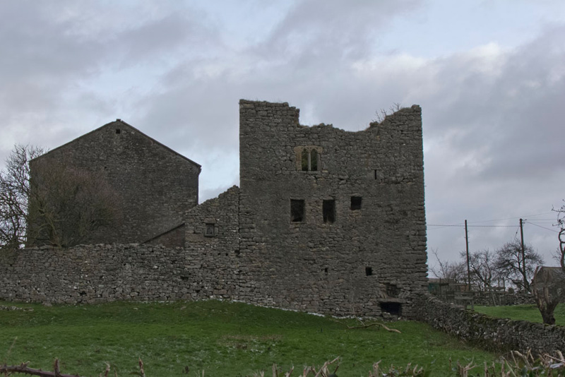
Now it was as this point that Dad's camera lens developed a fault, preventing him from taking any more pictures, so all we can do now is describe the rest of today's adventure in narrative. (Happily, a year later we walked this area again, so can now include at least a picture of Hazelslack Tower).
Arnside Station was at the end of the track bed, where it joined the line between Carnforth and Barrow in Furness. Here we joined the road and strolled along the promenade, to the Albion Hotel for lunch, as planned. This is run by Sue and John, who a while ago ran the Hest Bank Hotel where Dad remembered them from. Dad had a nice brie bacon & cranberry ciabatta and J2O to drink. We had packed sandwiches and cake and ate these sitting quietly in the corner.
Rest and lunch over the walk was resumed, retracing through the village and on to Black Dyke, where we went left on the Limestone Link path, crossing the railway and on over the very muddy and wet Arnside Moss, that required a very erratic course to get to the far side, and via a narrow gap stile to the road.
"Phew I am glad that part is over", said Dad with relief in his voice.
"Quite!", agreed Uncle Eric.
Opposite stands the ruins of Hazelslack Tower, the picture below showing the west side, where can be seen that a window remains with the lintels etc. It probably dates from the late 14th century and was reputedly built by Lucy, Margaret and Katherine de Thweng. The building was originally divided into a South and North half. The North half had a tunnel-vaulted ground room. The staircase was in the South half. Originally a building was attached to it on the East side. On that same side is a small original doorway, with a pointed head.
Now we followed the road as it bent left round the tower and on to then take a path off right. This led over a stile then headed up with woods to the left over more stiles to a gate, and along a track into a another field, and so finally to the road.
Walking left and then right at the junction brought us to the end Throughs Lane at its junction with Yans Lane. "We take Yans Lane and follow it to pass the shop and so reach the War Memorial", advised Shaun.
There we turned right onto Green Lane and followed it all the way down to the main road.
"It is still flooded", said Little Eric worriedly.
"No problem", replied Allen. "We will just have to use the footpath through Sandside Cutting once again, to get back to the cars."
"It has proved to be a vital footpath without which the second part of the walk would not have been possible today", added Tetley.
A good day and a longer walk than expected, but it got our 2014 account off to a good start!
"Thanks again Uncle Eric", said Little Eric, "It has been a most interesting walk, and we have explored areas that we have never been to before."
"You are most welcome. I am glad you all have enjoyed it", he replied.
So all that remained was to decide a date for our next walk, hoping that the weather will be kind, before Dad drove us home.