DUNNERDALE FOREST, WALLOWBARROW CRAG & RIVER DUDDON from BIRKS BRIDGE
Shaun, Tetley, Allen & Grizzly, complete The Fellrangers
Summary
Date - 19th April 2014
Distance - 6 miles
Ascent - 1500ft
Map - OL6
Start point - Birks Bridge car park (SD 235 995)
Summits Achieved
Name
Height (ft)
Height (m)
Grid Ref
Wallowbarrow Crag
958
292
SD 2223 9679
Preface
"Have you read that article from the Westmorland Gazette that Uncle Eric lent to Dad, remarked Tetley.
"No pal", Allen replied. "I have not had chance."
Just then Shaun, Little Eric and Grizzly arrived with the flasks and cake.
"Better get our priorities right, having the tea and cake. I'll tell you about the article when we are settled, and some consequences as a result", said Tetley.
The mugs were soon charged with tea, and the pieces of mincemeat slice were on our plates.
"Mmm, the cake is delicious Grizzly", said Southey.
"It is Little Eric you should thank, he did the baking", replied Grizzly.
So all content, Tetley then restarted his tale.
"The article, was about a hotel in Ambleside, that is encouraging guests to take their pictures on the summits of the fells, and post them in the hotel with an account of their experience."
"Seems like we beat them to that, with our website, and all the stories that Dad has been kind enough to type up for us", laughed Shaun.
"You mentioned a consequence", said Allen. "Should I be worried."
"Well the article refers to the Long Distance Walkers Association, where like the Wainwright Society, members can have recorded their achievement of certain challenges. Now we have done all the Wainwrights and Outlying Fells, but on checking Dad found that there are 105 Outlyers on the Association's list as against 104 on ours."
"Oh, does that mean we have not completed that challenge then", said Grizzly, with a frown on his face.
"Well Dad has investigated and found that St John's Hill (935ft) and Caermote Hill (948ft), near Bothel, are now being treated as two summits.", informed Tetley. "The good news is that on the way to Caermote Hill, we must also have crossed the summit of St John's Hill. So all is well and Dad has updated the page on the website."
"Phew", breathed Allen, "that's a relief."
"That is not all, as he has also discovered a new set of guides called The Fellrangers, by Mark Richards. There are eight books in all and include 227 summits in the National Park."
"Sounds like the Wainwrights plus a few extras", interjected Shaun.
"Yes, that is right, they are indeed either Wainwrights, Outlying Fells and /or Birketts. Now just to be sure Dad printed a list off and checked them against summits we have climbed. The total done is 226, leaving just one outstanding. This is Wallowbarrow Crag near Seathwaite in Dunnerdale."
"Makes one wonder if he included this, so that walkers like us who have done the Wainwrights and Birketts, would still not have completed his challenge", laughed Allen.
"I think you may be right, and as Dad has created a page for The Fellrangers, we will have to get this one climbed so that they can be shown as completed", replied Tetley. "Now this weekend is Easter, and he had planned to take us somewhere remote, but now this has come up, he has decided that we must do Wallowbarrow Crag."
"Great", called out Grizzly. "Dunnerdale is a lovely area, so it will be a truly lovely walk, and the forecast for Saturday is for sunny weather."
The Walk
We had not been to this area specifically since October 2010, when we climbed Harter Fell, but the Duddon Valley is beautiful, so as well as bagging the summit, we were all looking forward to the walk, and for Southey it would be a completely new area he would discover.
The drive was ever so familiar, having done it many times. Along the Barrow road to Greenodd, where for the first time we used the newly constructed roundabout at the junction.
"It has needed to be built for a long time, and will make this junction, where there have been many accidents, so much safer", said Tetley.
Then the familiar road to Duddon Bridge, turning right up the valley just before and after a few miles reach Ulpha. Usually after this we have taken the right turn and climbed the steep hairpin bends to take the road over Birker Fell, but today we kept straight ahead to Seathwaite. The road is very narrow in places and Dad's big car seemed to fill it. We did not meet too many other vehicles, but there was always just about enough room to squeeze past. Eventually we came to the tiny Birks Bridge, where a few hundred yards further was the Forestry Commission car park.
It was a bright sunny day, light winds, and clear skies, a little cloud bubbling up near the end, so Dad was walking in shorts again.
Exiting the car park to the rear, we crossed the bridge over the River Duddon, sparkling blue in the sunshine.
Immediately over this we took the signed bridleway left, a grassy trod that led to Birks, passing the buildings right. There were two other couples, ahead of us, walking this path too. Through the gate the route was again left off the wide track. One couple asked, "is that the way to Harter Fell."
Dad replied, "it is directly in front of you along the track you are taking."
Our route, a narrow path soon led to a forest road, that we walked along left. Dad talked a little to the other couple, Brian and his wife, at various times on the walk, but we did our my best not to join them as such. They did notice us and Dad had to explain.
"According to the map the actual route is off this road and through the forest", said Shaun.
Well we kept our eyes peeled, but there was no signpost and it was hard to spot the path. However it was of no consequence as the forest road brought us to the same place, to take a narrow path left that led all the way to Grassguards Farm.
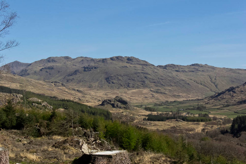
The forestry had been felled so providing lovely views, Tetley calling out at one point, "Dad I think you should take a shot looking back to the more distant fells."
"Ooh yes", agreed Dad, getting the camera out of the bag.
"That is magnificent. So what are we looking at?", asked Southey.
"The pointed summit at the left behind the nearer fells is Esk Pike (2903ft), then from the left is Little Stand (2428ft), Cold Pike (2300ft) and Pike O'Blisco (2313ft)", reeled off Tetley.
Walking on the path finally brought is to Grassguards, crossing the ford to get to the buildings.
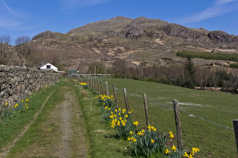
Beyond, the good track continued in the same direction, Allen remarking, "that is a lovely view of Harter Fell, rising behind the farmhouse, and the daffodils along the track add a splash of colour."
We should add that Harter Fell is the higher and distant hill behind the more prominent and nearer Brandy Crag.
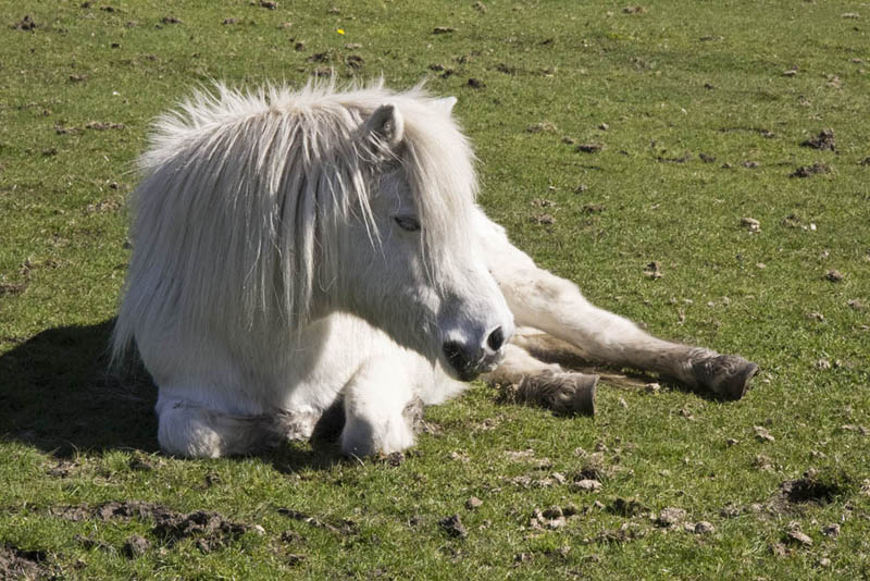
In the field to the right two snow white horses, were sitting down enjoying the lovely sunshine, Dad focusing the camera on one.
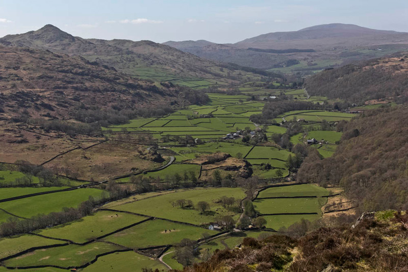
The track stretched out ahead, dropping then rising to a col beside Wallowbarrow Crag, our summit objective.
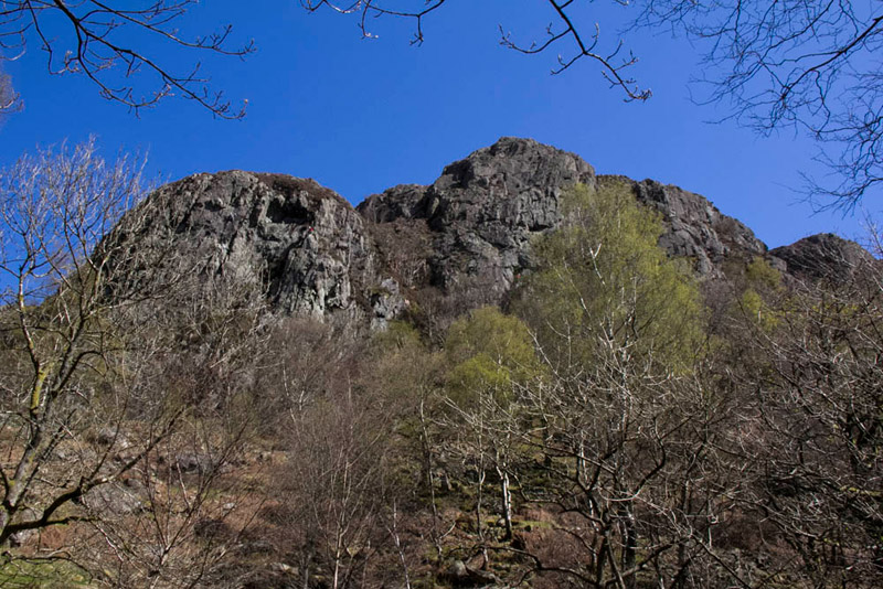
"On the drive to the start, we saw that Wallowbarrow Crag lives up to its billing, in that the south face is a sheer and vertiginous rock face", said Grizzly.
Indeed here is that southern aspect, taken later after we had climbed to the summit. It is a magnet for rock climbers and although they really cannot be made out, there were a number climbing the crags on the left. The crags are also a place where peregrine falcons nest. This was imminent, so shortly climbing was to be prohibited for the period of the nesting season. Indeed as we were driving home, we could see one of the falcons, circling above the crag.
"So, went on Grizzly,"it is as well that the northern side is grassy and rocky, and has a much gentler gradient", as we looked ahead along the track.
As the track started to ascend to the right, Tetley called out, "there seems to be a vague path to the left that climbs the fell."
So we made for this and Dad initially climbed to come to some prominent rocks. "Well, this is not the summit", Dad said, as we could clearly see that the ground continued to rise heading south.
Crossing the rough area ahead, there was then a ravine, and once down into and up the other side, there was no doubting the summit just beyond, a small ridge of rock running east-west, and rising to a pointed rock at the east end, being the highest point.
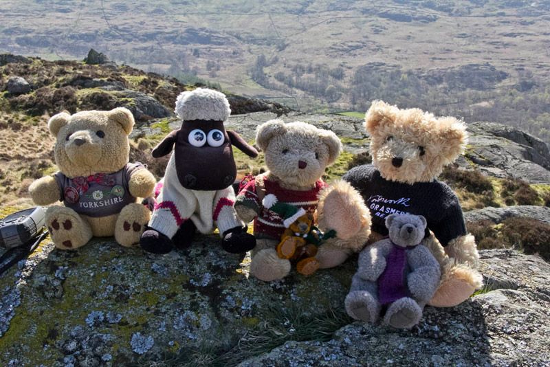
"Hooray" cried Shaun, "That is the Fellranger challenge completed for Allen, Grizzly, Tetley and I, and you too Dad of course!"
"Come on", Allen said, "let's get up there and have our picture taken."
It took a bit of fiddling to get settled properly, but finally we were ready, and here is the result.
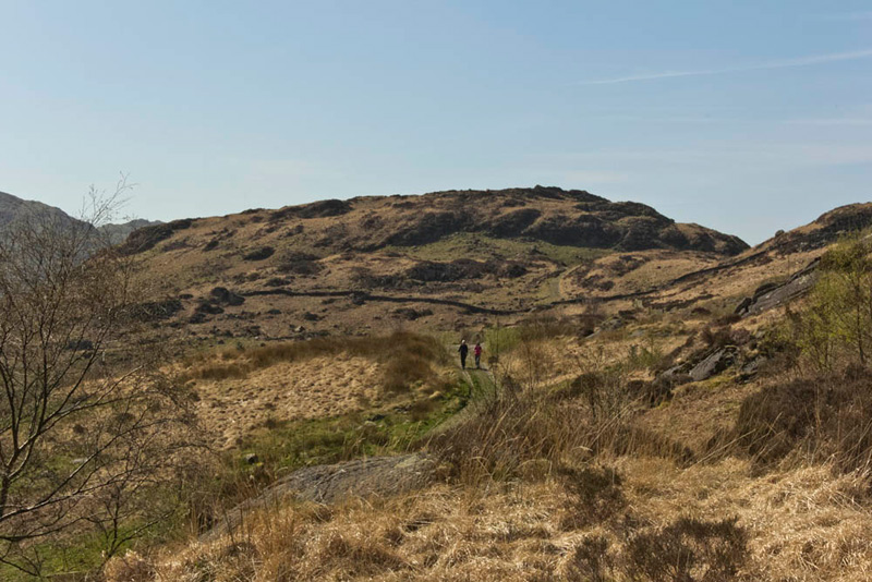
In previous accounts of our adventures, we have said that it is not necessary to be on the highest summits to get wonderful views. Well this is truly the case with Wallowbarrow, its summit being at a modest 958ft, yet the view south of the Duddon Valley, is just breathtaking.
The pointed summit on the left is Caw (1735ft), and Black Combe (1970ft), is highest fell in the distance. The small community in the centre of the valley is Seathwaite. Closer the group of buildings is High Wallowbarrow, to which our path would take us. Then for the return route it was to be along the track that passes the triangular shaped enclosure.
A narrow trod led west from the summit, and never in doubt descended to the track, but further on that where we had left it to make the ascent.
The couple we had talked to earlier had made a refreshment stop, but now as we made the descent they were passing along the track, Dad waving, and they waved back. He got into conversation shortly afterwards, and Brian said, "we saw you standing at the top, and also bending to help arrange the lads for their photo!"
Soon the track, rough and stony, began to zig-zag steeply down to the valley and on to High Wallowbarrow Farm. The couple were following a walk in a guide book, but in conversation became interested in the route Dad had devised for us, so on arriving at the farm, they opted to take our route along the river.
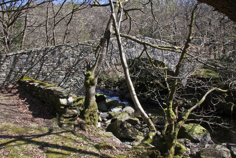
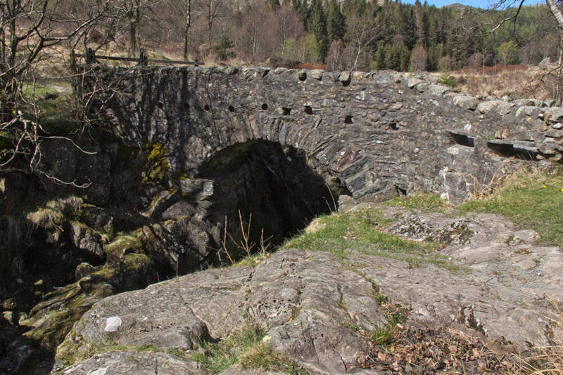
A good path to start, coming to a graceful narrow stone arched footbridge. "How lovely", said Southey.
We do not cross", said Shaun, "but continue up the valley on this side of the river."
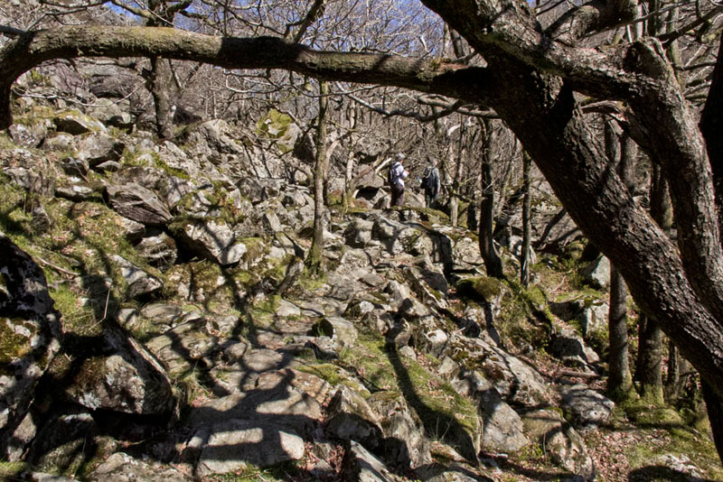
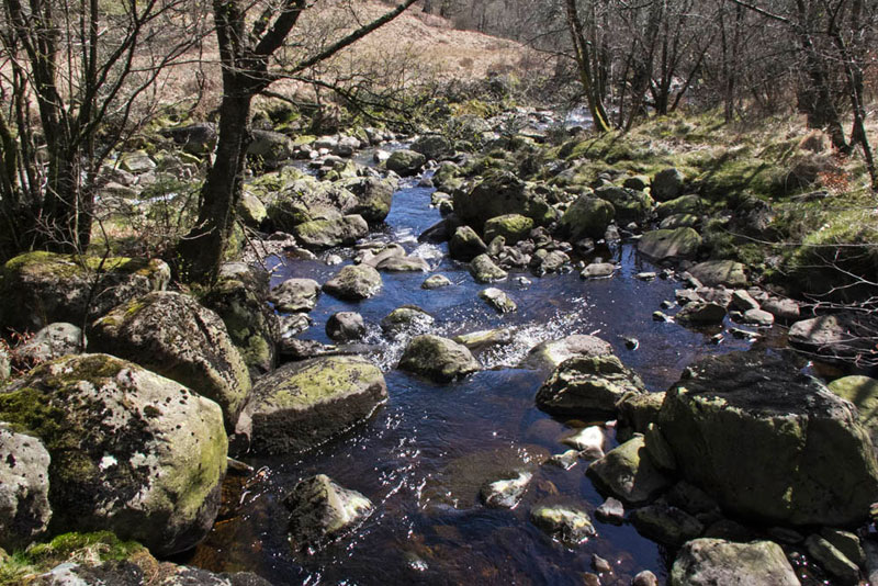
Soon Dad climbed the stone step stile into Wallowbarrow Gorge. Just superb through here the path being narrow and rocky along by the river. A sylvan way. This was yet another area of Lakeland we had not visited before, but it is a real delight and we would recommend it. Here is an example of the path.
As can be seen the Brian and his wife were ahead, but they soon stopped for lunch. We did too, a little further on, a large boulder providing a seat.
We all sat quietly munching away on our sandwiches and cake, with just the sound of the river flowing before us. "What a wonderful path,", said Tetley. "An inspired choice of route Dad."
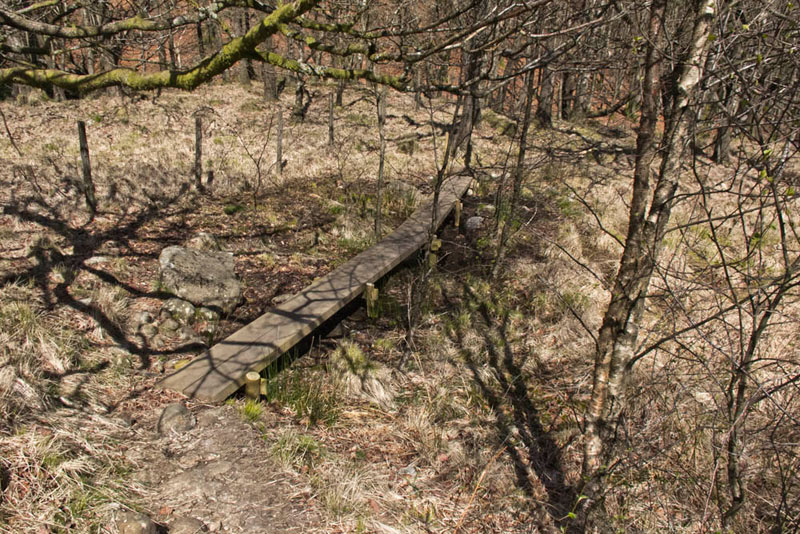
On the way again, we soon reached another stile, to then follow the footpath climbing high above the river. It then dropped down, passing over some boggy areas, where duck boarding had been provided to ensure dry feet...
and fairly soon cross a footbridge over a Grassguards Gill, at the point where it joins the River Duddon.
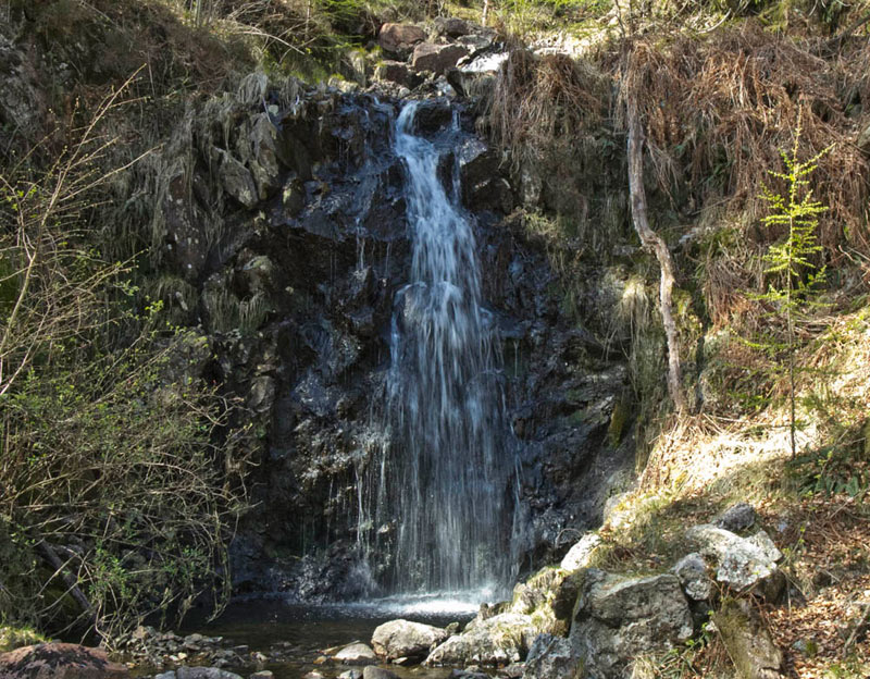
On the far side of the footbridge, the rough but delightful path kept on ahead, through the forest and by the river again. Shortly Wet Gill had to be crossed, and looking left, Grizzly called out, "just look at that lovely waterfall"
"Just beautiful", agreed Southey, "you must take a picture Dad."
After a further lovely section through the woodland, we came to an area where the forestry had been felled. Much debris had been left lying about, and so it was not easy to see the route of the path.
"We encountered a similar situation, when we were making for the summit of Bowness Knott", said Tetley.
"Aye lad", replied Dad. "That was really tough as there was ascent involved too, and to add to the torture, we had to return by the same route, to continue the walk."
"Well if it is any help", advised Shaun, who had been looking at the map, "the path bears a little left away from the river, before rejoining it further on at the end of the felled section."
"Thanks for the advice, lad", replied Dad.
It did indeed help and with careful observation Dad was able to pick out the path and make steady progress. We met a group of walkers coming the opposite way, and a lady kindly told us, "the path soon goes a bit right over some boggy ground to regain the river, and then on beside it on a good clear path."
"Thank you", replied Dad, who then said to the lady, "there is not too much of this felled area, and soon there will be a good path in woodland."
By the river again, we soon spotted a bridge crossing it, Shaun saying "we will have come to Troutal Farm on the opposite side of the river, at the bridge. The path then goes left leading to Birks, but we then soon need to go off right through Great Wood"
The path seemed to fail just before the bridge, but Dad went left, and found it almost immediately, climb up and right, to the track on the bridge, crossing this and then climbing left to find again the path that led to Birks.
"OK", said Allen, "So far so good, but now we need to find the path on the right to Great Wood."
Soon Dad said, "this looks a possibility." Then after a few steps, Dad said, "no, this just leads to the edge of the crags and a long drop."
So, we retraced to the path, and continued towards Birks. Very soon, Tetley called out, "how about this narrow unsigned trod, on the right."
"That's it", agreed Dad, "well done."
It climbed, then seemed to disappear, but some walkers coming the opposite way, indicated the route. Crossed a broken wall and after wandering just a bit too far left, Dad found the path again that descended through the lovely woodland, to arrive at its end by the pretty Birks Bridge.
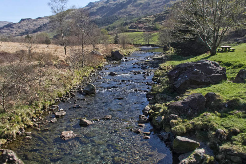
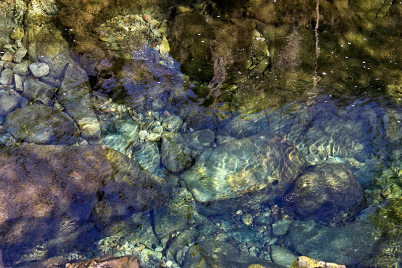
"I have noted on the walk by the river, how pure and clear the water is", remarked Southey.
Shaun's final directions for today were, "it is over the bridge then left the short way along the road to the car park."
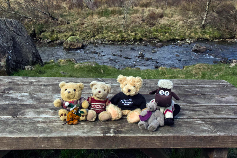
While Dad was getting his boots off we went and sat on one of the picnic tables, Grizzly, calling out, "will you take our picture, to round off the story?"
"OK lad."
As we settled in the car, Allen said, "I wonder how Brian and his wife are going on, as the path after Troutal was quite difficult to find, even with a map.",
Well not long after we had set off along the road towards Seathwaite, we saw them coming in the opposite direction, and stopped to chat briefly.
Brian said, "We could not see the path from the bridge, so crossed it and went to the road at the farm."
Dad replied, "whilst I did find it, it was not plain at all, and there were no waymarks, so you made the right decision.
His wife, seeing us , said "have they enjoyed their day."