BLACK MOSS TARN, PATTON BRIDGE, WHINFELL TARN & SELSIDE from OTTER BANK
Summary
Date - 23rd April 2014
Distance - 8.25 miles
Ascent - 1000ft
Map - OL7
Start point -
Layby by A6 at Otter Bank (SD 5315 9277)
Summits Achieved
No summits were reached on this walk
Preface
Allen was sitting with Southey and Tetley, and had the iPad in paw. "We have a walk day down this week with Uncle Eric."
"Great", Tetley replied. "Let's hope the weather is good. That was a super walk we did with him last week around Sedbergh."
"Yes. I especially liked the part at Brigflatts and visiting the Friends Meeting House. It was just so so peaceful", added Southey.
"A perfect place to de-stress pal. It was planning on the part of Uncle Eric for him leading a walk in Christian Aid week, and I hope that a good few people turn up, as they will certainly like it, and it will be a just rewards for his efforts", said Tetley.
Just then Shaun, Grizzly and Little Eric arrived. "It was indeed great to be out with Uncle Eric, but also I truly enjoyed our walk in Dunnerdale and that totally new section we did on the return by the river", said Shaun.
"Climbing Wallowbarrow Crag too", added Grizzly, "because it meant we completed the Fellrangers."
Seeing the flasks, Allen said, "ooh great, tea."
He and Southey were soon back with the mugs and plates, as Little Eric announced, "we have Grizzly's fruit scones, and I have made some peach and apricot slice. I found the recipe in a book, so thought I would give it a try. Hope you like it."
Tetley took a bite out of a piece and said, "it's delicious. You have really become a great cake maker."
"He really has", added Grizzly, "and it is a great help to me."
So we were all content with steaming mugs in paw and the cakes. Thoughts then turned to walking once again. "I guess it will be up to Dad and Uncle Eric to decide on the walk we do", said Southey.
"True pal", replied Allen. "They will be talking this evening, so we will find out then."
It was Tetley who eventually brought the news. "It has been decided to do a walk published in the Westmorland Gazette. It starts at Otter Bank at a lay-by on the A6 just north of Kendal. We will visit three tarns including Black Moss Tarn, and return via Selside. Dad said that he last walked round there in 1995, which was before any of us went walking, so it will be new ground."
"Sounds good", replied Allen. "Roll on."
The Walk
For the first time for ages we drove to Uncle Eric's, calling out "good morning", to him as we arrived.
"Nice to see you again lads" was his reply.
Here we decamped to his car, for the short drive to the start at Otter Bank, parking in a lay-by beside the A6, that was once the road.
The day was cloudy with occasional sun, and some light rain mostly at the latter end, but this did not spoil the enjoyment.
Soon ready and with us safely tucked in Dad's rucksack, we strode off going left through the yard of Otter Bank Farm, to a gate into open pasture., Then the path curved left by a some sparse woodland with a overgrown pool in the centre.
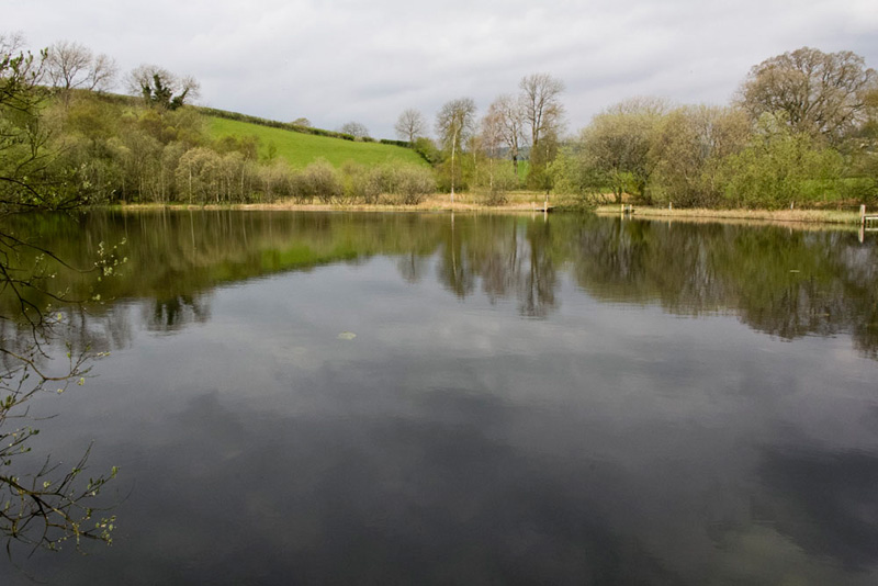
Seeing the stile on the left, Shaun, said "we should cross that and then walk on in the same direction, which will bring us shortly to Skelsmergh Tarn."
"How pretty", said Southey. "I thank my lucky stars every day that I was adopted by Dad."
Dad took a number of shots as we used the duck boarding to go round left, using the fishing platforms for the purpose. This we considered to the be best.
We exited from the tarn via a gate into a field. The actual route was round right and over a footbridge, but the gate we used brought us into the same field.
"We cross this to join the narrow road at Tarn Bank and follow it left", instructed Shaun.
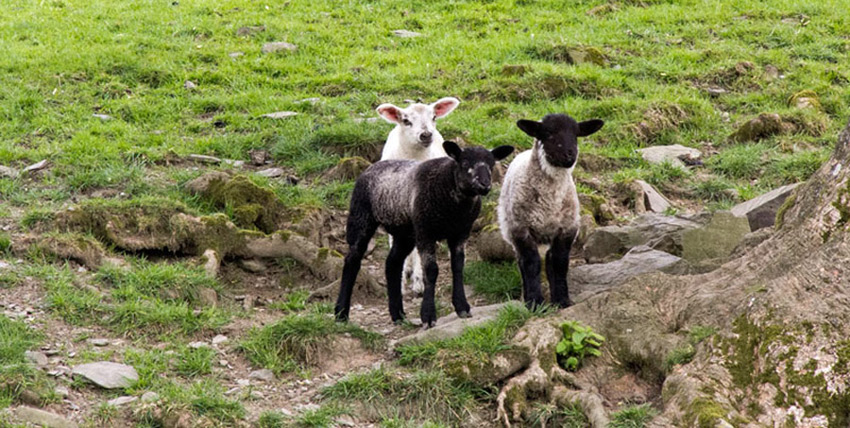
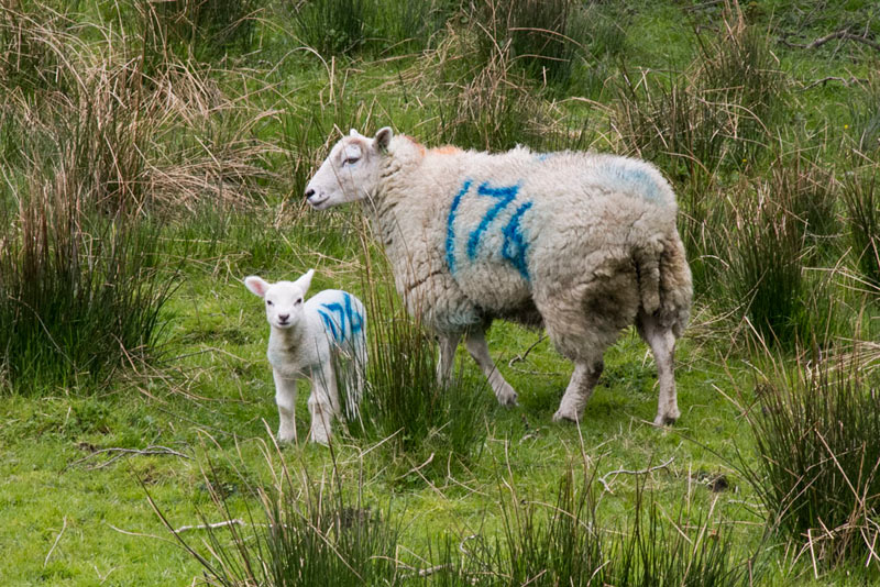
In the fields were sheep with lambs, Dad getting this group shot. "Humph", said Allen, "there goes yet another sheep picture free story."
"Ahh", said Little Eric, "they are so cute."
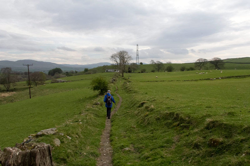
The road took us past the houses at Garnett Folds, and on to Goodham Scales. "We do not follow the road to the farm, but keep on ahead on the grassy track to New House", advised Shaun.
Here Uncle Eric strides out along it.
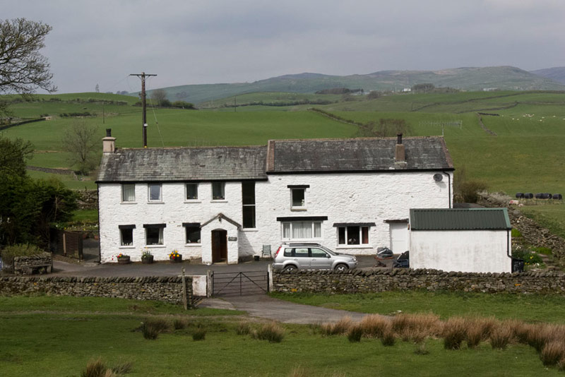
This is a shot of New House that Dad took after we had passed through the gate to the access road and started the climb up the hill opposite
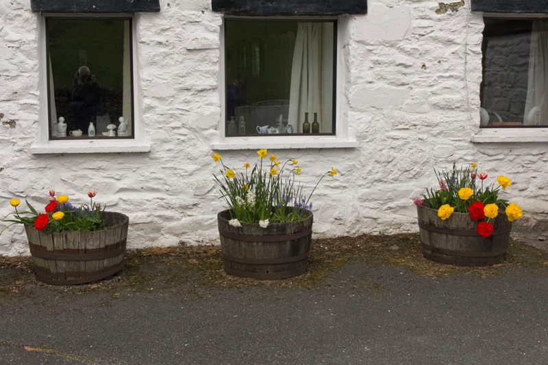
"Those tubs under the windows are nice and colourful", Tetley had commented as we passed by.
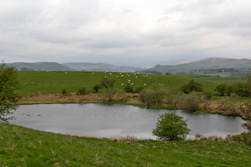
Cresting the rise pretty Black Moss Tarn, was revealed below. The path crossed the footbridge over the outflow to the left, and then passed through a kissing gate, to bear right to an awkward stile over the wall.
Before climbing the stile, Dad and Uncle Eric continued right climbing the banking, which was the best vantage point to get a picture of the tarn.
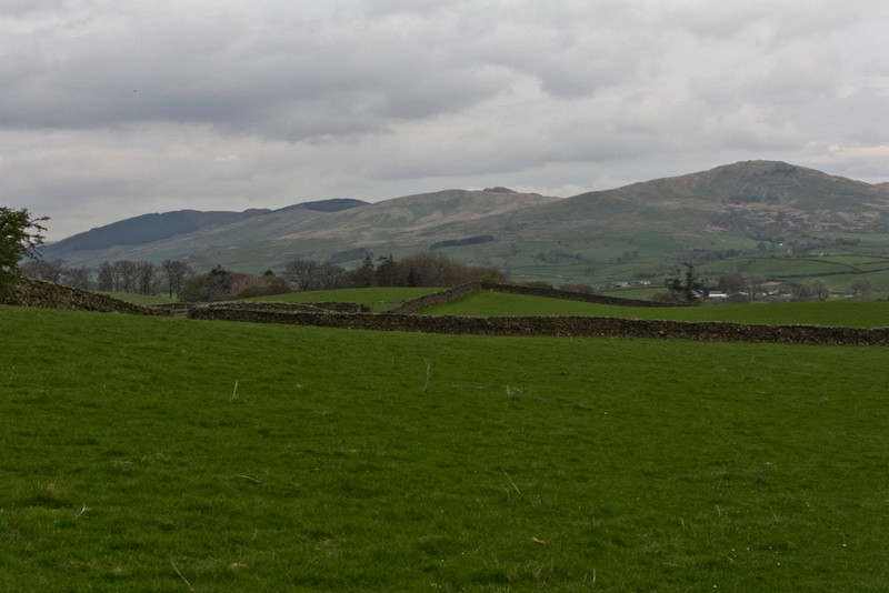
Now following the waymarked route of the Dales Way the path led to a gate to the road by a house called Biglands. Along this section, Southey asked, "what are those line of hills over to the left?"
Quick as a flash Tetley replied, "the Whinfell Ridge, that form the south side of the valley of Borrowdale in Westmorland. From the left they are called, Ashstead Fell (1539ft) with the forestry on its slopes, Mabbin Crag (1581ft), Castle Fell (1568ft) and Whinfell Beacon (1549ft) closest on the right. They were included by Wainwright in his 'Walks in the Howgills' book, so were included as part of that challenge. Although Shaun and I alone did them in 2003, we climbed them again in two walks in 2010 so that Grizzly, Allen and Eric could like Shaun and I complete the whole of the Howgill challenge."
Looking at the map, Shaun said, "we cross the road and continue to the houses at Shaw End.,"
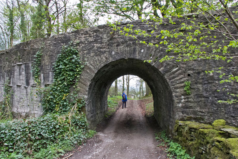
This took us through a gate to the road, where Shaun then said, "we go left, and through that tunnel over which runs the access to the Georgian mansion of Shaw End, that is now luxury self catering apartments."
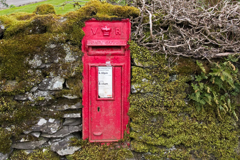
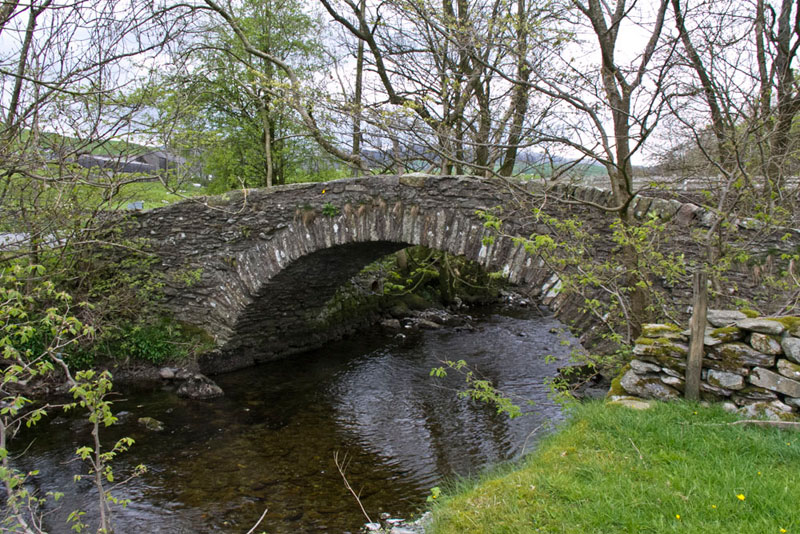
Walking on then brought us to the small hamlet of Patton Bridge, where set in the wall is this post box dating from the reign of Queen Victoria.
Uncle Eric read from the walk instructions, "we cross the bridge that spans the River Mint, then soon go left along a narrow road that will lead us to the house called Hyning, with Whinfell Tarn to the right and then on to Topthorn."
It was along here that we met a cyclist, who lived at nearby Topthorn. He stopped and we chatted. He was in his 70's and off on a ride to get ready for a 60 mile ride on Sunday. He also told us in his younger days he had been into long distance running, doing distances like 100miles! Wow we thought.
As the tarn came into sight, Little Eric called out, "just look at that so so cute little lamb with its mother. I don't care what Allen thinks about having sheep pictures in the stories, but that has got to be a must."
"Alright", agreed Allen, "it is cute as you say pal."
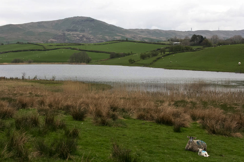
Whinfell Tarn lay to the right and from this angle it was not particularly easy to get a decent shot. Tetley said, "please try Dad, as when we write the story we would like to include a picture of each of the tarns."
So this is the result and with Whinfell Beacon and to the right the Repeater Station, forming the backdrop.
Reaching Topthorn, we got into a garden by mistake, having missed the step stile on the right, which the lady pointed out. It was so plain to see we do not know how we missed it!
"Sorry", said Dad.
Over the stile was where the cyclist we had met lived. He had in fact come back as he had forgotten to take his cycling tool kit.
The route was through a gate onto a track and along this to another gate, to then follow a wide green path. From here it looked like the route went left, but Shaun was studying the map and said, "I think that we should actually go slightly right through that gate."
He was right too, but being the most experienced member of our group we were not surprised.
Walked over a hill then on down to a stile by a wall corner and then climb half right beyond, to cross this stile on to a narrow road by a sharp corner.
"Which way now?, said Allen.
"Straight ahead along the road then by the junction we go left on the track to Guestford", replied Shaun.
Approaching the buildings of Guestford, Uncle Eric said, "the instructions say we should turn right by the farm."
Well try as we might we could not find the path, so instead we kept ahead through gates to come by beside the River Mint, where we walked right to soon rejoin the route. Then it was across a large pasture to Rossil Bridge Farm, and the narrow 17th century packhorse Rossil Bridge, which we crossed over the River Mint. The parapet on one side was in need of repair and Uncle Eric said that there had been a local campaign, concerning this.
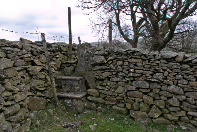
Opposite the bridge it was along the drive to pass a barn, and then go immediately left to Yoadpot Farm (stables). Here is was through the gate ahead and then right to another gate, and up the hill beyond to a further gate into open pasture. Now we deviated slightly by going over the hill, instead of contouring round to the right. At the top it was across a stile in the wall and then on to the right corner and a gate, that then led us down to the lovely house called Candy Slack.
Shaun said, "the map clearly shows that the route is not along the drive, but over the wall on the right."
The step stile is in fact waymarked, but is now hidden by a tree that has been planted directly in front! Then it was over the stile clearly seen ahead and on up the hill.
Uncle Eric said, "we should ignore the ladderstile, and go on a few yards to cross the next stile."
This led down to cross the stream on a plank bridge, and then to a gate into a walled track passing behind the house called East Above Park, and out to the road by Selside Church.
"I'm hungry", said Allen rubbing his tummy.
Uncle Eric replied, "it is past time for lunch, so let's sit on that banking opposite the church."
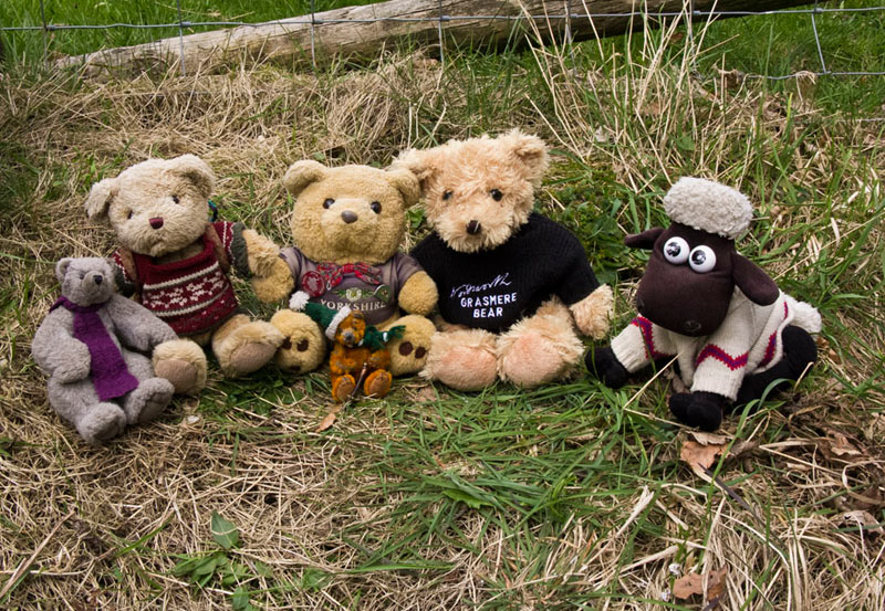
Very peaceful in the quiet surroundings and we all felt better after the sandwiches etc. Before we hopped back in the rucksack Grizzly said, "will you take our picture Dad, after all we have to make at least one appearance in each story."
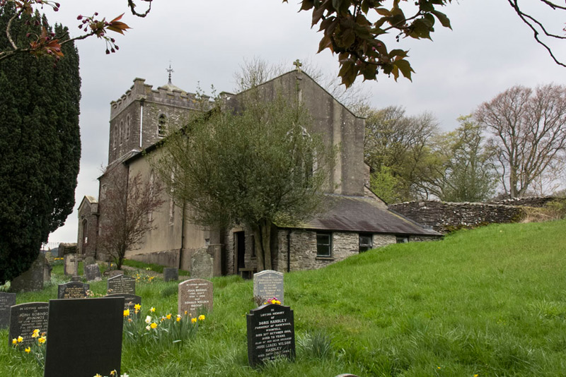
The church, dedicated to St Thomas does not have a very pretty exterior, being rather utilitarian with a squat tower, this shot being taken from the corner of the graveyard. Despite this is in fact Grade II listed, and dates from 1838, the tower being added in 1894.
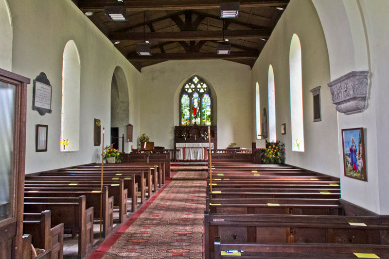
Dad then tried the door which was unlocked so he took this shot of the rather simple interior. "That was a nice surprise", said Grizzly, who loves to look round churches.
From the church we followed the road a junction where it was right passing Selside Hall, then along Firtree Lane and then left at the junction. It was here that the rain started and was pretty much on and off until the end of the walk, but we had less than a mile to go now.
Climbing the tall stile on the right, the path led along by the wall to a stile onto a path that will no doubt be very overgrown in summer. This led up to a kissing gate on to the road, adjacent to the Watchgate Water Treatment Plant. Turning left we strolled the lane past this and so descending to Strawberry Bank where the road goes sharp right steeply down to the A6.
"We go straight ahead through that gate", called out Shaun. This led along a grassy path, to another gate, and then on a stony path to the lay-by where we started from.
"That was a nice walk, Uncle Eric", said Southey. "Thank you so much for agreeing to do it and it has be lovely to have your company."