BRANSTREE, HIGH HOWES, SELSIDE PIKE & BROWN HOWE from MARDALE
Summary
Date - 3rd May 2014
Distance - 5.25 miles
Ascent - 1800ft
Map - OL5
Start point -
Layby on Mardale road(NY 4792 1192)
Summits Achieved
Name
Height (ft)
Height (m)
Grid Ref
Branstree
2339
713
NY 4780 0997
High Howes
2208
673
NY 4876 1033
Selside Pike
2149
655
NY 4907 1118
Brown Howe
1436
529
NY 4872 1219
Preface
"It's the Bank Holiday weekend coming up, so I wonder if Dad will be able to take us walking?", mused Southey.
"You have really got the bug, pal", replied Allen. "But it is a pleasure to have welcomed you to our club, and have your company too."
"Just think", went on Southey, if Kim had not gone to work at the Wordsworth Hotel in Grasmere, Dad would not have visited the hotel, or seen me. It was fate, and I was overjoyed to be adopted!"
"What are the weather prospects?", asked Tetley.
Grabbing the iPad, Allen quickly navigated to the Met Office site. "Hmm Saturday looks to be OK, sunny even, but the other days are unsettled with rain at times.
"Well it's a good job Dad is not working at the Lifeboat shop this Saturday, then", said Tetley.
" Wonder where we might go", mused Southey.
Just then Shaun with Little Eric riding on his back and Grizzly, arrived.
"Ooh tea and cakes", exclaimed Allen, going off to get the mugs and plates.
"What's the cake today?", asked Tetley.
Grizzly replied, "Flapjack made by Little Eric, and I have made chocolate brownie."
"Scrumptious", cried Southey. "Is it all right if I have one of each."
"Sure pal", replied Little Eric.
All was well with the world, with steaming mugs in paw and cake on the plates, as our thoughts turned to walking.
"I know that Dad will want to do a walk that is more challenging, but we are not the best judge of exactly how his recovery is going on, and so maybe we should let Dad choose", suggested Little Eric.
"Let's just have a think and see what we can come up with", said Shaun. "I know he is working up to doing the round including Helm Crag, so it needs to be something similar."
So as we munched away at the cake, we put our thinking caps on. After a few minutes, Tetley commented, "the cakes are really delicious." Then he said, "we have not been to Mardale for a while, and I recall back in late 2006, we did a round taking in Branstree and Selside Pike, including two other tops. In many ways it will be similar to the Helm Crag round."
"They are in the Far Eastern Fells", said Allen, bringing up the listing. "Mostly over 2000ft, but after the long climb to Branstree, it is not too challenging."
"Well it is worth suggesting", agreed Grizzly.
Allen drained his mug and getting the Wainwright book, said, "I will go and see what he thinks."
Picking his mug up, Shaun refilled it. "I know he will want another, he is a real tea belly.
Allen soon returned. "Thanks pal", he said accepting the mug. "Dad says the walk is fine, and if this goes OK, he will take us to Helm Crag, so you can finish Book 3, Little Eric."
"Well I have not been to any of these either, so that will be an advance on Book 2, and of course our pal Southey will bag them too."
"Yes it will be a completely new area for me. I can't wait."
The Walk
Saturday dawned and looking out Allen said, "it's sunny."
We were ready in good time, having packed our picnic, and settled in the car, as we heard Dad slam the boot of the car shut.
As he pulled out of the drive Southey asked, "how do we get there?"
"It is up the M6 to Shap, then along the narrow roads to Bampton, then to and down by the reservoir."
It is often the case that the weather in Morecambe is better than in the mountains, and so it was to turn out today. As we headed north we could see a line in the sky where the blue skies were replaced by cloud. The forecast was still for sunshine, and we hoped the cloud would clear away, but no, it was a cloudy day and cool and breezy on the tops.
Passing the Haweswater Hotel, Dad remarked, "the parking area is about a mile and a half further on." Keeping an eye on the odometer, we found this without any difficulty, there being just one other car in the lay-by. Other cars passed by as Dad was getting his boots on, all headed for Mardale Head.
Looking down the road, Tetley said, "Southey, Little Eric, that is Branstree, and we have to go to the furthest highest point we can see."
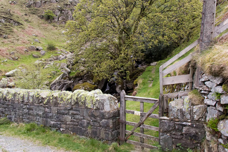
Shaun added, "do you see the gate by the road. That where we will come down to at the end."
"That is after that long climb is over", said Southey a bit worriedly.
"Don't worry", replied Grizzly, "Dad will be up to the challenge.
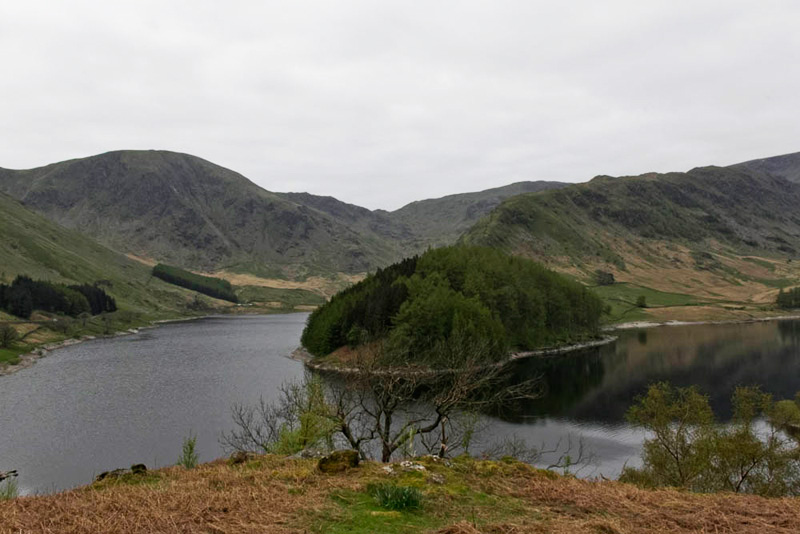
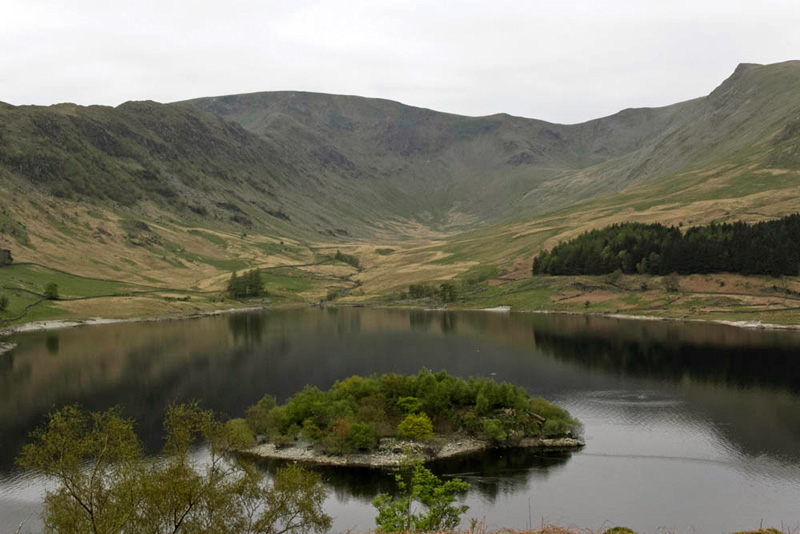
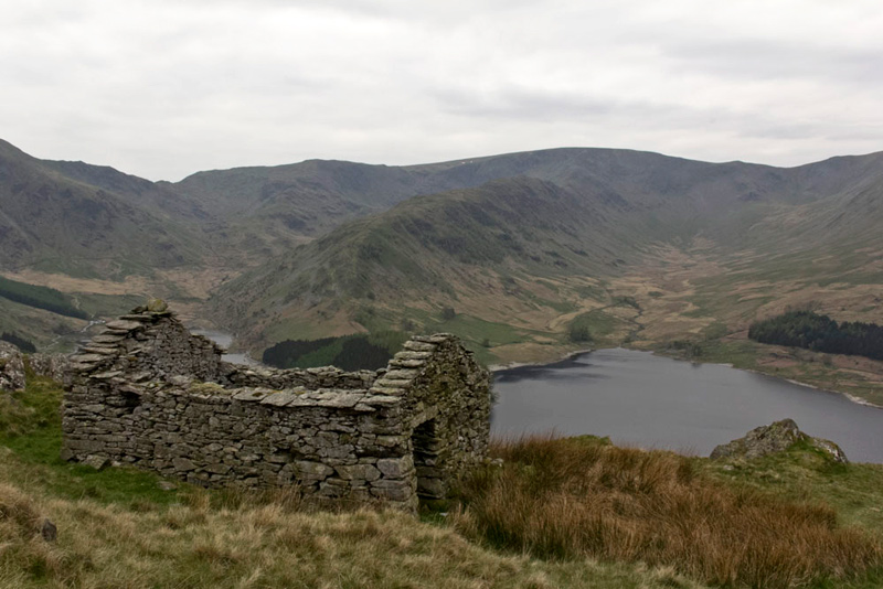
Dad ready we were about to settle in the rucksack, when our attention and Dad's was drawn to the superb views across the reservoir. First looking towards Mardale Head.
Having not been here before, Southey was anxious to know about the view.
"The mountain to the left is Harter Fell (2552ft), falling right to Nan Bield Pass, and then rising to Mardale Ill Bell", lectured Tetley. "In the foreground is The Rigg, with it's lower slopes clothed in trees. It is a long ridge that rises over Rough Crag and finally steeply to High Street, along which runs the Roman Road."
"You can see that if you look a bit to the right", said Tetley. "The valley is lonely Riggindale, the haunt of the only golden eagle in England that has been on his own since 2004, when the female died. To the right is Kidsty Pike, with its unmistakable triangular pointed summit.
"Right" said Shaun, " suppose we had better be making a start."
"Yes" replied Dad. "Get settled in the rucksack and we will be off."
Well it was best foot forward, but only for about a hundred yards or so, before Dad came to an abrupt halt, as he lined up the camera again.
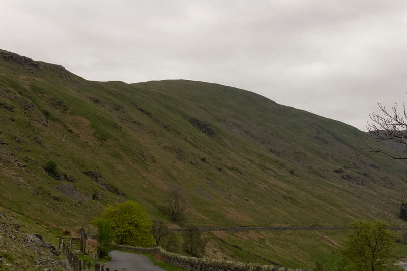
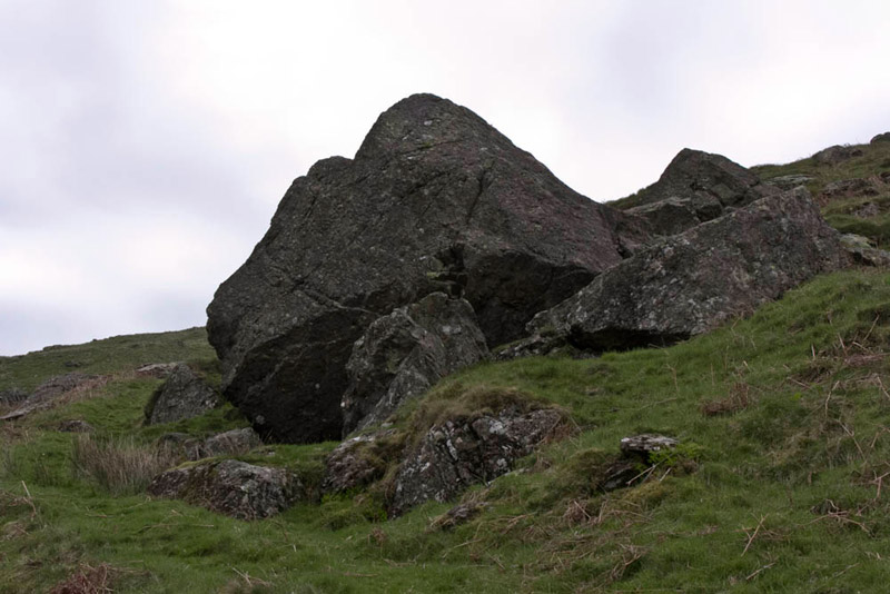
This gives some idea of the initial ascent. A green path can be seen rising at the right of the picture passing the large boulder, which although it may not look it, was steep and unremitting.
Immediately after crossing the bridge over Hopegill Beck a small gate gave access to that green path.
Winding steeply up the path soon passed by the large boulder with a cavernous base. "According to the map this is called the Hollow Stone", advised Shaun.
Still steeply the path continued to then pass the ruins of two buildings and so finally gain the north ridge where the gradient eased.
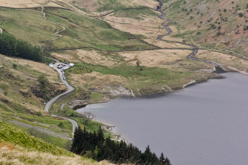
Dad had paused, and Allen called out that is a fine view of Mardale Head, and shows perfectly where most of the cars coming into the valley are parked."
Tetley said, "we have climbed that path above the car park. It had many zig-zags and leads to Gatesgarth Pass."
"That was back in June 2010, when we did Adams Seat and Harter Fell. A misty day too if I recall correctly", added Grizzly.
Up this ridge of Branstree there no path as such, but we followed a sheep trod, that drifted over to the right, and when it started to go down, Dad struck left steeply up to gain the higher part of the ridge again. The climb seemed never ending and when we thought we were near the top, at a rise, found that there was yet another flatish area to cross, before the final climb up a grass and rock slope.
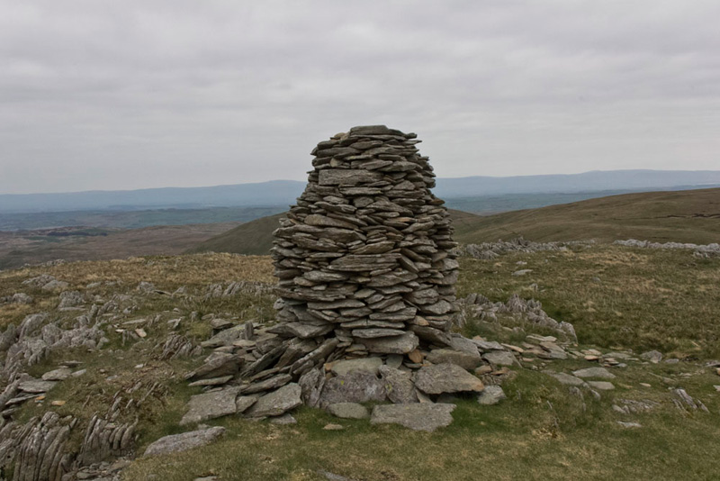
A fine cairn stands here at Artlecrag Pike.
Checking the GPS, Shaun, said, "this is not the summit."
Oh no", cried Southey, "it has seemed to be an endless climb. Do we now have to go to that summit over there."
"No pal", replied Tetley, "That is Harter Fell and about another two miles. We just keep on ahead and we are sure to find the summit in about a few hundred yards."
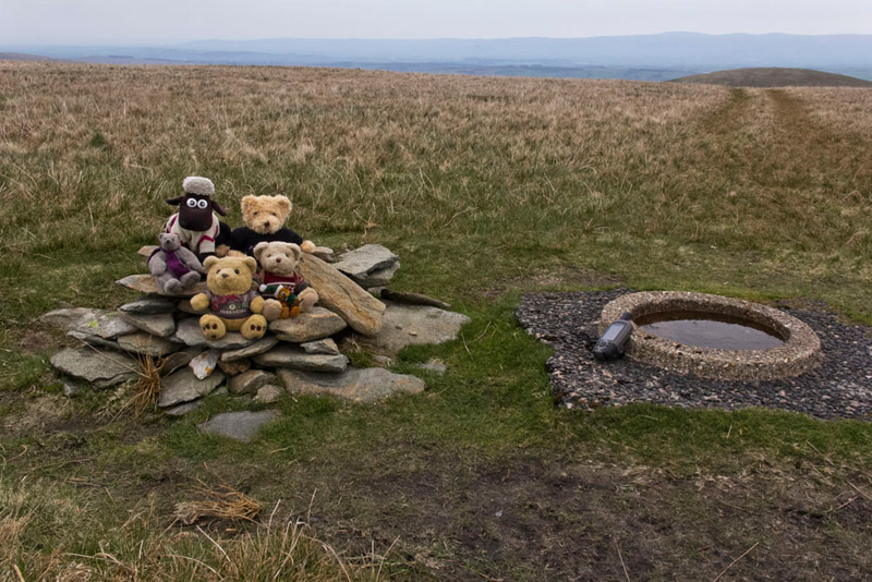
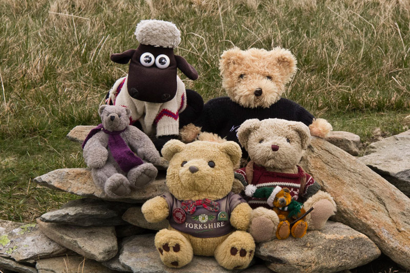
He was right too, and soon we were by the small cairn and trig point a ring embedded in the ground.
Dad then kindly took a close up shot of us here, before ringing Uncle Brian to see he was OK. He was having a nice quiet day with Dad being out here on the fells with us!
"Where to now?", asked Southey.
Shaun was quick to reply, saying, "we head back towards large cairn, but then take a tractor track going right and down to climb the fence."
As we approached this, he pointed across saying, "Southey we are heading across to that fell that is named by Birkett as High Howes, although unnamed on the map."
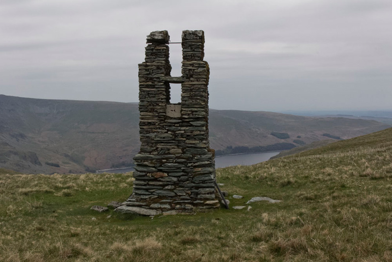
Descending the path wound its way passing this old masonry tower. "What is that", asked Little Eric.
"It is a relic from when Haweswater was created as a reservoir for Manchester. It is one of the survey towers used by engineers when they were planning the aqueduct to carry the water," replied Allen.
We looked more into this when we got back, having seen the dam as we had driven up the valley earlier. This was started in 1929 and the valley started to be flooded in 1935. Before this all the farms and dwellings of the villages of Mardale Green and Measand were demolished, as well as the centuries-old Dun Bull Inn at Mardale Green. The village church was dismantled and the stone used in constructing the dam. All the bodies in the churchyard were exhumed and re-buried at Shap. When the reservoir is full it holds 18.6 billion gallons of water. The aqueduct runs from the reservoir to Heaton Park, Manchester and is 134km (83 miles) long.
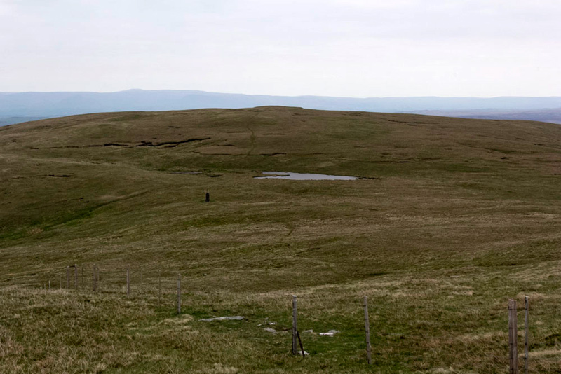
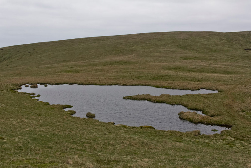
In the depression lies a small tarn, this shot being taken looking back towards Branstree,
from which it was a gentle 100ft or so ascent to the cairn at High Howes, where we hopped out of course and settled for our picture. To the east and below the map shows Howes, which is in fact a Wainwright Outlying Fell. The ground steadily rises then in a westerly direction to this unnamed summit, so it is logical that Birkett decided on the name High Howes.
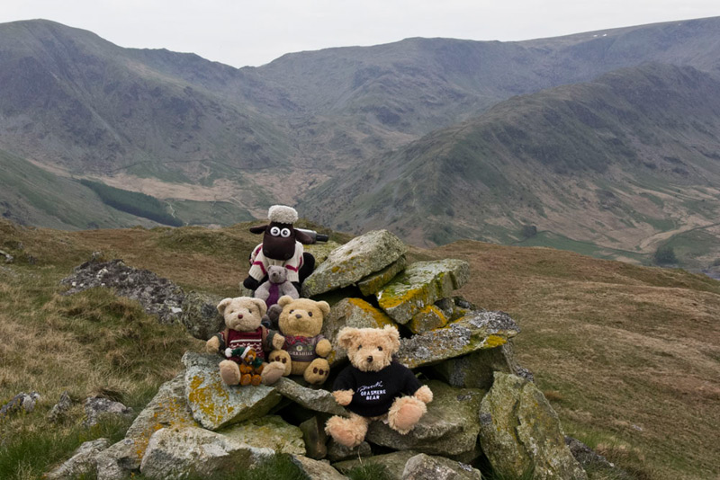
"To Selside Pike now", said Grizzly, which was clearly in view roughly north.
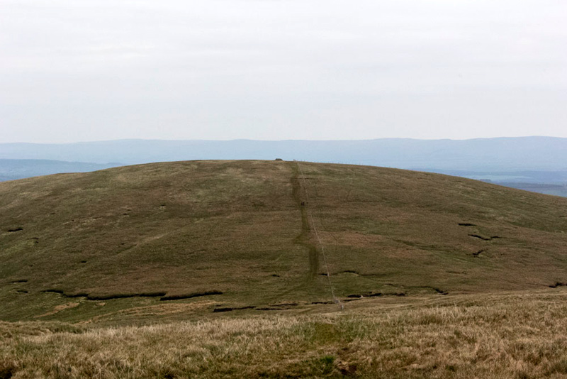
The path descends the shoulder to the fence, and climbing the hurdle we then climbed the slope, that can be seen in the picture to the summit with its large shelter cairn.
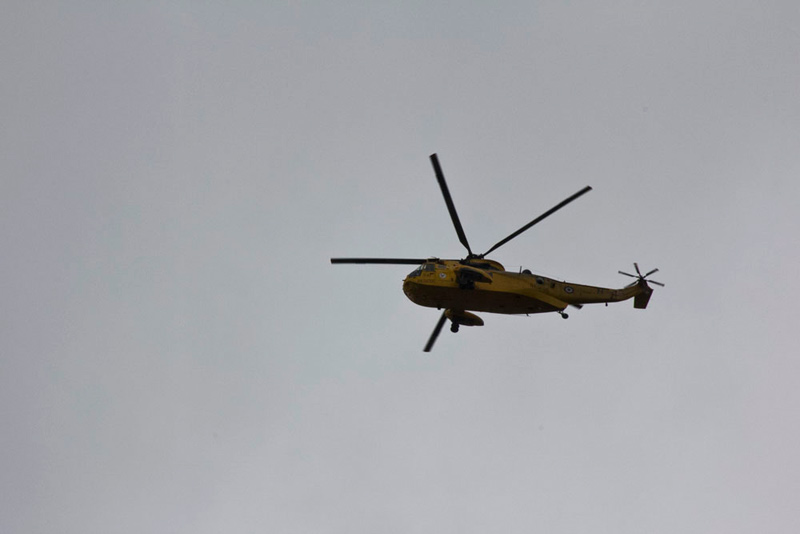
Shortly before the summit, a rescue helicopter passed over, heading towards High Street on the far side of the Haweswater Valley. We watched at times as it circled around, and then disappeared, maybe perhaps landing, as later is reappeared heading in the direction of Lancaster. If indeed they did have a casualty aboard, we hope they soon made a full recovery.
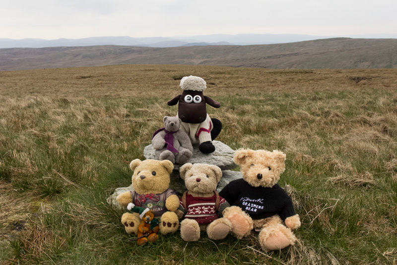
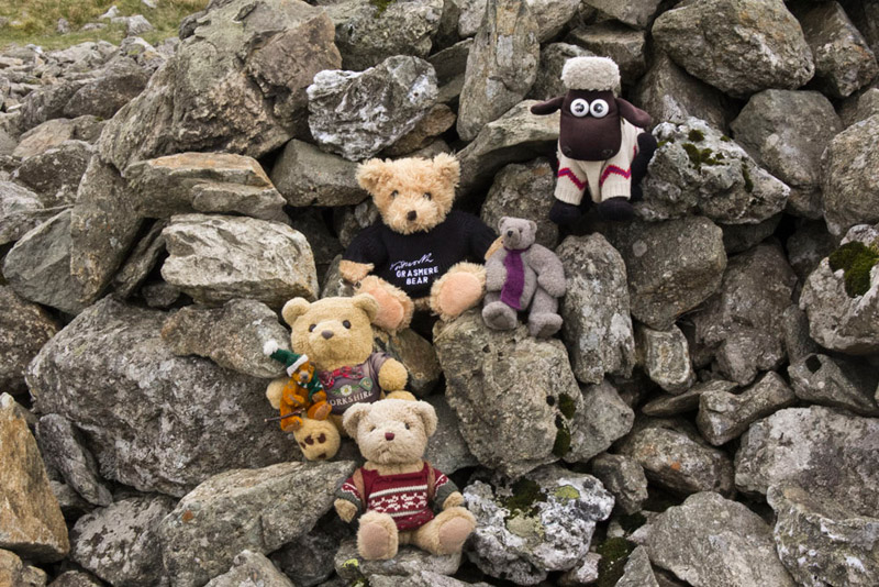
Reaching the summit, Southey called out, "come on pals, let's get settled for our picture."
I'm hungry", said Allen, rubbing his tummy.
"Yes it is time and a good place to sit and have lunch", agreed Dad.
We sat outside the shelter, leaving the inside for the couple who we following us. We had first seen them at a distance on Branstree. They had only gone to the cairn on Artlecrag Pike and not the summit, so we hoped that they were not bagging Wainwrights. Mum was the word!
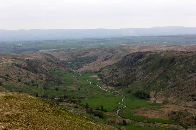
Suitably refreshed it was now on the clear path down the fell. Looking right at one point, Allen called out, "what a superb view of Swindale."
"We have been there a few times, climbing the fells on above the right side, and more than once to Nabs Moor and Howes", said Shaun.
"Ooh yes the last time we did those with Uncle Eric was in February 2009, when there was thick snow. That was an exciting adventure", enthused Grizzly.
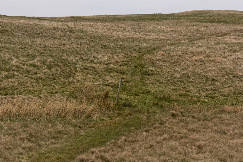
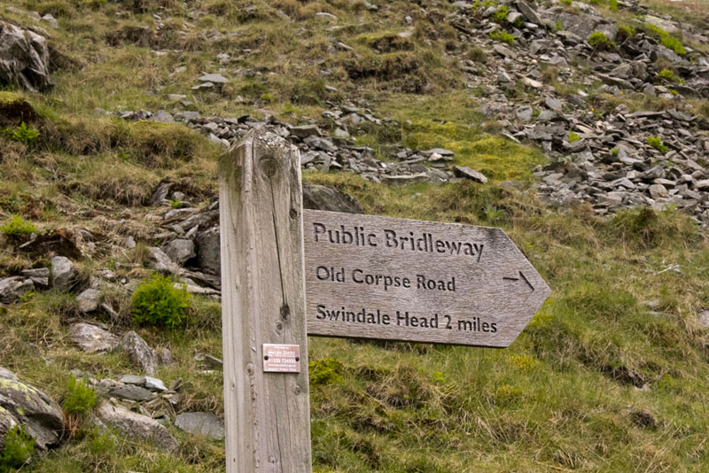
The clear path continued reaching the Corpse Road by an old post, where we turned left.
"Why is it called the Corpse Road", asked Southey.
"Well", said Tetley, "before there was a church at the now drowned villages in Mardale, this was the route by which the dead were taken on horseback for burial at Shap. The last such journey being made in 1736."
Strolled along this, before going off to the right to make for and find the cairned top of Brown Howe, our final summit today.
Then descended to regain the Corpse Road and follow this down. We passed two ruined buildings, of which this is one, with Mardale Ill Bell, High Street and The Rigg forming the backdrop.
Towards the end the gradient steepened and Dad said that both his knees hurt. This worried us, but hoped that this was in part due to his still getting his stamina etc. back.
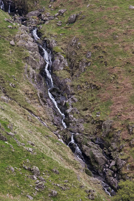
Here too the ravine of Hopegill Beck was clearly in view to the left, the beck falling in a dramatic waterfall.
Soon now we reached the gate to the road, where the Corpse Road we had followed down is clearly signposted.
"Thanks Dad, that was a great walk", cried Little Eric. And, I have ticked off two Wainwrights in the Far Eastern Fells book and no less that four Birketts too."
We settled in the car while Dad got changed. "I guess you are looking for some refreshment now?", said Tetley.
"Sure thing and I will see if the Abbey Coffee Shop is open in Shap", replied Dad.
It was too. A nice place and friendly staff. He had a cheese and onion pasty (this had a bit too much pastry and not enough filling), followed by a lovely piece of chocolate flapjack and a pot of tea. It had a pretty extensive menu, so Dad said that he would come here again.
So a good day and Dad was pretty happy with his performance and his ongoing recovery, and said "I reckon we can give Helm Crag etc., a go later this month."
"That would be wonderful", enthused Little Eric. "It would see me finish Book 3 Central Fells."