SIMPSON GROUND RESERVOIR, CARTMEL FELL & SIMPSON GROUND ALLOTMENT from CHAPEL HOUSE WOOD
Summary
Date - 5th June 2014
Distance - 8.5 miles
Ascent - 1060ft
Map - OL7
Start point - Chapel House Wood (NY 382 853)
Summits Achieved
No summits were reached on this walk
Preface
Shaun, Little Eric and Grizzly, had arrived with the cake and flasks of tea.
"Great", cried Southey, "I always look forward to tea and cake. I must be like you Allen", letting out a laugh.
Allen & Tetley went to get the mugs and plates and soon we had steaming mugs of tea in paw.
"What are the cakes today?", Allen asked.
"I have done your favourite scones, cherry & ginger, with raspberry jam and cream", was Grizzly's reply. "As well there is mincemeat slice, made by Little Eric."
"It all sounds scrumptious", replied Allen taking one of each.
So we all tucked in, Southey saying, "absolutely delicious pals. Thanks."
After a while Allen picked up the iPad and checking the calendar said, "there is a walk date down with Uncle Eric for Thursday. It will be about six weeks since we last had his company, so that will be really nice. Has it been decided where to go?"
"Well Uncle Eric lent Dad a copy of a walk that was published almost ten years ago", replied Tetley. "It starts from Chapel House Wood and goes past Simpson Ground Reservoir, and then to Cartmel Fell. This is what has been decided on."
Glancing at the copy and the published date, Shaun said, "I feel sure that Dad must have a copy of this in the binders, as it was during the time he got the Westmorland Gazette."
With Tetley's help the binder was lifted down, and then looking over each other's shoulder, we scanned down each page. About six pages in, Grizzly suddenly said, "there it is, number 268."
"It's in the other binder", said Allen, who with Southey's help he lifted off the shelf. Then leafing through he found it. "Yes that's the one. So that will be another we can mark as done after Thursday."
"We have walked a number of times in this general area in the past", remarked Tetley, "but not for some years, so it will be nice to explore again."
"I can't wait", added Southey enthusiastically, "as it will be all new to me."
"Roll on Thursday", cheered Little Eric.
The Walk
We were all excited to be walking with Uncle Eric again, so made sure that we got up early to all lend a paw and stow the picnic in Allen's rucksack.
Settled in the car as Dad reversed out of the drive, Southey asked, "how do we get to the start?"
"It is along the A590 road that leads to Barrow in Furness, to Newby Bridge", replied Shaun. "Then it is left towards Bowness, but almost immediately we turn right to Staveley-in-Cartmel."
"Well that place is new to me for a start, as well as the walk too", he replied.
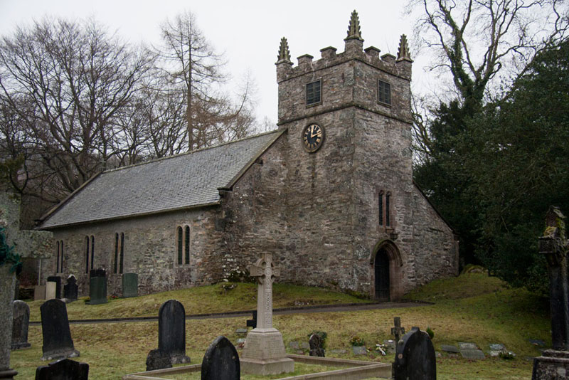
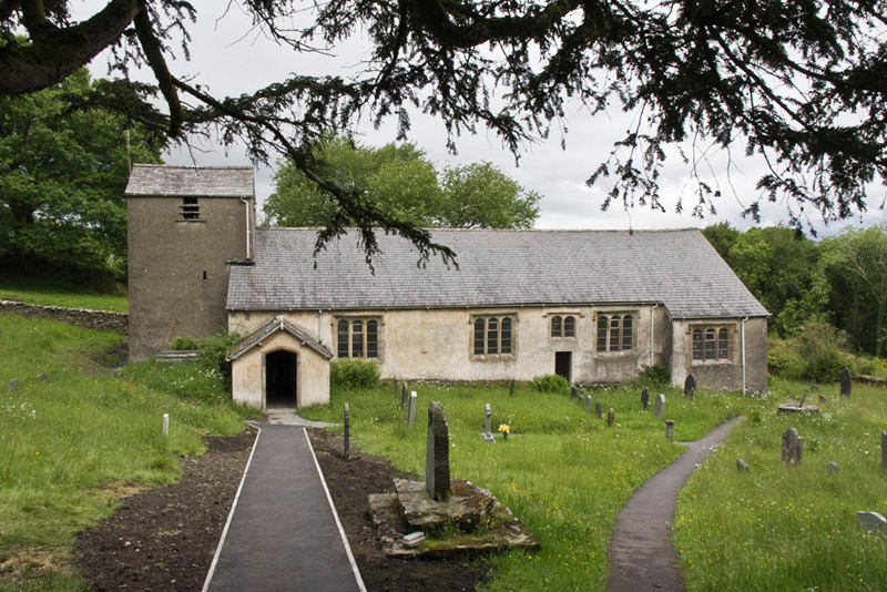
Once in Staveley, Dad turned right again, passing the church, this picture of which Dad took in January 2013. This sturdy building constructed in stone rubble with a slate roof, is dedicated to St Mary and was built by 1618 being extended or restored a number of times since. Its plan consists of a nave and a chancel in one range, a south aisle and a west tower. This has its doorway on the west side and a two-light window above. There is a battlemented parapet with crocketed pinnacles at the corners.
After another couple of miles, we then came to the roughly surfaced car park on the left at Chapel House Wood. We were meeting Uncle Eric here, and he was waiting as we arrived.
"Hi Uncle Eric", we called out. "It is so nice to see you again and to have your company today."
"Thanks Lads", he replied, "Nice to see you, too."
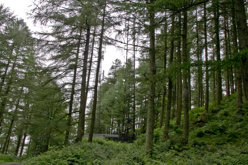
The day was to be cloudy for the most part and dry, but with a bit of drizzle at times. Soon they were ready and meanwhile we had got settled in Dad's rucksack. Dad then shouldered it and we set off along the forest road, climbing steadily and passing the radio masts at Barrow Banks.
Being such a long time since we had seen Uncle Eric, Dad and he had lots to talk about, and thoughts of the route were pushed to the back of their minds.
We had walked quite a way on the forest road, when Shaun said, "I think we aught to check the instructions."
The main feature on the early part of the walk is Simpson Ground Reservoir, but the map accompanying the description did not show this, and if it had would have made route finding much easier. In the published walk this part and that past the reservoir was repeated at the end, the route being to the south of the reservoir. This was not in fact the route we actually took outwards, our path being to the north of the reservoir. This in our opinion improved the walk, reducing the repeat and making for a more varied circuit.
Shaun's plea was at the point where there was a junction on the forest road. Thinking about this afterwards, we should have gone right, but there was a clear waymark directing us ahead.
"I suppose we should follow the waymark", said Dad.
"OK", agreed Shaun, "But we need to be going to the right into the woods."
After a short distance, Tetley called out, "there is a clear path right that seems to fit the bill."
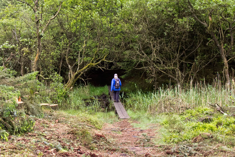
We took this crossing some planking over a boggy section on entering the wood.
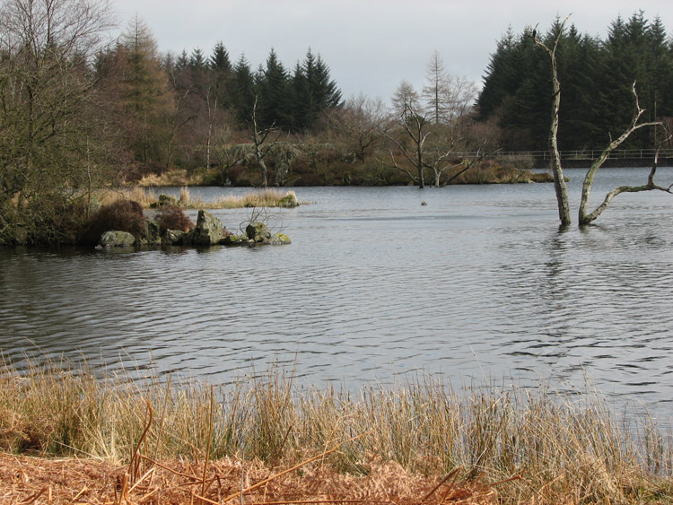
This was a quite delightful path that meandered, passing first Simpson Ground Reservoir to the right. Dad did not stop today to take a picture, so we include this from April 2006, looking across towards the dam. It must have been after a wet period, as the water level is high, with trees stranded in the water. The reservoir was established in 1957 and has a capacity of 44m gallons. It supplies fresh water to Grange-over-Sands, and via the Haweswater aqueduct to Barrow.
Past the dam, the path continued through the woods, with considerate duck boarding being provided over severely boggy areas. "Without this it would have been impossible to make progress", remarked Little Eric.
Eventually it came to the substantial stone wall bounding the wood. "I really can't make proper sense of the instructions", said Shaun. This of course was because we were not on the published route, as mentioned above.
The map was examined, and Uncle Eric said, "well there is no doubt that we should go left along the path beside the wall."
There was open ground to the right, with the forestry pressing in on the left. The path eventually came to a stile, over which we were in open ground with small rocky outcrops.
Now the instructions made sense finally, and Shaun said, "we should follow near to the wall on the right, and pick up a wide grassy path."
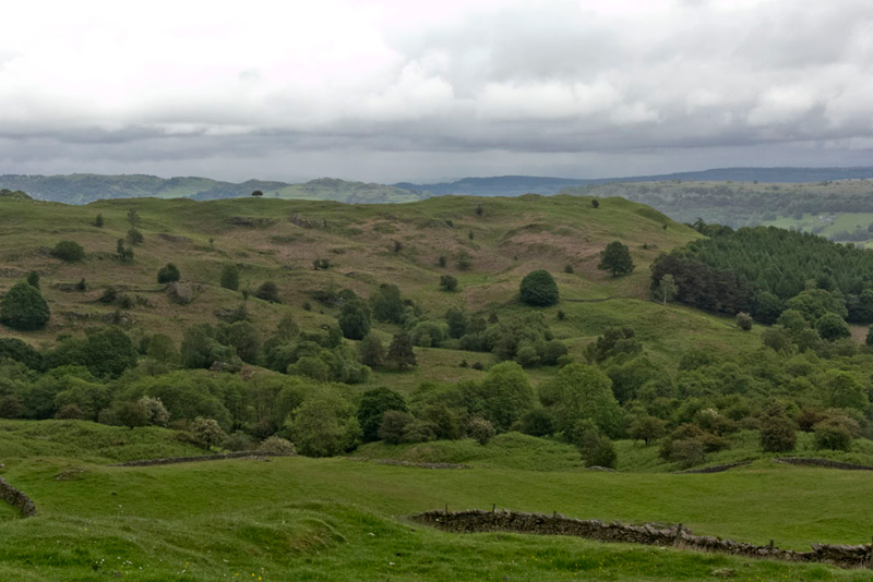
Initially we climbed then at the brow, a wide view opened out. "Ooh that's lovely", called out Southey. "What is that hill called?"
"It is Ravens Barrow, being the highest point on Cartmel Fell", replied Allen. "It is one of the Wainwright Outlying Fells, the summit being at 525ft. If memory serves me correct we last climbed it in July 2012, for Little Eric to bag the summit, on his quest to complete the Outlying challenge."
"You're right pal", responded Little Eric. "At that time I still had many to bag, but now there are just two walks to go for me to complete the challenge, which hopefully I will do in your company Uncle Eric."
"Yes there is a good chance we will get the walks done soon", replied Uncle Eric.
A wall can be seen at the bottom of the picture, and we now made the descent to the narrow lane that ran beside it.
"We go right, through the gate and down to Foxfield", instructed Shaun.
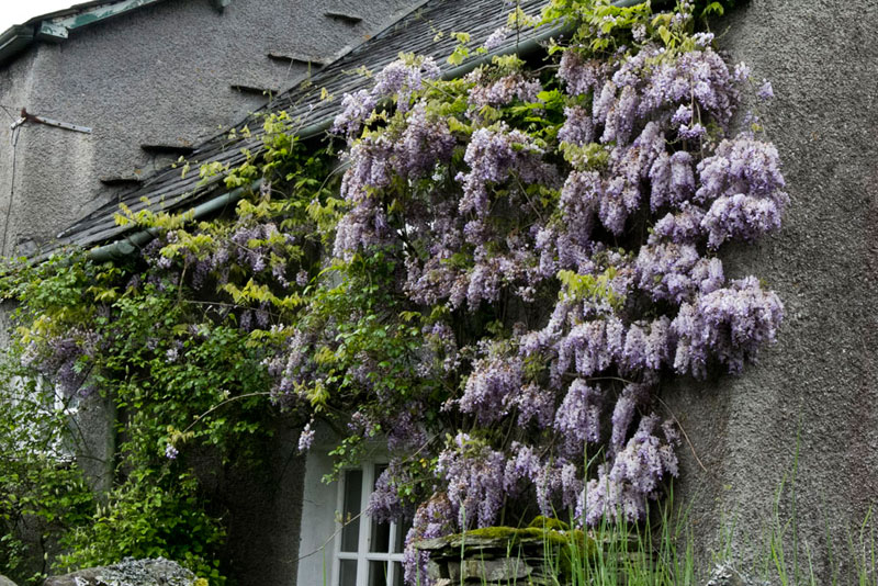
Passing the house of the same name, Grizzly said, "just look at that wisteria. It is beautiful."
"The instructions now say, we should go on along the road and through a white gate on the left."
After a little while Grizzly said, "this must be it, although the paint has faded a lot over the last ten years, but there is just enough to show the gate was once white."
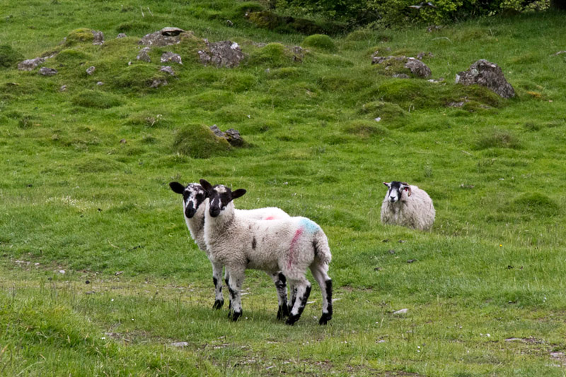
Sheep with lambs were grazing in the field beyond, these two standing to pose for Dad, who whipped the camera out and snapped off this shot.
"Darn", said Allen, "no sheep picture free story yet again!"
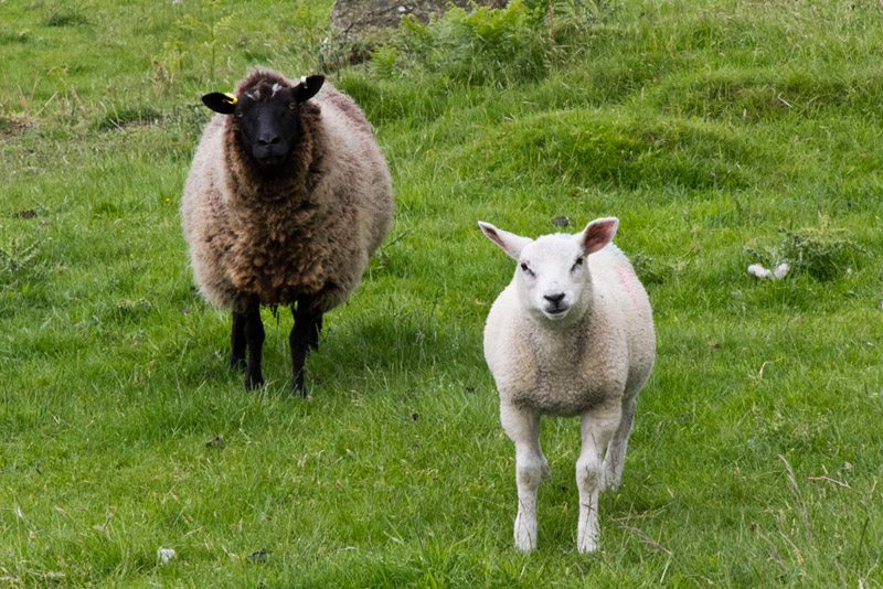
The lambs are in fact standing on the track we had to follow through the field, to come by a wall. There were more ewes and lambs, and to Allen's despair, Dad was presented with another opportunity.
"OK, I guess that picture will be included too", said Allen exasperatedly, "but that is the last one in this story!"
"When we get to the end of the wall, we need to go right through the gate", advised Shaun.
This then took us along a walled path to another gate, where beyond we continued on a wide grassy trod.
Shaun then advised. "We will cross Chapel Beck, and soon after we need to look out for the fork in the paths, where we go left."
"Here it is" called out Southey, after a little while.
This path was narrower than the main track, and led initially to a stile into Rankthorne Plantation. We then walked on through this to exit via a gated ladderstile.
Again the path forked, and Shaun read out, "beyond the ladderstile take the right branch."
Striding along this we then came to a stone step stile. Tetley said, "the path on the left is the one we climbed to summit Ravens Barrow. We came in the opposite direction along the path we are now going to walk, and over this stile. The path will now take us down to a ladderstile onto the road."
He was absolutely right too. "However do you remember all this?" remarked Southey with wonder in his voice.
"I just seem to have the capacity to recall past walks and routes. Also it was the third time that I had climbed Ravens Barrow."
Immediately across the road a signpost read, 'to the church' pointing along a narrow path. This led down to a stile into the churchyard of St Anthony's Church. There was a seat just inside. "Good place to stop for lunch", said Allen, rubbing his tummy in anticipation.
"Absolutely", agreed Uncle Eric.
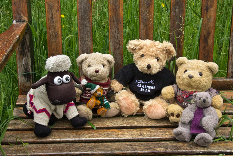
Very pleasant it was too in the very peaceful surroundings. We of course have to appear at least once in every story, so afterwards, we posed sitting on the seat.
Then Uncle Eric explored the churchyard, while Dad took this picture from the lych gate.
The church, which is Grade I listed, was built in about 1504 as a chapel of ease to Cartmel Priory. Lateral extensions were added to the north and south at the east end of the church in about 1520, with the south porch being added in the 16th century, and the vestry probably in the 18th century. It was restored in 1911 by John Curwen. It is constructed in roughcast stone with ashlar dressings and roofed in slate. In plan it consists of a three-bay nave and a chancel in a single range with north and south extensions and a south porch. The tower at the west end has a saddleback roof and louvered bell openings. In the foreground to the right of the path, the rectangular stone plinth is thought to have been the the base of a sundial, or possibly a mounting block, and is listed at Grade II.
"Can we go and look inside?", asked Grizzly, who loves to look round old churches.
"Sure" answered Dad, "let's just hope it is not locked."
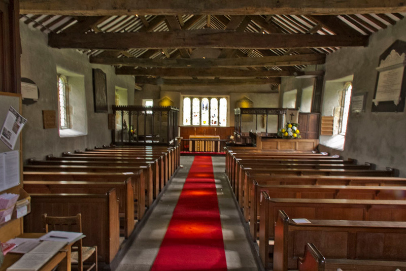
Well as the picture below shows it wasn't.
There are three elaborate pews that have been constructed for the church. The one that can be seen on the left is the Cowmire Pew that was probably created from a reredos and chancel screen in 1571. It has possibly been used as a schoolroom, as there are inscribed calculation aids on a bench. Beyond this, but not in view in the picture, is a smaller pew dated 1696. The one opposite on the right is the Burblethwaite Pew, made in the 17th century, and reconstructed in 1810. The pulpit is a three-decker dated 1698. The altar is surrounded by a three-sided communion rail, dating from the 18th century. The east window contains stained glass dating from about 1520. It contains depictions of St Anthony, St Leonard, the Crucifixion, and the Seven Sacraments.
As we came out Grizzly said, "thanks Dad, that was really interesting."
Beyond the lych gate. we passed the old school now the church hall. Dad remarked, "I once gave my teddy bear talk here, a long time ago now."
On the wall is this beautiful mosaic, made to celebrate the Millennium.
Jesus is depicted to the left and St Anthony to the right. The main feature is a tree, with surrounding fields, where sheep cows, pigs and wild animals roam. Birds are depicted too, owl, hawk and blue tit amongst others.
"How lovely", said Southey. "Once again I say thank you lads, and Dad, for letting me join the group and see the wonderful countryside."
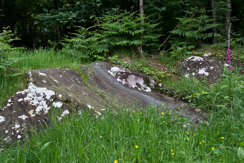
Opposite Uncle Eric pointed out a smoothed rock. "This is as a result of generations of school children that used to slide down."
So after this really interesting visit it was time to move on. At the road we went right so completing a circuit from where we had descended off the fell. Now at a road junction it was sharp left, following this down and then right to pass a house called Gateside.
"In about another third of a mile, we will come to High Loft Wood. Just before we take the metalled track right, at an acute angle", said Shaun.
This climbed through Poor House Allotment and on to a brow. Shaun was looking at the map, and said "if we kept on ahead we would come back to Foxfield again. However very soon we should go left."
This was a stony track that meandered over the area of Simpson Ground Allotment. This had been divided into fenced areas, with names like Waybeck Fell, Owlet Fell, Juniper Fell, Carr Fell etc. In some of these new trees had been planted. It seemed to us that some form of management plan was under way, although even a diligent search of the Internet, has not revealed any information. What was clear though, was that we, Dad and Uncle Eric had never been here before.
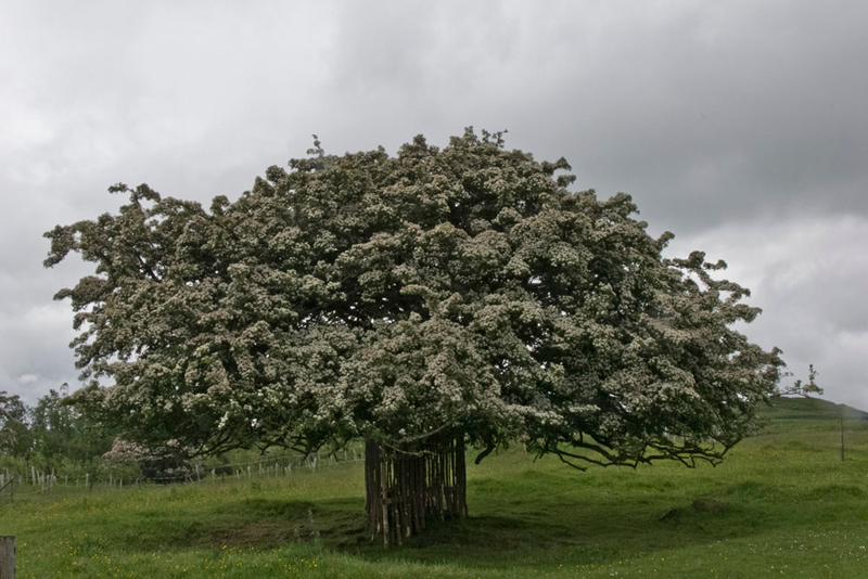
Some of the trees were mature, like this impressive hawthorn.
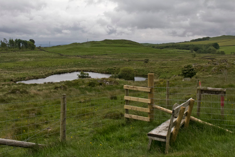
The path actually climbed as we passed through the allotment, where at one point a seat had been placed affording a wide view and overlooking a fenced area with a small tarn. "Another place for lunch", remarked Little Eric, "if we ever come this way again."
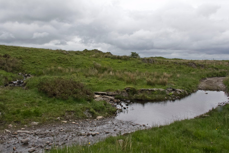
"We will have to ford Way Beck", said Shaun.
"Will that be a problem?", asked Southey, a little worriedly.
"I don't expect so", replied Dad.
Well here is the ford, looking back after we had crossed, by the narrow part of the beck running in from the left.
Fairly soon then we came to Simpson Ground Farm, where just before the gate into the buildings, the path was clearly signed right to a gate in the wall, with the dam of the reservoir visible ahead. Soon now it was left on a good track with tall trees to the right that eventually came to a forest road.
Reading the walk route Shaun said, "it says we should go right."
However Uncle Eric was looking at the map, and said, "I think actually going left will be better."
It we had followed the published route, we are sure that we would have come down to the junction of forest roads, where this morning we had gone ahead. Trusting Uncle Eric, the route left brought us to a signed path right that descended more steeply. It then soon entered the trees, the path being narrow and rough, to at the bottom exit on to a forest road. This was the one we had followed outwards at the start. Turning left we soon passed the mobile phone masts at Barrow Banks...
and so arrived at out start point Chapel House Wood car park.
"Thanks Uncle Eric and Dad for a good day and a really interesting walk. I have loved exploring this area", said Southey.
"Refreshment time now?", asked Tetley.
"Yes lad", replied Dad. "Uncle Eric and I are going to try the new cafe, called Harrys, at Yew Tree Barn."
It has changed in that there are not the antiques, clocks etc., that Jane and Sam had, so it seems larger and more spacious. The food was very nice and there is a wide and varied menu.
"It is back on the list then", remarked Allen later.
"Yes indeed and I am taking Uncle Brian tomorrow in fact."
Well he enjoyed it too, and we had had a good day and say thank you to Uncle Eric for his company.