LOW KOP, WETHER HILL, LOADPOT HILL & ARTHUR'S PIKE from MOORAHILL FARM
Summary
Date - 22nd June 2014
Distance - 11.25 miles
Ascent - 1680ft
Map - OL5
Start point - Moorahill Farm (NY 49606 18232)
Summits Achieved
Name
Height (ft)
Height (m)
Grid Ref
Low Kop
1877
572
NY 4744 1647
Wether Hill
2199
670
NY 4557 1678
Loadpot Hill
2201
671
NY 4568 1812
Arthur's Pike
1747
532
NY 4607 2067
Preface
Little Eric was tapping away on the iPad, then looked intently at the screen.
"What are you on with pal?", asked Tetley.
"I'm looking to see what the weather is like for Sunday, in the hope that we may be going for a walk."
"Now I know that having completed Books 3 and 5, you are anxious to get Book 6 out of the way, but bear in mind that Dad is at the Lifeboat Shop on Saturday, and he will be going with Uncle Brian to Elaine's as usual on Monday. So I think that it will be a bit much to expect him to drive all the way to Crummock Water and then do that big ascent up Grasmoor and on over the other tops."
"You're right of course", agreed Little Eric, "but what to do instead?"
"Well there is Book 2 Far Eastern Fells,", replied Allen. "We did two summits from Haweswater, when Dad was rebuilding his fitness and stamina. I have looked at the list and you have done 21 of the 36, so maybe that might be the next book that you could finish."
"That would be really good, but will Dad be happy to repeat those again."
"I'm sure he will be agreeable, especially as it is over eight years since we last climbed many of them", said Tetley. "After all he repeated nearly half of the Wainwrights so that Allen and Grizzly, could complete the challenge."
"I would love to do some of them, as it will be another completely new area for me", enthused Southey.
About to wonder which ones might be done on Sunday, our thoughts were interrupted by Shaun and Grizzly arriving with the tea and cake.
"Great!", exclaimed Allen. "I'm gasping for a cuppa and the cake will get my brain into gear to think of where to walk."
Meanwhile Southey and Tetley had been and got the plates and mugs. The latter were filled by Shaun, and the plates passed round.
Grizzly announced, Little Eric has made flapjack, which we have not had for ages. I have made peach and apricot slice topped with icing."
We all helped ourselves and there were murmurs of satisfaction as we sank our teeth into the cakes. Scrumptious", cried Southey. "Delicious", added Allen.
He then outlined the discussion we had had to Grizzly and Shaun.
"Sounds a good idea", agreed Shaun.
"So what to pick", said Grizzly, who had opened the page on the iPad.
Allen was looking over his shoulder, and after a few moments, suggested, "how about doing Wether Hill, and Loadpot Hill and on to Arthur's Pike. There will be good views of the Helvellyn range and of Ullswater too."
"I like the sound of that", agreed Little Eric.
"The question is where to start to make it a circular walk, as last time we got the boat to Howtown from Pooley Bridge, climbed the fells and walked back", said Tetley.
Shaun had by now got the map and Wainwright book opening this at Wether Hill. He paged through then said, "there is an ascent from the Bampton side, that goes up over Low Kop, He had opened the map and finding the location said "it starts at the end of what looks like a very narrow road to Moorahill Farm. That will be new up to the ridge. Then we walk on over Loadpot Hill and then to Arthur's Pike"
Well it is always good to do a new route, but how do we get back to the start?", was Grizzly's next question.
"Wainwright shows a path from the Roman Road, descending to near Knotts on Helton Fell, from where we need to make what seems will be a trackless traverse round Knotts to Scales Farm. Here we pick up a bridleway to a road, then along this past Rough Hill to the road we will drive along and then just a very short way back to the car."
"Seems an awful long way", said Southey who had been following Shaun's directions on the map.
"The only tricky bit will be getting from Knotts to Scales Farm", said Allen, "but you and Dad usually find the way. As for the distance, we can only see what Dad thinks." So draining his mug he picked up the book and map and headed off to ask.
"Better refill his mug, Shaun", said Tetley, "we all know what a tea belly he is.
Little Eric had helped himself to another piece of cake, but thoughtfully and put a slice on Allen's plate too.
A few minutes passed by and we sat in companionable silence each lost in our own thoughts, before Allen returned. "Thanks pal", he said as Shaun handed him his refilled mug. "Dad has said OK to our suggestion. He likes the idea that apart from the section on the ridge it will all be new. We have never been on the road from Bampton to the start at Moorahill Farm, so he says that will be interesting, and hopes we do not meet too many other vehicles."
"Great", shouted Little Eric. "I am such a lucky bear. But I say again that I still do not expect Dad to repeat all my outstanding Wainwrights."
"Here's to Sunday", added Southey, raising his mug.
The Walk
Dad wanted to be walking by 09:00, so we had to be up early to get the picnic ready and packed in Allen's rucksack, all of us lending a paw. Once Dad had loaded up we settled in the car and off we went, a very happy band with high expectations of a good day ahead.
The route was a speedy journey up the M6 to junction 39, then on the A6 north through the long linear village of Shap, taking the narrow road left, and following this for a few miles to come to the village of Bampton Grange.
"We came this way when we climbed Branstree, but then we turned left after the bridge to take us to Haweswater", said Tetley.
Today we went right and drove the short way on to Bampton Bridge. Here at the junction it was right signed Helton, but after about a couple of hundred yards we turned left. Now we were on completely new ground having never driven along this road before. It was single track, and after passing a house, climbed steeply up some hairpin bends, to continue with stone walls either side.
"We're doing well so far", said Southey, but hardly had the words been said than we met a 4x4 coming towards us. Fortunately Dad only had to back about 50 yards to the passing place. Plain sailing then, passing the farms of High and Low Hullockhowe, and the access to a property called Vaugh Steel, to cross the cattle grid and find the verge parking just before Moorahill Farm, where the road ends.
We got out, and it was just so peaceful and quiet. No other people in sight, and just the sheep and lambs grazing. "Oh how wonderful", whispered Southey. "I thank my lucky stars that Dad chose me amongst all my other cousins at the Wordsworth Hotel, and that Kim went to work there in the first place, otherwise Dad would never have visited."
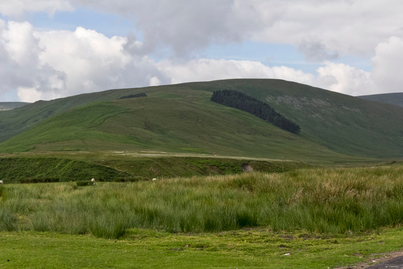
Surveying the scene west, Shaun said, "that is the ridge we will climb. You can see the track climbing Hause End and then along the Hause past the plantation. " Glancing at the map he said, "there is another plantation opposite on the left side, the top of which can just be seen peeking over. The valley on the right side is Cawdale through which runs Cawdale Beck, which we will have to cross to access the ridge."
"Thanks pal", replied Little Eric, "you have set the scene perfectly."
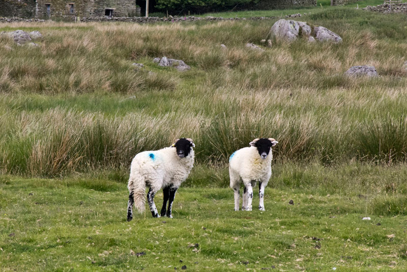
So in accordance with Birkett's instructions we crossed the road and walked by the wall and then across the open ground seen above where the sheep were grazing.
"Oh no!" growled Allen, as these two lambs stood and posed while Dad snapped their picture. "We have only been walking a few minutes and there goes a sheep picture free story."
"Ahh, but they are really cute", replied Grizzly.
"Humph!", growled Allen.
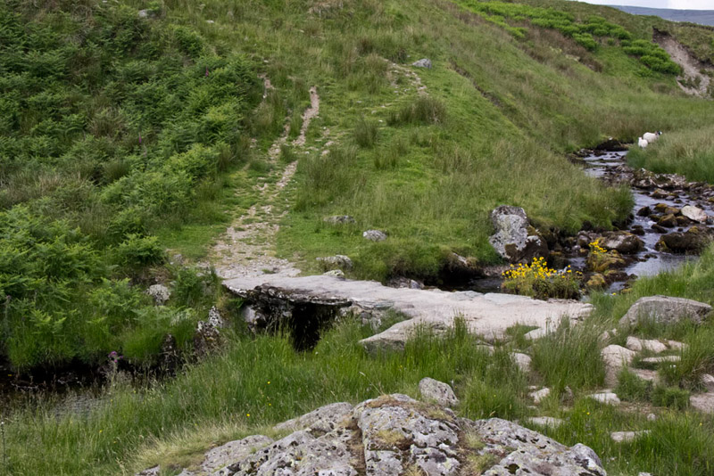
A path emerged and led down to the small slate bridge over Cawdale Beck.
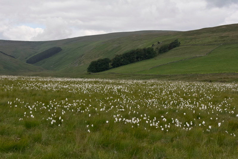
Up the steep bank beyond the ground was level, with the cotton grass waving in the light breeze. Cawdale forms the backdrop, with distantly the ridge to which we had to climb.
Tetley said, "we will shortly pass Towtop Kirk that according to the few references on the Internet, could have been an ancient village or settlement from prehistoric times."
Grizzly pointed, "that must be it. You can just see the slight rise of the embankment and some stones at intervals amongst the tussocky grass."
Dad tried to take a shot, but the tussocky grass effectively disguised it, so the result is only of relevance to us alone who had been there.
A track ran past this and on to climb quite steeply Hause End and along the The Hause, eventually between the two plantations, as Shaun had predicted. Then passing a cairn to the left we reached the large flat area that is Low Kop, a Birkett summit. With the exception of Southey we had all been here before.
"The last ascent was in January 2009, when we took in Pinnacle Howe and a few other tops", said Tetley.
"I recall then that we had to cast about a bit to find the highest point", added Grizzly.
Shaun said, "according to the map paths run either side and the spot height is shown between, so we need to leave the path and go off left."
This we did, and again after a bit of casting about, we agreed with Dad that a small rise was the unmarked top. Dad logged the summit waypoint on his GPS, then compared this to the grid reference we had noted back on 2009. It was identical except that his current GPS gives a five figure reading instead of four.
"Well this must be truly right as we have come to the same conclusion again", said Allen. We compared the two summit pictures when we got home, and without a word of a lie, Dad had sat us in the identical spot on a circle of mossy ground amongst the sea of grass!
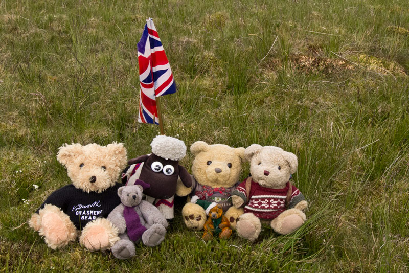
"Let's have our picture taken", called out Southey as we scrambled out of the rucksack. "As there is no cairn will you get the flag out too, Dad?"
We were nearer the left path and Shaun said, they join together in the direction we want, so we may as well use it."
"I recall that this was the path we used on the ascent last time, and then going down to come beside Haweswater", remarked Allen.
So we strolled on, the paths soon merging, and then it was on along the centre of the shoulder and climbing again. There were lots of birds, crows and seagulls flying about ahead.
"A bit Hitchcock", remarked Grizzly.
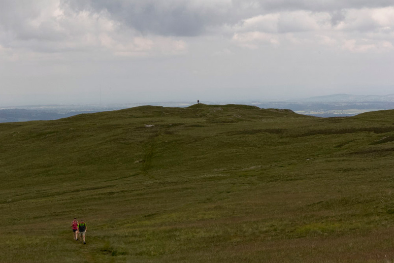
So this brought us to the level of High Kop, where then making a level traverse the path not being quite so well defined at times, the ridge was achieved, and here we saw the first other walkers, at a distance.
"Good", said Dad, "that is the bulk of the climbing out of the way."
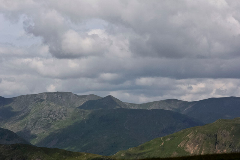
We turned right, but our progress was arrested for a short while as we took on the magnificent prospect of the Helvellyn Ridge. Fairfield, Dollywagon Pike, Nethermost Pike and Helvellyn with the ridges of Striding Edge and Swirral Edge the latter falling to climb then to Catstycam.
"Wow", shouted Southey, "what a stunning view!"
This picture has the flat top of Helvellyn with Striding Edge rising on the left, and Swirral Edge right falling and rising to the pointed top of Catstycam. Tucked in between Swirral Edge and Catstycam is Helvellyn Lower Man.
With this view continuously to our left, Dad walked on and we started to climb again. "There's a cairn on the skyline", said Little Eric.
"It must be the top of Wether Hill", replied Shaun.
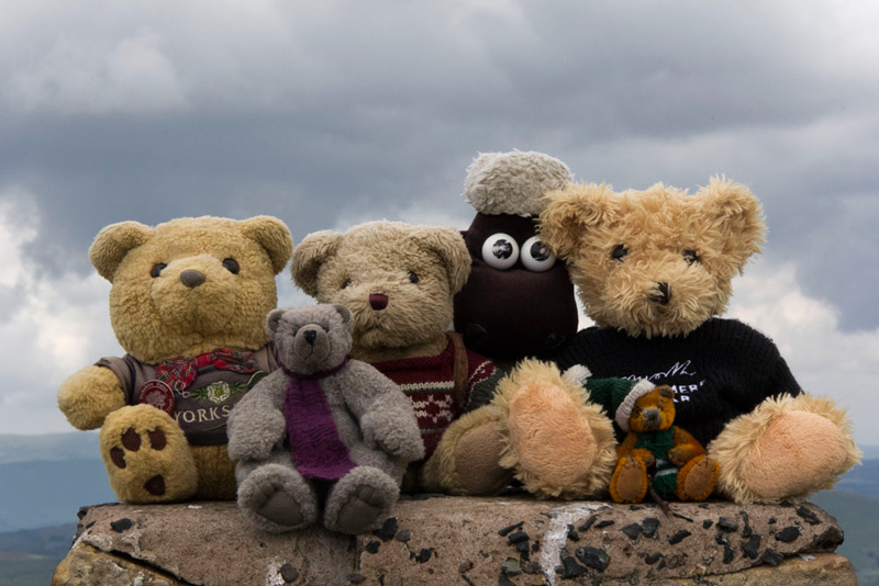
Well he was right too and we could not wait to settle on it for our picture. We think the large rectangular shaped stone is an old boundary stone. The derivation of the name is probably in relation to the hill where wethers (castrated lambs) grazed.
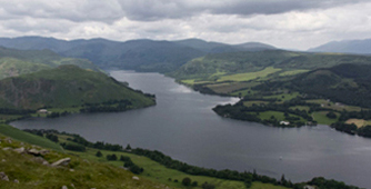
There was now another fine view looking west. In the foreground, bathed in sunlight, is Steel Knotts whose sharp summit is called Pikeawassa, with behind Hallin Fell. Beyond Steel Knotts, can be seen a dark stretch of Ullswater, with Gowbarrow Fell above. To the right the rounded hill is Great Mell Fell. Then in black outline, left to right, Blencathra. Bannerdale Crags. Bowscale Fell & Carrock Fell, all of which we had climbed recently, in our pal Little Eric's quest to complete Book 5, Northern Fells, which he did summiting Blencathra just two weeks earlier.
Turning matters back to the walk, Tetley said, "do you see the trig point on the skyline, Little Eric. That is our next objective Loadpot Hill just another mile distant."
We got settled in Dad's rucksack and shouldering it he strode off. Now we should mention that we were walking the steps of the Roman Legions, as along this runs the High Street Roman Road. Sadly we did not see any Legionaries today. Perhaps they were resting at their forts. (lol) The path descended to a depression, after which we made the steady 180ft of climb to summit. Shortly before the actual summit we passed the site of the Lowther House, an old shooting lodge. Fifty years ago all there was left standing was the forlorn chimney, a wonderful drawing of which Wainwright includes on page 12 of his chapter on this fell, in his Book 2 Far Eastern Fells. Fifty years on this is now all that is left. A pile of stones and some concrete floor.
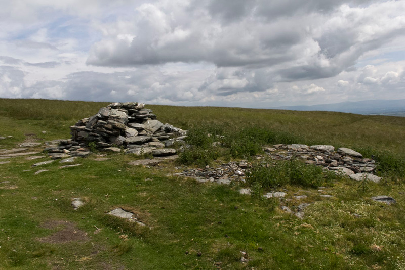
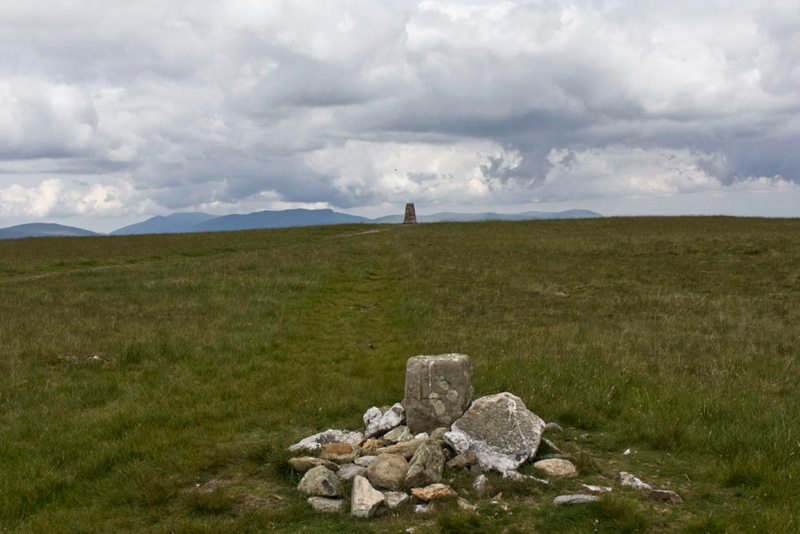
Just a short way on the flat summit area of Loadpot Hill was reached. A nice little cairn of stones with glittering quartz content surrounding a boundary stone and behind the trig point that is the actual highest point, despite the fact that on the OS map it is the cairn that is shown as highest by one metre.
"Ooh, there is not much wind, so we will be able to sit on top for our picture", called out Allen with glee.
"So that's two down just one to go", said Little Eric excitedly, as with the rest of us he settled in the rucksack again.
"Yes Arthur's Pike next", said Shaun, "about two miles of pretty easy walking."
There was some hundreds of feet of descent to rejoin the Roman Road, passing on the way the deep Loadpot Hole. This is the derivation of the name of the fell, being the hollow with ore - i.e. load/lode.
On the Roman Road again we kept on for about another mile, Arthur's Pike being in view ahead.
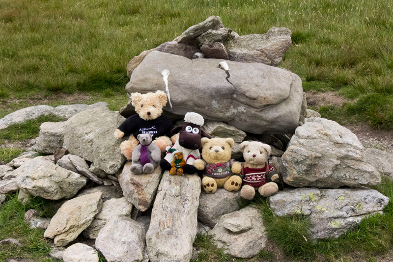
Where the Roman Road drifted right, we kept ahead soon then reaching the summit with a rather untidy cairn, after a very short ascent.
"Yippee" cried Little Eric, "that's the three summits done, meaning too that I have done two-thirds of those in Book 2. Photo time!"
"Absolutely", enthused Southey.
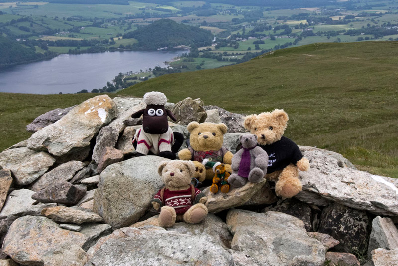
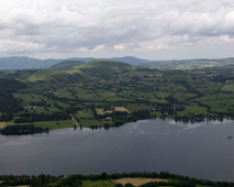
Ullswater forms the backdrop looking to Pooley Bridge with the tree clad Dunmallard Hill.
Surely it is time for lunch?", asked Allen. "My tummy has been rumbling for a while."
"Yes Lad it is and after all the effort we have earned it", replied Dad.
We were going to sit at the cairn, but some mountain bikers were approaching, so in deference to them we decamped just a few yards away to enjoy the sandwiches, cake and tea. We should say that this is what we have. Dad does not eat very much at all on the walks, and usually it is just a sandwich or two, chocolate biscuit and water.
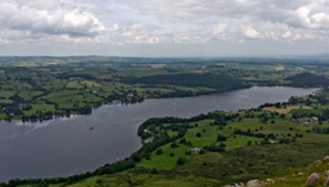
Shaun had been leafing through the Wainwright book, and commented, "he suggests walking to the large cairn called the Beacon, to get the best view of Ullswater."
"Right then", said Dad, "that is what we will do."
As we arrived, Allen exclaimed "wow he is so right, truly stupendous."
This is a compilation of three shots Dad took of each section. Unfortunately Dad's current camera, unlike his old Canon S2IS which he gave to Uncle Eddie, does not have the picture stitch facility. The left picture is taken with a slightly different focal length so does not exactly match in the upper landscape, but nevertheless shows what an amazing view there is of the lake. Probably one of, if not the very best there is.
So now we had to start the descent, the paths we were to take being totally new, and as is the case with the OS maps not all are shown.
"First we need to get back to the summit cairn" said Shaun, "then to save having to walk back towards Loadpot Hill to regain the Roman Road, cross roughly south-east over what is likely to be a trackless ground."
As well as being trackless it was a bit boggy too, but Dad is so used to it he hardly noticed. The GPS provided a good guide to direction and after cresting one rise, it was not long before we were on the Roman Road. Looking at the grid reference, Dad said, "we need to go left top find the path east down the fell."
"Looking over his shoulder Shaun replied, "I agree."
We did not know quite what to expect, but as it turned out after a few hundred yards there was a clear fork, where it was right. The tractor track meandered down and after a while Grizzly called out, "a hill has come into view below that must be Knotts, so we are certainly on the right track.
Further meandering brought us soon close to Knotts, where it was clear we had to go right to get over to the bridleway below Scales Farm.
"Hmm", said Dad, "I am not took sure about this next bit. We could instead go left down to that road."
"Well yes", replied Shaun, "but it will be a long long way round, but if you think that is best that is what we will do."
Now sometimes fate takes a hand, and just a few minutes later we met and elderly couple, who we presume must have been locals, as when the gentleman asked Dad where he was making for, he knew exactly where Dad meant.
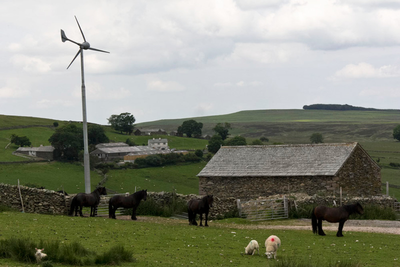
"You need to go under Knotts", and pointing right said, "there is a good track that starts just 20 yards over there, which I suggest you follow." He also pointed on the map to a sharp bend in the bridleway near Keldhead, saying, "you will know when you have got to this point as there is a wind turbine that will act as a marker."
So thanking him we headed off, and indeed just yards away the path that was wide and clear materialised leading below and round Knotts. Now it maybe that we might have happened upon this ourselves, but we are certainly grateful to that gentleman for his assistance. After a while as we got to the south side, it began to rise, but suddenly there was a right fork that descended.
"I reckon we should take that", said Shaun.
"I agree", replied Dad, now making a rapid descent, to soon arrive at the buildings of Scalegate, just over the other side of the wall.
Allen was assisting Shaun with the map, and said, "we have to get to the bottom of the valley and to Scales Farm, then follow round and cross Heltondale Beck, if we are to get to that wind turbine we can see, which must be the one the gentleman referred to."
"Well there is no way through the wall to the buildings, so the only option is through this gate on the right and extremely steeply down the field", said Dad.
As we made the descent Tetley remarked, "I bet you are glad not to be coming the other way."
"Absolutely lad."
Well arriving at the bottom gate, suddenly there were waymarks! Grizzly said, "well done all, we have got to the bridleway."
These were followed as they directed us, crossing the beck and then climbing a field. Now suddenly there were no waymarks prompting Southey to say, "oh heck, what will we do now."
"Again the only option is through this gate on the left, and up the field towards the wood", replied Dad.
It was quite steep and for a few seconds it looked like there was no way through past the wood, but then getting closer it was clear there was a wide track between the wood on the left and the wall on the right. At the end it was through the gate right in the wall. Here we followed round by the wall to the left, to come by the wind turbine, which actually made a nice scene with the horses and sheep and Keldhead Farm behind.
"Glad that's done", said Little Eric with some relief in his voice, "but I knew you and Shaun would work it out Dad."
So, now it was just the simple matter of following the rough access track to the road. Here Shaun said, "we go right and follow the gated road leading past Rough Hill Farm."
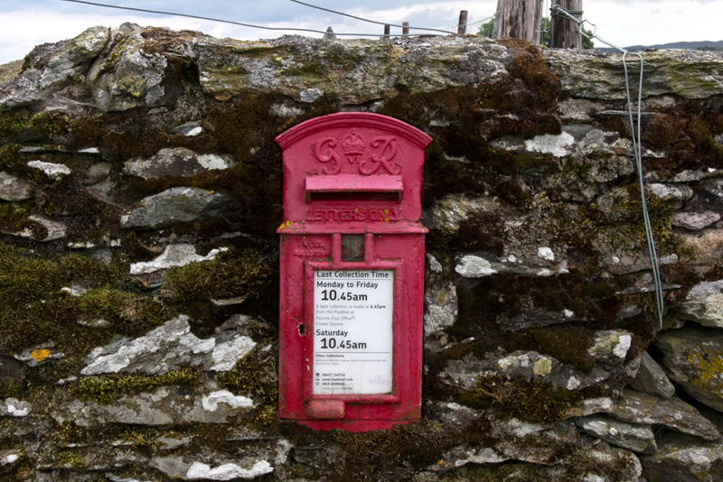
Now as well as sheep Dad likes to take pictures of the wall post boxes, in remote areas. This one dates from the reign of King George VI.
Allen said, " it always amuses me that under the slot it says letters only. It would be impossible to get anything larger in."
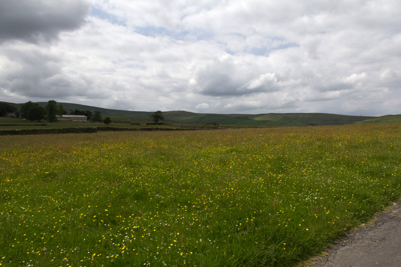
Beyond the gate the way led past this field full of wild flowers. "What a lovely sight, and a complete contrast to the terrain on the rest of the walk", said Southey.
The road led down to and past Rough Hill Farm where sheep were being sheared. For some reason our pal Shaun was very quiet here!! Then through another gate we finally reached the road we had driven this morning passing to the right of the property called Vaugh Steel. Turning right it was just a short way to the cattle grid and then the car.
"That was a really good walk", said Allen, "and all new apart from the ridge."
"Another area of Lakeland explored", added Tetley.
"Despite the distance I did not find it too hard, so I must really be getting my fitness back", said Dad.
"Refreshment time now?", asked Tetley.
"Yes, I plan to go to the Abbey Tearoom in Shap, as I am sure it was open the last time."
Well as it turned out it was closed, so we just drove home. When we checked the day of the Branstree walk we found that it was a Saturday not Sunday.