ANGLETARN PIKES, BROCK CRAGS & REST DODD from PATTERDALE
Summary
Date - 20th July 2014
Distance - 9 miles
Ascent - 2460ft
Map - OL5
Start point - Patterdale (NY 39603 15906)
Summits Achieved
Name
Height (ft)
Height (m)
Grid Ref
Angletarn Pike - North
1860
567
NY 4133 1482
Angletarn Pike - South
1854
565
NY 4143 1469
Brock Crags
1842
561
NY 4166 1366
Rest Dodd
2283
696
NY 4327 1369
Preface
"It has been nearly three weeks since we last walked", said Little Eric mournfully.
"I know pal", replied Southey, "I am as anxious as you to get out on the fells again."
"Well Dad has had a lot of commitments. First Fletcher Polly and pals went to Armathwaite Hall with Dad and Uncle Brian, for three nights, then this week Panararmer have been fitting the new back door and window", said Tetley. "But I am sure that Dad is as eager as we are to walk, so perhaps we will get out this Sunday."
Looking up from the iPad, Allen said, "the weather is set fair."
"I wonder if perhaps Dad will agree to re-climb some more of the fells in Book 2 so that I can progress towards finishing it off?", mused Little Eric.
"I am ready for a cuppa", said Southey.
"Me too", added Allen.
Tetley reassured them saying, "I'm sure Shaun and Grizzly, will be along soon, but in the meantime, perhaps we could think about which fells in Book 2 we might suggest to Dad to climb."
Allen quickly navigated to the web page, and immediately said, "Angletarn Pikes would be a start. The route up would be from Patterdale via Boredale Hause."
"My we have not been there for a while. About seven years if I recall correctly", said Shaun, as he and Grizzly arrived with the flasks of tea and cakes.
"You're a lifesaver", cried Southey, as he and Allen got the mugs and plates.
"Before you ask, the cakes are chocolate coconut and cherry slice, and Little Eric has made peach and apricot slice."
So content with steaming mugs in paw and cake, our thoughts turned back to the prospective walk, but not before Southey had said, "the cakes are really scrumptious. Thanks pals, you both really spoil us."
"Whatever we do, it will not be a circular walk, so we need to see what can be attained logically beyond Angletarn", suggested Tetley.
"Rest Dodd for sure, as it will save a long climb to it when we tackle others from Hartsop", stated Shaun.
"I need to bag Brock Crags", said Little Eric. "Could that be done too?"
Shaun got the map and after a minute said "yes, it is just a little to the west from near Satura Crag above Angle Tarn."
"That has got to be the best way too, as it is a steep old climb from Hartsop, but from here it will only be like a ridge walk", added Tetley.
"There is no path on the map, but the latest Wainwright shows a path forking right, just before the gate, in its direction", advised Shaun.
"Right then we seem to have a walk, all we need to do is see if Dad is agreeable to our suggestion", enthused Little Eric.
"OK", said Allen draining his mug and grabbing the map and book, "I'll go and ask."
As he trotted out of the door, Tetley laughed saying, "fill his mug up, as we know what a tea belly he is."
It was just a few minutes later that Allen came bounding back into the room. The wide smile on his face was sufficient to tell us that Dad had agreed. "Yes pals Dad thinks our suggestion is excellent, and indeed we will be going on Sunday." Taking the refilled mug from Shaun he said, "thanks pal."
"Great", enthused Southey. "Another new area for me, and more tops bagged by Little Eric and me."
"Roll on Sunday!", cried Little Eric, raising his mug in salute to Dad.
The Walk
By the time Sunday arrived, the weather forecast was not quite so good and suggested that early on the cloud would be down on the fells, so Dad decided that we would aim to start walking about 10:30, meaning setting off around 09:15.
Up the M6 we turned off along the link road past Kendal and continued towards Windermere. The traffic was quite busy, and Southey said, "do we go all the way to Windermere?"
"No pal", replied Tetley. "We will go as far as Ings, then take the narrow road right over to Troutbeck. It is a short cut."
"As we turned off, Southey said, "the sign does not read Troutbeck."
"That is because, as it is so narrow, they do not want tourists to use this route, and so it is only known to locals, and drivers in the know like Dad."
When we finally got to the main road again, Southey said, "I see what you mean, there really were some very narrow sections."
Then it was through the village passing the church, and on to climb up to Kirkstone Pass. The road passes the Queens Head Hotel. This had been recently extensively damaged by fire. There were temporary traffic lights, as the road had been narrowed to one lane because of scaffolding. "My what a mess. That is going to take some rebuilding", breathed Allen. "What a shame too."
As we reached the top of the pass, Southey asked, "what is the mountain ahead?"
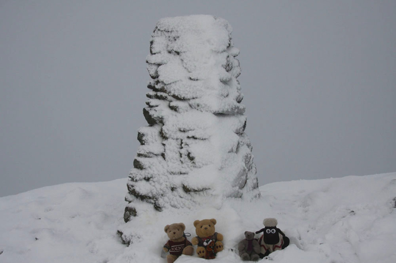
"Red Screes", replied Grizzly. "We have had some good times climbing that over the years, including in thick snow, where we huddled by the summit cairn in the strong wind, with the vertical precipice just yards behind."
The road took us past the Kirkstone Pass Inn, and then descended to the valley floor. Near the top Allen called out, "look Southey, do you see that rock that looks like a church tower. The Scottish name for church is kirk, and this is how the pass got its name."
"Thanks Allen, I am interested to learn as much as I can about Lakeland", he replied.
As we continued, the scenery was dramatic, with the fells rising high on either side. At one point Dad called out, "look Little Eric there are the Angletarn Pikes on the ridge to the right."
Soon then we passed pretty Brothers Water. Tetley said, "it was originally called Broad Water, but the name was changed in the 19th century, after two brothers drowned here."
A few minutes later we arrived at the village of Patterdale, the rough car park being on the right opposite the Patterdale Hotel. Dad got ready, and then with us safely tucked in the rucksack he strode off beside the road in the direction of Glenridding.
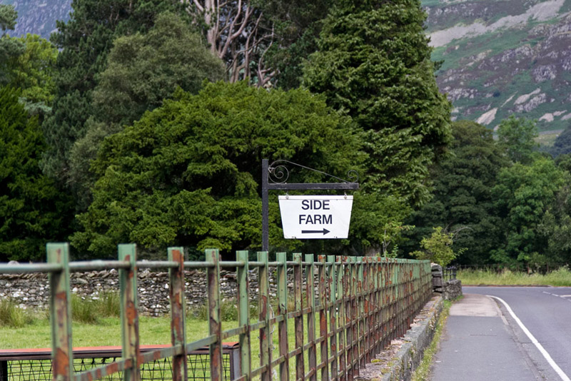
"Very soon it is right along the access track to Side Farm", said Shaun. The clear sign by the road left us in no doubt about this.
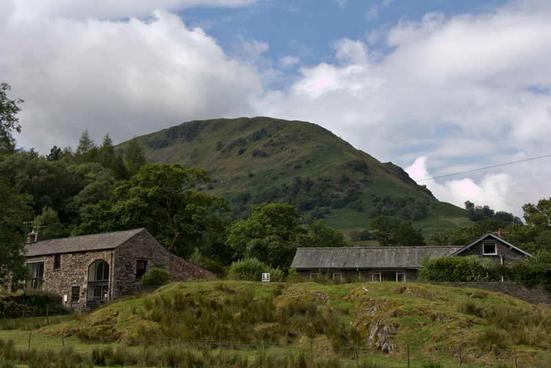
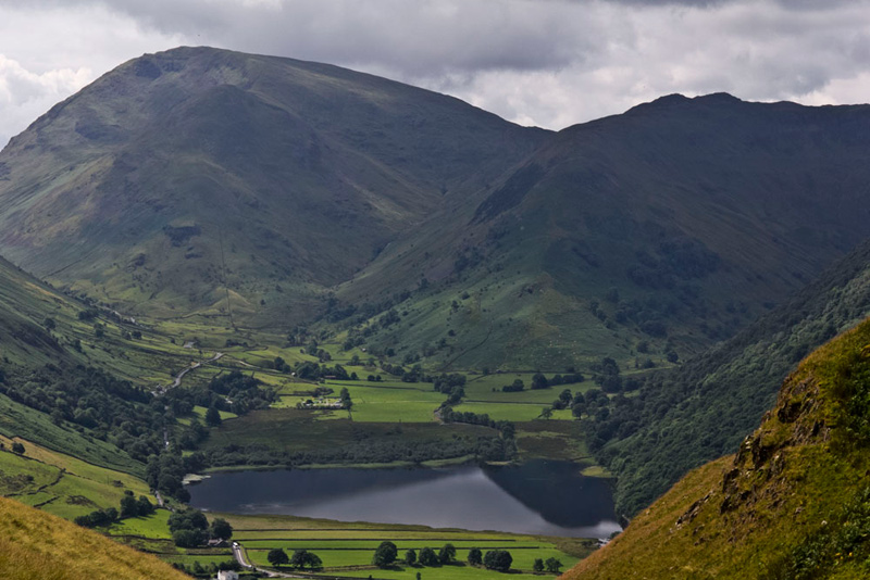
Before crossing the road we took time to look at the views, while Dad took some pictures, of which we include this of Birks (2040ft). Quite a stiff climb to its summit, the path then naturally leads on to St Sunday Crag, from where there is a ridge route via Cofa Pike to Fairfield or descent to Grisedale Tarn. This was the walk we had largely done back in July 2011, but not taking in Fairfield, when we were on the mopping up operation at the end of the Birkett challenge.
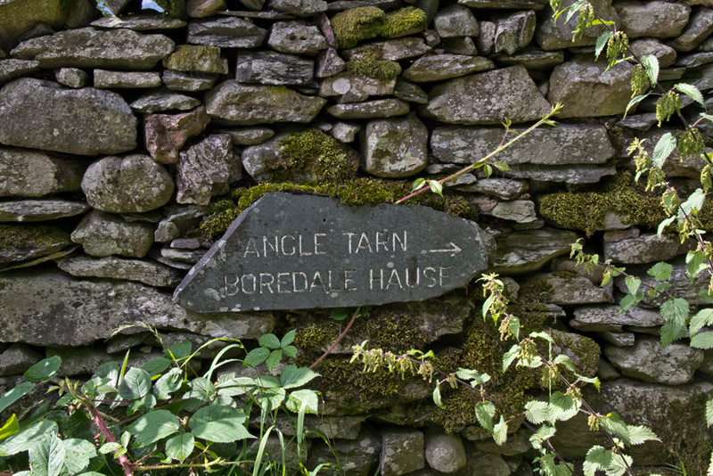
Striding the wide track it was on through the buildings at Side Farm, and then right on the wide surfaced track to a gate and on to another, to turn sharp left a few yards to a gate onto open fell. The slate sign on the wall clearly indicated exactly our route.
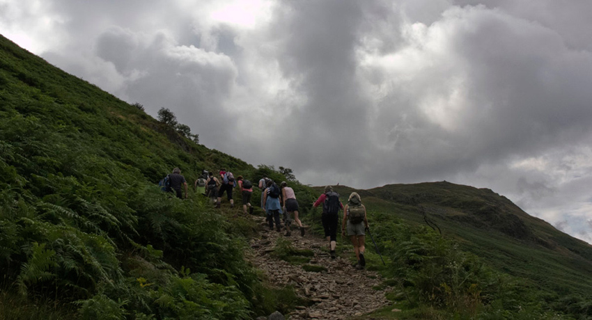
Just ahead we could see a party of walkers on the initial zig-zags, that resolved into a clear path rising right below Place Fell. The party stopped and here it became clear they were being led by a guide, who was allowing them to catch their breath, while he described the scene. We marched on, but having not quite got his second wind, after a little while Dad paused and sat on a convenient boulder. The walkers caught up, stopping here too, the guide then pointing out the fells tops across the valley, which revived happy memories of climbing them. The party walked on, us following behind a short while later.
Quite suddenly, the guide took the party off on a path left. "I wonder if they are going up Place Fell?", mused Allen.
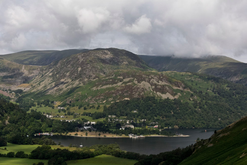
"Wow what a view looking back", exclaimed Southey. "It is a beautiful scene, please tell me what I can see."
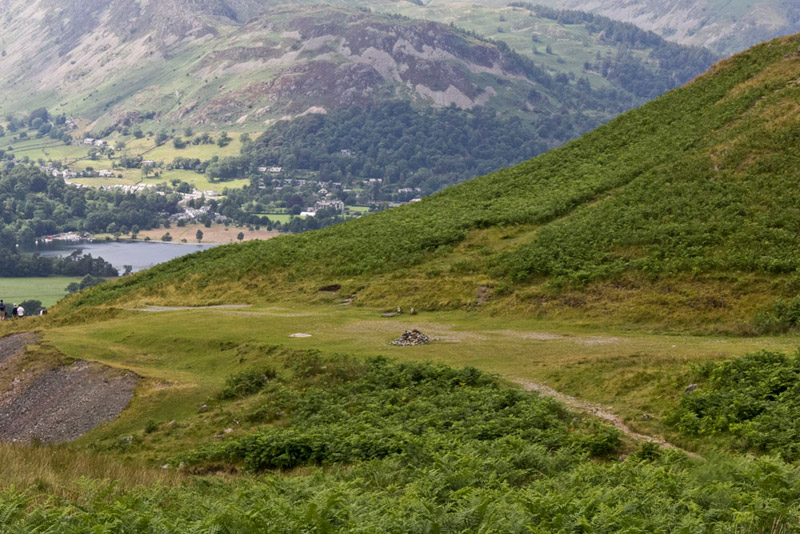
Tetley obliged saying, "the lake is obviously Ullswater and the village is Glenridding with the landing stage for the Ullswater Steamers that ply the lake. Behind, the lower fell is Glenridding Dodd (1450ft) with Sheffield Pike (2215ft) rising beyond. Behind the ridge from the left is Stybarrow Dodd (2766ft), White Stones on Green Side ( 2608ft) & Hart Side (2481ft) under the cloud."
"Right lads time to get going again", said Dad.
With determined tread, we continued up, the path fairly soon bending left and levelling at Boredale Hause. Here paths go in many different directions. One climbs north steeply up Place Fell, while another heads south down to Hartsop. Easterly there are two paths, on descending into Boredale, and the other over Beda Fell, which we had recently climbed. Our route was roughly south-east being the path leading ultimately to High Street.
"That's the path" pointed Shaun. "The one dropping to cross that beck."
Dad strode off, and as we climbed up, Grizzly, called out, "the guided party were not going to Place Fell, as they are heading for this path."
We were actually to see them from a distance later having we presume stopped for lunch above Angle Tarn. They moved off before we got there, and then did not see them again.
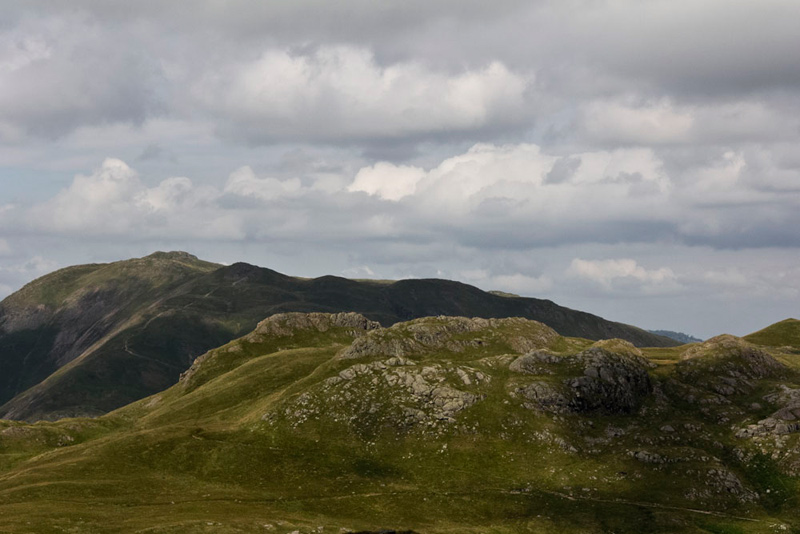
Passing below Stony Rigg, suddenly Angletarn Pikes were revealed. There are in fact two separate summits, but this is not clear from this viewpoint.
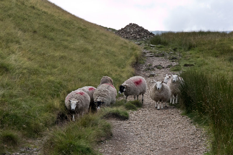
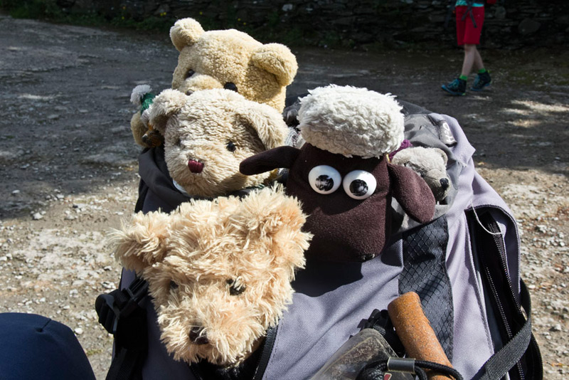
Rough and stony the path led on, Tetley saying after a few minutes, "look our way is baaed by sheep."
"Oh, that is a truly awful pun, pal", replied Allen, who then said, "and I suppose the picture will have to be included in the story. These days I have given up trying to get sheep picture free stories!"
They moved off of course but soon after passing the large pile of stones, our progress was arrested by Little Eric, exclaiming, "what a magnificent view. I know the large mountain to the left is Red Screes, but I am not sure of the overall scene."
"My turn to oblige", replied Grizzly. "The lake is Brothers Water of course and indeed you are right about Red Screes (2546ft). The pointed top below Red Screes is Middle Dodd (2146ft) and the fell to the right is High Hartsop Dodd
(1702ft). Clearly seen too is the road winding up the valley that we drove along earlier.
Onwards now passing a junction, where soon afterwards Shaun said, "we should have taken a left fork, Dad."
"Yes you are right lad."
To get back on track Dad made the short climb left over rough grass to gain this path, which was followed right and then left to the summit of the north pike.
Gaining it Allen said, "this is the highest, by about six feet, so is the Wainwright summit."
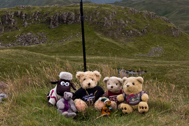
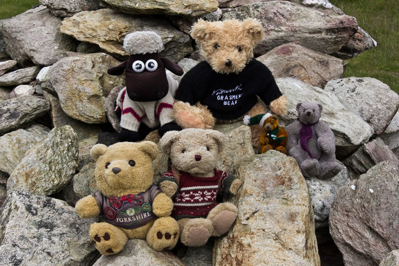
"Yippee", cried Little Eric, "come on pals, it's picture time."
Shortly three gentleman, from Carlisle arrived, one saying, "I guess there is a story to the teddies."
So Dad explained, and this caused some amusement. They were in fact doing the Wainwrights and will have about 70 to go after today. About the same our pal Little Eric has, but of course Dad is not repeating them all?
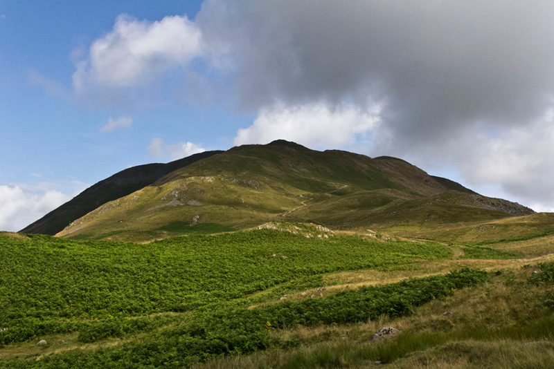
At their request Dad took their group picture, and the gentleman who has started the conversation, took ours! We are never shy in this respect! There was chat about various walks including Ennerdale, where one of the party had once lived. Everyone agreed that the long walk in from Bowness Knott car park to Gillerthwaite, makes these walks more challenging! So with Dad wishing them well in completing the Wainwrights, they headed off to Place Fell, while we crossed the depression in the background of the above picture to climb to the south pike. This is a Birkett summit. The nearest fell to the left is Rest Dodd, which was to be our last climb today.
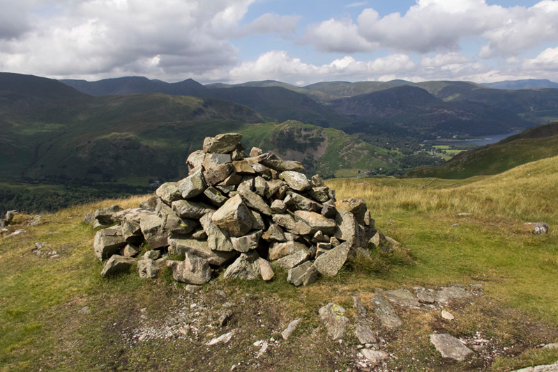
A cairn adorns this top, where we quickly settled.
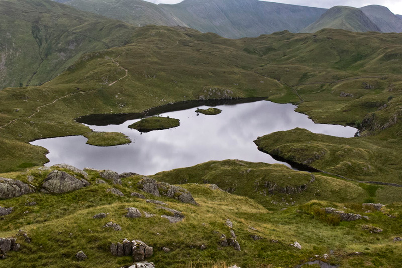
Lovely Angle Tarn was now below, the path we had to follow winding along the left side. This is an enchanting view seen below in its full glory. "Just magic", said Southey. "Oh I am so so lucky to have been adopted by Dad."
"What's our route now?, asked Little Eric, still marvelling at the wonderful prospect.
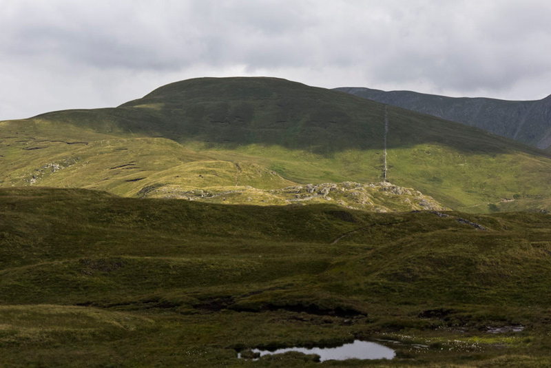
Shaun obliged. "We have to make our way down and gain the main path, then follow it round the tarn and climb on to the rise that is Satura Crag. Just before, we have to find a path branching right, to make for the fell above the tarn on the right of the picture, Brock Crags."
We were reluctant to leave the summit, but there was still lots to do, so we quickly settled in Dad's rucksack. The descent was quite simple and soon we were striding the path round the tarn. It was here up ahead that we spotted the guided walking party again, but they had disappeared over the hill by the time we got to that point.
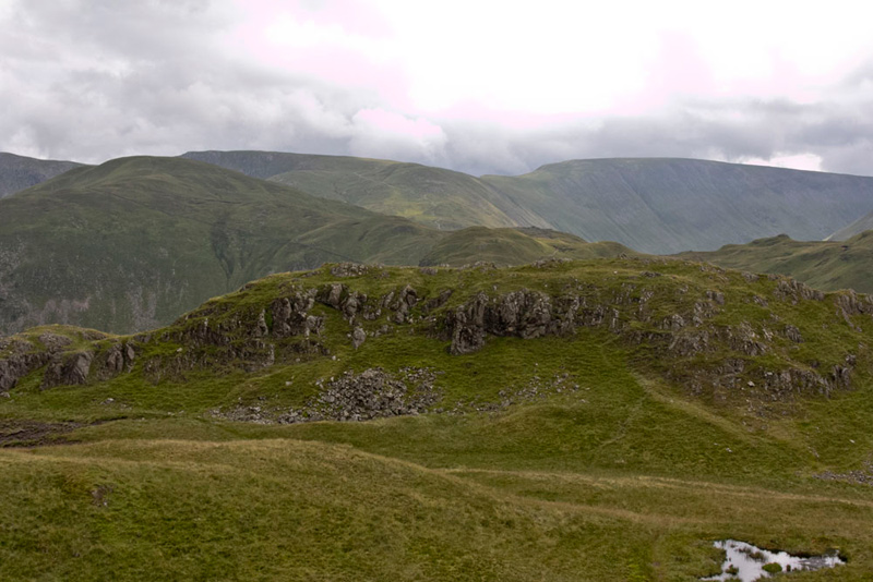
Now we had to look out for the branching path to Brock Crags. We were not sure about this but suddenly Grizzly called out, "here it is."
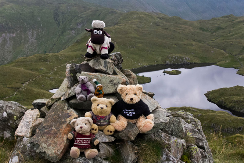
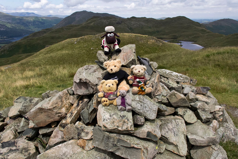
This soon joined another path from the left, and after crossing a ruined wall, very soon the summit was reached with its neat cairn.
"Come on pals", called out Southey, "picture time!"
"Time for lunch, don't you think?", said Allen, rubbing his tummy in anticipation.
"Yes it is", replied Dad. "I don't reckon we will be disturbed by other walkers, and there are some beautiful views too."
Allen slipped his rucksack off and passed the sandwiches round, followed by the cake. Shaun meanwhile had poured the tea.
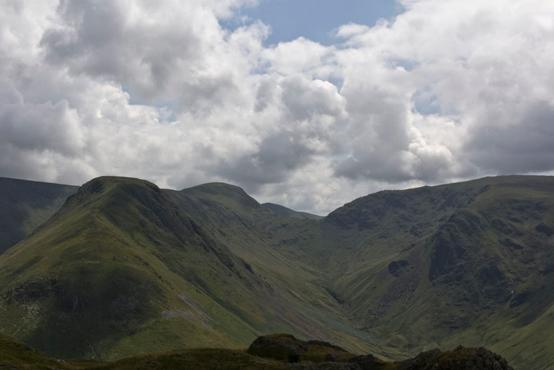
We sat facing south with this wonderful prospect of the fells above Hartsop.
"What can I see", asked Southey.
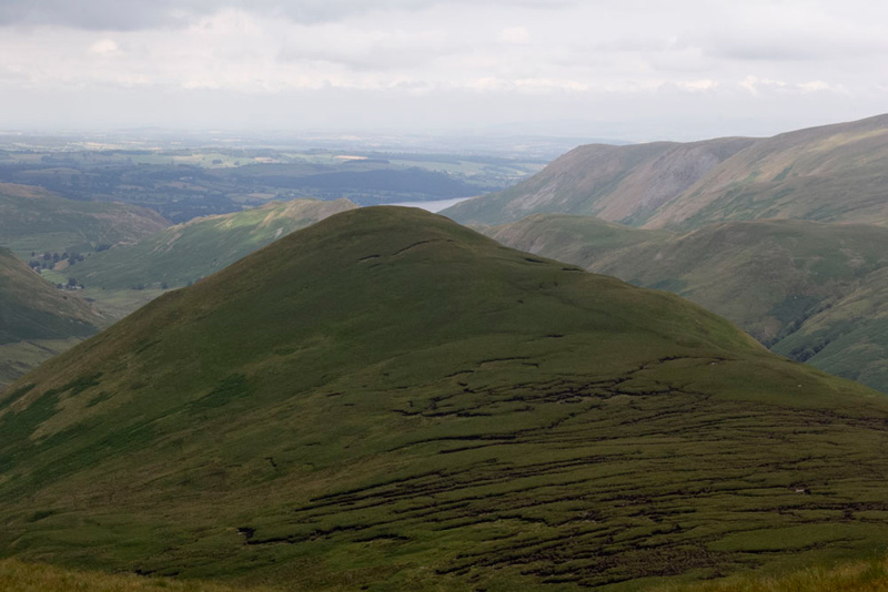
Tetley quickly replied, "left is Gray Crag (2293ft) its ridge running up to Thornthwaite Crag (2572ft). To the right is Threshthwaite Cove, with rising above it to the right Stony Cove Pike (2503ft) with the ridge running towards the camera of Hartsop Dodd (2028ft).
"I have the first two still to climb", said Little Eric.
"Yes lad", replied Dad. "I hope to be able to do the walk taking those in soon. If we get Kentmere Pike and Shipman Knotts done first, that will then see the completion of Book 2."
"Ooh that will be great. Thank you Dad!"
Lunch over, we took a little while to enjoy the other views, which Dad recorded for us.
This is looking west, and anticipating Southey's question, Grizzly said, "to the extreme right on the foreground is Arnison Crag (1422ft), then behind is Birks (2040ft) rising to St Sunday Crag (2758ft) in shadow. Behind Birks the flat top is Helvellyn (3116ft) with right the unmistakable pointed summit of Catstycam (2919ft).
Turning to look north, Little Eric said, "there is Angletarn Pikes. From here the ridges of the north and south summits can be seen clearly. The fell behind is Place Fell, where we met the Adele Pennington a true mountaineer, who had twice climbed Everest."
The only other direction left was east and Shaun said, "there is our last objective today, Rest Dodd."
"How will be get to the top?", asked Southey.
"We will have to cross the rising ground to gain the ridge on the left, then it will just be a simple climb right to the summit."
Looking hard, Allen said, "I agree, and there does seem to be some sort of path."
And so it proved. We walked to the gateway on the main path, walking right a little way over Satura Crag. "There's a path here going left", called out Grizzly. "It must be the one we want."
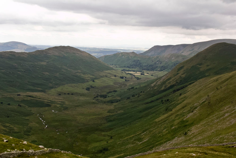
It was never in doubt, and the fact that we could see other walkers descending confirmed Grizzly's assertion. Undulating and climbing steadily, with away below The Nab. This is wholly within the Martindale Deer Forest, and is home to the oldest herd of native red deer in England.
"I'm sure there is some of the deer grazing far out on the fell", said Dad, zooming in as much as possible to take a shot. When we got home we used the computer to zoom in further on the deer, only to find that in fact they were three small peat hags. We think perhaps Dad needs to go to Specsavers!
Striding on the ridge of Rest Dodd was soon reached, where it swung right and climbed on to a cairn, and then across a small depression to the one at the actual summit.
"Come on pals", called out Little Eric, "let's get settled for our picture."
"Great", cried Southey, "that's the summits done as planned."
So now it was just the matter of returning by the outwards route. Dad made short work of the descent from here, and soon we were at the gateway on Satura Crag, and heading towards Angle Tarn.
Just past the gateway, Tetley called out, "Wainwright says that if we go just off the path, there will be a good view of Bannerdale."
The Nab encloses it to the right, while the fell to the left is Beda Fell, that we climbed at the beginning of the month.
"There is no habitation, " said Shaun. "A lonely valley and a place of profound solitude."
Crossing a rise, the path soon descended to the right of Angle Tarn, then went left and right to pass below the Pikes.
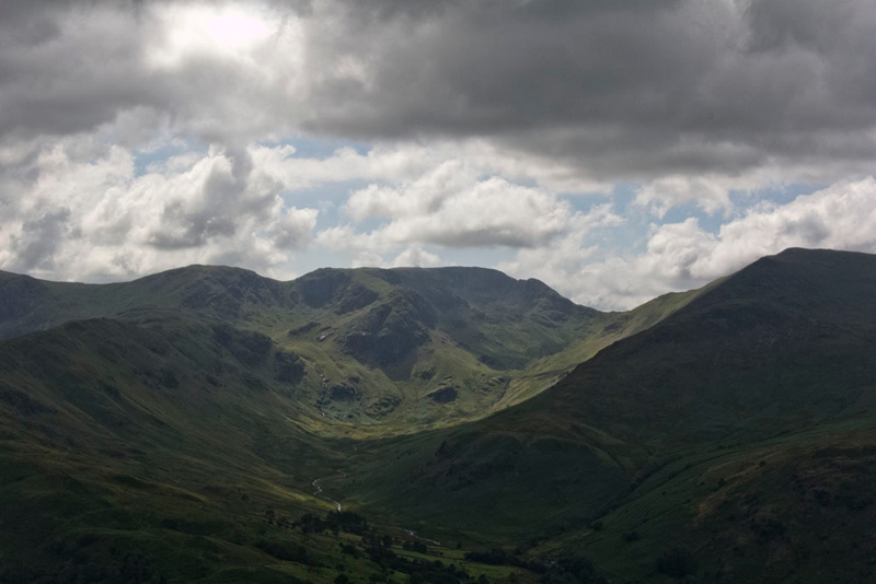
The sun and cloud was casting shadows over then fells and Grizzly, called out, "that makes quite a dramatic shot of Deepdale with Hart Crag and Fairfield."
"You can also see Cofa Pike on the right slopes of Fairfield, and the ridge running round to St Sunday Crag enclosing the right side of the valley", added Allen. "That was a tough climb from the col to Cofa Pike. I really felt for you that day Dad, but as always you were up to the challenge."
As we continued on there was a shower of rain, but not enough to make us want to take shelter in the rucksack. After a level section the path began to drop again, and soon we arrived at Boredale Hause.
Starting down, Dad took the lower path bringing us to the gate off the fell. This gave a variation from the ascent. Beyond it was right through the gate and along the surfaced track to Side Farm.
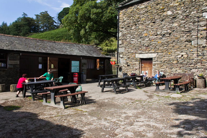
We had noted on the way out that there was a cafe here, and Tetley said, "are you stopping for tea, Dad"
"I am!"
Despite the sun the seats were wet after the earlier shower. Dad got his mat out of the rucksack, but we elected to stay tucked inside.
Dad enjoyed a pot of tea with extra hot water and delicious piece of chocolate caramel shortbread. All for the princely sum of £3! Then all that remained was to walk the access track to the road and return to the car.
"Thanks Dad for a super day", said Little Eric.
"Yes", agreed Southey, "I have enjoyed every minute."
And finally the summit stats. Little Eric and Southey bagged 4 Birketts and 3 Wainwrights.