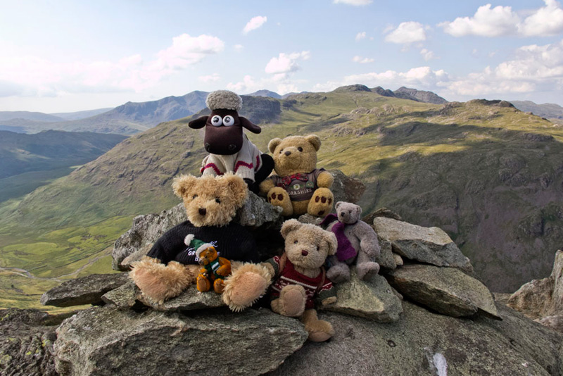
LITTLE CARRS, GREAT CARRS, SWIRL HOW, GREAT HOW on SWIRL BAND, GREY FRIAR & HELL GILL PIKE
from WRYNOSE PASS
Summary
Date - 23rd July 2014
Distance - 6.75 miles
Ascent - 2230ft
Map - OL6
Start point -
Verge parking on Wrynose Pass (NY 27901 02813)
Summits Achieved
Name
Height (ft)
Height (m)
Grid Ref
Little Carrs
2270
692
NY 2705 0150
Great Carrs
2575
785
NY 2707 0094
Swirl How
2630
802
NY 2728 0055
Great How on Swirl Band
2526
770
SD 2733 9997
Grey Friar
2536
773
NY 2601 0035
Hell Gill Pike
2147
662
NY 2693 0163
Preface
"Phew, it's so hot this week", sighed Southey. "This sort of weather really does not suit me at all."
"Well, I know that Dad would sympathise with you, as it is the same with him", replied Allen, taking a sip of tea from his steaming mug, followed by a mouthful of cake. "I just love your cherry and ginger scones, Grizzly, thanks as always from making them."
"And thanks to you Little Eric, for the chocolate caramel shortbread", added Shaun, "it's truly delicious."
"Your welcome pals", they replied in unison.
Tetley said, "picking up on what you were saying about Dad. He has told me that summer is his least favourite season. He is really a winter person preferring the cooler temperatures. Ideally he is happiest from this point of view in spring and autumn."
"The heat does sap ones energy, but despite this are we going to be able to have a walk this week?", enthused Little Eric.
"There is a date down with Uncle Eric for Wednesday, so we need to get our thinking caps on", replied Tetley.
We all fell silent for a little while enjoying the tea and cakes, then Allen mused, "I know that you are still saying Little Eric, and quite rightly so, that Dad is not to repeat the all Birketts and Wainwrights you still have to do to finish those challenges, but as each walk goes by you creep ever closer. Two of the seven Wainwright books are complete, and two more pretty close, but it is Book 4 Southern Fells and Book 7 Western Fells where there is most to do. So...., just in case Dad does eventually make the decision to actually repeat them all, perhaps we should think about suggesting doing some in Book 4 on this next walk."
"I really do not want to put undue pressure on Dad", replied Little Eric, "but you are right, at the rate we are going we are bound to come to a tipping point, and getting moving on with these books is logical."
"I know that Uncle Eric has a lot to do in Book 4 and somewhere in the drawer is a list that he gave to Dad", said Grizzly.
"I'll go and have a look", replied Southey trotting out of the room. After a minute or so, he called out, "found it!"
We Tetley and Allen, looked over his shoulder, Tetley saying, "there are all the Coniston Fells listed. That is perhaps a good place to start."
"I know what would be a good suggestion", said Shaun. "Climbing via Wet Side Edge and taking in Swirl How, Great Carrs, and Grey Friar. I know that they are over 2500ft, but with starting at the summit of Wrynose Pass, we will be at about 1000ft, so easing the amount of ascent."
"There are some Birketts very close by too", added Allen. "Three if I remember rightly. Two on the ascent of the edge, Little Carrs and Hell Gill Pike. The third one is just a little way beyond Swirl How, and perhaps it we ask Uncle Eric nicely he will agree to the detour."
"Yes a good idea", agreed Tetley. "It will be seven years almost to the day that we did this identical walk with Uncle Bob. That was on the quest for you and Grizzly, to complete the Wainwrights."
"That would be absolutely fantastic", cried Little Eric, his voice full of enthusiasm.
"Oh I hope that Dad and Uncle Eric will agree", added Southey, as it will be another completely new area for me. I now that I will never complete any of the challenges, but just to have done a few from each of the Wainwright books, and explore different areas of Lakeland, will be so wonderful."
"Right", said Allen, as he drained his second mug of tea, "I'll go and see what Dad thinks about our idea."
Very soon he returned. "Dad is fine with the idea, our suggestion, but it is not a done deal, as he needs to speak with Uncle Eric and see if he is agreeable."
Well he was, and we all cheered when Dad told us, looking forward to an exciting day.
The Walk
It was agreed that we would drive to Uncle Eric's in Kendal, there decamping to his car for the drive to the start.
We called out a cheery, "good morning, nice to see you Uncle Eric", as we did.
"Nice to see you Lads", he replied.
The route was via Windermere to Ambleside, here taking the Coniston road, turning off soon after Skelwith Bridge, on to a road signed to Little Langdale and Wrynose Pass. Through the valley the road is very narrow, with passing places, and Dad remarked, "I had forgotten how narrow it is, and if we had been in my big car, it would have filled the road width even more."
"Will we have to come this way for other walks?", asked Southey.
"Yes", replied Dad, "as at some point we will have to repeat Pike O'Blisco, Cold Pike and few associated Birketts. Still, it will be fine as it is just a case of taking great care along these roads, as Uncle Eric is doing today."
Soon we passed the Three Shires Inn, and out of the valley the road climbed Wrynose Pass towards its summit at the Three Shires Stone. Just before there was a pull off to the left and Dad said, "I suggest we park here, as there is not much space by the Stone."
"OK", agreed Uncle Eric, pulling off the road.
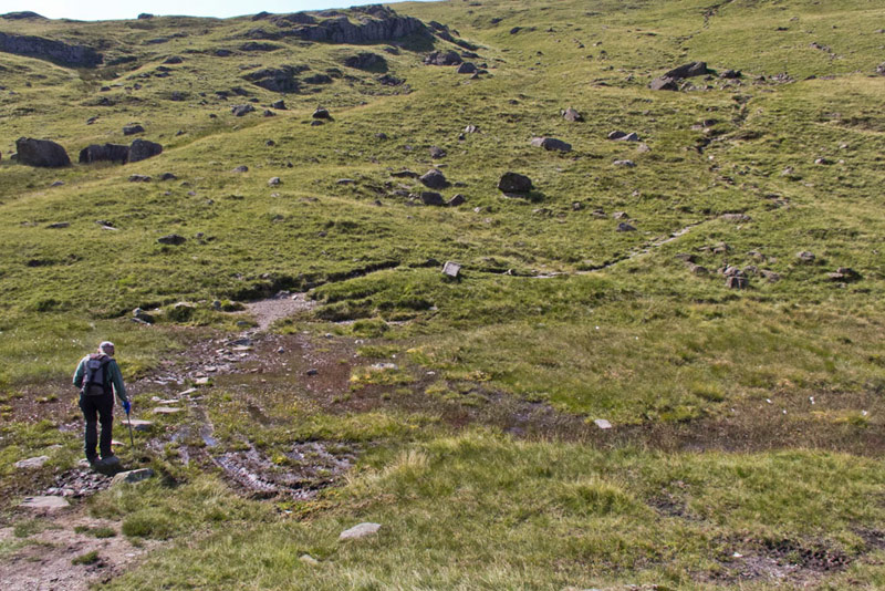
While they got ready, we looked about, Tetley pointing, "that is Wet Side Edge, where we will make the climb."
"Ooh great. I can't wait to get started", enthused Little Eric.
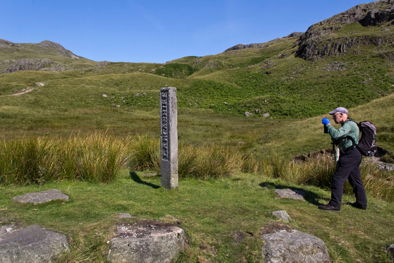
With this in mind we now got settled in the rucksack, so that we did not delay Dad and Uncle Eric. Shouldering this, Dad strode off the short way to the summit of the pass, where is sited the Three Shires Stone. Before the reorganisation of the county boundaries on the 1970s, this marked the point where the boundaries of the then counties of Cumberland, Lancashire and Westmorland came together. Cameras were out, Dad snapping this of Uncle Eric taking a picture of the Stone. More about this at the end of the tale.
"The map shows the path up Wet Side Edge starts just beyond the Stone, although I cannot recall it from the last time", said Shaun.
"Well there is no doubt", replied Tetley, and here Uncle Eric makes his way over the stepping stones across Widay Gill. There was little water, which was hardly surprising with the dry hot weather. Yes the day was dry throughout, but thankfully it was quite breezy as we got higher so reducing the effect of the heat, and making for a very pleasant walking day.
A steady ascent ensued, with stops to take in the views around. As we gained height this became impressive looking west, and Southey asked, "what can I see, pals?"
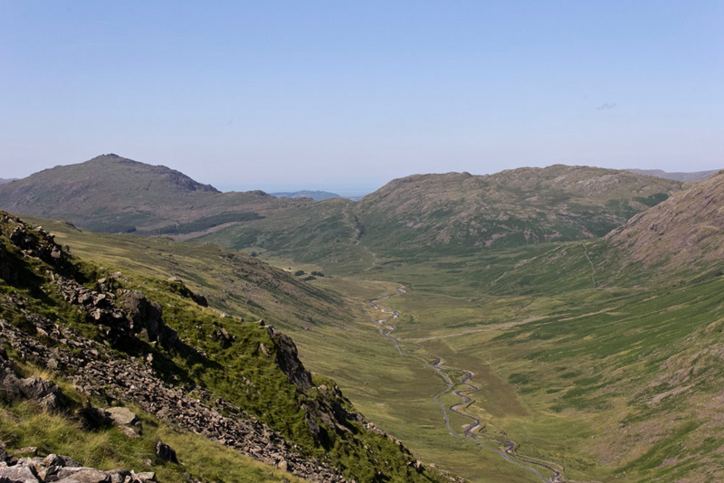
Grizzly, was quick to oblige. "The road of Wrynose Pass can be seen snaking along the valley reaching Cockley Beck, where there is a road junction. Beyond the slopes of the valley on the left, the Seathwaite Valley then runs away left under the dominant slopes of the Harter Fell (2141ft) on its right. Continuing ahead from the valley bottom, the road can be seen climbing Hard Knott Pass. It is very steep in places with hairpin bends and so provides a challenge to drivers. To the right of this the rocky fells are Border End (1713ft) and Hard Knott (1803ft)."
"Thanks pal. You have set the scene for me perfectly. I guess in time I will get to recognise views such as this."
"Border End and Hard Knott are on my to do list", remarked Little Eric.
"And mine too", added Uncle Eric.
"Well hopefully we will get them climbed soon", replied Allen. His words were to turn out prophetic, as they were tackled on our very next walk!
Looking back to the parking area, Tetley remarked, "a mini bus has pulled up."
This had brought a party of walkers, who we soon realised were coming up Wet Side Edge too. They were a group of school children from Church Stretton in Shropshire. One boy in particular was very keen to be on the fells and got ahead of all his other friends, soon catching us up. Dad and Uncle Eric stood to one side, to let him pass, Dad saying, "your young legs are stronger and faster than ours." The adult leader chatted a little to Dad and Uncle Eric as he passed, and then later as they passed us again, the group having stopped for a rest.
Finally the ridge was reached and we climbed on. "That is Hell Gill Pike with its cairn at the far end", pointed out Shaun.
"Do you mind if we leave that for the descent?", replied Uncle Eric.
"No of course not", said Allen.
The ascent had eased a bit here and soon the small rise just yards off the path to the left, that was Little Carrs was reached. Dad took us to the cairn where we hopped out and had our picture taken. "Great, that's another Birkett top bagged", enthused Little Eric.
Setting off again, Great Carrs loomed ahead, the stony path climbing this more steeply. "Is that the summit we can see?", queried Little Eric.
"Probably not", replied Dad. "I think there will be a further bit of climb beyond that to the top." He was right too!
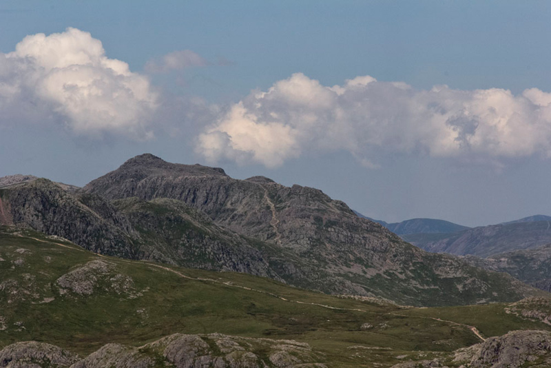
Before tackling this Dad turned the camera left to snap this shot of the large bulk of Wetherlam (2502ft), that buttresses the south east end of the Coniston Massif.
Dad strode on up the stony path, the views opening out further, and once again progress was halted as Southey said, "wow, please tell me what I can see now?"
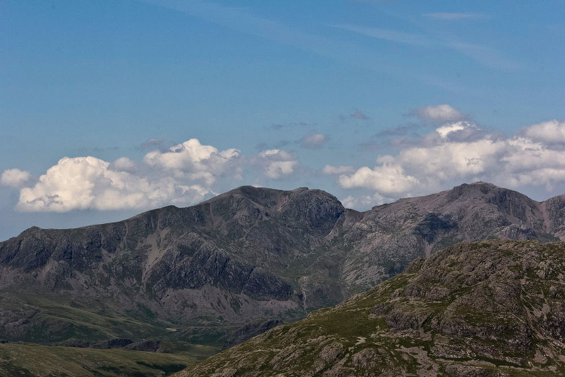
First looking north-west, Tetley providing the answer. "To the far left the pointed rise is Slight Side (2499ft) the ridge rising to Scafell (3162ft) the second highest mountain in England. Right of this is the gap known as Mickledore, with the slope rising right to Scafell Pike which at 3210ft is England's highest mountain. In the foreground is Pike de Bield (2657ft), which we climbed on 31st August 2011. It was then one of the few Birkett summits we still had to conquer."
And looking north, Allen jumping in to answer, "this way we are looking at the Langdale Group. The unmistakable rounded summit is Pike o'Stickle (2326ft), then to its right Loft Crag (2238ft). Further right and set back is Harrison Stickle (2415ft) and Pavey Ark (2288ft) to the right of this again. Running back from Loft Crag, the range rises first to Thunacar Knott that has two summits at 2351ft and 2372ft. The higher is the Birkett summit while the lower is the Wainwright. Beyond this the highest point is then High Raise (2500ft). On the skyline, distantly on the right is Blencathra, while similarly on the left behind Pike o'Stickle is Lonscale Fell."
"Just incredible", said Little Eric. "We are so lucky that it is so clear."
Well we are sure that Dad and Uncle Eric and us would have wanted to linger longer looking at these wonderful views, but the summits beckoned, and so putting best foot forward they climbed on and soon Great Carrs was done, the cairn to quote Wainwright being, 'finely placed above the steep precipice that drops to Greenburn Valley'
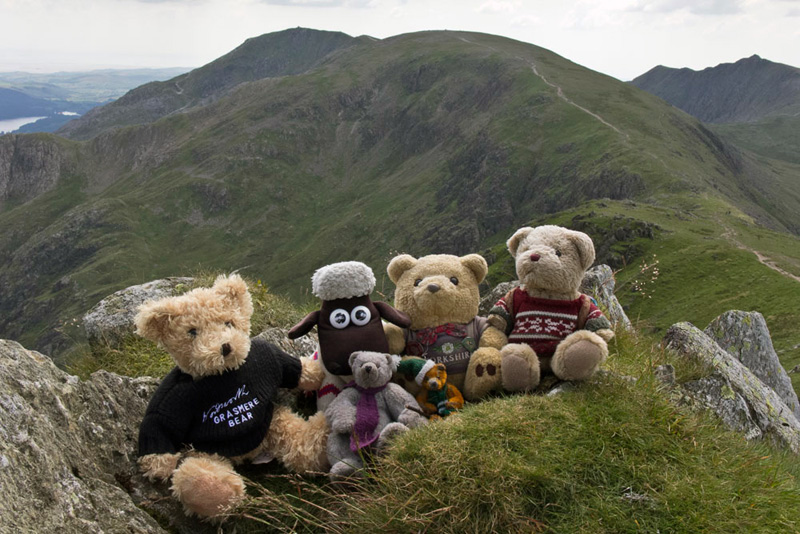
"Come on pals", called out Little Eric, "time for our picture."
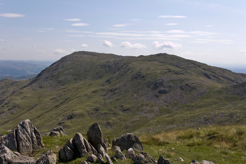
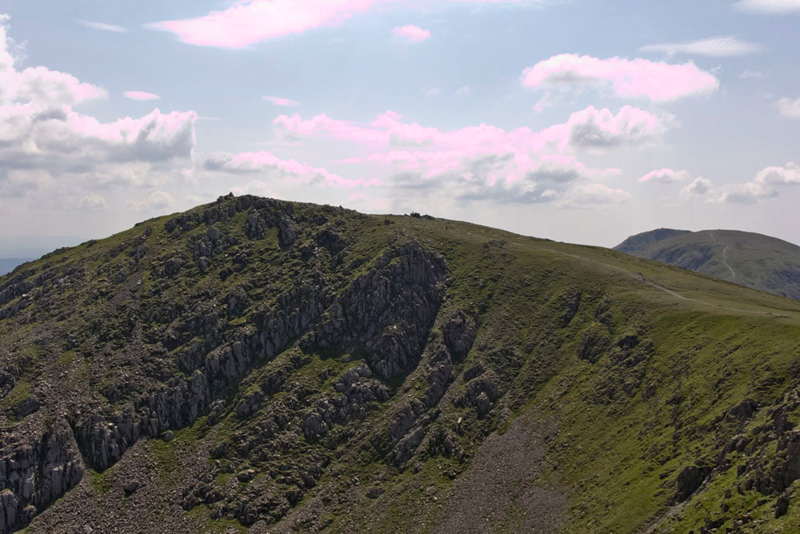
"Swirl How is next", said Little Eric excitedly.
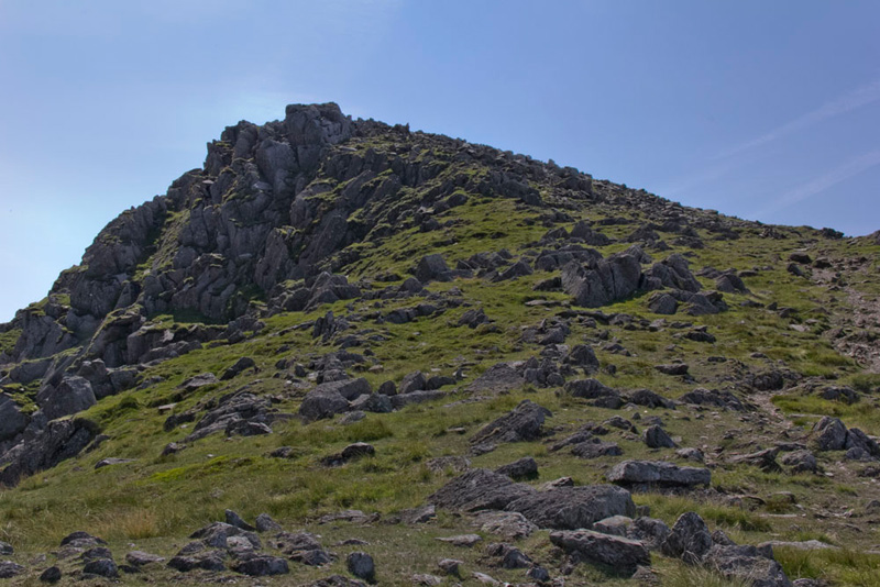
"That's right", agreed Shaun. "It is just a third of a mile further on round the rim of the crags, followed by a short climb", as this picture illustrates.
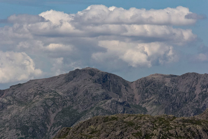
It was a few minutes before we actually set off again, as the views once again arrested our attention. "Little Eric, Southey, the rocky mountain over there is Bowfell (2960ft)", said Shaun.
"That's another one I have still to bag", replied Little Eric.
There is a different angle to the view of the Scafells. What exactly can I see now?", asked Southey.
Grizzly once again obliged. "Well pal, Scafell Pike is in the centre, the ridge on the right dropping to the depression of Little Narrowcove. Immediately right the summit is Broad Crag (3054ft), and extreme right and nearer the camera Ill Crag (3067ft). Once again in the foreground is Pike de Bield. Immediately above the left side of this ridge is the Dow Crag that buttresses Scafell Pike. On its top is Pen (2500ft), which was finally summited last August and marked the completion of the Birkett challenge for Shaun, Tetley, Allen and I. That was a truly momentous day!"
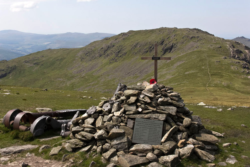
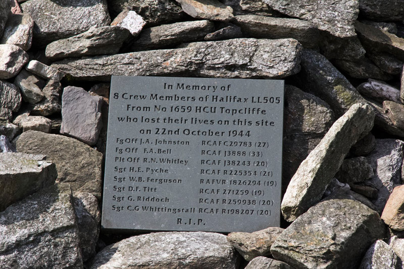
"Well lads, we had better be getting on", said Dad. So we quickly settled in his rucksack, and we made our way towards Swirl How. Part way, to the right of the path stands this poignant memorial to a Halifax aircraft that not having enough height, crashed into the fell on 22nd October 1944. It was flying west to east, the undercarriage being ripped off, with the rest of the plane then plunging down the slopes of Broad Slack killing all on board. Much of the wreckage was taken to the Ruskin Museum in Coniston in 1997. Grey Friar forms the backdrop, which we would climb later.
Here is the memorial plaque to those who perished.
After pausing a few more moments to think about the poor airmen who perished that day, we continued towards Swirl How, and very soon we were crossing the rocky strewn ground to the summit.
Dad got into conversation with the lady in the picture. As a family they were spending 8 weeks in the Lakes doing the Wainwrights. One of her sons proudly showed us a chart indicating how many they had done so far, and which ones they were intending to do during this holiday. They loved the idea of us walking with Dad, and when we had settled on the cairn, he had to tell them each of our names, and about what we had achieved over the years. Such nice people.
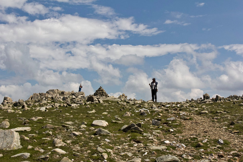
The large cairn is situated at the end of the long and level summit plateau, where the northern slope falls abruptly away. Tetley said, "do you remember when we were here with Uncle Bob, back in January 2007. What a day that was, snow, hail, rain and gale force winds. At this summit there was a hail storm and it blowing in horizontally."
"Ooh yes", recalled Allen. "We were covered in hail and looked like polar explorers. That was one of the very few occasions that Dad has been unable to take our picture at a summit.
"We would have been blown over the precipice if he had tried", added Grizzly.
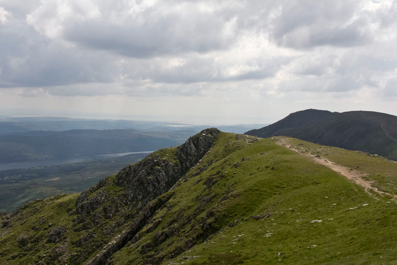
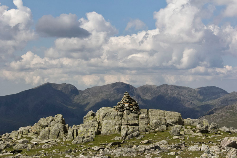
It was now decision time, with regard to taking in the summit of Great How. Shaun pointed saying, "Uncle Eric that is Great How, just about a third of mile along the path that leads eventually to Brim Fell and Coniston Old Man." The cairns on each of those mountains can be seen on the skyline.
"It is not far, so yes I am happy to go there", he replied.
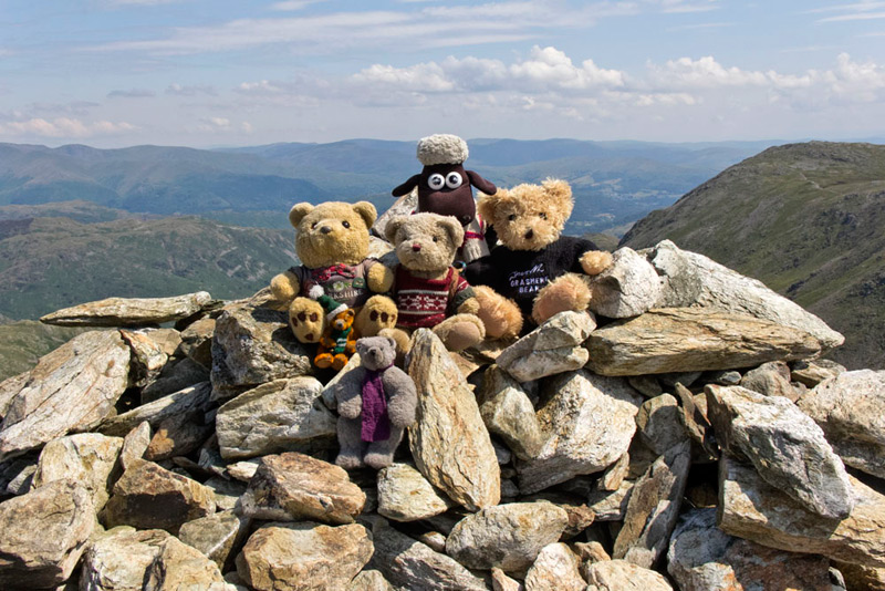
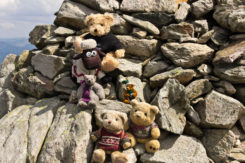
So, saying goodbye to the family, it was best foot forwards again on the short descent and on up to Great How, the summit being on a rocky upthrust of the crag, with the cairn again being just yards from the path. "Yippee", cried Little Eric, "that's another Birkett bagged", as we scrambled out and settled for our picture.
"This will be a good place to stop for lunch, as we have got most of the climb out of the way", said Uncle Eric.
"Ooh yes, great", replied Allen. "I am hungry", he went on, rubbing his tummy in anticipation.
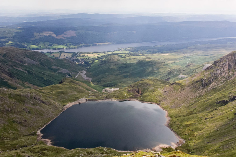
"No surprise there", laughed Tetley, as with the rest of us he found a place to sit just on the other side of the cairn. Below was this superb view of Levers Water Reservoir, with the Coppermines Valley beyond and Coniston Water, Coniston village nestling between. Grizzly said, "I could not find much out about Levers Water, other than it is a naturally occurring tarn that was enlarged by the building of the dam in 1717 to provide water and power to the copper mines below. These are long defunct and now it supplies water to Coniston and the surrounding villages."
Allen passed the sandwiches round, then followed up with the cakes, and there was tea from the flasks to wash it all down. "What an absolutely marvellous view", said Southey. "I know I keep saying it, but what a lucky bear I am to have been adopted by Dad, and that you have let me join you on these wonderful adventures."
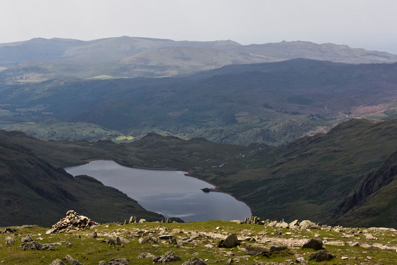
We could have sat and looked at this view all day, but there was more to do, so packing up, we settled in Dad's rucksack ready for the off. Before doing so we took time to look down the other side of the ridge at this super view of Seathwaite Tarn.
"I looked this up as well on Wikipedia, yesterday", said Grizzly. "It is a reservoir that was created in 1904 by the building of a dam that is nearly 400 yards (366m) long, which resulted in considerably enlarging the existing tarn, the depth being around 80 feet (24m). The water is not taken directly from the reservoir, but from a take-off weir some distance down river. Apparently during the construction some of the navvies rioted damaging buildings in the village of Seathwaite. Several of the rioters were shot, one dying the next day."
"That's a bit gruesome", remarked Southey.
Grizzly then went on, "following a statutory inspection in January 2007, works were recommended to be carried out on the concrete face of the dam and to prevent further deterioration of the concrete. This was done in 2010, by contractors working on behalf of United Utilities, which ensured that the reservoir would meet the requirements for a Category A reservoir."
"Thanks pal for all your research, it really does add to our understanding of the landscape", said Shaun. Then turning matters to the walk, he went on, "there is no point returning to the summit of Swirl How. What we need to do is contour west under the summit and cross to join the path from Swirl How to Grey Friar."
This we did, descending to a col called Fairfield, from where Shaun said, "according to Wainwright there is 270 feet of ascent to Grey Friar's summit." He also commented, "that path going off right, is the one we will need to take on the return. It will take us on a contour below Great Carrs, and bring us to the main path between Great Carrs and Little Carrs."
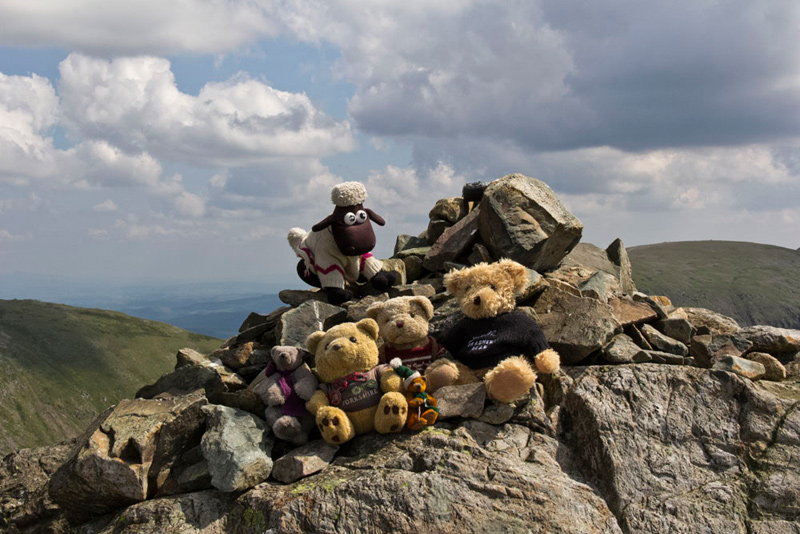
From the col it was a steady ascent on a clear path to reach the long level grassy promenade. This led to a stonier area, where 40 yards apart are two rocky outcrops, each with a cairn. Despite the one to the right (north-west) having the better cairn Shaun said, "it is the one on the left (south-east) that is higher and thus the actual summit."
"Fine", called Southey, and as we got to the cairn, he called out, "picture time again", as we scrambled out of the rucksack.
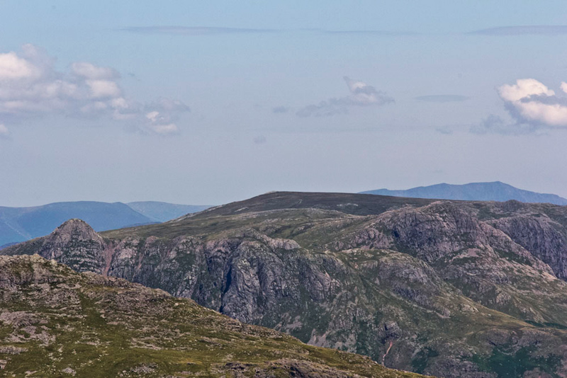
Taken from here is the north-west summit with its more impressive cairn, which for the sake of completeness we visited, although in no sense can it be considered to be a separate summit. "What a magnificent backdrop of the Scafells", breathed Southey.
"Yes pal", replied Allen. "Precisely they are from the left, Scafell (3162ft), Scafell Pike (3210ft), Broad Crag (3054ft), Ill Crag (3068ft) and Great End (2984ft)."
"Wow, this is really a walk with truly magnificent views", said Little Eric.
Grizzly, "do you know where the name Grey Friar derived from?", asked Southey.
"I have looked in the book Dad has on Lake District place names by Diana Whaley. She says that whilst one reference is self-explaining it is nevertheless still unusual and rather puzzling, since the hill is not notably grey. If Friar refers to a brother of a religious order, then it could refer to the slightly hooded appearance of the domed top. The original Greyfriars were an order of Friars Minor established by St Francis in the early 13th century and so named in English from the colour of their tunics."
"Thanks again pal, you have been a mine of information today", replied Southey.
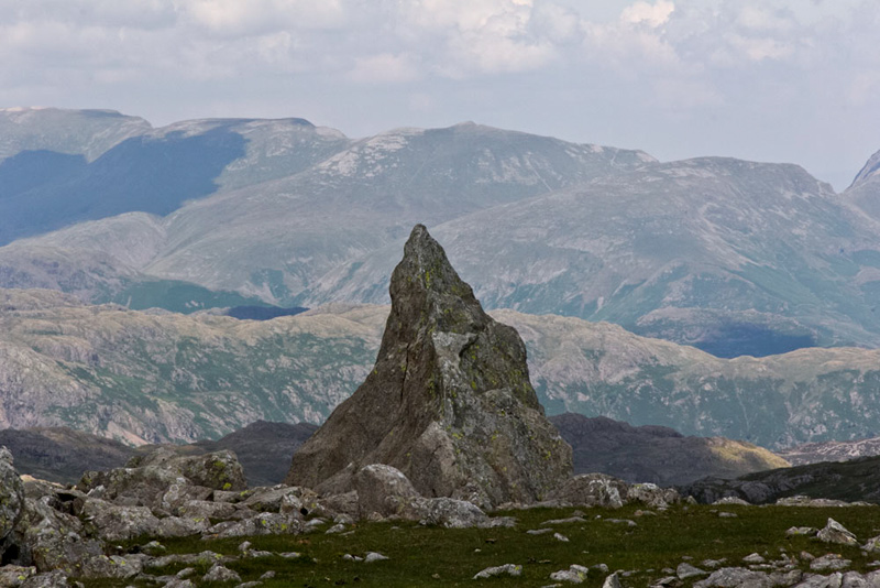
As we strolled back the way we had come, Dad said, "look Eric, Lads, there is Matterhorn Rock, so named because of its shape."
This is seen against a superb backdrop of the Helvellyn Ridge. From the left Helvellyn, Nethermost Pike, Dollywagon Pike and Seat Sandal behind which lies Grisedale Tarn.
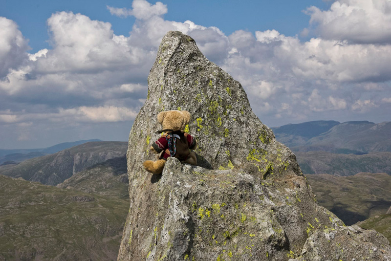
Allen is the more adventurous of us, and immediately said, "I'm going to have a go at climbing that."
"Oh are you sure", replied Southey, who being the newest member of our club, was still a bit cautious about taking risks.
"I'll be fine!", said Allen, immediately decamping from the rucksack. He found the necessary paw holds, and Dad snapped this shot of him as he neared the top.
"That was great", he said after making the descent from the summit.
Settled in the rucksack again, it was off down the way we had come up, to the col at Fairfield, and taking the path Shaun had indicated earlier, it now being to the left, of course. It was never in doubt and mostly grassy led over slightly undulating terrain eventually rejoining the main track at the bottom of the climb we had made to Great Carrs.
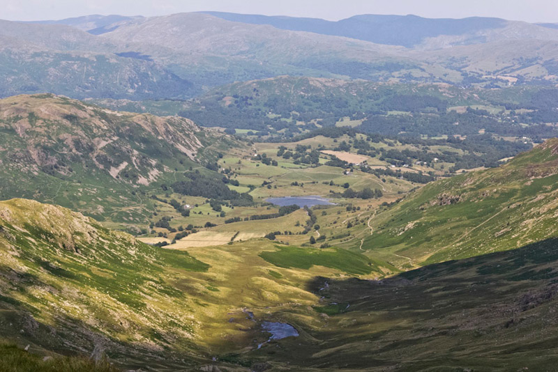
Looking east Little Eric called out, "wow that is a wonderful view of the Greenburn Valley."
Grizzly once again set the scene for us. "The highest body of water is the disused Greenburn Reservoir. From it flows Greenburn Beck that runs down into Little Langdale Tarn. Greenburn Reservoir is a natural tarn that was dammed in the early 18th century to provide water for the Greenburn Mine. The 250 yard long barrage has now been breached to leave a collection of pools and bogs."
It was now the case of retracing our outwards route, passing below Little Carrs, and then deviating the short way left to the summit of Hell Gill Pike. This was the last of the day, and once again we jumped out to have our picture taken. "Yippee", cried Little Eric. "That's 6 Birketts and 3 Wainwrights ticked off, and for you too, Uncle Eric."
"Me too", added Southey.
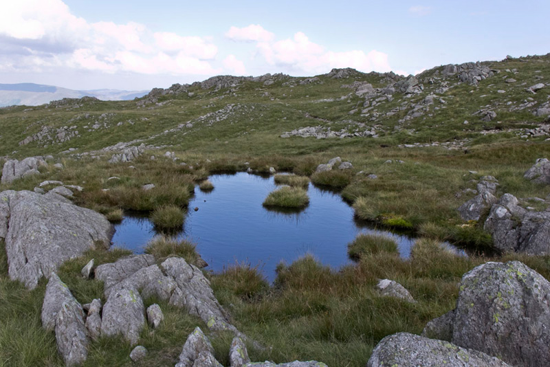
To reach the summit we had crossed a short grassy and rocky ridge, where at the end nearest to the path lies this small pool. "It makes rather a nice picture", said Tetley.
Behind the path can be just about discerned and this was followed down. Some way down a junction was reached, and at Uncle Eric's suggestion we took the right fork towards a large cairn. It did indeed seem to be the right decision, but shortly afterwards and following more descent, Shaun looking at the map said, "we should have taken the left fork."
"Well never mind", replied Dad, "what we will do is when we reach the bottom of that small rise ahead, strike left and descend directly down to Wrynose Pass."
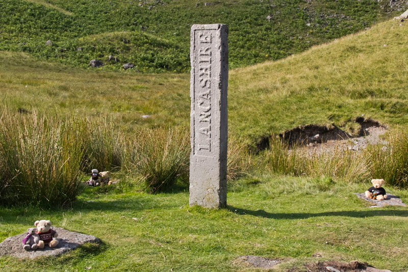
We were well down any way, and although trackless it was not too difficult. Just a bit tricky negotiating the boggy section near the bottom, but then almost immediately the road was reached, by the Three Shires Stone.
Here it is the tradition that Dad sets us up sitting in each of the three old counties. Shaun explains. "Allen & Grizzly are sitting in Lancashire, Southey and Little Eric in Westmorland, and Tetley and I in Cumberland."
Two gentlemen were getting ready to set off up the fells, and seeing the set up on of them said, "great shot!"
Close by Allen and Grizzly lies an inscribed stone, which reads -
THREE SHIRE STONES
Three stones have traditionally marked
the adjoining counties of
Cumberland, Westmorland and Lancashire
on this site
The limestone monolith carved in 1816
for the Furness roadmaster
William Field of Cartmel (d. 1860)
was set up by friends after his death
Repaired and re-erected by the National Trust in 1998
with local support
"That was an absolutely super day Dad", said Little Eric.
"Yes" agreed Uncle Eric. "Thanks for doing these again."
"My pleasure. It was worth it to see the wonderful views, as well as getting the summits ticked off for you and Little Eric."
So it was just a short stroll down to the car, and once changed, Uncle Eric drove us safely down the pass and through the narrow lanes of Little Langdale, and so on home.
We were all a bit tired and so slept very soundly that night, but we were a very happy group, having had such a grand day out.