HARD KNOTT ROMAN FORT, BORDER END, HARD KNOTT, YEW BANK & LINGCOVE BRIDGE from JUBILEE BRIDGE
Summary
Date - 31st July 2014
Distance - 7 miles
Ascent - 2060ft
Map - OL6
Start point -
Car parking just above Jubilee Bridge (NY 21358 01117)
Summits Achieved
Name
Height (ft)
Height (m)
Grid Ref
Border End
1731
522
NY 2282 0188
Hard Knott
1803
549
NY 2319 0237
Yew Bank
1637
499
NY 2319 0307
Preface
Little Eric was tapping away on the laptop, with Southey looking over his shoulder.
"What are you looking at?", asked Allen, who was on the iPad.
"The pictures Dad took last week on our walk in the Coniston Fells. They have turned out good too, so there will be plenty to chose from for the story. Come and look Allen, the one of you climbing the Matterhorn rock on Grey Friar is brilliant."
"Ooh yes, it has come out better than I expected", agreed Allen.
Tetley had put down the book he was reading and come over too. "There are some terrific shots of the Scafells, and to the Langdales and Bowfell. It is going to be a long story I can see, so lots of typing for poor Dad."
"He rather gets the raw deal", said Southey. "Not only is it his legs that carry us up and down the fells, but he has to type the stories, while we sit and tell him what to put in."
Looking out of the door Allen said, "great, here come Shaun and Grizzly, with the tea and cake. I'm gasping for a cuppa and hungry too."
"You certainly take after Dad", said Tetley, letting out a laugh.
Meanwhile Southey had been and got the mugs and plates, passing them round. Shaun filled the mugs with steaming tea, while Grizzly said, "there are sultana scones with raspberry jam and cream, or mincemeat slice that Little Eric made earlier."
So we all helped ourselves and sat contentedly. "The mincemeat slice is delicious", said Tetley.
"And those scones are truly scrumptious", added Shaun.
Little Eric then said, "what's the situation about walking this week."
Allen grabbed the iPad and after a few taps, replied, "there is a day down to walk with Uncle Eric on Thursday, and the forecast is good for the weather."
"So it is a case of deciding what to do", mused Grizzly.
"Well I think we should consider doing another walk from Wainwright Book 4", replied Shaun.
"I recall that view from the ascent of Wet Side Edge to Hard Knott, which I have to bag and Uncle Eric told us he has too", said Little Eric.
"Good idea", agreed Tetley. "We could repeat the walk we did in July 2006, and as well as bagging Hard Knott, you will tick off two Birketts as well. Border End and Yew Bank."
"That will be brilliant, as it will take us into Mosedale and Eskdale, where we will get fine views of the Scafells, Esk Pike and the Crinkle Crags", added Grizzly. "You will love it Little Eric and you too Southey. All new ground for you both."
"OK, so that's our suggestion, but we will have to see if Dad and more importantly Uncle Eric is agreeable", said Allen, who draining his mug went off to ask Dad.
"Better fill his mug again", said Tetley, "you know what a tea belly he is."
Well Allen was soon back, and accepting the steaming mug, said, "thanks pal." Then he went on, "Dad is fine with our suggestion, so all that remains is to see if Uncle Eric agrees when they speak on the phone tomorrow."
And thankfully he was, so we all looked forward to an interesting walk.
The Walk
The route to the start was one that we were very familiar with, having driven it on a number of occasions, for walks starting along the access track to Brotherilkeld Farm and up into Eskdale. Most notable were the three times for the attempts on Pen, our last Birkett summit. Tetley remarked, "it is hard to believe that it's almost a year since we made that steep climb to achieve the summit."
"What a great sense of euphoria and relief too, to finally get there", added Allen.
The drive took us to Duddon Bridge, where we turned up the valley to Ulpha, and then turned left up the steep hairpin bends to cross Birker Fell, with initially Hesk Fell rising to the left.
At one point Shaun said, "we parked on the verge along here to climb Green Crag and other Birkett summits, away to the right."
"That was back in May 2009", replied Tetley. "Over five years ago. My how time flies by."
Continuing, we then soon came to a junction where a road marked 'unsuitable for cars', went right signed to Stanley Ghyll. "This is the start point for the round of fells above Devoke Water", called out Little Eric. "The track to the left is the start of the walk. It was towards the end of 2012 that you repeated the walk for me Dad. That and so many others too, the last being just month ago, for me to complete that challenge."
The road over Birker Fell is quite narrow, but there were few cars, the scariest moment being as we rounded a corner to find a Herdwick lamb sitting in the road! Dad pulled up, and then carefully went past, the lamb unconcernedly staying put. "Well", remarked Grizzly, "this is where they live after all."
Reaching the bottom of the fell road a very narrow section was then negotiated, to opposite the George IV Hotel turn right, with warning signs about the steepness and narrow road over Hard Knott Pass. Along here we passed Dalegarth, the Eskdale terminus of the Ravenglass to Eskdale Railway, that Uncle Brian and our railway bear pals have travelled on.
Narrow and twisting Dad drove carefully along the road, the last bit being single track between high hedges, to come to the telephone box at the entrance to Brotherilkeld Farm. Here we saw Uncle Eric, who had stopped to get his bearings, so we waved, and he then followed Dad the short distance over Jubilee Bridge and up to the verge parking, arriving about 09:45.
"Well at least we are here at a more reasonable time today", said Allen. "When we came to do Pen, we were setting off walking at 08:20."
We then called out, "hi Uncle Eric, nice to see you. Here's to a good day."
"Yes, and nice to see you Lads", he replied.
The weather forecast was for showers at times, but whilst it was not sunny, it stayed dry throughout. There was some cloud on the higher mountains, but this was to lift off some for a while so we got some good views.
Dad and Uncle Eric were soon ready, so we quickly settled in the rucksack, and off we went walking the road climbing up the pass. Shaun said, "we need to look out for a path on the left that climbs by a wall, but will the soon swing away right towards the Roman Fort."
It was not long before Southey called out, "look, there is a way mark pointing to our route."
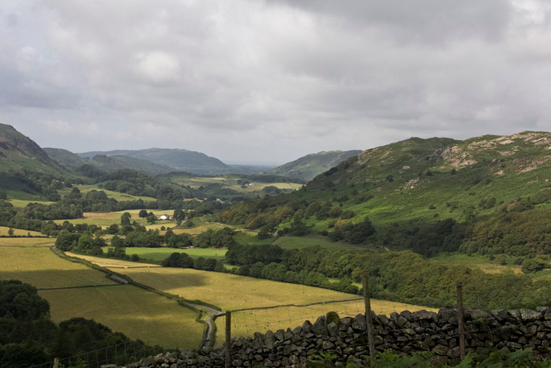
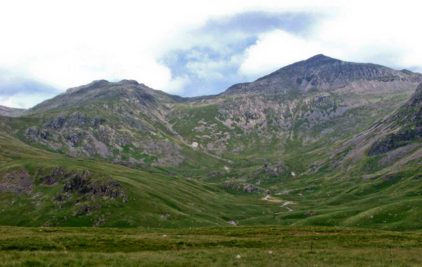
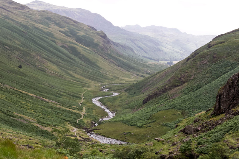
Shortly after the path swung away from the wall, Grizzly called out, "that is a super view down lower Eskdale. It will make a nice opening picture in the story."
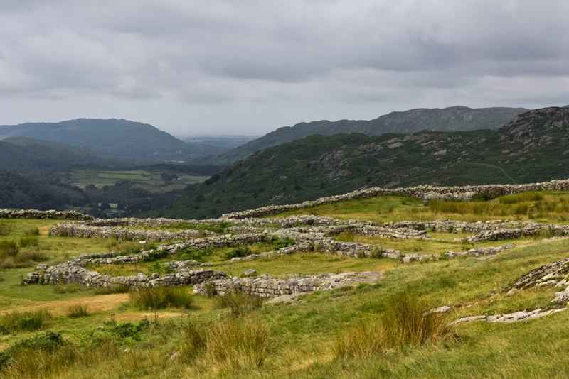
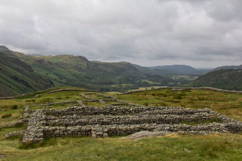
As the path levelled, we arrived at the gateway into the Roman Fort called MEDIOBOGDVM, established early in the second century AD. Its position commands the the Eskdale Valley, west down to the sea as in the picture above, north-east to its upper reaches, and east to Hard Knott pass.
The fort is square with rounded corners, 114 metres long externally, or 105 metres internally, the rampart wall being about 1.7 metres thick with ditches adding to the total width of the rampart. The low walls of the fort were "restored" some years ago, a slate course showing the height of the walls before their rebuilding, the courses below being original.
The outer wall has four gates, at the centre of each side, and lookout towers at each corner. Within the walls are the remaining outlines of three buildings. A garrison headquarters building and a house for the garrison commander...
and a granary..
As we wandered around looking a the various remains, Southey said, "I had been trying to imagine what it must have been like for those soldiers all those hundreds of years ago."
"A bit of a bleak posting, I guess", replied Tetley.
"They knew exactly the right place to site it, commanding all approaches", stated Shaun.
Our exploration complete, we left by the north-east gate, following a clear path, that in Roman times had been the road. Shortly we crossed a levelled area. This we found out later was the parade ground that is considered to be finest surviving example in the Western Empire.
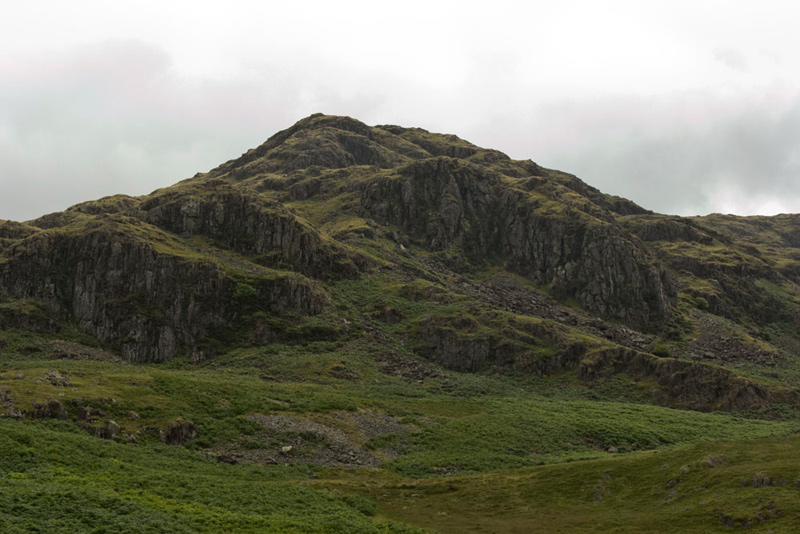
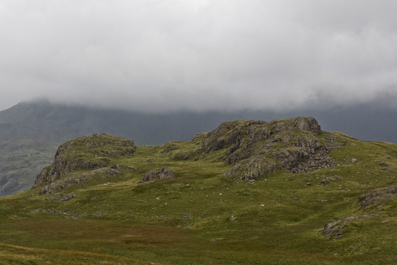
Rocky slopes towered ahead Tetley saying, "Little Eric, Southey, that is Border End, our first summit.
"How do we get to the top, as there doesn't seem to be any way up?", asked Southey.
Shaun replied, "we have to climb to the top of the pass, and then take a path to the left, which will climb to the ridge from where the ascent can be made."
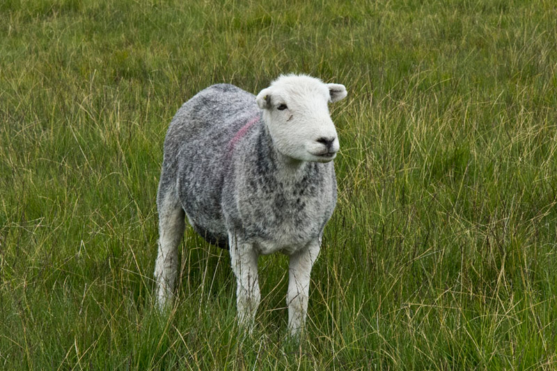
The path led on looping round behind some outcrops, our progress being delayed slightly by Dad seeing some of our favourite Herdwick sheep grazing close by.
One stood and posed, Allen saying, "I know, that picture will be included in the story. But as it is one of our lovely Herdwicks, I do not mind."
Now Allen would like to have sheep picture free stories, but these do not happen very often, as Dad so loves taking such pictures. Having accepted the picture above, he did not reckon with Dad immediately then getting this shot of a Herdwick lamb, sitting in the grass.
"Hmph!", he said, "not one but two."
"But the lambs are so cute", replied Southey.
Winding through the outcrops, the path was never in doubt, being on its latter stages just a narrow trod, that eventually brought us to the motor road once again, but much higher up the pass.
Looking at the signpost as we reached the road, Grizzly said, "we definitely followed the right path then."
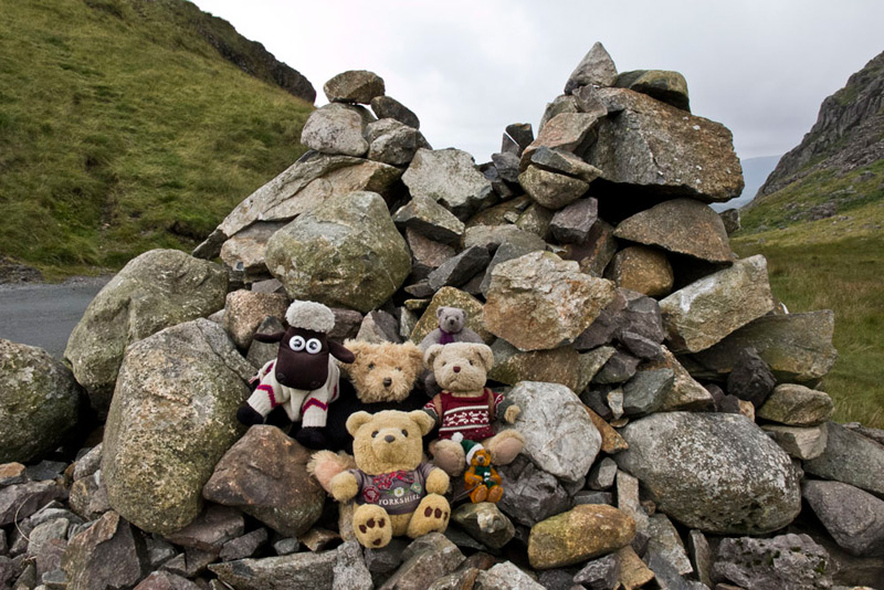
Beyond we followed the road as it climbed on from the top of a very sharp and steep bend, which the cars we saw approached with great caution. Fairly soon the gradient levelled and the summit of the pass was reached marked by a substantial cairn.
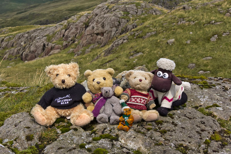
"I know it is not a hill summit", said Tetley, "but it is the top of the most difficult pass for driving the the Lake District, so will you take our picture please Dad."
"Of course Lads."
"Yippee", cried Little Eric, as with his pals he scrambled out and got settled.
Shaun called out, " there is the path we need to take left, just a few yards ahead."
Once again there was no doubt about this, and it rose steadily to the ridge and beyond reaching a boggy hollow.
Shaun consulting the book said, "Birkett says to climb off left here to a cairned outcrop."
"Well there seems to be a path now along by the hollow which will take us closer to the place where the summit is", replied Dad. "So let's follow that and see."
Towards the end of the hollow the path struck off left, to then head straight to a rise. "This is must be the next one referred to by Birkett if we had gone via the cairn. He says it is considered by the Ordnance Survey to be the summit."
We jumped out and Dad took our picture, all the time looking to a further cairned outcrop. "That seems to be higher and perhaps more worthy of the summit", mused Little Eric.
"I know", replied Allen, "but here we are at the grid reference for the summit and quite often what seems higher, can in fact turn out to be actually lower when one gets there. The optical illusion."
"Well I am happy that we are at the top", said Uncle Eric. "I think it is the height of the cairn that makes that outcrop seem higher."
"And me too", added Dad.
Ready for the off again, Shaun said, "Birkett says we should retrace our path to the boggy hollow."
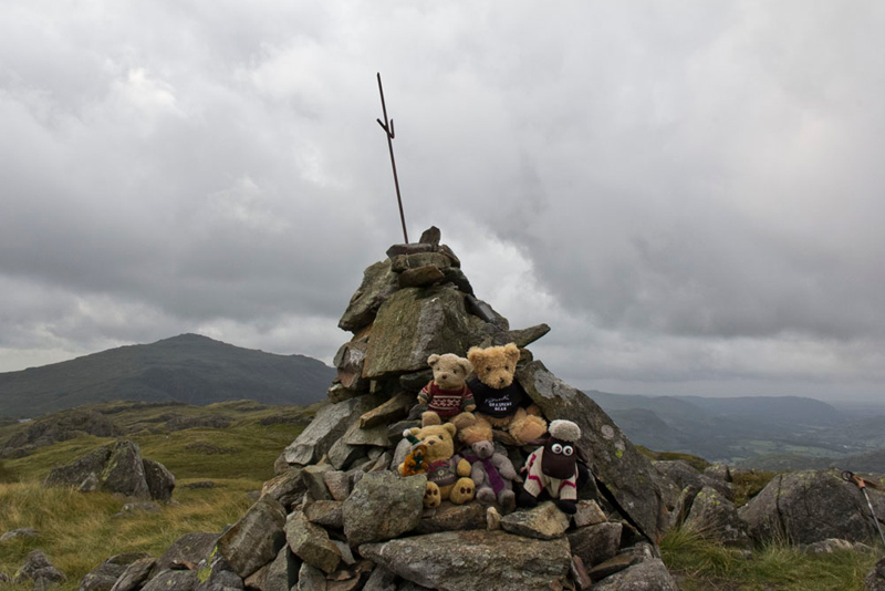
We did, but not on the Birkett route, so being at the wrong end of the hollow so to speak, we didn't get on to the main path to Hard Knott. Another path did lead up the opposite slope climbing quite steeply, and after a bit then swung half right to crest a further rise. Here the summit of Hard Knott was revealed beyond another hollow. Dad and Uncle Eric descended to cross this and then climb the slope beyond and so reach the summit marked with a cairn with a metal rod sticking out of the top.
Dad jokingly remarked to Uncle Eric, "is that a mobile phone tower?"
In fact we wished it had, because looking at his mobile screen Dad said, "there is no service, here."
"That's why there is a telephone box by the road at the entrance to Brotherilkeld Farm", said Grizzly.
We jumped out and settled on the cairn of course for Dad to snap our picture. The hill in the left background is Harter Fell (2140ft).
As we settled again, Southey asked, "where now?"
"The route is north, along that path there", pointed Shaun.
This descended the long shoulder with the valley of Mosedale to the right, where rising beyond were the steep slopes of Stonesty Pike and Little Stand.
"They are two Birketts I have to do", remarked Little Eric.
"When we did them", replied Tetley, "Dad extended the Birkett route that took in Pike O'Blisco and Cold Pike. You have those to bag too, so maybe that is what Dad will do again."
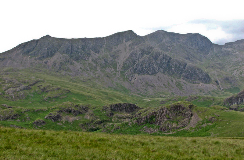
After the initial descent a small tarn came into view, and to the left rose the rock towers of Yew Bank. "That's the next objective", said Dad. "The summit is the rear of the one to the right. Behind are the Scafells, which would have been a magnificent backdrop had the cloud not been shrouding them."
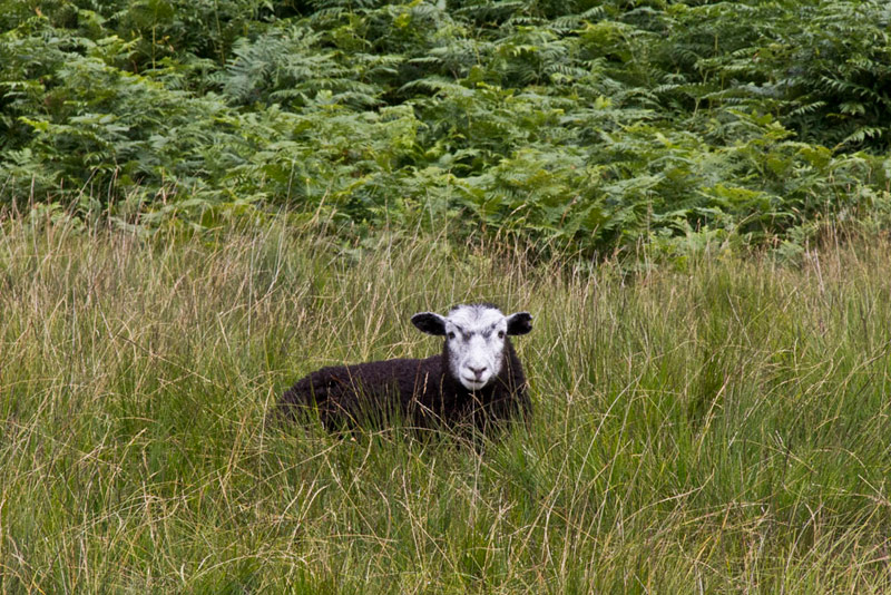
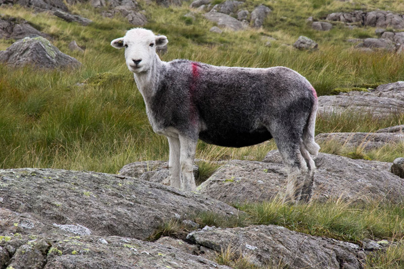
Dad set off making a beeline over the trackless ground, but progress was halted just a few minutes later, by this Herdwick sheep standing proud amongst the rocks.
"Not again!", moaned Allen, as Dad hauled the camera out and lined up the shot. Looking thin as it had been shorn of its fleece, this will soon regrow, ready for it to face the rigours of the winter on the fells.
Just under ten minutes later after a short climb, the flat rocky area that is the summit was reached.
"Great", cried Little Eric, "that's today's summits done. Three Birketts and one Wainwright."
"Picture time", called out Southey.
"Well I think it's time for lunch", said Uncle Eric.
"Quite", agreed Allen. "I was getting rather hungry."
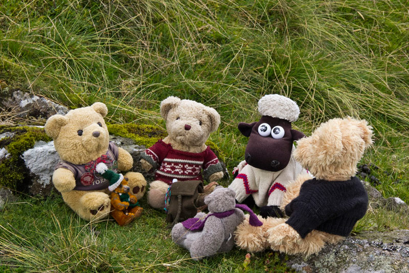
Descending a little way off the summit, we found a convenient place to sit. Then gathering round, Allen slipping his rucksack off, ready to hand out the sandwiches, cakes and tea.
Lunch over, the descent from Yew Bank was completed and the main path along the shoulder joined once more. This was followed to bring the head of Mosedale before us, enclosed by High Gait Crags, Pike de Bield, Esk Pike, Bowfell and the Crinkle Crags.
"Wow!, cried Little Eric, "What a truly dramatic scene."
"Yes", agreed Uncle Eric. "This is a must for any walker in the Lake District. Just wonderful."
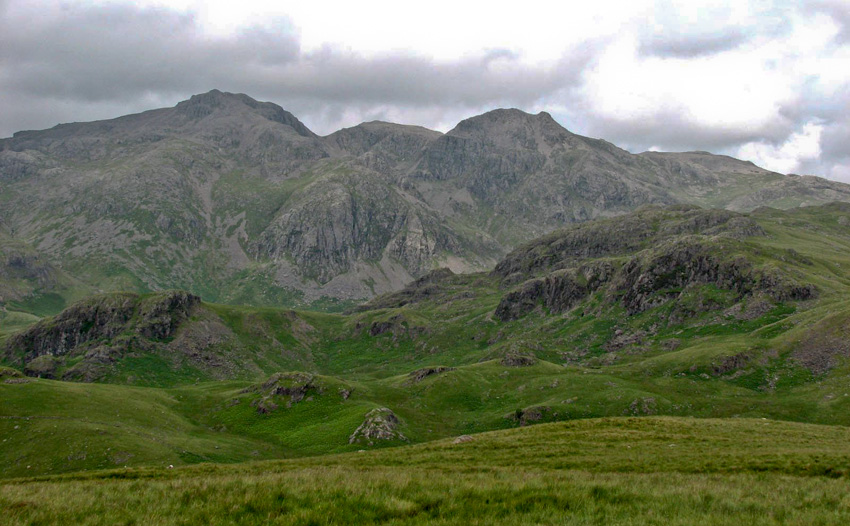
Here is some of that view, with Pike de Bield (2657ft) rising to Esk Pike (2903ft) and Bowfell (2960ft). To show it off to the best, we have decided to include this shot taken when we last did this walk on 8th July 2006.
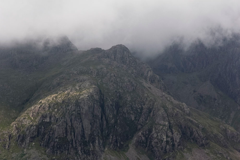
Then to the left is upper Eskdale dominated by the Scafell range. Sadly they did not reveal themselves today, being lost in the low cloud, but Dad was able to point out some of the lower fells such as Scar Lathing and Throstlehow Crags that add to the drama of the scene. We recalled the day we climbed those. "It was a really hard walk", said Allen, "especially as there were no paths for the most part."
"Yes it was pretty tough", agreed Dad. "I am glad that I do not have to repeat it again."
Then Tetley said , "the Scafells were clear, when we did the walk in 2006."
Grizzly replied, "we did get magnificent views of them on our last walk on the Coniston Fells, so that is some compensation."
Not wanting to deny our readers, we include these pictures Dad took in 2006. First of Slight Side (2499ft), being the pointed prominence on the left. The ridge then rises the top of the massive Cam Spout Crag, to the right of which is the summit of Scafell (3162ft). In the foreground are Throstlehow Crags (1325ft).
Below the shot shows the view further right of, Scafell Pike (3210ft), Broad Crag (3054ft), Ill Crag (3067ft) and more distant right Great End (2984ft). In the foreground to the left is Scar Lathing (1440ft) with right Long Crag with Low Gait Crags behind.
Looking intently Allen said, "there is Dow Crag, part of Scafell Pike more or less in line with Broad Crag. On its top is Pen (2500ft), our very last Birkett summit."
"Quite" agreed Grizzly. "It was so good to finally get to the top and complete this challenge."
"Tetley went on, "and in a fortnight it will be exactly one year since we did it."
With his new camera, the zoom is more powerful, so Dad was able to get a pretty good shot of the triangular shaped Pen, perched on the top of Dow Crag.
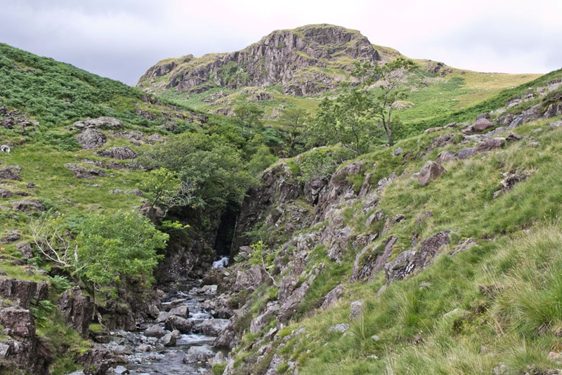
With these dramatic views before us, Dad and Uncle Eric continued along the shoulder finally descending to the path that runs through the Mosedale Valley and coming close to Lingcove Beck that starts life as Yeastyrigg Gill high up on the slopes of Esk Pike, below Ore Gap.
"We go left on this path all the way down to Lingcove Bridge", instructed Shaun
Soon this was high above Lingcove Beck, and after an initial grassy section it became very rough rocky and steep making for hard going. "I have no recollection of this path, nor how rough and steep it is", said Dad.
"Well it is eight years ago", replied Tetley.
Eventually Eskdale came into view, stretching away before us. "That is our route to the start", informed Shaun.
Near the bottom Lingcove Beck runs through a steep sided gorge, seen here with Throstlehow Crags (1325ft) rising behind.
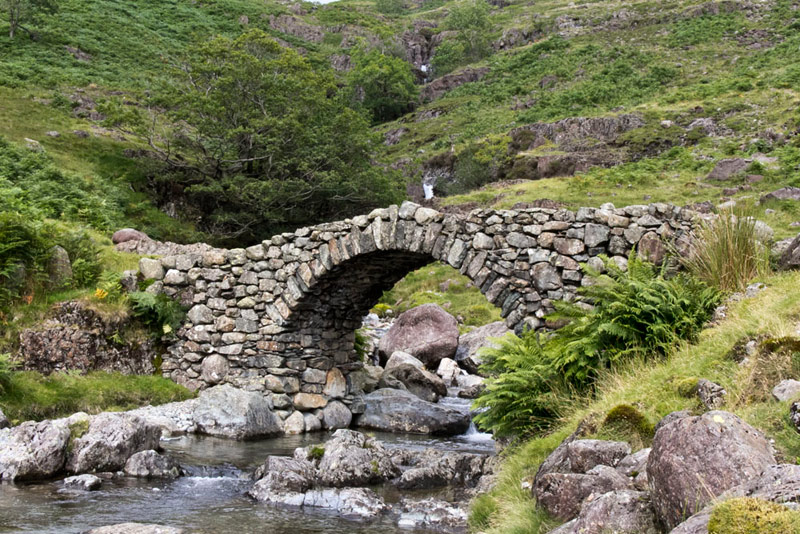
Finally it was done, and we arrived at the delightful Lingcove Bridge, whose graceful arch spans the beck, just above the point where it joins the River Esk.
"What a lovely scene", said Southey.
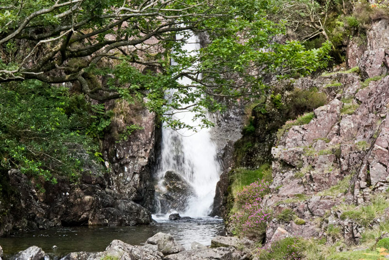
Behind, the beck can be seen dropping in a number of waterfalls, this being the lowest.
Both Dad and Uncle Eric spent time here taking pictures, and we all just enjoyed the scene. "I don't suppose we will come back here again", said Tetley, "as it reckon Little Eric you have bagged all the summits around this location."
"No", agreed Allen, "we best enjoy the surroundings and try to fix them in our minds for all time."
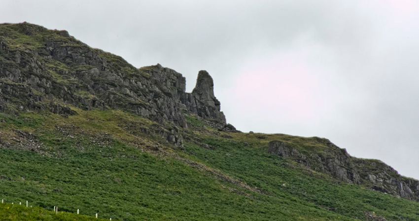
Finally ready for the off, Dad and Uncle Eric strode along the clear, less rocky, and much more level path down Eskdale. Some way along Grizzly called out, "Look there is the Eskdale Needle high up on the hillside to the left."
Shaun went on, "Wainwright says that it is also known as The Steeple and is about 50 feet high on its longest side facing the valley."
After a ladderstile the path was then mostly grassy to a gateless gap. Beyond it led on to another gate after which it was narrow being fenced to the left and with the steep bank of the River Esk on the right. This led to another gate into the yard of Brotherilkeld Farm.
Here we strolled its access track to the road by the telephone box, then left over Jubilee Bridge and uphill, about a final 100ft of ascent, to the cars.
"That was a terrific day", cried Little Eric. "Thanks Dad for repeating the walk."
"You are welcome Lad."
Uncle Eric said, "my thanks too. I have never been to this part of the Lake District before, and it was superb to see the dramatic scenery."