It was Monday, and as usual Dad and Uncle Brian were at Elaine's at Feizor. Southey had the iPad in paw, and looking up said, "there is a walk day down with Uncle Eric, tomorrow."
What's the weather forecast then?", responded Tetley.
A few taps with his paw later, the Met Office app was opened. "Hmm, it is a bit tricky. Rain for the early part of the morning, clearing up by about 11:00."
"And that's the problem. There is every likelihood that it will have changed by morning either for better or worse", replied Allen. "Still I think we should suggest going anyway."
"I agree", called out Shaun, as he came in with Grizzly and Little Eric. "I bring tea".....
"And we bring cake", added Grizzly and Little Eric in unison.
"Great", exclaimed Allen, going with Southey to get the mugs and plates.
"The cake is either flapjack, made by Little Eric, or cherry and ginger scones that I have made", explained Grizzly.
"Mmm, lovely. One of each please", said Tetley.
Soon we were all content with cake and tea, and our thoughts retuned to where to walk tomorrow.
"With the forecast as it is we do not want to be going too far", mused Shaun, "so I was wondering about perhaps doing one from the book that Dad has of walks in Arnside and Silverdale."
"I think that is a good idea", agreed Grizzly. "I do not think that many of us have done these, as Dad explored this area in the pre-STAG days."
Tetley went and got the book and we poured over the index. Pointing Allen said, "how about this one, that starts in Arnside and goes along the coast returning via Arnside Knott."
"Sounds good" agreed Little Eric. "I am sure that none of us at all have ever been to the summit of the Knott."
Getting the map, Shaun traced the route. "It takes us via White Creek to Far Arnside, then over the Knott, but we could extend it by crossing to the Holgates Caravan Park and walking to Arnside Tower, and then up the Knott."
"Sounds like a plan, all we have to do is see what Dad thinks when he gets home, and also if Uncle Eric likes the idea too", said Southey brightly.
It was Allen who did this, on his return telling us, "Dad thinks it is a good idea. Yes he has done this walk before, but many years ago, and honestly cannot remember much about it at all. As well, he has been up the Knott, by car, but probably not on foot, and he has never been to the actual summit, so he too is looking forward to ticking it off."
Later in the evening Dad came and told us, "I have spoken to Uncle Eric, and he likes the idea, and the plan is to meet about 10:30 when hopefully the weather will have cleared up."
"Yippee", cried Little Eric, "I can't wait."
The Walk
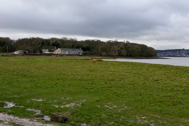
The agreement was to meet Uncle Eric at the parking on Arnside promenade at about 10:30. To get there we drove via Warton and Silverdale, then passing below Arnside Knott, Tetley calling out, "that's Arnside Tower over to the right that we will visit, and there on the left is our path up the Knott."
Very soon then we entered Arnside along past the houses and finally dropping down quite steeply the road bending right and left to the promenade.
"Back in the 1980s and 1990s I used to come this way often to go to Paddy's, a lovely cafe that did plain but delicious home cooked food. Many a happy time, and I took Uncle Brian, mum and dad and my sister Elaine there too. Sadly it is long gone now." As the road bent left Dad pointed saying, "there is the building, now just a private house."
"Well you have Elaine's now", replied Shaun.
"Yes we have, and the best tearoom in Yorkshire!"
As we arrived on the promenade, we noted Uncle Eric had already arrived and we greeted him, calling out, "Happy New Year."
"And to you too, Lads", he replied.
The rain had largely stopped, so it was agreed to set off. There were a few light showers and a strong wind, but after a little while these gave way to brighter weather.
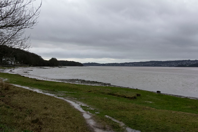
Quickly we got settled in the rucksack, and shouldering this Dad and Uncle Eric strode off, along the promenade, and on to the concrete ramp that led to the beach.
Arnside is situated on the estuary of the River Kent, close to where it joins Morecambe Bay. High tide was only about an hour away, Tetley commenting, "just look how fast the water is coming in."
"It really makes one realise how dangerous Morecambe Bay is and why people who are unwary get into such difficulties", said Allen.
"What is that town on the other side of the estuary?", asked Southey.
"Grange-over Sands", replied Grizzly.
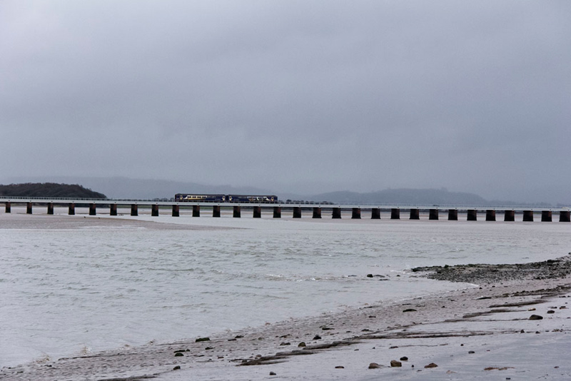
Pointing back, Allen said, "the viaduct carries the railway line that runs from Carnforth to Barrow in Furness, so connecting the station at Arnside with that at Grange."
Just a minute or so later, Southey called out, "ooh there is a train crossing the viaduct now. Can you get a picture Dad."
Another quarter hour along the sandy and rocky shore we reached New Barns Bay. "The instructions say to keep to the inner side as the intervening creek is deep and nasty", said Shaun.
"Right lad", replied Uncle Eric striding on along the rocky shore.
The way circled round to reach the buildings associated with the caravan site on the far side and then keeping to the shoreward side of Firth Wood.
Passing by the wood Shaun soon said, "that is Blackstone Point ahead. Being high tide we may not be able to continue along the shore."
"Whatever are we going to do then?", demanded Little Eric.
"The instructions clearly state that there is a high level path along the top of the point through the woods", replied Shaun.
A few minutes later, Allen pointed and said , "that must be the cliff path."
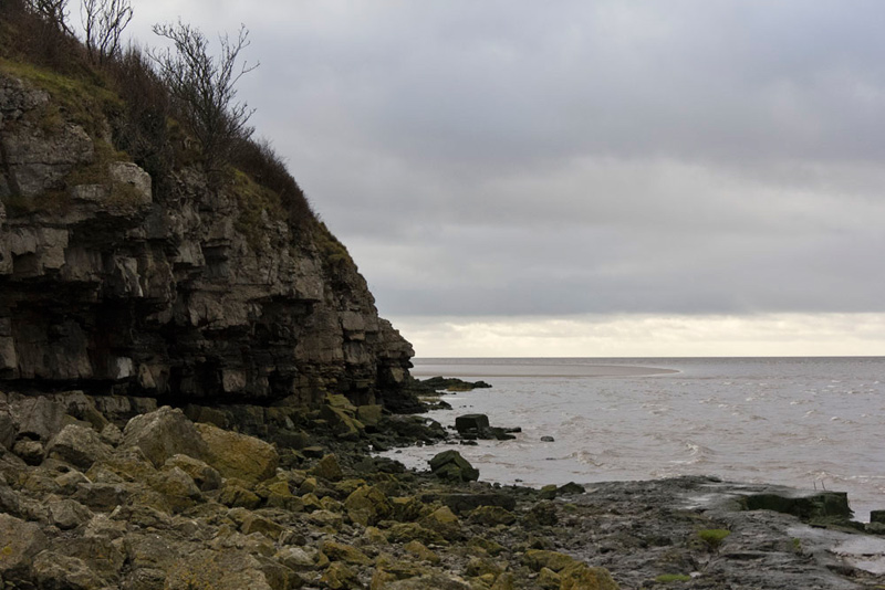
Dad said, "it's not that far to the point so let's see if we can get through."
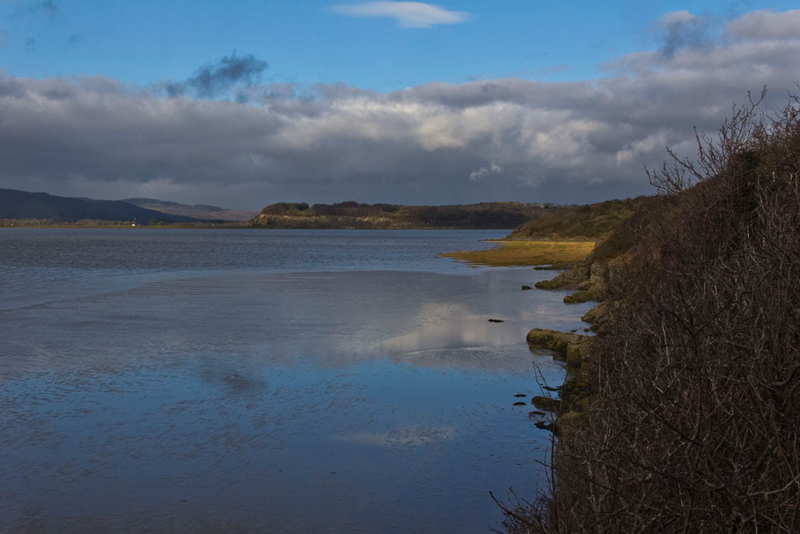
"I doubt it", replied Tetley, "it's nearly high tide now."
He was right too, as this picture shows.
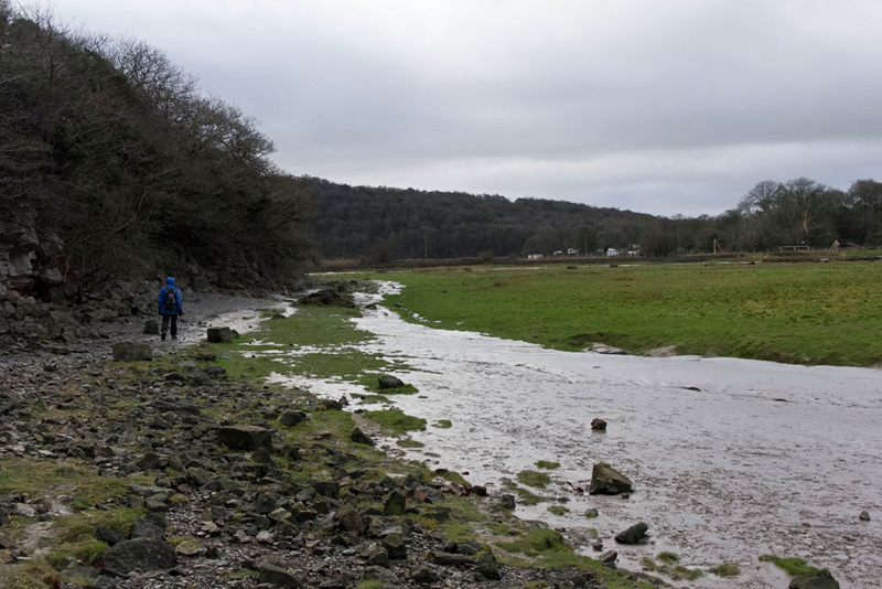
Turning back, Dad and Uncle Eric made their way carefully once again over the slippery rocks and then up the initially steep path to walk through the woods that clothe the top of Blackstone Point, bringing us then to the next bay called White Creek.
"I remember coming here to start the walk across the Bay with the guide Cedric Robinson", reminisced Dad. "My, that was a long time ago." (When we got home we looked at the framed certificate Dad has, which is dated 19th June 1985. Long long ago before any of us were adopted!)
"That must have been quite fascinating, Dad?" said Grizzly.
"Yes it was. The Bay is very dangerous with quicksands, so it is only safe to go with the guide. Cedric Robinson is royally appointed Queen's Guide to the Sands, a position he has held since 1963. Having walked from Arnside as we have now we started out across the Bay from here. There must have been well over 100 people doing the walk that day, and at one point Cedric stopped us, then made us spread out in a line as the sand was very soft at this point, to prevent us sinking into it. As is the case some people walk faster than others so we got strung out. I soon realised that is was best to keep up with Cedric, as after he had stopped to let stragglers catch up, he would immediately set off again. In the process it was necessary to cross the River Kent twice. Before guiding the people Cedric goes out and marks the safe crossing points with branches of laurel, called brobs. I actually did the walk twice. The first time the water came halfway up to my knees, but the second time it was up to my thighs. A case of wide and shallow, and narrow and deep. Good fun."
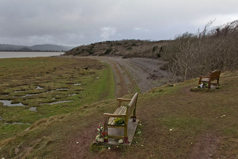
Reaching the shore again, Shaun read out, "we need to walk the edge of the pebble beach and then at its end take a path climbing left up onto the cliffs again."
This shortly came out of the woods on to a flat open area, with two seats. They has dedications, one to a lady who had lived to be 100!
"Wow", said Tetley.
"How nice it would be to sit here and look at the lovely view of the Bay and Grange, if only the day was warmer and less windy", said Uncle Eric.
"Yes it would", agreed Allen.
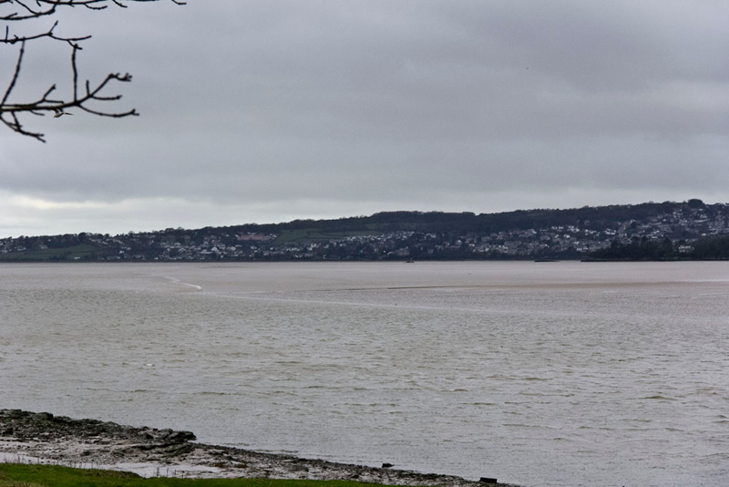
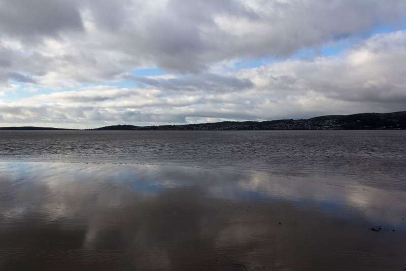
The path now climbed to join another, where we went right on the cliff top path running from Arnside Point to Park Point. Shortly we did stop to admire the view, as with the weather now improving and blue sky beginning to show through the clouds, there were some nice reflections in the sands.
For a while now along the cliff top, the path was named by Uncle Eric as the 'PCTTE'. This was because the instructions said that it was at times 'perilously close to the edge'!
It had been lovely seeing the tide coming in, Tetley remarking "Uncle Brian would have really enjoyed that, but not this cliff top path, as we know he does not like heights."
At Park Point, there was this nice view looking back to White Creek and beyond the wooded slopes of Meathop Fell on the opposite side of the estuary. More nice reflections too.
Beyond Park Point the path climbed through the woods to another path. "We go right here", called out Shaun.
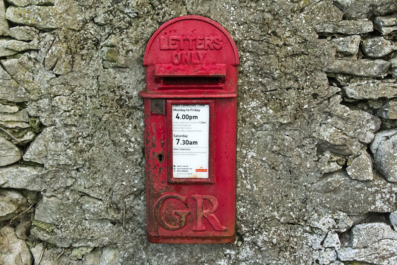
This led us to and through the hidden and huge caravan park. They are permanently sited caravans and we say huge as it was noted that one was numbered 296! Following the waymarks, this then led on through the cottages of Far Arnside, and so to the main road that we had driven along this morning. Directly opposite was this wall post box that dates from the reign of King George V.
"This is the start of the extension that we planned", said Shaun. "Instead of taking the path off to the left that we have just passed, we should cross the road and go through the kissing gate opposite. Then its is over the field to the gate on the far side."
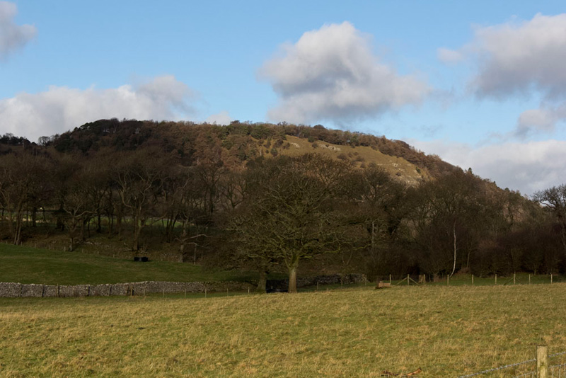
By the far gate Dad paused and getting the camera out said, "this seems like a good place to take Arnside Knott, our ultimate objective."
Clear too is how the day had improved with mostly blue skies having replaced the grey dismal cloud.
"Small in stature compared to many we have climbed, but nevertheless a worthwhile summit to bag", said Grizzly.
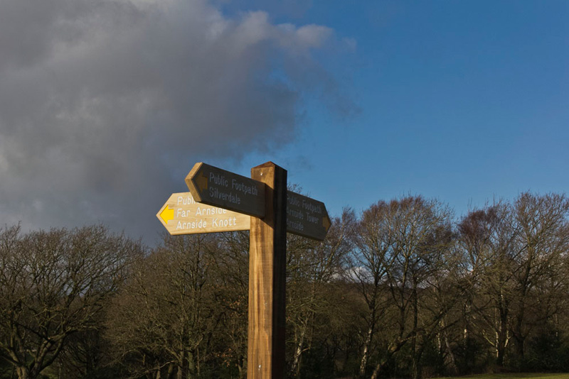
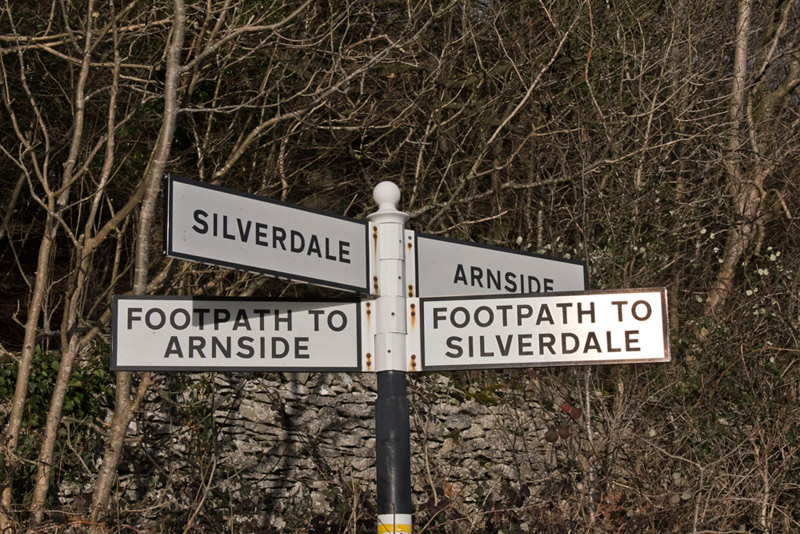
Following the waymarks the path led between some trees, to bring us to Holgates Caravan Park, with its tarmac drives and neatly manicured verges. In the centre was this three-armed signpost.
We had come in from the direction of the leftward sign, and Shaun instructed, "we now go right to Arnside Tower."
The route was clearly waymarked along the drive, then at a junction we followed the waymark directing us along a rough track to a gate. Beyond the track continued with the ruin of Arnside Tower looming ahead. Through the next gate it was left on the track by the wall.
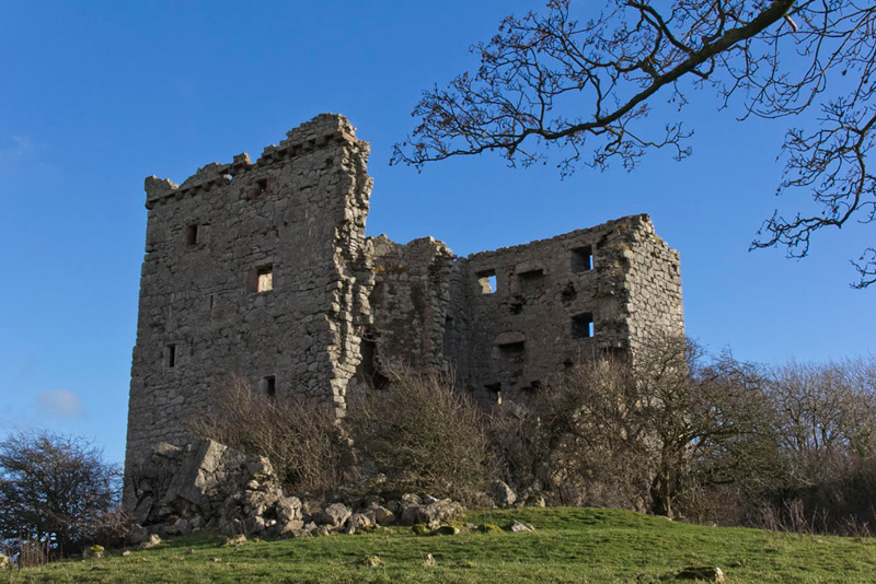
Dad had already taken a picture of the tower, but there was a better angle from this side, which we include below.
There were signs warning of the dangerous state of the ruins, but by just looking this was quite obvious and we sensibly did not go anywhere near. It was built in the second half of the 15th century and was originally five storeys high, measuring 50 feet by 34 feet. The tower was built with an adjacent wing of equal height built onto the side of the tower in a style common in Scotland, but rare in English tower houses. The tower suffered a serious fire in 1602 but after repairs remained in use until the end of the 17th century. The collapsed wall seen from this angle occurred around 1900.
The track descended to and through the yard of Tower Farm and then along its access to the main road once again.
"We cross and take the path opposite to make our ascent of the Knott", said Shaun.
Laughing Little Eric said, "look at the signpost. It appears to be contradictory in that the road and footpath directions are the opposite way round."
"Nevertheless they are quite correct", replied Tetley.
"Oh quite", agreed Little Eric.
Entering the trees that clothe the lower slopes we climbed steadily on the wide leaf strewn track.
Checking the map, Shaun said, "if we keep on this path it will eventually bring us either back to Far Arnside or around the lower slopes. So we need to look for a path going right to get to the summit."
Keeping our eyes peeled, Southey suddenly called out, "there is a gate just ahead on the right"
Whilst it was not signed or waymarked, Uncle Eric said, "this must be the path we want."
After an initial level section the gradient steepened, as the path swung left and then continued to the ridge.
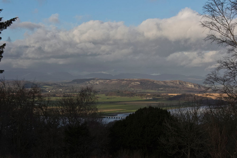
"Wow", called out Grizzly. "What a superb view of the estuary and Whitbarrow Scar."
"The scar is bathed in sunlight, but not so the dark line of the Lakeland Fells beyond", said Allen. "We made the right decision to come here today."
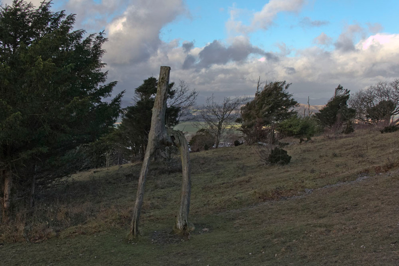
"We certainly did", agreed Uncle Eric. Then as we moved on to the right he said, "there is the famous knotted tree."
There used to be two such trees, but only one remains now. Legend has it that in Victorian times, two lovers, knotted two saplings together that then grew into this special shape.
"Where now?", asked Allen.
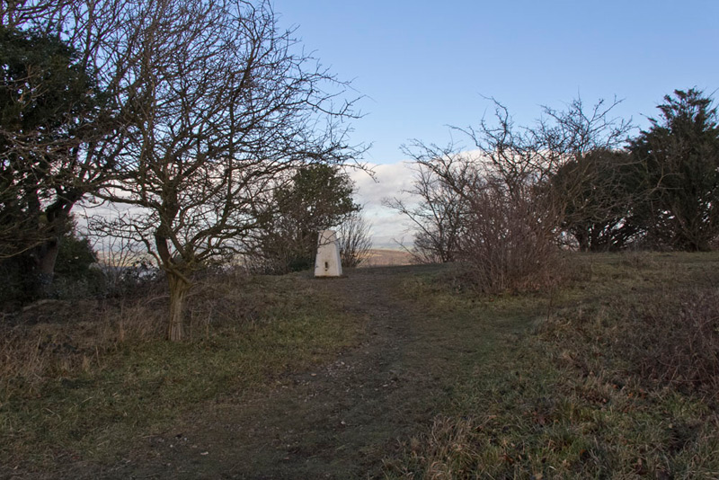
"We keep right on the main path to that brow, where I suggest we go off to the right up to the higher ground to find the summit", replied Dad. "It should be easy to spot as there is a trig point."
"Ooh great", cried Little Eric, "let's hope we can sit on top."
Walking the path from the brow, Tetley, suddenly called out "look there's the trig point off to the left."
We quickly scrambled out of the rucksack and Little Eric's wishes were fulfilled for our picture. Dad kindly let us sit on the map case to prevent us getting wet bottoms. Thank you! This summit was a first for us all, Dad and Uncle Eric included.
While we were getting settled again, Uncle Eric was looking at the map. "We need to return to the main path and go a short way right. Here we will find a gate through the wall on the left to the open ground that is called Red Hills. This we descend to a gate in the wall on the right."
Beyond this gate the narrow muddy path led through the woods joining a wide track at right angles. This was followed left to the houses on Redhills Road that looped right down to another road, where Uncle Eric said, "we go right."
This soon brought us to Silverdale Road that was followed left down the hill to the promenade at the start.
Content now just to sit in the car and have our belated picnic and warming mugs of tea, we waited patiently while Dad and Uncle Eric went in search of refreshment. They walked along towards the station going to Sheila's Heron Cafe. Here Uncle Eric had a toasted teacake and Dad a piece of Bakewell Tart, washed down with a warming pot of tea. "Just what we needed", said Dad.
They did not linger as it was clear that the cafe was shortly to close. While there Dad thought the owner looked to be familiar but he could not place her. He commented on this to Uncle Eric, and on the walk back, suddenly the penny dropped. He said, "of course, she used to run the cafe at Bob Parratt's in Milnthorpe."
So a good day and we said our goodbyes to Uncle Eric and look forward hopefully to another walk with him next week.