BURN MOOR FELL, CATLOW HILL & WHITE HILL from STAIREND BRIDGE
Summary
Date - 25th May 2015
Distance - 14.5 miles
Ascent - 1700ft
Map - OL41
Start point - Stairend Bridge (SD 6503 6399)
Summits Achieved
Name
Height (ft)
Height (m)
Grid Ref
Burn Moor Fell
1319
402
SD 6943 6458
Catlow Hill
1595
486
SD 6978 6080
White Hill
1785
544
SD 6739 5879
Preface
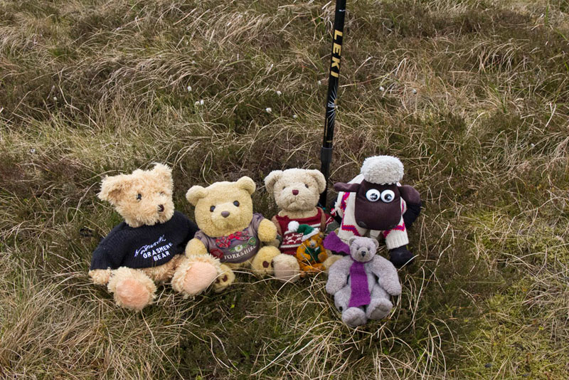
Allen, Southey and Tetley were huddled over the laptop, when Shaun, Grizzly and Little Eric arrived with the tea and cakes.
"What are you on with pals?, asked Shaun, putting the flasks down.
Tetley replied, "Because it is Bank Holiday next Monday, Dad and Uncle Brian are not going to Elaine's at Feizor, so he has said that we will be walking."
"So", went on Southey, "we have been planning the next expedition in the Bowland Fells"
Meanwhile Allen had spotted the flasks and called out, "tea and cakes. Just what I need."
He and Southey went off to get the plates and mugs, then Tetley assisted Shaun in pouring the tea.
"Little Eric has made flapjack today, and I have made chocolate caramel shortbread", said Grizzly.
The plates had been distributed and then Little Eric passed round the cake tins.
Taking a bite, Southey said, "the flapjack is delicious. Thank you pal"
"You're welcome", replied Little Eric.
"Lovely millionaires shortbread too", said Tetley.
So all was well and our collective thoughts turned back to walking.
"We wondered about Burn Moor and White Hill", said Allen. "We have searched around the Internet and found a possible route, starting from Stairend Bridge that is reached along the narrow road from Wray opposite the tearooms."
"It is about 12 miles and looks to be hard going as about half will be over trackless moor, which worries me somewhat", went on Southey.
"Well never fear", replied Grizzly, "Dad is well used to that kind of walk, from when we explored the Yorkshire Dales with Uncle Bob."
"Quite", agreed Tetley. "I bet Dad has forgotten how many miles of trackless walking by fences he has done."
Shaun had meanwhile got the map and spread it out. "Right, you call out the details Allen, while I highlight it on the map. I've just got to find Stairend Bridge?"
Grizzly looked over his shoulder and after a few seconds, pointed his paw, "here."
With Allen's help it was soon done, Shaun commenting, "some of it is on the other side of the map."
"Oh heck", said Little Eric, "that could cause a problem if it is windy."
Tetley had got the original sheet from 'Go4aWalk.com' and said, "there seems to be another summit, Catlow Hill, that the author did not include." Then looking at the map he said, "it is off to the left at the end of the long initial long walk by the fence, and will require an up and back to bag it."
"The walk is long enough as it is", said Southey.
"I know, but we do not want to have to repeat parts to bag this summit later", said Allen. "I'll just have to use extra charm when I go and see Dad about our suggestion."
"Well, no time like the present", said Shaun, handing him the map.
It was a little while before he returned. "Sorry I took so long, but Dad was on the telephone. He fully realises that some of these walks are going to be hard going, so is in agreement with our suggestion and to include Catlow Hill too."
"He truly is the best Dad in the world", replied Southey, raising his mug in salute.
"Roll on Monday", cheered Grizzly.
The Walk
In view of the distance Dad had told us that he wanted to start walking by 09:00 at the very latest, so even though was not very far to drive we made sure that we were ready in good time.
It was to be a completely new area to us all, and as we drove up the Lune Valley, Dad said, "the road from Wray to the start is one that I have never driven along before. In the village, it was along the main street and over the bridge then turning right and climbing the narrow road. Walled to both sides, as we reached the top of the moor it became open to once again become walled as we dropped down to the start at Stairend Bridge, where just before is a hatched area for parking. The day was mostly cloudy with some light drizzle at times and windy.
Dad soon got ready, and we settled in the rucksack, and shouldering it, Dad strode off at 08:45.
"We cross the bridge and then take the signed gate on the left", instructed Shaun.
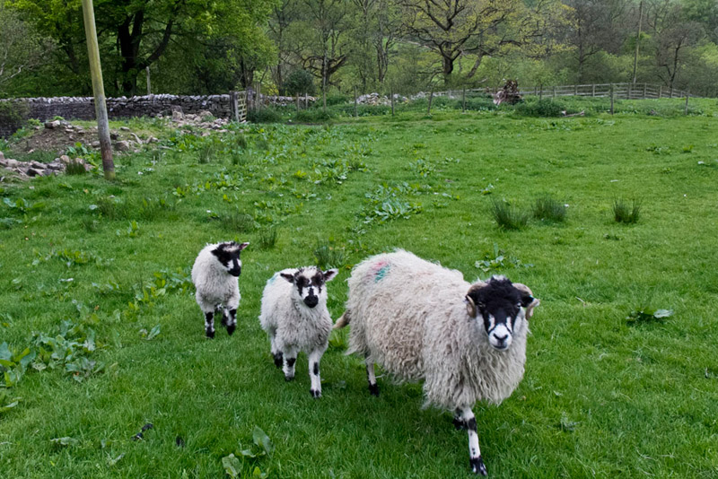
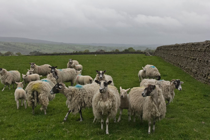
Immediately Dad started up the field we saw that it was full of sheep and lambs with Dad quick to snap this shot."
"Oh noooooo", cried Allen. "We have hardly started and any idea we would have a sheep picture free story is in the wind!"
"Well, they are cute", replied Southey.
Whether is was to greet Shaun, or the fact that they thought Dad was going to feed them, suddenly the whole flock were running across towards us.
Through the gate at the top of the field it was then up the next keeping to the left of the large barn.
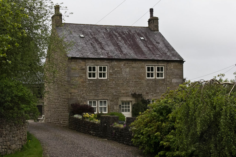
"Beyond the barn, we go through the gate to its left and then walk the track through the few houses at Ivah", said Shaun.
"The farmhouse has a date stone for 1755, two hundred and seventy years ago. My I wonder what stories it could tell", mused Tetley.
Where do we go now?", asked Southey.
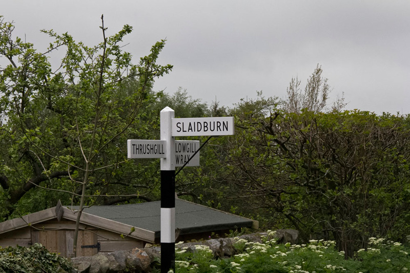
"It is right along the road signed Slaidburn, which we follow uphill to a t-junction", replied Shaun.
At the junction Shaun said, "we go left.
This quiet lane eventually descended passing through a gate. "There are not many gated roads around these days", remarked Little Eric.
"No", agreed Tetley. "There are three I can think of, off the cuff. The one in Dunnerdale past Hoses, then the Kingsdale road over to Dent from Ingleton, and that near Ings, off to the left by the pub."
"My pal, I never cease to be amazed by your memory", said Southey.
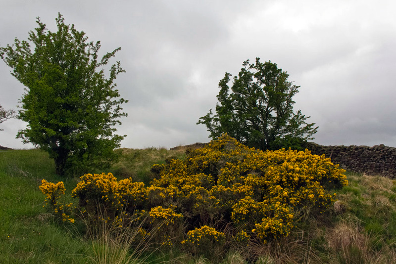
Continuing down hill, we passed this gorse brightening the day. "Framed by the two trees it will perhaps make a shot worthy of the story", said Grizzly.
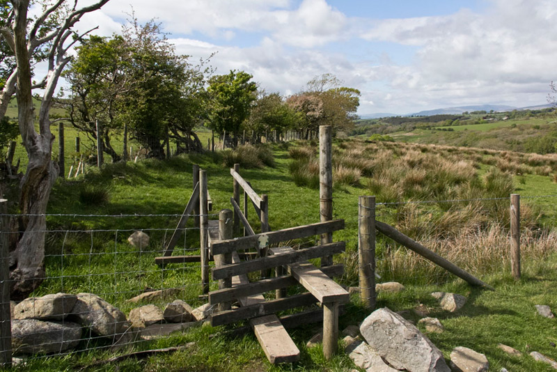
At the lowest point we crossed the Croasdale Beck and then walked up to pass the buildings of Ringstones. "Opposite the drive we climb the stile in the wall right", advised Shaun.
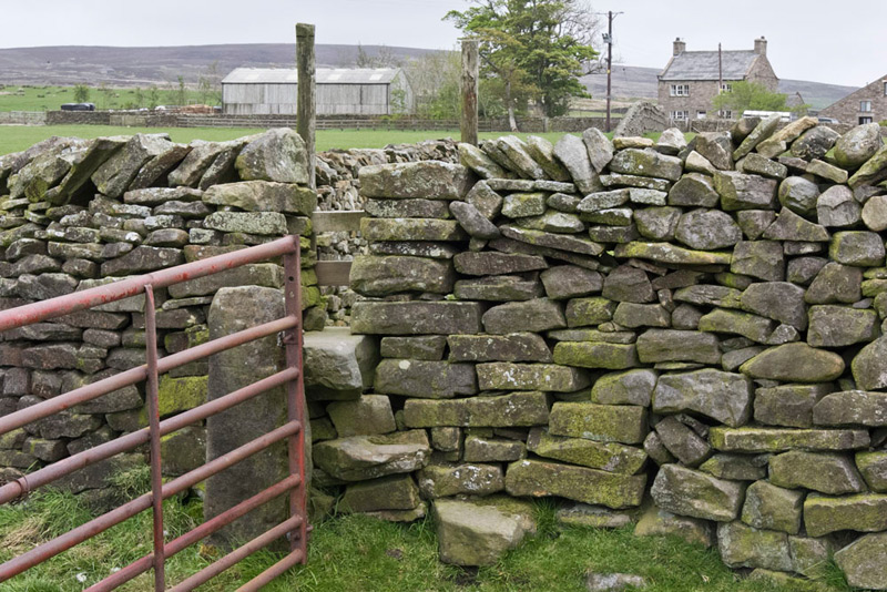
Now we walked up the field by the fence to the right making to Lanshaw Farm seen straight ahead. The fence became a wall and this was followed for 100 yards, where Shaun then said, "we go through that gate in the wall and then turn left."
Reaching a corner it was over the wall ahead via a step stile, seen in the picture below. Distantly over the large barn is Burn Moor and our first summit.
Striding on towards Lanshaw Farm, Shaun now instructed, "we cross the drive to the left end of the barn conversion, and then go through a gate, and so pass to the left of the farmhouse, and to a waymarked gate into a field."
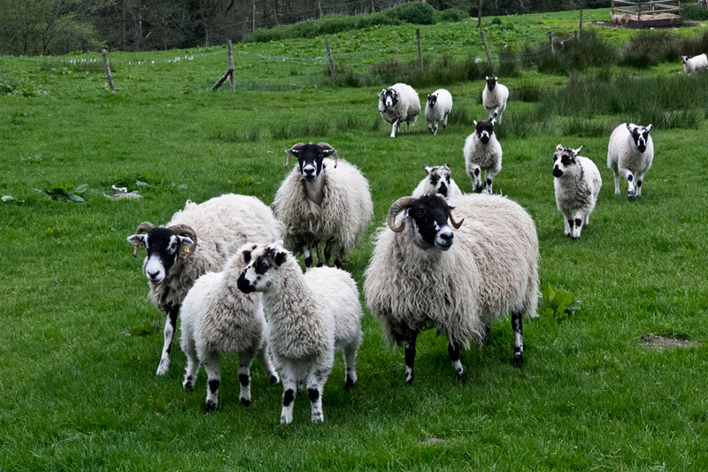
Here once again the sheep and lambs came to greet Shaun. "Hmph", complained Allen, "I guess that's another sheep picture in the story."
After passing through two more gates, the next wooden gate took us to open moorland. "We go left following the wall and then make for a nearby wooden post beside the Bentham-Slaidburn road", said Shaun.
We paused here so that Dad could ring Uncle Brian, to check that he was OK, as he had still been asleep when we left.
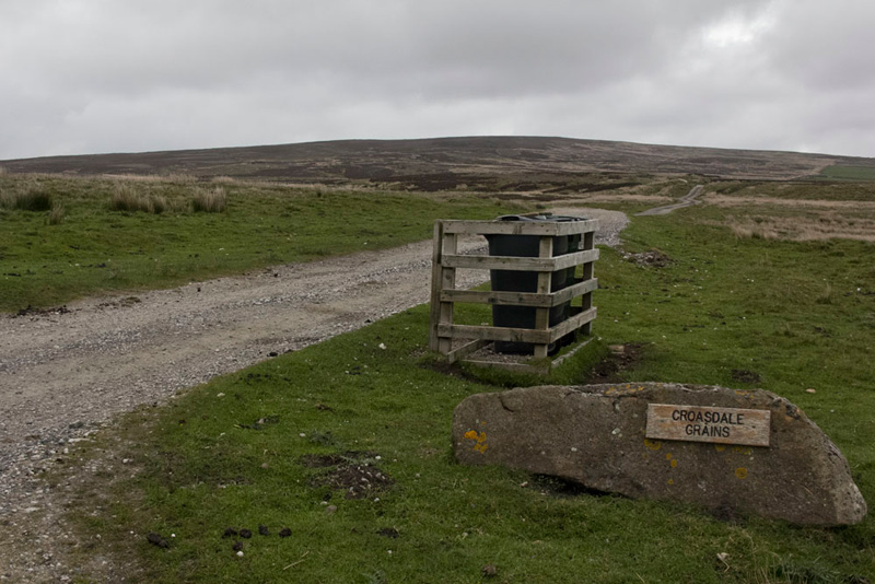
The way now was on the opposite side of the road on the track known as Petersbottom Lane that as can be seen ultimately leads to Croasdale Grains Farm.
"Blimey, they have a long way to bring their wheelie bins for collection", remarked Tetley.
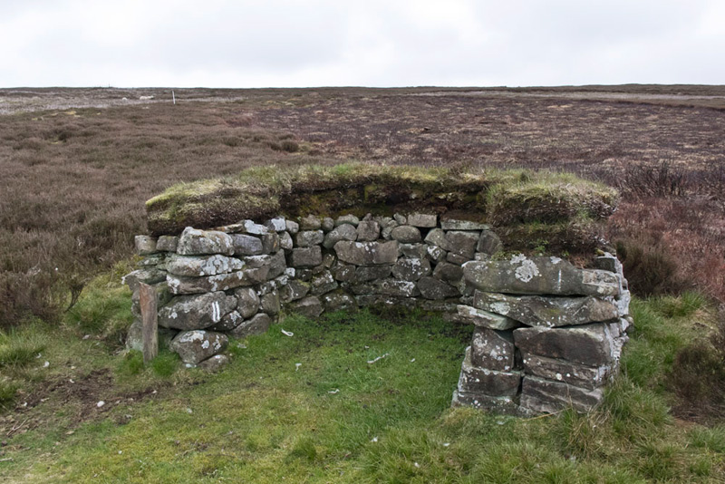
After half a mile the track forked and Shaun said, "we go left towards that shooting box."
"What is that for?", asked Southey.
Allen replied, "when it is the grouse shooting season and the landowners are hosting shoots, this is where the refreshments are served."
After another 250 yards Shaun said, "it's left along this grassy vehicle track for 150 yards, until we reach a shooting butt on the right. Then we turn right and follow the line of butts uphill."
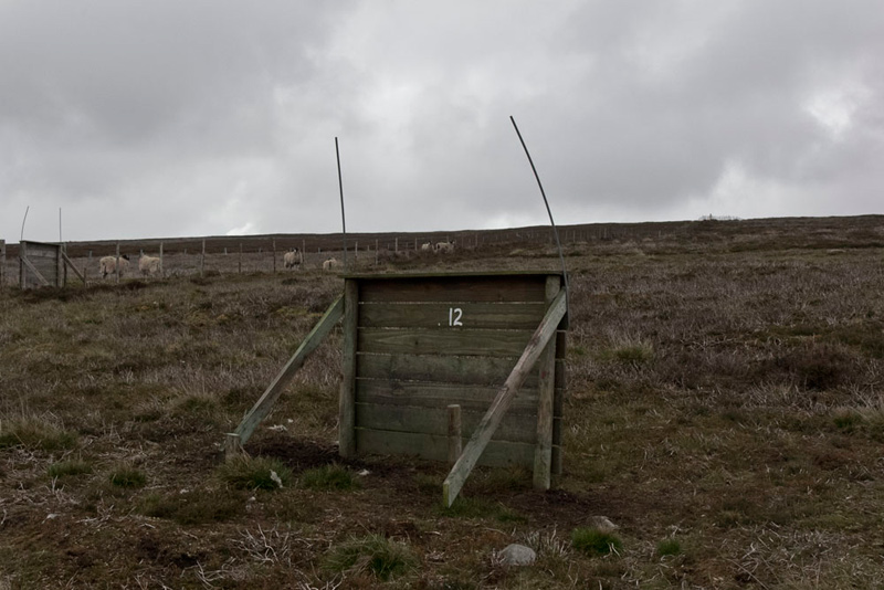
Here is number 11.
Close by was no. 12, somewhat less prepossessing.
We include this as the background shows clearly the type of terrain that Dad was faced with, and the fence which was to be our companion across this rough and trackless moor for almost 3 miles.
"This is where the hard part begins, Dad ", said Little Eric with some trepidation in his voice.
"Aye lad, but I am well used to this from all the exploration in the Yorkshire Dales, so it's just best foot forward."
The summit of Burn Moor Fell came into view, and Tetley called out, "there's the trig point, on the opposite side of the fence."
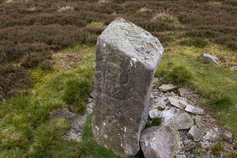
In a few steps the fence bent left, by which stands the boundary stone known as the Standard of Burn.
Across the top the word 'Standard' has been carved while the three sides going round left have initials, 'B', 'N' and 'T'.
"I wonder what they stand for?", said Southey.
We all pondered this, Grizzly finally suggesting, "'T' could be for Tatham parish, and 'B' for Burn Moor. As for 'N', I have no idea."
A search of the Internet did not answer Southey's question either.
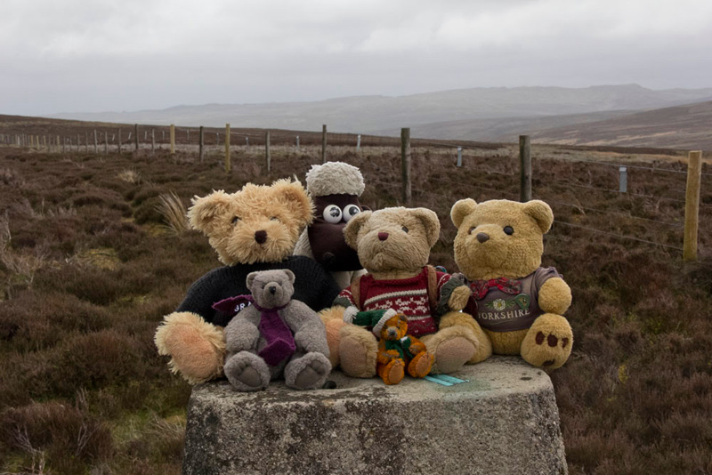
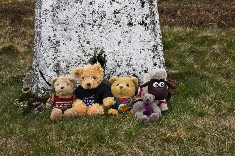
Just a short walk now brought us to the trig point marking the summit of Burn Moor and once Dad had climbed the fence, we were quick to settle on top for our picture.
Recrossing the fence Dad then trudged on. "There may be no path, but at least there is not too much bog", remarked Dad.
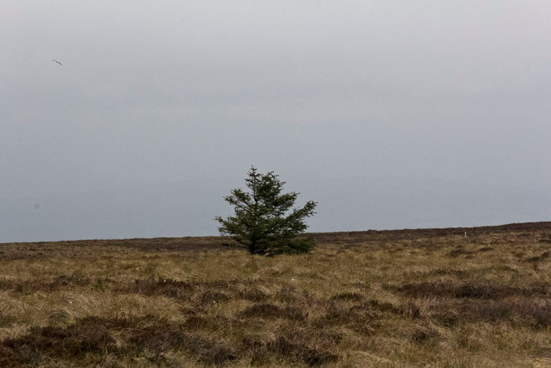
Forty minutes or so passed, and the monotony was relieved only by a small pool to the left of the fence and this solitary tree standing out bravely on the featureless moor.
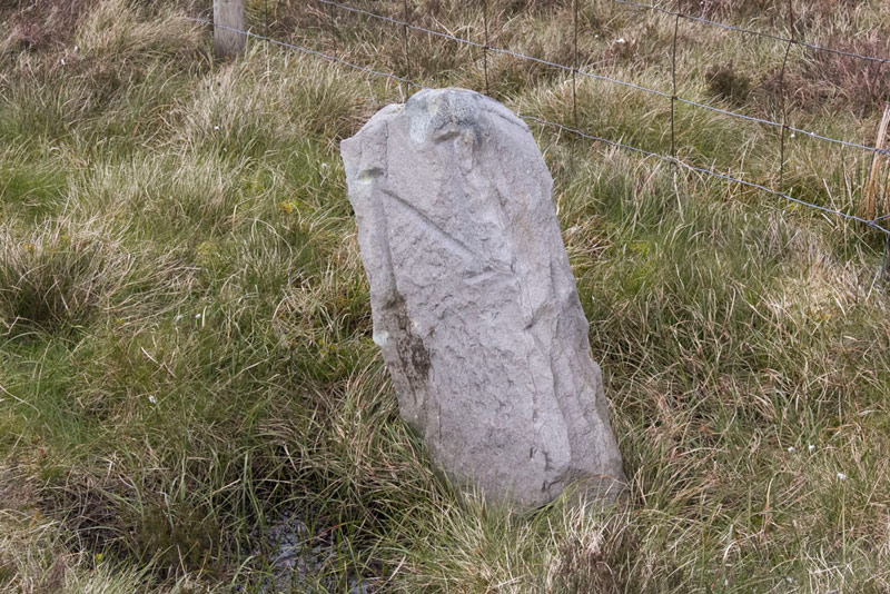
Then a few minutes later, Allen said, "look there is another boundary stone." Then examining it more closely he said, "it has the initials 'N' and 'B', like on the Standard of Burn."
"From the map I am pretty sure that Grizzly is right, that the 'B' means Burn Moor", said Shaun.
However the meaning of 'N' still eludes us.
So ever onward. Suddenly Grizzly called out, "what is that bird that is seemingly skipping across the moor?"
We peered closely Allen saying, "it looks like and owl, but surely not during the day time."
"I know", said Tetley, "it must be a Marsh Harrier."
Recently there had been quite a number of incidences of these birds disappearing without trace in the Bowland area, so we felt privileged to have seen one.
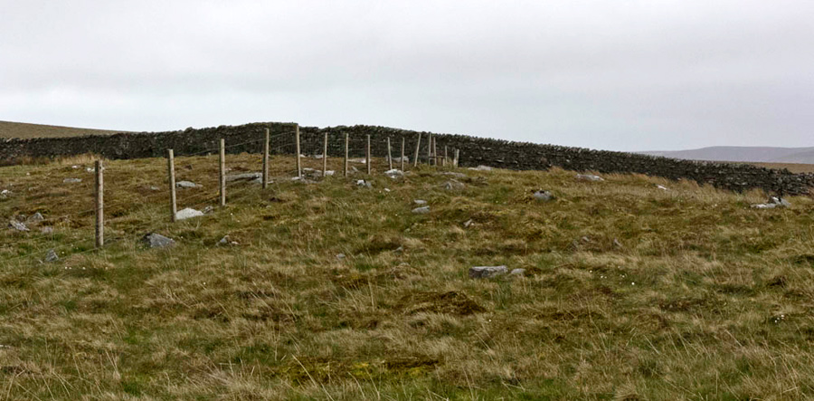
Finally it was with some relief, particularly for Dad, that the short section of substantial wall came into view at the grassy level area known as Raven's Castle or Crowd Stones.
"This is where we have to strike off to Catlow Hill", said Tetley.
"That's right pal", agreed Shaun. "Eventually we will go right by the wall and then fence, but first we have to cross that stile in the fence we have been following, and then strike uphill with the wall and then fence to our the right."
No track of course and after a little over a quarter mile the gradient eased and we came to the unremarkable flat top of Catlow Fell.
"There is no cairn or anything else to mark the summit", commented Southey.
"The map shows the spot height as just on the other side of the fence", replied Shaun.
So Dad climbed over, and we settled on the heather at what in our opinion was the summit?
Looking across the valley Tetley said, "that must be White Hill. The trig point seems to be a long way left on the fell, so looks to be another section of hard walking."
"You're no doubt right, but we will not be defeated, and when done we will not have to go there again", responded Dad.
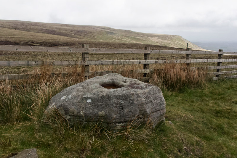
So settled again in Dad's rucksack, the route was reversed to Raven's Castle, and after climbing the stile once more, we followed the wall and soon fence down and up to the road at Cross of Greet, of which just the large base stone remains.
This the highest point on the road from Tatham Fells to Slaidburn is known as 'Cross of Greet' or 'Top of t’Cross'. The boulder stands on the Lune-Ribble watershed, and was the county boundary with Yorkshire’s West Riding until 1974, when the Slaidburn area became part of Lancashire. It is usually asserted that a stone cross once stood here. However the hole in the boulder looks to be too shallow to have supported a cross, but maybe it was once deeper. Some hold the view that the boulder had nothing to do with the cross, suggesting it is a 'Plague Stone', and its hole a basin. In times past, there was a superstition that washing money in a Plague Stone would protect the traveller against catching disease in the new territory beyond.
"How about we stop for a bite to eat?", said Allen, "we are all getting a bit hungry."
"Fine", agreed Dad, "it will certainly be nice to have a little rest."
Two cyclists who passed by heading for Wray commented in us, and another going in the opposite direction called out to Dad, "hello", and then "hello teddies."
Ready for the off again, Shaun said, "we go through the gate opposite."
This first section was particularly rough and pretty boggy, to come by and then follow the fence. "We will pass a kissing gate in it and then soon reach a cross fence", said Shaun.
Beyond the kissing gate in the cross fence a the fence to the left continued uphill. "That's our route to White Hill, the summit being about a mile away", said Shaun.
"That looks pretty horrible", said Southey with sympathy in his voice."
"Well never mind", replied Dad, "nil desperandum."
And true there was more rough terrain although a path is developing, but at times wide detours were necessary to avoid the obviously dangerous bog. Tetley pointed out to Southey, "the greener the ground looks the more it will be bog that should be avoided at all costs."
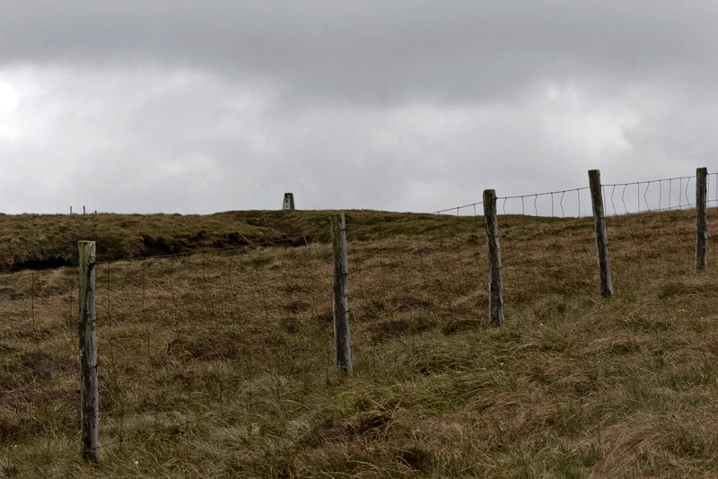
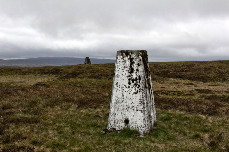
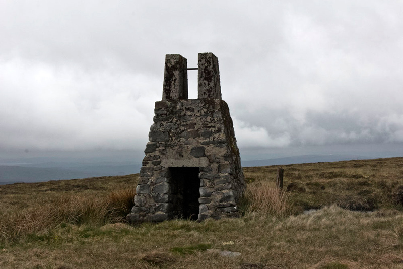
Finally the trig point came into view.
"Hallelujah", called out Little Eric.
"Amen to that", replied Dad!
The fence bent away left and bearing away from it there was just a short further section of rough ground to gain it.
"Let's sit on top for our picture", called out Southey eagerly.
The wind was blowing pretty hard and Tetley wisely said, "it's just too windy pal, we will have to settle for sitting at the base."
Now you may have noticed in the picture of the trig point, a tower like structure a short distance away, and we went across to have a closer look.
"What is it all about?", asked Southey.
"It is one of the old survey towers built for the Haweswater Aqueduct, that runs underneath the ground here", Tetley told him. Then pointing his paw in the direction just a little east of south, he said, "you can just see the top of another one."
So now we had to retrace our route to the kissing gate, but with us now having effectively turned for home this was accomplished in about half the time of the climb.
"I don't reckon we will be going up there again", said Little Eric.
"No lad", replied Dad firmly.
"OK", said Shaun, "we go through the gate then follow left by the fence, and after a while leave it right to come by Middle Gill."
This was mostly followed on the long descent of Whitray Fell, over more rough ground eventually to a gate on to a road. Dad caught his foot and fell full length at one point.
"Are you alright", said Allen with concern in his voice.
"Yes lad, no harm done, only my pride."
We tried not to laugh, but failed miserably!
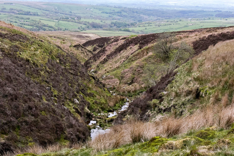
At times the gill had steep banks either side as this picture shows.
Finally on the road, Dad said, "well I am heartily glad to get off the rough trackless moor, but I guess we will have lots more of that, before our exploration of the Bowland Fells is completed."
Shaun said, "we go left now to the roads end at Botton Head Farm."
In the yard a waymark sent us right between walls to a gate into pasture, where our route followed a vehicle track across two pastures. We were to find out later that this had been constructed in the recent past by United Utilities, when a survey check was carried out on the Haweswater Aqueduct.
At the far corner of the second pasture it was left through a gate and then down the stony track to Botton Bridge, that has a 3 ton weight limit. We paused on the bridge and Dad took this shot of the River Hindburn.
Beyond a grassy track zig-zagged upwards to pass through a gate and so to the road at a bend.
"We go ahead", said Shaun. "Then after about 300 yards it is right down the drive to Lower Thrushgill."
This is a small community of houses, where the way was left through a gate and then another small gate to the left of the white house into the garden. At the end we went right through a gate right on to a grassy path.
At the time the owners of the house, Ian and Judy, were sitting having tea outside and Dad said, "thank you for letting me walk through your lovely garden."
"Would you like as cup of tea and biscuit?", asked Judy.
"Yes please", replied Dad, "that is very kind of you."
So a very happy 20 minutes or so was spent chatting to them, about the countryside and where we had been, and of course we got introduced too.
Ian said, "you are one of the very few walkers who have been through here in the last six months, in fact we could count the numbers on one hand."
He told Dad too about the hyperfast Rural Broadband that had been recently installed with a cable running in a circle through the fields. It delivers speeds of 1000 megabit-per-second, that makes our BT Infinity broadband at home seem positively pedestrian. Dad is jealous!
So thanking them once again we took our leave climbing the stile at the end of the grassy path into a field and straight across to another stile and then another with a footbridge.
"We keep straight on, by the fence to a stile in a wall", advised Shaun.
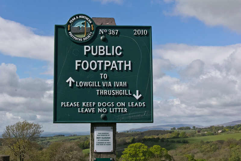
Here there was no doubting the route, with this splendid sign erected by the 'Peak and Northern Footpaths Society'. The smaller plaque below indicates it is dedicated to Roy Clough of Lancashire who has been a member of the society for over 40 years.
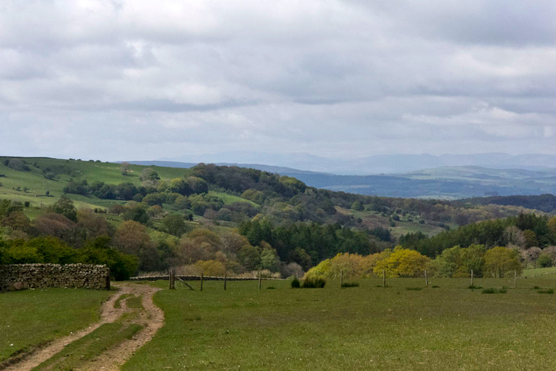
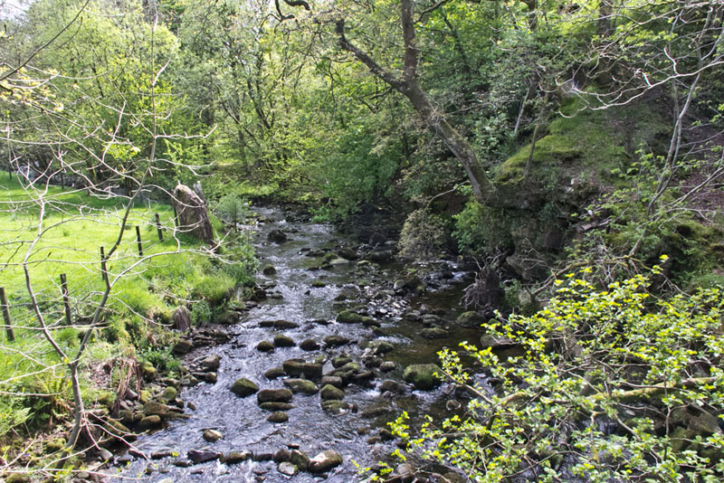
Beyond we kept to the left of a lone ash tree and so to the far distant corner of the field. Here we passed to the left of an isolated oak tree and drifted left to descend the steep bank and pass the river bend.
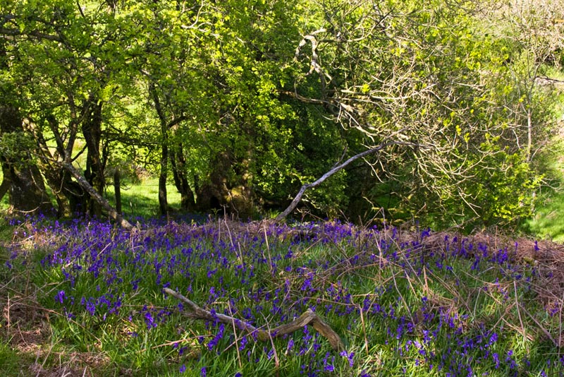
"Ooh", called out Little Eric, "those bluebells make a really pretty sight."
The car was now just a few yards away through the gate on to the road by Stairend Bridge.
"Wow", said Southey, "what a walk. I bet you are glad to be back at the car."
"Yes lad", replied Dad. "I'm glad we have got those summits out of the way."
Then it was just the matter of driving home to shatter his peace Uncle Brian's peace.
We do not intend that our stories should be necessarily used as guides to walks, but in case anyone is considering doing this we must stress that it really is a hard and demanding walk, with a considerable distance over the very rough and trackless ground. This needs to be born in mind and we would not suggest doing this in misty weather, and plenty of time should be allowed.