Road junction near High Salter Farm (SD 6060 6271)
Summits Achieved
Name
Height (ft)
Height (m)
Grid Ref
Mallowdale Pike
1420
433
SD 6111 6043
Hawkshead
1338
408
SD 6339 6030
Preface
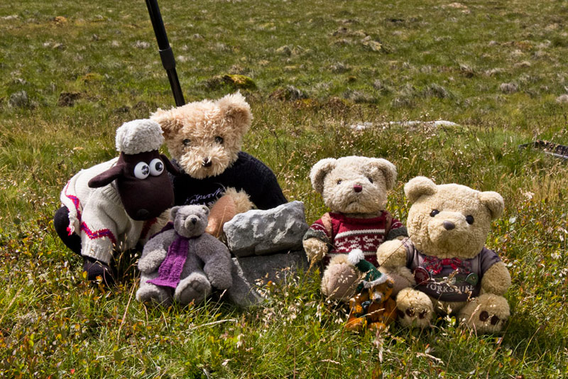
As Grizzly, Little Eric and Shaun arrived with the tea and cakes, they found Tetley and Southey looking over Allen's shoulder as he tapped away on the laptop
"What are you on with pals?", asked Shaun.
"Looking at the pictures Dad got of the walk to Nicky Nook", replied Southey. "It was such a lovely adventure especially the parts through the woods."
Gathering round Shaun, Grizzly and Little Eric scanned the pictures too. "They have come out fine", said Grizzly.
"Absolutely", agreed Tetley, "plenty to make a good story of the day."
Thinking of his tummy, Allen now said, "what's the cake today?"
Mincemeat slice from Little Eric and cherry and ginger scones with butter and raspberry jam from me", replied Grizzly.
"Scrumptious", cried Southey as with Allen he went to get the plates and mugs.
Soon the mugs were charged with steaming tea, and we all had cakes on our plates.
Then our thoughts turned to walking, Allen saying, "Dad is free both days this weekend with Saturday looking to be OK for the weather."
"So where to go this time in Bowland?", mused Little Eric.
"I have been looking at the map and in particular Mallowdale Pike that is off to the east of Ward's Stone", said Shaun. "Doing it as part of and ascent to Ward's Stone does not seem feasible, so I had a look at Matt O'Brien's website. There is a route he took that starts from High Salter Farm at the end of the motor road in Roeburndale West. And as well as Mallowdale Pike, on the return we can take in the minor summit of Hawkshead just to the east of the track called Hornby Road."
"That's great", responded Tetley, "you have done the thinking for us."
I'll just get the map", said Allen, "so that we can highlight the route before I go off and see what Dad thinks."
This was soon done and off Allen trotted, to return very shortly, the smile on his face telling us that Dad had agreed.
"Yippee", cheered Southey, "more new ground for me."
"For us all in fact", added Tetley.
The Walk
Eager to be off we got up early and dashed out to the car as we heard Dad slam the boot shut, after loading his gear.
Taking the route as if he was going to Feizor, Dad drove up the Lune Valley turning off towards Wray and Wennington. Before either at a crossroads we turned right up the road signed to Roeburndale West. It is mostly single track, but there was little or no traffic.
Shaun said, "according to Matt there is space to park by High Salter Farm"
Before reaching this there was a road sign that prohibited cars. "Oh dear", called out Little Eric, "whatever are we to do."
"Keep going", replied Dad.
Finally we came to the farm where the way was blocked by a gate. There was a space to park just beyond the gate, but it was in the farmyard. Fortunately the farmer was there, and Dad asked, "would it be possible to park here? I am going to walk up the valley."
"I am afraid not", he replied, "as I am sorting the sheep today."
We were downcast, but then quickly brightened as he went on, "but you can park by that pile of stones about 200 yards back."
Thank you", said Dad. So he reversed carefully pulled the car off the road, by a junction with a track.
Dad got ready, and meanwhile Shaun was looking at the map. "The original plan had been to take the footpath from High Salter to join a track leading to the buildings of Mallowdale. However, this track is the access to Mallowdale, so we can just follow it instead."
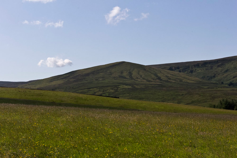
Meanwhile Grizzly, was looking up the valley and said, "that must be Mallowdale Pike our first objective."
"Yes", agreed Allen. "A fair step and further than it looks too."
"Right I'm ready", called out Dad.
"OK", replied Little Eric, as he and the rest of us settled in the rucksack.
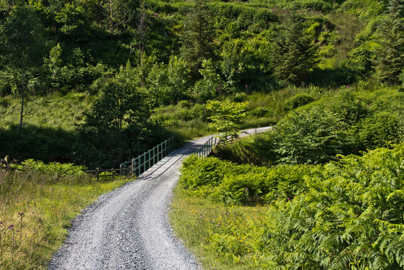
So off we went, Dad striding the surfaced track that curved left and right descending to cross the bridge over the River Roeburn.
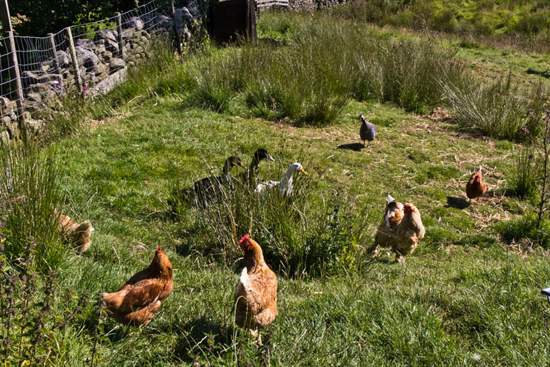
Beyond it climbed towards the farm, passing these chickens and ducks wandering freely in an adjacent field.
The track ended at the farm with a facing gate. "That's not our route", called out Shaun. "We go right through that gateway and then immediately left through the gate and walk the good surfaced track between walls."
"That is a terrific view of Mallowdale Pike", remarked Tetley. "We will be making the ascent up the left side, once we get beyond the distant wall that crosses left to right."
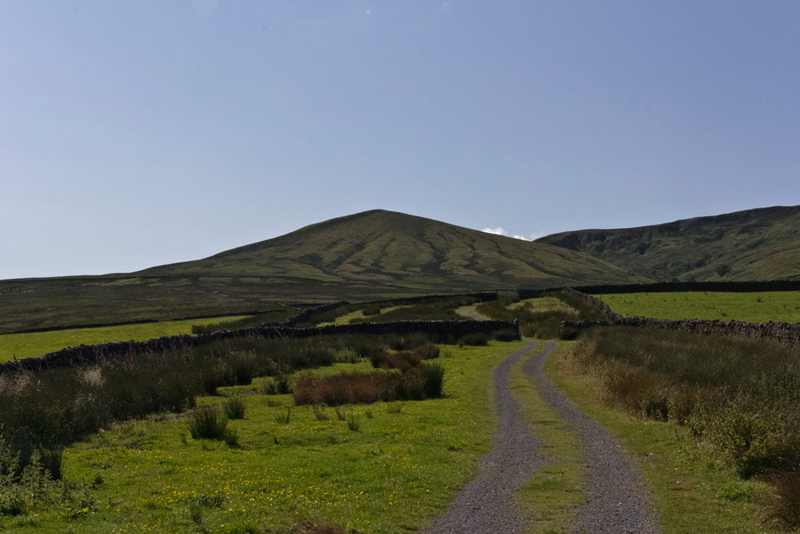
The track led via gates, to come by a wall on the left, and then went through this via another gate and finally up to final gate to the open fell. Here the good track gave out and became nothing more than a quad bike track over the grass.
A little way further we came to some grouse butts. "This is our guide to the ascent", said Tetley.
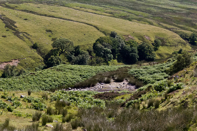
"Matt mentioned visiting the Tarn, that appears on the map. Are we going to do this?", queried Little Eric.
"It means we will have to go down the grouse butts and then climb up again, so I guess the decision rests with Dad", responded Allen.
"I don't mind and at least it will satisfy your curiosity", said Dad.
After the descent there was a bit of wandering about, Shaun at one point saying, "we are too near the wall, so need to go more right."
Finally there was success, but not in the way we had hoped. Being summer it was all dried up.
"I'm sorry Dad", said Little Eric contritely.
"It's not your fault, you were not to know", replied Dad.
Putting best foot forward, Dad regained the grouse butts and climbed beside them.
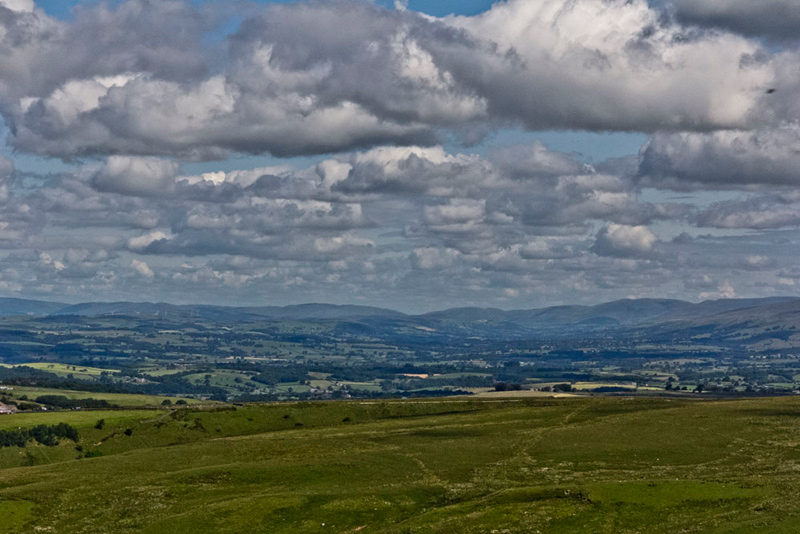
A few minutes later Allen said, "there is a super view of the Lune Valley, and even though it is pretty distant it will still, I think, be worth a picture for the story."
The grouse butts were followed to their end, from which a quad bike track led up to the shoulder and turned left up the ridge. "Matt commented it was a tough climb, but it was not any where near as hard as I had expected", said Dad.
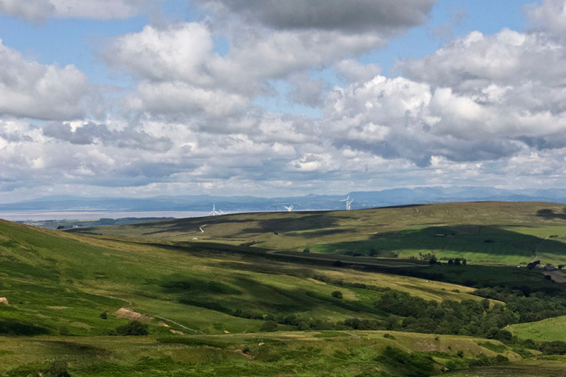
Stopping at the ridge. Dad had the camera out again, taking this shot.
"That is the wind farm on Caton Moor", said Tetley, "So the rise to the right must be Whit Moor, the summit we bagged about 6 weeks ago. And behind beyond Morecambe Bay, our beloved Lakeland Fells."
"I still hope to get some of the fells done for you Little Eric, this year", said Dad.
I don't mind either way", he replied. "We are all enjoying the Bowland walks."
Soon now Dad completed the climb the summit area being a ridge running north-south.
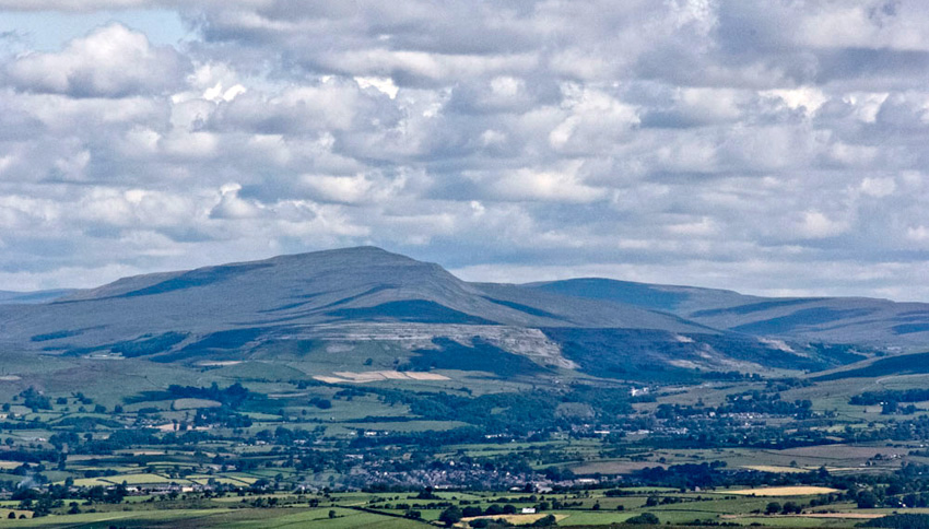
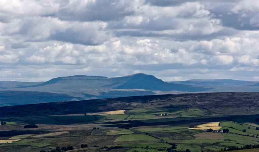
"Wow, what a quite magnificent prospect to the east of the famous Three Peaks", said Grizzly. "With the cloud there are some very dark shadows."
So here they are. Firstly Whernside (2416ft) and Yorkshire's highest fell.
Then the unmistakable shape of Ingleborough (2373ft).
And finally Pen-y-ghent (2278ft).
Every year they are the subject of the Three Peaks fell race, a distance of about 23 miles or so. The record time stands at a few seconds under 2hrs 30mins. It makes us tired just thinking about it!
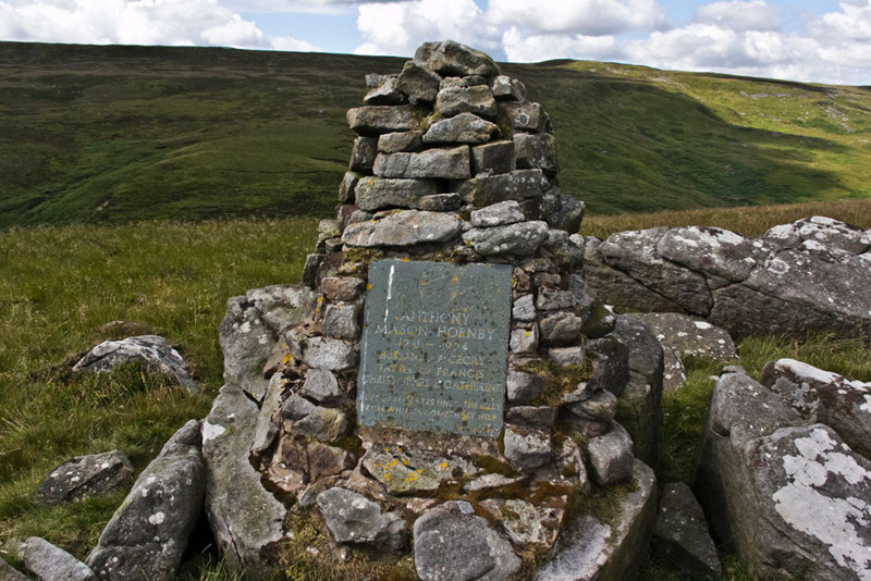
The feature at the top of Mallowdale Pike is the memorial cairn to Anthony Mason-Hornby.
The full text reads -
ANTHONY
MASON-HORNBY
1931 - 1994
Husband of Cecily
Father of Francis
Christopher & Catherine
Lift up mine eyes unto the hills
from whence cometh my help
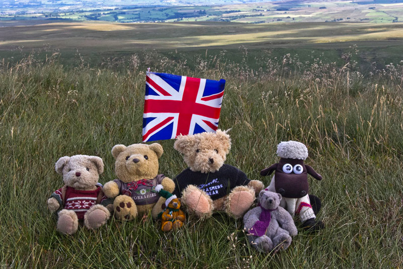
We sat at the cairn so Dad could take our picture, but then Tetley said, "this is not actually the highest point on the fell."
"Quite right", agreed Grizzly, "We passed that about 30 yards back long the summit ridge."
"OK", said Dad, " we need to get the GPS reading for the actual summit and also take your picture for the record and story."
The actual summit is unmarked so Dad kindly got the flag out.
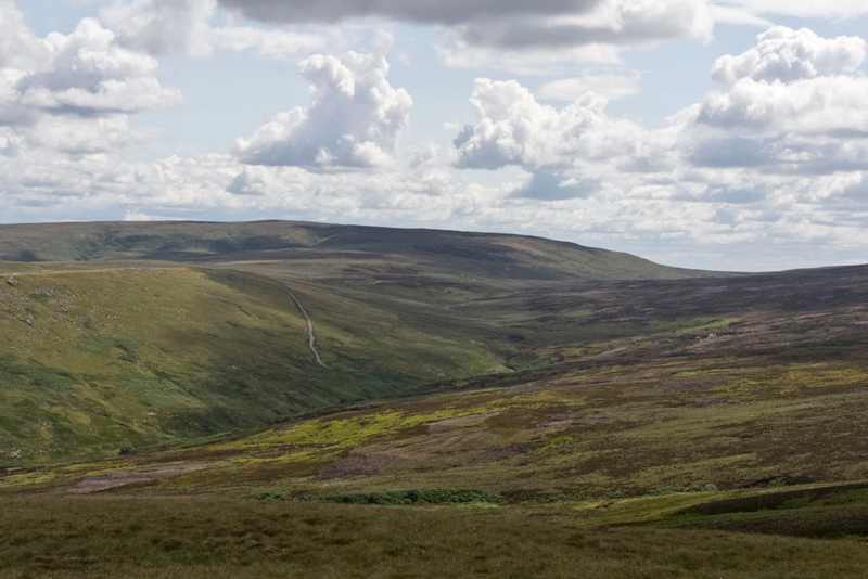
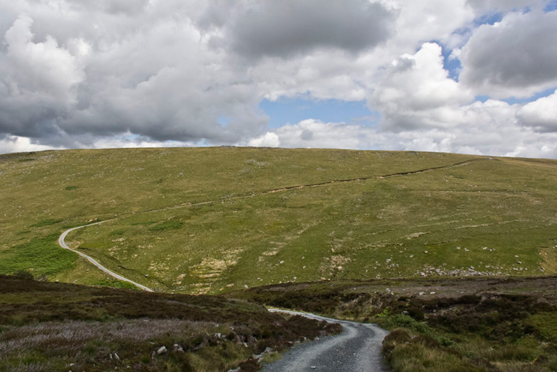
"Now for the hard part", said Dad. "Our aim is the shooters track, to then climb the track up Alderstone Bank that can be seen quite clearly from here."
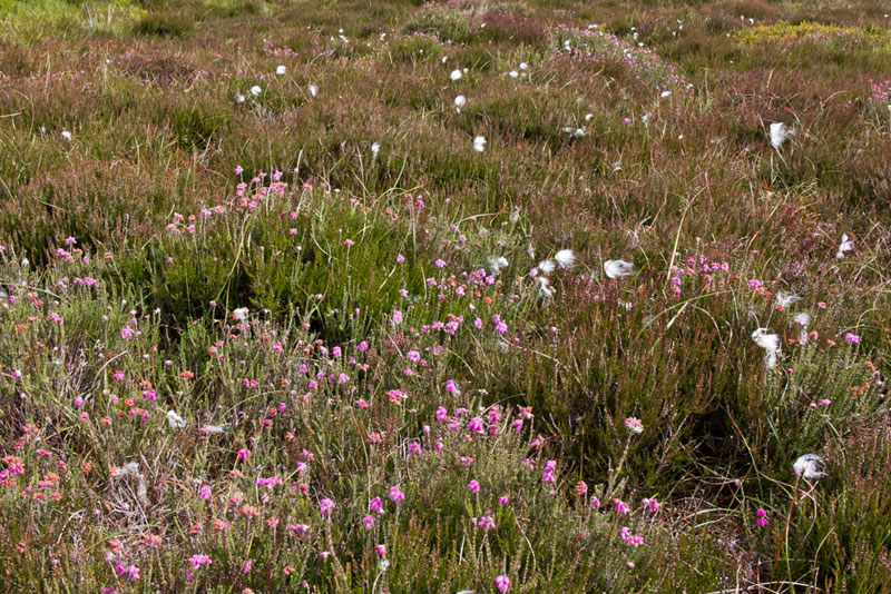
The descent was grassy at first but soon became a trackless trudge over rough bilberry & heather moor and crossing a number of streams. The monotony was relieved by patches of wild flowers and cotton grass.
It was a distance of about 1.25 miles, but the nature of the terrain made it seem twice as far.
Finally gaining the track, Little Eric said, "I bet you are glad that part is over, Dad?."
"Yes lad, I am not sorry to have reached the track. Just another mile or so to add to the many miles crossing such terrain that we have walked in Yorkshire and the Lake District. So now it's just a matter now of climbing Alderstone Bank."
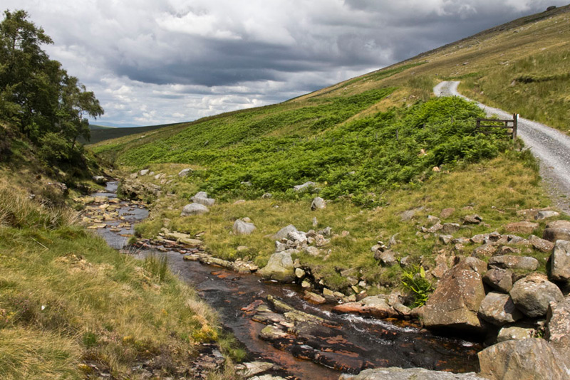
Turning left the track descended first, to a bridge where we recrossed the River Roeburn, now nearer its source
Looking ahead Southey said, "ooh Dad, Alderstone Bank looks steep."
"Aye lad it will be a steady climb, but not as steep as some we have had to make over the years."
"That route up Dollywagon Pike from Seat Sandal comes to mind", suggested Tetley.
"Yes and that up Lonscale Fell", added Allen.
"Oh I remember them well", sighed Dad.
"And there was the ascent of Scale Knott, above Crummock Water", said Grizzly.
"Heck yes lad, I had forgotten that. It was truly unrelentingly steep, and the irony was that if we had gone further left before starting the climb we would have found a nice contoured path."
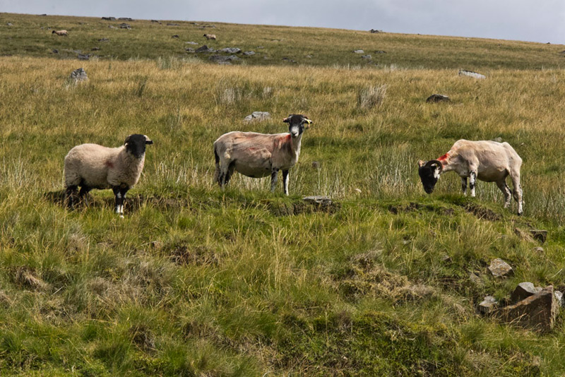
So putting best foot forward, Dad made the climb up Alderstone Bank. Up to now Allen's luck for a sheep picture free story had held, but these three lined up proved to be too much of a temptation for Dad.
"Darn", said Allen with feeling.
Completing the climb this brought us to the track called the Hornby Road. "This is our return route", said Shaun, "but first there is the matter of bagging the minor summit of Hawkshead."
We made a beeline for it by going straight across the grassy ground, to the obvious summit that is marked by just two small stones.
This done, it was back in the rucksack, and Dad headed roughly west to regain the Hornby Road that we followed to High Salter Farm. There was a little bit of rain as we walked back.
Tetley commented, "we are fortunate as it is only light here, but it is really pouring down on Mallowdale Pike and Ward's Stone."
Close to the farm we passed this deep ravine called Salter Clough through which runs the beck of the same name.
While we saw some motorcyclists from a distance, and some lads on quad bikes as we walked through the farm, there were no other walkers, but this hardly surprised us at all.
"That was super", said Shaun. "Nice to explore a completely new area to us all."
"So Dad, I guess it is refreshment time", said Tetley.
"Aye lad. We are not far from Wray, so I am going to Bridge House Farm."
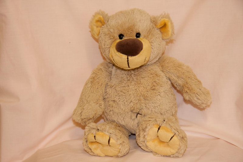
Here he had a pot of tea and a piece of bakewell tart and chocolate caramel shortbread. We had not been here since 23rd December 2012, when he adopted our hug pal, Wray. Well he looked so forlorn sitting on the shelf, that Dad just had to give him a loving home. I am sure readers will agree.