WARD'S STONE, WOLFHOLE CRAG & BRENNAND GREAT HILL from TOWER LODGE
Summary
Date - 19th September 2015
Distance - 13 miles
Ascent - 2020ft
Map - OL41
Start point - Tower Lodge (SD 60489 53866)
Summits Achieved
Name
Height (ft)
Height (m)
Grid Ref
Ward's Stone
1841
561
SD 5925 5873
Wolfhole Crag
1730
527
SD 6337 5784
Brennand Great Hill
1555
474
SD 6205 5633
Preface
Tetley trotted into the room. "I've got your Cumbria magazines, Allen and Southey. They have just arrived in the post."
"Ooh great", cheered Southey. "I can't wait to read it."
"Me too", said Allen, brightly.
Just then Shaun with Little Eric riding on his back, and Grizzly arrived with the tea and cake tin.
"Super", cried Allen. "I'm gasping for a cuppa", as he went off to get the mugs and plates.
"You don't change pal", laughed Tetley. "A real tea belly just like Dad. What is the cake selection today. Grizzly?"
"Little Eric has made chocolate coconut and cherry slice, and I have made chocolate caramel shortbread."
"Scrumptious", cried Southey, putting a piece of each on the plate Allen had handed him.
Tetley helped Shaun to fill the mugs, then we all settled down contentedly.
Allen picked up the iPad and commented, "Dad is not at the Lifeboat shop, this weekend giving us two options for walking."
"I was speaking with Dad yesterday, and if the weather is good for Saturday, he said he is determined to get the long walk to Ward's Stone, Wolfhole Crag and Brennand Great Hill done", said Shaun. "The original plan had been to start from Tarnbrook, but Dad is not sure about parking, so we are to start from Tower Lodge, walking the Wyre Way to Tarnbrook and then tackle the summits."
"That would be great", cheered Grizzly. "Ward's Stone is the final catch up for Allen, Little Eric, Southey and I."
Tapping the screen Allen's paws had brought up the Met Office app. "Saturday is dry, but early on there is mist forecast for the tops."
"Well that should not stop us", replied Tetley, "and for all our sakes it will good to get it done, clearing the way to get the whole challenge completed this year."
"Roll on Saturday", cried Little Eric.
The Walk
The length of this walk was such that Dad told us he wanted to be starting walking about 08:30. So it was an early rise for once and we all lent a paw making the picnic and stowing it in Allen's rucksack.
We were to enjoy a day that was totally dry with sunny intervals once the mist lifted off the tops.
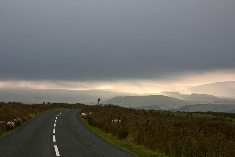
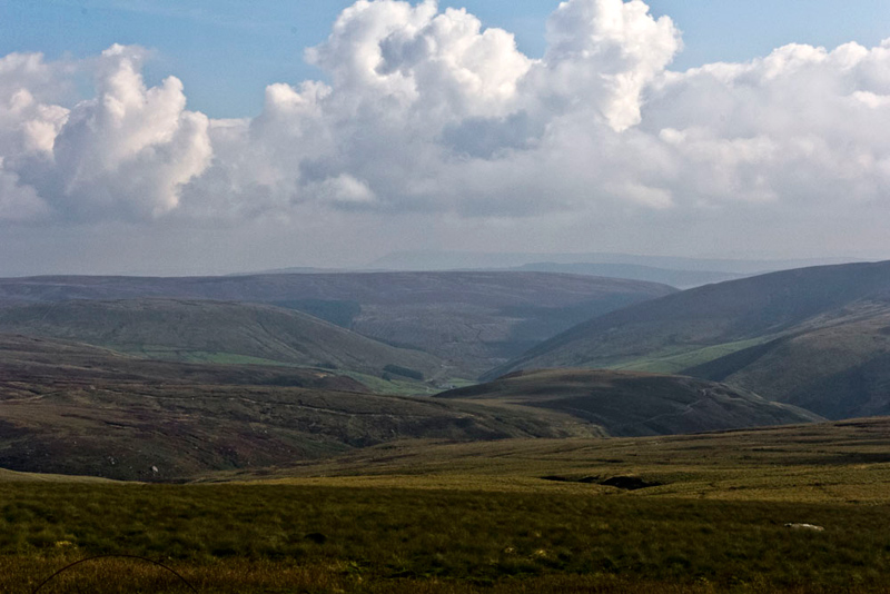
Our drive to the start was by now so very familiar, taking the road out of Lancaster through Quernmore, and up over the tops to pass Jubilee Tower. The sky above was rather lowering, but looking into Bowland it was brighter with mist hanging round the lower slopes.
Just a few yards beyond Tower Lodge there was a convenient parking area on the opposite side of the road by the Marshaw Wyre. "That's a pretty scene", commented Little Eric, as we waited for Dad to get ready.
Soon Dad called out, "I'm ready, so get yourselves settled in the rucksack."
"OK", replied Southey.
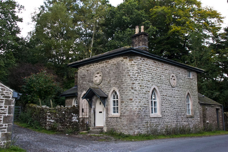
Crossing the road, we walked back the few yards to Tower Lodge...
...going through the gate and along the track to its side, being part of the long distance path called the Wyre Way. The track climbed steadily to a further gate, where shortly beyond Shaun said, "we should keep on the Wyre Way by taking the path left to Gilberton, as indicated by the signpost." He added, "our return route will be along the concessionary path from White Moor."
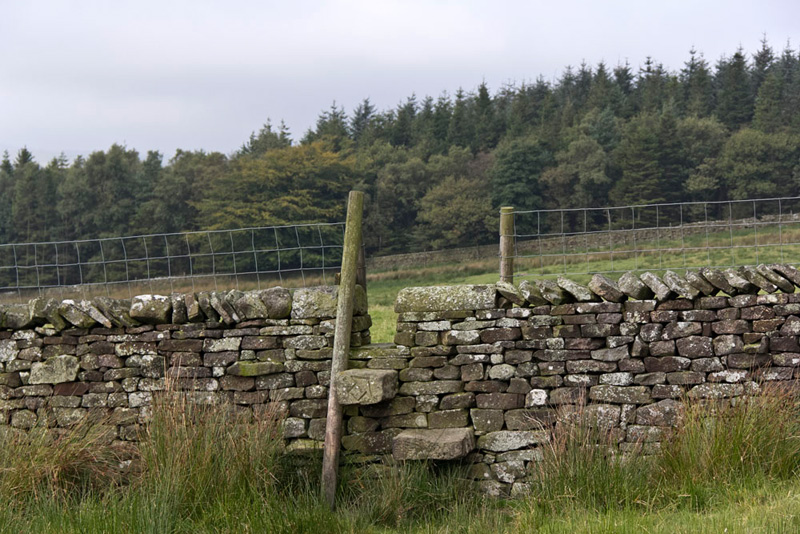
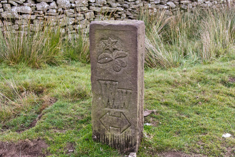
Crossing the rough pasture we came to this stepped gap stile, the ongoing route indicator being carved into the through stone.
This took us on to a ladderstile by which was another of the many inscribed direction stones we had come across on the parts of the Wyre Way we had walked.
Once over Shaun instructed, "we now have to go sharp right by the wall."
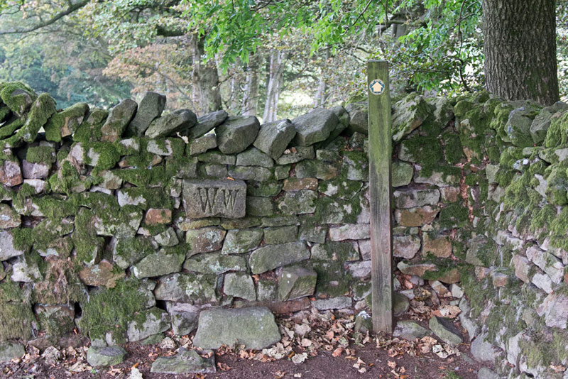
This brought us to a gate and then on to a stile in a cross wall, with an inscribed through stone and waymarked post. "Well, there's certainly no mistaking the route", remarked Allen.
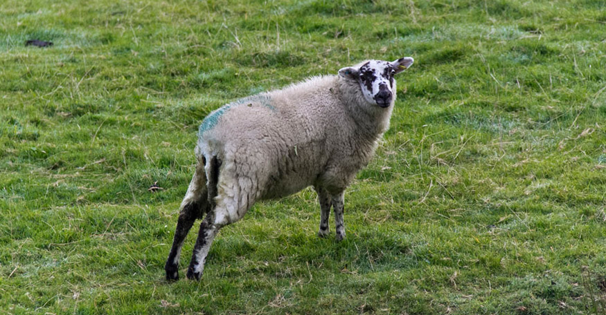
The path led on down by the wood to waymarked gate and then on to Gilberton Farm, through a field with sheep, where Dad, much to Allen's chagrin could not resist taking a picture.
Now for once both Dad and Shaun's map reading deserted them as the route we took was to the left of the farm, but later looking closer at the map it was clear the route was to the right. As soon as the mistake was realised, Shaun said and pointed, "we will have to double back, trespassing over that field to get on track."
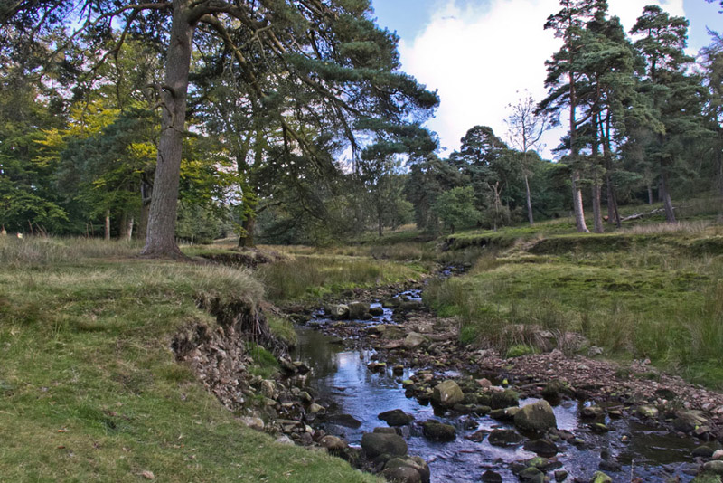
This brought us to a footbridge that we should have crossed. Looking in the direction we should have come, Grizzly said, "those trees will make a nice picture."
Now crossing a plank bridge, we then walked the good track to soon come to the hamlet of Tarnbrook. "Phew", breathed Southey. "It has been a bit of a trek to get here and we haven't even started up the hills."
"Yes lad, but at least we will not be faced with this at the end, instead just the easy good track down to Tower Lodge"
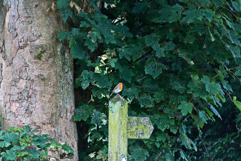
As we walked the road, Tetley whispered, "look there is a robin perched on that signpost. A sign of autumn and winter to come."
Shaun then said, "we take this surfaced track right."
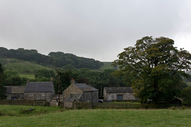
Shortly Dad paused to take this shot looking back to some of the buildings in the hamlet.
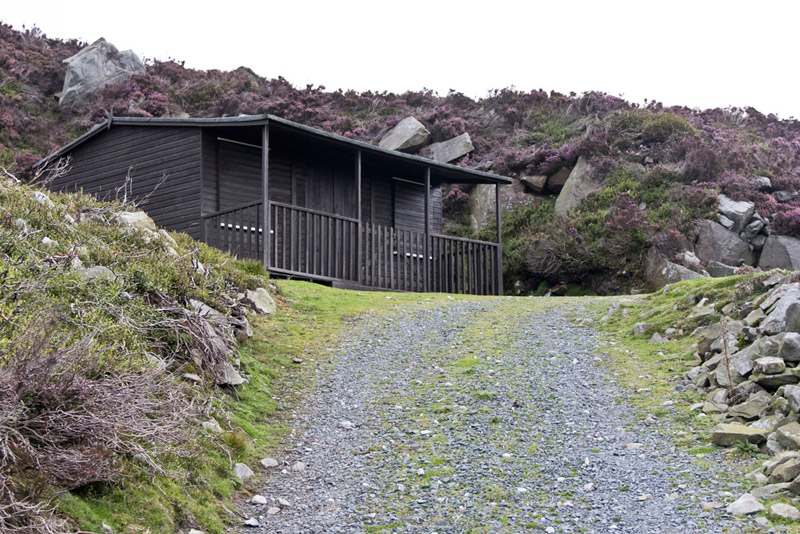
Then, putting best foot forward, he strode determinedly along the track that wound steadily upwards coming eventually to a gate in a wall below the rocky escarpment of Coppy Heads. Here the track zig-zagged up the escarpment to pass this luncheon hut, used for feeding parties on grouse shoots.
Soon we passed another hut and came to a junction. "We keep ahead and then at the next junction we should keep right", instructed Shaun.
This led to a circular area, where the track ended. "I presume this is used to park the vehicles when bringing the shooting parties to the butts", commented Grizzly.
There were murmurs of agreement from the rest of us.
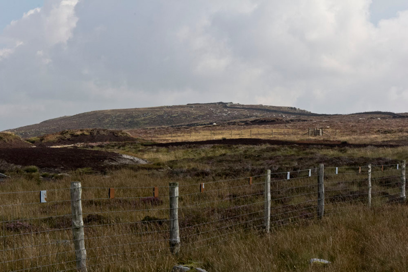
"Right", said Dad, "now for the more difficult section across the trackless ground to continue the ascent of Ward's Stone."
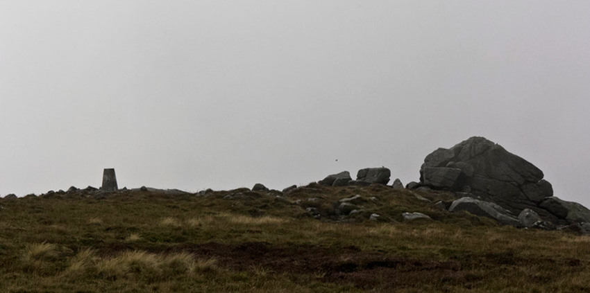
What made it more difficult too was the fact that we had disappeared into the mist making navigation harder. Knowing the grid reference for the first objective we made good use of the GPS to navigate to the wide flat top of the fell and then traverse a short way left to gain the trig point at 560m with adjacent the large boulder that give the fell its name.
At the trig point we wasted no time in settling on top for the first of our many pictures today.
"OK", said Southey, "where now."
Tetley was quick with the reply. "We cross the flat top roughly east to the other trig point that is measured at 561m."
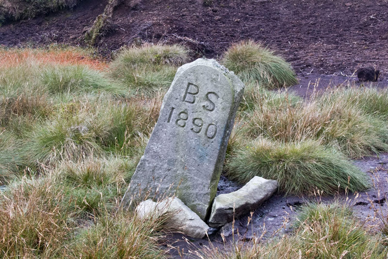
So Dad strode off, following a path and passing this ancient boundary stone. "I wonder what its significance once was", mused Little Eric.
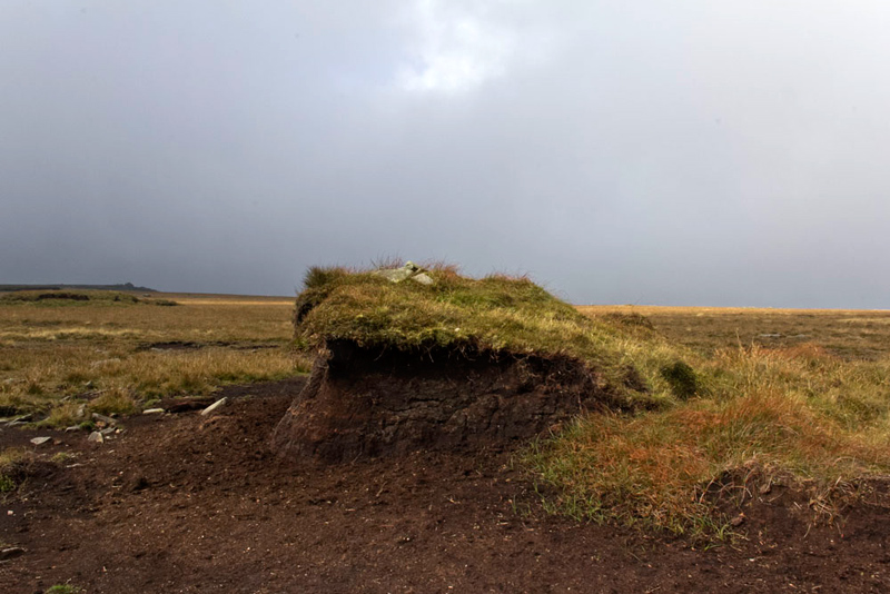
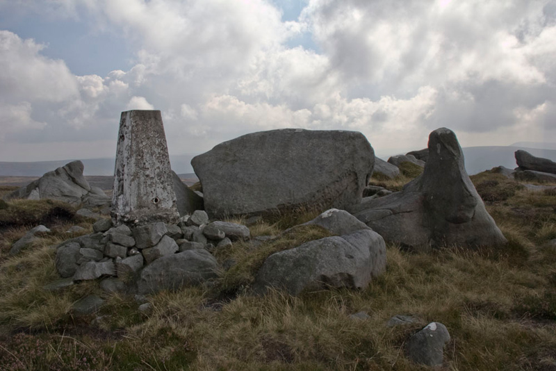
Quite soon we reached the eastern trig point at 561m that is generally accepted as the summit, but just yards before it stands a peat hag with a cairn that one listing shows is measured at 563m, although this is not acknowledged on the OS map. If you look closely the Ward's Stone can be seen distantly in the left of the picture.
Allen said, "the other peat hags we passed could perhaps be just as high as this one, but we had better have our picture taken by the cairn for the sake of completeness."
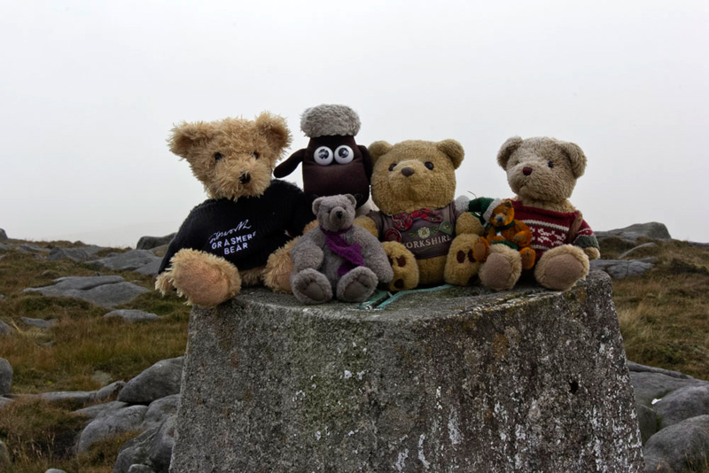
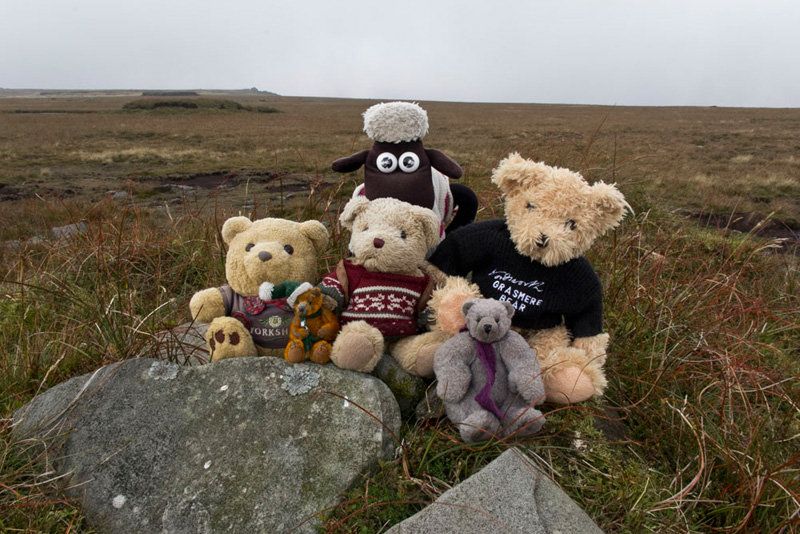
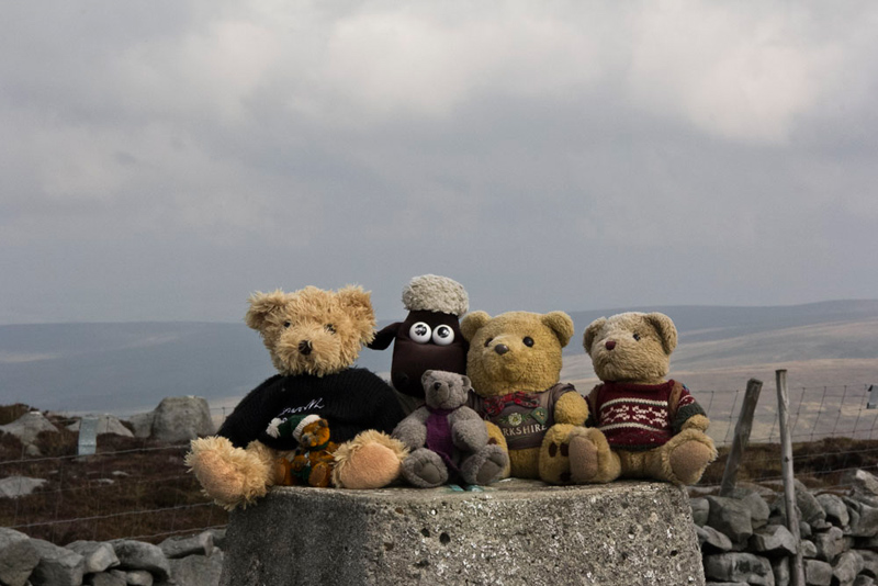
Then we scampered the short way to the trig point posing on top for the final picture on this fell.
"Yippee", shouted Little Eric, "we have all finally bagged the same number of Bowland Fells."
"And we can say it is well and truly done too", added Tetley. "It is such a long time since we did it with Uncle Eric. I feel sure we would have gone to both trig points, but not the cairned peat hag."
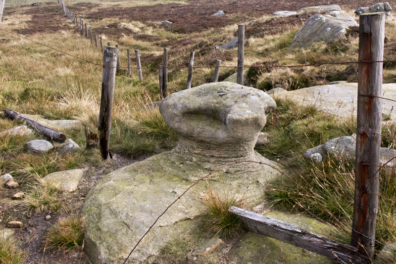
Ready for the off again, Shaun said, "we take that path and follow it down to a junction of fences, where a stone stands that is called the Queen's Chair.
"We follow the right of the fences down and over an area called Mounds and then up to a junction of walls on that distant ridge,", instructed Shaun.
Gaining the ridge we struck right by the wall over Grey Crag following a narrow path with the only obstacles being some peat hags that had to be crossed.
About 2 miles in the distance rose a hill, Tetley saying, "that must be Wolfhole Crag our next summit."
"Oh heck", said Southey, "it seems such a long way. I have as yet only limited walking experience, but know that Dad is well used to such long treks between summits."
So on and on by the wall and fence to eventually cross a surfaced track. Looking up from the map Shaun said, "we have been to either end of this. The western end is by the second luncheon hut we passed on the ascent of Ward's Stone earlier. Its northern end is up Alderstone Bank that we climbed on our walk to Mallowdale Pike and Hawkshead."
By now Wolfhole Crag was much closer and we could see the wall by which we would make the ascent to the summit.
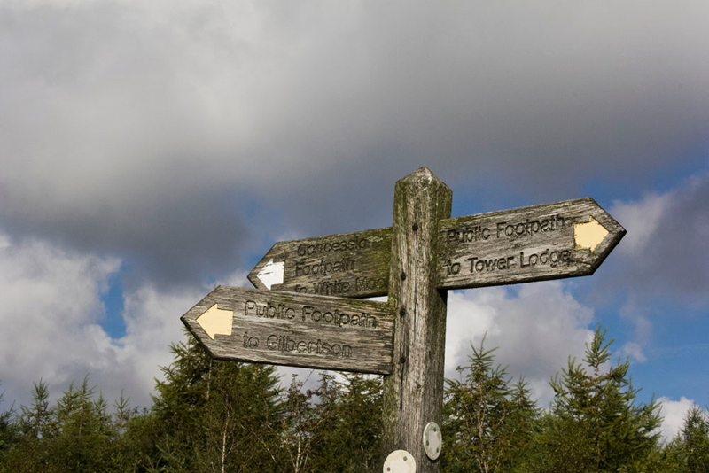
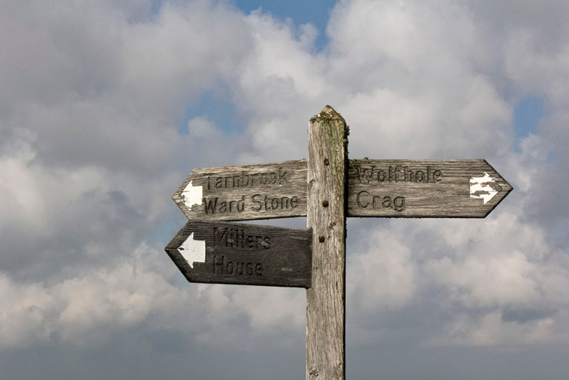
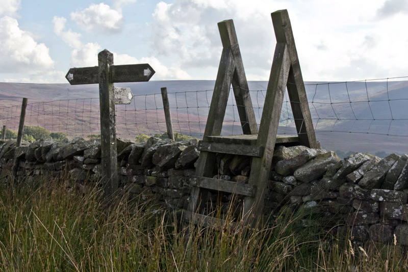
Very soon a wall came in view ahead by which stood this three-armed signpost. It went without saying where we were going first, but Shaun said, "we have to return here from Wolfhole Crag and then head for Millers House."
The climb was gentle up Wolfhole Crag and as we neared the summit we met a group of about half a dozen walkers coming the opposite way. They were the only people we saw all day. After passing the time of day with them, Dad took this shot of the summit area.
"Come on pals, photo time", encouraged Southey.
It was a bit windier up here. We got settled, but then a gust of wind caught Allen who took a back flip off the top.
"Are you OK, pal", called out Little Eric.
"Yes fine", responded Allen, who dusting himself down, settled again on top.
To prevent a recurrence Dad quickly snapped the picture.
"After all the trek so far, it must be time to take a breather and have some lunch", stated Allen, rubbing his tummy.
"Yes lads, I agree."
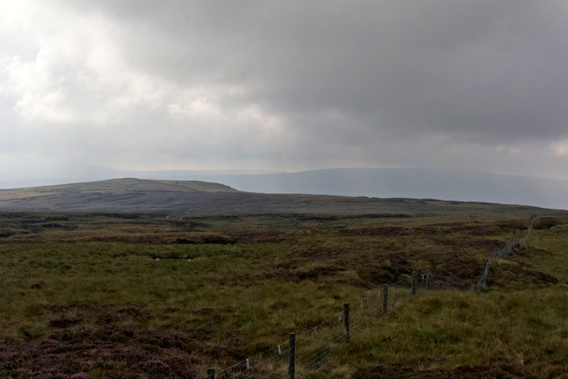
It was very quiet and peaceful, as we sat munching away on our sandwiches and cake, while taking in the views of the surrounding landscape.
"It is a very lonely and seldom visited location, so it came a surprise that we saw that group of walkers.", said Tetley.
After a few more minutes Little Eric said, "we're done Dad, and ready for the final section."
"Right lad, but I just want to give Uncle Brian a ring to check he is OK", replied Dad.
He was, and that done we settled in Dad's rucksack, and retraced the ascent to the three-armed signpost. Here we took the route left signed to Millers House, for the long trek by the fence and wall to Brennand Great Hill. The wall can be seen rising over the fell.
Harder going now, as it was obvious that this is not walked as often, so the path was poorer, and there were more peat hags to negotiate. Dad ploughed on steadily and as we started the final ascent that was not very steep, there was easier going underfoot.
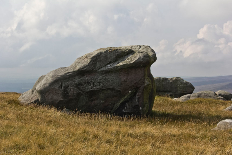
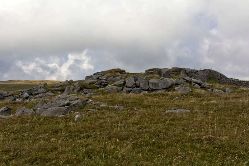
Near the summit we passed this huge boulder, which, if you look carefully, can be seen in the picture above.
"I bet you are glad that section is over, Dad, "said Southey.
"Aye lad, but it was not as bad as the ascent and descent we made to White Hill back in May."
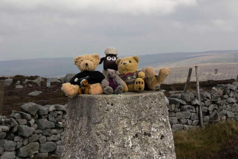
The top is wide and flat. A height of 474m is shown, but the spot height was almost impossible to see on the map and it was only when we got back that Shaun said, "there it is, just a little way from the wall."
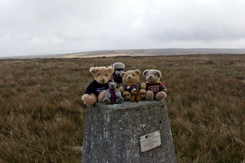
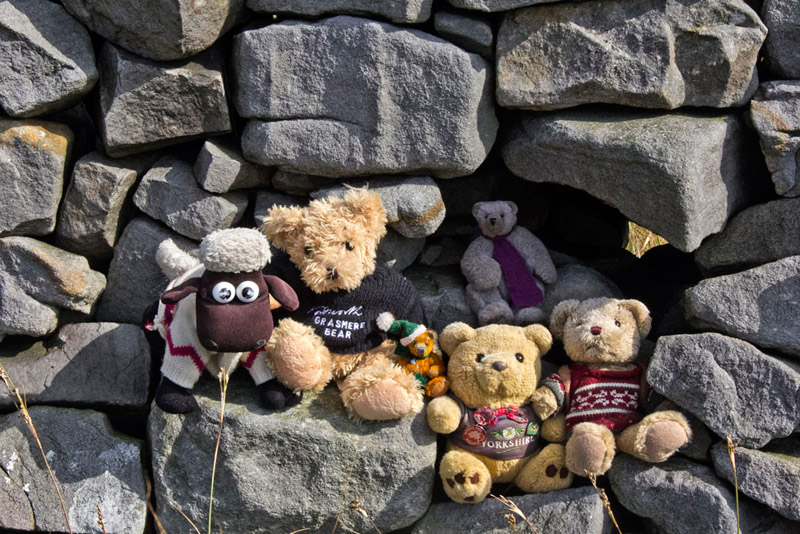
However there was no actual difference in altitude and like many such fells the position of the summit is somewhat a matter of conjecture. We decided to take the summit as by the wall as there was this neat spot to sit for our picture, Grizzly having a place of his own in a little niche!
Walking on we continued by the wall down the fell. "That's the Brennand Valley in the distance, where we walked after climbing Whins Brow", commented Allen, "and the hill rising to the left is Middle Knoll, which we climbed two weeks ago."
"That's logical too, bearing in mind this is Brennand Great Hill", confirmed Tetley.
The descent brought us to the boulder topped rise called Millers House. "Here's me thinking there would be an actual building", laughed Southey. "I wonder what the origin of the name is?"
We were at a loss to answer his question.
Here a signpost pointed right to Tower Lodge, and a narrow path headed in that direction, but after about 50 yards it just disappeared and there was just rough boggy trackless moor.
"Hmm", said Little Eric, "that's not very good."
"We'll get a bearing for the direction we should take and then use the GPS to monitor progress", replied Dad.
This he did checking frequently, and eventually we came to a broken wall, and beyond at a lower level another wall.
A quick look at the map and Shaun said, "it shows that the path runs beside that wall."
So all was well, and eventually we reached a hut with netting sides. From the dead rabbits hung up, Grizzly commented, "must be a gamekeepers hut." There was also a crow inside, but how it got there we do not know.
Stepping forward Dad was suddenly pulled up and stumbled to the ground. "Damn", he said, "I have got my foot caught in a wire trap."
Fortunately he was able to easily free himself, but we did not think much of such traps being set on a footpath. Keeping ever on by the wall we crossed White Moor and finally come to a ladderstile over the wall the signpost indicating that was the direction to Tower Lodge.
Over the stile we joined the good track that led us unerringly down to Tower Lodge.
"That was a super super walk", cheered Southey, echoing all our thoughts. "Thank you Dad as always."
"You're welcome, it is good to get this walk finally done", said Dad, adding, "I am always glad to have your company, too."