THE ROUGH, SPENCE MOOR, RIGG OF ENGLAND & BLACK HILL from SABDEN
Summary
Date - 11th October 2015
Distance - 10.5 miles
Ascent - 2250ft
Map - OL21/OL41/287
Start point - Sabden car park (SD 7791 3736)
Summits Achieved
Name
Height (ft)
Height (m)
Grid Ref
The Rough
1033
305
SD 7618 3798
Spence Moor
1509
460
SD 7943 3932
Rigg of England
925
282
SD 8170 3801
Black Hill
869
265
SD 7820 3666
Preface
It was Thursday. Allen and Southey were reading their Cumbria magazines, while Tetley was sitting quietly reading his Dalesman.
"Some good articles", said Southey, looking up.
"Yes pal", agreed Allen, who went on to say, "my tummy tells me it is tea and cake time."
"Oh yes", replied Southey enthusiastically.
"I don't know", laughed Tetley. "I've said it before and it is totally true that you two are just like Dad. Cake Stuffer and Tea Belly."
"Well, here we are to the rescue", announced Shaun, as he with Grizzly and Little Eric arrived with the flasks and cake tins.
"Thanks", cried Southey as he and Allen went to get the mugs and plates, the latter being passed round, while Tetley helped Shaun fill the mugs.
"Cheers", said Allen, raising his steaming mug.
"What are the cakes?", asked Tetley.
Little Eric has done chocolate caramel shortbread, and I have made peach and apricot slice", replied Grizzly.
The tins were passed round and there were murmurs of contentment from us all this being voiced by Southey who said, "both the cakes are absolutely delicious. Thanks pals, we really do appreciate your baking."
"We love doing it", replied Little Eric, "so it is a pleasure."
"So what are the prospects for a walk this weekend?", asked Grizzly
Allen quickly had the iPad in paw, and said, "it will have to be Sunday, as Dad is at the Lifeboat shop." Then a few more taps and he went on "the day looks to be dry, but rather cloudy."
"That's OK then", said Southey, "so where to go."
"There is only Blaze Moss left in the Bowland Fells, so the time has come to tackle the Pendle area", said Shaun.
"Yes", agreed Tetley, "a completely new area for us all. Dad has decided too, that he will take us to all those summits that we found in the listing on Matt's website.
"I have had a look at that", replied Shaun. "There is a walk that will get four of them out on the way in one go."
"Ooh like we did on the walks in the Lakes", interjected Allen.
"Quite", agreed Shaun. "We start for the village of Sabden, and go up to the Nick of Pendle, via a fell called The Rough, then over to bag Spence Moor. Then it's on to the Rigg of England and finally along a road to gain Black Hill, before dropping down into Sabden. In all about 10 miles."
"Well that sounds like a plan", said Southey.
"The only problem is that the position means it is spread over three maps. OL41 that we have been using all the time lately, OL21 and a small part on sheet 287. I've checked and Dad has OL21 but not the other", said Shaun.
"Well let's get the ones we have out and highlight the route", suggested Allen. "Then I can go off to Dad and see what he thinks."
This was quickly done and Allen maps in paw, trotted off. He was soon back. "Dad is fine with our suggestion. He sees no problem about not having sheet 287, as it will be easy to navigate that section, and not worth the expenditure just for one walk."
"Roll on Sunday", cheered Little Eric, raising his mug in salute.
The Walk
As we got the picnic ready and stowed in Allen's rucksack, Shaun said to Dad, "which way are you going to Sabden."
"The easiest and quickest route is via the motorway. South down the M6 and briefly on to the M61 taking the first junction on to the M65 and following this to junction 8. Then skirt round Padiham, turning off for the few miles to Sabden, where there is a car park.
The motorways were quiet and it was not long after leaving them that we turned off to Sabden, dropping into the valley and coming to the village.
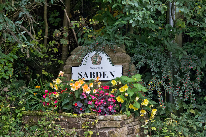
As we drove along the main street, Tetley suddenly called out, "here's the car park on the left."
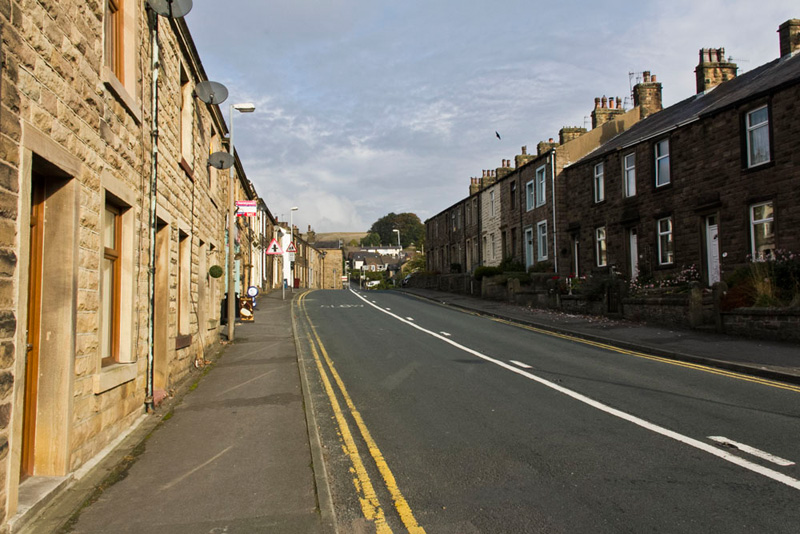
Soon ready, and us settled in his rucksack, Dad strode off turning left to walk along Clitheroe Road, between the typical terraces of mellow stone houses.
Like many towns and villages in east Lancashire, Sabden sits in a valley, so soon Dad began to tackle the steady relentless climb towards the Nick of Pendle. On pavement first, then once out of the village there was narrow path on the verge on the right side that kept us off the road.
This ended at a car park, Southey commenting, "you could have parked here Dad, and avoided the fee."
"I could, but then I would have been faced with the steep climb at the end of the walk."
"Oh yes, I see. We are better parked in the village.", agreed Southey.
Shaun checked the map and said, "we should cross the road here and take that waymarked track."
This then curved to a gate and stile. Beyond we crossed the pasture to an open gateway and then struck half right towards a gate, Shaun pointing and saying, "we are heading to Wilkin Heys Farm."
After the gate a narrow path climbed to the access track, where turning left we passed the farm on to a continuing grassy track.
"There is no real path according to the map", remarked Shaun, "but fairly soon we just strike off right up the fell."
After a few more yards, Grizzly, called out "there is the makings of a narrow path here."
"Well then, here is as good a place as any then", replied Dad.
This soon gave out, so it was just a case of climbing steadily over the trackless ground towards summit of The Rough. "The fell is well named, bearing in mind the terrain", remarked Tetley, laughing.
"That it is lad."
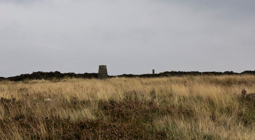
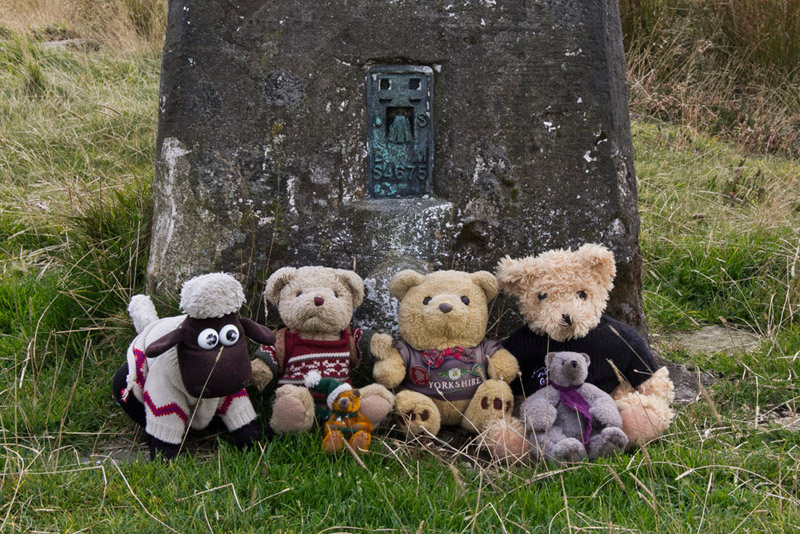
Dad kept steadily on and after about twenty minutes, Grizzly called out, "look there's the trig point."
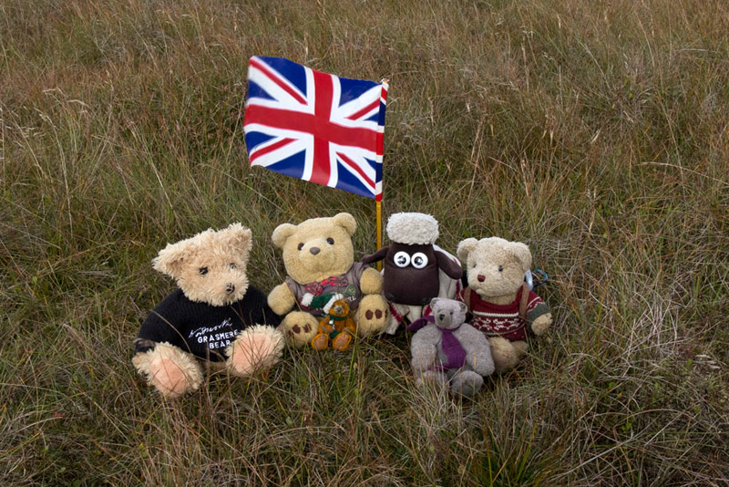
"Reaching this Southey called out, "come on let's sit on top for our picture."
"It's just too windy", chided Little Eric, "we will have to settle for sitting at the bottom."
We met a gentleman coming along the ridge. They chatted, the gentleman asking, "is there a path from here?"
Dad said, "there does seem to be one, but I do not know where it goes to, as we have made the ascent up the flank." He then asked, "does the path you have come along go all the way to the road?
"Yes, by the wall. The way is barred by a cross wall, but it is obvious where many people have climbed that."
So saying goodbye we went out separate ways. Along the ridge we could see a path on the far fellside ascending Apronfull Hill.
"That will be our route beyond the road", said Shaun.
"What is that complex down by the road?", asked Allen.
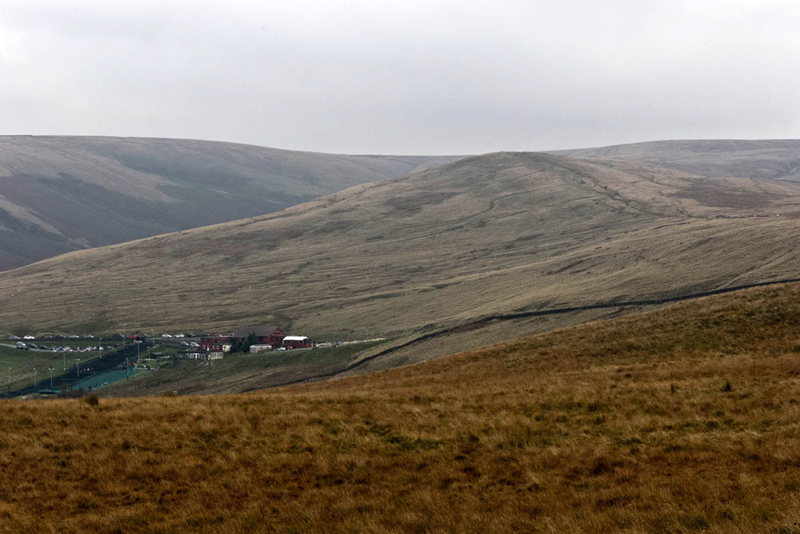
"There seems to be a dry ski slope, and a hotel.", replied Dad. "Now long ago when I was young, Grandad Bill would take us out for rides and he would point out a white building on the Nick of Pendle called the Wellsprings Hotel."
When we got home we looked into this and did manage to find one photograph of the white painted building as Dad had described. When exactly this was demolished and the present buildings constructed we do not know. It is now a Mexican and Spanish restaurant.
Soon the path brought us to the busy car park at the summit of the road. We saw a lady cyclist being congratulated by another gentleman cyclist, for making it up the very steep road to the Nick. Dad had a few words with her too.
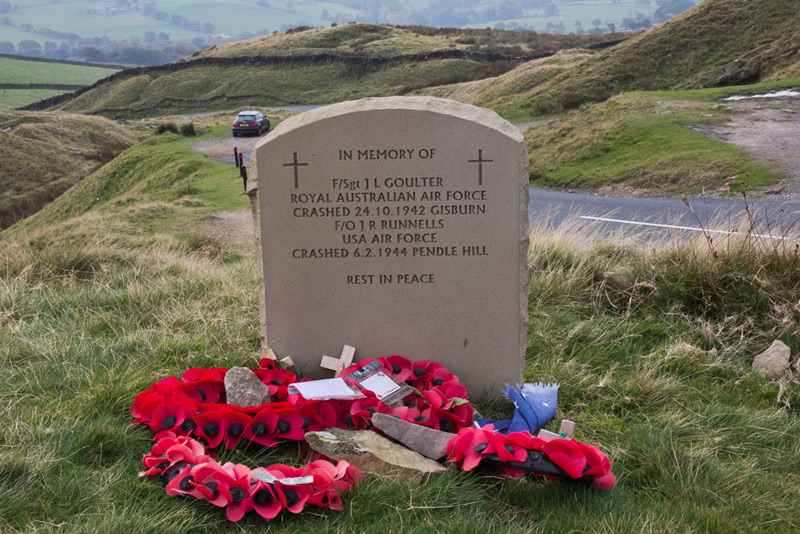
By the road was another of the poignant memorials to airmen who lost their lives.
The track opposite, seen to the right of the picture, was our route and suddenly there were lots of walkers.
"Why is that"?, said Little Eric.
"Because this is one of the routes to Pendle Hill", replied Tetley. "It is popular in the same way that Helvellyn is in the Lake District."
A steepish ascent to Apronfull Hill, where the gradient eased. "We need to look out for a narrow path going right", instructed Shaun.
Shortly Allen called out, "here it is."
Dad strode on passing a lady coming in the opposite direction, and otherwise leaving all the other walkers who went on to Pendle Hill.
"I guess it would be best not to climb Pendle at a weekend", said Grizzly."Hopefully it will be a bit quieter."
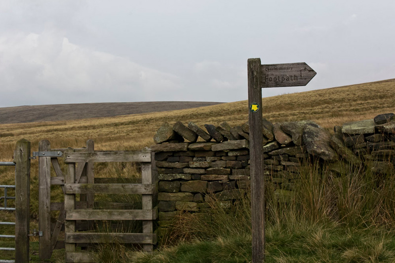
The path led to a kissing gate, where it went on ahead and also there was a sign for a concessionary path by the wall.
"It is probably best if we take the concessionary path, as we have to cross through this wall eventually", advised Shaun.
"OK lad", agreed Dad.
In about half a mile the two paths met at a kissing gate in the wall and through this the boggy track climbed and then levelled off at the top of Spence Moor. This was another of those summits with a wide flat area. The map did not even show a spot height, so looking about, Tetley said, "just off the path on the left seems to be top."
"Good enough", replied Dad.
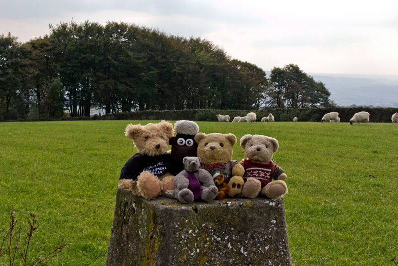
As it was so featureless Dad kindly got the flag out to brighten the picture.
We were spotted by a passing couple, who fully understood, when Dad explained!
So onwards along the at times very boggy path to reach a ladderstile over the wall and then descend by the ravine of Cock Clough, towards the plantation of the same name.
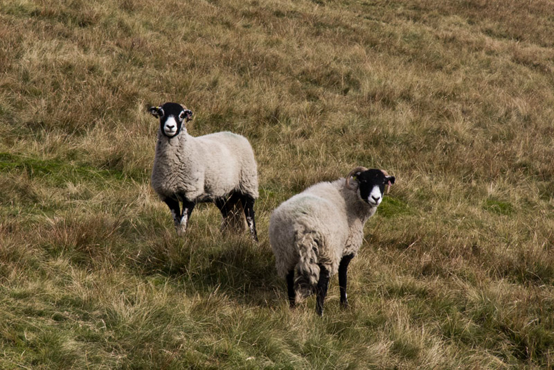
Just as Dad was about to put the camera away, Southey said with mischief in his voice, "those sheep are begging to be photographed."
"No they are not", said Allen forcefully, knowing full well that Southey was winding him up.
His pleas were in vain, however.
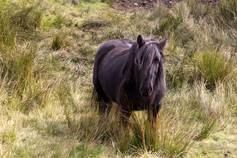
The path brought us to a gate at Cock Clough Plantation, by which there were a group of inquisitive horses, this being on of them.
"The path goes through the wood", said Shaun.
After few yards, Tetley said, "here's the stile."
It went on by the wall clinging to the narrow bank above the deep ravine of Cock Clough.
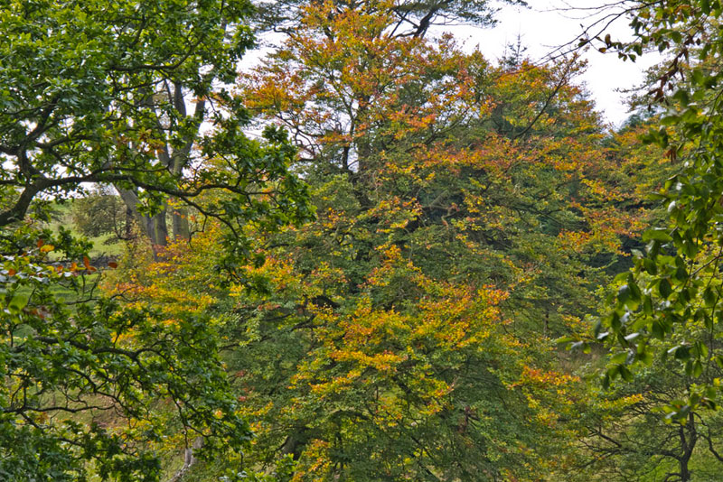
Those autumn colours are lovely", said Grizzly.
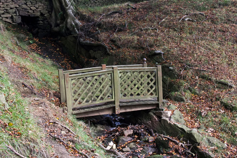
Soon the path looped down the bank to the stream crossed by this novel bridge...
...to then climb again and continue close to the wall, and exit the wood at a gate. Then immediately crossing the stile right in the fence, it was down to the road at Sabden Fold Farm.
"We go left", instructed Shaun.
This took us past the houses at Lower Sabden Fold and then on along Haddings Lane, where ahead we could see the ridge of a hill.
"That must be the Rigg of England, our next summit", commented Allen.
The road climbed on to Higher Town Farm. "We go left here past the buildings and then just before a gate across the track, we take the gate right into open pasture", advised Shaun.
The bank was steep soon reaching a path, part of the long distance path called the Pendle Way. Going right this ascended, then Dad contoured left to gain the ridge.
"We go through that gate in the wall to the left", said Shaun, "and then take the gate in the wall on the right."
This led into a field in the centre of which stands the trig point at the Rigg of England. "That is not the summit, although we would like our picture taken there eventually", said Allen.
"That's right" said Dad, "It is in the next field I think, the one we were just in, but it is hard to tell from the map but we do have the grid reference."
So Dad walked across to the left and climbed the wall, to then walk across the next pasture to get over a fence/gate with the intention of doubling back by climbing the adjacent gate to what looked to be the highest point in the field to our left. However this proved to be impossible, due to the gate being tied up and covered by a high netting fence!
"Damn!", exclaimed Dad.
So there was nothing for it but to return the way we had come and we took the opportunity to visit the trig point.
"Right", said Dad, "we'll go through the gate into the next field, which we should have done in the first place, to get to the summit."
However as we reached the rise, Shaun looked up from the GPS saying, "I don't quite know how to tell you, but the summit is beyond the wall in the next field."
"Darn me!", exclaimed Allen, "that was the one we were in earlier."
"I'm getting pretty fed up with this summit", said Dad. "I know I said we could not get through that gate due to the high netting fence, but I am definitely not walking all the way round again!"
So he slipped the rucksack off and put it and us over first. Then he managed to slide over the wall underneath the fence.
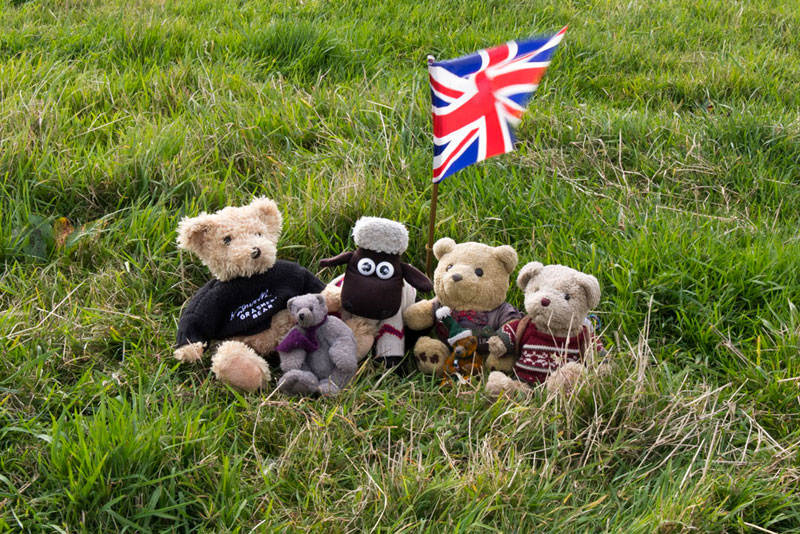
"Finally we are at the highest point", cheered Grizzly.
"The name of the fell would seem to indicate something of a grand summit, but here we are sitting on a slight rise in the corner of a field. Very unprepossessing", stated Tetley.
Quickly we jumped out and settled for our picture. The summit being unmarked, Dad kindly got the flag out.
As we got into the rucksack, Grizzly said, "not a summit we will be returning to."
"Definitely not", agreed Dad.
The reverse process was made over the wall and then we made straight across the field and through the gate.
"We have to get to the road", said Shaun. "There is no point going down and past the farm as we will just have to climb up again. So we should head straight on to that wall corner."
Here a stile got us over the wall on to the road, where it was left to a junction.
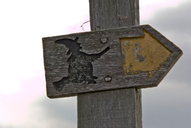
"What is that sign?", said Southey pointing to a post.
"It is an indicator for the long distance path, the Pendle Way and most appropriately is the use of a witch on a broomstick, as we are in Pendle Witch country", replied Tetley
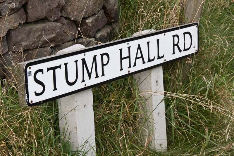
Pointing the the road name Shaun said, "our route lies to the right along..."
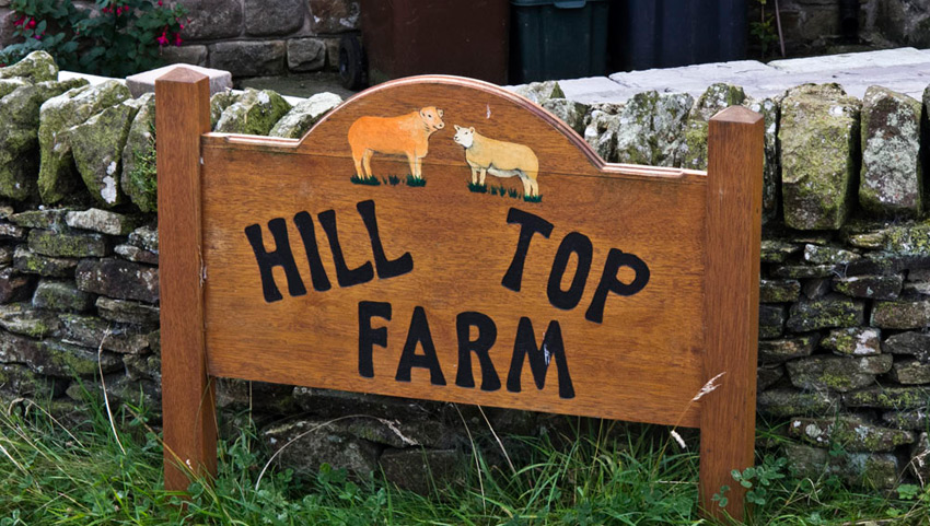
This was followed on and on passing some farms, one with this appealing sign.
Away over to our right rose a ridge. "That is Spence Moor", said Allen.
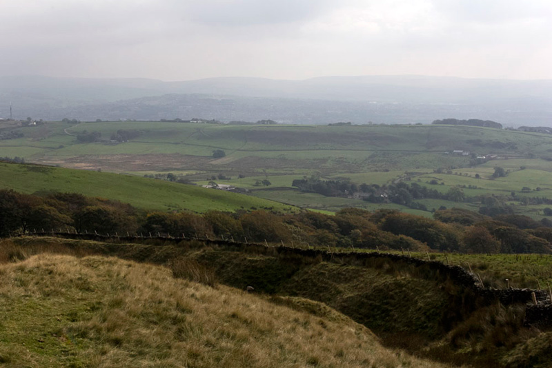
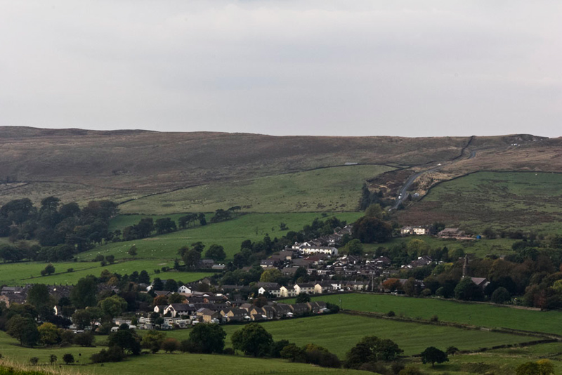
Eventually we reached a crossroads. Left and right was the road we had driven along this morning, to Sabden, which was spread out below in the valley.
"The road up to the Nick of Pendle can be clearly seen, and the ridge to the left is The Rough", said Little Eric.
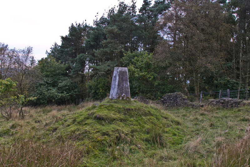
We kept on ahead to soon reach a car park. "Black Hill is on the higher ground to the right", said Shaun.
"This stile looks to be a good likely access", said Grizzly.
A path of sorts led over the rough ground and soon we had attained the summit at the trig point positioned on a little mound...
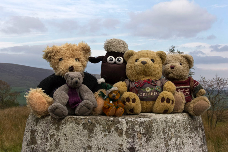
.. where posed on top for the last of our pictures today.
"Fantastic", called out Southey, "that is half of the Pendle fells bagged."
A thin path led from the trig point towards Sabden. It wound this way and that as we descended, coming to the brink of a steep drop.
"We don't have to go down there?", queried Little Eric, worriedly.
"No", replied Shaun. Then he pointed saying, "it continues right along the edge."
After a while the path swung left again and went ever on down to eventually come to a gate to the road, where it was just a short walk into the village and to the car.
"That was a good day", said Allen. "Thank you Dad as always."