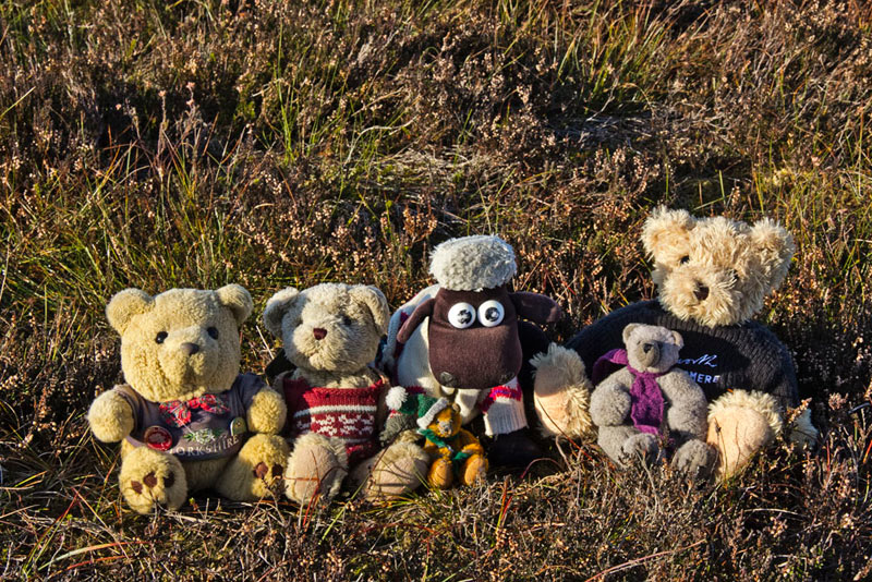
It was Friday, and as Shaun, Grizzly and Little Eric arrived with the tea and cakes, they found Allen, Southey and Tetley. huddled round the laptop.
"What are you looking at?", asked Grizzly.
"The pictures Dad took on the last walk", replied Tetley.
"Oh, Wheathead Height etc. and Weets Hill", said Shaun.
"That's right", replied Southey, "and as usual there are plenty to include in a story of that adventure."
Allen then looked up and cried, "tea! Just what the doctor ordered."
He and Southey went off to get the plates and mugs and then Tetley helped Shaun pour the tea.
"What cakes have you done today pals", asked Southey.
"Little Eric has made flapjack, while I have made peach and apricot slice", Grizzly replied.
These were quickly passed round, Southey echoing all out thoughts as he said, "both are scrumptious as always. Thanks pals."
"You're welcome", replied Little Eric. Then he went on, "last weekend Dad had other commitments both days, so I was hoping that we might get out this weekend."
Picking up the iPad, Allen said, "the best day seems to be Sunday, although there are indications that the mist may linger in the morning."
"That will not be a problem, as we are bound to be climbing Blaze Moss to complete the Bowland area, and then leaving just Pendle Hill to finish the challenge", replied Shaun. "The route Dad has worked out is about four miles so can be done easily in less than half a day."
Allen then drained his mug, saying, "I'll go and see what Dad says, then."
As he dashed out of the door Tetley said, with a laugh, to Shaun, "you had better fill his mug again, as we all know what a tea belly he is."
"And I'm a cake stuffer", admitted Southey, taking another piece of flapjack.
"Of that there is no doubt", laughed Shaun, as he poured the tea.
Just a few minutes later Allen returned. "The walk is on, and Dad agrees with the idea of setting off about around lunchtime."
"Yippee!", called out Little Eric, "roll on Sunday."
The Walk
Sunday dawned and looking out, Tetley said, "it's misty, as the forecast predicted."
"I wonder if we will still be going?" said Southey a little worriedly.
"I'm sure it will not deter Dad", replied Shaun, "but I guess he will not be rushing to set off."
So it was a leisurely morning, as Dad had announced that we would be setting off about 12:00. As we heard Dad slam the boot of the car shut for the last time, we dashed out calling our goodbyes to Uncle Brian and our other pals.
The mist never lifted at home all day, but as we climbed up towards Jubilee Tower suddenly it all cleared off and we could see Grit Fell and Ward's Stone to our left.
Looking right, "Tetley remarked, "it's still misty over Morecambe and Lancaster."
The road has become very familiar this year, and soon we were entering the Trough where the hillsides crowd in on both sides. Crossing the cattle grid, Shaun remarked, " after the summit, we will descend to this point."
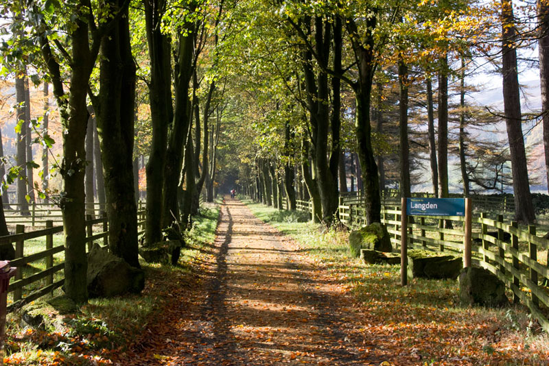
Very soon we reached our start point at the roadside parking by the entrance to the Langden Valley, and where there is the tea bar, but that was for later.
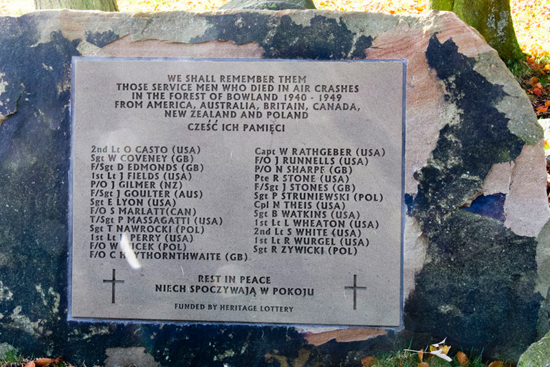
On our adventures we had encountered a number of poignant memorials to airmen who had crashed on these hills. Here this one lists them all. We stood in respectful silence for a little while.
The day was calm and sunny as we set off along the paved valley road,
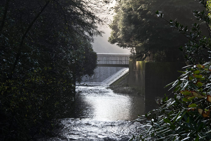
to soon pass the waterworks. Langden is another of the valleys where water is collected to supply the people of Lancashire.
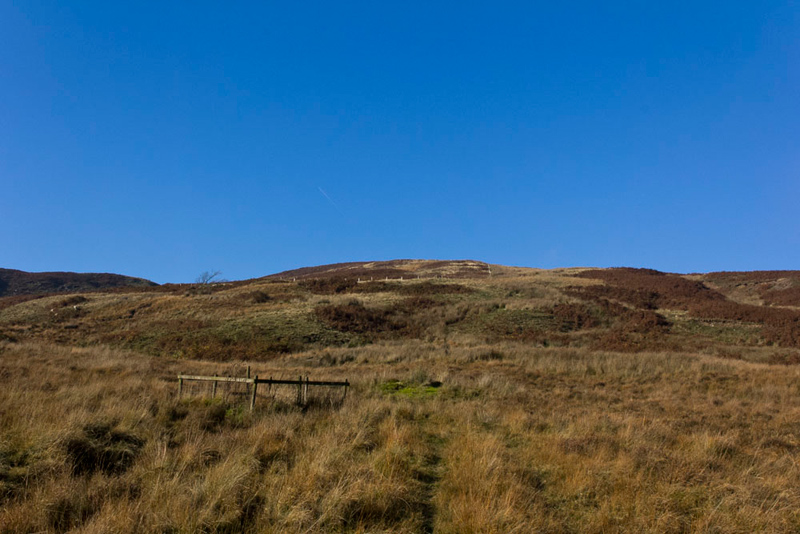
Beyond a gate we entered access land and in a few yards we came to a gate in the fence on the right.
"We should go through that gate for our ascent route." said Shaun.
A track climbed for a short distance and then became a narrow trod up Stake End, leading to a fence enclosing an area of land.
As Shaun looked at the map, Allen looking over his shoulder said, "its not marked on map."
"No pal", he agreed, "but I suggest we just keep on up with it to our left."
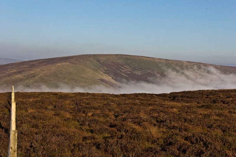
As can be seen there were cloudless skies, and warm sunshine, such that Dad's coat went in the rucksack and he was able to walk just in his t-shirt.
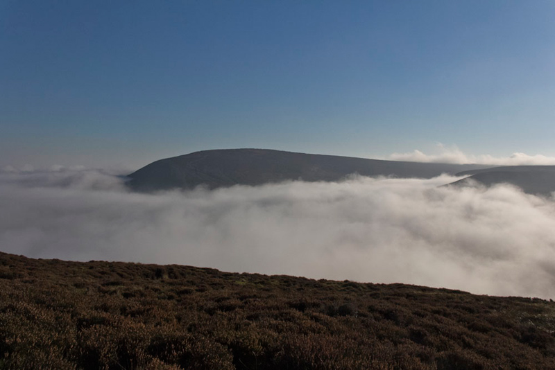
However the same could not be said for the valleys as the cloud had rolled in creating an inversion. "That will make an interesting shot towards Totridge", remarked Grizzly.
"It reminds me of the day we climbed Ingleborough with Uncle Bob", said Tetley. "We were in the mist for most of the ascent, to then come out into the sunshine just below the summit and see a similar scene."
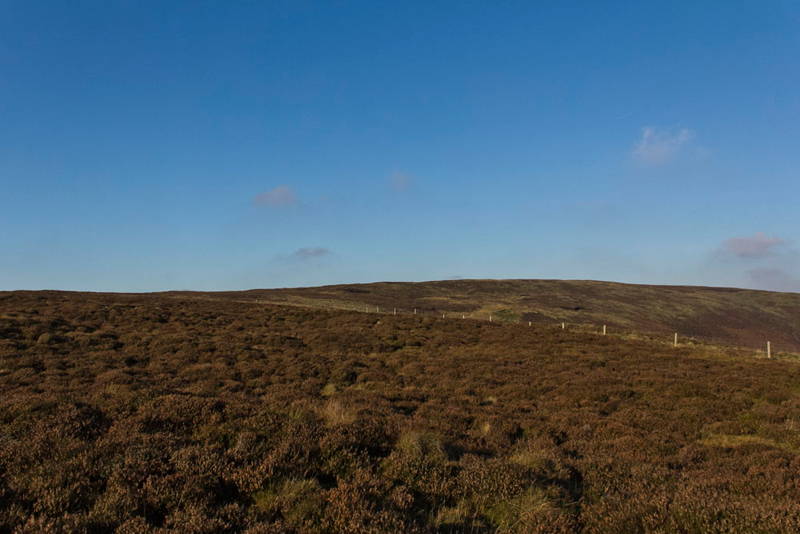
When the fence turned away left, Dad climbed on to come to another such fence. "This one is not on the map either", said Shaun. Then glancing at the GPS, he advised, "I think it would be best to follow this to the left, and then keep by it when it turns right uphill."
The gradient was steep over the rough heathery terrain that was boggy in places. As this eased Southey pointed, "there is a fence across to the right."
"Now that is marked on the map", said Shaun. "We should make for it and then walk alongside up to the ridge. From there it will be right to the summit that can be seen behind."
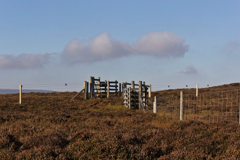
Gaining the brow the fence junction was reached with a kissing gate in each one.
"So which one?", asked Southey.
Grizzly glanced at the map and replied, "the one in the cross fence as the highest point is on the far side to the right."
A path was soon found just a little way from the fence and with his eye on the GPS, shortly Shaun called out, "this is the summit."
Placing the GPS for the picture, Dad said, "yet another unprepossessing summit amongst a wide mainly flat expanse. It does make me yearn for the Lakeland Fells where for the most part there is little doubt about the highest point."
Pretty wet around here we found the driest patch of heather to sit. "Can we have the flag?", asked Little Eric.
"There's no wind lad so there does not seem to be any point", replied Dad.
Looking ahead along the fence, Allen said, "I can just see the trig point on that hill on the far side of the Trough."
"It's Whins Brow, which we climbed on 23rd August", informed Tetley.
"So then, along the fence and down to the road", said Shaun.
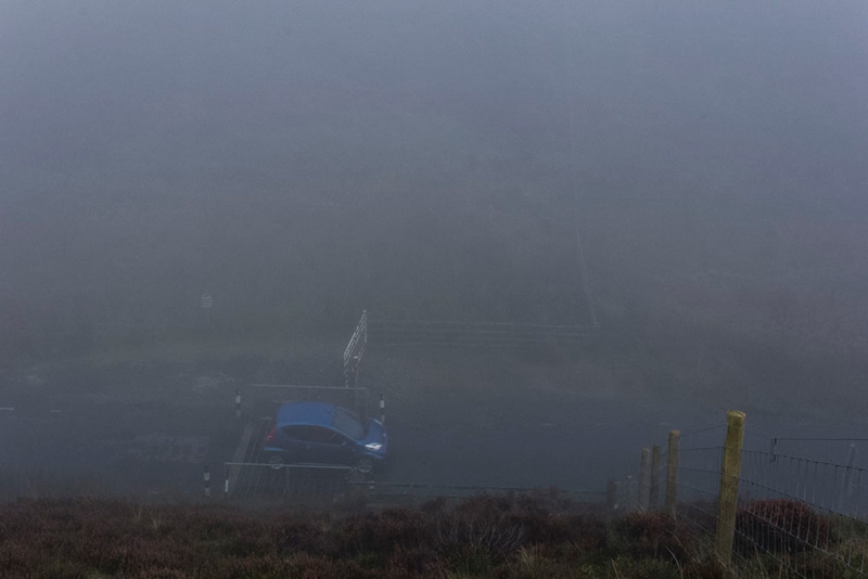
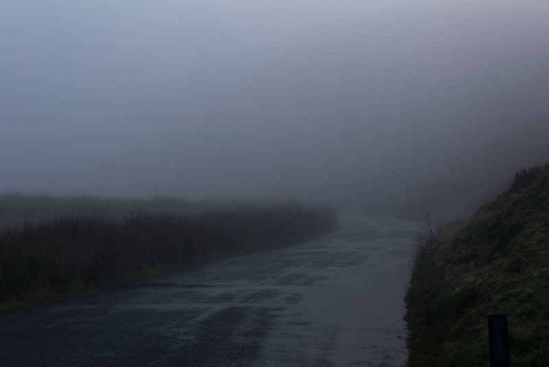
Gentle a first the gradient gradually steepened. The blue skies and sun disappeared too as our descent took us into the mist, this being the view as we looked down on the cattle grid at the top of Boundary Hill.
"What a contrast", exclaimed Little Eric.
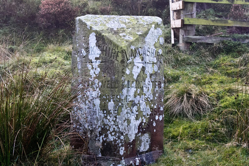
Here by the road stands the Grey Stone of Trough that once marked the border between Lancashire & Yorkshire.
Facing the stone, to the left was Yorkshire the inscription stating distances of 5½ miles to Whitewell and 12½ miles to Clitheroe. To the right Lancashire showing 12 miles to Lancaster and 10 miles to Bay Horse.
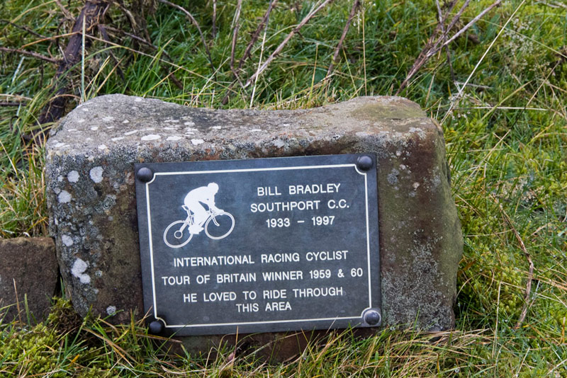
Adjacent stands this memorial plaque.
"I remember him, as he lived in my home town Southport", said Dad.
Bill Bradley was twice English National Road Race Champion, represented Great Britain in the 1960 Olympic Games in Rome, won twice the Tour of Britain Road Race and until recently held the record for climbing the Grossglockner in the Tour of Austria. He remains the only rider to have won the Tour of Britain in two consecutive years. He rode for the Southport RCC throughout his career. Source Wikipedia.
To regain our start point it was along the road into what was once Yorkshire. "Excellent visibility", joked Allen.
Fortunately there was little traffic and it was not far before the road dropped down, where the visibility improved.
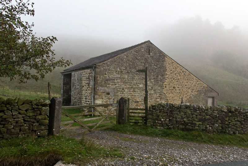
Further on Grizzly said, "that's Trough Barn on the left. The track beside was our route to Staple Oak Fell and Whins Brow, then down Oster Rake to Brennand Farm to return to the start via the Dunsop Valley."
Very soon on the left we passed the hurrying stream of Swine Clough, where it empties into Losterdale Brook,
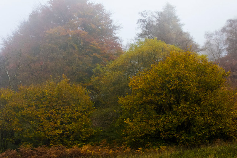
while to the left the trees still had some autumn colour.
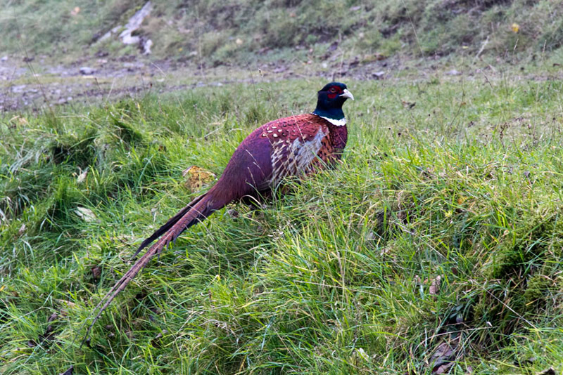
Just moments later we came across this pheasant sitting on the verge. What was interesting was that when we drove home along the road later it was still there!
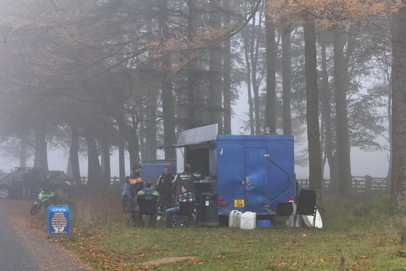
And so, after another ten minutes the tea bar loomed out of the mist, Dad's car being parked just beyond.
We settled in the car to have our picnic. Getting his boots off, Dad then went to the tea bar. No surprise there then!
Here he had a delicious bacon and sausage bun (3 rashers of bacon and 2 sausages) and mug of tea.
He chatted to the owner about where we had been today and about how the mist comes and goes and how disorienting this can be. Both he and Dad were in agreement that carrying a map and compass is essential. A GPS too is helpful, but not using a app on a mobile phone as this will be useless if there is no signal. Something we have found often on our adventures in Bowland.
A lady came worried that her husband had not returned from an off track walk. Her phone was not working, and when the tea bar owner went to get his out, she said, "I don't have his number!" By now it was getting towards 16:00 and not long before it would be getting dark. With her not knowing exactly where her husband had gone, the owner suggested that the mountain rescue should be called. Dad agreed, but up to our leaving she had decided to wait a little longer. We will never know how things turned out, but just hope that he returned safely.
As we drove home, Southey said, "so that just leaves Pendle Hill to complete the challenge."