Southey and Tetley were reading their magazines, when Shaun, Little Eric and Grizzly arrived with the tea and cakes.
"Lovely", said Southey going to get the mugs and plates.
"I'll help pour the tea", volunteered Tetley.
Grizzly announced, Little Eric has made peach and apricot slice, while I have made chocolate cherry slice."
"Ooh that is my favourite", said Shaun.
So content our thoughts turned to walking. "The forecast for the weekend does not look good at all, with storm Ciara making landfall", Little Eric said rather mournfully. "So I don't suppose we will be able to get out."
Southey was reaching for another piece of cake, when he said, "where's Allen? He's the arch cake stuffer."
"I am sure he will be along, as he can smell tea a mile off", laughed Tetley. "Better make sure there's some cake left though."
Grizzly refilled his mug, and was just lifting it to take swig, when the whirlwind that was Allen, came flying into the room. "Ah tea. Just what I need. I was gasping for a cuppa."
"Here you are", laughed Shaun passing him a mug.
Little Eric offered the cake tin and Allen took a piece of apricot slice. Taking a bite he said, "delicious pal. Southey and I may be the cake stuffers, but you and Grizzly are the cake makers extraordinaire"
"Where were you?", asked Grizzly.
"With Dad. He has been looking at the weekend weather in relation to storm Ciara. It is not due to arrive until later on Saturday, so he has resolved to make and early start on Saturday, so we can make the most of the calm weather, before the winds strengthen in the afternoon.
"So do we have to come up with and idea?", said Tetley.
"No pal. Dad has already done that. We are doing another Lancashire walk. The one from the village of Churchtown near Garstang another new area for us. It is not far to go, just down the A6. He plans to use the M6 to junction 33 to get on to the A6, thereby avoiding Lancaster's traffic."
"Great", cheered Southey, and raising his mug said, "here's to the best Dad in all the world."
22nd November 2020
We decided to repeat this walk, as it did not involve driving too far from home. The weather recently had been very unsettled, with lots of rain, so the conditions underfoot were very similar to those experienced last February. Today was dry apart from a few spots of rain on the canal section, with light winds and sunny periods. Rather than park on the street, this time Dad left the car in the church car park. The slightly shorter distance can be explained by the fact that we did not miss the path from Tan Yard Road.
The plan was to be walking by 09:30, meaning we were on the road by 08:45. The day was calm with hardly any wind and quite sunny
As we headed down the A6, Grizzly commented, "it is hard to believe that there will be wind gusts of over 60 mph tomorrow with the arrival of storm Ciara."
Turning off towards Fleetwood, within yards we took the road left into Churchtown village.
"The instructions give no indication where to park", said Shaun.
"There are only two roads", replied Dad. The first was narrow, then at the junction Dad turned right back towards the road we had just come off. There were spaces in front of the houses. Seeing a suitable place he said, "here will do."
He quickly got ready and not wanting to delay, we hunkered down in the rucksack.
Ready, Shaun said, "we should walk back and then along Church Street."
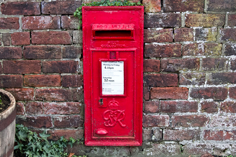
Nearing the junction, Little Eric called out, "there's the wall post box. I like to see them and they make a colourful picture for the story." Then looking more closely he said, "It dates from the reign of King George VI."
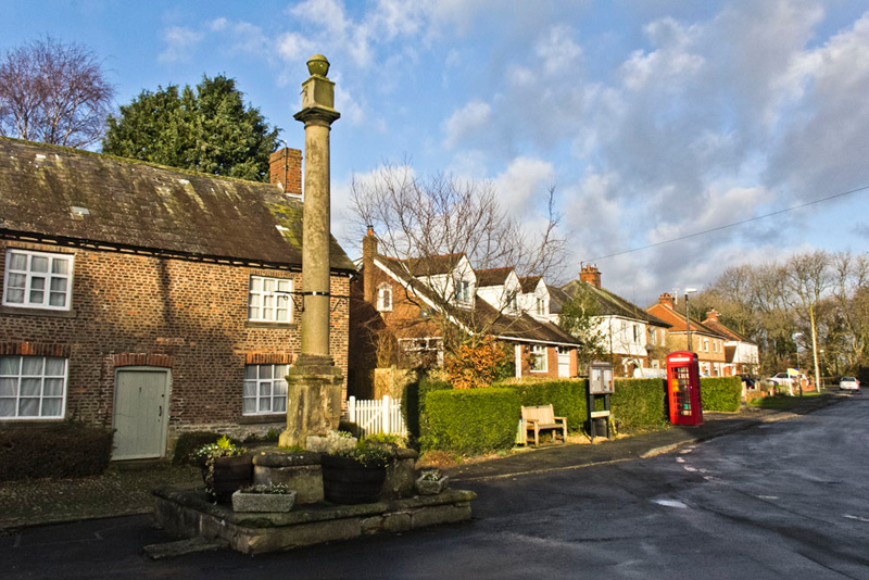
Just opposite at the junction stands the Market Cross that is thought to originate from some time in the 18th century.
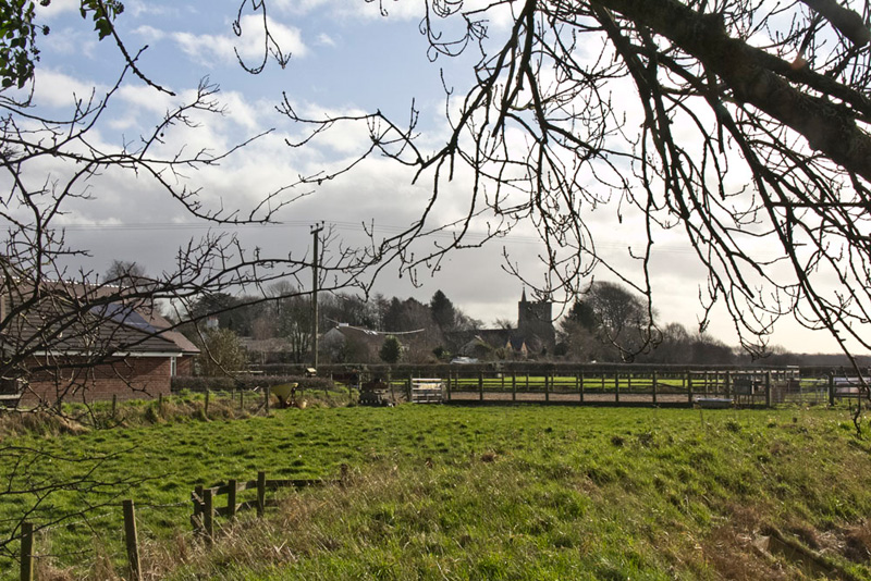
Having enjoyed the features, Dad then strode on to the come to St Helen's church. We were admiring the building, when we heard a lady say, "you got a few teddy bears in your rucksack."
So Dad went on to explain about us and mentioning the website, and that STAG is the initial letters of Shaun, Tetley, Allen and Grizzly, being the first four members of our club. He told her that we had been on many walks and had climbed the fells and mountains in the Lakes and Yorkshire etc.
She had been walking her dog that had been recently adopted. "He comes from the Lake District, and is named Carrock."
"After the fell of the same name?", asked Dad.
"Yes. Have you been up it."
"Yes", replied Dad. "It is a nice one to climb."
How nice it had been to talk.
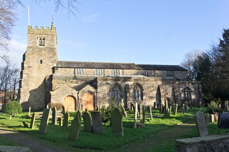
The sun was not in the best position to photograph the church, but from the far side he was successful.
Having done some research Grizzly said, "this is Garstang Parish Church the village of that name being about a mile and a half away. It is due to this that the village name originates, being called at one time Garstang Church Town. The church was originally founded around 1160. The current building is thought to originate from the 15th century. There were alterations in the 16th century, 1811, and the building being fully restored in 1865-8. It is Grade I listed."
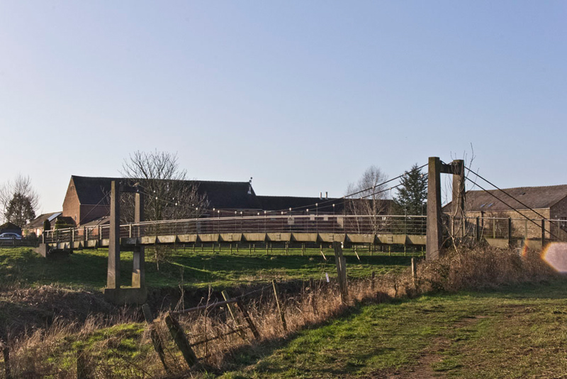
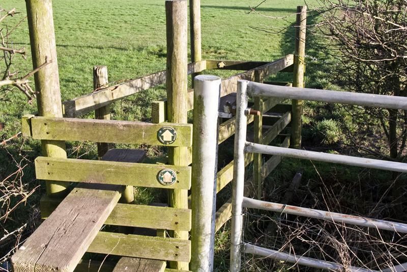
Taking the path from the rear of the car park led us to and across the suspension bridge over the River Wyre.
Over the stile on the far side, Shaun called out, "we now go left."
The path crossed fields, coming to a double stile adjacent to a gate.
"There doesn't seem much point to the gate", said Tetley, seeing the hedge blocking access on the far side.
Looking more closely Grizzly said, "there's a cattle grid that the hedge has grown through. Must be years since this was last used."
Soon we reached Arnwood House, to follow its drive to Old Lancaster Road lined with houses.
"This must once have been the main road", stated Allen.
Halfway a path left led through a gap to the A6.
"We cross and take Tan Yard Road opposite", advised Southey.
This took us past the works of Collinson a company supplying agricultural silos and feeding solutions.
"Along here we go left down to the River Wyre", advised Shaun.
Oblivious Dad just marched on and reaching some recently built housing, Shaun said, "I am sure we have come too far."
"You are right as always lad", agreed Dad retracing his steps to find the path between railings. "It's waymarked too, however did I miss that."
"Never mind", replied Little Eric. "We should have kept a sharper look out as well."
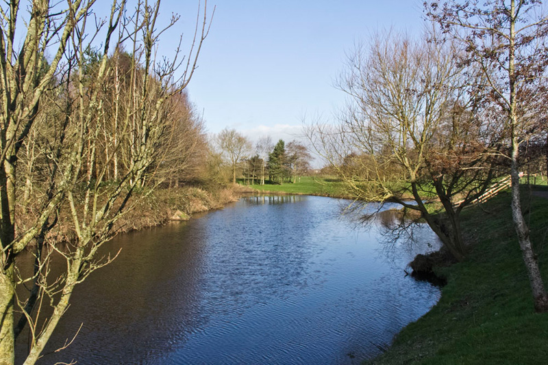
At its end we had this nice view of the River Wyre at the point where the River Calder feeds in from the right, behind the trees.
"So blue under the blue skies and bright in the sunlight. Both of which have been in extremely short supply these last few months. And what have we got in prospect, storm Ciara, and more unsettled weather with further storm next weekend", remarked Tetley dejectedly.
"I feel so sorry for the people whose houses will inevitably be flooded over the weekend. There is a lot to be said for not living near a river", said Southey.
Now swinging right we crossed grass and muddy paths to a play area. Here we met another couple who Dad chatted to as we walked on for a short way. They had a little dog that was very friendly.
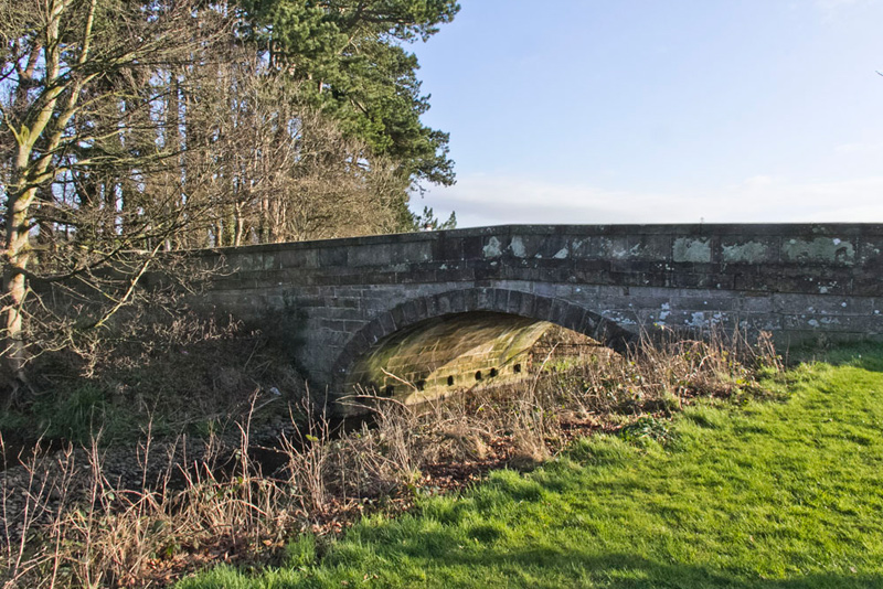
The path led up to a road at Calder Bridge. Once again Grizzly had information for us, saying, "it is constructed of sandstone ashlar and dates from 1812. It has Grade II listed status".
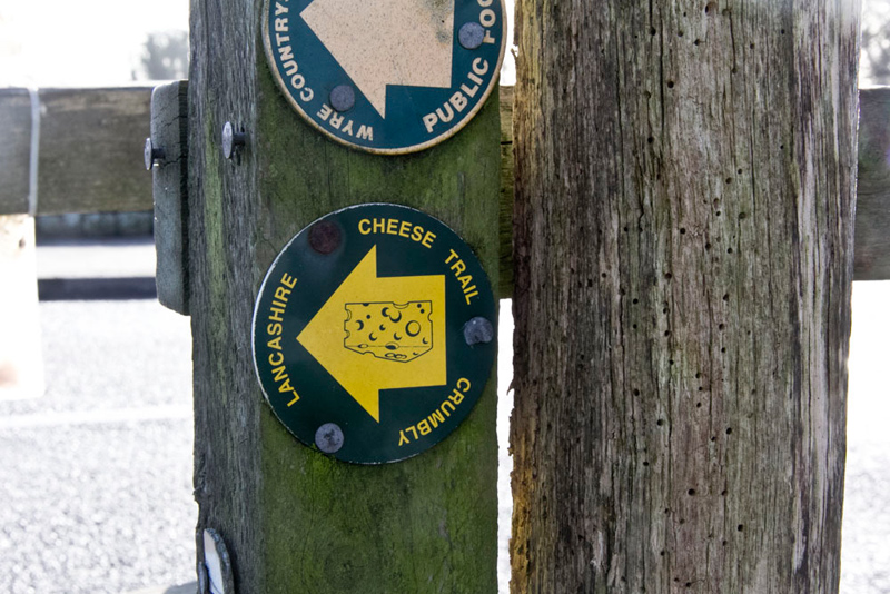
A stile at the road was waymarked, one telling us that we were following the Crumbly Lancashire Cheese Trail, done in its entirety on our walk today.
"Over the bridge, then immediately right", advised Southey.
Two stiles led into fields, and after about 500 yards brought us onto a farm track. "We go right to Sturzaker House", called out Shaun.
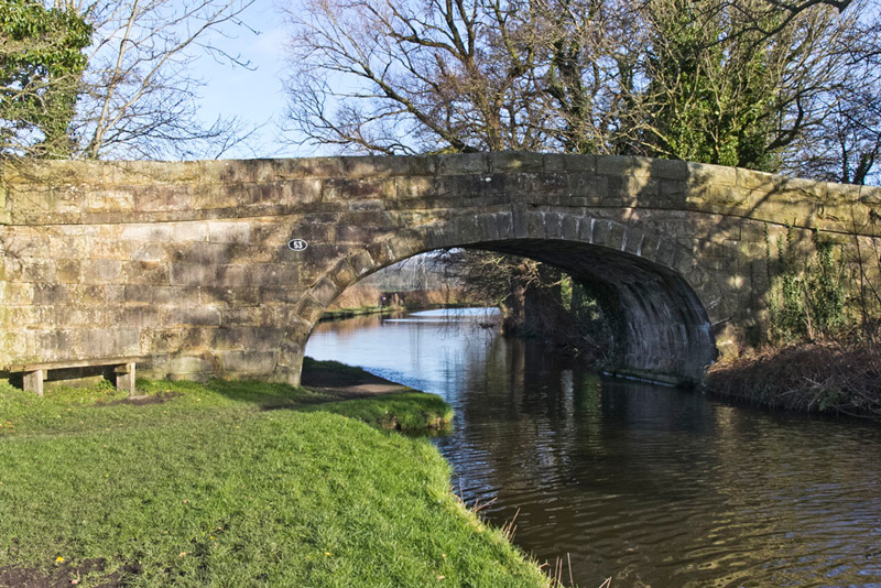
Once there, he then said, "now left on this private road and before the canal bridge take the gate right and down onto the towpath."
This was bridge 53.
Spotting the seat, Allen suggested, "seems sensible to have our picture taken there for the story, to get it out of the way."
"Good idea, pal", agreed Grizzly. "there is one thing for sure we are never camera shy."
"Of that I am certain", laughed Dad.
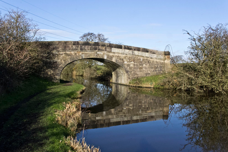
"Left under the bridge" said Shaun once we were settled again. Then for about the next two miles we follow the canal."
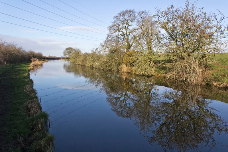
At the next bridge, Southey said, "wow what lovely reflections. A must picture for the story."
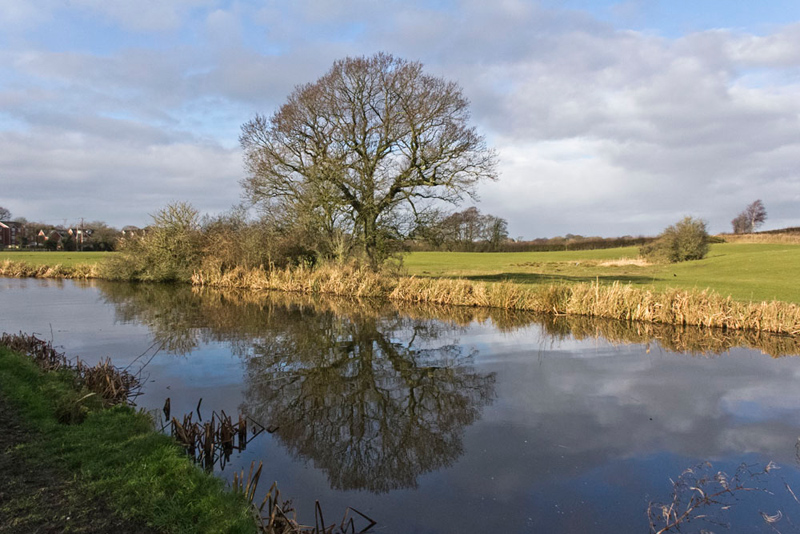
Then just beyond, "the reflection of the trees will make another nice shot", suggested Tetley.
Lovely and peaceful along here, except for the hum of traffic on the nearby M6. Eventually the canal swung left on reaching Bonds a large fairly recent housing development south of Garstang. Just before Dad took this further shot of reflections.
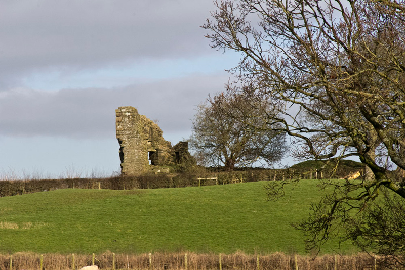
On the November day, Allen commented, "there's that ruin away to the right. Still wonder what it is."
Looking up from the map, our super sleuth Grizzly called out, "I have solved the mystery. It is what remains of Greenhalgh Castle."
"How can you be so sure?", asked Little Eric.
"Because the nearby buildings are called Greenhalgh Castle Farm."
Tetley said, "I remember now. Back in 2012 we walked past on a circular walk to Calder Vale. I am sure we tried to visit the ruins."
Back at home, Grizzly researched this. "You were quite right pal. The ruins are all fenced off but we gleaned lots of details from the information board. We can put them in this story."
The castle was built in 1490, by Thomas Stanley, 1st Earl of Derby, having been given the land by King Henry VII for his help in defeating Richard III at Bosworth Field. It was a plain building probably three stories high. The walls were 16 yards apart on one side and fourteen on the other, with a square tower on each corner thought to be about sixty feet high and with walls five and a half feet thick. There was only one entrance and it was probably surrounded by a dry moat.
The castle was built to be impregnable and in its 150 years it was never captured despite a one and quarter year long siege during the Civil War, when efforts were made to undermine the walls. It was the death of the Governor, Nicholas Anderton, which led the Garrison to surrender on the condition that everyone was given safe passage and no reprisals were to be taken. Following this, Oliver Cromwell gave orders for the Castle to be dismantled and the wood and lead sold. Soon afterwards much of the stone was taken and used in nearby farm buildings. The ruins that stand today are part of the Western tower.
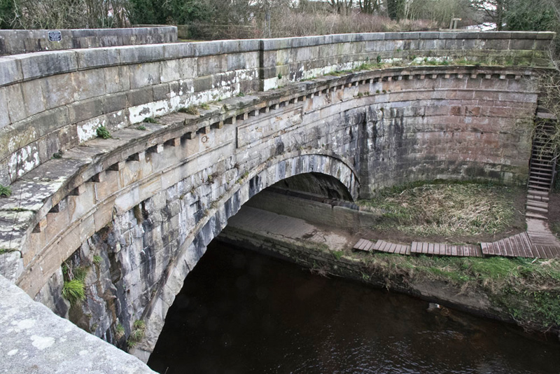
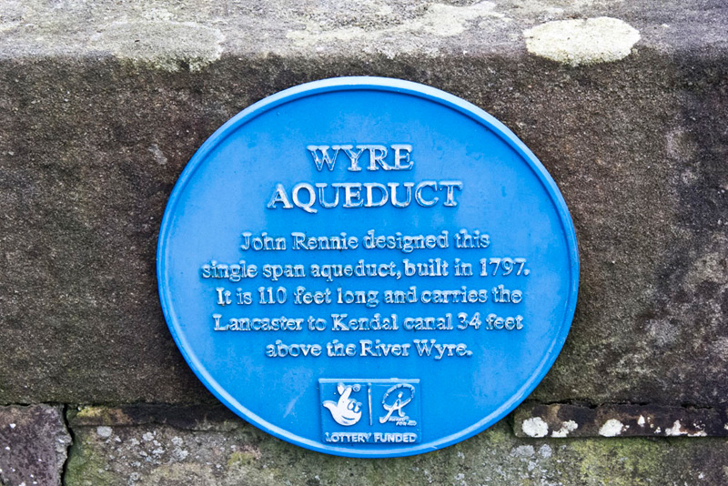
The canal edges the houses, to fairly soon cross the Wyre Aqueduct...
...about which, this plaque tells all.
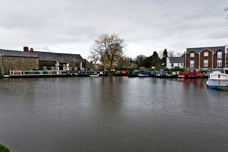
On the far side is this marina.
Here Shaun called out, "this is where we leave the canal through that gate on the left."
"No doubt there, as the sign reads Churchtown, and also indicates we are now on the Wyre Way", confirmed Allen.
It started to rain. Looking at the sky, Tetley said, "it will soon pass over so there is no need for us to go inside the rucksack."
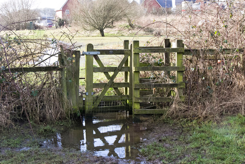
The route was clearly waymarked via stiles and this kissing gate.
"Oh heck!", exclaimed Little Eric. "It is a good job I am in the rucksack, otherwise the water would be over my head."
Dad approached carefully, and standing on the lower section of the inner frame got through without wet feet.
Shortly we passed a new housing development that was still under construction. There were piles of bricks and concrete blocks. Dad said, "the bricks are supplied by Forterra. I bet they come from the brickworks at Claughton that I pass every time I go to Elaine's Tearooms."
"We've seen the quarry and the aerial ropeway that carries the clay down to the works in the valley", said Grizzly.
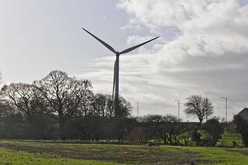
Strolling on Southey called out, "wow, what an enormous wind turbine."
"It is sited at the Dewlay Dairy, where they make many different varieties of cheese including Crumbly Lancashire", said Tetley. "It stands 126m (413ft) tall and produces 2mW of electricity to power the factory."
"Thanks for researching that and adding to our education", replied Grizzly.
After crossing a footbridge a final short steep section brought is to the A6 again, via a stile. "We go left then cross and walk the drive of Cross House Farm", said Southey pointing to the buildings.
Soon, we came to a gravelly track on the left. "It's along here now", called out Southey.
Just as Dad stepped forward Allen shouted, "mind the trip wires.
"Thanks lad, I had not seen them."
They seemed to be electrified so Dad stepped over carefully. By November these had gone, replaced by a fence and gate.
To the left of the track we could see the Dewlay Cheese Factory. When the track turned away left, our way was through the waymarked gate in front and across the field to it far right corner, by Kirkland Hall.
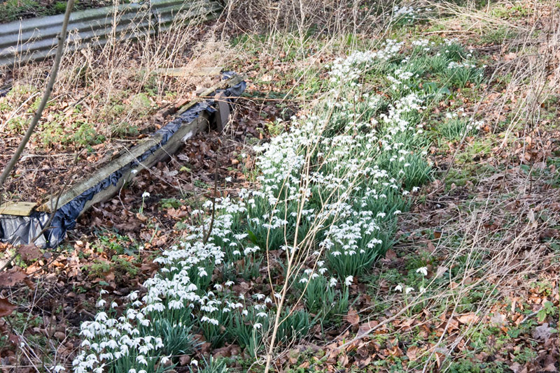
The track now led right by these snowdrops over the fence. "A sign of spring. Let's hope that brings dry sunny weather", said Little Eric.
Passed through Kirkland Hall Farm and then along its access to the A586. Crossed carefully and then took Ainspool Lane into Churchtown.
"That was a lovely walk", said Little Eric.
"Thank you Dad as always for taking us", said Southey. "We are such a lucky group."
"You are welcome lads. I am never alone with you for company."