This hamlet lies at the bottom of
the Kirkstone Pass with Brothers Water nestling nearby and on
either side the fells rise steeply. Dad took us on two walks with
Uncle Eric to explore these, going first up the fells to the west
side and then those to the east.
GALE
CRAG, HARTSOP ABOVE HOW & HART CRAG from COW BRIDGE
Grizzly's 4th Birthday Walk
Summary
Date - 1st July 2008
Distance - 6 miles
Map - OL5
Start point -
Parking area at Cow
Bridge (NY 403134)
Summits Achieved
Name
Height (ft)
Height (m)
Grid Ref
Gale Crag
1680
512
NY 3927 1244
Gill Crag on
Hartsop above How
1909
582
NY 3831 1200
Hart Crag
2698
822
NY 3690 1120
The Walk
A few steps along the track we
veered off right to climb steeply through the woodland to reach
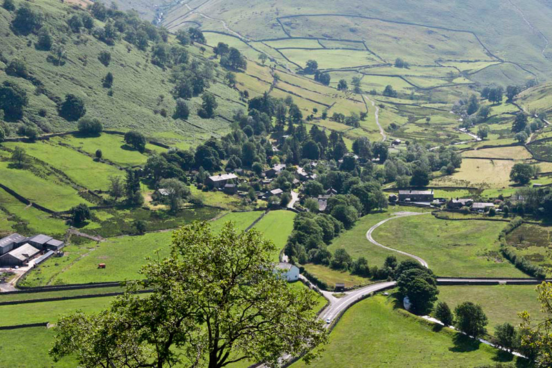
the ridge. The views opened up as we climbed, first of the
village of Hartsop nestling in the valley.
Shaun pointed, "pals, see the path from the rear of the village snaking up across the fell side. It leads up
Hayeswater Gill and will be the route for our next walk with you, Uncle Eric, to summit The Nab."
"I will be glad to get that done", replied Uncle Eric.
"Yes", agreed Allen, "as Little Eric and I will also tick it off."
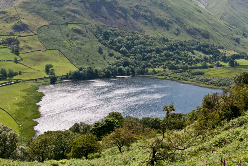
Climbing on Tetley stopped our progress, by calling out, "that's a superb view of Brothers Water, sparkling in the sunshine."
Grizzly said, "it was once called Broad Water, but the name was changed in the 19th century when two brothers drowned there."
The ridge gained, we all stopped to
rest a few minutes and take in the views. "
"OK", said Uncle Eric, "I'm ready to go on."
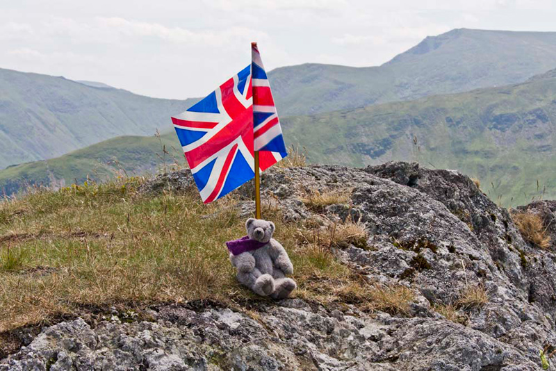
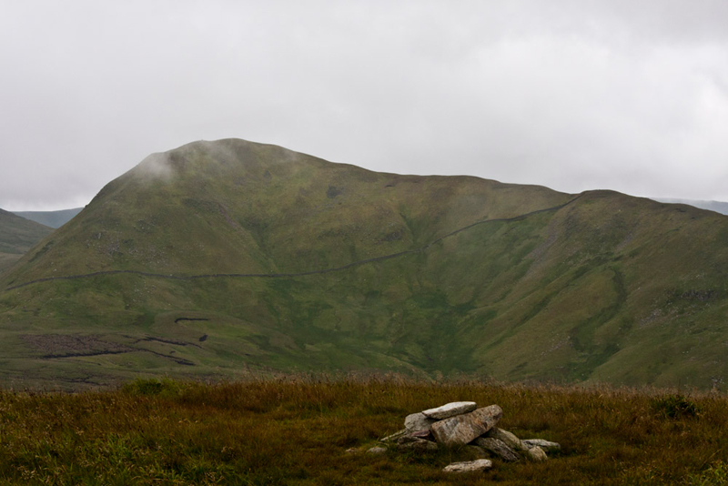
The steady ascent continued to the first objective the Birkett summit of Gale Crag, where Allen said, "picture time."
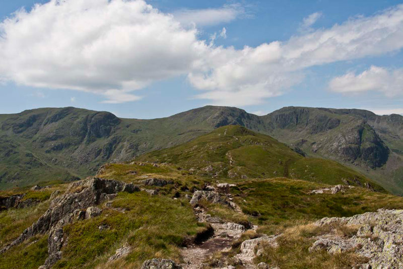
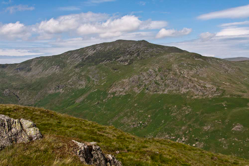
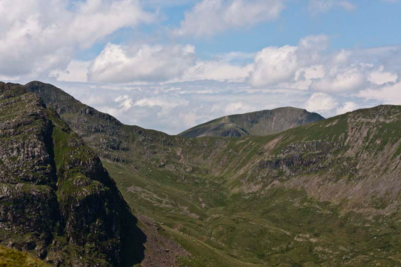
From here we had a clear
view onward towards the summit of Hartsop above How backed by
Dove Crag, Hart Crag and Fairfield. "Wow", breathed Little Eric. "How majestic."
Our attention too, was drawn to the towering mountain that is St Sunday Crag (2758ft).
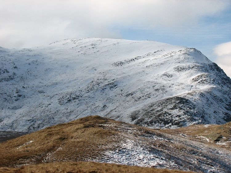
"It looks so benign today", remarked Tetley. "Very different to the day we climbed in February 2006. Then there was deep snow." Here is St Sunday Crag from Birks on that day.
Allen went on, "the day started off sunny, but as we got onto St Sunday Crag the weather closed in, and to an extent we had to follow footprints in the snow to reach the summit and then make the descent."
"Our records show that Dad rang Uncle Brian, from the summit, who told us that it was sunshine in Morecambe", added Shaun.
So reminiscence over we jumped back into the rucksack and off we went, descending first,
before making the final climb to the summit of Hartsop above How. This is one of the Wainwright Fells, as well as Birkett summit.
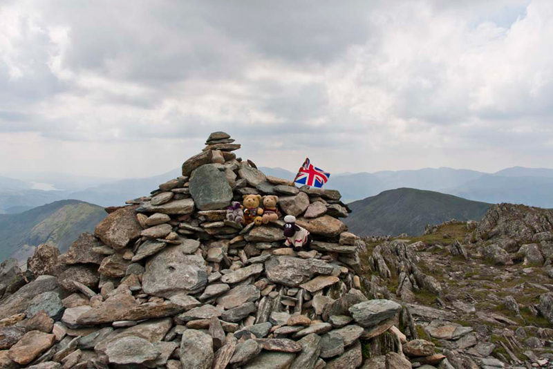
Tetley spoke up, "Shaun and I having completed the Wainwright challenge, have been here before on 4th December 2003. We did four summits that day. Little Hart Crag, Dove Crag, Hart Crag and lastly Hartsop above How. For whatever reason Dad you did not take our picture here. So this is the only Wainwright for which there is no summit picture."
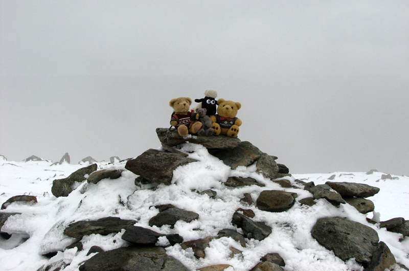
"Well lads get settled and I will rectify that now", said Dad.
Grizzly said, "I am getting near to completing the challenge too, and this is my last in Book 1 – Eastern
Fells."
"In that case pal", said Allen. "You should have your picture taken on your own. Especially too, as it is your birthday!"
The next objective was Hart Crag
just a mile and a half away, but the sting in the tail was that
to reach the summit Uncle Eric and Dad had to climb 1000ft
higher. It was quite an easy walk on grass at first but then
there was a rough scramble over rocky ground to the cairn at
2698ft. Aren't we lucky to be inside the rucksack carried to
the top?
As we ascended we enjoyed this view to Dollywagon Pike
over Deepdale Hause. Across the Hause is a path linking the fells
of Fairfield, Cofa Pike seen on the left behind the rocky foreground, and St Sunday Crag.
"Another magnificent view", breathed Little Eric.
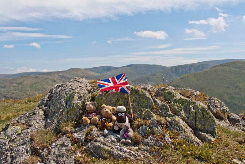
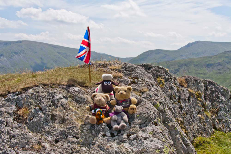
It was extremely windy on Hart Crag
but nevertheless we climbed up on to the cairn for our photo, Shaun saying, "it will be hard for you Little Eric, so come on ride on my back."
"Thanks pal."
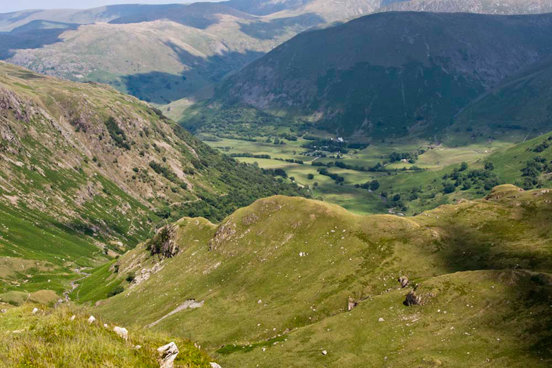
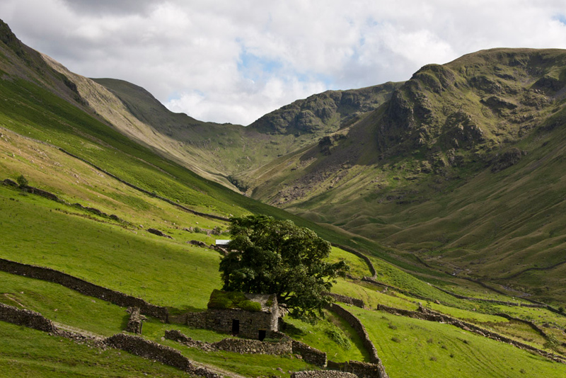
Our return route was to descend
into the lovely valley of Dovedale shown below, and then walk
alongside Brothers Water to reach Cow Bridge.
"Thanks Dad and Uncle Eric for giving me such a super walk to celebrate my birthday", said Grizzly. "And here's to many more adventures in the future."
THE
NAB from HARTSOP
Summary
Date - 15th July 2008
Distance - 7 miles
Map - OL5
Start point -
Hartsop-parking area
through hamlet (NY 408132)
Summits Achieved
Name
Height (ft)
Height (m)
Grid Ref
The Nab
1887
576
NY 4342 1519
The Walk
This summit is a long rib extending
outwards from the fell called Rest Dodd, and for many years was
actually off limits being part of the Martindale Deer Forest and
home to the oldest herd of native red deer in England. Now most
of the land is open to the public although walkers are requested
to approach from Rest Dodd and as far as possible not disturb the
deer.
The day could not have been more of
a contrast to the previous walk because as soon as we started the
rain set in and persisted for over half the walk, light and
patchy at times but also some heavier showers. Still we are not
to be put off and snuggled as low as we could in the rucksack.
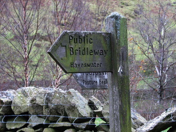
The signpost by the gate clearly
showed our route up Hayeswater Gill.
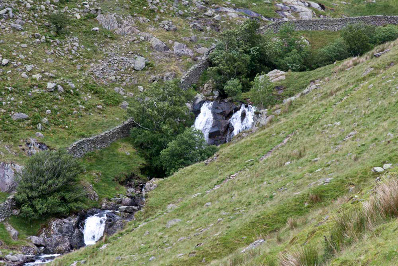
The gill flows out of Hayeswater
itself and has a number of waterfalls. Allen said, "they will make a nice picture."
Once the lake was reached a steep
and uninteresting climb over rough ground brought us to the main
path from Patterdale to High Street. "We follow this for a while, then we need to strike right over the ridge of Satura Crag", instructed Shaun.
This done, Allen pointed, "there's The Nab, and that is Ullswater peeking out behind."
The weather improved as the day went on, and this picture was actually taken after we had returned from the summit.
Whilst at this point we were on a
level with the summit it was first necessary to make a steep and
rough descent down and across to the peat hags (the dark patches)
before attaining the path that led to the summit. "Oh dear", sighed Little Eric. "This summit is harder to reach than it looks on the map."
"Yes pal", replied Tetley. "Despite being only 1887ft getting to it makes for quite a tough walk."
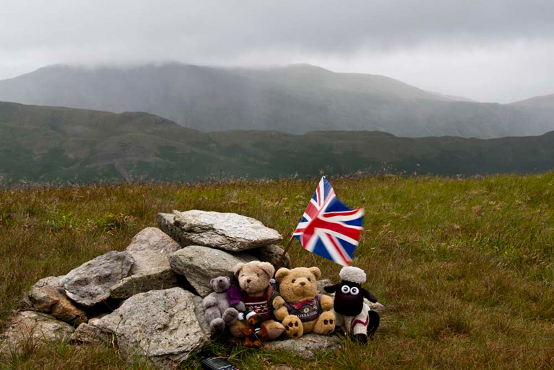
At the small cairn, Tetley said, "come on pals we need to get settled for our picture quickly as that rain shower is imminent."
"Great" cheered Allen,"that's another that Little Eric and I have ticked off. I doubt we will be coming back here again."
"Not very likely", agreed Dad.
Uncle Eric was a little way behind us, so safely hunkered down in the rucksack again, we waited patiently for him to arrive. He too bagged the summit and agreed he would not be returning here either.
Tetley's comments about it being quite a tough walk are further born out by the fact that from the summit there was
nothing for it but to reverse the route, having again to climb
steeply below the slopes of Rest Dodd. Then cross the wall and over the ridge to the right to gain the main path. "Definitely not coming here again", stated Uncle Eric.
Happily the weather improved
markedly and it was a much more enjoyable walk as we descended to
Hartsop.
On the first photo of the signpost
you will see that a path is indicated to Pasture Beck shown in
the picture below. This valley leads to a place known
as Threshthwaite Cove and then steeply to Threshthwaite Mouth, a
rough steep and stony col between Thornthwaite Crag and Caudale
Moor.
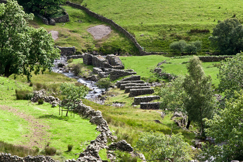
In the 19th century
there were lead mines in this area and a lead mill to extract the
ore. Beside the beck in the picture below stand remains relating
to the mill. The "U" shaped walls are where the water
wheel was housed and the other walls carried the trough along
which the water ran to turn the wheel and power the mill.
To make the return slightly
different we had used the track from the Filter House on the
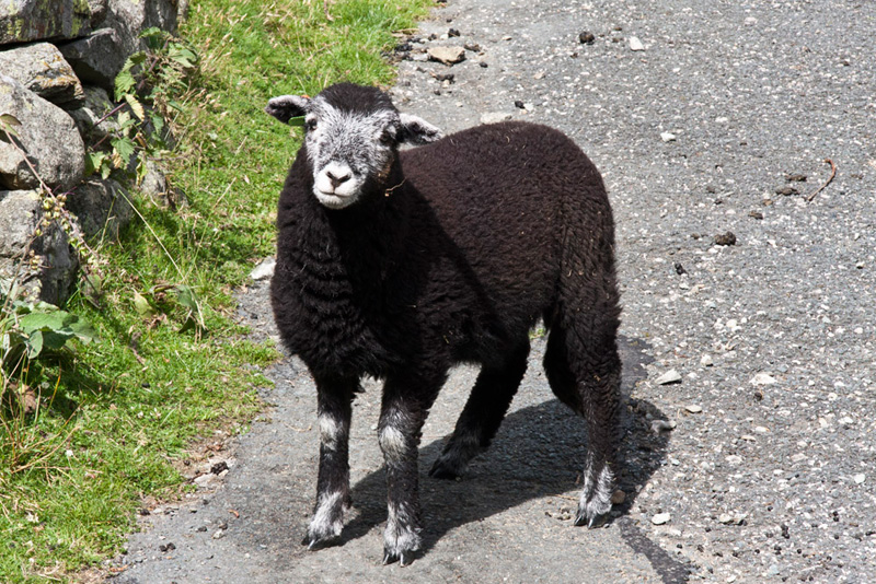
opposite side of the gill. We passed through a gate by which were
some Herdwick sheep. One of the lambs was inquisitive and gave
Dad the opportunity to snap him. "Aww", said Grizzly, "they do have such lovely faces, and the markings seem to be different on each one like a fingerprint."
From here there was just a short walk to the start.
"A typical Lake District Day, with the weather contrasts", commented Grizzly. "But a good walk nevertheless and thank you as always Dad and Uncle Eric, for taking us."
"You are welcome lads", replied Uncle Eric. "It is always good to have your company."