PINNACLE
HOWE, FOUR STONES HILL, BAMPTON FELL & LOW KOP
from BURNBANKS.
Summary
Date - 4th January 2009
Distance - 6 miles
Map - OL5
Start point - Burnbanks (NY 506161)
Summits Achieved
Name
Height (ft)
Height (m)
Grid Ref
Pinnacle Howe
1257
383
NY 4970 1668
Four Stones
Hill
1362
415
NY 4915 1627
Bampton Fell
1604
489
NY 4871 1648
Low Kop
1877
572
NY 4744 1647
Preface
New Years Day.
"Another year starts", said Tetley. "I wonder what it will hold for us all."
"Lots of walks", I hope replied Shaun.
"Yes", enthused Grizzly, "and as many as possible with either Uncle Bob or Uncle Eric too."
"I hope it will be a good year for Dad and Uncle Brian. That they have lots of good days going to Elaine's and holidays too", said Little Eric.
"How fortunate we are to go on the walks", said Tetley. "We have the best Dad in the world."
Just then Allen came bounding into the room. "I have news. Dad has told me we are going walking on Sunday."
"Great", cheered Grizzly. "It will be good to get the first miles under our paws of our 2009 campaign."
"Where are we walking?", asked Shaun.
"We are to bag four Birkett summits", replied Allen. "The start is at Burnbanks."
He got a blank stare. "Where ever is that?", asked Little Eric.
"Near to Haweswater. The summits are above the east side of the reservoir", said Allen.
"Here's to Sunday", cheered Grizzly.
The Walk
Sunday dawned, on another cold frosty winter day. Nevertheless we were eager to be off to the to get those first miles of the New Year under
our paws.
"How to do we get to the start?", asked Little Eric.
Dad replied, "north on the M6 motorway, to junction 39, then to Shap village. There we take the road to and through Bampton and on towards Haweswater. Just before the road by the reservoir, a minor road right leads to the tiny village of Burnbanks."
Allen said, "it nestles just a little way below the
huge dam wall of Haweswater Reservoir built by Manchester
Corporation."
That's right" agreed Grizzly. "Here's what I have found out about it. The dam wall measures 1542 feet
long and 90 feet high, and at the time of construction between
1929 and 1940 it was considered to be cutting-edge technology, as
it was the first hollow buttress dam in the world, being
constructed using 44 separate buttressed units joined by flexible
joints. The Lord Mayor of Manchester set off the first explosion
in 1930 to start the works the only casualty being one rabbit.
When completed the reservoir took two years to fill and raised
the height of the existing lake by 95ft. Its capacity is 18.6
billion gallons – that’s a heck of lot of baths!! Like
Thirlmere the water is transported over 100 miles to Manchester
using the force of gravity alone."
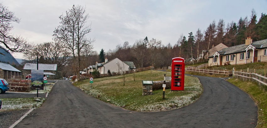
Reaching Burnbanks, Dad parked at the roadside, just before the green. "What a pretty village", commented Tetley.
Burnbanks was originally built by
Manchester Corporation to house the workers engaged on the
construction of the dam. This was no "navvy" camp but a
model village comprising 66 purpose built bungalows of sturdy
cast iron construction with electricity, hot and cold running
water, modern kitchen and bathrooms. They were the envy of many a
local farmer. It was a true community, Manchester providing a
mission, recreation hall, dispensary and shop, and paid for a
policeman, nurse and shopkeeper. In the 1960s and 70s there was
further work to expand the catchment area of the dam, but the
population of Burnbanks started to dwindle. Some of the houses
were dismantled and re-erected elsewhere. The village passed out
of Manchester’s control with the reorganisation of local
government. Much of Burnbanks became hidden under self seeded
trees and shrubs. Uncertainty over its future was finally
resolved by the granting of planning permission for the
rebuilding of 18 surviving bungalows and a new village green.
Well that’s the history lesson
out of the way, now we had better get on with the walk.
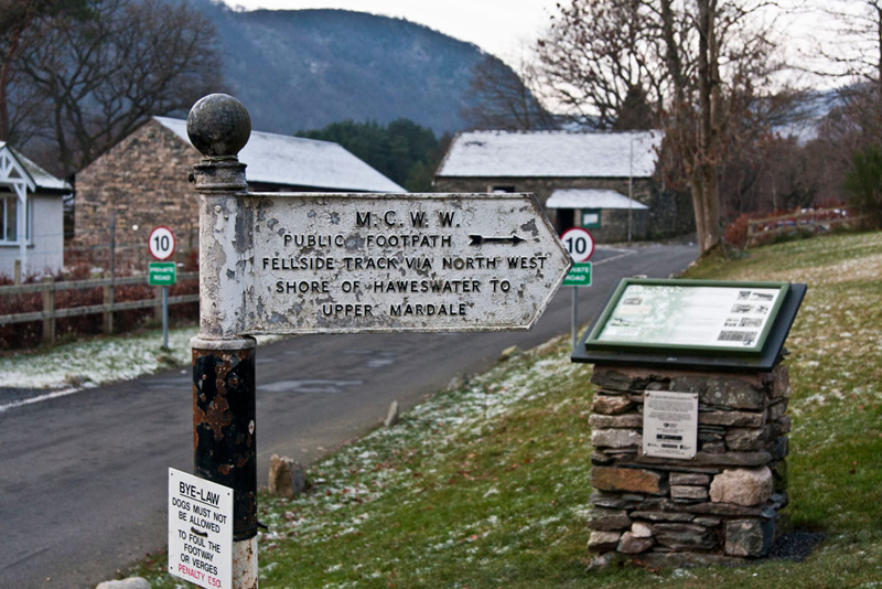
Shaun instructed, "we follow the direction of that original signpost, past the bungalows and
into the woods."
The path shortly reached a gate and
the open fell. Shaun called out, "our route is right on that rising path."
This rounded the
shoulder of the hill and continued in the direction Drybarrows Farm. Here a hill to the left rose above us.
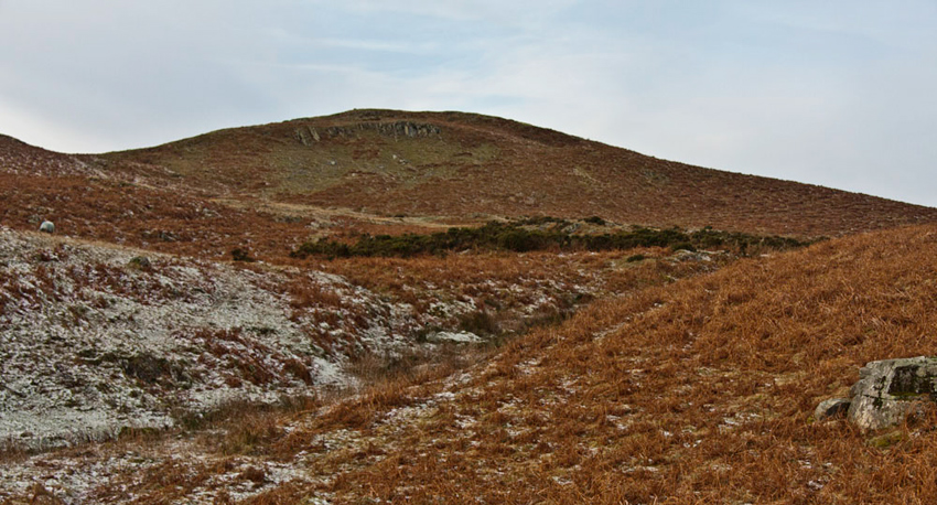
Allen pointed, "that is Pinnacle How. Our first summit objective."
Dad strode on until the path reached the rising ridge to the
right in the picture. Then he made short work up this to the rocky outcrop that is the summit.
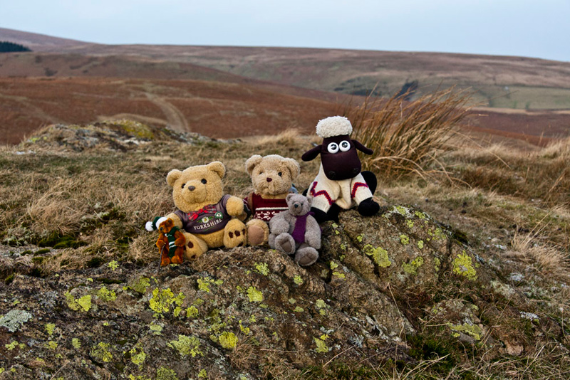
"Come on pals", called out Little Eric. "Time of our picture."
Back in the rucksack, Grizzly said, "where now?"
Shaun replied, "we head roughly south-west. Descend to then climb over Little Birkhouse Hill."
From here another steepish ascent followed to the summit of Four Stones Hill.
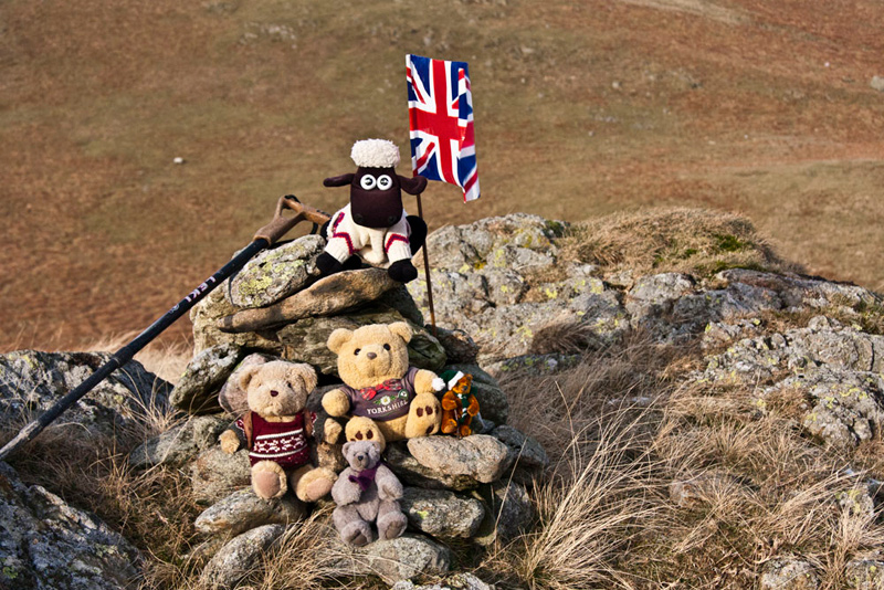
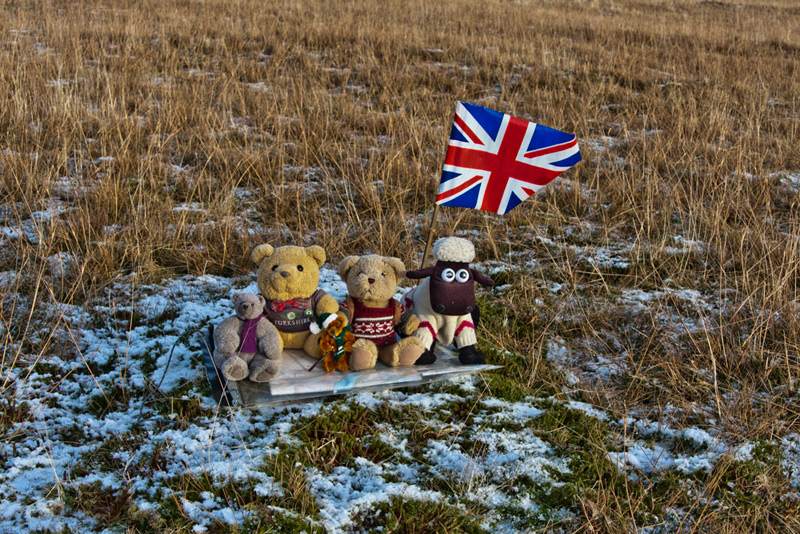
Tetley said, "will you get the flag out for this summit photo, Dad?"
Grizzly pointed, "the hill gets its name from those
Bronze Age standing stones. Only two of
the original four now remain."
Here they are with the expanse of
Haweswater behind. Don’t you think the cold literally oozes out of this shot.
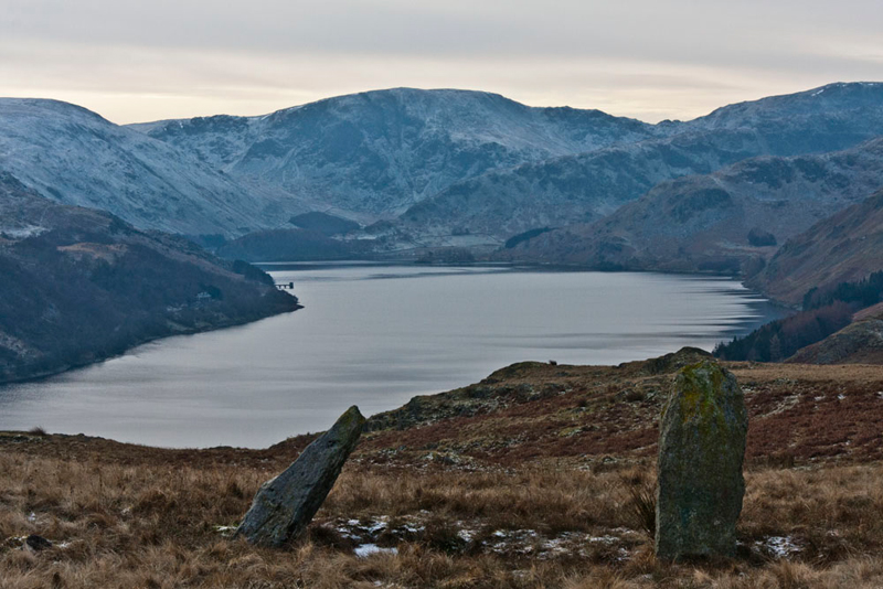
Allen said, "to left is Branstree then at the back Adam's Seat rising to Harter Fell. This drops right to the depression of Nan Bield Pass, with Mardale Ill Bell to the right."
Tetley added, Gatesgarth Pass climbs up left between Branstree and Harter Fell."
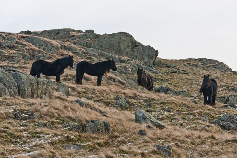
"Look there", called out Little Eric. "More of the wild fell ponies we saw earlier."
"Where to now?", asked Grizzly.
Shaun said, "up that steep slope on the far side of the path by the stones."
"Oh dear", said Little Eric.
"Don't worry lad", replied Dad, "my stamina has returned."
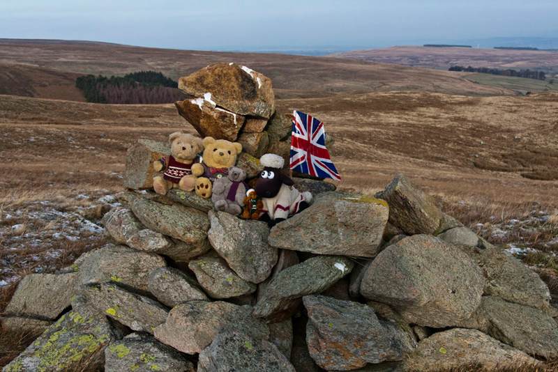
So soon we were at the large cairn on Bampton Fell, which we scrambled up to record reaching the summit. "Thanks for getting the flag out again", called out Allen.
This done, Shaun said, "just Low Kop now to complete the summits. It's roughly west from here."
"Thanks lad. I'll just use the compass to get the correct bearing."
No pun intended.
Descending from Bampton
Fell we joined a track that then wound up the hillside to come to another track. According to the map there should have been a
track going right to the summit, but this seemed to have
disappeared. So we just walked on up and soon reached the flat
top.
"No cairn", commented Tetley.
Dad found the seemingly highest point and
he kindly let us sit on the map case to have our picture taken. "Thanks for saving us from sitting on the
frosty ground", said Grizzly.
That done we returned to the track, Shaun saying, "We go left and need to find the path to the bridge over
Measand Beck."
Scratching his head, Little Eric said, "unbelievably this is the same path we walked
from Bampton Fell."
"Maybe the map is not quite correct", suggested Allen, "or we are not on the path we think we are on the map. There are more than one."
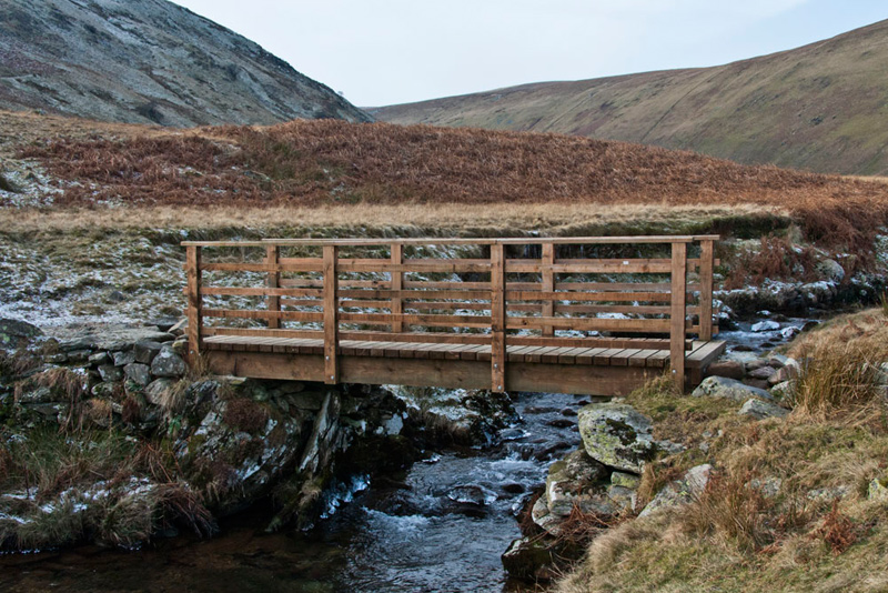
As we dropped down a good path branched right. "That's the one to the bridge over Measand Beck", confirmed Shaun.
It does not really show in the
photograph but the "rock" in the centre of the stream
under the bridge was actually a solid block of ice.
"I assume we follow the path from the bridge", said Little Eric.
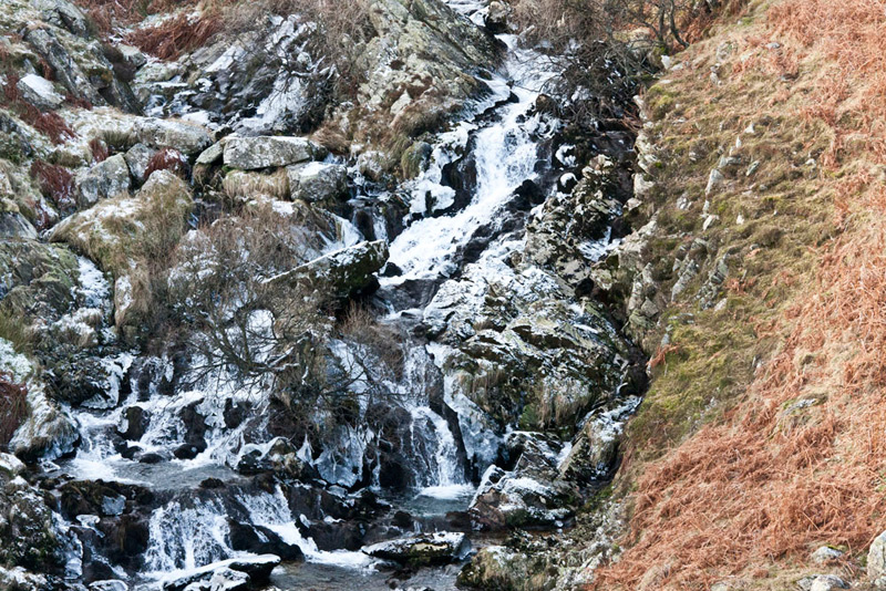
"No lad", replied Shaun. "Birkett says to stay on this side and descend the left side of the beck."
It was soon apparent that this path is really not in general use
and so was at times hard to follow. The bonus was the great views afforded of the waterfalls called The Forces.
Further views of more falls were to
be had standing on the edge of a rather large drop. "We are always
relieved that you are so sure footed", said Tetley, who with the rest of us was peering over the edge."
Eventually the shore of
Haweswater was reached. A wide track follows the shoreline. At times
this was rather tricky to negotiate as the lying pools of water
had formed into solid ice. Dad was careful and thankfully no mishaps occurred.
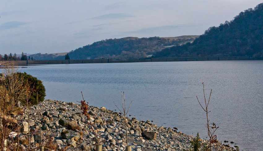
Intermittently there were views along the lake towards the dam.
The stone "beach" in this
photo is indicative of how dry it had been lately as the
reservoir was not completely full. A sturdy fence
prevents access to the shoreline. The water is deep and people
would be foolish to cross the fence.
Soon we reached the gate
into the wood that we had used at the start of the walk. "Look", whispered Allen. "A red squirrel."
We were
very excited about this.
They are in danger of extinction caused by the larger greys, and
the Lake District is one of their few remaining strongholds. So
we were privileged to see one.
The car was soon reached and once
changed Dad set off for home.
"Are you stopping for refreshments?", asked Tetley.
"Yes lad, I'm going to Junction 37
Services just off the M6."
While we had our picnic in the car with warming mugs of tea, Dad enjoyed a large plateful of delicious beef
stew with new potatoes and vegetables.
Then it was an easy drive south on the motorway home.
"Thanks Dad for a super walk", said Grizzly.
"Good to get our 2009 campaign underway", added Tetley.