This adventure started on 14th
September 2008, but was actually only destined to be completed on
19th March 2009. No, we were not camping out for all
that time. As you will see the first walk had to be aborted, due to an unfortunate incident. It was
only on the second date that Dad finally laid the ghost so to
speak. So, here are the accounts of those two walks.
GRASMERE & SOUR MILK GILL
Summary
Date - 14th September 2008
Distance - 2.5 miles
Map - OL7
Start point -
Broadgate Meadow car
park (NY 338077)
The Walk
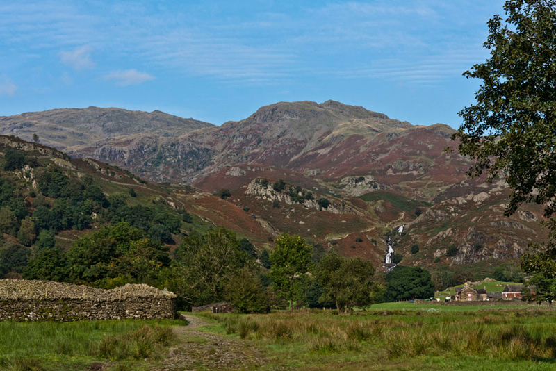
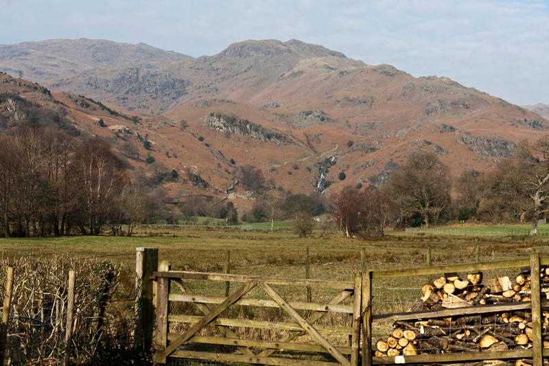
On this fateful day we started out
from the very popular village of Grasmere. Just on the outskirts
is Dove Cottage once the home of William Wordsworth, and indeed he
is buried in the churchyard.
We were full of anticipation, none more so than Little Eric and Allen.
"It will be a catchup for us both", commented Little Eric. "More so for you Allen, as you are more likely than I to eventually complete the Wainwright challenge."
"Yes pal, but it will mean we do not have to return to these summits, and there is the prospect of ticking off another Birkett."
If there can be any compensation for
what was to happen, the fact that there was a power cut in Grasmere
this morning, meant that the car park machine was not working, so
saving Dad the £6 fee.
So off we went, full of hope and optimism, Shaun saying, "we take the Easdale Road."
Soon after crossing Goody Bridge, Shaun issued further instructions, "it is along that signed path
through woodland and on to the wide path to Easdale Tarn via Sour Milk
Gill."
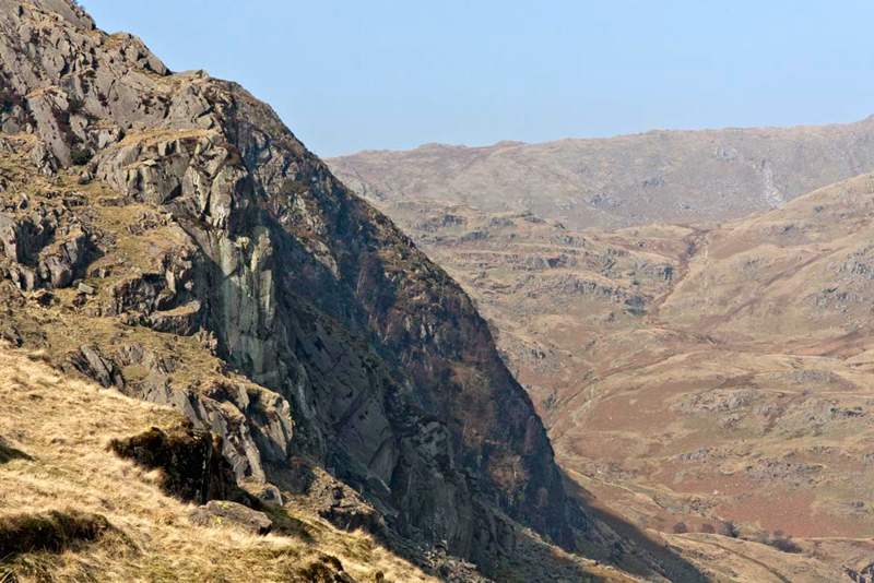
Seeing the view towards Sour Milk Gill, Tetley said, "that's Tarn
Crag with the notched top and behind is Codale Head. The first two objectives of the day."
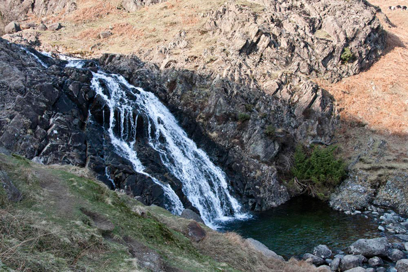
Dad put best foot forward and after the level section, we began the ascent the path rising beside Sour Milk Gill and passing the waterfalls.
Just past these we reached level
ground. There were a good few people out, and all but Dad
continued on the popular path to Easdale Tarn.
Shaun said, "we however need to cross the gill to get to the narrow path that ascends the east ridge
of Tarn Crag."
On the far side the ground was very boggy and this
sadly was where disaster struck, as Dad slipped and his left leg
folded under him as he fell backwards, crying out in pain.
"Oh Dad", called out Little Eric. "Are you badly hurt."
He gingerly picked himself up and rested
by a rock, saying, "not sure lad. It is certainly very painful, but if I rest a while it will pass."
Determined to walk on, Dad began to climb the path on the east ridge, but he was limping.
Grizzly said, "Dad I think you have hurt yourself more than you think. It really is not wise for us to carry on."
"Yes", agreed Allen. "I dearly want to bag these summits, but they will be there another day."
"I've not broken my ankle as I can still walk, but it must be quite severely sprained", replied Dad. " You are quite right. We will have to abort the walk today."
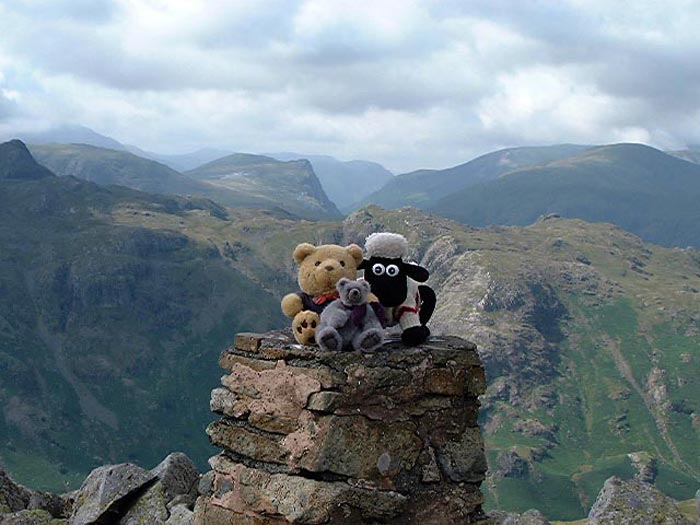
If we had made it to Tarn Crag
this is the cairn, where Shaun, Tetley and Grizzly had sat when they climbed in November
2004.
"Struggling as you are, I do not think it would be wise for you cross the gill on those rough stones. Better to descend via Stythwaite Steps, where there is a footbridge", said Shaun.
"Yes you are right, lad."
Slowly, resting frequently, Dad made it down to the footbridge, and then on along rough
path by the beck. We had noted that there was a long
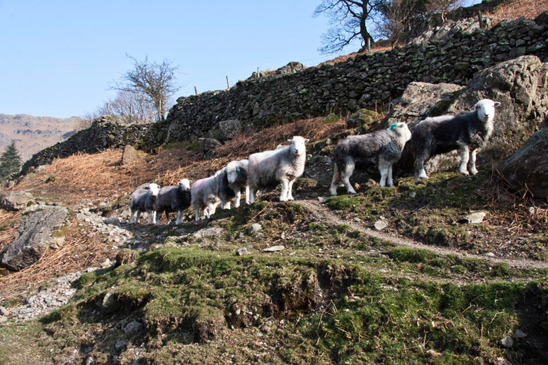
line of Herdwick sheep coming along a distant path. Suddenly they were right behind and also in front of us, bleating away.
"They are talking to you Shaun", said Tetley.
They stopped at a Brimmer Head Farm just a
little further down where we were completely surrounded.
To some walkers Dad said, "I am not responsible for
bringing the sheep down."
Another walker passing and seeing Shaun, commented, "you've put one in your rucksack."
Soon now, the Easdale
road was reached and then to Dad's great relief, the car. We all
had our picnic, before Dad drove us home. One other compensation
today was that while it started off blue skies, the cloud and
mist soon obscured the tops.
As Dad had thought, thankfully it was nothing more than
a very severe sprain, but it did keep us confined to barracks for five
weeks. Another annoyance to Dad and us was that this was during some good weather, which
was a rarity in 2008.
"Have no fear lads, the hill are not going anywhere, and I promise we will do this walk."
TARN CRAG, COLDALE HEAD, HIGH RAISE, SERGEANT MAN & BLEA RIGG from GRASMERE
Summary
Date - 19th March 2009
Distance - 10 miles
Map - OL6/7
Start point -
Broadgate Meadow car
park (NY 338077)
Summits Achieved
Name
Height (ft)
Height (m)
Grid Ref
Tarn Crag
1807
551
NY 3036 0930
Codale Head
2401
732
NY 2890 0908
High Raise
2500
762
NY 2807 0954
Sergeant Man
2414
736
NY 2864 0889
Blea Rigg
1776
541
NY 3016 0783
Preface
Allen was engaged in one of his favourite pastimes. Drinking tea and dipping into the biscuit tin.
His peace and that of Shaun, Grizzly and Little Eric was shattered by Tetley bursting into the room. "I bring news of our next walk on Thursday, and you are going to be very happy Allen. Dad has said it is about time he laid the ghost of the walk from Grasmere, that ended in disaster last September.
"Great", cheered Allen. "That means that Little Eric and I will tick off four outstanding Wainwrights.
"And, added Grizzly, another Birkett."
Shaun said, "we must at all costs avoid that boggy area where Dad fell, so I would encourage him to use the Stythwaite Steps route where there is the bridge over Easdale Beck."
"I'm sure Dad will agree", replied Little Eric.
The Walk
We were up early and dashed out to the car, as soon as we heard Dad slam the boot shut after loading his gear.
"Be careful", called out Uncle Brian, "we all know what happened last time."
"I will mate. That boggy area where I fell will be avoided I can assure you", Dad replied.
A pleasant drive to Grasmere, Tetley saying, "the weather has been super this week, the best so far this year, and we are in for another clear sunny day today."
We parked again at Broadgate. "No power cut today", commented Grizzly as Dad fed the machine to get the ticket.
Dad was soon ready and with us settled into his rucksack, Shaun said as he had last time, "the route is along the Easdale Road."
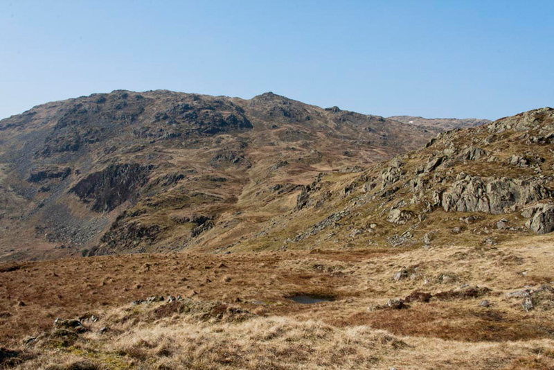
Soon the view opened out, Allen pointing and enthusing, "there's our first objective, Tarn Crag, with Codale Head behind."
"Sour Milk Gill is in the centre", said Tetley. "You are going to avoid the need to cross that today, aren't you Dad."
"Yes lad, I intend to reverse the descent route we took last September, past Brimmer Head Farm."
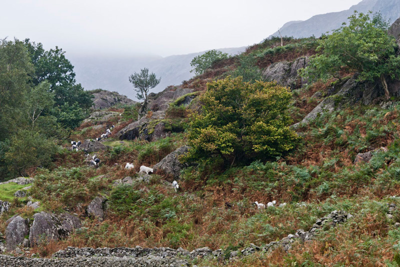
As we walked
along the rough track we were surprised to see again those
Herdwick sheep. Little Eric commented, "they must have come to greet you Shaun, and perhaps
to wish you well Dad, for the walk today."
"Just love the Herdwicks", said Tetley. "So important to the Lake District."
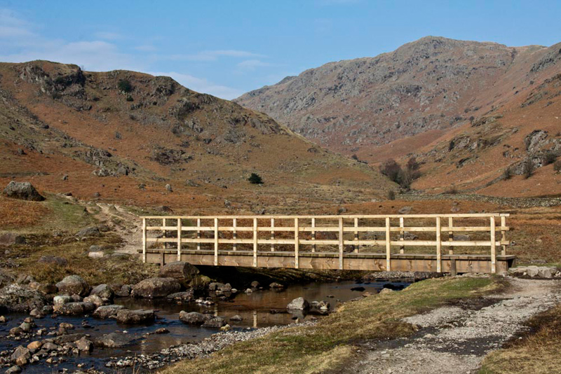
Continuing up the valley we soon
reached Stythwaite Steps, so named for the stepping stones across
Easdale Gill. "It is good that a bridge has been provided for safe crossing in all conditions, such as the beck being in spate", said Grizzly.
Shaun said", a path continues on this side up Far Easdale. The fell rising on the right is Gibson Knott."
"We all climbed that in December 2005", said Tetley. Then adding, "that was before you were adopted, of course Little Eric."
"Our route is across the beck", instructed Shaun.
The stepping stones can be seen in the
foreground, which Dad skipped safely across today, and as he did, Little Eric said, "I know all will be well today, and our objectives will be achieved."
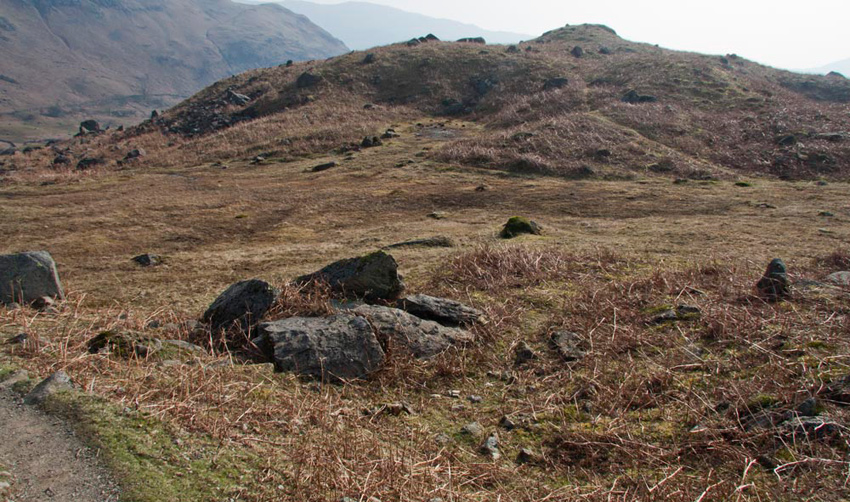
A steepish climb now brought us to
the scene of the disaster, at the foot of Tarn
Crag. We gave the boggy area the evil eye!
This avoided; we now started the
steep ascent of the east ridge of Tarn Crag.
"Finally" cheered Allen, "Little Eric and I are on new ground."
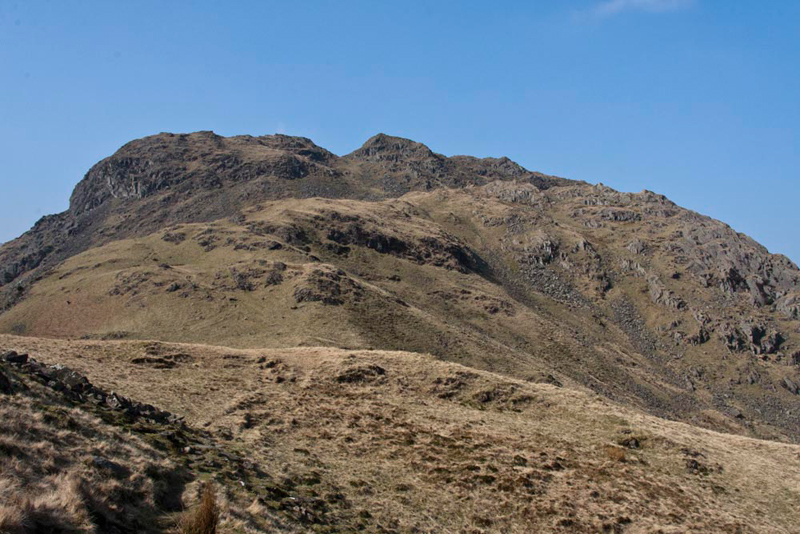
The path surmounted a number of smaller rises
including Greathead Crag. To the right was the precipitous Deer
Bields Crag, below the summit.
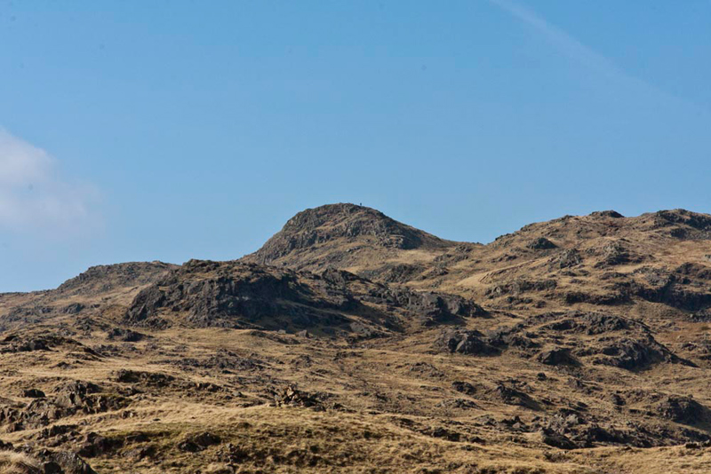
Looking ahead, Grizzly said, "just one more rise to cross, Dad, before the final ascent to the summit."
"The summit is the peak on the right of
the notch", said Tetley.
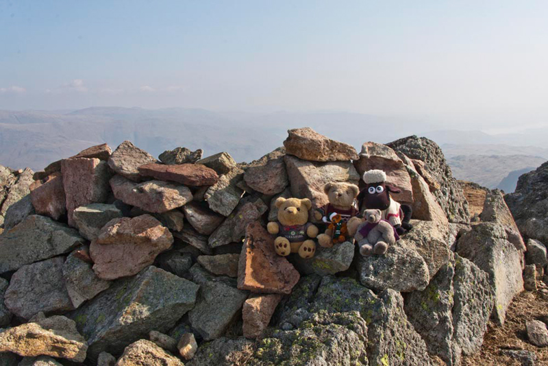
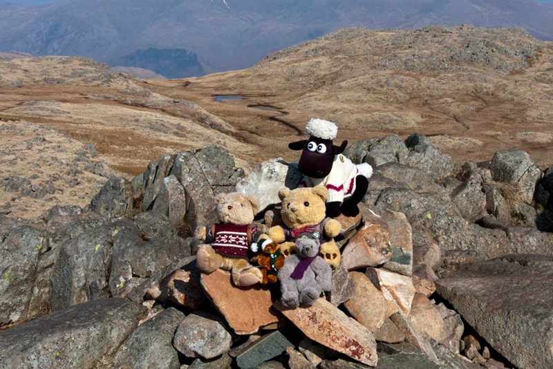
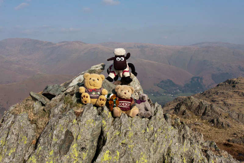
Soon there we jumped out and settled at the cairn for our picture. Allen cheered, "at least Little Eric and I will be
on it this time too."
Shaun said, "and let's give a big cheer to Dad for finally bringing us all here."
"It should be easier from here", mused Little Eric.
"Maybe, maybe not", replied Dad. "We are at 1800 feet, but our furthest objective High Raise is 2500 feet. So still quite a lot of climbing to go"
"There's the next section", said Shaun, looking ahead. "Up to and over that ridge that is Codale Head. According to Birkett a line of cairns is supposed to mark the route."
Dad strode off picking his way across the pretty pathless terrain, saying, "I'm going to aim for and then climb the gully just to the left of that little prominence that is the highest point in view."
As we proceeded, Tetley remarked, "no sign of those cairns. They seem to have
just disappeared."
Soon after topping the gully, the ground levelled
off and it was just a short walk to reach the small cairn on
Codale Head.
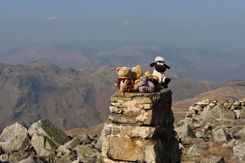
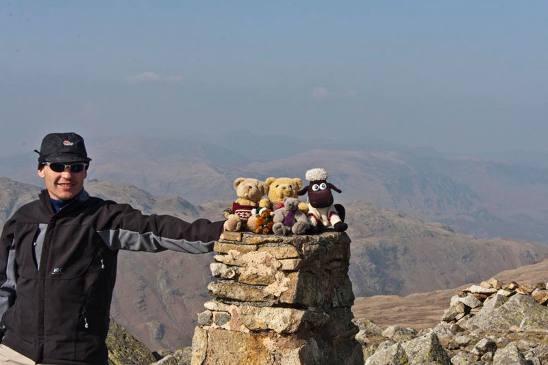
"Come on pals", called out Grizzly. "Time for our picture again."
"That's another one of the Birkett summits ticked off", said Allen.
"Yes lad, all of us have bagged it", replied Dad.
"Not far to High Raise now", Shaun said. "Half a mile and just 100 feet of climb."
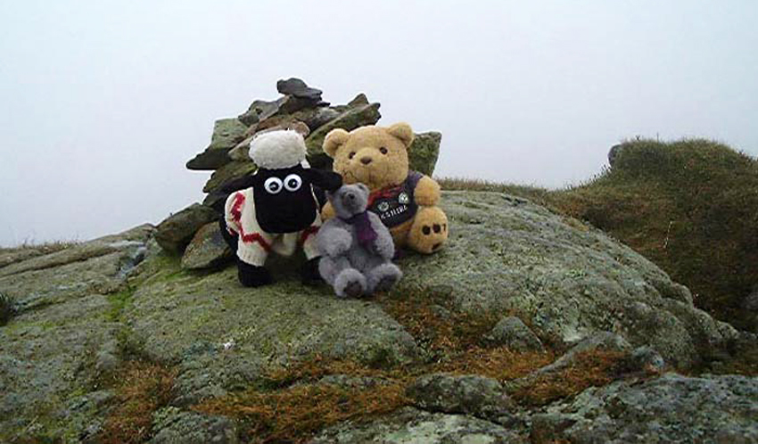
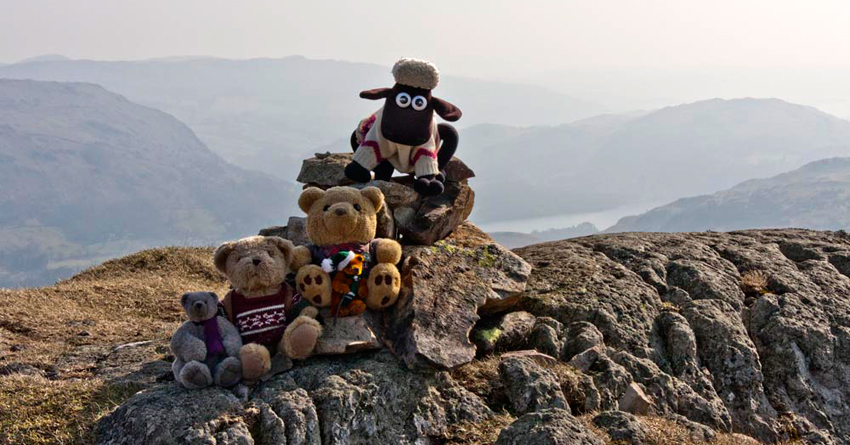
Dad said, "in 2004 Dad I took a super shot of Shaun,
Tetley & Grizzly there on the trig point and I want to try and replicate it today."
Sadly though, the weather was not as clear
and the fells behind were obscured. It was rather windy too, but
being the plucky lot we are, we insisted on sitting on the trig
point. Dad focused the camera on us, but just at that moment
there was a gust of wind, causing Shaun and Tetley to take a dive off the
back.
"We are ok", called out Tetley, as he and Shaun picked themselves up.
Before attempting the picture, Dad had chatted to a group of walkers who were resting here. We think that they were from Tibet. These fells must seem tiny to them, being overlooked by the Himalayas in their own country.
They were amused by Dad trying to take our picture, and one of the guides kindly agreed to hold on to us while this was accomplished.
Grizzly said, "when it is clear the views to the fells above the Honister Pass are superb. When the story is written, we aught to include that shot taken in 2004."
The pointed top
above Tetley’s head is Honister Crag rising behind to
Fleetwith Pike. To the left of this is Grey Knotts. Below
Honister Crag runs Honister Pass above which to the right is
Hindscarth and Dale Head.
Some months after Dad took this,
there was a feature about a Teddy Bear exhibition, on our local
news programme North West Tonight. The presenter asked if viewers had any special stories. Well, as you can guess, Dad could not wait to
write, sending this photograph. The very next night as Dianne Oxberry presented the weather forecast, we were
famous TV stars!
Well, enough of that, and back to
the walk.
"Time for lunch don't you think Dad", said Allen hopefully, rubbing his tummy in anticipation of the sandwiches, cake and tea."
"Yes lad", agreed Dad. "Then I will be suitably fortified for the rest of the adventure."
Lunch over, Shaun then issued directions. "We take the same path back, but then veer off a bit right to that pointed top, which is our next summit, Sergeant Man."
Arriving we quickly scrambled out onto the cairn.
During the time here, we met a number of people.
First a Polish
couple, who had no map with them, and so were unaware that this summit
was Sergeant Man. They thought it was High Raise. Dad did his best to orientate them,
and they wandered off. The lady said, "in Poland the routes have many signposts"
As they wandered off, Allen said, "it is just as well the day is clear, for if cloud came down, they could have been in trouble.
Even if you know the fells and paths well it is essential to have a map and compass and nowadays a GPS
device."
He chatted to another couple who it turned out were from the Nottingham area. So Dad told them about Brian and that he was born in Codnor.
The lady said, "my grandparents came from Codnor."
Finally he talked to a gentleman who was on his own, about the enjoyment of being out on the fells. He said, "I have lived here since 1973, and been up on the fells many many times."
Dad commented, "the lads and I are doing the Birketts."
"I've done those", he replied, "all except one, which I am sure you will guess."
"Ahh, Pillar Rock", replied Dad.
"Yes. I have stood at the bottom and looked to see if there is a safe route to walk up, but it is not the case."
"Well", replied Dad, "when we complete the challenge that one will remain unclimbed."
The social interlude over, and with us tucked in the rucksack, Grizzly asked, "which way now?"
"Along that clear path below"
replied Shaun.
Striding off, we made the descent, Dad pausing to take this shot looking back to Sergeant Man.
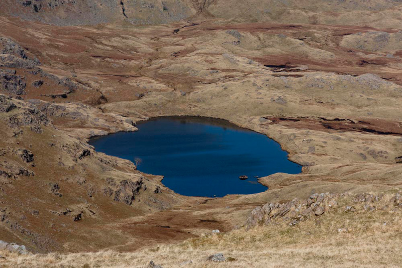
The valleys of Codale and Easdale have tarns, Little Eric calling out, "wow, look how blue Codale Tarn is. Beautiful."
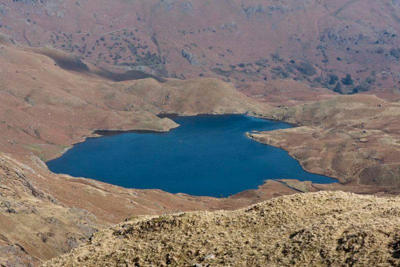
"And Easdale Tarn", pointed Grizzly. "Superb."
At a junction of paths, Shaun said, "going ahead leads to Stickle Tarn, while the one left descends to Easdale Tarn and then down by Sour Milk Gill. We need to take the route in between along that long ridge that will eventually lead us to Blea Rigg, our final summit today."
As we continued the path meandered
avoiding a few boggy areas, and passing a number of rocky tops.
Little Eric said, "haven't we gone too far, Dad."
"No pal", said Shaun. "Dad is on track."
Then very shortly Dad suddenly struck left
uphill, passing two tiny tarns and then climbing to a high point
adorned with a small cairn.
Shaun said "this summit is actually quite tricky to
find amongst other outcrops. I'll just check the plan in the Wainwright guide." Then looking up from the book, "Dad is spot on, we are at the summit."
"I
should never have doubted you", said Little Eric. "Time to hop out for our final summit photograph."
"Last summit", cheered Allen. "Thank you Dad, finally the ghost has been laid."
"Not too far to go now?" asked Little Eric.
"Quite a way actually", replied Shaun. "About three miles to Grasmere."
"Phew", said Grizzly. "We are sure
lucky to be carried in that rucksack.
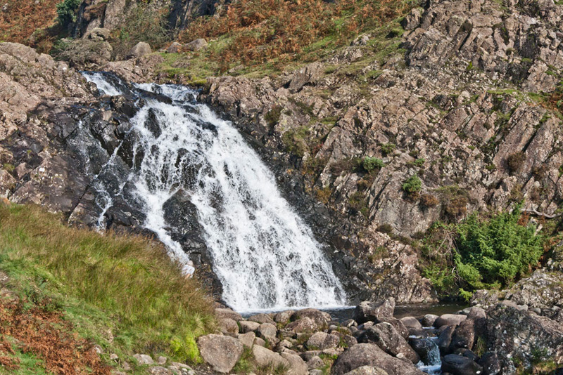
So, first there was the steep descent
to Easdale Tarn, where we joined the main path. There going right the descent continued to after some distance pass the lovely waterfalls on Sour Milk Gill.
Onward the clear path falls to the
valley, leading to the Easdale Road and Grasmere.
We were exhilarated by the walk but rather tired too, so
gratefully settled in the car to have another picnic.
"Thank you Dad", said Allen. "You are the best Dad in the world and I love you so much."
"You're welcome lad. I am glad to have got it done without mishap this time."
"Refreshment time?", asked Tetley.
"Yes lad. I'm going to the Miller Howe Café for an expensive pot of tea and
cake."
"Such are the prices here in Grasmere, being a major tourist honey pot
in the Lake District", commented Allen.
A wonderful day and we all slept
very well that night.