TARN
CRAG, HARROP PIKE, GREY CRAG, & GREAT HOWE
from SADGILL BRIDGE, LONGSLEDDALE
Summary
Date - 19th July 2009
Distance - 7 miles
Map - OL7
Start point -
Longsleddale,
Sadgill Bridge (NY 483057)
Summits Achieved
Name
Height (ft)
Height (m)
Grid Ref
Tarn Crag on Sleddale Fell
2178
664
NY 4885 0785
Harrop Pike
2090
637
NY 5007 0781
Grey Crag (Longsleddale)
2093
638
NY 4971 0717
Great Howe (Longsleddale)
1621
494
NY 4888 0639
Preface
"There seems to be a good
forecast for tomorrow", said Shaun. "But after the
incorrect one last Thursday, when Dad got soaked, I wonder if we
will be walking."
"That was at Carron Crag. The rain was torrential. We were lucky, keeping dry deeply snuggled in Dad's rucksack. There was forest, but it did no good as the water just ran off the trees", said Grizzly.
"Poor Dad", went on Little Eric, "but as he has told us it is not the first time he got soaked. He remembers well a walk with Uncle Eric from Aira Force. It just rained and rained and rained. A long time ago even before any of us were adopted."
"I'll go and see, about tomorrow",
volunteered Tetley.
He was soon back, and full of
excitement.
"Yes we are walking. You'll be very pleased Allen. We are going to Longsleddale again, to
climb a few tops, including Tarn Crag, which is one of your
outstanding Wainwrights and you and Little Eric will get a Birkett catch-up with Great Howe."
"That's great" cried
Allen. "I can't wait. Another step closer on the Wainwright challenge."
The Walk
Sunday dawned and we were up early making the picnic and stowing it in Allen's rucksack.
Dad got his gear together, and when we heard him taking it to the
car, we rushed out and settled on the front seat, eager to be off.
Shaun had been right about the weather forecast. A glorious day was in prospect with plenty of sunny periods, but a cool wind at times.
Through
Kendal, we headed north along the A6, the old road to Scotland,
then once again took the narrow road signed Longsleddale. The
road is single track for most of its length to where it ends at
Sadgill Bridge, some 5.5 miles.
Part way, Dad said, "I need to stop at the public convenience."
Had this not been necessary, it is likely that
he would not have then met the
farmer in the landrover.
"Oh heck", called out Grizzly, as Dad reversed until is was possible to pass.
"OK", said Dad. "Let's have another go."
After a little way a tractor and muck
spreader, loomed before us!! "Oh no, not again", cried Little Eric. "You're going to need even more space this time."
"So into reverse gear again", sighed Dad. Finally a wide enough pull-in was reached and the farmer sailed by, waving a hand in acknowledgment.
Meeting no other vehicles, we arrived at Sadgill, where just one
other car was parked.
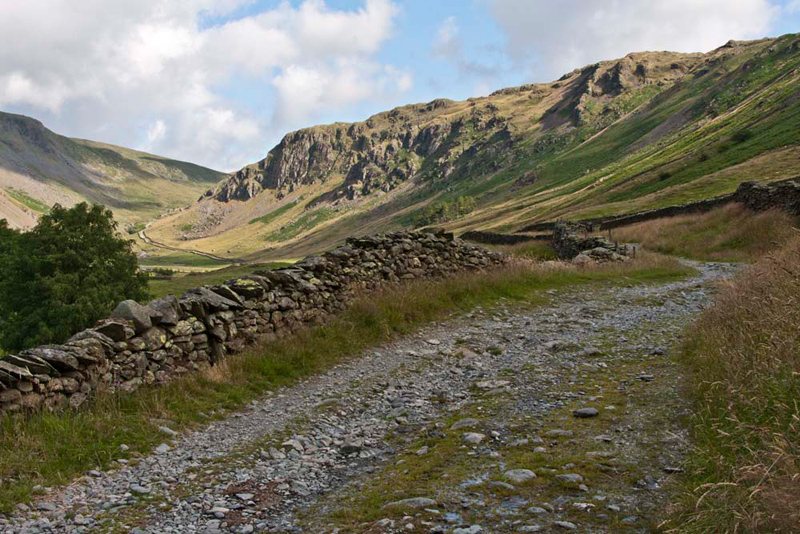
Soon ready, and with us tucked in the rucksack, Shaun said, "This time we do not cross the bridge, but head along the track."
This is seen below stretching away into the
distance below Buckbarrow Crag. It leads to the Gatesgarth Pass
and eventually down into Mardale & Haweswater.
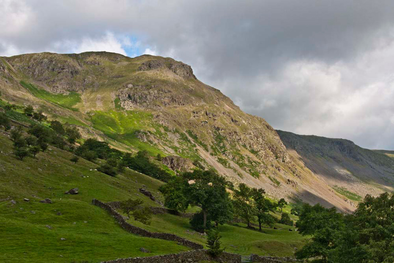
From the start the views were
spectacular. The air was very clear, so the fells were picked out
in high definition - you can't beat the real thing! "That's Goat Scar immediately
ahead on the left", pointed Tetley. "We climbed that in July 2006, when we did the Kentmere Horseshoe. It is actually a Birkett summit."
"That was before I was born", replied Little Eric. "Hopefully some time I will be able to tick it off."
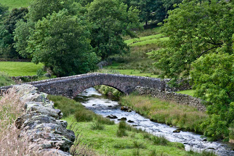
Allen then called out, "isn't
that view back to Sadgill Bridge nice?"
"Yes", concurred Grizzly,
"I think you should take it Dad." Then he went on, "It dates from the 17th or early 18th centuries, being widened on the far side during the 19th century. It carries grade 11 listed status. The name Sadgill probably means 'the ravine/stream by the sheiling'. This is from the Old Norse saetr 'sheiling' and Old Norse gil 'ravine with a stream'. This is from Diana Whaley's book on Lake District Place Names."
As we strolled on, Dad met two
gentlemen, who it turned out owned the other car parked at the
start.
They said, "we are Birmingham, and have been overnighting at
the bothy, Mosedale Cottage in Mosedale."
"Oh yes. We saw that last February on a very snowy walk from Swindale."
"Where are you from?", asked one gentleman.
"Morecambe."
"Have you been to the Midland Hotel, since its recent restoration?"
"Actually no, but it looks splendid now, and once more is an asset to the town."
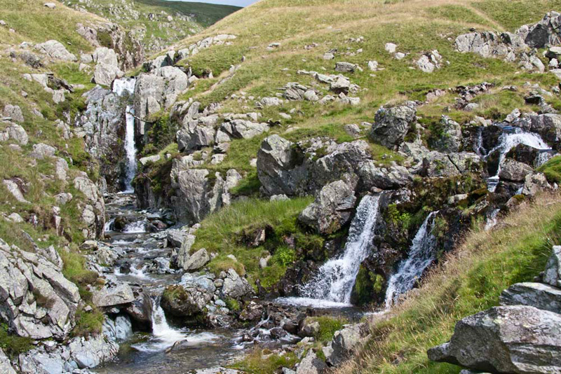
Continuing we
passed another group of walkers, as the path climbed. "Worth taking a shot of the waterfalls", said Little Eric.
After this steeper climb the track
levelled and once through the gate we reached the junction of
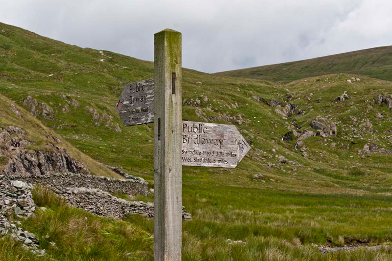
paths at Brownhowe Bottom.
Shaun said, "as the sign indicates, if we continued ahead a further two miles, the track would
bring us Mardale Head and Haweswater Reservoir. However
our route is right, crossing the stream, and follow the bridleway that
leads eventually through lonely Mosedale and then down to
Swindale."
"That was where we walked up from last February in the snow with Uncle Eric", said Allen. "The gentlemen from Birmingham will have come this way from Mosedale Cottage."
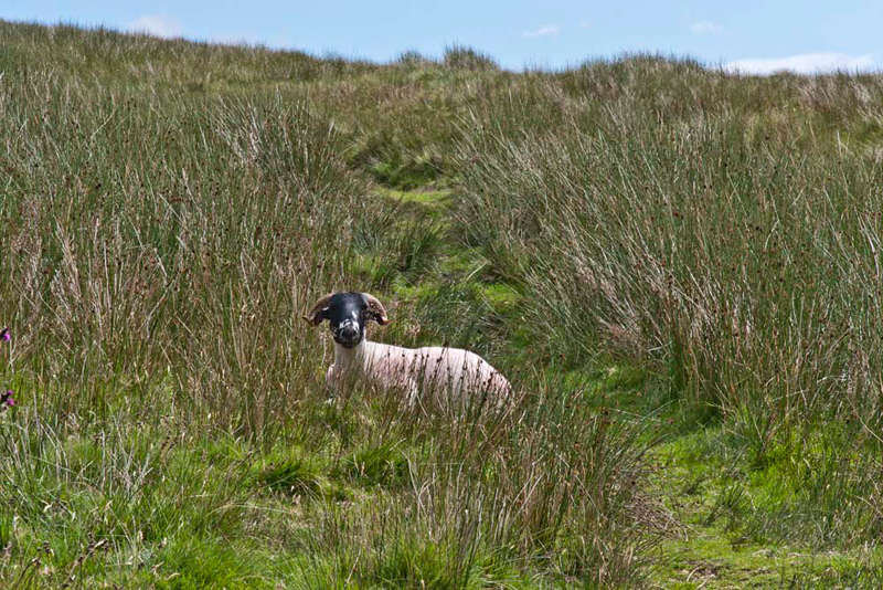
It had been dry so far underfoot,
but now the indistinct path was rather wet and boggy. At
one point a sheep barred (what an awful pun!) Dad's way. "Aww", said Dad. "It looks so comfortable, I'll walk in a circle to avoid disturbing it."
"How very considerate", replied Tetley.
The path climbed gently to come to
the fence with its gate and stile. Shaun instructed, "we leave the bridleway right, and
climb steeply that narrow path parallel to the fence
The view opened out below. "Wow", called Grizzly, "that's a superb view to lonely Mosedale. We can see the bothy, Mosedale Cottage too. In the Howes chapter of his Outlying Fells book, Wainwright describes Mosedale as 'desolation profound'."
Eventually, when the fence turned away left, Dad kept on along
the path to the summit of Tarn Crag.
"Hooray", shouted Allen,
"that's another Wainwright ticked off."
"Me too", called out
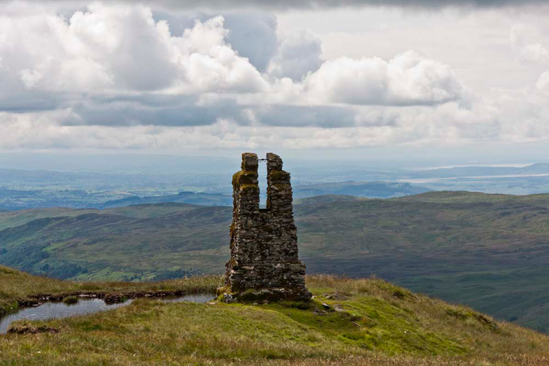
Little Eric. Then he pointed, "what is that odd looking structure over there?"
Grizzly replied, "it is an old survey tower,
used by the engineers of Manchester Corporation, when
constructing the Longsleddale tunnel conveying the Haweswater
Aqueduct south."
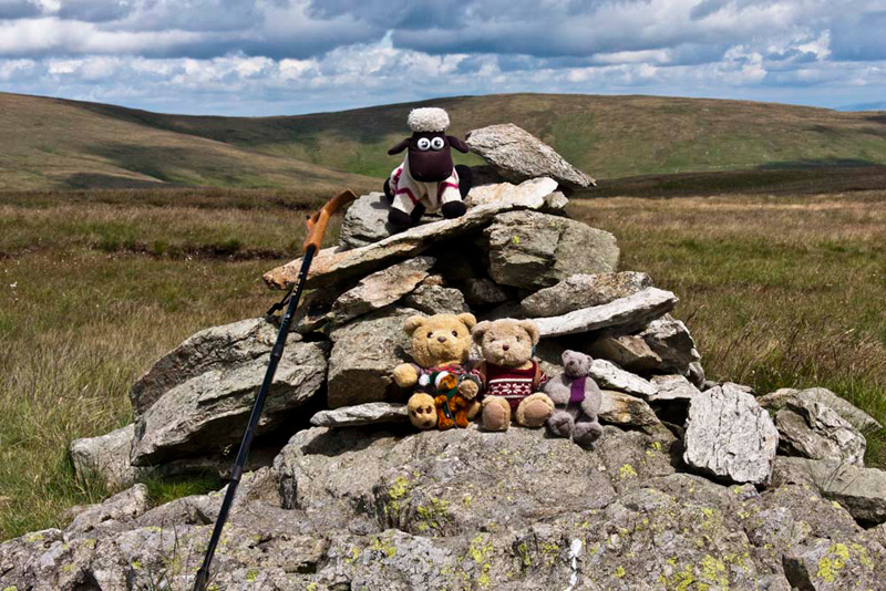
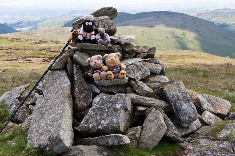
"At the cairn, Allen called out, "come on pals picture time."
Grizzly informed us, "the name means 'the rocky height by the small mountain pool'. In this case Greycrag Tarn, although this has disappeared and is now just a boggy area."
This was evident as rejoining the fence we then
followed it down into the boggy hollow where once Graycrag Tarn was.
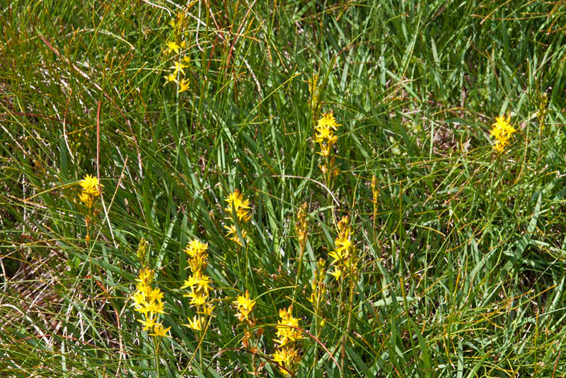
Near the
path these pretty yellow flowers were in bloom. "I wonder what they are called", mused Tetley.
"We'll just have to enlist the help of our hug flora and fauna experts, Bracken and Moss", replied Allen.
Straight away they said, "it's Bog Asphodel."
"Thanks pals. You are so knowledgeable", replied Allen.
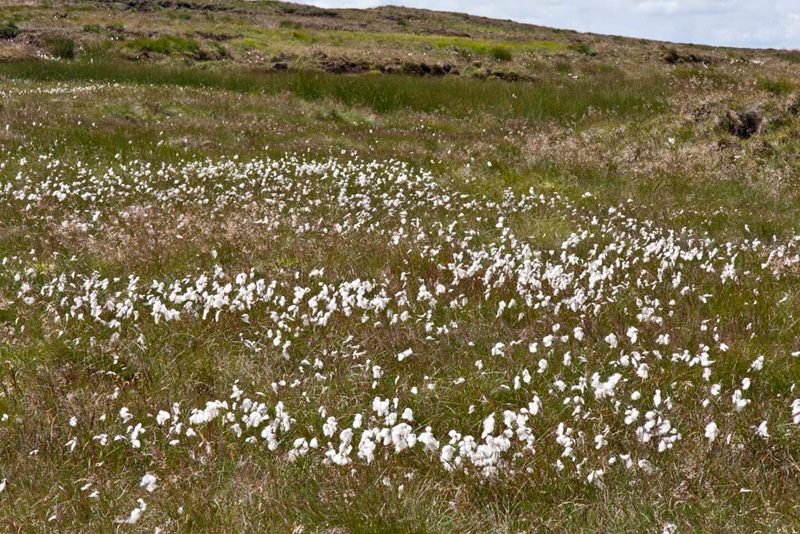
Just a little further on was this large
area of cotton grass.
The next objective was the Birkett summit of Harrop Pike. At the fence corner, Shaun said, "we follow it
left."
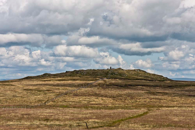
Splashing through the boggy terrain Dad headed towards it. This shot taken later on the return, shows what we had to cross.
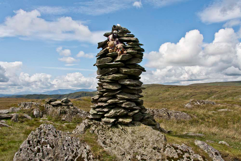
As can be seen the summit is a
broad rocky knoll, topped by an impressive cairn.
"Ooh that's very tall"
said Little Eric.
"No problem", said Allen,
getting the rope he carries with him.
He slung it up around a protruding
stone, secured it, and then we were able to climb up for our
picture.
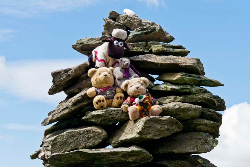
"Will you take a close-up, please Dad", called out Little Eric.
Whilst up there we enjoyed the
superb views of the Shap Fells, all of which we had climbed, and
the distant Pennines. Safely down, Allen stowed his rope, and we got settled.
Shaun advised, "we have to retrace to the fence corner. Sorry Dad. More splashing through bog."
From there a clear path led to Grey
Crag and its summit cairn. "Super", cheered Allen, "that's the second Wainwright you have bagged today, Little Eric."
Grizzly said, "the name means, 'the grey rocky heights'."
Note Dad's new pristine stick, his third following losing the first at Brownber Head, and the second at Sharp Knott just 12 days ago. We wonder how long this one will last!
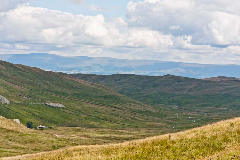
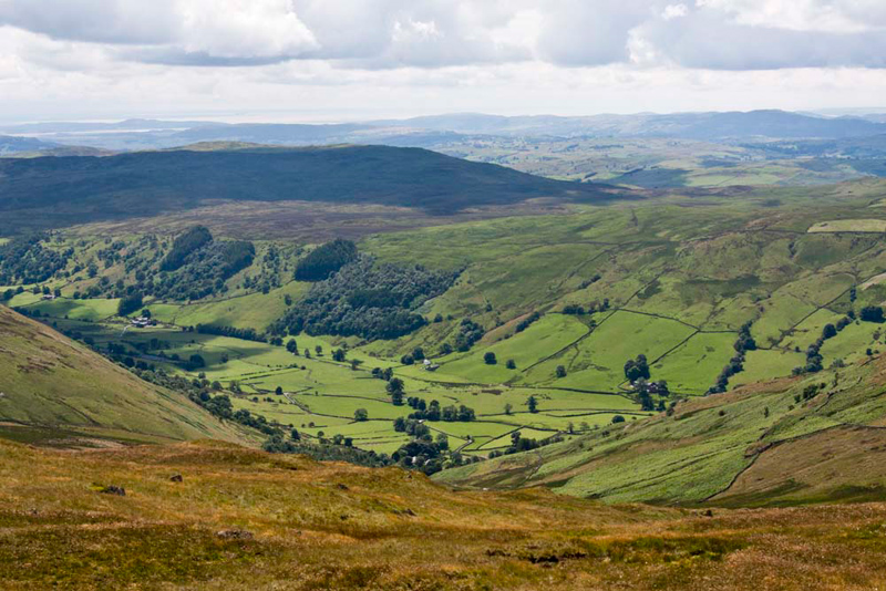
What superb views again", commented Allen, "especially that of Longsleddale."
Shaun said, "our route to Great Howe, is that clear path that meanders over the grass and through the rock outcrops."
Over a stile we continued along
the path, which then swung left along the spur of Great Howe. It was
here that we met the only other walker today, a lady from
Yorkshire. Dad chatted, as he does, and she mentioned that it had
been pouring with rain when she set off, so we were in the best
place today.
Walking on at a brisk pace Dad soon reached Great
Howe. "That grassy knoll just right of the path is the summit", pointed Tetley.
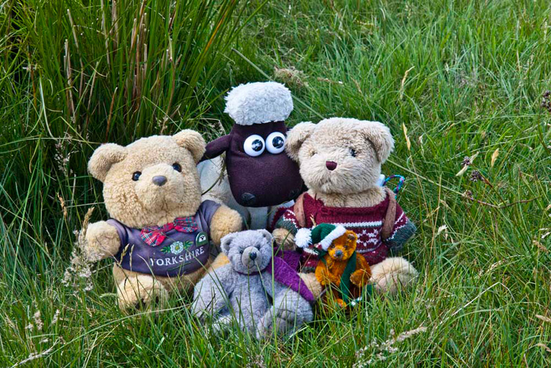
We jumped out and settled for Dad to take our final picture of the day. You can see a loop
of Allen's rope behind his left shoulder.
"The name literally means, 'the big hill'", informed Grizzly.
"Ok", said Allen, "all we have to do is get down to the valley."
Shaun said, "first we need to bear right down to that line of fence, which becomes the fell wall."
That done he told Dad, "we should cross the fence where it abuts the wall, and then bear right again finding a natural corridor down through the craggy ground."
Dad was careful and once this was accomplished the path continued down through thick bracken coming to a stile over the wall.
"Now go diagonally left across the field to that gate immediately above Sadgill Bridge", was Shaun's final instruction.
As we settled in the car, Tetley said, "in the words of Wallace
and Gromit that was yet an another 'Grand Day Out'."
"That's all the tops done in this area", said Allen, "so I guess it is unlikely we
will be here again for a while".
To Dad's relief the drive back
along the valley was clear, only meeting a farmer on his quad
bike near Garnett Bridge!
And just for clarity the summit tally today
- Allen bagged Tarn Crag & Great Howe, while Little Eric
bagged them all.