SCOPE
END, RED KNOTT, HIGH CRAGS (NEWLANDS), HINDSCARTH, DALE
HEAD & ROBINSON from NEWLANDS CHURCH
Summary
Date - 25th July 2009
Distance - 9 miles Ascent
- 3266ft
Map - OL4
Start point
Car park above
Chapel Bridge, Little Town, Newlands Valley (NY 232194)
Summits Achieved
Name
Height (ft)
Height (m)
Grid Ref
Scope End
1352
412
NY 2240 1830
Red Knott
1483
452
NY 2210 1795
High Crags (Newlands)
1736
529
NY 2175 1749
Hindscarth
2385
727
NY 2156 1651
Dale Head
2472
753
NY 2230 1532
Robinson
2418
737
NY 2018 1687
Preface
Grizzly, Little Eric and Tetley,
came in, to find Allen sitting in the corner looking very
miserable.
"Whatever is the matter?"
asked Grizzly.
"The weather for Sunday is
heavy rain and wind so it looks like we won't get to go out on
the hills", he replied
Just then Shaun trotted in, having
overheard Allen's remarks. "Cheer up" he said. "It
is Dad's Saturday off from the Lifeboat Shop, it is a brilliant
forecast to boot, and he says we are going Saturday."
"Where too?", enquired
Tetley.
"The Newlands Valley to climb
Hindscarth, Robinson and a few other tops", he replied.
Allen jumped up and ran round the
room cheering, and saying, "wonderful, that will be a few
more of my outstanding Wainwrights ticked off, and for you Little
Eric too."
The Walk
Saturday dawned with
clear skies, and we were up early and eagerly ready for the off.
As soon as we heard Dad loading his kit into the car we dashed
out and settled on the front passenger seat. Our route took us
north on the M6, passing the Howgill Fells, and we mused about
the walks we had done in the past on those hills. Onwards north
over Shap summit at 1035ft, and then the gentle descent to
Penrith where we joined the A66 heading west.
The high fells began
to come into view with Blencathra towering above on the right.
"That was some
day when we climbed that last time", called out Shaun.
"It certainly was,
and we reached all the numerous tops too", replied Allen. Only Hallsfell Top the highest point is a Wainwright. All the rest are Birketts including Hallsfell of course."
Soon we were passing
above Keswick, and then turned off along a narrow road through
the village of Portinscale. As we continued up the valley we
could see Causey Pike and the fells making up the Coledale round.
Then ahead we could see the objectives of today.
"Wow", said Little Eric, "we are in for some adventure today."
Soon though they
disappeared as the valley sides closed in. Now on a very narrow
road we reached a rough parking area and the start, near the tiny
hamlet of Little Town.
Dad got his boots on
and we settled into the rucksack, and then off we went. Just a
few yards took us over Chapel Bridge, then a few yards further a
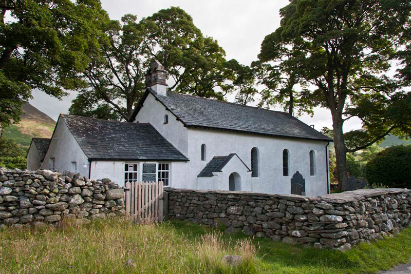
track led left passing the pretty Newlands Church.
It was rebuilt in 1843 on the site
of an earlier Church", said Grizzly. "The tiny building adjoining the Church was
the school, built by parishioners in 1887. It finally closed in
1967, and has recently been restored."
He then said, "in May 1826 William Wordsworth and
his daughter were on a walking trip, and the poet was so
impressed with the appearance of the Church through the trees,
that he wrote a poem 'To May'. It is on display in the Church."
Our final school lesson just now, Grizzly told us, "just before the parking area, we drove through the the hamlet of Little Town. This area
was made famous by Beatrix Potter as the home to Mrs Tiggy Winkle,
the story of which was dedicated to Lucy Carr, daughter of the
vicar of Newlands Church."
"Thank you, pal", replied Little Eric.
It is not often that we can see
most of our objectives from the start, but today was an exception.
"There's Robinson, our last summit today", pointed Tetley. "We will make the
steep descent along the rim of those dark crags and then continue
on along the level ridge. That however is for much later in the
day."
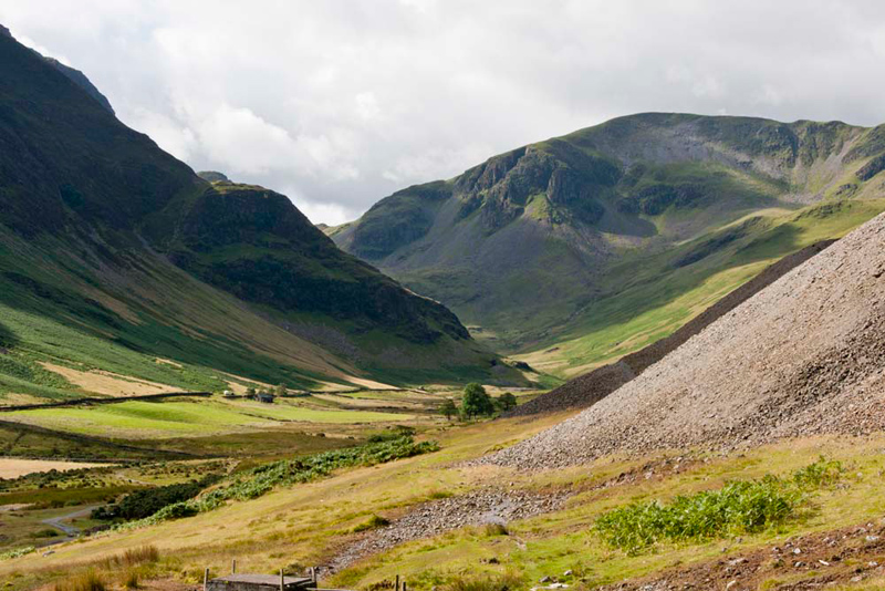
"To the left is Scope End", said Shaun. "Behind to the right on the ridge is High Crags, which will be our third summit. This is the focus of our initial ascent. Up the wide green
path snaking through the bracken, and then continuing much
narrower as a rocky scramble."
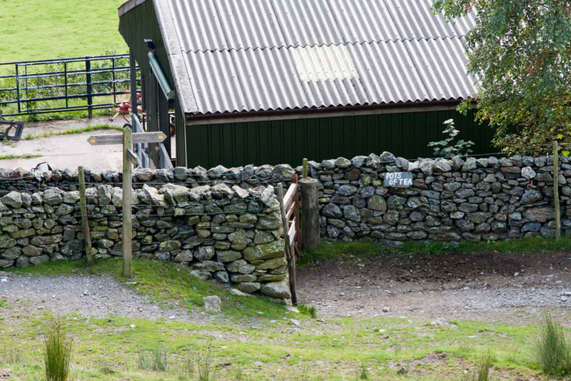
To reach this we strolled left from
the church along a track that led to Low Snab Farm. As Dad passed
through the gate at the end of the farm yard, he noticed this
sign on the wall.
"It's closed", cried
Allen.
"Too soon for tea anyway",
scolded Shaun.
"OK", sighed Dad
miserably, as he plodded his way up the path.
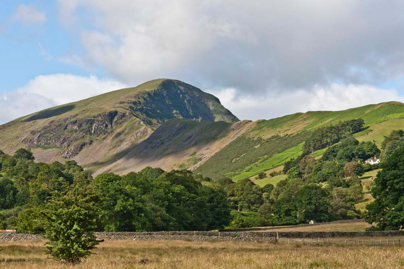
Then Tetley shouted, "just
look at that view along the valley, it's just incredible. That
summit is Dale Head, Allen. Dad is taking us there so you and
Little Eric can tick it off."
"Ooh, do take a picture Dad",
implored Little Eric.
"School time again", called out Grizzly. "the spoil heaps you
can see on the right are from the old Goldscope Mine. This
operated intermittently over a period of six centuries, eventually
closing in 1864. One of the oldest mines in the district, it was
also the most important in output, having rich veins of lead and
copper. Silver and gold too have been extracted. Its early
development on a large scale was undertaken by Germans, and its
long history has been marked by many adventures and much
litigation."
Now, the real climbing started and
soon we were on that green path through the bracken.
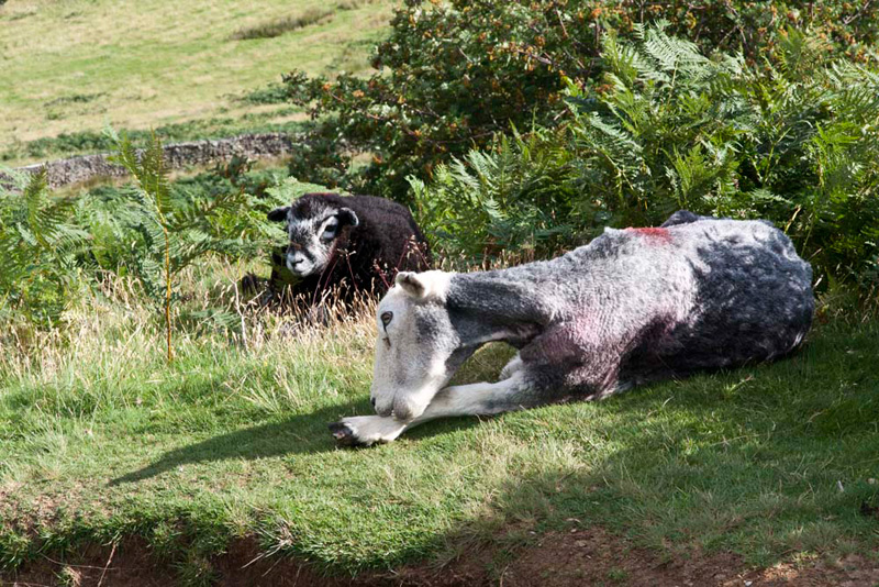
"Aww", pointed Shaun. "look there's a Herdwick lamb with its mother. How beautiful are the markings on its face."
Soon Dad was climbing the narrow
rocky path and then we crested the ridge, but as is often the case
there was another climb to be made before we reached the summit
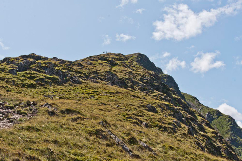
of Scope End. There is no cairn, and indeed the narrow path
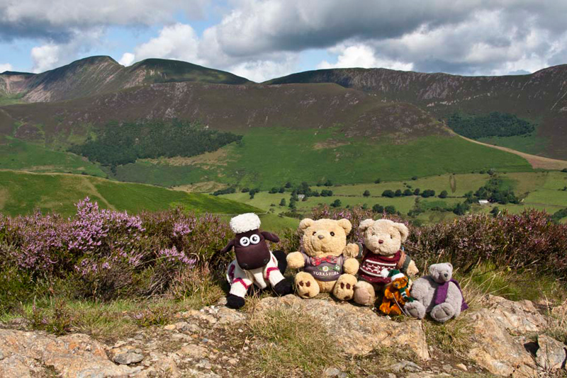
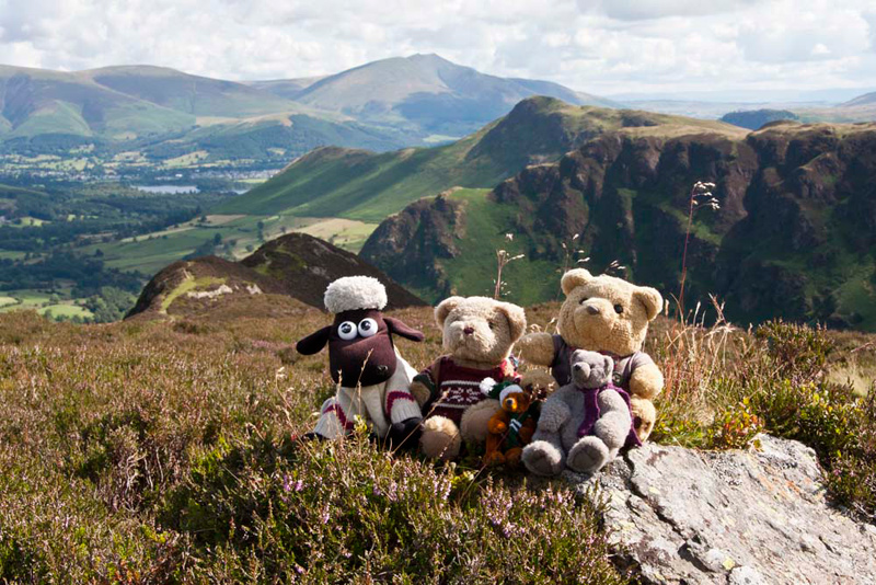
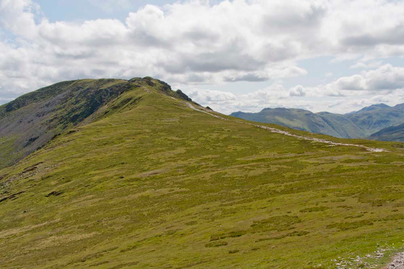
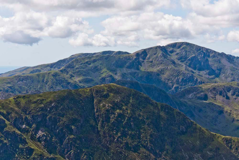
crosses the highest point, where we sat to have our picture taken. The backdrop of this is from the left Crag Hill, dropping to Sail, and the long ridge of Scar Crags. The ridge in front is Ard Crags.
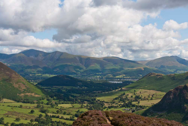
Then we turned to look at the view towards Keswick. "Absolutely awesome", cried Little Eric.
Tetley set the scene. "We can see part of Derwent Water. The tallest peak to the left is Skiddaw, with right Skiddaw Lower Man and Lesser Man. That then falls to Jenkin Hill and the ridge ends with Lonscale Fell in front of which is Latrigg. On the far right is of course Blencathra. More in the foreground the ridge right is Skelgill Bank, the initial part of the climb to Catbells."
"Thank you", replied Little Eric. "One final thing, what is the dark tree clad hill in the centre."
"Swinside. It is private land, so there is no actual right of way to the summit."
"Right lads, I know we could look at the view all day but there is a long way to go."
The path climbed on
very gently, and in about 10 minutes we arrived at Red Knott. "The summit is on that rocky
outcrop", pointed Shaun.
Distantly in the centre Blencathra is in view, with in front Skelgill Bank rising the rounded summit of Catbells, probably one of the most climbed summits in the area.
The ascent now gathered pace and a little under half an hour later the summit of High Crags was attained.
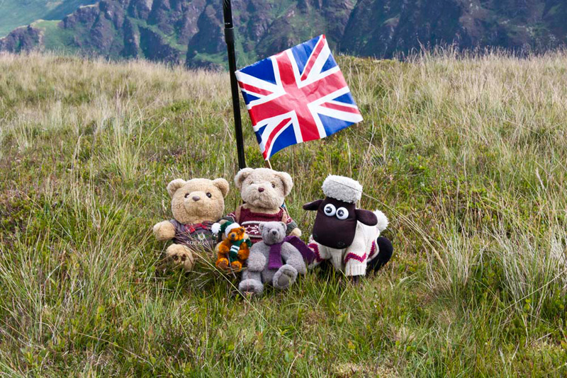
"There's no cairn", moaned Allen. "Will you get the flag out to brighten up the picture, please Dad."
"Right", commented Shaun, "that's the three Birkett tops done,
which we have all bagged. Now for our first Wainwright summit of the day, Hindscarth."
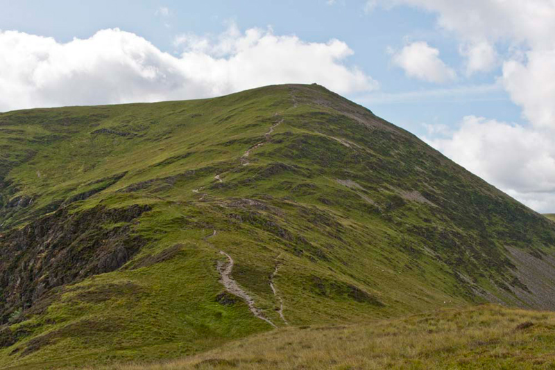
Looking ahead
we were dismayed to see how steep the climb was to be. "Oh dear", sighed Little Eric. "that will be a slog Dad."
We jumped into the rucksack, and
Dad shouldered it. Then taking a deep breath he said, "it's best foot forwards as once this is out of the way the rest will be easier."
Initially there was a descent to the col before the climb started
in earnest. He strode on and taking just the odd stop to catch
his breath, in half and hour we reached the crest, and in a few yards the large
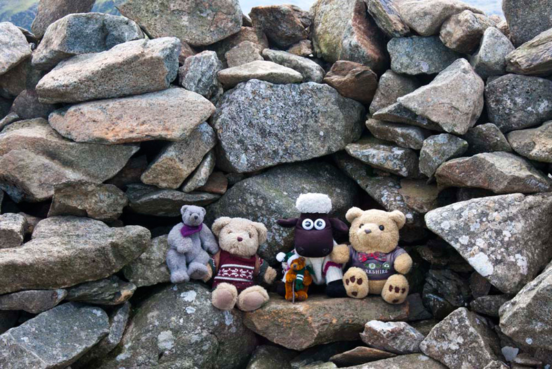
shelter/cairn on the summit.
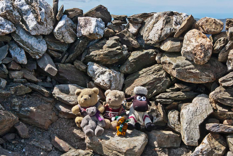
"Come on pals", cheered Allen, "let's get settled for our picture."
Grizzly said, "according to Diana Whaley, Hindscarth is and attractive but enigmatic name that appears to mean 'the pass of the hind or female deer', although there is no obvious gap in the landscape."
What wowed us though was the fact
that the view ahead had opened out, and was breathtaking to the
fells above Wasdale and Buttermere. More on that later.
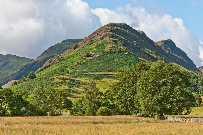
"There's Dale Head to the left", pointed Shaun. "The next objective."
The path cuts the corner under the
end of the Hindscarth Ridge, to join the path along Hindscarth
Edge that you can see leads up quite steeply to its summit.
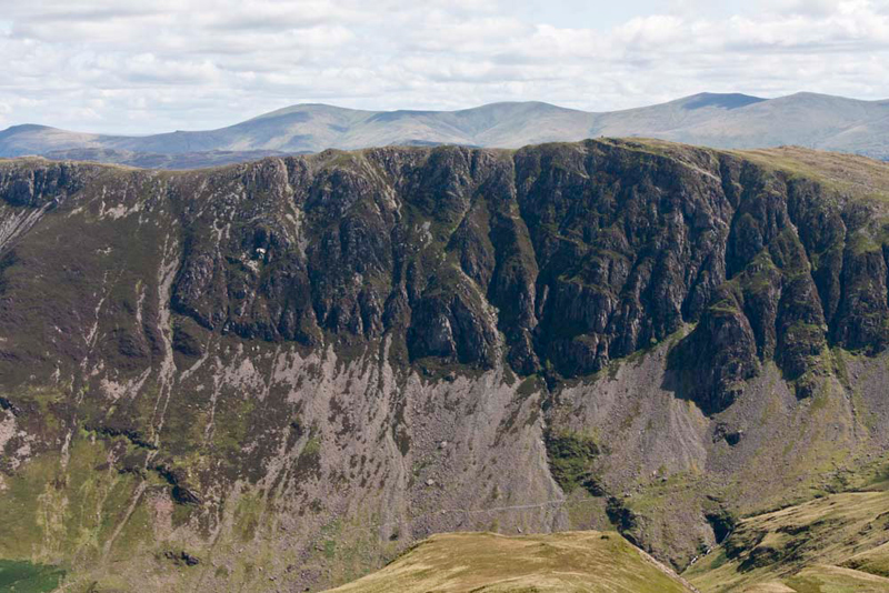
Looking away left, Allen said, "those are the sheer precipitous Eel
Crags below High Spy. We can just about see the summit cairn to the right end."
Then he went on, "the distant fells behind are the
Helvellyn Ridge. From left to right, Clough Head, the tiny
pimple of Calfhow Pike then rising to Great Dodd. In the dip is
Watson's Dodd, then rising to Stybarrow Dodd. This then drops
away to the Sticks Pass. Then right again to Raise and White Side."
"Magnificent", breathed Little Eric.
Just before we reached the summit
Dad paused so that we could all enjoy the breathtaking view of
the length of the Newlands Valley.
"Stupendous", cried Tetley.
"You've just got to take that"
called out Little Eric.
"You bet", replied Dad as
he got the camera out.
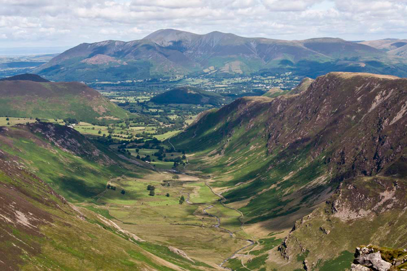
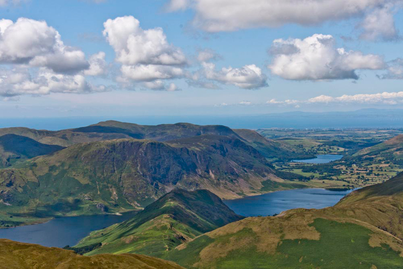
To the left of the valley is the
ridge that we had climbed earlier, while to the right are Eel
Crags, and behind that Catbells. Skiddaw and its associated fells
dominate the background.
In quick time Dad completed the climb to
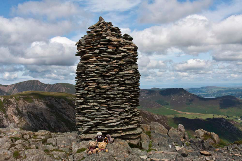
the tall shapely cairn on Dale Head's summit. We immediately
jumped out, and Allen called out, "come on Dad, take our
picture."
In the background to the right is Causey Pike that falls to Rowling End.
Sitting near the edge looking down
at the breathtaking view of the valley, we now had our lunch, which was especially well
deserved for Dad!
Normally from the way we had approached Dale
Head, the round would now lead steeply down to Dalehead Tarn, and then climb on to High Spy. But that was not objective today.
Instead Dad retraced the route towards
Hindscarth. As we descended, Shaun said, "there's the foot of Honister Pass far below, and Buttermere backed by
High Crag and Red Pike.
Looking across the pass, Tetley said, "that's Fleetwith Pike
backed by the massif of Pillar, with the Wasdale Red Pike peeking over behind."
Returning to the col the path we had walked
before curved off right, Shaun saying we keep on ahead along Hindscarth Edge."
"I thought the steep climbing was over", said Little Eric looking ahead.
"This is the last", replied Shaun. "We have to cross the end of the ridge, then dropping down once again, along
Littledale Edge.
There we could see that the path swept right to make the final
ascent to the summit of Robinson.
Grizzly said, "the name derives from a Richard Robinson who owned lands in this area including this unnamed fell, in the 16th century."
"Just as well he was not called Shufflebottom", laughed Tetley.
The
summit is a broad plateau, with two ridges of rock about a roads
width apart. The westerly one is slightly higher and has the main
cairn fashioned into a shelter, where we posed for our picture.
Of much more interest was the view.
We all said "wow" in unison, and then Grizzly went on,
"get snapping Dad."
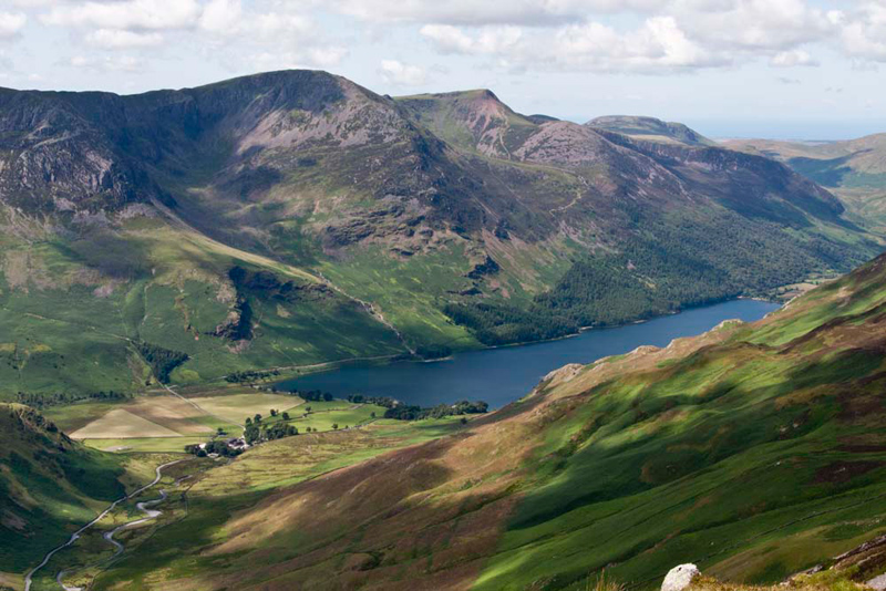
Allen set the scene, "the near lake is Crummock Water,
seemingly split by the rib of Rannerdale Knotts. Mellbreak is the
fell behind it. The more distant lake is Loweswater. Behind
Mellbreak, are some of the Western Fells, the highest being Blake
Fell."
"We did all those Western Fell tops recently", said Little Eric. "Two super adventures."
We were reluctant to leave as we
could have sat all day looking at that view, but we had to be on
our way. At first the descent was quite gentle but then it
steepened significantly as we walked along near the edge of
Robinson Crags. There were three rather awkward rocky steps, but
Dad got down safely if a little inelegantly. Here looking back
one can see the steepness.
"That's the hard part over", said Dad, "now a more gentle descent."
The ridge levelled and we
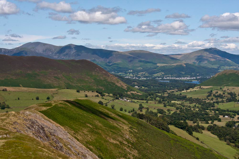
walked along High Snab Bank. This was a joy, with now once again
the superb views towards Keswick and Derwentwater with Skiddaw
and Blencathra again dominating behind. The heather covered fell
in front of Skiddaw, is Ard Crags.
The path meandered along the ridge
until it turned right for the final steep section today, down to the valley, to
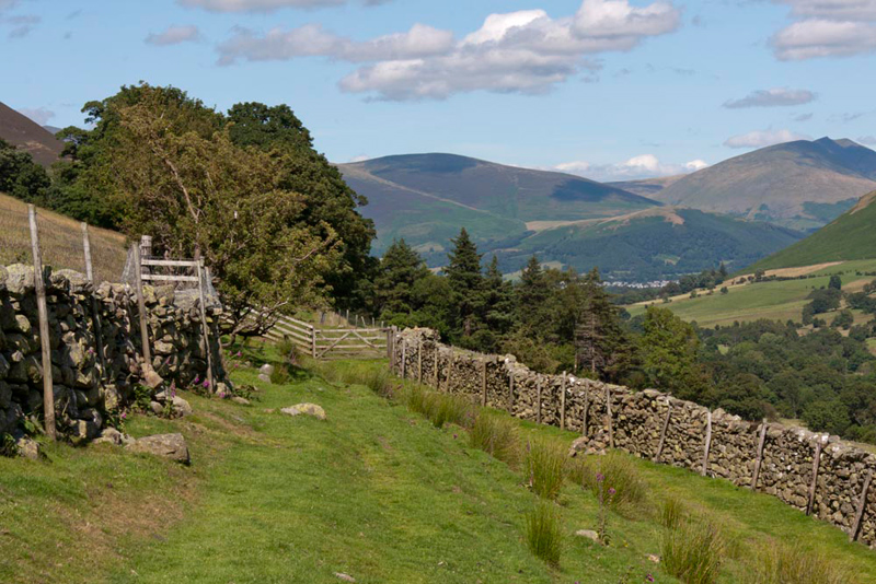
join the lane to Low High Snab.
This led through patches of
woodland, and eventually became a road that brought us to
Newlands Church, and so the short distance to the car.
"What a fantastic day", cheered Allen. "Thank you Dad."
"Hear, hear" cried Little Eric.
"You have certainly earned your tea and cake today", called out Tetley. "Are you going to the cafe and shop in Portinscale."
"Yes lad."
Meanwhile we sat in the car
to have the rest of our picnic, and discussed the adventure.
"How fortunate that we had such terrific views today", said Shaun.
"Quite", agreed Grizzly. "it's hard to think that there is to be
such an abrupt change in the weather for tomorrow."
And finally the summit tally for
today - we all, Dad included, bagged those along the Scope End
ridge, while Allen and Little Eric also bagged Dale Head,
Hindscarth and Robinson.