Allen & Tetley wandered in to
find Shaun with Little Eric sitting on his back, pouring over one
of the Wainwright Guides.
"What are you doing",
asked Tetley.
"Well, I overheard Dad talking
on the phone to Uncle Eric, and they have arranged a walk for
tomorrow. We are to do some of those Outlying Fells that we have
long wanted to do in the Cockermouth area, so I thought I would
read the appropriate chapters."
"Which ones are we doing",
asked Allen.
"Watch Hill, Setmurthy Common
and then Clints Crags", replied Shaun.
"I have looked for those first
two when we have driven along the A66, but have never been able
to spot them", said Allen.
"Well", said Tetley
knowingly, "that is because the majority of the A66 between
Keswick & Cockermouth, is now on the track bed of the railway
line that once ran all the way from Penrith to the west coast.
The hills are above the old road, which we will have to use
tomorrow."
"That will add extra interest
before we start, then", said Allen, glad of the
clarification.
The Walk
Apart from a short hail shower it
was a dry day if rather cold in the wind. Along the familiar A66
we passed under the towering slopes of Blencathra. Then passing
Keswick, we continued along beside Bassenthwaite Lake, before the
road swung west towards Cockermouth. The level and straight
nature of this stretch made it plain that it had once been a
railway line. Uncle Eric is a railway enthusiast, and we knew
that he would prefer this to still be a railway. He pointed out a
number of buildings, now private houses, that had once been
associated with the railway. Leaving the A66 at Embleton we then
followed what was the original main road, now a quiet byway, to
its junction with Higham Lane, parking in a convenient layby.
Watch Hill & Setmurthy Common
A few yards further along the road,
brought us to the bridleway for our ascent (part of long
distance path called the Allerdale Ramble). This crossed a number
of fields and climbed steadily. The fields were full of ewes with
their lambs, a lovely sight and the epitome of spring. Eventually
the track turned more left, at which point we kept ahead, to soon
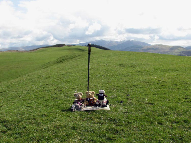
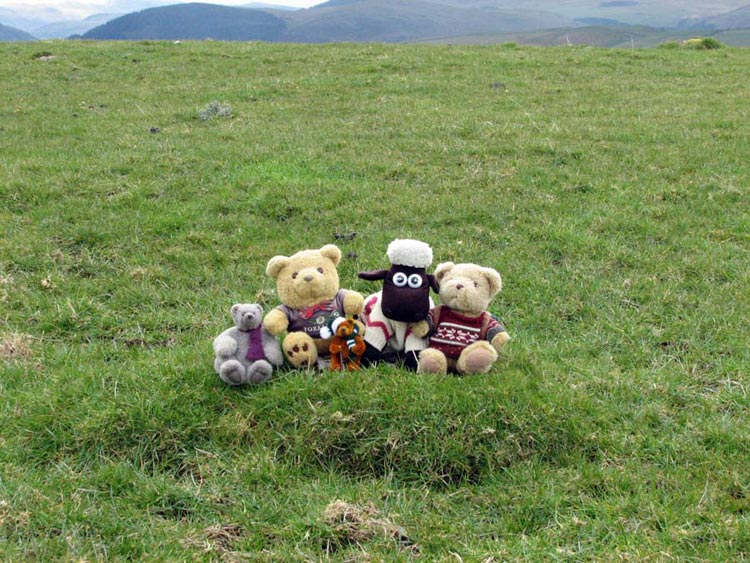
reach the unmarked flat top of Watch Hill. The grass was rather
wet, so Dad kindly sat us on his map case, while he took our
picture.
In the corner formed by the trees,
the tops of which can be seen, is the summit of Setmurthy Common,
our next objective. However progress towards this was delayed as
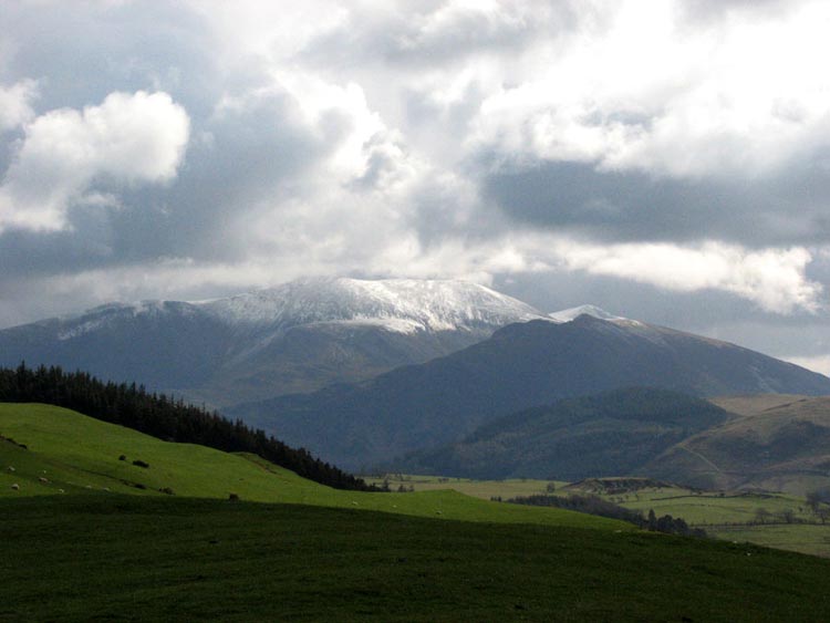
we just looked in awe at the wonderful prospect of the Lakeland
Fells, many of whose tops we had visited. The closest were
Skiddaw and its associated fells, dramatic under a covering of
snow.
"Wow, what a view" cried
Little Eric. He only joined the club last March and this was only
his second walk in Lakeland. "You must take a picture Dad."
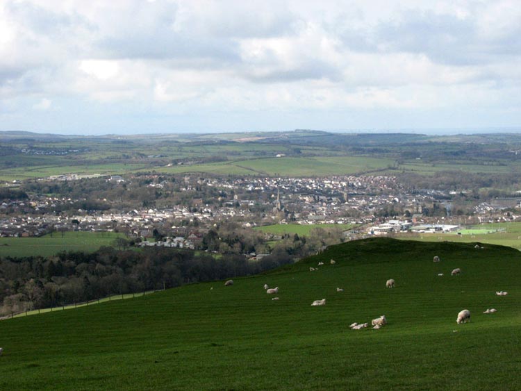
To the north was the Solway Firth
and Scottish hills, and nearer, Cockermouth was laid out before
us. Find out more about Cockermouth in Elmer's story of the
holiday to Armathwaite Hall.
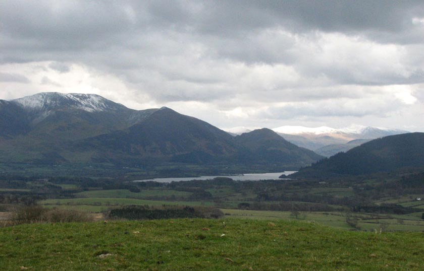
We were privileged to able to see
these views for most of the day. Walking on we descended slightly
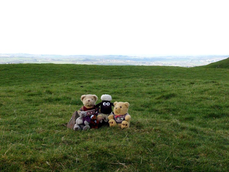
before crossing over undulating ground to the corner bounded by
woodland. Here three stones marked the top of Setmurthy Common
our highest point today.
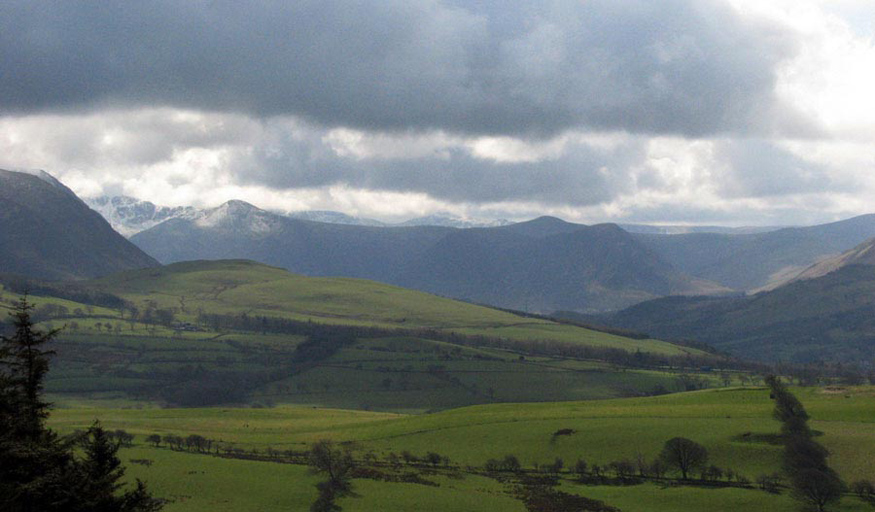
Beyond the end of the Skiddaw group,
we could see the clouds swirling over snow covered Red Pike and
the ridge to its left rising to High Stile. To the right is the
pointed top of Starling Dodd, seen between Mellbreak.
There is not any way to make this a
circular walk, so our outward route was followed, with the superb
views before us to return to the car.
Clints Crags
To ascend Clints Crags we needed to
start from the village of Blindcrake, which is off the main A595
road from Cockermouth, which for stretches follows the line of a
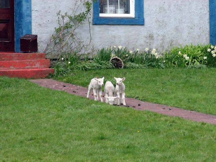
Roman Road. Walking to the end of the village we passed Allison
House Farm, where these three lambs were playing on the garden.
Across the road was a path signed
to the small hamlet of Sunderland, which we took (Uncle Eric and
Dad engaged in much banter about the Stadium of Light etc etc!!).
[In NE England is the large town of Sunderland whose football
team play at the Stadium of Light]. It was a muddy track that
eventually reached the open fell through a gate, from where it
was just a short walk to the highest point of Clints Crags. Again
a flat top, the summit being unmarked.
Despite the modest elevation, there
were dramatic views of Skiddaw, Bassenthwaite Lake, and behind
the snow covered skyline of the Lorton & Crummock mountains.
After all the effort so far is was
now time for lunch, and we sat out of the wind in a hollow below
the summit (remains of a long disused quarry). The wonderful
views were spread out before us, and again we realised what a
lucky lot we are. Settled in the rucksack, we then continued on
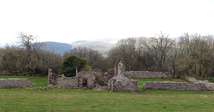
ahead passing the sad ruin of Thackray Cottage, and on along a
walled track.
At the end, rounding a corner on
the right, at another gate, we doubled back to walk through
parkland between plantations to reach Blindcrake.
These had both been delightful
walks, and it just goes to show that even from low altitude there
can be superb views. Although much less strenuous than some of
our adventures, these summits were an important step towards
achieving our objective of climbing all the fells in Wainwright's
Outlying Fells book.