HIGH TOVE, MIDDLE
CRAG, SHIVERY KNOTT, WATENDLATH FELL, ARMBOTH FELL &
FISHER CRAG
from ARMBOTH car park
Summary
Date - 24th August 2008
Distance - 5 miles
Map - OL4
Start point -
Armboth car park,Thirlmere
(NY 305172)
Summits Achieved
Name
Height (ft)
Height (m)
Grid Ref
High Tove
1690
515
NY 2891 1650
Middle Crag
1587
484
NY 2879 1579
Shivery Knott
1610
491
NY 2889 1535
Watendlath Fell
1689
515
NY 2890 1486
Armboth Fell
1570
479
NY 2967 1596
Fisher Crag
1381
421
NY 3049 1630
Preface
Allen and Tetley were
sitting quietly in the corner discussing the previous week's walk.
"It was nice to
start, but after Combe Head what a change", remarked Allen
"Yes, those rain
showers were torrential and Dad got soaked. Thank goodness we
huddled down inside the rucksack", replied Tetley. "The
amazing thing though, was that when we arrived at the summits it
was dry for our picture."
"True, but it was
typical Borrowdale weather", replied Allen. "When we
reached Rosthwaite Fell, it was a cause for celebration for
Grizzly and I, as we finally completed all the Wainwright fells
in Book 4 - Southern Fells."
Just then Shaun and
Grizzly strolled in with Little Eric who had hitched a ride on
Shaun's back.
Shaun said, "the
weather forecast is not bad for tomorrow, and Dad has told us we
are off for a walk."
"Where to?",
Allen enquired.
"To climb High
Tove, Armboth Fell and a few other Birkett tops". he replied.
"Oh good, that
will be a couple more off my Book 3 outstanding list",
cheered Allen.
Tetley chimed up,
"one thing you can be certain about is that it will be a
squelch, squelch, squelch all the way along that ridge, as
Wainwright says in his chapter on Armboth Fell."
"Yes"
replied Shaun. "Just what Dad said, when he told us where we
were going"
The Walk
Sunday dawned and we
hurried to get ready, and dived into the car when we heard Dad
loading his gear. It turned out to be a considerably better day
than last week with just an odd shower that did not last very
long at all. The start point was Armboth car park by the shores
of Thirlmere. Dad and Uncle Brian sometimes come here on Boxing
Day, as there is a nice view for Uncle Brian, across the lake.
Dad usually goes for a walk, as do our intrepid Lakeland Bears,
Ruskin and Langdale. This was indeed to be the case on the
forthcoming Boxing Day, and Ruskin and Langdale, have kindly
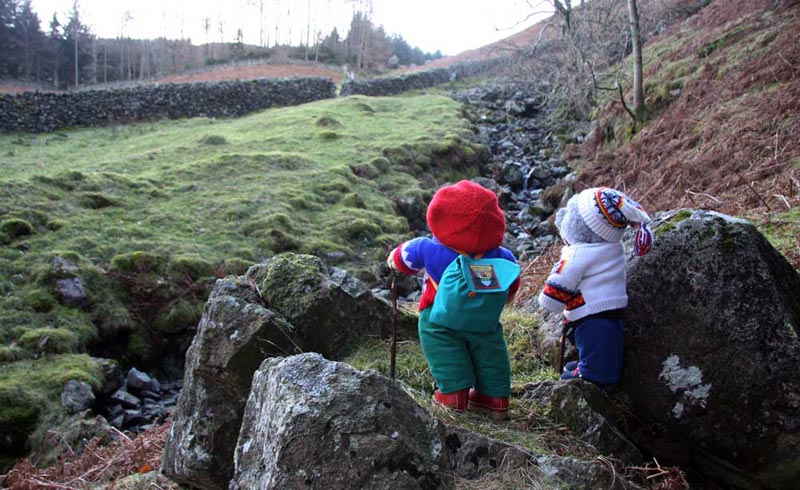
contributed this picture, which indicates our route.
Dad with determined steps traversed the rough ground,
through the gap in the wall, and then along a stony path, up Cockrigg Crags, beside the trees. Inside these is Fisher Gill, one of the many
streams that feed water into the reservoir.
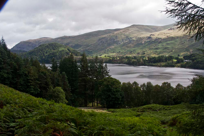
"Dad just look at
that super view", called out Allen.
Turning round, he said
"you're right, and it is worth a picture too."
For Little Eric's sake, Tetley described what we could see. "The high Fells above
the lake are what are referred to as the Dodds. They are the northern end of the Helvellyn ridge. "From left to right, Clough Head, the tiny pimple of
Calfhow Pike, Great Dodd (summit hidden) and Watson's Dodd. The
lower hill covered in trees is Great How."
At the end of the
trees a gap in the cross wall gave access to open fell. "We head roughly west up that steady ascent for about three-quarters of a mile", instructed Shaun.
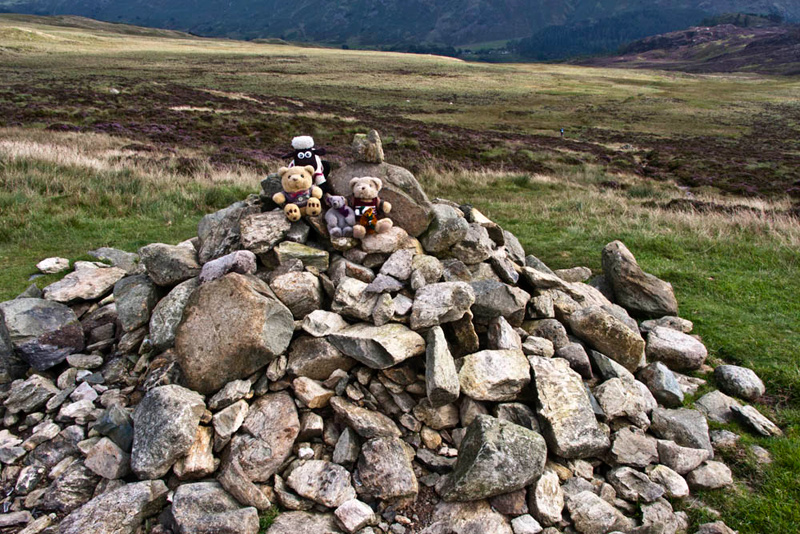
This brought is to the summit of High Tove, marked by a large cairn. "Come on pals", called out Allen. "Time to scramble onto the cairn for our picture."
Settled again, Shaun advised, "we head due south following the line of the fence"
So as we had alluded to in the preface the true boggy
nature of this central spine of Lakeland, revealed itself in all its
glory as Dad paddled his way across
extremely wet ground, to first take in the Birkett summit called Middle Crag.
As we descended Grizzly commented, "it's really nothing more than a rocky outcrop."
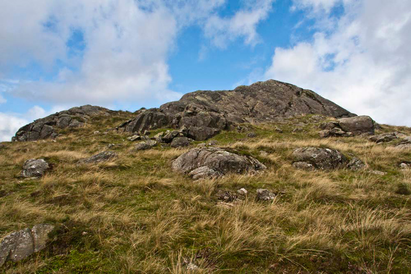
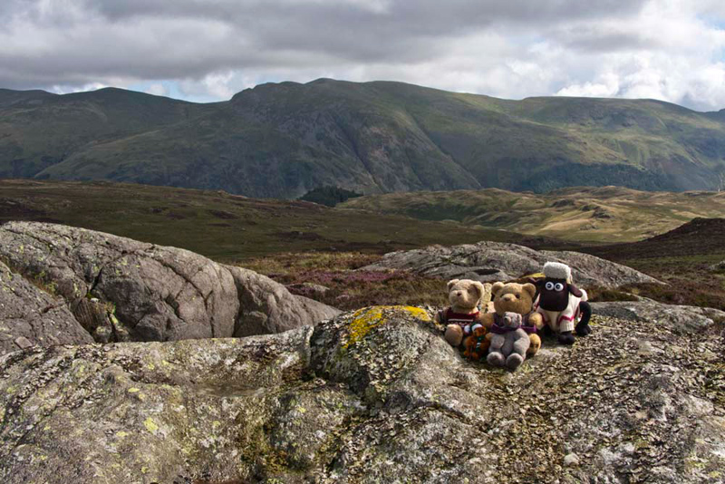
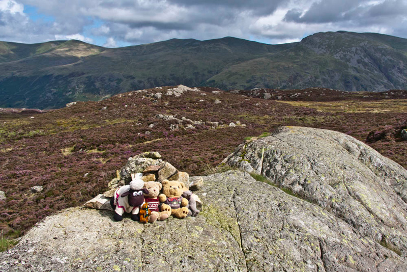
Then in just under half a mile we arrived at the next summit called Shivery Knott.
The backdrop is the fells above Borrowdale. Oh and immediately above our heads Middle Knott.
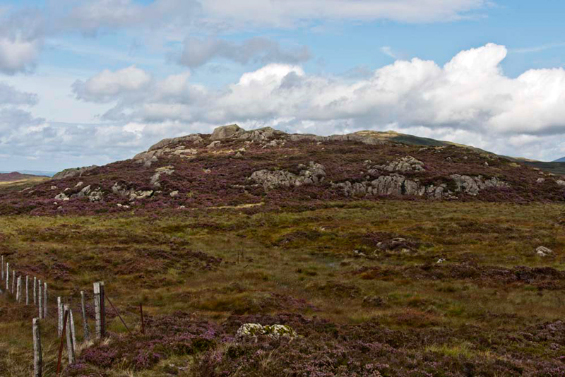
Snuggled again in the rucksack Shaun issued his instructions. "We keep on by the fence and about where it turns a corner, marks the summit of Watendlath Fell."
So off we went, Dad pausing to take this of the heather clad rocks of Shivery Knott. "May as well have the picture, as I doubt we will not be back here again if ever", commented Little Eric.
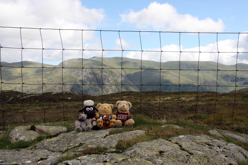
About half an hour of steady walking and we arrived. The summit is an area of flat and crossed, as Shaun had indicated, by the
fence that had been our guide from High Tove.
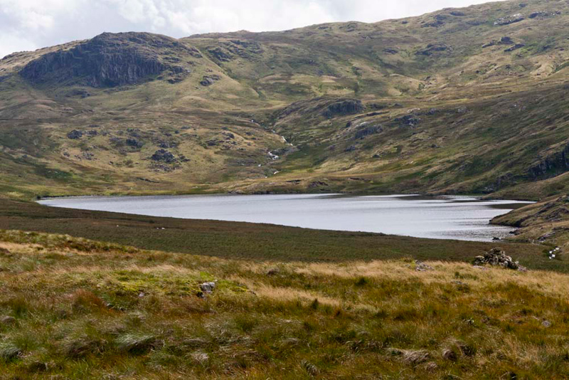
Pointing Allen said, "that is lonely Blea Tarn the dominant fell behind being Coldbarrow Fell."
The tarn is silver today, in another story telling of our climb to Coldbarrow Fell and a few others, you will see it was deep blue.
"The fence has been a good guide and help especially had it been misty", said Little Eric.
"Yes pal", replied Shaun. "But we have now reached the southern
most point on our walk today. We have to now head north
east to Armboth Fell. That will be a tramp of around a mile over pretty trackless heathery ground and best not to be attempted in mist."
"You are right pal. I have only been walking a few months and I have a lot to learn", replied Little Eric.
It was a hard mile over more boggy ground to reach the large rocky outcrop with a small cairn that is the summit. This was the second
Wainwright bagged today by Allen and Little Eric, the other being
High Tove.
"Where to now?", asked Little Eric, after we had settled in the rucksack.
"Roughly east to Fisher Crag". replied Grizzly. looking up from the map.
It soon came into plain view, and as we made our way towards it. Yet more very
wet ground had to be negotiated, the route being over heathery
ground and around the right side of a small tarn.
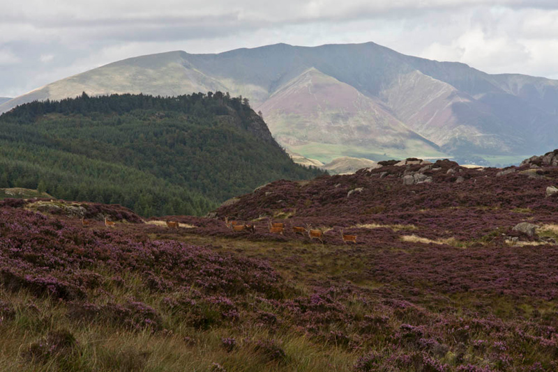
Suddenly, in a loud
whisper, Tetley said, "Dad look, there are some red deer
over there"
Despite being a little
way off, Dad did not waste any time getting the camera out, and
snapping them before they disappeared. The majestic backdrop is Blencathra with tree clad Raven Crag.
Shaun remarked, "that
is the first time we have seen deer in this part of the Lake
District."
Dad then walked on towards
Fisher Crag. A wire fence was climbed, and then passing through the
perimeter conifer trees, we crossed a broken stone wall. Just a
short ascent followed to the rocky knoll swathed in vegetation
that is the summit.
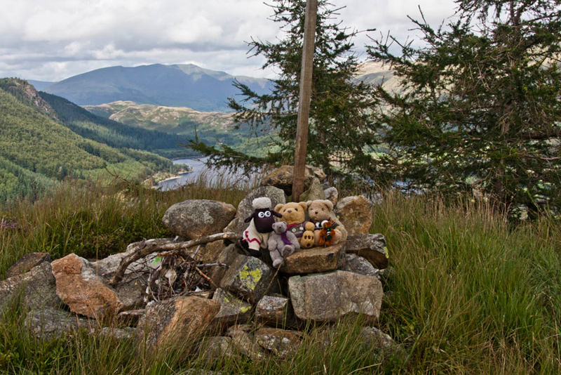
"There's the cairn" called out Grizzly. "Time for our final picture."
Walking just a few
yards further on, we all exclaimed in unison "what a
fantastic view of Thirlmere"
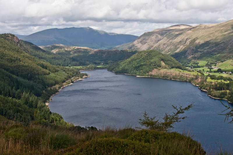
"You have got to
take that", called out Little Eric.
Again Blencathra
dominates the background. To the left is Raven Crag and to its
right High Rigg, and then further right the tree covered Great
How. The high fells to the extreme right are the Dodds.
Now all that remained
was the return to the car.
"There was no real clear path, Dad", said Shaun. "Best to head generally north west over the heathery terrain,
maintaining height as much as possible. which will make the crossing of Fisher Gill easier."
We encountered a few
crags but sure footed he negotiated his way down safely. Having kept high Dad was
able to easily cross the main source of Fisher Gill. Then continuing
to traverse, the second source of the gill was then crossed.
"There's the original path", pointed Tetley.
"Yes lad the hard work walking is done now."
So just a case then of descending via the outward route, to the car park.
That was a good walk", said Allen. "Thanks for visiting the Wainwright tops again so Little Eric and I could tick them off."
"You're welcome lads. I am glad to get the Birkett tops out of the way too. I have to say it is highly unlikely we will visit them again, especially as the ground underfoot is so extremely wet and boggy!"