HIGH HARKER HILL,
HIGH CARL, GIBBON HILL & HEIGHT OF GREETS from
GRINTON LODGE
Summary
Date - 1st February 2009
Distance - 10 miles
Map - OL30
Start point -
Parking area Nr Grinton Lodge (SE
047 978)
Summits Achieved
Name
Height (ft)
Height (m)
Grid Ref
High Harker Hill
1528
466
SE 0181 9719
High Carl
1820
555
SE 0009 9577
Gibbon Hill
1781
543
SE 0127 9606
Height of Greets
1676
511
SE 0282 9568
The Walk
As we had a long drive to the start and this meant a very early start, Tetley suggested. "let's get the picnic made up tonight and put it in the fridge."
"Good idea", agreed Grizzly as we all lent a paw to do this.
Next morning, still dark and Uncle Brian sensibly still tucked up in bed, we dashed out to the car and around
06:45 Dad backed out of the drive.
The route was oh so familiar, to Ingleton then over past Ribblehead, where it was barely light.
"I always get a thrill seeing the magnificent viaduct that carries the Settle-Carlisle railway line", said Allen.
So then on to Hawes, to continue through Wensleydale to Leyburn, there taking the Reeth road over Ellerton Moor past the military firing ranges. A road side parking area by the junction with the road to Redmire near Grinton Lodge was where we met Uncle Bob.
"Hi Uncle Bob, nice to see you again", called out Tetley.
"Good to see you lads", he replied.
It was another cold day (we are having a real
winter this year) and snow was threatened later and overnight.
While Dad and Uncle Bob got ready, we snuggled down in Dad 's rucksack ready for the off. "Brr", said Allen, "good job we are made of stern stuff."
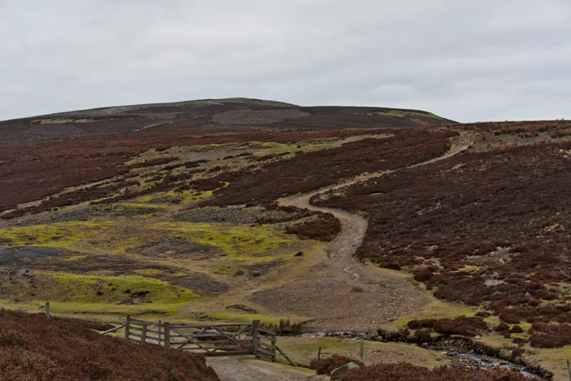
It was about 09:30 as Dad shouldered the rucksack, Shaun giving his instructions. "we take the Redmire road and ignore the first two paths."
The road climbed quite steeply
and at a left hand bend, Shaun called out, "now it's right on the bridleway."
"Pretty bleak terrain", commented Little Eric, "but at least there is a good track."
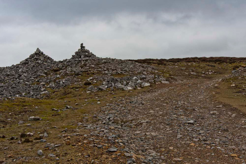
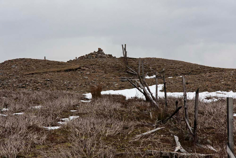
This was to be our route for some miles, first climbing over Low
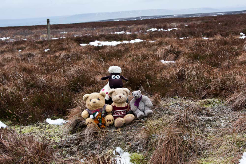
Harker Hill. "Those shapely cairns are worth a picture", pointed Grizzly.
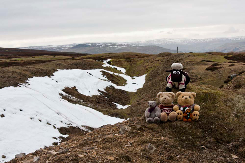
The gently ascent then continued to our first summit of today, High Harker Hill.
Allen chirped up, "that small
bank by the track seems to be the highest point"
"I agree", cried Grizzly.
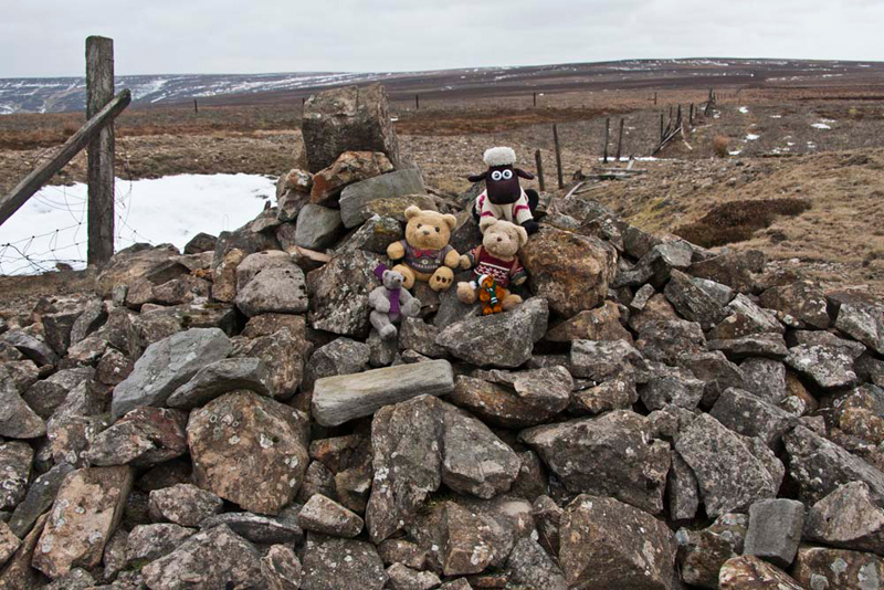
As we scrambled out of the rucksack,
Shaun called out, "come on Dad take our picture".
Uncle Bob explained, "the track
is so well maintained to facilitate shoots, due to the area being
extensive grouse moors."
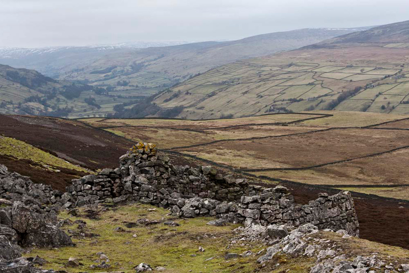
We saw lots of grouse, as we walked on enjoying the excellent views down to Swaledale, being
able to see for miles along the valley.
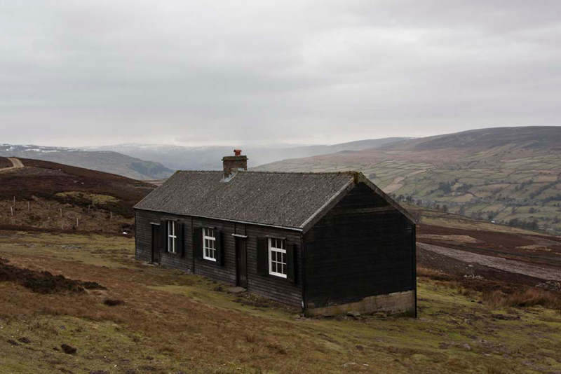
"What's that building?", asked Little Eric.
"A shooting hut
used by grouse parties", replied Grizzly.
Swaledale can be seen behind. "That's Blea Barf that we climbed in August last year", pointed Tetley. "We can see where we descended to the Bloody Vale, and the high wall that Dad and
Uncle Bob had to climb."
Grizzly told us ", although now grouse moors, this area
has in the past had been extensively mined for lead."
There was evidence of this from the spoil heaps etc., that we could see as we continued onwards, passing this ruined limekiln, again with extensive views of Swaledale.
Eventually we reached Green
Hill Ends where the track turned south and dropped down. This
then brought us to a junction of tracks on Whitaside Moor.
"We are further west than the green dashed track on the map", said Uncle Bob.
"Yes" agreed Dad, "that's because we have continued to follow the grouse track. It's just added a bit more to the distance."
"Not a problem though", replied Shaun. "We just need to turn left and walk up to the fence line."
There Allen said, "it would be nice to just be able to continue on
the track, but to get to the summit of High Carl, it's more walking over trackless moorland by the fence."
"Aye lad", replied Dad, "we are well used to that."
A steady trudge of just under half a mile then brought us to the flat top of High Carl, where we sat at what was judged to be the summit, just a little way from the fence.
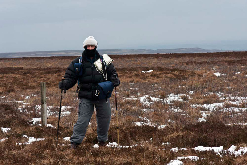
It was bitterly cold up here, so
sensibly Uncle Bob was well protected against it. "You look like you are special forces", said Tetley.
Having snuggled again in the rucksack, Shaun said, "the next summit is Gibbon Hill. To get there we just keep on by the fence over the trackless moor for about three-quarters of a mile."
The ground was reasonably solid being a cold winter day, but in
the warmer weather it would have been very boggy. Even so it was
hard going and we were glad to be carried in the rucksack. Uncle Bob commented again, "how many times have we walked along by a fence from seemingly nowhere to nowhere!!"
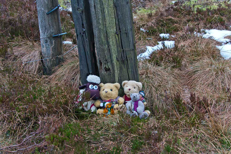
The summit is featureless, other than the wooden posts at the remains of the fence
junction, that coincides with the spot height on the OS map.
As we snuggled down in the rucksack, Little Eric said, "where now?"
"More of the same, pal", sighed Shaun. "On along the fence for about a mile for our final summit,
Height of Greets."
More hard slog for Dad and Uncle Bob and we were all mightily relieved as we approached the summit.
Tetley called out, "look at
last a cairn. Thank goodness, we're fed up with having to sit on the boggy ground
to have our picture taken."
"Time for lunch", implored Allen. "I'm hungry and am sure we are all ready for a warming drink."
"Yes", agreed Uncle Bob. "Let's sit here by these stones sheltered from the bitterly cold east
wind."
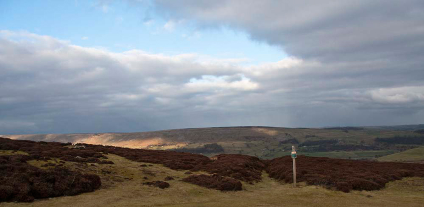
We did not linger too long however and ready for the off, Grizzly commented, "great a good track again that will make for much easier walking."
This led to the road. "Turn left", advised Shaun, "then we take a path off this where the road bends right."
At that point, Allen pointed, "that's Fremington Edge above Reeth. We climbed that with you Uncle Bob in December 2007."
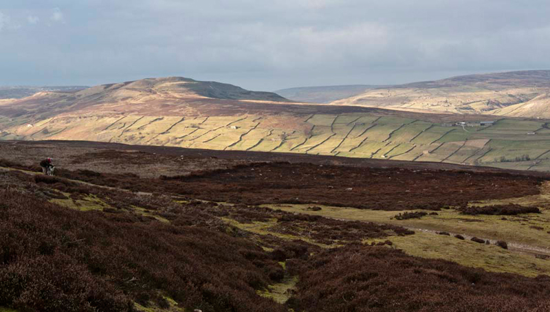
Then as we descended onwards we had this fine view of Calver Hill and Swaledale bathed in sunlight. "It looks so benign today, in contrast to the ferocious hail storm we encountered when climbing it", commented Tetley ruefully.
"Wow", said Little Eric. "Just look at all the stone walls above the valley."
The path led to the road by the bridleway we had taken this morning, and from there it was just a short stroll to the cars.
"The distance is 10 miles", commented Dad.
"I am a bit surprised", replied Shaun. "I did not think it seemed that
far."
We dived into the warmth of the car as a snow shower passed over. "A great walk, but it is nice to be in the warm again", said Grizzly.
"Refreshment time now?", asked Tetley.
"Yes lad, we are going to Reeth", replied Dad.
We stayed in the car to have another picnic and more warming mugs of tea.
Dad and Uncle Bob first went to the Tourist Centre as Uncle Bob wanted to
get some socks for Aunt Ann, but unfortunately they did not have
the right colour. Then of course it was cafe time! Their usual,
Ivy Cottage, had closed early, so instead they went to another near the
Tourist Centre, for tea and chocolate cake.
It was Uncle Bob's treat today, for which Dad said, "thank you."
On the
table was a draughts board so they played a game. Uncle Bob was victorious!
By now it was even more
bitterly cold in the strong wind, so hurried goodbyes were said
after a great day. Uncle Bob followed us to Leyburn where we went
our separate ways.
Of course we stopped at Aunt Eileen's at Newby Head. Dad had
already placed his order yesterday, and collected orange sponge,
chocolate cake and scones. The farm is high up around 1400ft so very exposed to the
weather and with the forecast, they had placed a large board
blocking the lower doorway to prevent the snow coming in. Best to
be well prepared!
Then on home where we settled in the lovely warmth, to tell our pals about our adventure, on what had been another grand day out!