COCKLAW FELL &
GREEN QUARTER FELL from SADGILL, LONGSLEDDALE
Summary
Date - 26th April 2009
Distance - 4.75 miles
Map - OL7
Start point -
Sadgill Bridge, Longsleddale (NY
483057)
Summits Achieved
Name
Height (ft)
Height (m)
Grid Ref
Cocklaw Fell
1197
365
NY 4806 0383
Hollow Moor on
Green Quarter Fell
1398
426
NY 4689 0395
Nameless summit
1370
417
NY 4735 0425
Preface
On his way to take the flasks in for tea, Shaun stopped to ask Dad, "are we going out
tomorrow, as the weather is forecast to be dry and quite sunny?"
"Yes", replied Dad,
"but I have decided to have an easy day. We are going to
Sadgill in Longsleddale to tick off the Birkett top, Cocklaw Fell,
we have wanted to do for a while, and then on to Green Quarter
Fell again, which will allow Allen and Grizzly to get another
catch up of a Wainwright Outlying Fell.
"Great", said Shaun.
"They will be very happy about that."
The rest of us were sitting quietly reading when Shaun arrived. "Super", cheered Allen, "tea."
"I'll get the mugs and help pour", said Tetley.
"Thanks pal"
"And here's the tuck tin", said Little Eric. "Grizzly and I have stocked it up."
Allen immediately dived in. "Dark kit kats and Yorkies, some of my favourites."
So all content, Shaun then said, "Dad says we are walking tomorrow. It will be an easy day, under 5 miles. But three summits will be climbed. First Cocklaw Fell, a Birkett we all need to bag, then on to Green Quarter fell."
"That will be a catch-up for Grizzly and I", cried Allen. "And Little Eric will tick it off too."
"What's the third summit?", asked Tetley.
The nameless one at 1370 feet that is included in Wainwright's Outlying book."
"Roll on tomorrow" cheered Little Eric.
The Walk
As we set off the next morning, Little Eric asked, "where are we starting from?"
"Sadgill", replied Tetley. "It is at the end of the surfaced road in Longsleddale. To get there we go through Kendal and on up the A6, to take the turning into the valley. From there it is a further
5.5 miles to Sadgill Bridge. The road is very narrow in places so I hope we do not meet traffic coming in the opposite direction."
Thankfully there was no other vehicles on the narrow sections, and arriving Dad pulled off onto the verge where it was obvious walkers parked their cars.
As Dad got ready, Little Eric said, "I have never been here before. Where does to ongoing track lead to."
"To Gatesgarth Pass, and ultimately down to Haweswater", replied Allen. "We will definitely be coming here again, as you and I have yet to climb Grey Crag and Tarn Crag that rise above the track to the right."
"I look forward to that", enthused Little Eric.
By now Dad was ready. "Right lads get settled in the rucksack so we can be on our way."
Shaun instructed, "we cross the bridge and follow the Byway that
leads ultimately to the next valley Kentmere."
It was a steady but
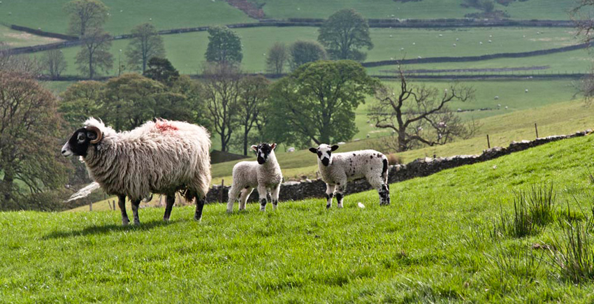
easy climb. As you would expect there were plenty of sheep. "Aww you must take that of the ewe with her lambs", called out Tetley. "The very epitome of
springtime on the fells."
"Just so cute", said Allen. "I know that I do not generally like sheep pictures, but that one was a must."
Coming to a gate, Shaun instructed, "once through we take the bridleway left along by the wall."
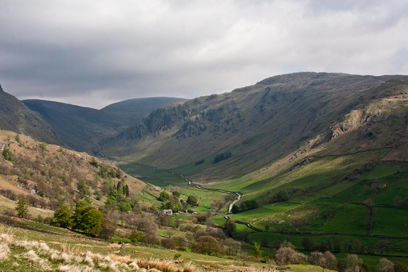
Soon the path began to climb again and the view of the valley opened up. "That will make a lovely picture, looking back to the buildings of the farm at Sadgill and the track leading up towards Gatesgarth Pass", called out Grizzly.
Tetley further set out the scene. "The prominent crags in the centre are Buckbarrow Crag,
that rises right to Tarn Crag on Sleddale Fell. The round fell in the centre at the back is Harter Fell with in front to the left Kentmere Pike. Two of the summits on the Kentmere Horseshoe."
"We did that in July 2006", commented Allen
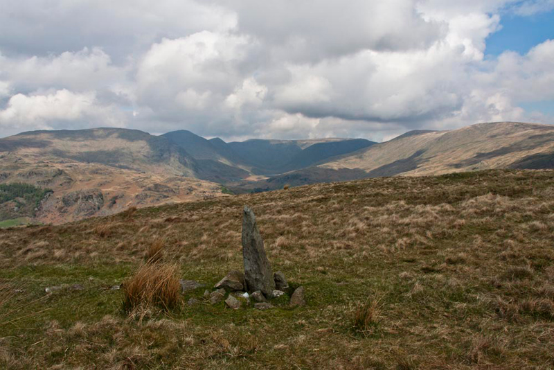
After passing through a second gate, the gradient eased and Shaun said, "where convenient Dad, we have to strike off left to that gate, then make the easy climb to the summit
of Cocklaw Fell."
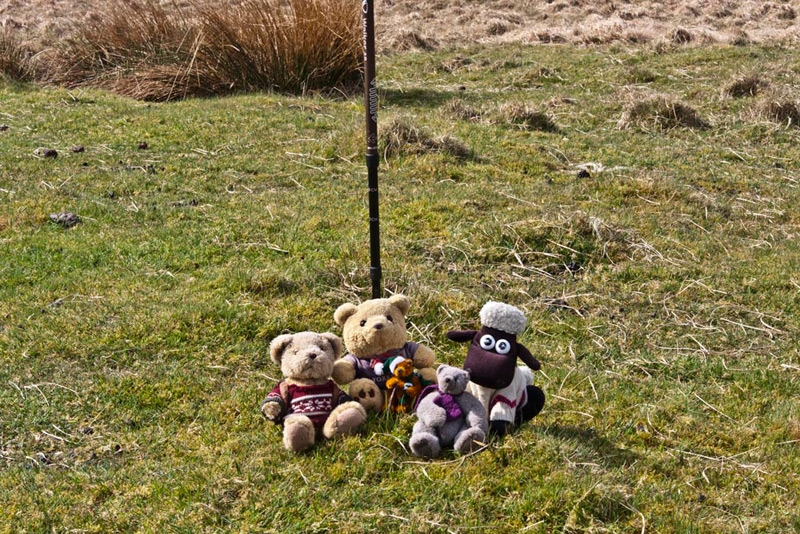
There is nothing to mark it so Dad planted his stick in front of which we posed.
"Can you tell us anything about the origin of the name, Grizzly?", asked Little Eric.
"Yes pal. According to Diana Whaley's book it means 'the hill where the blackcocks play'. There are other places with similar names and seem to refer to the disporting of the male black grouse."
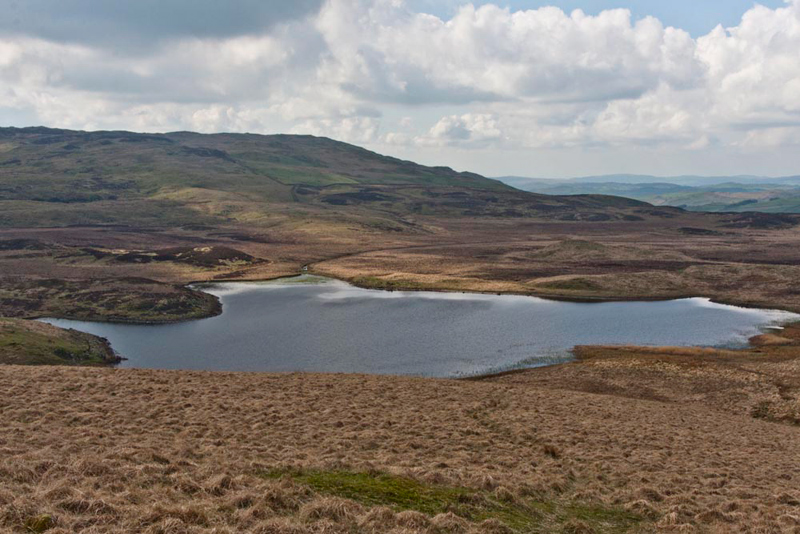
"That's a fine view of Skeggles Water", pointed Tetley.
"What a lovely name", said Allen. "Can you tell us the origin, pal?"
"It is a personal name 'Skokul's lake'. This is from the Old Norse, Skokull that was originally a nickname referring to shaking or brandishing."
We now settled back in Dad's rucksack, and Shaun pointed, "we need to descend and regain the bridleway."
This was achieved by crossing a boggy area
to a gate. Then we continued along the bridleway
to pass through another gate.
"Turn right here for Green Quarter Fell", called out Shaun.
A fence blocked our progress, but Dad soon negotiated a way over, after which it was a straightforward ascent of Green
Quarter Fell, its summit being Hollow Moor.
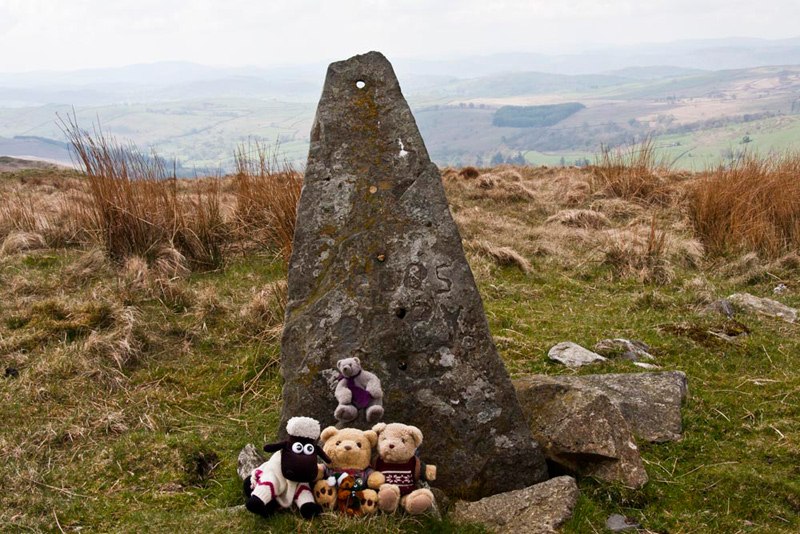
Allen said, "this old stone gatepost, is generally considered as the summit,
although the Ordnance Survey actually marks the spot height a little
further on in the direction of Kentmere. We will cross that point when we continue on."
"Picture time", called out Grizzly. "That's another Outlyer catch-up for Allen, Little Eric and I."
Setting off again, Shaun instructed, "we should follow the path that will take us to a stile in the fence to the right."
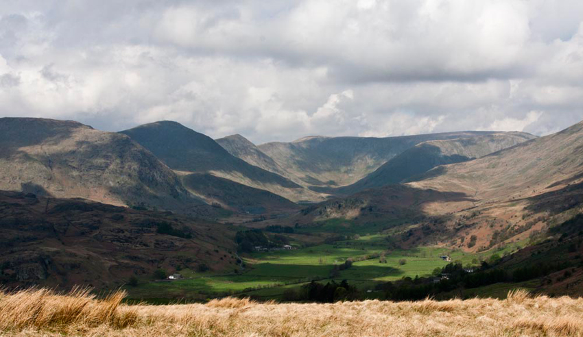
As we did the view opened out ahead. "Wow", exclaimed Tetley.
"Just look at that fantastic view of Kentmere. Please Dad,
take a picture." Then for Little Eric's sake he explained, "from front to back the tops on the left are
Rainsbarrow Crag rising to Yoke, Ill Bell, Froswick, and
distantly Thornthwaite Crag. Then going right at the back, High
Street and Mardale Ill Bell. The slopes to the right are of
Kentmere Pike."
"Thank you for that pal", said Little Eric. "All this helps me to become familiar with the fells and their names."
"All that is left now is visiting the unnamed summit referred to in the Green Quarter Fell chapter of Wainwright's Outlying Fells book", said Allen.
"Quite" agreed Dad. "I am determined to take you there."
Shaun stated, "from the stile it is just a short ascent in front."
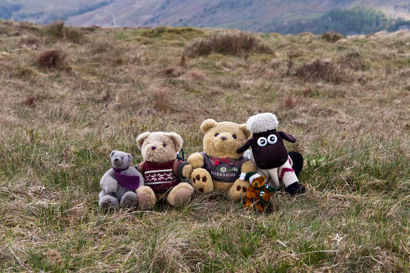
The map shows no spot height, but as we approached, Grizzly called out, "there are a few stones for a little cairn to mark the top."
Looking at the GPS, Shaun said, "the height reads exactly 1370ft, just as Wainwright states in his book. We must have a picture to record our visit."
Of course lads."
We jumped back into the rucksack, and Shaun issued his next instructions, "we descend roughly north-east."
This led to another fence
that Dad then followed to a wall corner. After climbing this a further steepish descent returned us to the Byway. Here, going right,
this was followed passing where we had struck off onto the
bridleway earlier, and then on down to Sadgill Bridge.
"Despite
being a short walk it has nevertheless been interesting", said Allen. "Thank you Dad for taking us.
"Yes", agreed Grizzly. "We can now say that all the tops in this area have been bagged by us all."