Junction of
Croasdale to Lamplugh road with road to Kirkland (NY
087183)
Summits Achieved
Name
Height (ft)
Height (m)
Grid Ref
Kelton Fell
1020
311
NY 0940 1813
Godworth
1197
365
NY 1009 1829
Banna Fell
1496
456
NY 1162 1739
Floutern Cop
1480
451
NY 1223 1737
Gavel Fell
1726
526
NY 1169 1838
High Nook on Gavel Fell
1601
488
NY 1203 1891
High Pen
1558
475
NY 1099 1890
Low Pen
1427
435
NY 1044 1894
Knock Murton
1467
477
NY 0946 1907
Preface
Shaun had brought the tea, and we had steaming mugs in paw. "The weather forecast for Sunday is
brilliant with cloudless skies and hot sun", said
Shaun.
"Let's hope Dad will take us walking then", responded Little Eric.
A minute later Allen dashed into the room. "I bring news of a walk on Sunday", he said
breathlessly.
"Well first just calm down and have your tea", replied Tetley, passing him a full mug.
"Thanks pal, I'm ready for a drink." Then calmer Allen went on "Dad has just told me that we are going to do
the first of those walks to tick off the Birkett tops in the
Western Fells. The highest point we will reach is Gavel Fell.
"He will have to drive almost to Ennerdale, so I expect there will be an early start", said Grizzly.
"Magic", cried Shaun.
"I can't wait, went on Tetley. "We will get quite a few Birketts ticked off."
The Walk
It was indeed an early start, setting off about 07:15. Up the M6 to junction 40 then along the A66 to Cockermouth taking the road towards Egremont. Then at the village of Kirkland he took the road left to the t-junction that was the start point.
"Here's a good spot to park on the verge", said Dad.
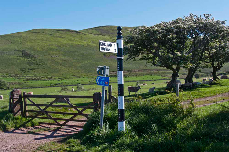
Shaun said, "our route is along the track behind what Birkett refers to as the football score signpost."
As we walked to the gate, Tetley pointed, "the words 'Cumberland County Council', are written down the pole. That harks back to when what is Cumbria now, was divided into the two counties of Cumberland and Westmorland."
"I suspect there are many people who wish they had not been merged in the boundary reorganizations", added Grizzly.
"Lancashire lost a big area too. All the Furness peninsula, and the area up to Coniston and Wrynose Pass", said Allen.
Through the gate, the clear track
led by hawthorn bushes glorious in blossom, where the sheep were taking shelter from the sun.
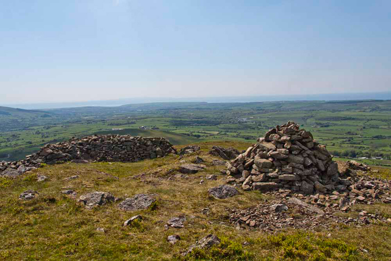
At the end we passed
through another gate, Shaun saying, "we walk the track right, then leave it to climb right to the first summit Kelton Fell at a cross of
walls."
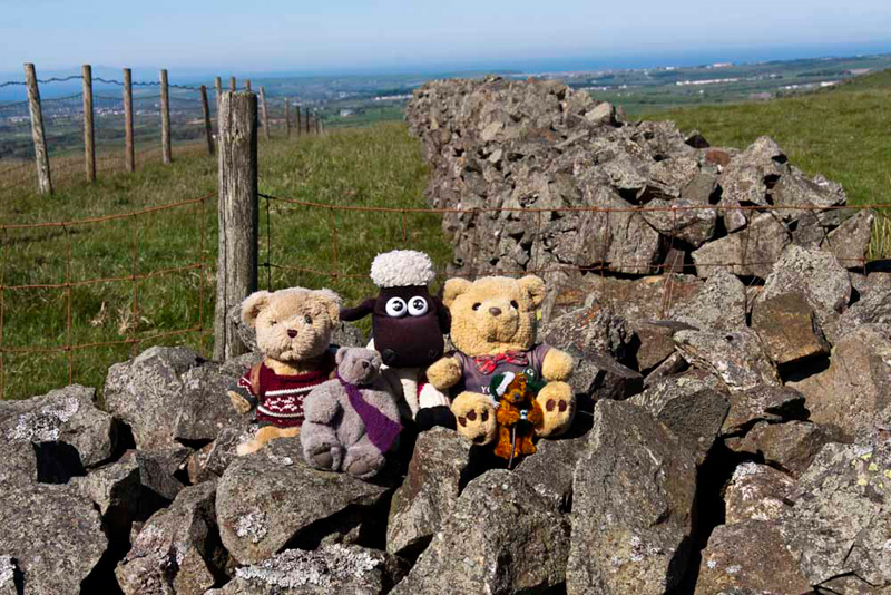
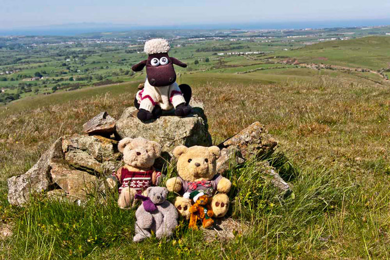
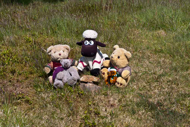
"First picture of the day", called out Tetley, as we settled on the wall.
Grizzly said, "according to Diana Whaley's book, Kelton probably means 'the settlement by the spring', as there are a number of these below the Fell."
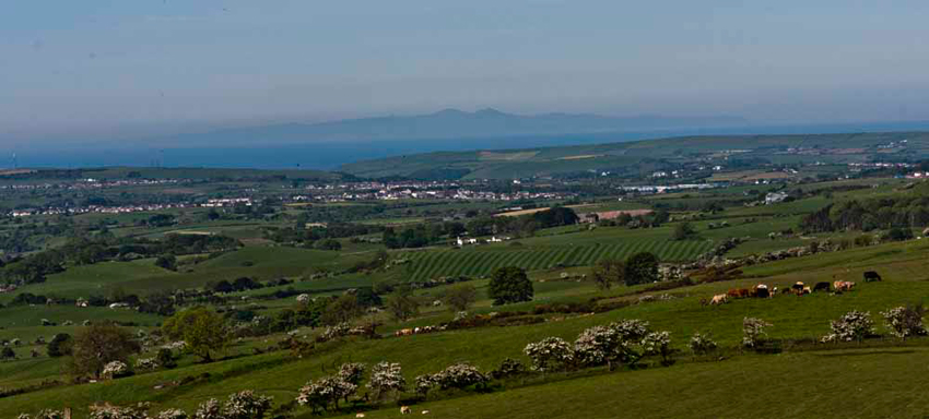
Here the wide view of the landscape opened up across to
the coast. "Look", said Little Eric. "That's the Isle of Man we can see on the horizon through the haze."
Aunt Tish and Uncle Eddie were in our thoughts,
as they come from the Isle of Man.
Settled in the rucksack, Dad descended to the track, and then
walked ahead over boggy ground take an ascending path.
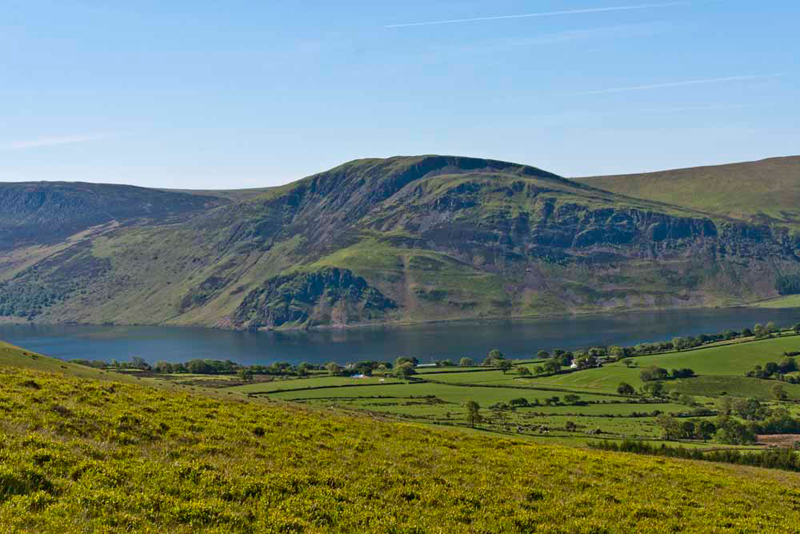
"Wow", called out Tetley.
"Just look over there. What a fantastic view of Ennerdale
Water. That is Crag Fell behind and the crag below is Anglers
Crag. Do you remember that we walked along there and to that
summit with Uncle Bob."
"Yes", replied Allen.
The camera tucked in its bag, Dad then continued the ascent, and very soon we arrived at the
cairn marking the top of Godworth.
Shaun said, "from here we have to climb that shoulder above, and then bear right, to descend past the sheepfolds into the upper ravine of Croasdale Beck."
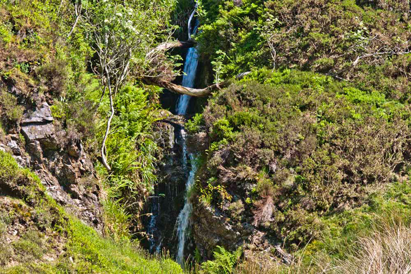
Hidden in a small
side ravine is the waterfall of Comb Gill. "That is very pretty", commented Little Eric. "I reckon very few people who visit the Lake
District ever see this."
A number of streams feed into this
ravine. Shaun said, "according to Birkett we need to climb to the left of High Bridge Gill."
"Hmm it is just a case of which one that is", replied Dad.
As it turned out we actually climbed by Grain Gill, in effect doing the other two sides of the
square, and requiring a bit more ascent, to achieve the flat topped
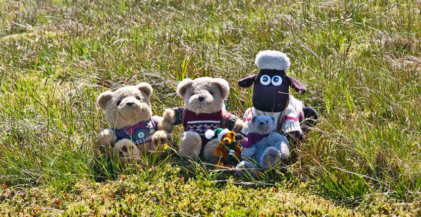
summit of Banna Fell.
"There's no cairn", moaned Allen.
"I have the grid reference here", said Dad. Getting the GPS out, he moved around, then said, "this is the summit."
"Come on pals, let's gather round for our picture", said Shaun.
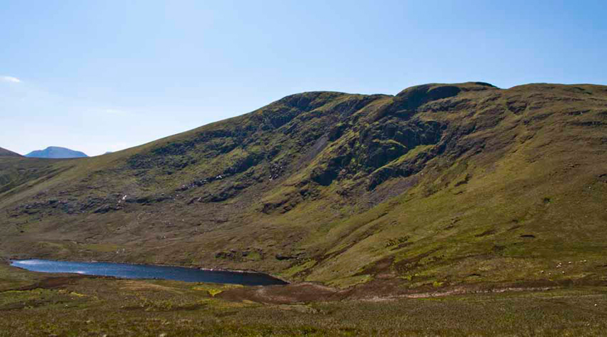
As we got settled again, Tetley said, "that whale back of
Skiddaw Slate is Floutern Cop, and is our next objective."
Crossing the fence we made a short descent over
boggy ground, followed by a short climb to its thinly grassed
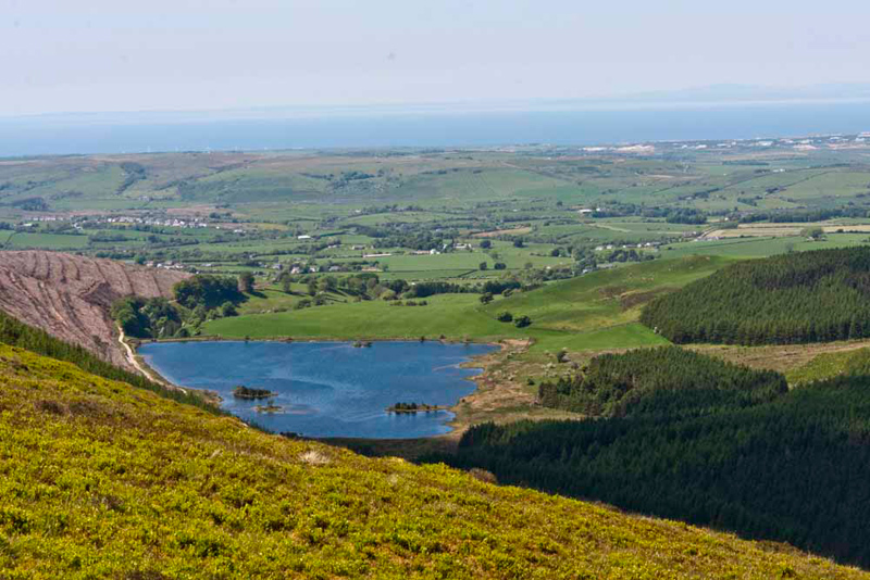
summit, where we quickly hopped out. As we sat, Grizzly said, "it is not entirely clear where the name derives from. The first element 'Flou' is obscure. The second, 'tern' is from the Old Norse tjorn, meaning 'small mountain pool'.
Allen called out, "that's a terrific view of pretty Floutern Tarn dominated by Great Bourne."
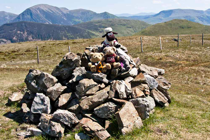
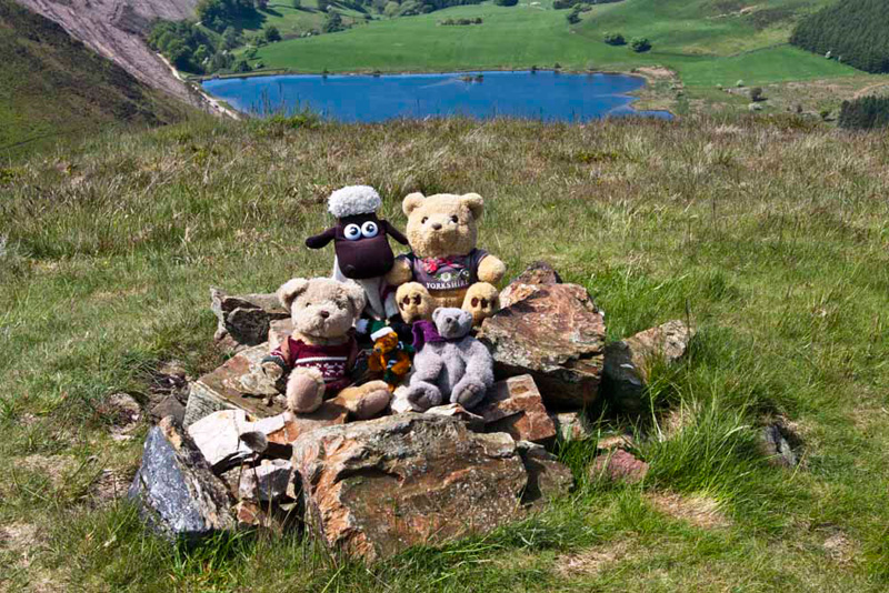
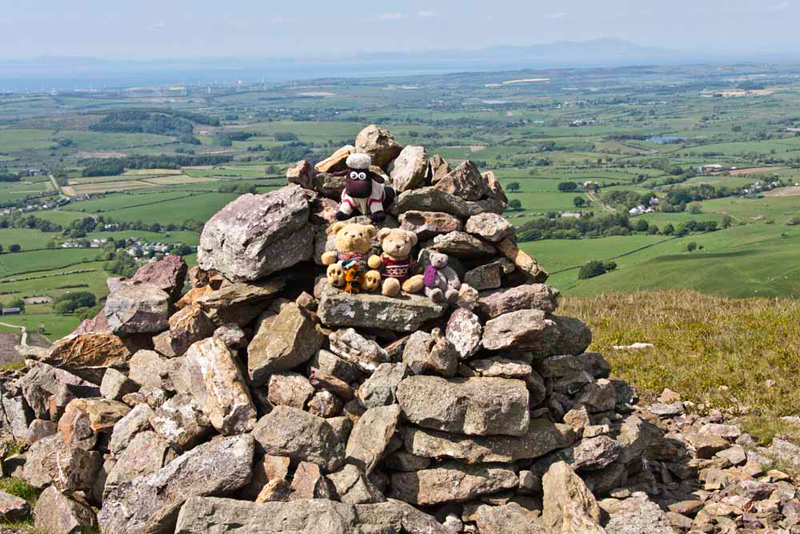
Consulting the map, Shaun told us, "we descend basically north to traverse Whiteoak Moss, and come by the fence. Then climb by this over White Oak, and up to the large cairn at the summit of Gavel
Fell that at 1726 is the highest point we will reach today."
At the cairn, Allen looked at the map and said, "what is rather strange is the the
OS map shows the spot height a bit further on."
"Well to me the elevation here seems to be higher", said Grizzly
"Me too", agreed Little Eric.
We clambered onto the cairn for our picture with a dramatic backdrop. Grizzly said, "the name means, 'the gable-like hill'."
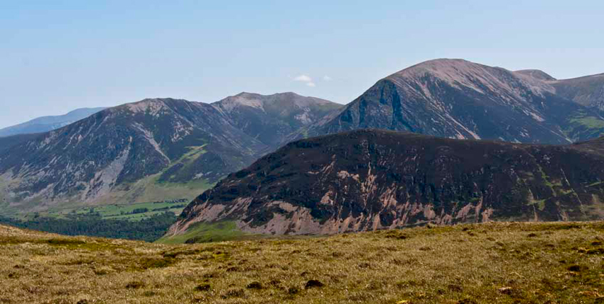
And the backdrop. Mighty Grasmoor, then right is Wandope & Whiteless Pike. Between the first two the tip of Crag Hill can be seen. In front of those is Mellbreak. On the right is Hen Comb backed by Robinson.
"The views are absolutely
fantastic all around", exclaimed Little Eric.
Dad snapped this shot of Whiteside,
Hopegill Head and Grasmoor, with Mellbreak in front.
"According to the book, the next
part north-east to High Nook on Gavel Fell is over thick heather", stated Shaun.
"Hmm, that will be hard going", replied Dad. "I am not looking forward to that."
So imagine our delight, when we saw there was a clear path to the cairned top. "I think this path must have been carved out with all the walkers doing the Birkett challenge", said Allen.
Once again Grizzly was able to tell us about the name. "It describes the situation on a rising corner of land between two streams. In this case Highnook Beck and Whiteoak Beck."
"Where now?", asked Little Eric.
"We have to descend roughly west to Fothergill Head, and cross the stile in the fence that descends from Gavel Fell."
At the stile Shaun then instructed, "we take that grassy track past the steep descending ridge of Blake Fell, before moving right to
gain the ridge, and then cross the fence and get to the top of High Pen."
There were just a few stones marking the summit, that we gathered round. Grizzly said, "Pen seems to reflect a Brittonic word for 'hill'."
"That tarn far below is Cogra Moss", pointed Tetley.
"The origin of the name Cogra is unknown", stated Grizzly.
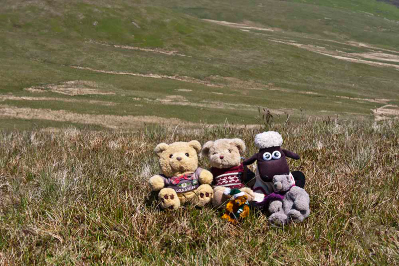
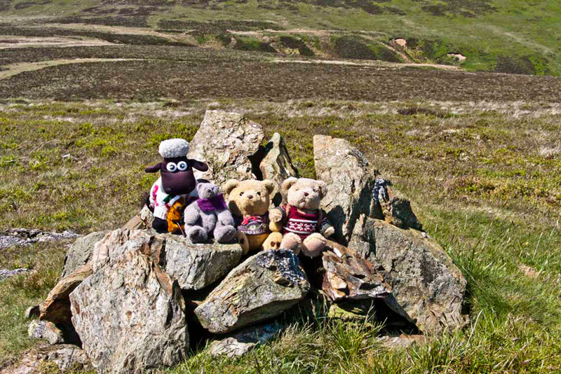
Having settled in the rucksack again, Dad continued down the ridge to the lower summit of Low Pen, with its handy
cairn for our picture.
"Looking ahead, Tetley said, "there's the final challenge of
the day, Knock Murton."
"Oh dear", sighed Little Eric. "I seems we have saved the toughest climb for the last of the day."
"Yes lad, and I'm sure it is every bit as steep as it looks."
From Low Pen the path descended to
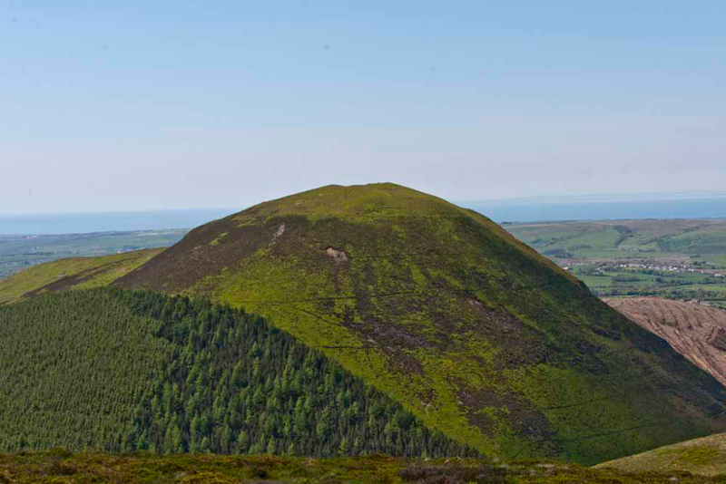
the forest road. Here Shaun instructed, "take the path right towards Cogra Moss. Then we have to find the narrow path through the trees to start the ascent."
As the picture shows thick forest clothes the lower half of Knock Murton. We looked closely, then Dad said, "there it is."
The path was clear through the trees, but the ascent was very very steep indeed,
and really hard going in the oppressive heat.
Reaching stile in the fence Dad said, "I am really in a sweat. At least for the next part we will be on open fell, so there will be more air."
However there was no let up in the steepness, and the gradient was
unrelenting all the way to the summit, with its large cairn and shelter, and extensive views to the coast as well at Blake Fell, Gavel Fell and Ennerdale.
"Phew", said Dad, "I'm
glad that's over."
"Well done", cheered Shaun. "You never let us down. You truly are the very best Dad in all the world."
"Thanks lads. Now get settled on the cairn so I can take your final picture of the day.
So Grizzly, what can you tell us about this name?", asked Tetley.
"Murton probably means 'the settlement by the upland waste'. Knock is from cnocc meaning 'hillock'.
The descent was over mostly rough
trackless ground, but finally we were down to the wide track.
Then once through the gate we walked on the remains of an old
railway track to the road, and then just uphill a short distance
to the car.
Grizzly told us, "the railway once brought ore from the long abandoned
iron mines. Apparently in 1888 alone it produced some 46,100 tons."
The latter part of the day had been
extremely hot, giving Dad a headache, and we were sorry he had
such a long drive home.
"I hope you will feel better once you get home", said Little Eric, with concern in his voice.
"We have had a super day", said Tetley. "Thank you so much as always Dad.
"Great to ticked off 8 more Birkett tops", cheered Shaun.