(1) Wanthwaite (NY
316231).
(2) Old quarry at Park Brow (NY 397211)
Summits Achieved
Name
Height (ft)
Height (m)
Grid Ref
Threlkeld Knotts
1686
514
NY 3301 2302
Bracken How
1224
373
NY 3929 2105
Round How
1270
387
NY 3918 2081
Common Fell
1811
552
NY 3823 2046
Swineside Knott
1814
553
NY 3790 1972
Brown Hills
1808
551
NY 3778 1939
Preface
"Well after the
euphoria of completing the Outlying Fells, I guess we will be
back to ticking off some of the outstanding Birketts on Sunday",
remarked Shaun.
"That's right",
replied Tetley. "Dad talked about taking us to Martindale on
the east side of Ullswater", he continued.
"I guess we will
know soon enough, as I reckon that is where Allen is, finding out
from Dad", said Little Eric, who as usual, was sitting on
Shaun's back.
"Here he comes",
called out Grizzly.
Allen came rushing in
breathless as usual, so Tetley said, "now just sit a minute,
so that you can tell us properly"
After catching his
breath, Allen said, " we are not going to Martindale, as Dad
is a little wary of the road in these cold and icy conditions.
Instead we are going to climb Threlkeld Knotts, and then drive to
near Aira Force, to tick off Bracken How and Round How"
"It will be great
to get Threlkeld Knotts out of the way, as we pass it every time
we drive along the A66 to Keswick", said Grizzly.
"That will mean
that we will have done every summit on the Helvellyn Ridge too",
added Shaun.
"Not me",
said Allen a little downheartedly.
"Well I am sure
that Dad will take you to most if not all of your outstanding Wainwright
tops next year", said Tetley.
The Walk
THRELKELD KNOTTS
It was a frosty
morning as we dived into the car ready for the off. The day was
to be dry with some sunshine, much better than the rains of the
last few weeks. It was that oft travelled route up the M6,
passing by the Howgill Fells, some under early morning mists. At
Penrith we took the A66 west, soon Blencathra coming into view to
the right.
After a further few
miles, Allen suddenly called out "there's Threlkeld Knotts".
"Our turning must be coming up soon".
Sure enough we saw the
sign 'St John's in the Vale", and Dad went left along the
rather narrower road.
Shaun said, "we pass the site of Threlkeld Station
on the long closed railway line from Penrith to Keswick, then continue for about a mile to Wanthwaite where there is limited parking according to Birkett."
"Here we are", said Tetley a couple of minutes later. "There is space here by that gate."
There was ice on the road round the car, so Dad had to
be very careful not to slip. We had settled in the rucksack and
waited patiently while he got ready. Then he shouldered the
rucksack and off we went.
"Continue a few yards then take the track left called the Old Coach Road, passing the house on the right", instructed Shaun.
Grizzly said, "this is the other end of the track that we have walked along from Dockray, when we climbed the Dodds."
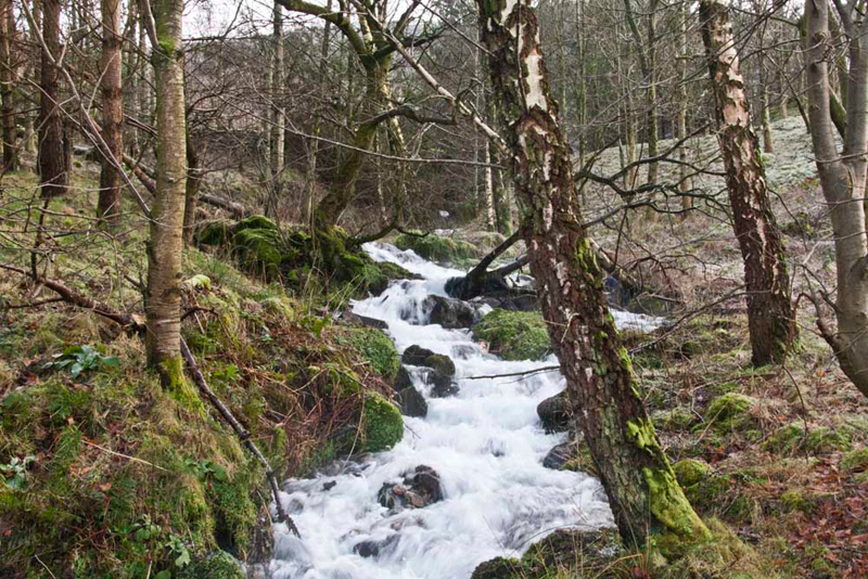
Just beyond a gate, the swollen beck was hurtling down. "That's got to be worth a picture Dad", called out Little Eric.
The path climbed
steadily, bending right and then left at a junction, and continuing
with the wall to the right.
Looking back along the track, Allen said, "that's Hill Top Farm we passed with High Rigg and Naddle Fell."
The wall ended, Shaun saying, "we climb that stile and continue on the
narrow path that winds its way steeply up the old quarry tips, and come to a wide track."
This done, Shaun issued the next instructions. "Now take the signed path
that climbs steeply by a wire fence."
"There is no sign now, but this must be it", said Dad.
About halfway Little Eric pointed, "there's a faded white topped
post. Must indicate we are on the right route."
At the top Dad climbed the stile, Shaun saying "now ascend the field to climb
that ladderstile to open fell."
"Just look at
those superb views", called out Tetley.
"Must be worth
taking a few shots", added Shaun.
"OK", said
Dad, not needing a second asking to get the camera out.
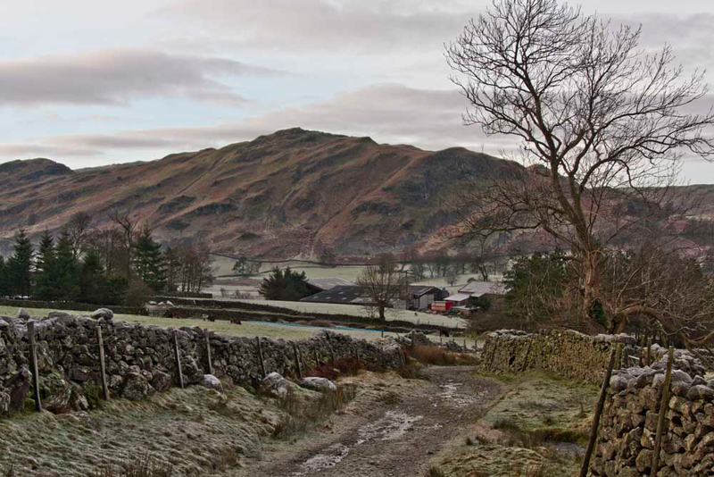
First, here is St John's in
the Vale, white under its covering of frost.
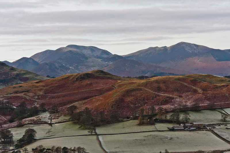
"There's the Coledale Fells beyond Low Rigg", said Grizzly. "The highest to the left is Grasmoor over topping Crag Hill with Wandope on the left, and in front of Crag Hill, Sail dropping to Scar Crags and Causey Pike. Lower in the centre is Barrow with Outerside behind. Then finally right, the prominent summit is Grisedale Pike with just poking over the col behind the very tip of Hopegill Head."
"I have some of
those still to do", remarked Allen.
"Yes lad ",
agreed Dad. "I promise to take you to tick them off next year."
A clear path now meandered towards the very steep ascent to Clough Head. After a while Shaun said, "we leave this left to climb to Threlkeld Knotts. The summit is not the cairn at the viewpoint, but the grassy dome behind."
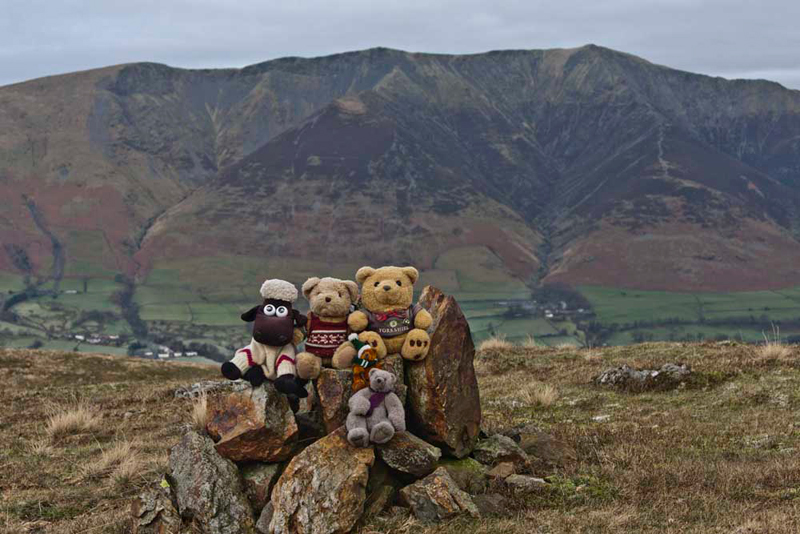
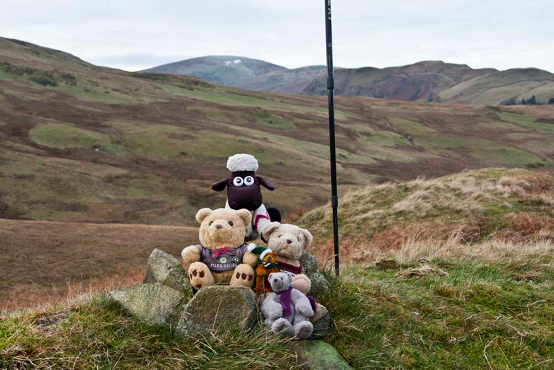
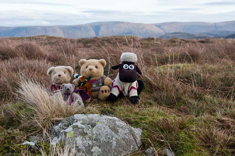
There a small cairn marks the summit. "Come on pals, let's get settled for our picture", called out Tetley.
Mighty Blencathra forms the majestic backdrop.
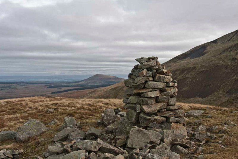
"Although at a slightly lower level it would be nice to visit the other two cairns at the viewpoint", said Grizzly.
"Sure" agreed Dad.
One has been fashioned into a neat
pillar, see here with Great Mell Fell in the distance.
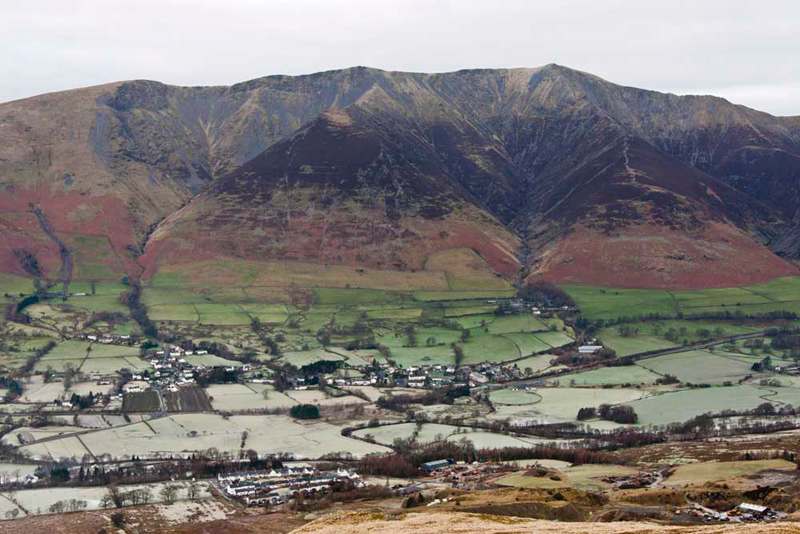
"Terrific view to Blencathra with the village of Threlkeld below", said Little Eric with wonder.
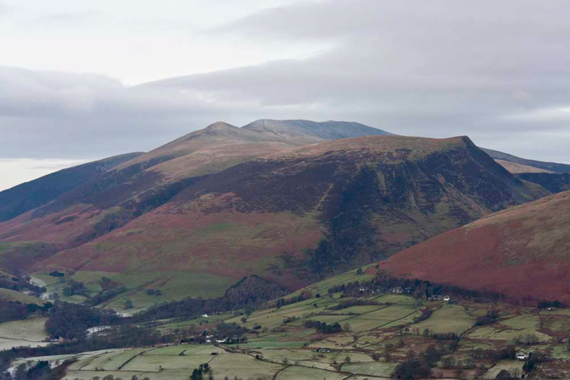
To the west of this
is a commanding view of the Skiddaw Massif.
"That was some day doing that round", said Allen. "Lower Man is in the centre, and behind can be see the path to the summit ridge of Skiddaw that has four tops - South, Middle, High Man (summit)
and North. All ticked off now. On the right is Lonscale Fell. The unrelentingly steep path we took can be seen. It required some effort Dad to get to the top."
"Aye lad. Dogged determination. I do not plan to ever go up that way again."
There was more to do today, so we had to tear ourselves away from the terrific views, Shaun saying, "we just return to the car by the same route."
BRACKEN HOW & ROUND HOW
"Where to now?",
enquired Grizzly.
"We drive back to
the A66, and head towards Penrith, but then turn right at
Troutbeck", replied Shaun.
So, off we went, and
soon we were turning off the A66.
A little further on,
Tetley suddenly called out, "that's the caravan site that
Uncle Bob was staying at, when we met him to climb Gowbarrow Fell,
Little Mell Fell and a few other Birkett tops."
Then before long we
passed through the hamlet of Matterdale End, and further on
Dockray.
"We have been here before", said Allen.
"That's right",
replied Shaun. "When we climbed the Dodds and Clough Head, starting from the other end of The Coach Road that we walked up earlier"
Shortly now at the
brow, we saw on the left the large space of the old quarry. "This is where we park", said Tetley, looking up from the Birkett book.
We had stayed in the rucksack, so all
Dad had to do was shoulder it and off we went.
"Climb the narrow path to the right side that leads to a stile by a
ruined building" advised Shaun.
Once over, the ascent steepened, and
getting up a very slippery rocky outcrop, required Dad to take care. "Glad that's done", said Dad
Coming to a broken stile, Shaun instructed, "we cross the wall then continued on with it now on the left, to soon at a right angle climb to Bracken How."
This involved crossing over the small rocky ridges and valleys to the summit crowned with a small cairn.
You will see that Dad's
stick is firmly planted in the ground behind us, and we are
pleased to report that he did not forget it nor did he need reminding, as we set off again!
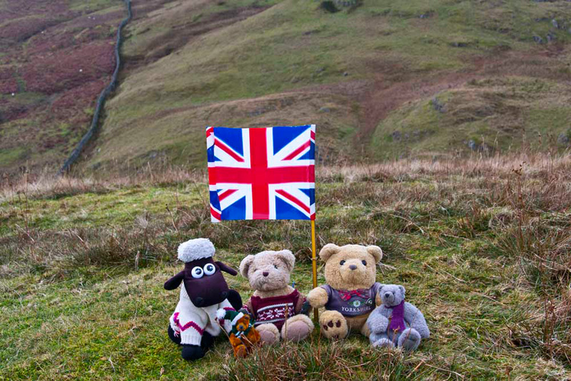
"That's Round How closer to the wall", pointed Shaun.
"Very aptly named", commented Grizzly.
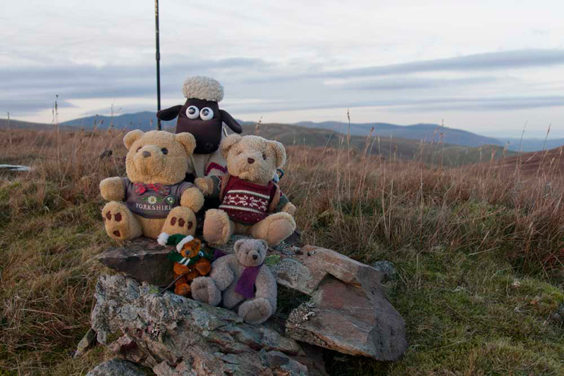
Just a short walk and its summit was reached. Seeing there was no cairn, Allen asked, "will you get the flag out to add colour to our picture?"
"That are the tops done in this walk in Bill Birkett's
book", commented Little Eric.
"Yes pal", said Tetley, "The instructions now state we should go along the wall behind us under the slopes of Common Fell, Swineside
Knott and Brown Hills. We needed to climb these too, so the plan is to deviate to these tops."
It was a few hundreds of feet of climb by the
wall, to eventually reach a brow of sorts, under the slopes of
Common Fell. "Now we have to climb steeply right to the summit", said Shaun.
Almost immediately
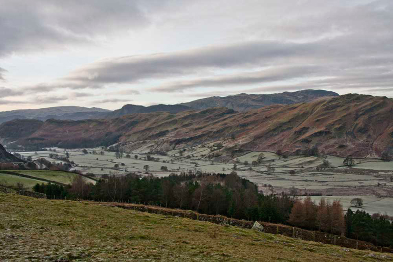
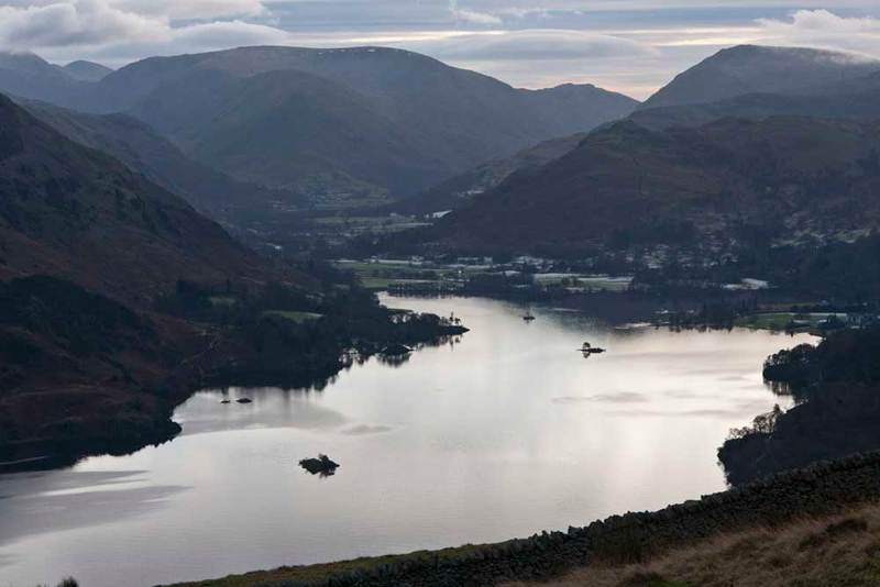
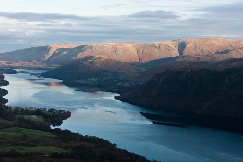
Little Eric called out, "Dad, look at that superb view of
Ullswater. Worth a picture don't you think."
The view is towards
Glenridding, with the Hartsop Fells beyond. We think it looks
icily cold in the winter light. A brooding shot.
A steady climb for about another
15 minutes, and we were at the summit cairn of Common Fell.
Settled again, Shaun pointed, "we just follow the path."
It was along this section that we passed a young couple, the only other walkers we
saw to speak to all day.
Presently the path bent round left to
climb imperceptibly to the pretty flat and undistinguished top of Swineside Knott.
Pointing Tetley said, "I think that slight hump with a boulder is the summit as far as I can see."
"I agree", replied Dad. "If you sit behind it I'll take your picture."
The name probably means 'the shieling for hill for pig grazing', said Grizzly. "This is according to Diana Whaley's book."
Brown Hills was next,
and looking at the map, Tetley suggested, "it would seem to be away to the right, halfway up a
ridge."
Dad said, "you would think so, but it can't be, as the change in GPS reference
required is much closer."
So after just a short walk, with again
little change in height, we were there. "Those few stones
perched on the edge of that little drop, seem to be the
highest point", said Allen.
"We now have to get back
to the wall", said Shaun.
So Dad made the short steep descent. "That's another superb view of Ullswater with the sun catching Arthur's Pike, Bonscale Pike, Loadpot Hill
and Wether Hill", called out Tetley.
Directly opposite
where we had descended, there was a stile over the wall. "This is exactly where we need to be to rejoin the original Birkett
route", said Shaun. "Over the stile then follow the path left."
This delightful section took us through Glencoyne Park and eventually to the road, where after a steady
walk uphill we regained the car.
Dad had done quite well keeping his
trousers clean up to this point, but the last part through the
Park was very boggy, so they needed yet another wash! This was
only for Dad to muck them again on Tuesday. Uncle Brian is
extremely understanding!
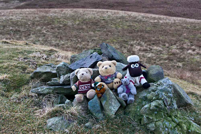
"Well, that is another area
we have not visited before", said Tetley. "But we have got all those Birkett tops ticked off now."
"I wouldn't mind going back to Threlkeld Knotts", said Grizzly, "but I cannot really say the same about Bracken
How etc."
Dad was hungry now, so
he drove to Greystone House at Stainton, where he had some
warming beef casserole with potatoes and carrots, and a pot of
tea.
"Ahh, another grand day out", cheered Allen, as we headed home down the M6.