So up early we were ready on time and dashed out to the car. The route was very familiar. North on the M6 leaving this at junction 40 to take the A66 west past Keswick.
"The start is the far side of Whinlatter Pass", said Tetley, "so we will be turning off at Braithwaite."
"That's right pal", replied Allen. "We have been over Whinlatter Pass a few times, and there will be more times to come."
Up the steep climb to pass the visitor centre, then descend towards Lorton. Shaun said, "the start is Spout Gill car park that is on the right, just a short way before a sharp left bend."
We kept a look out, and it was Grizzly, who called out, "here it is Dad."
We should say now that the weather was poorer than we had expected with low level cloud that obscured the views especially late morning and early afternoon when there was drizzle, and pretty windy making for a cold day.
Dad got ready and we snuggled in the rucksack. Shaun issued instructions, "we follow the track to the property called Darling How, then walk the lane past the house, to go through two gates. On then to a third, in a stone wall, which leads to a break in the conifer plantation."
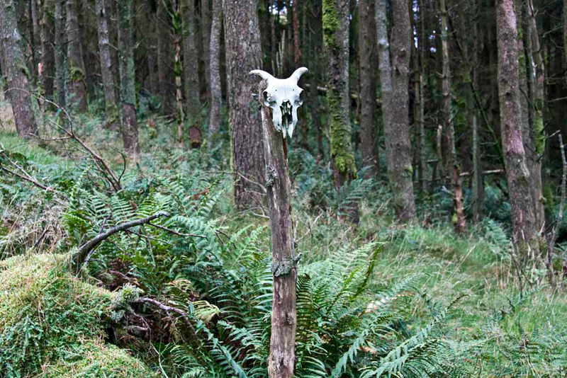
Here a narrow and intermittent path ascended steeply through the trees.
"Ooh", called out Allen. "Beware the sheep ghost of the woods", pointing to this skull.
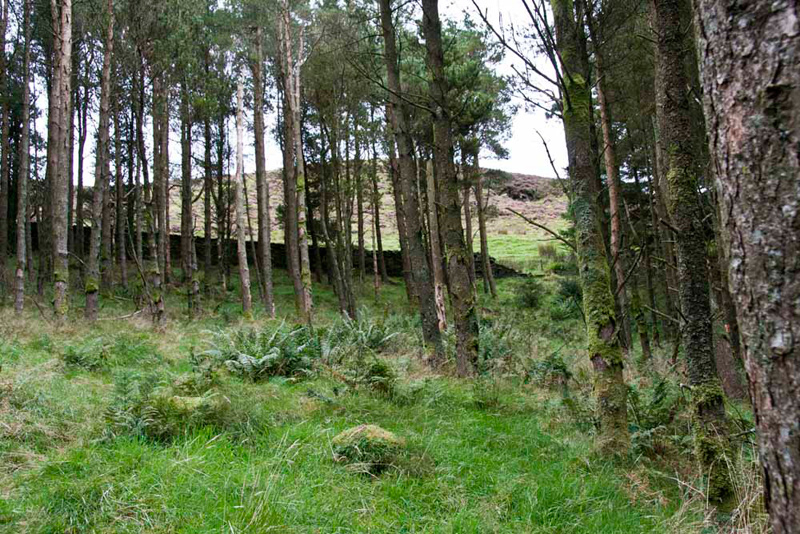
Climbing on eventually we reached a fence. Shaun advised, "go left by the fence to the stile onto a forestry track."
There he said, "cross and follow that avenue through the trees to gain the open fell."
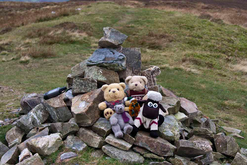
We now climbed steeply to the top of Brown How, the summit being marked by semi-circular shelter.
Grizzly said, "this is what Wainwright considered to be the summit of Whinlatter the altitude being 1696 feet. However at the time of writing he speculated that the eastern top was in fact higher and this has subsequently been proved to be the case by the Ordnance Survey at 1722 feet. That is now referred to as Whinlatter top and is our next summit."
Tetley said, "you are right pal, and whilst we did reach Whinlatter Top on 24th July 2005, I do recall that we did not walk along to Brown How. So, from a technical point of view it is in reality only today that you, Shaun, Dad and I can say we have finished the Wainwrights."
"What a fine view across the Vale of Lorton", pointed Allen. "On the right are the slopes of the Lorton Kirk Fell with the road running below. While across the vale to the left is the end of the Fellbarrow Group."
"The summit we can see there is Hatteringill Head on Whin Fell", added Tetley.
Settled again, Shaun said, "now we just continue on to Whinlatter Top, the highest point on the fell."
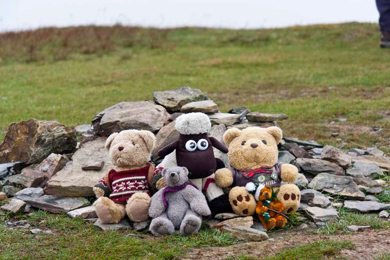
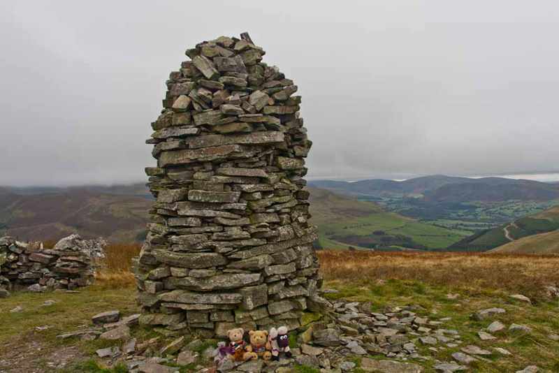
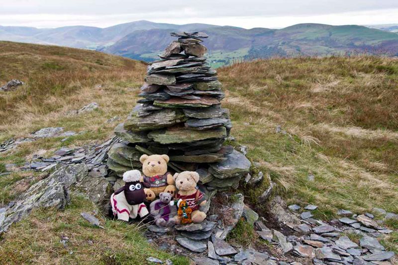
A small cairn marks this and Little Eric said, "come on pals picture time again."
Grizzly said, "the name probably means 'the slope where gorse grows', from Old Norse hvin 'gorse' and Gaelic lettir or leiter 'hill slope'."
On the way here we passed a couple in shorts who were running over this fell. "Phew they must be very hardy", said Little Eric.
"Where now", asked Tetley.
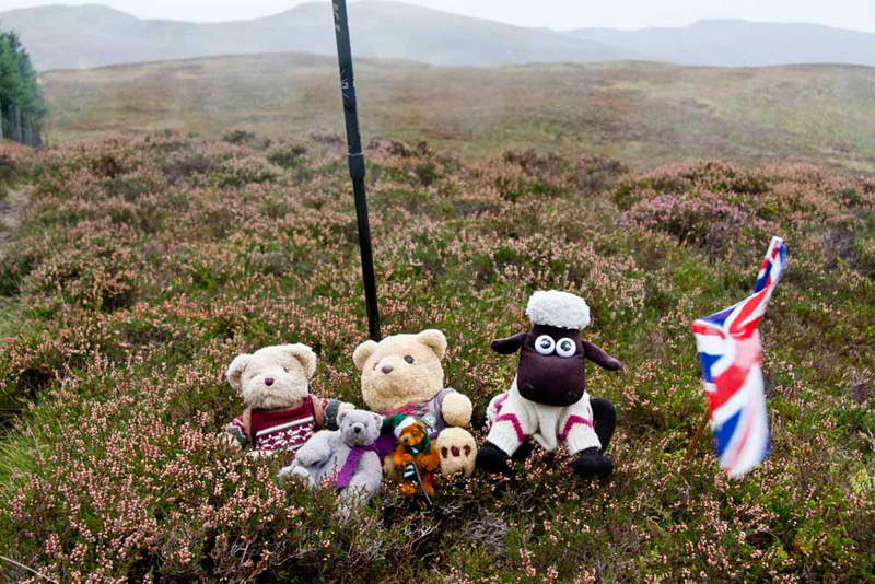
"Follow that narrow path descending to the boundary fence of Thornthwaite Forest, then climb left to top of Tarbarrel Moss close to the fence corner. According to Birkett there is a cairn."
However this has gone, so instead Dad planted his stick. By now it was drizzling but this did not deter us posing at the summit. "Will you get the flag out to brighten the picture please", said Grizzly. The damp misty conditions are evident as is the wind from the blur of the flag.
Quickly back into the rucksack, Shaun advised, "the route is through that gate."
This led to a dark tunnel like path that dropped down through the trees, to first cross a cycle route and then to the main forest path.
"Go right a few yards then take the left fork", called out Shaun.
At the next split in the paths, Little Eric said, "which way now?"
"The path right", replied Shaun.
This skirted the forest then after a while led through heather, to climb to Ullister Hill's bare summit.
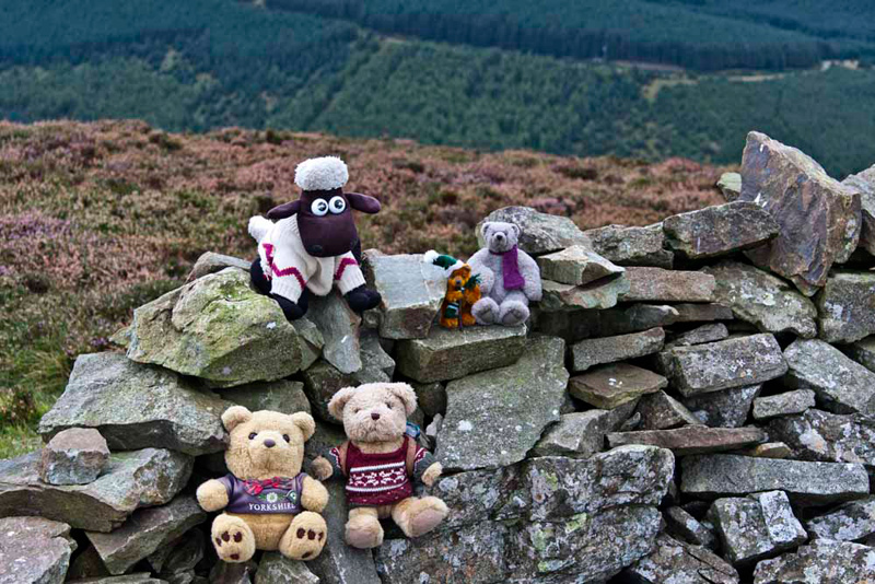
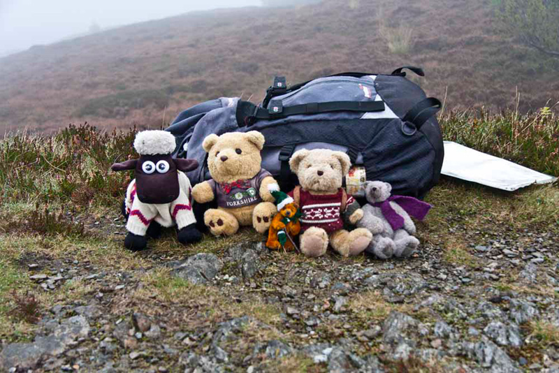
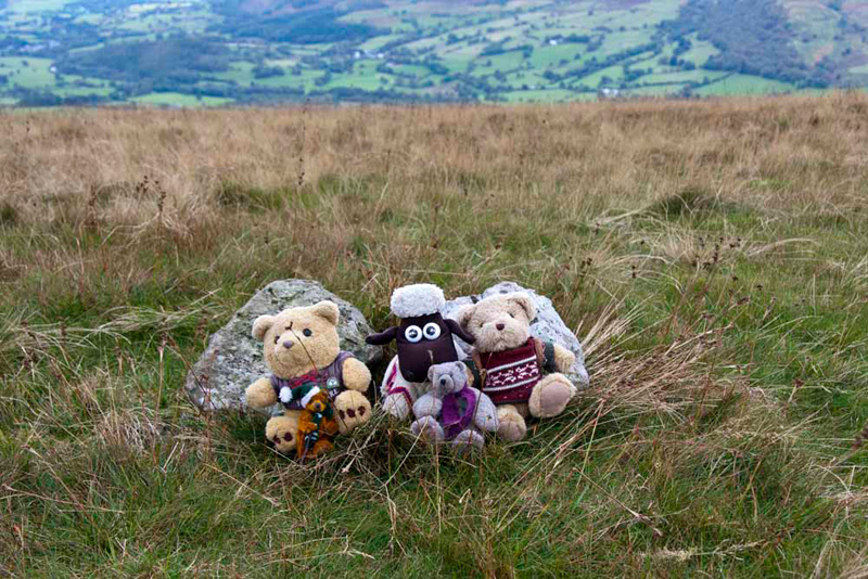
Still raining and windy we were undeterred, Tetley saying, "I think we will need to sit against the rucksack to stop blowing away while we have our picture taken."
"So Lord's Seat next", said Allen looking at the Birkett book.
"Yes as far as his walk is concerned", agreed Shaun, "but he does Seat How on a separate walk, and we need to go there first to ensure all the tops in this area are done."
"So how to we get there?", asked Grizzly.
"Descend back to track then go left though the forest."
Soon the trees parted and there was just a short climb to the rocky outcrop at the summit. "That would have been a superb view to Derwent Water" said Little Eric. "However the weather has rather spoilt it today, and not worth a photograph."
Here we met a group from Jersey who were on HF holiday, and Dad chatted to a lady for a few minutes.
"We retrace the route to Ullister Hill and then continue down to a good path that allows dry passage across an extensive boggy area. Then climb on to cross a stile and ascend to Lord's Seat" instructed Shaun.
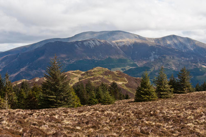
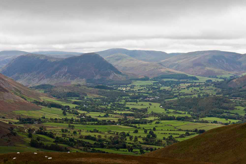
Again the weather spoilt the views, but had it been clear we would have enjoyed this looking over Barf in the foreground to the Skiddaw group. This picture was taken on 15th April 2012.
"Time to take our picture Dad", said Little Eric. "That's another Wainwright I have ticked off."
A couple were here with their daughter and the lady asked about us. "Are they doing the Wainwrights?"
Dad pointing to each of us said, Shaun, Tetley and Grizzly have done them all, while Allen close to completing the challenge. Little Eric only joined the group last year so still has many to climb." Then Dad asked, "are you doing them?"
"Yes eventually", she replied. "So far we have done 11."
"Well we all wish you good luck on your quest", replied Dad.
We wonder as we write this story in 2021, if they did indeed succeed.
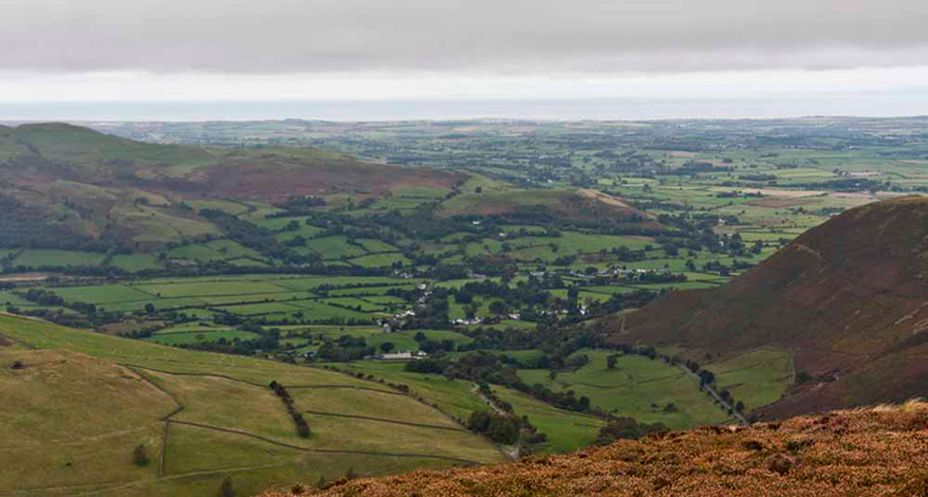
Before moving on, we include this shot taken on 9th May 2012, of the excellent view we should have had of Graystones, our next but one summit and at the left end Kirk Fell our final summit.
Setting off, Shaun said, "follow that ridge to Broom Fell."
About 20 minutes later we arrived and jumped out to sit by the tall cairn. Grizzly informed us, the name simply means, 'the hill where the broom grows'."
Tetley said, "the highest point according to the map, which we crossed is just before the cairn, but as Birkett says few will accept it as so."
"So where now?", said Little Eric.
"Walk down the shoulder to a gap in the wall, then along by the edge of Darling How Plantation over Widow Hause", replied Shaun.
Coming to the end of the plantation Shaun then instructed, "go through that gate onto the grassy track, and follow it diagonally left and then right up to the open shoulder. There go left to the cairned grassy bump that is the north top of Graystones."
Getting there Allen said, "this is not the actual highest point, but it does give a fine view." The weather had cleared up now.
Little Eric said, "I think I know what the fells are. Closest is Mellbreak with behind Little Dodd rising left to Hen Comb. I think those on the right are Carling Knott over topped by Blake Fell. Not sure about the one behind Hen Comb."
"You are spot on pal, well done. It takes time to work the, out", replied Tetley. "The highest behind Hen Comb is Great Bourne."
"We head to that rocky knoll just to the south for the summit", pointed Shaun.
"Yippee", cheered Little Eric. "That is four Wainwrights I have ticked off today."
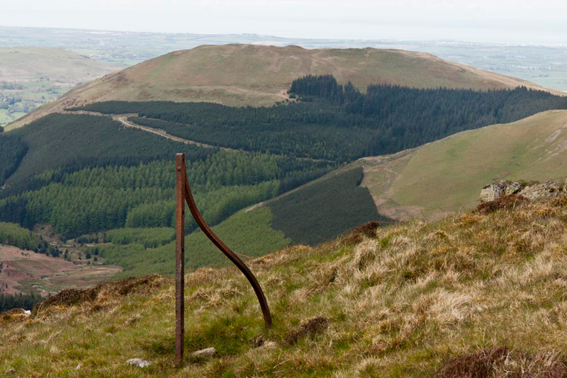
This just left the Birkett summit of Kirk Fell. Shaun instructed, "Cross west and over the wall, then cross a hollow and climb gently to the flat top of Kirk Fell. There is a small cairn and wooden post to mark the summit."
As can be seen the latter is gone. Grizzly said, "the name means 'church mountain'. In this case the fell lies east of Lorton church and dominates the views from there."
"Now for the steep descent", said Tetley looking at the map."
"Yes", sighed Dad.
"Descend the grassy slopes and enter Sware Gill by an old stone wall. There we cross the gill and follow the ruined stone wall left to the edge of Darling How Plantation", said Shaun.
There Shaun said, "Birkett then says to enter the woods."
"Hmm I see", replied Dad looking at the map. "However I am just going to keep descending steeply by the plantation and pick up the path right to the road at Scawgill Bridge."
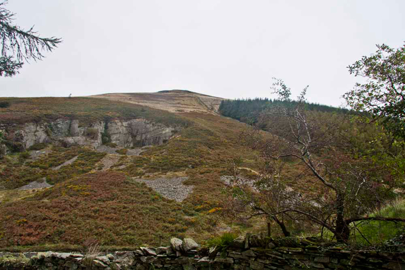
This shot gives an idea of the descent from Graystones. In the left foreground are the remains of a long disused quarry.
At the road we crossed the bridge and walked to the track and so to the car.
"That was a terrific day", cheered Allen, "despite the weather."
"Absolutely", agreed Little Eric, "I have bagged all nine summits and the rest of you have bagged five."
"Aye", agreed Dad. "A good day, although I found it a bit hard going, perhaps due to the weather conditions."
"Nevertheless a grand day out", said Tetley.