HIGH
PIKE, HARE STONES, THE LINGY HILLS & COOMB HEIGHT
from MOSEDALE ROAD END
Summary
Date - 12th February 2011
Distance - 6.25 miles
Ascent - 1780ft
Map - OL5
Start point - Mosedale road end (NY
326326)
Summits Achieved
Name
Height (ft)
Height (m)
Grid Ref
Hare Stones
2057
627
NY 3152 3439
High Pike
2157
658
NY 3187 3501
Great Lingy
Hill
2021
616
NY 3101 3397
Little Lingy
Hill
1998
609
NY 3036 3389
Coomb Height
2057
627
NY 3107 3272
Preface
Grizzly, Shaun and Tetley wandered in to
find Allen tapping away on Dad's laptop, with Little Eric sitting
beside him, looking earnestly at the screen.
"What are you on with, pal?",
asked Grizzly.
"Checking up on the forecast for the
weekend", Allen replied
It has been so changeable this week so far,
but it would be great if we can get out, and maybe into the Lake
District", said Tetley.
"So, what's does it look like?", said
Shaun impatiently.
"Saturday looks to be the best day. Dry
with some sunshine", Allen read out.
"That's great, so all we have to do is
decide where to go and then see if Dad is agreeable", said
Grizzly enthusiastically.
The last time we were out at the weekend Dad
had planned to do the last of the Birkett tops in the Northern
Area", said Shaun. "However the plans were changed at the last minute, to walk with
Uncle Bob."
"That's right", agreed Tetley.
"It would be good to get those finally out of the way."
"So, all that remains is to see what
Dad thinks", said Little Eric.
"I'll go", volunteered Allen
dashing out of the room.
While they were waiting for him to return,
we all gathered round Shaun as he showed us on the map the likely
route, we would take. "The ascent beside Grainsgill Beck
will be completely new to us, as will the walk over to Little
Lingy Hill and then across to Coomb Height", he said.
"Looks like we will have an interesting
day", said Little Eric. "Going to High Pike will be
another Wainwright I will tick off."
Just then Allen hurtled into the room like a
whirlwind. "Dad thinks it is a great idea, so the walk is on
for Saturday", he said breathlessly.
"Super", cried Tetley. "Lets
have a mug of tea and biscuit from the tuck tin to celebrate."
The Walk
We got ourselves up early, as usual
on a walk day, and all helped to pack the picnic, which was
safely stowed in Allen's rucksack.
Soon after Dad called out, "I'm
ready for the off."
Not needing a second asking we
dashed out to the car, calling our goodbyes to Uncle Brian and
the rest of the Hug.
"Have a good time Lads, and take care", called back Uncle Brian.
The fells are in the Northern Lakes,
so our route was north via the M6. As we swung round into the
Lune Gorge, Tetley called out, "there's Linghaw, which was
our last summit, to complete the Howgill challenge."
"Yes it was a great day for
you four, but just a stepping stone on the way to completion for
me", replied Little Eric. "I am overjoyed however that
Dad has agreed to revisit those tops I have not done, so
hopefully I will join you in having completed the challenge later
this year."
Soon we were passing Shap summit,
and then the long descent followed to junction 40, where we took
the ever so familiar A66 west.
"There's Blencathra",
called out Shaun. "Just before we need to take the side road
right, to Mungrisedale."
The road is familiar to us as we
have done quite a number of walks over the years from it.
"There are the Eycott Hills
over to the right", said Grizzly. "There was no problem
finding the summit of Great Eycott Hill, but Little Eycott Hill
was quite another matter as it could have been any one of a
number of hummocks. Still you and Dad sorted it out eventually, Shaun."
"Let's hope that we do not
have the same problem with Great Lingy Hill and Little Lingy Hill
today", added Allen.
The road wound on through the
village of Mungrisedale and on to hamlet of Mosedale. Here we took an even
narrower road left up the pretty valley, between Carrock Fell to
the east and Bowscale Fell to the west. This was our second
journey along here. The first time being a few weeks ago to check
that there was somewhere to park near the point where the road
ends and becomes a rough track, that forms part of the long
distance path the Cumbria Way. We crossed the tiny bridge, and
bumped along the track for a short distance, where Dad turned the
car round and parked on the grassy verge behind a few other cars.
High fells towered all around Shaun pointing above the track and saying, those are the lower slopes of Coomb
Height, our last top today."
"That looks steep",
remarked Tetley.
"Well at least we are not
going up that way", replied Grizzly.
Starting off, we recrossed the
bridge over the tumbling Grainsgill Beck, just before it joins
the River Caldew.
In a few yards, the Cumbria Way
went left up the valley of Grainsgill, the signpost indicating the
destination of the first part of our walk. "That's our route", said Shaun.
"This is an excellent track",
remarked Little Eric.
"That's because there were
mine workings in this area, and this must have been the access
track to them", replied Tetley.
"Just look at those sparkly
stones on the track", called out Grizzly. "They must be
some mineral left over from the abandoned workings."
It would have been nice to take a
piece home as a souvenir, but then we saw a sign, that confirmed
Grizzly's comment, and further stating that a permit was needed
to collect mineral samples. We kept our paws firmly in the
rucksack!
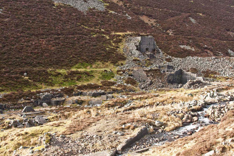
As we climbed gently on, tumbledown
remains of mine buildings came into view, hardly recognisable now.
Uncle Eric has lent Dad a book
about mining in Lakeland, by W T Shaw. From this we have been
able to identify that these remains once formed part of the
Carrock Mine. It was started about 1854 principally in the hope
of finding lead ore, in the area of Brandy Gill on the opposite
side of the valley. The trials were unsuccessful and closed in
1858. A lead vein was discovered further up the gill in 1868. At
first some rich ore was found, but it was only a small pocket so
again it was abandoned. More trials were made by various people
over the next 30 years but in 1901 operations for wolfram (tungsten)
began in earnest lasting until 1905. A German company then
restarted workings in 1908 and worked it steadily until 1911. In
1913 the Carrock Mining Syndicate took over, and there followed a
great period of activity. The mill was rebuilt and the latest
type of concentrating tables were installed increasing recovery
to over 90%. The use of rock drills made it possible to raise the
mill throughout to 50 tons per day and this was maintained, until
the end of the First World War brought a slump in the price of
tungsten; the mine closed in 1919. There was interest again
during World War Two and the Korean War, but despite exploratory
work no actual ore was produced. After further ownership changes,
the mine did reopen in April 1977 and produced around 16,000
tonnes per annum until closure in October 1981. The price of
tungsten concentrates had fallen again. Following abandonment of
the lease in 1988 the mill and associated buildings were
completely cleared. The only remains of buildings are those in
the picture that Dad took. For more information and pictures
click the following link - Carrock Mine
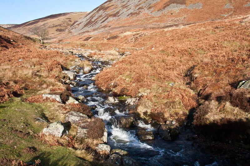
The track continued climbing beyond
the remains, and then it seemed to have once crossed the valley.
"There are more mine remains
up there", said Little Eric.
"That leads up Brandy Gill,
but our route is to climb on by the beck, and anyway they maybe
dangerous, so it would not perhaps be wise to go up there",
replied Shaun.
The mine track ended and ongoing it
was just a narrow trod muddy in places after all the rain,
alongside the rushing beck in spate. Eventually this brought us
to the ridge below Coomb Height, at Miller Moss.
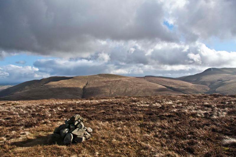
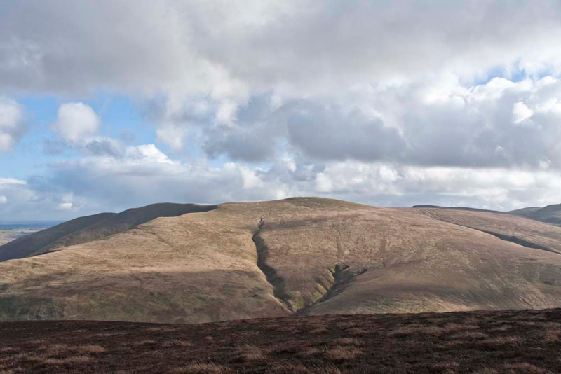
"We take that clear path under the slopes of Great Lingy Hill, a summit for later", instructed Shaun.
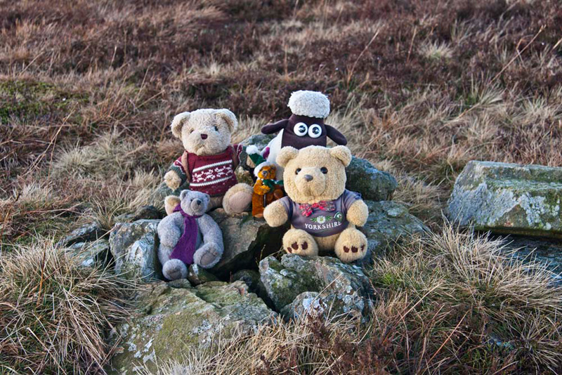
This climbed then descended, before
rising to Hare Stones, the cairn marking the summit being just to
the left of the path.
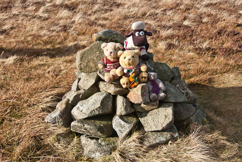
"Just I have bagged this today", said Little Eric excitedly. "Another Birkett ticked off."
"Well a picture is a must to mark this", called out Allen.
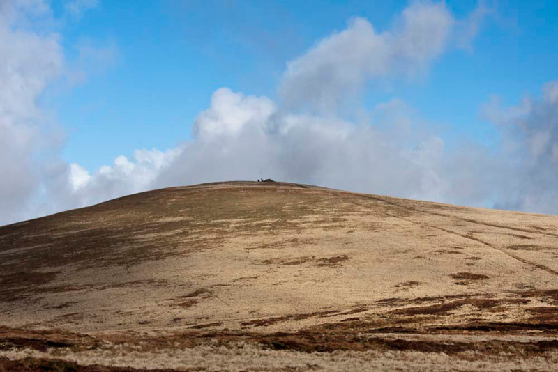
Ahead was High Pike, the clear path
to its summit, being reached after a short descent from Hare
Stones.
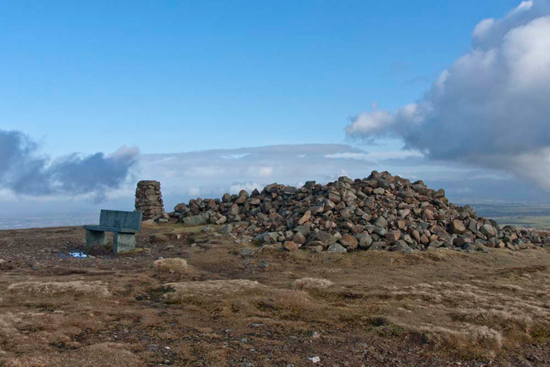
The summit is marked by a large
pile of stones fashioned into a shelter, trig point and seat.
"Yippee", cheered Little Eric. "That is another Wainwright summit I have bagged."
"It is also our highest point too", said Tetley. "We must have a picture sitting on the seat with us gathered companionably around you."
"Time for lunch don't you think", said Allen, rubbing his tummy in anticipation.
"Yes pal" agreed Grizzly. "And Dad can sit beside us on the seat."
We ate our sandwiches and cake, washed down with warming mugs of tea, while looking at the views. While there, a group of people from Caldbeck
arrived. A gentleman in the party spotted us and asked Dad, "have they walked up!" He then said "I think an explanation is
needed."
Dad obliged telling them about our
achievements and the many adventures we have had over the years,
then going on to tell them that some are recorded on our website.
"You are certainly veterans of the fells", the gentleman replied. "Well done to you all." Then as they set off down he said, "we'll have a look the website."
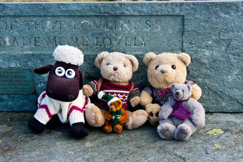
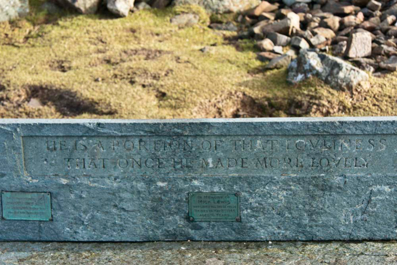
You may have noticed in the above
picture that the seat has an inscription and dedication plaque, and the picture below shows this in full.
The inscription reads - 'He is a
portion of that lovliness that once he made more lovely'. The
dedication in the centre reads - 'In Memory of Mick Lewis who
loved these fells. He died on May 8th 1944 aged 16 years'. The
second plaque is to his mother Millicent Mary Lewis who died on
10th November 1970.
"How poignant", said Little Eric.
"Time to get going again Lads",
said Dad
"OK", replied Shaun, as
we jumped into the rucksack.
While we had been here the mist had
rolled in obscuring the fells we had crossed earlier, but it
proved to be only temporary and lifted somewhat after a while. In
any event it would not have caused Dad any problems as he was
sure of the route we had to take. Retracing our ascent we headed on over Hare Stones towards Great Lingy Hill.
At the depression between the two, Shaun said, "now we have to head half right across the rough ground, to reach the cairn at the summit of Great Lingy
Hill."
"That's another catch-up for me", cheered Little Eric.
"Yes lad", replied Dad. "But the next two will be new to us all and will see the completion of the Northern Area of
the Birkett Fells, for Shaun, Tetley, Grizzly, Allen and I."
While still sitting on the cairn,
Tetley called out, "that must be Little Lingy Hill just over
there, with its summit cairn standing proud."
"Quite right", replied
Dad. "Now come on and settle in the rucksack, so we can head
for it."
So, in the same direction, we
descended to cross the dip, and then after a short ascent, Little
Lingy Hill had been ticked off. Its cairn is even more impressive
than that on Great Lingy Hill, being well constructed from large
stones.
Looking round Grizzly said, "that fell in the background is
Knott, which was my last Wainwright. I climbed to its summit on
24th June 2009".
"That's getting on for two
years ago", replied Shaun. "My how time flies."
Grizzly then, with the rest of us, jumped out to settle on the cairn. He then went on the names of Great and Little Lingy mean 'the heathery hills'."
"Where to now?", asked
Little Eric.
"To get to Coomb Height, we
first need to get back to the ridge path at the top of Grainsgill",
replied Shaun. "So there is nothing for it but just to cross
the rough ground to the right of the slopes of Great Lingy Hill."
"You're right", agreed
Dad. "Also I must be careful not to stray too far down, to
avoid the worst of Miller Moss."
So off we trudged. The terrain was
pathless and rough, and whilst Dad is well used to this kind of
walking, he was nevertheless glad when he reached the ridge path
once again. Here we crossed the upper reaches of Grainsgill Beck,
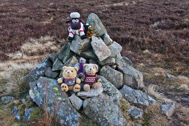
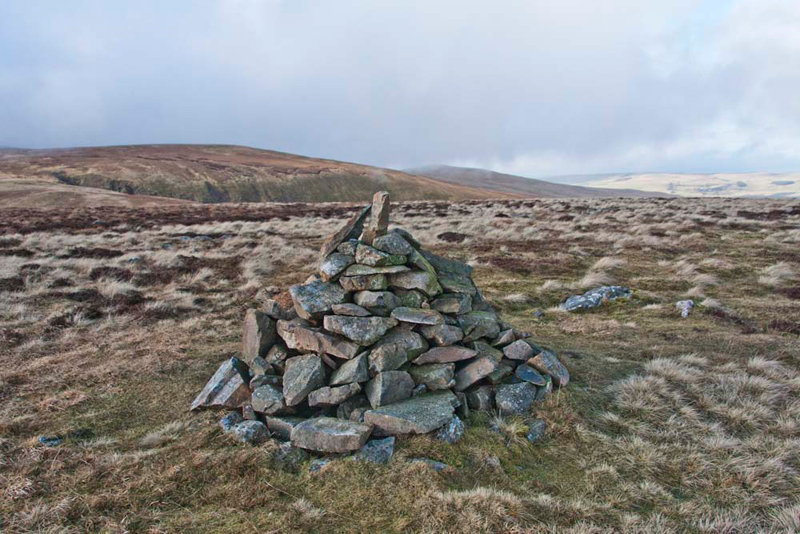
and on directly up the rough slopes of Coomb Height to the small
cairn marking it summit.
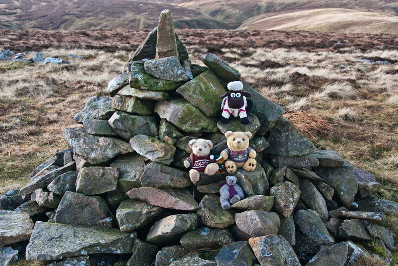
Setting the scene in front of us, Tetley said, "Bowscale Fell is directly behind the cairn, with to the right Blencathra."
"That's it lads, the Northern Area of the
Birketts done!!", said Dad.
"Hooray", we all shouted.
Then we jumped out to have our final summit picture of the day
taken.
"Dad, I know you had planned
to return via Grainsgill, but there is a clear path from here in
the direction we need to go", said Shaun.
"Yes lad, and I think we will
take it as it will make the walk more of a circular route and
will perhaps be less boggy than the upper reaches of Grainsgill."
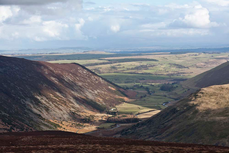
Across the summit the path was
grassy, and the views opened out ahead and we stopped to enjoy
this. Way below was Mosedale, which we had driven along this
morning to the start point. The narrow road hugs the left side of
the valley below the slopes of Carrock Fell.
The right side is dominated by the
massive bulk of Bowscale Fell. "We have climbed that from Mungrisedale in 2004 and 2007", said Grizzly. "However we have not viewed it from this side before."
Looking up from the map, Tetley said, "in the prominent ravines run streams. On the left Long Gill and right Short Gill. Quite logically named."
Once off the summit plateau the
hillside was swathed in heather. This caused the path to
disappear at times and then sometimes there appeared to be more
than one.
Shaun advised, "best to keep heading roughly in the direction of
Carrock Fell."
This proved to be the correct decision, as we
continued the descent in stages. Finally, as we had expected
because of the close contours on the map, we came to the very
steep path that wound down the nose of the fell. Care was
necessary as it was slippy in places, but Dad got us safely down,
coming to the track by the bridge and just a few yards from the
car.
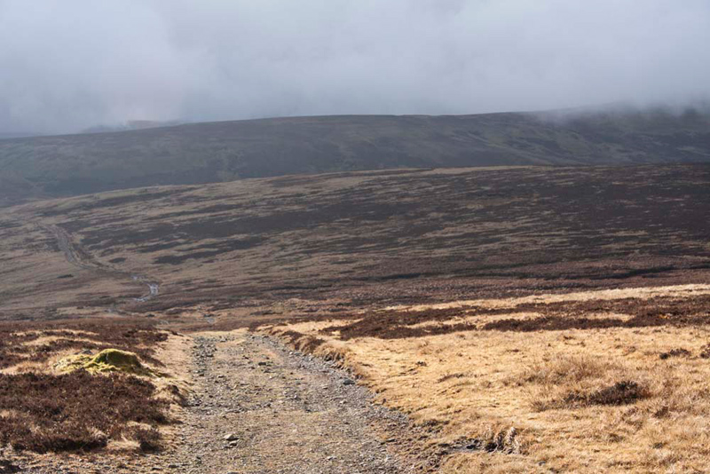
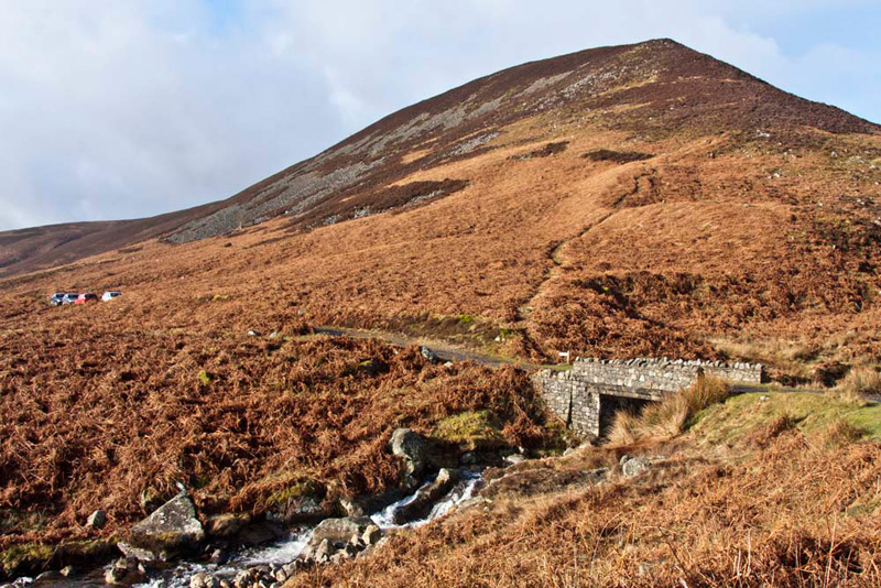
This shot, taken this morning, shows the
steep descent path, with the bridge under which Grainsgill Beck
tumbles down to soon join the River Caldew.
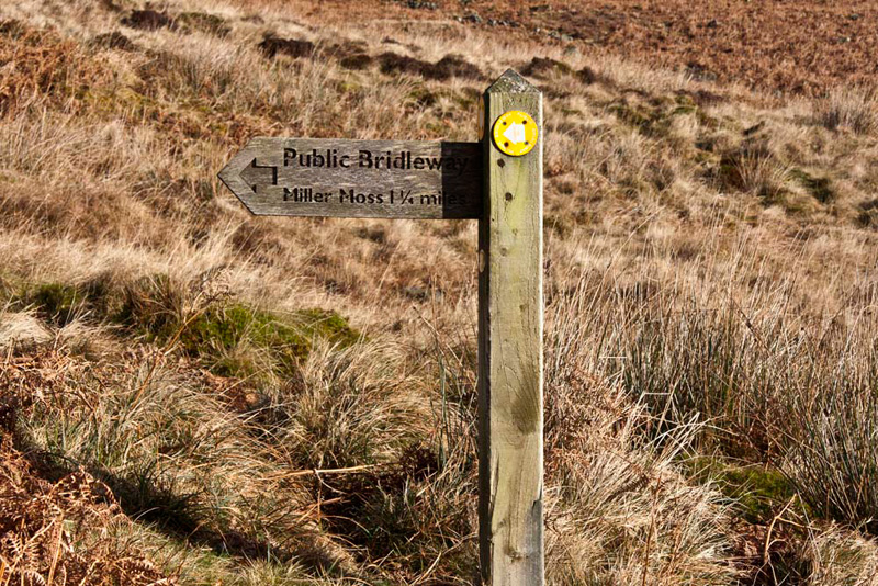
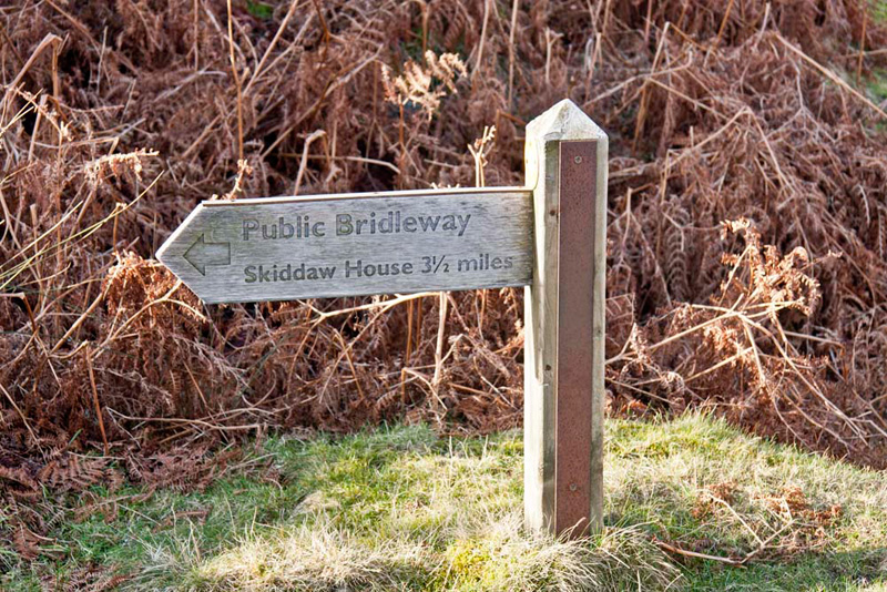
This small signpost stands by the
bridge pointing along the track.
We had been past Skiddaw House a
number of times on walks over Skiddaw, and to the fells below
that mountain.
"So that is where the path we
saw heading north east off the main track from the Youth Hostel
comes out", remarked Allen.
"From here it goes below the
slopes of Coomb Height marked Cocklakes and Snab on the map, and
then below Great Calva, before coming to Skiddaw House",
informed Shaun.
We had been followed down Coomb
Height by a couple, and as Dad passed them in the car he stopped commenting "it was steep coming down off there."
"Yes" replied the gentleman. "Now we just have the two miles along the valley to our car parked on the Caldbeck road."
"Would you like a lift", offered Dad.
"That would be very kind", he replied.
Dad's good deed for the day as he dropped them off by their car.
Unsurprisingly Dad was hungry now.
So the journey home involved a stop at Steve and Joanne's, The
Old Schoolhouse at Tebay. He had lovely carrot and coriander soup,
then liver and bacon with onion gravy, potatoes and vegetables.
Delicious. Thus suitably fortified, we completed the journey home.
"Thank you Dad once again for a super day", said Little Eric.
"A grand day out and another step forward on the Birkett challenge", went on Tetley.
"You are truly the best Dad in all the world", cheered Shaun.