THROSTLEHOW
CRAG, SCAR LATHING, HIGH GAIT CRAGS, HIGH SCARTH &
SILVERYBIELD from BROTHERILKELD, ESKDALE
Summary
Date - 24th April 2011
Distance - 9.5 miles
Ascent - 2550ft
Map - OL6
Start point -
Near foot of
Hardknott Pass (NY 211011)
Summits Achieved
Name
Height (ft)
Height (m)
Grid Ref
Throstlehow
Crag
1325
404
NY 2272 0436
Scar Lathing
1440
439
NY 2261 0494
High Gait
Crags
1877
572
NY 2300 0578
High Scarth
1598
487
NY 2153 0439
Silverybield
1296
395
NY 2219 0390
Preface
Grizzly wandered in to find Allen &
Tetley sitting in front of Dad's laptop, with books open on the
table at the side.
"Did you enjoy Fringe on Sky 1?",
Allen asked while tapping away with his paws.
"Very much pal, it gets better every
week. Quite a scary episode too", he replied. "What are
you two on with?"
"With all that Dad has had on this year,
we have not done as many walks as we would normally expect, but
we thought with all the good weather maybe we can get out into
the Lake District, and tick off some of those 25 Birkett tops we
still have to do", replied Tetley.
Allen went on, "I have pulled up the
outstanding list, and Tetley and I were just looking through to
see what we might suggest to Dad."
So Grizzly settled beside them to see what
ideas they could come up with. After a while he said, "if I
recall correctly, there is a walk that involved crossing a river,
and Birkett says that it is not possible if it is in spate. With
all the dry weather it will be low, so perhaps that is one to
consider."
"That walk is in Eskdale as it is the
River Esk that we have to cross", said Tetley. "They
are in the Western Fells, so page down Allen."
"OK pal"
"There they are, the group including
Scar Lathing", called out Grizzly.
By now Tetley was reading the description in
the book. "Birkett says it is an arduous walk, so it will be
hard for Dad, as he says he has lost some of his hill fitness
with not doing so many walks."
"Well, we will just have to ask him
very nicely", said Allen.
"You're the best at that", said
Tetley.
"OK, I will go, Allen replied. "But
not before I have had a mug of tea. I'm gasping."
It was then that Shaun with Little Eric
riding on his back as usual, came to the rescue, bringing in
flasks of freshly brewed tea.
"Your a saint", Allen called out
rushing off the get the mugs.
Meanwhile Grizzly had got the tuck tin and
called out, "biscuit anyone?"
"Too right", said Tetley.
While drinking his tea, Tetley explained to
Shaun and Little Eric the proposal.
"Sounds a great idea", agreed
Shaun. "If I remember rightly, when Dad looked at doing this
walk, he thought about taking in High Gait Crags too, as it is
nearby."
"Oh dear, that is going to make the
walk even harder for Dad. You will need to be at your persuasive
best, when you ask him, Allen", said Little Eric.
"Well no time like the present",
replied Allen trotting out of the room.
It was quite a while before Allen returned.
"Dad was on the phone, so that is why I have been so long.
The good news is he has agreed to our suggestion. He knows it
will be a hard walk, but will be glad to get these tops out of
the way, and as he pointed out it will mean 20% of our
outstanding Birketts will be done in one go."
"Roll on Sunday", said Shaun
enthusiastically.
The Walk
It is a long drive to Eskdale, so
we were up early to get ready. As we heard the boot slam shut, we
dashed out to the car, calling out, "goodbye Uncle Brian, enjoy your quiet day."
The route took us up the Duddon
Valley and over Birker Fell, to then take the road leading to the
Hardknott Pass.
"We have been along much of the route quite a few times", said Grizzly. "The roads are very narrow in places. Dad will need to be extra careful in his shiny
new car, as it fills these narrow roads."
So we all felt some trepidation for the drive, and kept our paws crossed. Happily, despite some squeezes passing
oncoming cars, the drive was accomplished safely in both
directions.
Once again today there were
cloudless skies, and with the walk being in upper Eskdale, we
were in for some stupendous views of some of Lake Districts' highest
mountains - Scafells, Esk Pike, Bowfell etc.
So, booted up, Dad shouldered his
rucksack with us safely tucked inside, and strolled the short way
towards the pass.
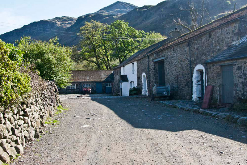
At the telephone box, Shaun said, "we go left along
the track to Brotherilkeld Farm."
The fells behind are Hard
Knott with Border End to its right", pointed Allen. "One of the Judy Boyes prints on the wall at home is of this farm. Whilst the buildings are the same, she has prettied the
painting with flowers and lambs."
The path is diverted round the
farmyard and then continues above the River Esk, skirting
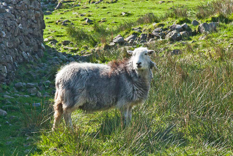
pastures on the right. Here as in other places too, the fields
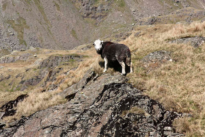
were full of our beloved Herdwicks.
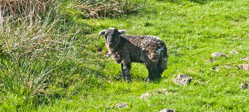
"I know you don't like sheep pictures, Allen", said Little Eric, "but we have got to include some of the lambs and ewes today."
"I don't mind pictures of Herdwicks, as they are our very favourite sheep", replied Allen.
Some ewes had ever so tiny new
born lambs, like this one, taken later in the day near Taw House.
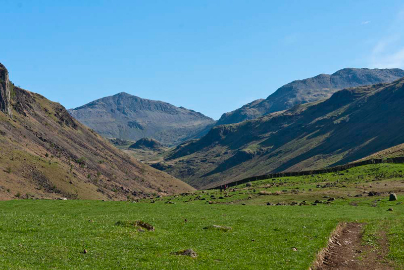
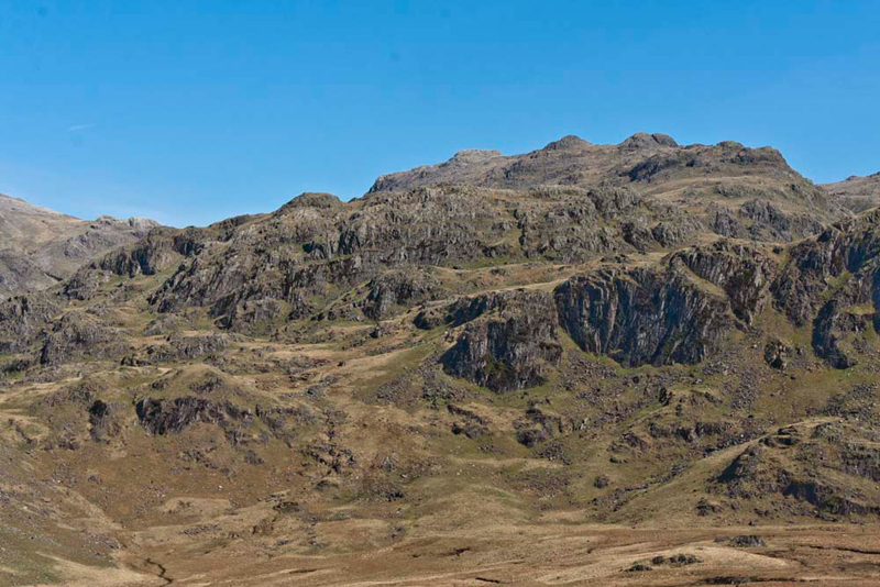
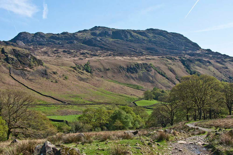
Pasture gave way to open fell. "Wow", breathed Little Eric, "what a majestic view."
"Yes pal", agreed Allen. "the massive triangular shaped mountain is
Esk Pike, and that to the left Bowfell."
Looking at the map, Shaun said, "I reckon that small hill the the centre, dwarfed by Esk Pike, is Throstlehow Crag our first summit."
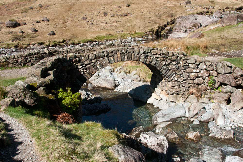
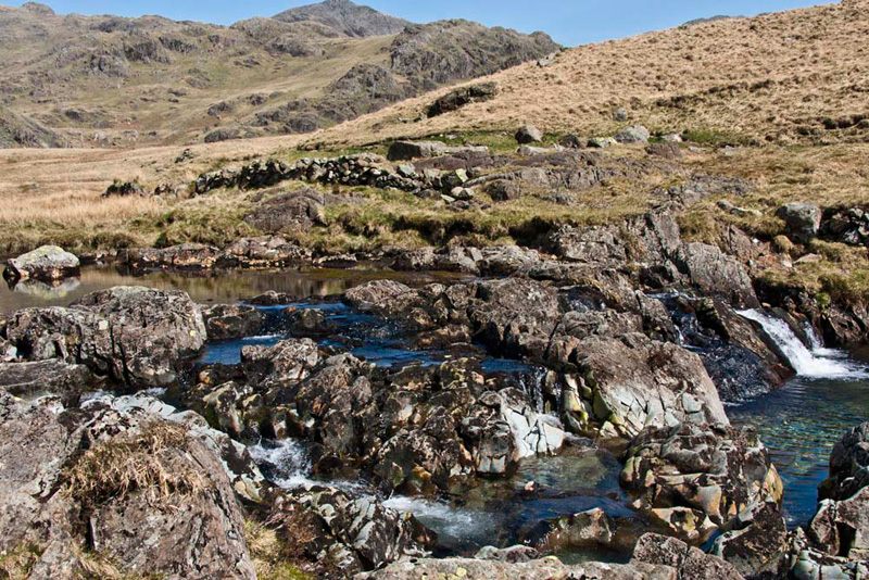
Dad strode on along the good path that brought us to the graceful stone arched packhorse bridge, that spans
Lingcove Beck, just above its confluence with the River Esk.
In his map reading role, Shaun
called out, "our route is across the bridge and on up the
path rising more steeply beyond."
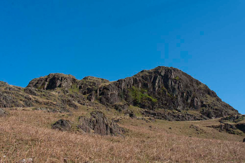
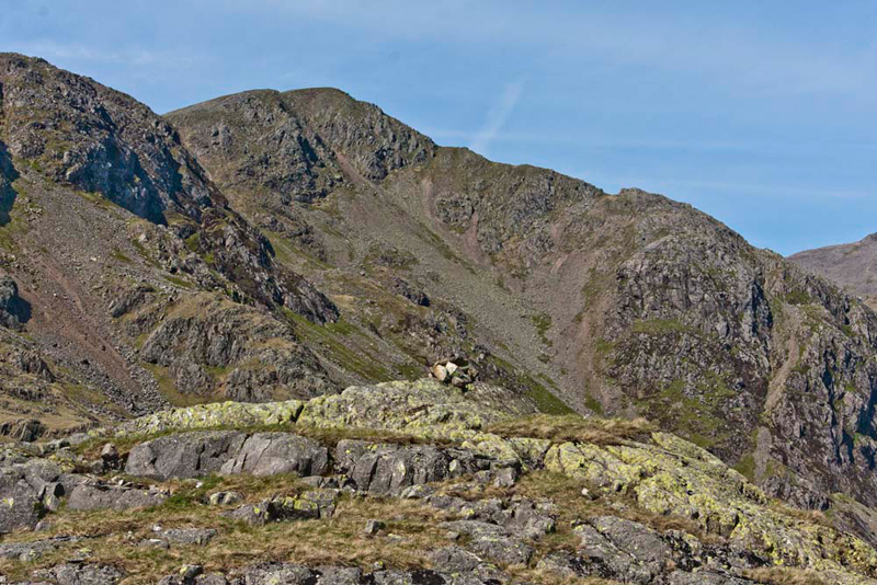
Soon the first objective
Throstlehow Crag was in view, showing its craggy side.
Dad said, "from a distance I had considered crossing the rough ground in front, as there seemed to be a path, but clearly there is none."
"The ground too looks to be boggy, and beyond there seems to be no clear way
through the rocks", added Tetley.
"Best to continue on the path to
the brow thereby gaining as much height as possible, and then strike right to climb steeply up between the crags", suggested Shaun.
The only
drawback was that we then had to turn back right again and cross
a rise, to attain the highest point on the front crag.
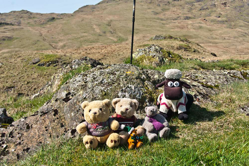
"Yippee", cheered Allen, "that's one down. Picture time pals."
Grizzly said, "the entry in Diana Whaley's book refers to Throstle Garth that we passed on the way to the summit. This means 'thrush enclosure'. Throstle could refer to either the fell throstle or song thrush. So where we are is the 'crag near the thrush enclosure'."
As we sat at the summit, Little
Eric exclaimed, "wow!, what a fantastic view. What exactly can I see?"
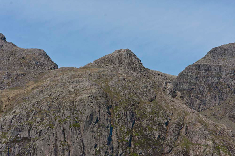
Showing off his knowledge, Tetley said, "we can see Scafell Pike, then Broad Crag,
with the triangular shaped top of Pen in front, and on the right the
massive Ill Crag."
"What's the fell in the
foreground?", asked Little Eric.
Shaun jumped in with the reply,
"that is our next objective Scar Lathing, and according to
Birkett the ascent has to be made via the green ride up the
centre."
"My that looks steep",
mused Allen.
How true his words were to be!
We descended the rough ground and
headed over the bog to the foot of the fell, where Dad then made the initial ascent on the right side.
"I think this was a mistake", said Dad, seeing the craggy area he then had to negotiate. This done the route to the central ascent was gained, to the left of the summit crag.
This was indeed every bit as steep as Allen had thought, and when
we reached the summit Dad sighed, "thank goodness that's done."
Scrambling out we settled for our picture, Little Eric saying, "there's no rush Dad, catch your breath first."
Sitting there we once again enjoyed the magnificent
prospect of the Scafells. "Awesome!", said Allen.
Once again Grizzly educated us. "The first element 'scar' is very suitable to this rocky outcrop. However the second element according to Diana Whaley is puzzling. Some connection with dial, lathe from the Old Norse hlaoa 'barn' is possible, although the farming here is definitely not arable."
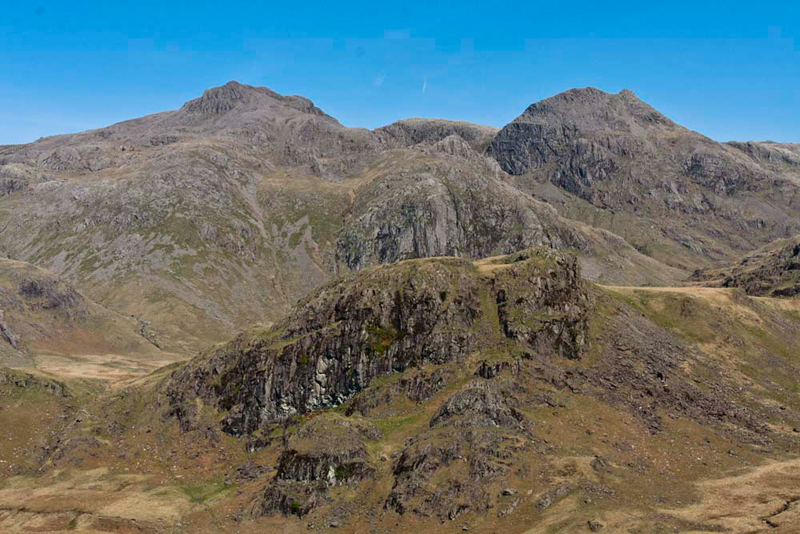
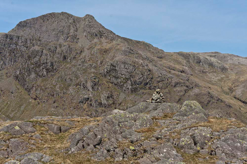
Of immediate import
now, was the ascent to High Gait Crags, seen here below
with Low Gait Crags in front and part of Long Crag on the right
in the immediate foreground. This was not on Birkett's planned
route, but was for us the best opportunity to bag this unclimbed
summit.
Shaun left us sitting at the summit
and moved away to scrutinise the map. "I know that you
planned to gain the ridge by climbing right between High Gait Crags and
Low Gait Crags. However looking at the map and the ground ahead,
it seems that it might be better to climb where there looks to be
a narrow stream, and then continue to the right of the main bulk
of Low Gait Crags."
Tearing his eyes from the view, Dad focused on the map. "I think you are right
Shaun, that route seems to be fairly grassy. There will still
be a steep slope to climb right afterwards, but that too from the
map looks to be mostly grassy. Taking this route too, will avoid
the rocky crossing of Low Gait Crags."
The debate over, Allen said, "come
on Lads, we had better get back in the rucksack so we can get
going."
Descending, we crossed a path that
seemed to head round Great Moss, to then follow the planned route,
which turned out to be a good option. At the ridge, we turned
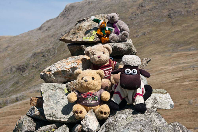
left to climb on between crags, to the furthest bump being the summit,
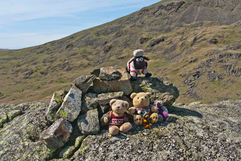
adorned with a neat and impressive cairn. The massive bulk of Ill Crag forms the backdrop.
"A cairn", called out
Grizzly with glee.
"Come on Dad, take our picture",
added Allen, as we scrambled on to it.
Grizzly told us, "the name means 'the rocky height frequented by goats'. This is from the Old Norse geit 'she-goat'."
Again the views were magnificent,
Allen saying, "let's rest a while to enjoy the views and have a snack and drink. I don't know about the rest of you but I'm hungry."
"Good idea", agreed Dad. "I will then feel revived to face the rest of the expedition."
Seemingly rather distant we could
see to the south-west our next summit, High Scarth. Dad said,
"rather than return south, I am going to take a more direct
route towards it."
Shaun replied, "looking at the
map, it seems that whichever way we go, it will be a hard walk."
"Can't be helped lad, but I do
not regret getting this summit done."
Soon after setting off, we saw one of
our lovely Herdwicks. It moved away gracefully over the ground,
then stopped and looked back as if saying - this is my kingdom,
you are only visitors. How true this is.
As we descended we came closer to
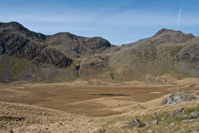
the flat and perennially boggy expanse of Great Moss. Scafell (3162ft)
and Scafell Pike (3210ft) form the backdrop.
"There's Pen again, to the
left of Scafell Pike", said Tetley. "One of the tops we
still have to climb."
"Looks like it will be a bit
of a scramble to the top", added Little Eric.
Unaware at the time, but this was destined to be our final Birkett summit and mark the completion of the challenge.
Eventually, the rough trek was
accomplished, and with Scar Lathing away to the left we reached
the River Esk. "Great", said Shaun. "This is exactly where Birkett suggests crossing.
Sure-footed as ever, Dad accomplished the crossing with easy boulder hopping. "I can fully
appreciate Birkett's comment that this would be impossible when the river is in spate", said Grizzly.
"Time to take a rest Dad, and
have another snack", said Allen. "I'm hungry again."
"You are always hungry pal", laughed Shaun.
"Absolutely", Dad agreed.
"That was hard going from High Gait Crags, so I am ready for
a rest, before we head up High Scarth."
It was lovely sitting in the warm
sunshine by the river, and we could have sat there all day, but
all too soon it was time to get going again. We settled ourselves
in Dad's rucksack once more, and shouldering it Dad headed up
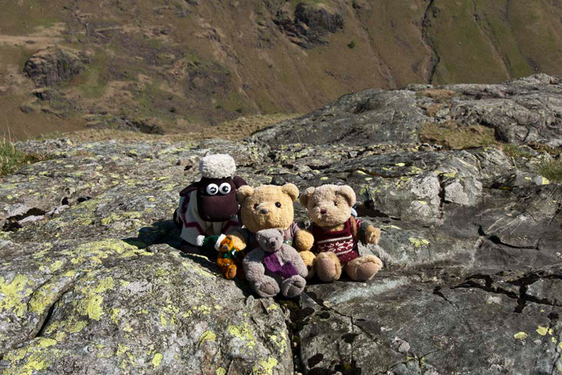
High Scarth that was immediately above. Not as steep as the
previous tops, but just a long haul, and of course the summit
with its cairn was the furthest away. Slight Side forms the dramatic backdrop.
As we scrambled out for our picture, Grizzly said, according to Diana Whaley the name presumably means, 'the rocky height beside the notch or col'. What is not obvious is which particular 'notch' is meant."
"Get settled lads", called out Dad as her lined up the camera.
"Just Silverybield to go",
remarked Tetley, as with his pals he settled back in the rucksack
after the summit picture.
So walking south, we headed down. Two sections were completed, before Dad suddenly stopped dead.
"What's the matter?", asked
Allen
"I've left the GPS at the
summit", replied Dad disconsolately.
"Oh no" cried Little Eric.
"Still, there is
nothing for it but to climb back up", went on Dad. " At least we had not got down
to the valley."
We were soon at the cairn and sure
enough there it was lying beside. There was in fact some benefit,
as it made Dad & Shaun look more closely at the descent. Reaching the end of the first section he said, "it will be better to head east now, to reach the valley floor."
"Yes lad, I agree."
In the valley, with
the line of fells across on the other side, and taking rough aim for
the one we considered to be Silverybield, the valley
path was crossed and then on over rough boggy ground beyond to start the ascent. The
GPS was helpful here, and guided us towards it.
Suddenly a cairn came into view and
Tetley called out, "that must be the summit."
As we approached Shaun checked the
grid reference, saying, "no this is not the summit. It's
that next rise over there."
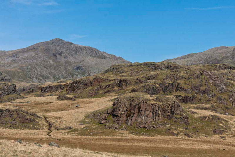
The top was flat and rocky and we quickly settled for our final picture.
Allen commented, "the valley behind is the one we walked up in the morning to Lingcove Bridge." Then looking north he pointed, "what a spectacular view to Esk Pike."
Tetley added, "We can also reflect on some of the earlier sections of the walk. Scar Lathing is in the
immediate foreground, with rising behind Low and
High Gait Crags."
"Well, that's the last one",
said Dad with relief.
"Yes", agreed Allen.
"I don't suppose we will be coming back here any time soon."
As we settled in the rucksack Grizzly said, "the name means 'the rocky height by Silverybield, the silver-coloured shelter'. What is not clear is why silvery."
Shaun was looking at the terrain. "I know it is the wrong direction,
but making the descent a little to the north, will be the easiest way to regain
the valley path."
This led unerringly down, Little Eric commenting, "it's so good to
have a clear path to follow,
even if it is rocky and rough in places, after all the trackless terrain you have had to face today, Dad."
At first it meandered
over the higher ground, before finally descending via the zig-zags
to Scale Bridge. A short distance further the path divided, Shaun saying, "we take the left fork across the pastures."
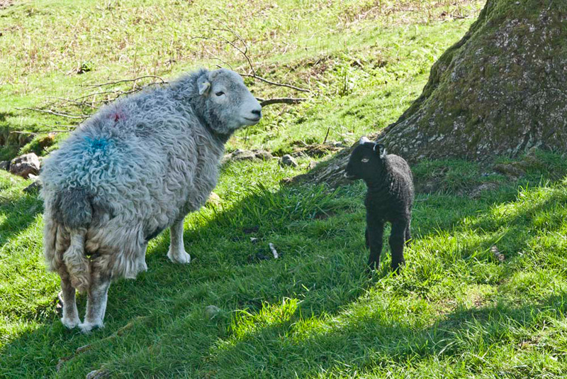
These were full of Herdwicks,
some with lambs. "Aww Dad, take some pictures", encouraged Tetley.
Away across Eskdale rose Harter Fell, providing a dramatic backdrop to the
valley. "We had a great adventure climbing that and ticking off two other Birkett tops, last October", said Allen.
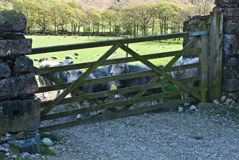
Soon we came to Taw House, where a
permitted path goes left through a gate across the field. Through
the larger gate beside, some of our lovely Herdwicks were keeping
an eye on us.
The path over the field led us to a
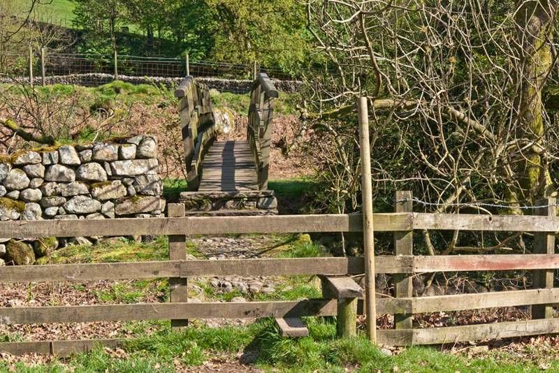
stile and footbridge over the River Esk to Brotherilkeld.
Here we turned right to follow the
access track, and then along the narrow road to the car.
"Although not high in stature the ascents to the summits without exception were steep", said Dad. "Birkett was quite right when he stated
that this was an arduous walk."
"Made more so by the fact that apart from the route to Lingcove Bridge, and the later return
path to Scale Bridge, all the walking was over rough grassy,
rocky and trackless energy sapping terrain", added Tetley.
"Aye lad I have to admit I am pretty tired now."
"So are we", replied Allen, "but the views were stupendous, and five summits have been
bagged by us all. Another part of Lakeland explored."
"Thanks Dad, for an amazing day!", said Little Eric. "You truly are the very best Dad in all the world."