Grizzly & Tetley,
wandered in to find Shaun & Little Eric sitting by Allen, who
was busily tapping away on Dad's laptop.
"What are you on
with?, asked Grizzly.
"Well, seeing as
how Dad's fitness took a leap in the right direction after our
walk to Birkett Knott and Hart Side, he has said we can choose
where our next adventure will be, as long as we do not pick the
Scafells", replied Shaun, who by now had unfolded one of the
OS maps.
"Have you come to
any conclusions then?, asked Tetley.
"We thought it
would be nice if we could combine ticking off an outstanding
Birkett with a Wainwright that Little Eric has not done",
replied Allen.
Continuing Shaun said,
while consulting the map, "walking from Buttermere to Scale
Knott and Mellbreak seems a good idea. There will be terrific
views and we will have the pleasure of walking along by Crummock
Water. The return would be via lonely Mosedale. We have also
considered the possibility of taking in Little Dodd and Hen Comb."
Tetley looked over
Shaun's shoulder to scrutinise the map. "I recall that
Mosedale is very rough and boggy and we would have to cross it to
get to Hen Comb." Then leafing through Birketts almanac, he
went on, "this and all the guide books say that really the
only way up to Hen Comb is from Loweswater village, so we should
be prepared to perhaps make that a separate walk. Now off you go
Allen and see what Dad has to say."
"I'm sure he will
be agreeable, so get the mugs and tea ready so we can have a
drink and biscuit to celebrate", called out Allen as he
trotted out clutching the map.
Shaun and Little Eric
then went off to get the flasks of tea, while Grizzly &
Tetley organised the mugs and tuck tin.
After a little while
Allen returned with a broad grin on his face. "Dad is happy
with our suggestion, but as you said Tetley, the decision when
to attempt Hen Comb, will have to wait for now."
"Great",
called out Little Eric, as he proceeded to fill the mugs from the
flask.
The Walk
Knowing that it was to be a very
warm day, Dad determined to set off early soon after 07:00, so we
would be walking by 09:00. Once again we used Newlands Pass to
get to Buttermere.
As we reached the hause, Tetley
called out, "there's Moss Force and the path we climbed to
get to High Snockrigg."
"We enjoyed some superb views
from its summit", added Grizzly.
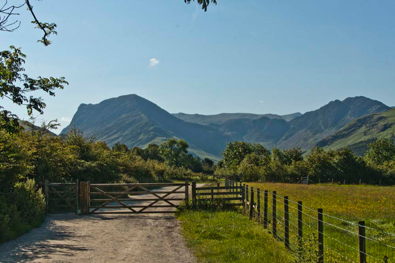
Continuing carefully down the steep
winding road, Dad then parked on the rough verge, above the
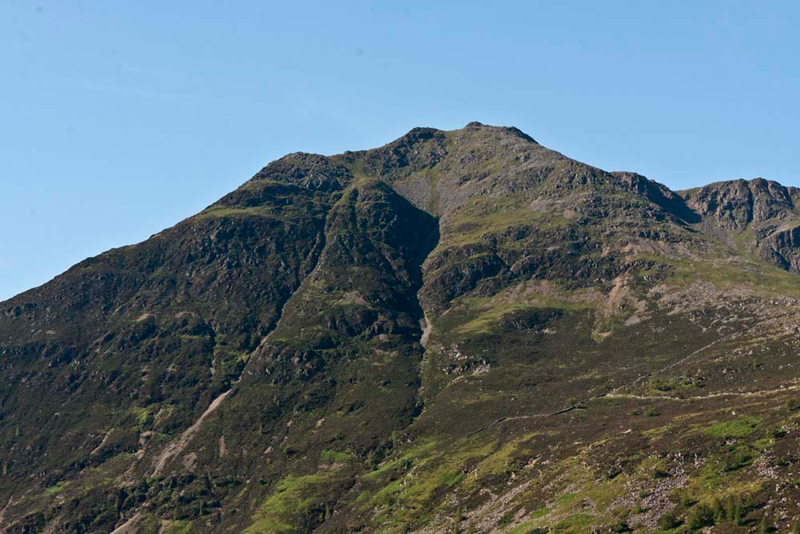
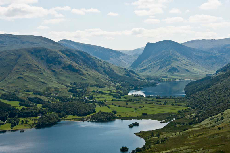
village. Buttermere village and its namesake lake is dominated on
the west side by the ridge comprising High Crag, High Stile and
Red Pike. The highest is High Stile (2648ft), majestic in the
early morning sun.
As this picture shows, we were set
to enjoy a beautiful summer day with mostly clear blue skies and
light winds. Dad got his boots etc. on, and meanwhile we settled in
his rucksack ready for the off. Shouldering this, we walked on
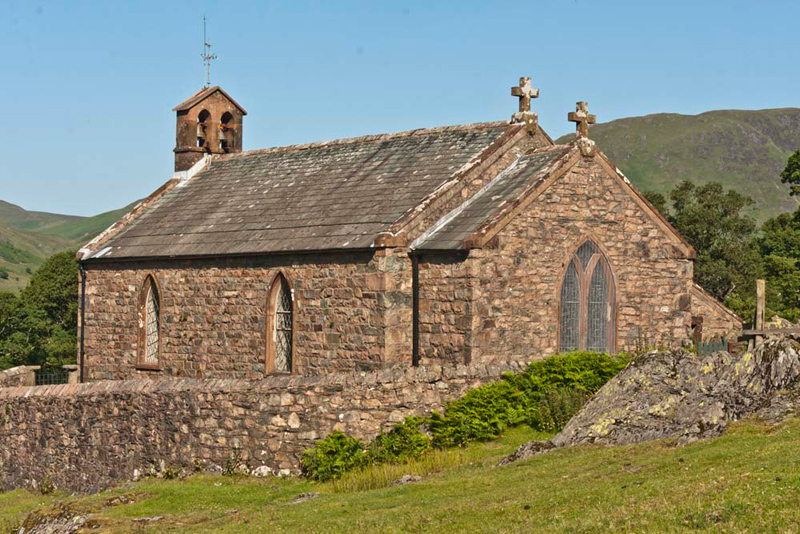
down the hill to the village, passing St James church.
Grizzly told us, "the church dates from 1840 with additions in 1884 and 1933. It is built in squared stone and slate rubble under graduated greenslate roof with coped gables. It consists of a 2-bay nave with west twin bellcote, west porch and north vestry and a single bay chancel. It is grade 11 listed."
He then went on, "as you will recall pals, below the window on the left,
through which can be seen Haystacks, is the memorial to Alfred
Wainwright -
PAUSE AND REMEMBER
ALFRED WAINWRIGHT
------------------------------------------------
FELLWALKER, GUIDE BOOK AUTHOR
AND ILLUSTRATOR
WHO LOVED THIS VALLEY.
--------------------------
LIFT YOUR EYES TO HAYSTACKS
HIS FAVOURITE PLACE.
1907 - 1991
After his death, in accordance with
his wishes, Wainwright's ashes were scattered on Haystacks, at
Inominate Tarn. Dad took this picture in June 2006. We sat a while here in quiet contemplation, thinking of Wainwright, before continuing on to summit Haystacks.
As we reached the foot of the hill,
Little Eric asked, "which way do we go?"
"Down the side of the Bridge
Hotel, and then we follow the path left", replied Shaun.
This led through a gate before
which there was this view ahead to the hills at the far end of
Buttermere lake. Allen said, "that's Fleetwith Pike with the
protuberance of Honister Crag on the left, while Haystacks is on the right."
Beyond this gate, Shaun then said,
"we do not want the path ahead that leads to the lake, but
the track right through another gate that runs alongside the line
of trees."
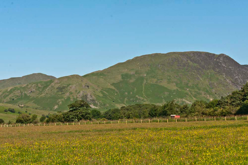
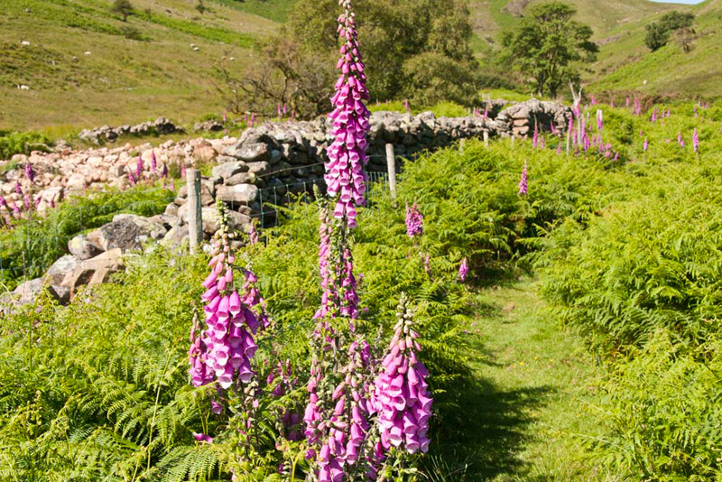
Before taking this we looked across
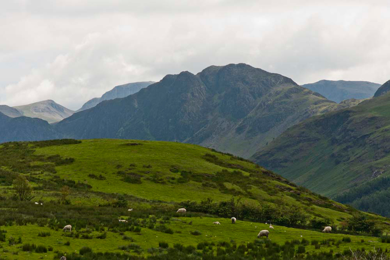
the field carpeted in wild flowers.
Tetley said, "we can see our
objectives clearly from here. The lower height is Scale Knott
with Mellbreak rising to the right, and behind to the far left is
Hen Comb."
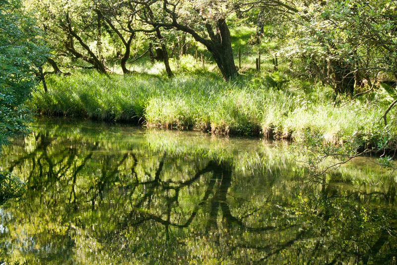
Once through the gate, Dad
strode out purposefully along the wide straight and level track. It then curved
right, and we came beside the almost mirror smooth beck. "According to the map it is called Buttermere Dubs", remarked Grizzly.
"What superb reflections",
exclaimed Allen. "Must be worth a picture Dad."
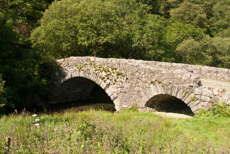
A few yards further we reached
Scale Bridge. "Cross and go right", instructed Shaun.
The rough rocky path meandered
north, first with a screen of trees to the right, but once they
had been passed, it was a joy to walk above lovely Crummock Water,
with its small islands - the first being the two named Holme
Islands, then Scale Island.
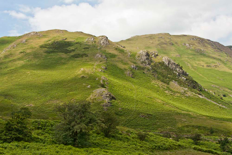
Ahead we could see the bracken
covered slopes of Scale Knott. Shaun pointed and said, "our ascent is up the right side
of the fence, which we can just
about see to the right of the line of rocky outcrops running
up the fell."
As we walked on the path bent away from
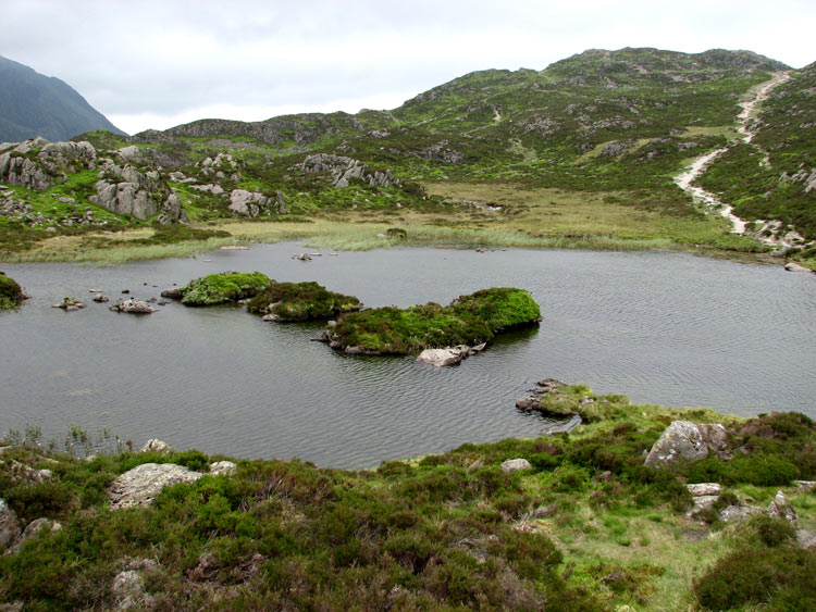
the lake and became grassy as it passed between bracken. It crossed Scale Beck, then passed through a gap in the wall, where
the path continued west climbing eventually to the Floutern
Pass.
"There's some of those
foxgloves, like we saw on the climb to Lad Hows", called out
Little Eric. "They do make a pretty sight."
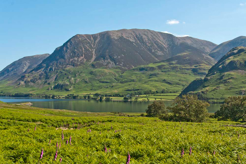
Looking east, Grizzly, cried out,
"that's just a stupendous view across Crummock Water."
"OK, I get the hint",
replied Dad.
"What exactly are we looking
at?, asked Little Eric, who being the last one to join STAG is
still not fully familiar with the views.
"Well pal", said Tetley,
"to the far left is Whiteside, then in the centre is
mighty Grasmoor. Behind that are the slopes of Crag Hill and on the far
right is Wandope, with the end of Rannerdale Knott below."
Excitedly Little Eric interjected,
"I thought that was Grasmoor, so that must be Lad Hows to
its right, which we climbed a few days ago. From here it can
clearly be seen that it is linked beyond by a continuing ridge to
Grasmoor's summit."
"That's exactly right",
said Allen. "Well done."
"Thanks pal, but I doubt I
will ever be able to recognise and name the fells as easily as
Dad does", replied Little Eric.
We were now immediately below Scale
Knott, and the fence could be clearly seen rising out of the
bracken. A gate gave access through a cross fence, and then we
paused to look up.
"Oh dear", sighed Shaun,
"that looks ever so steep."
"You're right", agreed
Dad, "but its no good just looking, we must get started with
the ascent."
And yes it was very steep, but with
pauses for breath Dad ploughed steadily up. The bracken became
sparser and here the ascent got even steeper and we really felt
for Dad. Eventually the fence turned away left, and here we
continued ahead, still climbing steeply, to finally reach the
highest point on the flat top of the fell, marked by a tiny pile
of stones.
"I'm not sorry that's done", sighed Dad.
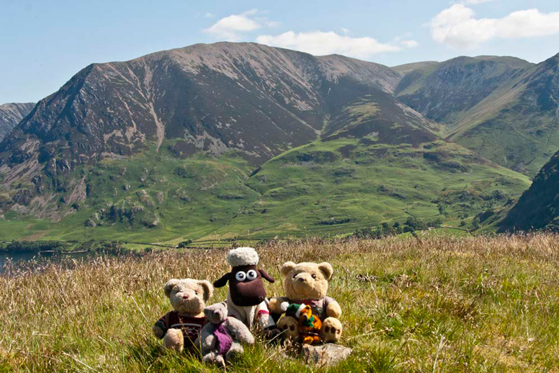
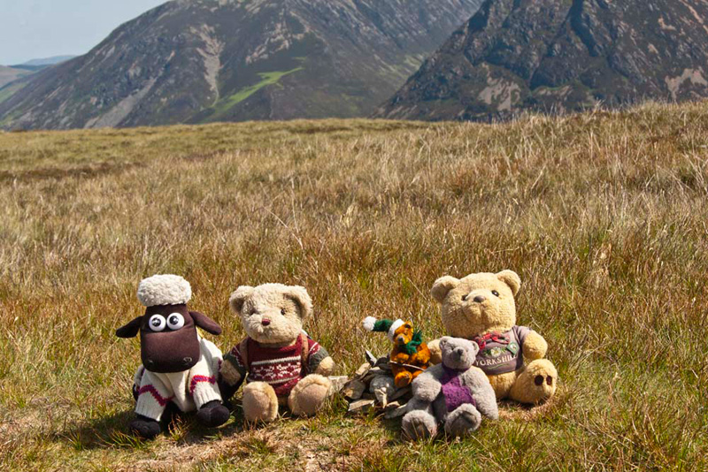
"Picture time", called
out Grizzly, as we settled by the stones, with the backdrop of
Grasmoor, Crag Hill, Sail and Wandope with the lower top of Lad
Hows. He told us, "according to Diana Whaley, scale means 'the shieling or shieling huts' from the Old Norse skali. Knott means 'the rugged height'. So, 'the rugged height near the shielings', and indeed traces of structures close to the mouth of Scale Beck are interpreted as 'a rare survival in Cumbria of a [medieval] shieling settlement'."
Looking around we just marvelled at
the wonderful views, none more beautiful than this of Crummock
Water with Buttermere beyond. Tetley set the scene. "Fleetwith Pike with the protuberance of Honister Crag rises above the end
of Buttermere, below which to the left is the deep declivity of
Honister Pass. The hills on the left from the back are Hindscarth
& Robinson, below which is High Snockrigg."
"One of the summits from our last adventure", added Little Eric, as we got settled in the rucksack again.
Mellbreak was next, so tearing his
eyes from the view, Dad continued on the clear path. The ascent
was still steep, but less so than Scale Knott. Towards the end
the gradient eased as the path contoured across to then curve
left to the summit. Just a bare patch of rock where the cairn
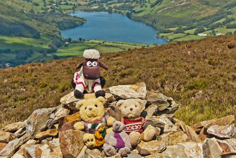
once was. A tiny cairn had been built, Little Eric saying, "I'm going to sit on that."
"That's the north top over
there", remarked Shaun.
"I thought you said this was
the summit of Mellbreak", said Little Eric exasperatedly.
"It is", Shaun replied.
"Well the north top looks
higher to me from here", said Little Eric.
"I agree, but it is just your
eyes playing tricks. See I will show you on the map. Here is
where we are with a height of 512m, and here's the north top
shown with a height of 509m.
Come on Lads, time to settle in the
rucksack, so we can get along to the north top and see that
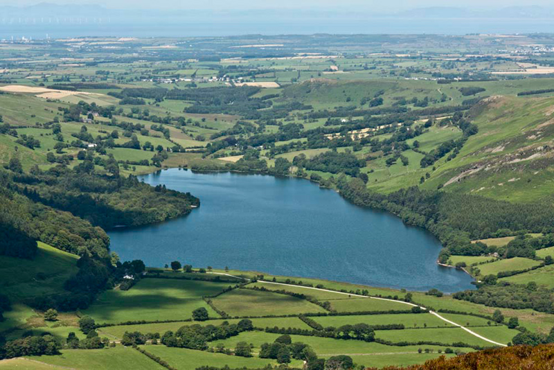
wonderful view of Loweswater", urged Dad.
The path wound its way down over at
times boggy ground into the dip at a height of about 447m, and
then it was a relatively easy ascent to the cairn at the north
top.
"You were right Dad. What a
fantastic view. Oh joy!!", shouted Little Eric.
Quickly then we scrambled out and sat on the cairn, Allen saying, take our picture please Dad."
We were here for quite a few
minutes as Dad chatted to two groups of walkers. This was good as
it gave us more time to enjoy the superb view. And also, allow Dad to have a rest.
"Where to now?", asked
Little Eric.
"We need to return to the dip,
and then take the path down to Mosedale", said Shaun.
"There's a path leading away
from here through the heather", remarked Tetley.
"It's not marked on the map
but I reckon if we were to follow it we would intersect with the
path from the dip", replied Shaun.
"I'm happy with that",
said Dad, shouldering his rucksack and striding off.
Sure enough
after some distance we joined the descent path to Mosedale, which
true to form with the walk today was very steep, but finally it
was accomplished safely.
It was decision time now concerning Hen
Comb and Little Dodd. Dad walked a little way to the right
along Mosedale, but soon said, "there is a long way to go before it will be possible to make the rough crossing of
the valley and find a way up. It's getting very warm too, so we'll leave that for another day."
"That's absolutely fine", replied Tetley. "You have made the correct decision."
So turning back we walked the
path along lonely Mosedale.
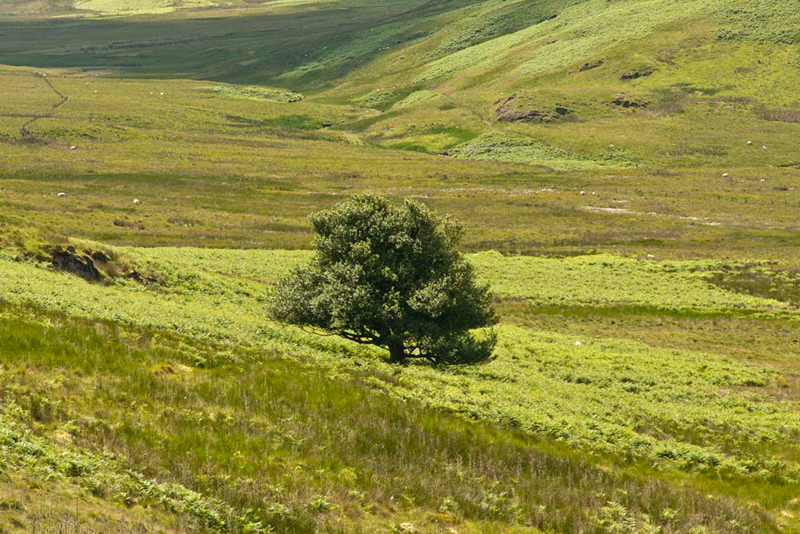
You will note the solitary tree
amid the boggy wasteland of the valley. This is the Mosedale
Holly Tree, and is the only tree in Lakeland to be given a name
on the Ordnance Survey map. "A very special tree, then", commented Little Eric.
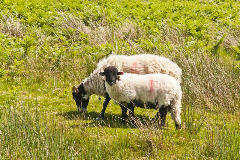
So far Allen's luck had held in that Dad did not have the opportunity to snap any pictures of sheep. But regrettably it was
too good to last.
"Oh nooo...", he called out, as this ewe with it's blackfaced lamb that stopped grazing the grass turned to pose for Dad.
"I know", commiserated Grizzly, "but we'll have to include the picture, as after all it will be Dad's fingers that are dancing over the keys
of the computer."
We followed the path as it wound
left, thinking that we were all the way down, but the path shown
on the map that leads to the Floutern Pass route has seemingly
disappeared. In fact the path brought us to the col between
Mellbreak and Scale Knott. Here a good path descended the right side of Scale Knott and
joined the main valley path.
"Huh", said Dad, "if only we had known about this, the ascent to Scale Knott would have been easier."
Near a footbridge we crossed a
stream, and then Dad climbed the fence ahead. A boggy path led on
and finally we dropped down to the path we had walked this
morning. This was followed to Scale Bridge and on to Buttermere
village and the car.
"I'm going to drive back via Whinlatter Pass", said Dad.
"That means we will have the lovely drive along Crummock Water and the superb views of the mountains", said Allen. "Thank you."
"Refreshment time, then?", queried Tetley.
"Of course. I'm going to make a stop at Greystone House in Stainton."
Here he had cottage pie with new potatoes, broccoli & carrots,
followed by a fruit scone with butter and jam. As usual a pot of
tea with extra hot water was provided. We enjoyed the rest of our
picnic sitting at one of the tables beside the car park.