Roadside pull off by
path to Blawith Knott (SD 256879)
Summits Achieved
Name
Height (ft)
Height (m)
Grid Ref
Blawith Knott
814
248
SD 2607 8839
Tottlebank
Height
775
236
SD 2692 8851
Little Burney
705
215
SD 2626 8657
Great Burney
979
298
SD 2608 8587
Preface
Shaun, with Little Allen riding on his back,
trotted in with Grizzly, to find Tetley looking rather mournfully
out of the window.
"What's up pal?, asked Grizzly.
"It's almost three weeks since the last
walk, when we climbed Pen-y-ghent with Uncle Bob, so I am feeling
a bit down in the paw about not having been out with the rest of
you in the hills."
Shaun was about to commiserate with his pal,
when the whirlwind that was Allen, burst into the room.
Rather breathlessly, he managed to get out,
"I come bringing good news, that will cheer you up Tetley.
Dad has just told me that we are off for a walk tomorrow."
"Great" cried Tetley, his face
brightening with a broad smile.
"Where to?", asked Little Eric.
"Well, as you know Dad and Uncle Brian
are visiting Uncle Bob and Aunt Ann on Monday, so he does not
want to have to drive too far to the start. So, as most of the
outstanding Birkett tops are a long way away, Dad he has decided
to do some Outlying Fells, in the Blawith area. Specifically,
Blawith Knott, Tottlebank Height & Burney."
"It was August 2006 when we last
visited those tops, before our pal Little Eric joined us, so at
least he will bag the tops", said Tetley.
"Just great", cried Little Eric.
"Shaun and I have brought the flasks, so we can have a mug
of tea to celebrate."
"Wonderful", cried Allen, "I'm
gasping for a drink."
"I'll get the tuck tin, so we can have
a biscuit too", called out Grizzly.
The Walk
As we were driving to the start,
Dad said, "I have decided to do the walk via a different
route starting with Blawith Knott, so we will in fact cover some
ground we have not walked before."
Shaun was looking at the map,
"oh yes I can see what you have in mind."
By now we were just beyond the
village of Gawthwaite, and Tetley said, "look Little Eric,
there's Burney to the right and you can just make out the trig
point on the summit, which we will visit later today."
"I can see. Thanks for
pointing it out pal."
It was the first outing on a walk
in Dad's new car, so we were very glad that he did not meet
another vehicle on the very narrow road from the A5092 to the
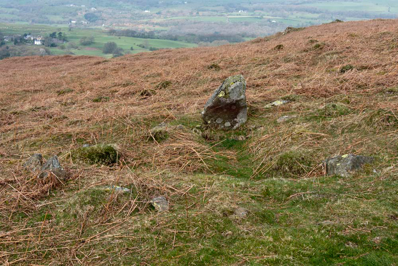
start by the Giant's Grave, which we went to have a closer look
at, while Dad got ready.
Grizzly told us, "it is thought to be a Bronze Age barrow,
perhaps 4000 years old. The large rock is like a headstone with a circle of stones on the southern side."
"I'm ready", called out Dad.
"OK", replied Shaun, as
we dashed over to settle in the rucksack.
The day was dry and warmish, so Dad
started off just walking in his t-shirt, however a cool wind got
up so it became necessary to put a jumper on. Initially the views
were hazy, but visibility improved as the day went on.
Shaun said, "that clear path up the fell is our route to Blawith Knott."
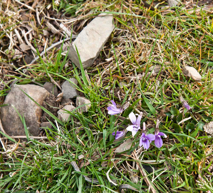
After a while, Grizzly said, "those
little flowers are rather pretty."
"They're wild violets",
said Dad as he hauled the camera out.
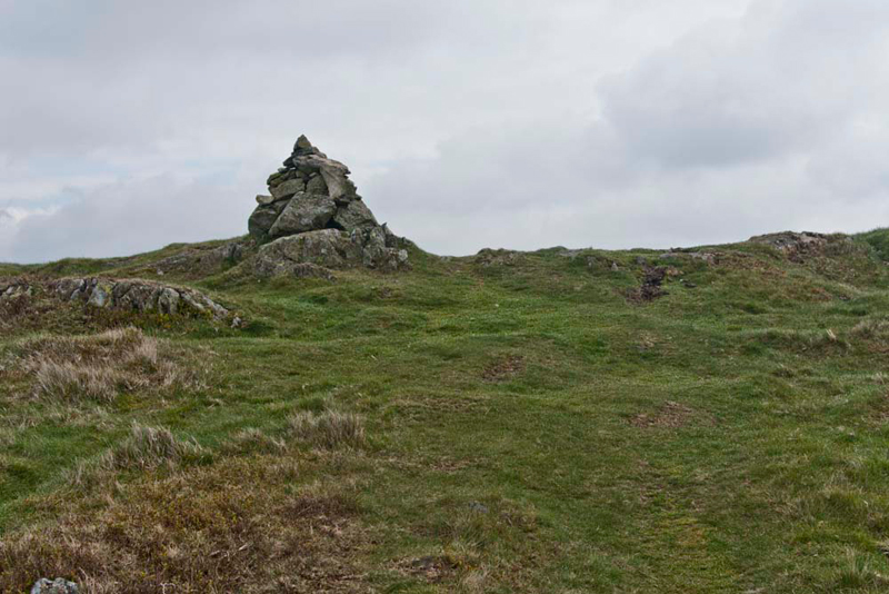
Striding on, it was not long before
a cairn came into view, and then this one to its right.
"That's the summit", said Tetley.
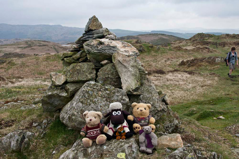
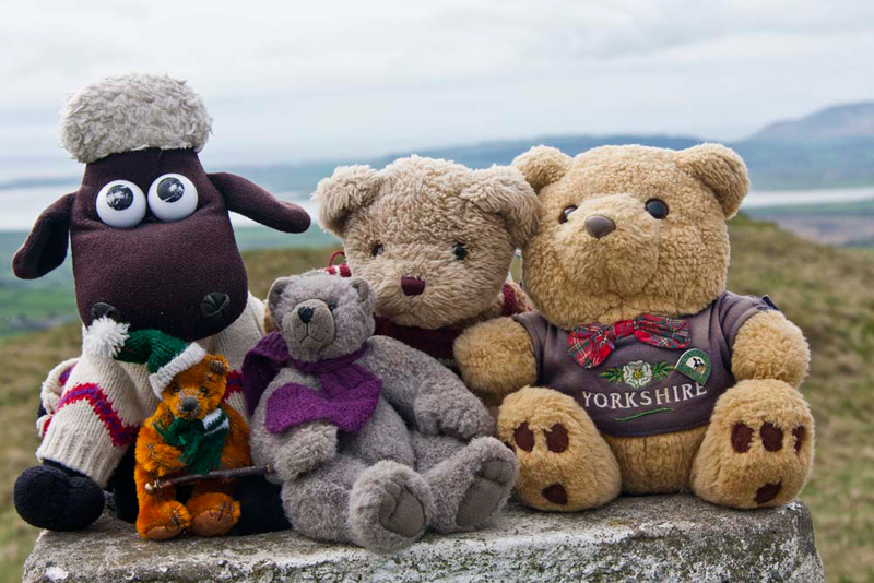
"Great, another Outlying Fell ticked off", cheered Little Eric, as we scrambled
out of the rucksack and settled for our picture, grouping
ourselves companionably around him.
According to Diana Whaley's book, Blawith means 'the dark wood' from Old Norse blar 'blue, dark', and Old Norse vior wood, timber. In medieval times this was forest combining a hunting preserve and woodland. The hill we are on is part of a stretch of upland grazing, named with reference to the parish."
"Thank you pal. Most interesting", commented Shaun.
The lady in the right
of the picture was one of a group of walkers, which unsurprisingly Dad chatted to
for a short time.
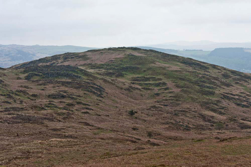
Meanwhile we surveyed the scenery in the background. Allen pointed. "Look Little Eric, we can just see in the distance a small tarn. The path will take us past that before we cross to the hill on the right, which
was our second summit Tottlebank Height."
Crossing the summit area, where on
a rocky outcrop stands another cairn, we then descended gently, the path trending left, with clearly ahead our next objective Tottlebank Height.
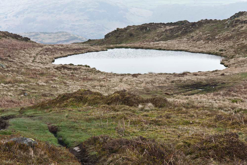
Soon the path curved right and climbed to the pretty little tarn.
Shaun said, "the route in Wainwright's Outlying
book, indicates following the narrow trod to the left of the tarn. However a new path seems to have developed, that cuts diagonally
right, towards Tottlebank Height."
"Right lad, that's the way we'll go then."
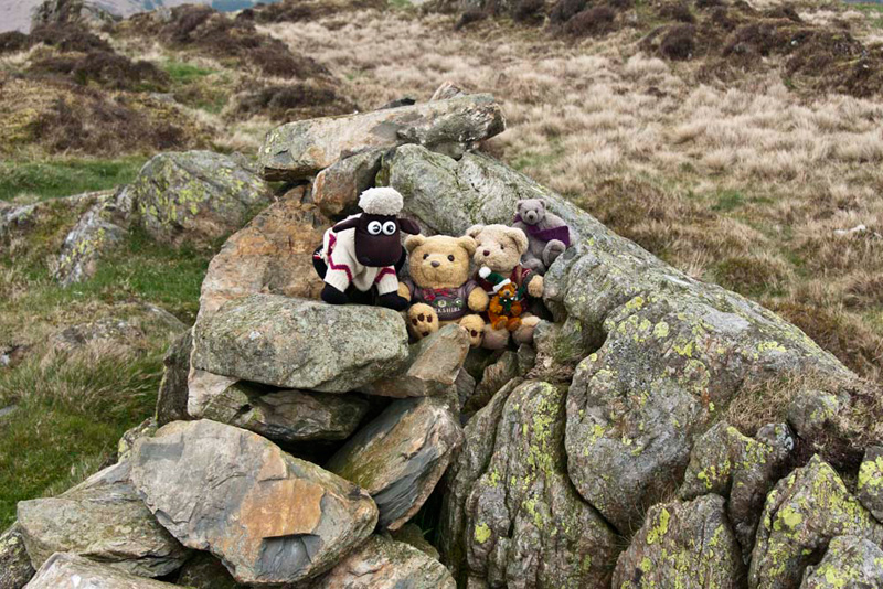
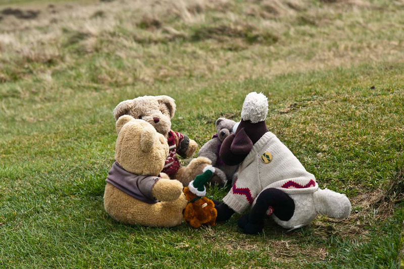
Soon we were on
Tottlebank Height, where some large stones on an outcrop marks
the summit.
"Yippee", cheered Little Eric. "Another ticked off", as we scrambled out for our picture.
Grizzly told us, "the name means 'the look-out hill', above the settlement of Tottlebank that stands at its foot. From the Old English tot-hyll."
Safely in the rucksack again, Shaun said, "we make for the buildings of Tottlebank." This initially involved descent of rough ground, before a path emerged.
His eyes on the map, Shaun called
out, "we now walk left for a short distance, then take
the gate on the right into the large pasture."
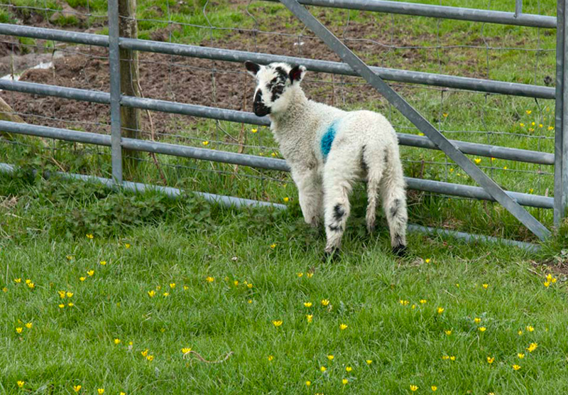
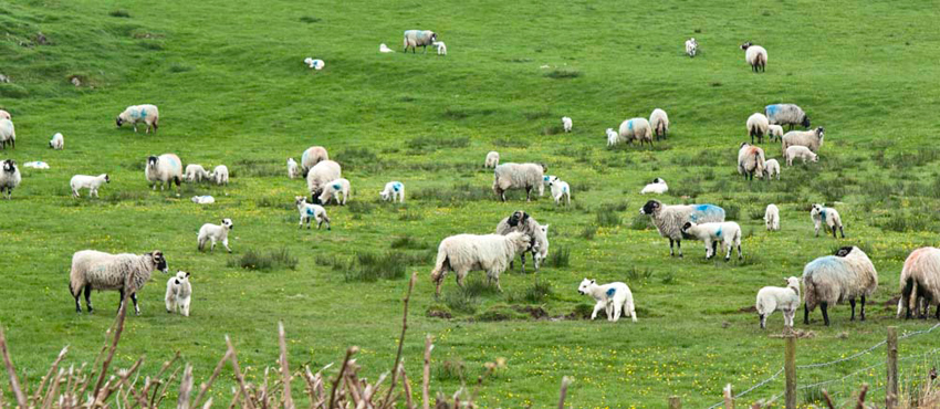
This was full of sheep and lambs,
and the farmers were busy tagging them.
"Oh heck", groaned Allen. "No sheep picture free story yet again."
"Never mind pal", replied Tetley. "We have just got to get a picture of that lamb on its own. So cute with lovely markings on its face."
Passing the farmers hard at work,
Dad exchanged a few words, to confirm the route, then once
through the gate out of the pasture, he took this shot looking
back, giving you some idea how busy they were dealing with all
the lambs.
The path now led along by the wall
to a corner, where a kissing gate allowed further progress over
the next boggy field, to intersect a cross path.
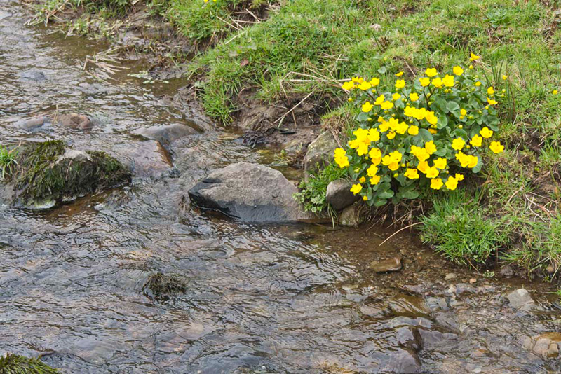
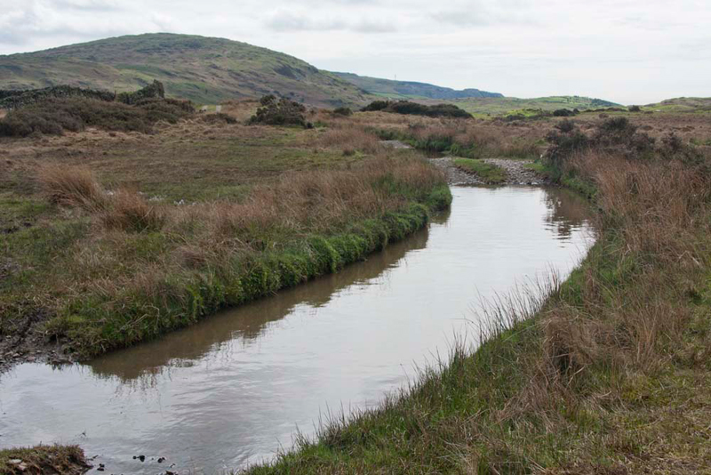
"We keep ahead to that gate, then drift a little right to cross the stream by the little footbridge", advised Shaun.
Here this Buttercup like flower gave a splash of colour.
All the time in front had been
higher ground - Little and Great Burney, our climbs to come.
Once
over the stream we continued across the field beyond to the buildings
of Crooked Birch.
All the way from Tottlebank the fields had been
full of ewes & lambs. "A lovely sight", said Allen, "but thanks Dad for not taking too many shots."
We followed the access track to the
road, where Shaun said, "turn right.
Soon the road will become unfenced and we will be able access Burney."
Keeping a lookout, Tetley called out, "there's the narrow path up the fell."
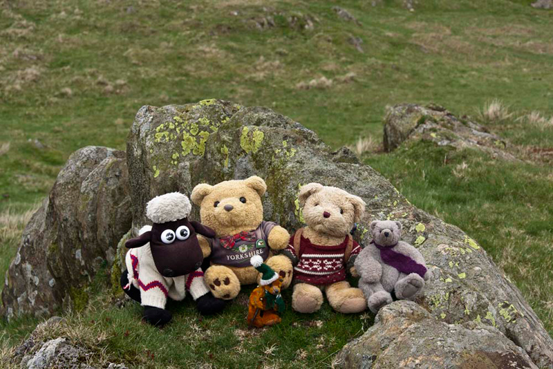
This brought us first to Little Burney, where Allen said, "this is not actually a summit, but there is a spot height on the map, so it would be nice to record this with a picture."
"OK lads, get settled, then."
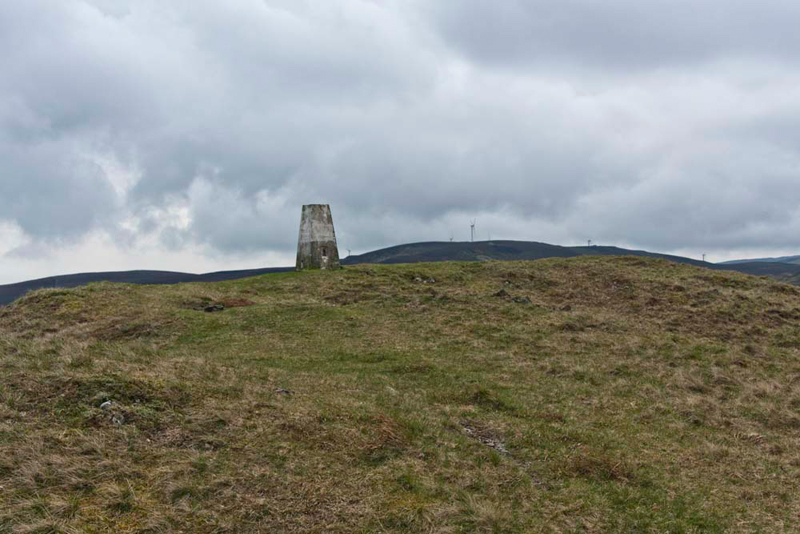
Onwards the path led across Grey Stone Moss, then steepened for the final ascent to Great Burney, with its trig point at the summit. "That's what you pointed out to me as we were driving
to the start this morning, Tetley", said Little Eric.
"It is calm enough to sit on top for a close-up shot", called out Allen.
As we jumped down, Dad announced, "time for lunch."
So we promptly gathered round,
Grizzly saying, "get the sandwiches out Allen."
There was no one else about, so we
enjoyed a quiet time, and then suitably refreshed we took some
time to look at the views.
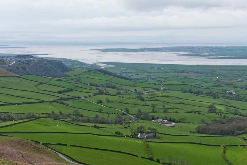
We could see the Coniston Fells and to the west many of the Outlying Fells down to
Black Combe. "We have had lots of adventures summiting them all", said Tetley. "Grand days."
Below
these is the beautiful Duddon Estuary.
"What are those workings to the left?", asked Little Eric.
"The massive Kirkby Slate Quarries operated by Burlington
Slate", replied Allen.
"So, where now?", asked
Little Eric.
"We have to retrace our ascent,
down to the road, and then head on to join the access road to Birch Bank",
replied Shaun.
"What would we do without your
map reading skills, pal" said Little Eric.
It seemed like no time at all we
were down at the road, and we looked ahead in the direction we
needed to go. "Can't see a path", said Allen.
"No", replied Dad. "There
is none shown on the map, so it looks like we will be ploughing
over rough ground, but I am well used to that."
It was pretty boggy in places, but
the rough terrain did not extend as far as on some walks, and
after a little while we reached the access road to Birch Bank that we followed right to the farm.
"We now want the second path going off left", advised Shaun.
This was flooded deeply in a number of places, but fortunately there
was plenty of verge to get past.
At the far end the track joined the bridleway
from Tottlebank, and turning left, soon brought us to the start.
As
Dad got his boots off, we sat looking at the view to Black Combe,
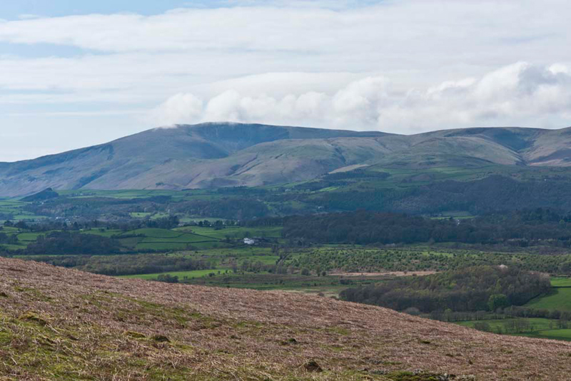
the clouds just occasionally dusting the top of the fell.
Grizzly said, "the next ridge to the right of Black Combe is White Combe and highest point further right is
Stoupdale Head."
"Another grand day we had climbing those with Uncle Bob", said Allen.
"A nice view Lads",
remarked Dad, snapping away with his camera.
Little Eric called out, "thanks
for a nice walk Dad, and for allowing me to tick off three more
Outlying Fells."
"Time for tea, I guess Dad",
said Allen laughingly. "I bet you will be going to Jane and
Sam's at Low Newton."
"Spot on lad, and I will take
you in to see them."
"Thanks Dad", replied
Tetley.
They were pleased to see us, and
Dad had their lovely ham lettuce & tomato sandwich, followed
by gorgeous apple rhubarb & cranberry crumble with cream. A
nice time, and as usual Dad exchanged plenty of banter with Jane
and Sam. He also chatted to a lady and gentleman from St Bees, who had come in for coffee.