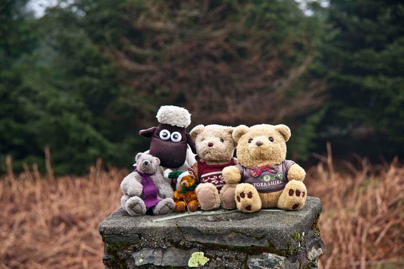
Allen, Grizzly &
Tetley were reading, when Shaun trotted in with Little Eric
riding on his back.
"I am so happy",
said Little Eric. "Dad had just told us we are walking
tomorrow, but he does not want to have to drive too far, so we
are to climb Claife Heights and Latterbarrow, above Windermere. I
know you have been there before, but for me it will be another
two of the Outlying Fells ticked off."
"Wherever it will
be good to be out again, and it will help to take Dad's mind off
Friday", replied Allen.
"Oh yes",
said Tetley. "It is Grandad Bill's funeral, and so it will
be a hard day for Dad, but at least he will have Uncle Brian and
Uncle Keith to support him."
"What's the
weather for tomorrow?", asked Grizzly.
"Hang on while I
boot the laptop and have a look at the mountain forecast",
replied Allen.
"While you're
doing that I'll pour the tea", said Shaun. "Will you
get the tuck tin so we can have a biscuit too, Tetley?"
"Sure pal",
he replied.
"Great",
called out Allen, "I'm gasping for a drink." Tapping
away, he then went on, "looks like it will be cloudy, but
dry, with a cool breeze on the summits."
The Walk
The start point was the National
Trust car park at Ash Landing, on the road from Far Sawrey to the
Windermere Ferry.
Settled in Dad's rucksack, Shaun instructed, "we take the path
from the rear of the car park, towards the ferry."
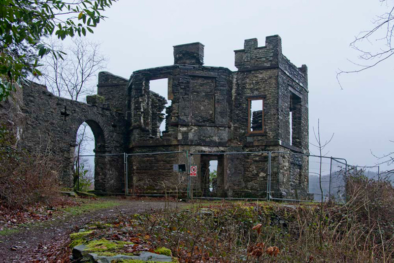
This brought us to the forlorn ruin that was once Claife Station.
'This station is now sufficiently
pointed out by the elegant building lately erected thereon....
which renders it one of the most delightful places near the lake',
as was quoted in Thomas Webb's classic Guide to the Lakes that
first appeared in 1778. This described several viewpoints or 'stations'
where tourists could enjoy the best views of the Windermere
landscape. In those days tourists were encouraged to appreciate
the formal qualities of landscapes and to apply aesthetic values.
Built in the 1790's, it was at its
most fashionable in the 1830s and 40s, when it was mentioned in
every guidebook, and was used for parties and dances as well as
for landscape appreciation. The windows of the drawing rooms were
the Station's most celebrated feature; each had a different
aspect, viewed through different coloured glass to enhance
variations in weather and season. The tinted glass in these
windows was intended to recreate lighting effects in the
landscape. Yellow represented summer, orange was for autumn,
light green for spring and light blue for winter. There was also
a dark blue for moonlight and a lilac tint to give the impression
of a thunderstorm.
So, suitably educated, and with
thanks to the National Trust for this information, we continued
on our way. By the building, we went left to climb the steep and
winding path through the trees to gain the ridge, then on over
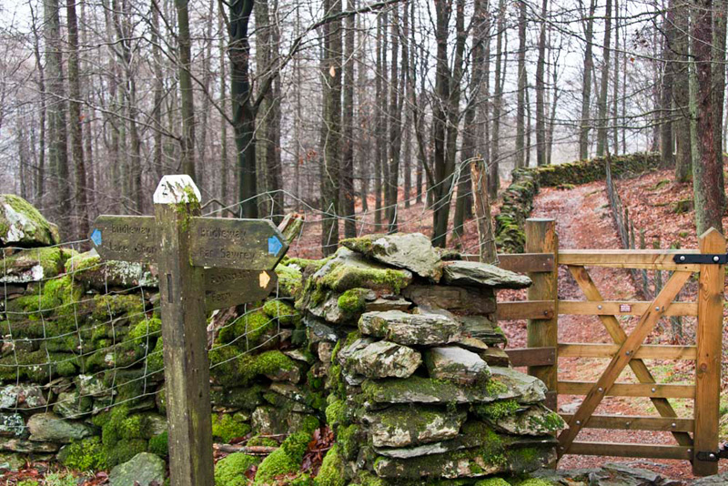
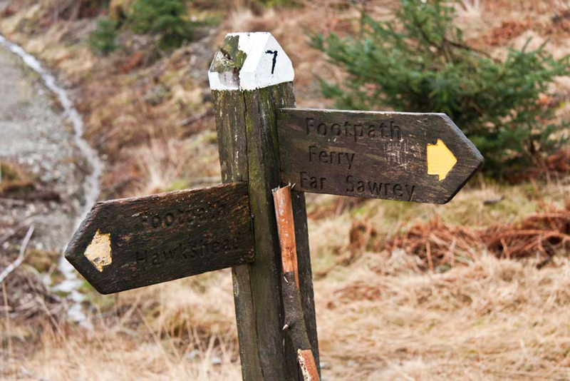
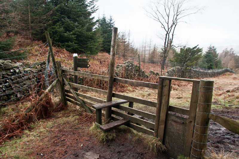
Mitchell Knotts to a gate on to the bridleway. It was here that
we encountered the first of many white topped and numbered
signposts.
This and the gate are seen here looking back to the path we had just walked.
These were to guide us on this walk. This is without
doubt a long established route, as the tops of some of the posts
had rotted away to an extent that any white paint and number was
no longer visible. Still we had our intrepid map reader Shaun
with us, and he never failed to give us the right directions.
"It's left here, towards Far
Sawrey", called out Shaun.
The path, muddy like most today, which was hardly surprising after all the rain, ran straight then curved
left round a small hill, to come soon to another signpost.
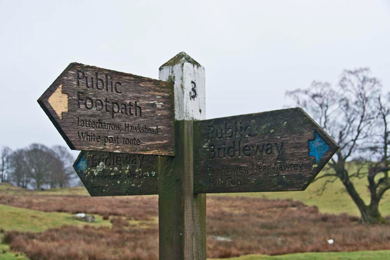
"So where now?", asked Little Eric.
"Here we want to go north, on
the path signed Latterbarrow, Hawkshead", said Shaun.
"Will we soon be at
Latterbarrow, then?", asked Little Eric.
"No lad, we have a long long
way to go yet", replied Allen. "Summiting Claife Heights is first."
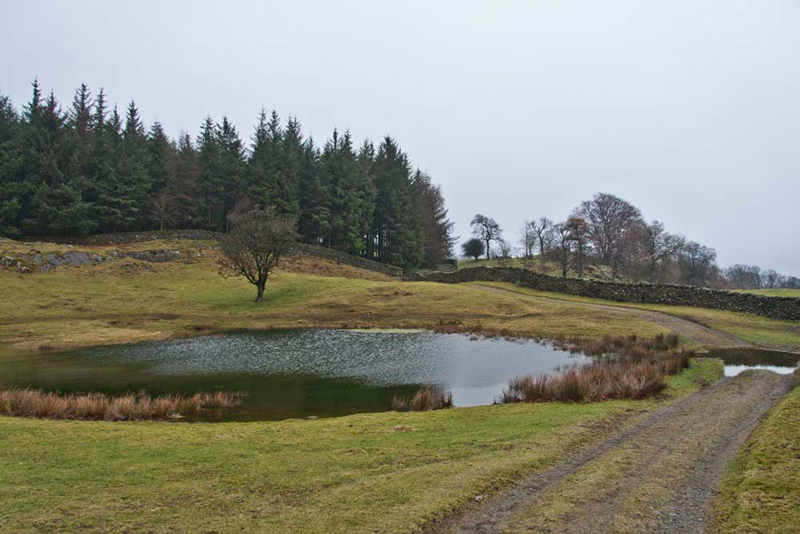
The track climbed on to pass by a
small tarn, which had completely overflowed the path, so Dad had
to to use stones by the wall to keep his feet dry.
"That would have made a nice
picture, Dad", remarked Tetley.
"I should have thought of that before crossing the stones. I'll just walk back to get the shot." said Dad. Happily his feet were still
dry when he had further crossed them again to continue on.
As can be seen this was a good wide
track, that eventually climbed steeply up Low Pate Crag to come
by a wall on the right, and another white topped post junction.
"It's left here", said
Shaun.
The path, hard to follow as it was
indistinct, led through the trees, coming beside Black Stone
Mires. Eyeing this Grizzly said, "that bog and morass are certainly to be avoided at all cost."
"We need to get to that small
bridge ahead, and cross it right", Shaun remarked.
The path seemed to continue ahead,
but our route was blocked by a large fallen tree, climbing over
which, was not possible due to sharp branches sticking up.
"Oh dear", said Little Eric. "Whatever are we going to do."
"Hmm", said Dad, standing
back to give the matter further consideration. After a short
while he said, "there's nothing for it but to crawl underneath",
slipping the rucksack and camera off and placing them beyond the
tree.
When we got to the bridge, Tetley said, "it's apparent that before the fallen tree, we should have gone
left through the trees."
"I agree", went on Allen, "but there was quite definitely no
apparent path."
Crossing the bridge, we walked on and then Shaun pointed, "we go right here on that narrow path."
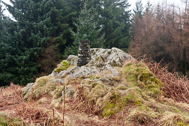
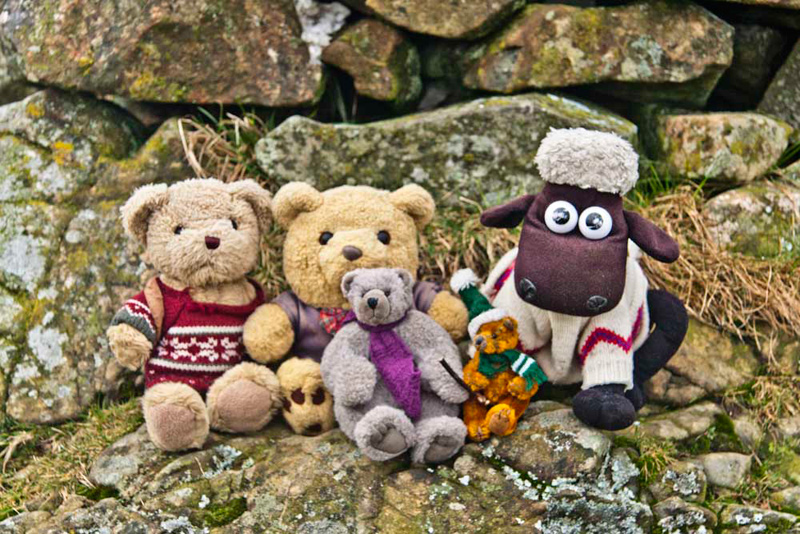
This climbed to the trig point standing on a rocky outcrop at High Blind How,
the summit of Claife Heights.
"This is our third visit, but
your first Little Eric", called out Grizzly, as we scrambled
up to settle for our picture.
"Yippee", he cheered. "That's another catch-up for me."
We then, as we have done in the
past, played jump off the trig point to see how far we could roll
down. When we were here in April 2006, Tetley won, but today
Allen was the winner! [what are they like! Ed]
Calmed down, we settled in the rucksack, and descending to the path went right to a junction.
"We turn left here", said
Shaun.
This then brought us down to a wide
forest road.
"We turn right here, and then
soon we strike off left", called out Shaun, looking closely
at the map.
"There's the signpost",
shouted Allen. "It indicates left to Hawkshead, the way we
need to go."
This section was a narrow, rough
and muddy path, level at first, then climbing over a hill, to
descend rather more gently to a bridleway and yet another white
topped signpost.
"To get to Latterbarrow, we
should go straight on, but eventually we will have to come back
here and then take the wide path signed Far Sawrey", said
Shaun.
"Right lad", replied Dad,
striding out ahead. The wide path dipped down then climbed again
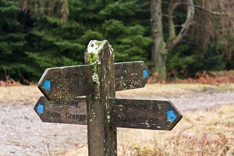
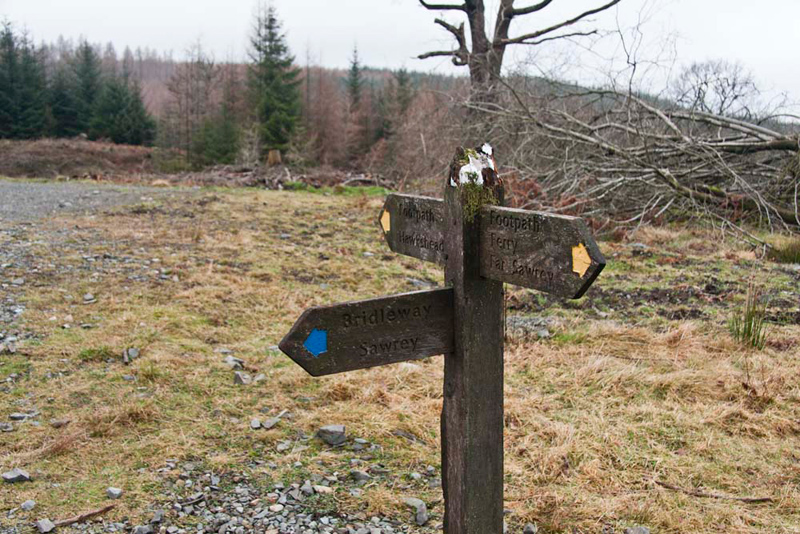
swinging right to come to a four-armed signpost.
"This is called 'Guide Posts'
on the map", said Shaun. "We go left along the path
signed Hawkshead."
To avoid any confusion here, we
would point out that Dad took the above picture, looking in the
direction we had just come from.
So, taking Shaun's advice, we
followed the track, and after about a ¼m reached a sign pointing
right reading Latterbarrow, whose tall obelisk we could finally
see distantly. The path dropped steeply before climbing to round
an area protected by a very tall fence. More about that later.
The path then turned right, soon entering more woodland, to come
to a stile.
Here the signpost, indicated that going ahead by
the fence would lead to Hawkshead, but taking the path climbing
half right led to Latterbarrow.
"No need to tell you where we
need to go now", said Shaun.
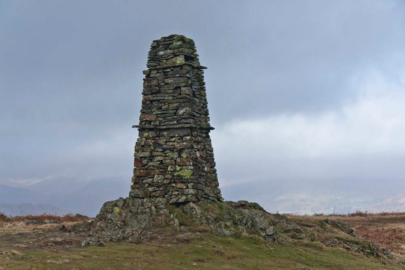
The clear path climbed steadily up
the easy slope to the summit, adorned with this elegant obelisk,
known as Latterbarrow Man...
...by the base of which we sat for our
photograph.
Grizzly told us, "the name may indicate 'a hill where animals had their lair'. This from the Old Norse latr, a lair or sty, and berg, a hill."
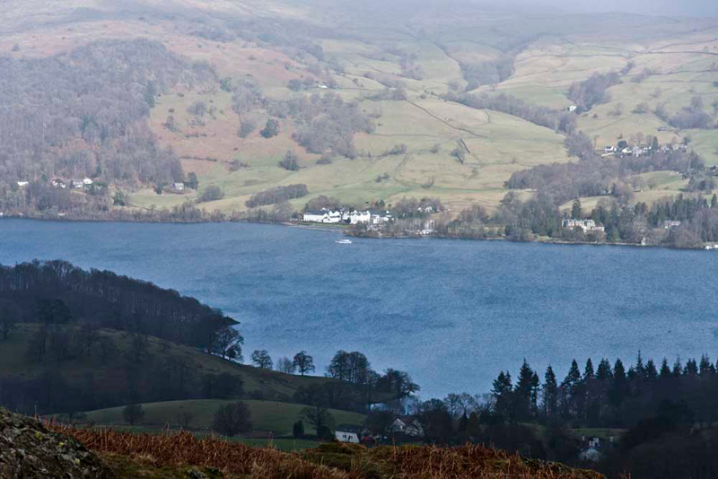
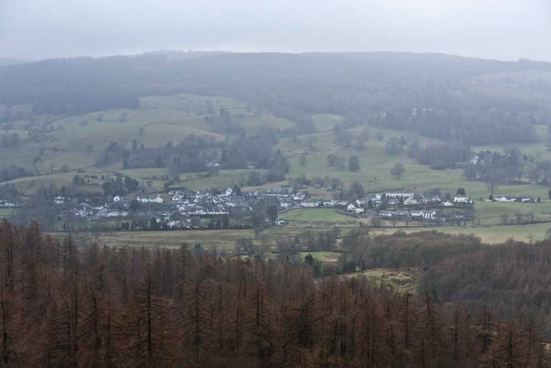
This is a fine viewpoint commanding
a wide panorama from the Coniston Fells round to the Kentmere
Fells, but sadly today they were all obscured by the cloud.
The
lower slopes were in view across Windermere, Little Eric asking, "what is that large white
building?"
The Low Wood Hotel", replied Tetley.
Looking in the opposite direction, Grizzly said, "that's
Hawkshead, to where most of the signpost directions we have
followed have been pointing to. The mistiness shows clearly what a dismal day
it is for views."
"Time for lunch ", said
Allen, "I'm really hungry, and ready for a drink too."
"Absolutely", replied Dad.
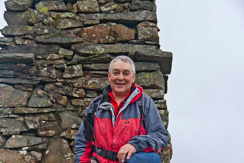
While we were eating a group of
about 5 arrived-mum, dad and children. They were from Newcastle.
Dad chatted to them, and they kindly offered to take Dad's
photograph, which he gladly accepted. We think it is a really
good one too!
Refreshed after our lunch and ready for the off again, Shaun said, "we return to the stile and then retrace the route through the trees
and on to come beside the fenced area."
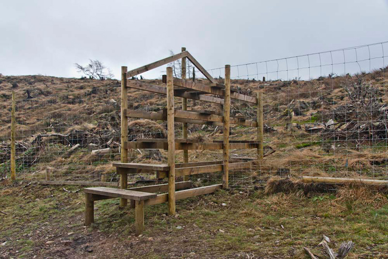
Having been cleared
the area was undergoing natural regeneration, hence the tall
fence to keep animals such as deer out. It can be crossed by
walkers, Dad saying, "we'll go that way to give a slight variation to this part of
the walk."
To gain access and leave, he had to climb ladderstiles
to end all ladderstiles! "Wow", exclaimed Tetley. "We have never crossed such large stiles."
"Right", said Shaun.
"We need to return to Guide Posts and then continue to the
bridleway we crossed before."
We had come from the direction in
the background, and Shaun advised, "our route is along the bridleway signed
Sawrey."
The track, a forest road, climbed then beyond a gate
became more grassy and muddy as it began to descend, passing
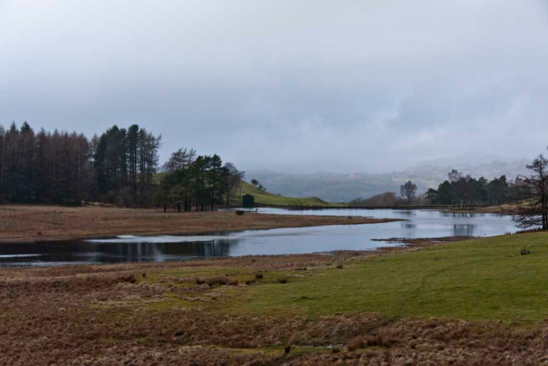
first Wise Een Tarn, a former reservoir, where again the fine
mountain view was lost in the low cloud.
Further on we passed Moss Eccles Tarn. Grizzly told us, "this too
was probably originally a reservoir. In 1926 it was bought by
Beatrix Potter, who liked to row on the tarn and her husband
fished in it. On her death in 1943, it passed to the National
Trust, the current owners."
Finally the path led us down to the
village of Far Sawrey. Here we strolled on past the hotel. Shaun, said, "we take the track off left. It cuts off a corner and some road walking."
Reaching some houses the footpath passed in front to then and descend again to the road. It was then just on
downhill to the car park.
"Thanks for a good walk Dad,
said Little Eric. "It means too that I have now done half of
the Outlying Fells."
"Thanks Shaun for your
excellent map reading", said Tetley.
"Yes indeed", added Little Eric. "Had it been left to me we would have got well and truly lost."
"You're welcome pal", he
replied.
"I know what is next",
said Allen, rolling about with laughter. "A visit to a tea
shop."
"Spot on lad", replied
Dad. "I am going to Jane and Sam's, at Low Newton."
"Great" cheered Tetley,
"that means we get to go in too."
Here Dad had a pot of tea, and
delicious apple apricot and chocolate crumble with custard. Yummy!!
It was nice to see them again too.